Tag: Kongsberg

  • Kongsberg taps Advanced Navigation in multi-million deal for FOG INS

    Kongsberg taps Advanced Navigation in multi-million deal for FOG INS

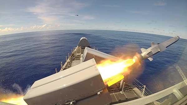
    Advanced Navigation has finalized a multi-million deal with Kongsberg Defence & Aerospace to supply more than 50 Boreas D90 fiber-optic gyroscope inertial navigation systems (FOG INS) to strengthen Kongsberg’s Protector RS4 in high-threat, contested environments.

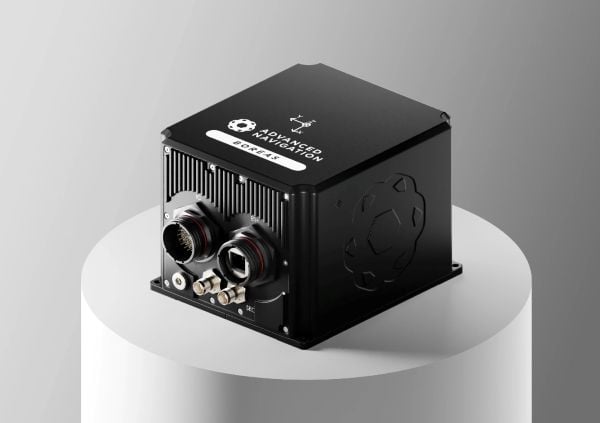
    As a strategic-grade INS, the Boreas D90 is engineered for the world’s most extreme environments, maintaining exact targeting and unwavering line-of-sight control for the Protector RS4.

    The Boreas D90 was selected not only for its superior precision in GNSS-denied conditions, but also for Advanced Navigation’s proven capacity to meet demanding delivery timelines. This agility is made possible by the company’s state-of-the-art, vertically integrated manufacturing. By controlling the entire production process, from sourcing raw components to assembly and testing in simulated EW environments, Advanced Navigation can rapidly scale output on demand and guarantee schedule certainty, a critical factor for Kongsberg.

    The Protector RS4 remote weapon system. Photo: Kongsberg)
    The Protector RS4 remote weapon system. Photo: Kongsberg)

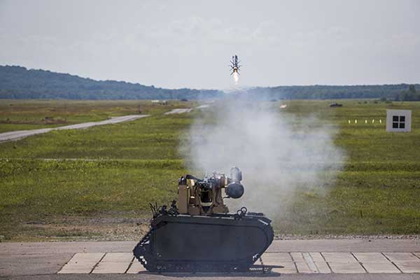
    The Protector RS4 is the world’s most fielded remote weapon system, deployed across more than 30 nations and multiple domains. The highly flexible, modular system is designed to integrate a diverse range of payloads, including small and medium caliber systems and guided effectors. Its advanced, modular sensor suite (day, night, LRF) provides exceptional and customizable situational awareness.

    The fully stabilized 2 + 2 axis (detached line of sight) system allows the operator to maintain focus on a point of interest, independent of platform movement or the delivery solution for the specific system in use. The Protector RS4 is platform-independent and suitable for both land and sea applications.

    By integrating Boreas D90, the Protector RS4 achieves a new level of precision and survivability, sustaining locked targeting and georeferenced stability even when GNSS is compromised or denied. This enhancement positions Kongsberg’s Protector RS4 as one of the few systems globally capable of maintaining precision pointing under active electronic warfare attack.

    The deal supports the Global Supply Chain (GSC) Program, an initiative by the Australian Department of Defence designed to connect local suppliers with major global defense prime contractors. Advanced Navigation is based in Australia; Kongsberg is based in Norway.

  • Silicon Sensing and Kongsberg Discovery partner to develop MEMS gyro technology

    Silicon Sensing and Kongsberg Discovery partner to develop MEMS gyro technology

    Silicon Sensing Systems Ltd and Kongsberg Discovery AS have joined forces to develop next-generation inertial technology. The companies signed the formal agreement June 2 during EXPO in Osaka, Japan.

    The agreement will merge the engineering skills of both companies to speed the evolution of products within each company. Kongsberg will use developments to enhance their next generation of high-performance systems – including attitude and heading reference systems (AHRS) and inertial navigation systems (INS). Silicon Sensing will use these outcomes to benefit its precision micro electro-mechanical systems (MEMS) inertial measurement units (IMUs), gyros and accelerometers.

    The companies are aiming to achieve navigation-grade performance from a MEMS-based gyro. Navigation-grade refers to a highly accurate and stable gyroscope used in inertial navigation systems (INS) to precisely measure angular velocity and rotational motion. 

    Gyro sensors measure changes in rotation angle over time, enabling detection of direction, angle, and vibration. They are used in smartphones, game consoles, car navigation systems, industrial equipment and devices requiring vibration detection, camera shake correction and attitude control.

    “The diverse range of applications for this technology is expected to grow significantly in the future,” said Anders Rønningen, executive vice president, Kongsberg Discovery. “This agreement will foster growth for both companies, as well as for Norway, Japan and the UK. We have established a strong presence in the maritime market and are now venturing into new markets.”

    “For over a year we have been working with Kongsberg Discovery, exploring how best to bring our engineering teams together to move us towards performance goals that will extend the capabilities of our entire product portfolio – bringing real operational benefits across many industrial sectors. This important agreement details how we will achieve those ambitions,” said Satoru Miyamoto, general manager, Silicon Sensing (Japan).

    David Somerville, General Manager at Silicon Sensing (UK), concludes, “This endeavor will fast-track development activities in key areas for both companies, bringing critical performance gains for customers in fields as diverse as satellite control, subsea mapping, industrial robotics, aviation and maritime.”

  • Raytheon awards Kongsberg contract for GPS-guided missiles

    Raytheon awards Kongsberg contract for GPS-guided missiles

    Kongsberg Defence & Aerospace has signed a contract with Raytheon Missile Systems to deliver Naval Strike Missiles under a contract worth $21.36 million. The missiles are for the United States Navy’s Over-The-Horizon Weapon System (OTH WS) program. Raytheon is the prime contractor.

    The Naval Strike Missile is a GPS-guided long-range, precision strike weapon that can find and destroy enemy ships at distances up to 100 nautical miles. The stealthy missile flies at sea-skimming altitude, has terrain-following capability (it banks to turn) and uses an imaging infrared seeker for precise targeting in challenging conditions. The missile employs a semi-armor-piercing warhead optimized for anti-surface warfare.

    According to Raytheon, the missile also is suited for land attack missions because it can climb and descend with the terrain. It was successfully tested in a land-based mobile launcher configuration in 2018 as part of a multination military exercise. In 2019, the U.S. Marine Corps integrated a land-based Naval Strike Missile into its force structure, sharing costs and interoperability with the Navy.

    The missile was first fired in the Indo-Pacific region, according to the Navy. Then, on Oct. 1, it was launched from the USS Gabrielle Giffords (LCS 10) during Pacific Griffin, an exercise conducted with the Singaporean navy near Guam Sep. 27 through Oct. 10, 2019.

    The OTH-WS program is a long-range, surface-to-surface warfare system intended to offensively engage maritime targets both inside and beyond the radar horizon. The system consists of an operator interface console, Naval Strike Missile, and the Missile Launching System. The OTH-WS is intended to be a stand-alone system requiring minimal integration into the ship’s platform.

    The Navy selected the Naval Strike Missile in 2018, with Raytheon as the contractor for its over-the-horizon defense of littoral combat ships and future frigates.

    Also in 2019, the Navy conducted a structural test firing of the OTH-WS to assess the integrity and safety of the weapon system installation on the launch platform. The test showed there were no problems regarding integration of the missile launching system with the platform.

    The Navy is planning to conduct Initial Operational Test and Evaluation and Live-Fire Test and Evaluation in fiscal years 2020-2022. and is developing a test and evaluation plan and live-fire test strategy.

    The USS Gabrielle Giffords launches a Naval Strike Missile during exercise Pacific Griffin. (Photo: U.S. Navy//Chief Mass Communication Specialist Shannon Renfroe/Released.)
    The USS Gabrielle Giffords launches a Naval Strike Missile during exercise Pacific Griffin. (Photo: U.S. Navy//Chief Mass Communication Specialist Shannon Renfroe/Released.)


  • Javelin missiles remotely launched from unmanned vehicle

    Javelin missiles remotely launched from unmanned vehicle

    Remotely controlled Javelin firings can help keep soldiers out of harm’s way. (Photo: Lockheed Martin)
    Remotely controlled Javelin firings can help keep soldiers out of harm’s way. (Photo: Lockheed Martin)

    The Javelin Joint Venture team, a partnership of Raytheon Company and Lockheed Martin, successfully fired Javelin missiles from a Kongsberg remote launcher mounted on a Titan unmanned ground vehicle built by QinetiQ North America and Milrem Robotics.

    The demonstrations, conducted at the U.S. Army Redstone Test Center, Alabama, validated the integration of the weapon station, missile and vehicle.

    “Javelin is ready to support emerging military robotic vehicle requirements,” said Sam Deneke, Raytheon Land Warfare Systems vice president. “Remotely operated technology like this protects soldiers in battle.”

    Javelin has been fielded on the Common Remote Operations Weapon Station-Javelin across U.S. Army Stryker 8×8 vehicle brigades in Europe.

    “Javelin offers true fire-and-forget engagements to 4 kilometers in most operational conditions,” said David Pantano, Javelin Joint Venture vice president and Lockheed Martin Javelin program director. “Once the launch command is issued, soldiers and vehicle assets like the UGV can reposition out of harm’s way. These tests demonstrated our ability to evolve Javelin capabilities to address new missions in support of the warfighter.”

    Javelin is a versatile one-man-portable and platform-employed anti-tank and multi-target precision weapon system. The Javelin Joint Venture team has produced more than 45,000 Javelin missiles and 12,000 command launch units. The program continually updates the system to stay ahead of advancing threats, including enhancing its platform-mounted capabilities.

    U.S. and coalition forces have used Javelin extensively in Afghanistan and Iraq in more than 5,000 engagements.

  • Belize’s Great Blue Hole revealed in expedition survey

    Belize’s Great Blue Hole revealed in expedition survey

    Photo: JamieB333/Shutterstock.com
    Photo: JamieB333/Shutterstock.com

    A sonar survey, camera and sensor data of the world’s largest marine sinkhole is shining light on sea level and climate change over 100,000 years.

    From Nov. 27 to Dec. 13, 2018, the Blue Hole Belize Expedition mapped the sinkhole. Led by Aquatica Submarines, the team of scientists, explorers and film makers included Virgin ’s Sir Richard Branson and Fabien Cousteau, grandson of the conservationist Jacques Cousteau.

    Kongsberg used both surface and submarine-mounted sonar equipment.

    Sonar expert Mark Atherton from Kongsberg’s Canadian subsidiary Kongsberg Mesotech was a key member of the science-based sonar and scientific data collection team. Atherton operated the sonars aboard the Research Vessel Brooks McCall, contributing to an invaluable high-resolution map of the entire sinkhole.

    “By understanding the geological history and geometric structure at the Blue Hole we can contribute new data to the global scientific community studying sinkholes and cenotes,” he said.

    Photo: Aquatica Submarines
    Photo: Aquatica Submarines

    Aquatica Submarine’s Stingray 500 submarine was used for sonar surveying, filming and dives. The team conducted more than 20 dives into the large sinkhole, taking videos and 3D images during each trip. They also completed a two-hour live broadcast featured on The Discovery Channel.

    A key outcome of the Expedition is creation of a complete 3D sonar map of the Blue Hole. The sonar map is enhanced with other passive submarine-collected environmental data. Once processed and collated, the data will be shared with the Government of Belize and the larger global scientific community as a legacy from the expedition.

    Perimeter Markers: Using an SBG Systems Ellipse receiver positioned directly over suspended tripods, positions were locked in the MS1000 processing software the instant each tripod touched bottom. With no current within the Blue Hole and the tripod and sonar weighing 21.7 kg, there was no issue with offset position differences between the vessel and the tripod hanging plumb during deployment. (Image: Mark Atherton/Kongsburg)
    Perimeter Markers: Using an SBG Systems Ellipse receiver positioned directly over suspended tripods, positions were locked in the MS1000 processing software the instant each tripod touched bottom. With no current within the Blue Hole and the tripod and sonar weighing 21.7 kg, there was no issue with offset position differences between the vessel and the tripod hanging plumb during deployment. (Image: Mark Atherton/Kongsburg)

    Processed Scan Data: A dual-axis sonar (DAS) system collected point-cloud data to create a 3D representation of the Blue Hole. The unit was pole-mounted on the survey vessel with the GPS and motion reference unit directly over the scanner’s head. (Image: Mark Atherton/Kongsburg)
    Processed Scan Data: A dual-axis sonar (DAS) system collected point-cloud data to create a 3D representation of the Blue Hole. The unit was pole-mounted on the survey vessel with the GPS and motion reference unit directly over the scanner’s head. (Image: Mark Atherton/Kongsburg)

    Mosaic: GPS tripod position and target matching on overlapping scans were used to align the 50-, 75- and 100-meter-range data collected at 21 drop locations. This mosaic is a very close approximation of the bottom of the Blue Hole. (Image: Mark Atherton/Kongsburg)
    Mosaic: GPS tripod position and target matching on overlapping scans were used to align the 50-, 75- and 100-meter-range data collected at 21 drop locations. This mosaic is a very close approximation of the bottom of the Blue Hole. (Image: Mark Atherton/Kongsburg)

  • Kongsberg reference system integrates GNSS services

    Kongsberg reference system integrates GNSS services

    kongsberg-DPS-432
    The new DPS 432 combines decimeter accuracy with high integrity and availability of GNSS data.

    Kongsberg Maritime has introduced a new position reference system that integrates all available GNSS and all possible correction services. The new DPS 432 combines full decimeter accuracy with high integrity and availability of GNSS data, supporting the safety and efficiency of offshore operations that rely on advanced dynamic positioning (DP) systems.

    The DPS 432 integrates signals from GPS, GLONASS, BeiDou and Galileo, and regional correction signals including SBAS (WAAS, EGNOS, MSAS, GAGAN), in addition to the new G4 services from Fugro, to ensure high flexibility for DP operations globally.

    Because DPS 432 exploits available combinations of GNSS signals, it is suited to complex operations in challenging environments. The system increases satellite availability, improves integrity monitoring and enables more precision under challenging signal tracking conditions, Kongsberg said.

    The new DPS 432 will be part of the Kongsberg DPS portfolio of products that meet requirements for operations in any geographical region.

    “DPS 432 expands our established and field-proven portfolio of position reference systems for DP operations, ensuring that we can offer a highly reliable solution for any DP vessel or operating region,” said Vidar Bjørkedal, VP sales and customer support, Kongsberg Seatex. “The system is based on the same architecture as other DPS products, which means it features a highly intuitive HMI [operator interface], while the ability to integrate all available GNSS and corrections provides integrity and availability of the position data needed for safe operations.”

    The DPS 432 features the sophisticated DPS NAV Engine used in all DPS solutions, which runs critical computations independent from the DPS HMI to ensure continuous and reliable operation. The DPS NAV Engine runs in a safe mode, protected from unintended user operations, while several DPS HMIs can be connected to the same DPS NAV Engine in a networked architecture.

    Straightforward operation to enhance DP operations safety further was a key design goal during development of DPS 432. The system can integrate multiple layers of information, giving the DP operator opportunities for a customized visual presentation, including electronic charts, seabed maps, well-head positions, static targets and Automatic Identification System (AIS) target information.

  • U.S. Navy to Deploy Underwater Drones from Submarines

    U.S. Navy to Deploy Underwater Drones from Submarines

    remus-600-specifications-500x281
    The Remus 600 Unmanned Underwater Vehicle, made by Kongsberg Maritime, a Norwegian company.

    The U.S. Navy plans to deploy its first underwater drones from submarines later this year, according to a report by Military.com.

    The website quoted Rear Adm. Joseph Tofalo, the Navy’s director of undersea warfare, who said the deployment will include the use of the Remus 600 Unmanned Underwater Vehicles (UUVs) to perform undersea missions around the globe.

    Sailors carry a Remote Environmental Measuring Unit (REMUS) 100. (Credit: U.S. Navy)
    Sailors carry a Remote Environmental Measuring Unit (REMUS) 100. (Credit: U.S. Navy)

    “Now you are talking about a submarine CO who can essentially be in two places at the same time — with a UUV out deployed which can do dull, dirty and dangerous type missions. This allows the submarine to be doing something else at the same time,” Tofalo said. “UUVs can help us better meet our combatant command demand signal. Right now, we only meet about two-thirds of our combatant commanders’ demand signals, and having unmanned systems is a huge force multiplier.”

    The Remus 600 is a 500-pound, 3.25-meter-long UUV equipped with GPS, as well as dual-frequency side-scanning sonar technology, synthetic aperture sonar, acoustic imaging, and video cameras manufactured by Hyrdoid, a subsidiary of Kongsberg Maritime. The Remus 600 is similar to Bluefin Robotics UUVs, which were used to search for wreckage of missing Malaysia Airlines flight MH370. Other applications include hydrographic surveys, harbor security, and environmental monitoring.

    In this video, Explosive Ordnance Disposal Mobile Unit One (EODMU-1) tests the Remus 600 to locate mines using autonomous guidance and advanced sonar.


  • Kongsberg Unveils Heading and GNSS Surface Position Options for eBird

    Kongsberg Unveils Heading and GNSS Surface Position Options for eBird

    Photo: Kongsberg Seatex

    Kongsberg Seatex has given users of the eBird System the ability to equip SmartWing instrumentation with two additional features — a compass and a GNSS receiver. eBird is a bird concept for lateral, vertical and roll streamer control in marine seismic acquisition that enables fault tolerant and efficient multi-streamer steering by employing a wide range of innovative and patented technological solutions.

    The innovative approach of placing a GNSS receiver in the wings opens new opportunities for improving the efficiency of an operation – in particular during launch and recovery but also when running lines.

    The built-in GNSS receiver has been implemented based on Kongsberg Seatex’ extensive competence within GNSS technology. Transmission of satellite data from the seismic vessel to eBird reduces the time to first position fix considerably – giving eBird a position with one wing semi-surfaced. The built-in compass has been developed based on Kongsberg Seatex’ deep knowledge and experience within sensor technology and is fully integrated with SmartWing. The compass provides heading information from a submerged eBird.

    These add-ons represent further improvements to the eBird streamer positioning and control concept.

    “We always try to find improvements to our solutions and these new features are excellent examples of how we combine our core technology and expertise to create improved value for our customers,” says Gard Ueland, President of Kongsberg Seatex AS. “This is one step further in our offering to the seismic market, and we will continue to improve our solutions in close cooperation with our customers.”

    eBird has, since its introduction at SEG in 2009, gained high attention within the seismic acquisition community with its sleek and functional design and utilisation of innovative technology together with proven performance in large seismic streamer spreads.