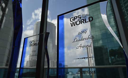
On Sept. 19, in conjunction with the ION GNSS+ conference, GPS World hosted its annual Leadership Awards dinner. Five honorees — chosen by a panel of GNSS experts — were recognized for their outstanding recent contribution or achievement in four categories: Satellites, Signals, Services and Products.
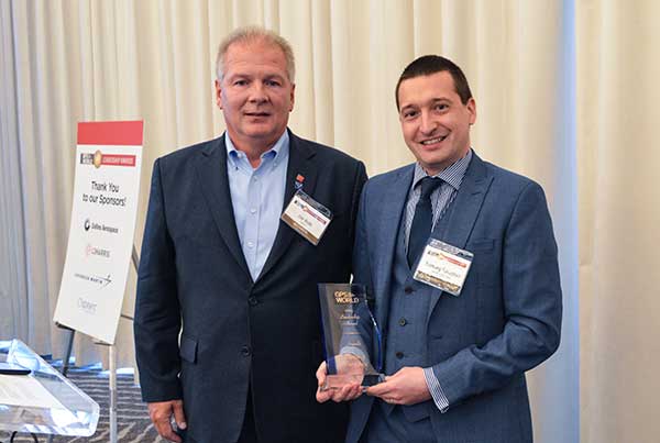
SATELLITES AWARD: Presented by Johnathan Caldwell (left) to Mark Crews, both of Lockheed Martin. Crews accepted on behalf of Tim Hartman. (Photo: GPS World)
Satellites Award
TIM HARTMAN: Satellites Award winner
Tim Hartman, Chief Engineer, Military Space Programs, Lockheed Martin
Hartman was recognized for serving as the program manager for GPS IIRM and GPS III Space Segments. Tim’s leadership and program dedication helped support the U.S. Air Force’s decision to declare GPS III ready for launch on Oct. 17, 2017.
On Aug. 22, Lockheed Martin Space celebrated the successful launch of the second of up to 32 next-generation GPS III/IIIF satellites that the U.S. Air Force contracted the company to design and build. Lockheed Martin’s commitment to positioning, navigation and timing can be found in the exemplary performance of the 18 Lockheed Martin-built GPS IIR and IIRM satellites that are a proud part of today’s 31-satellite GPS constellation. The company also is proud to support the Air Force with its continued sustainment of the current GPS Operational Control Segment.
SIGNALS AWARD: Presented by Joe Rolli of L3Harris (left) to Ramsey Faragher. (Photo: GPS World)
Signals Award
Ramsey Faragher, Founder and CEO, Focal Point Positioning
Focal Point Positioning’s new supercorrelator approach to indoor and urban GNSS signal processing could revolutionize smartphone-based GNSS. New signal processing methods for the correlation stage of a GNSS receiver enable several seconds of coherent integration while the receiver is undergoing dynamic motions. This improves accuracy and integrity, and provides anti-spoofing and spoofer-localization capabilities — without hardware changes or requiring access to encrypted signals.
L3Harris Technologies is an agile global aerospace and defense technology innovator, delivering end-to-end solutions that meet customers’ mission-critical needs. The company provides advanced defense and commercial technologies across air, land, sea, space and cyber domains. L3Harris has approximately $17 billion in annual revenue and 50,000 employees, with customers in 130 countries.
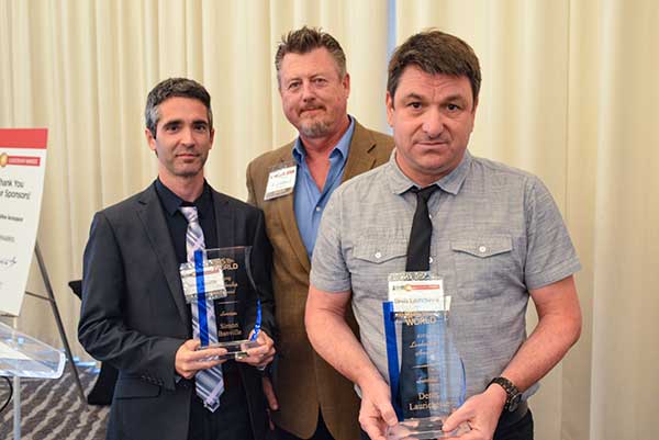
SERVICES AWARD: Presented by Mike Shepherd of Collins Aerospace (back) to Simon Banville (front left) and Denis Laurichesse. (Photo: GPS World)
Services Award
Denis Laurichesse, Navigation Systems Department Expert, Centre National d’Études Spatiales (CNES)
Simon Banville, Senior Geodetic Engineer, Natural Resources Canada (NRCan)
Laurichesse and Banville demonstrated instantaneous, centimeter-level, multi-frequency precise point positioning (PPP). Their work shows PPP might become, within a few years, a practical alternative to real-time kinematic (RTK) for a wide range of applications.
Collins Aerospace Systems, a unit of United Technologies Corp., is a leader in technologically advanced and intelligent solutions for the global aerospace and defense industry. Created in 2018 by bringing together UTC Aerospace Systems and Rockwell Collins, Collins Aerospace has the capabilities, comprehensive portfolio and expertise to solve customers’ toughest challenges and meet the demands of a rapidly evolving global market.
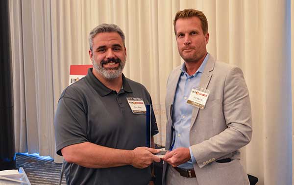
PRODUCTS AWARD: Accepted by Paul Alves (left) from presenter Jeff Martin of Spirent Federal Systems. (Photo: GPS World)
Products Award
Paul Alves, P.Eng, Ph.D., Technology Manager — Correction Services, NovAtel, part of Hexagon
Alves was recognized for his work on localization of interference sources for GNSS users leveraging the Interference Tool Kit. With the ITK, users can detect and mitigate adversarial jamming of GNSS signals, as well as unintentional interference from external sources.
Spirent has more than 30 years of experience delivering the world’s best test equipment. Spirent’s test solutions for GPS and GNSS, critical infrastructure SCADA vulnerabilities, Internet L3-L7 common vulnerabilities and exposures, and mobile vulnerabilities allow the world to communicate and collaborate faster. Spirent Federal Systems is a wholly owned subsidiary of Spirent Communications and was established to offer the world’s leading simulation equipment to U.S. government customers, armed services, education institutions, and prime contractors. Spirent Federal’s SimMNSA was the first to be granted Security Approval by the Global Positioning System Directorate.
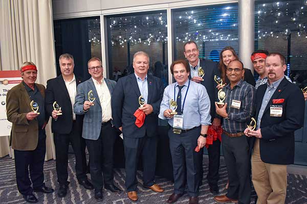
PNT CHAMPS: The L3Harris team earned the most total points in all six games, and took home a trophy each. (Photo: GPS World)
PNT Games
After dinner, guests broke into teams to test their personal positioning, navigation and timing skills, precisely determined by their ability to toss rings and throw horseshoes under time pressure. Each team rotated through yard games such as ladder toss, ring toss, corn hole and horseshoes to prove who was the most accurate and resilient. The L3Harris team took home the first-place prize.
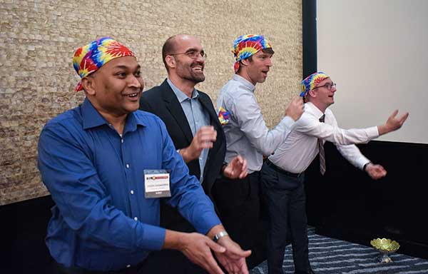
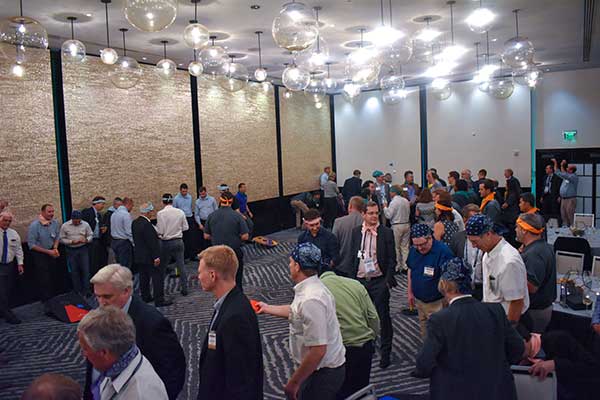
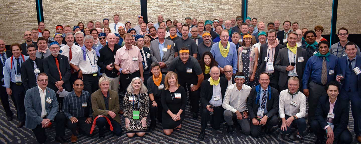
RAINBOW CONNECTION: Taking on giant pong are members of the rainbow bandana team, (from left) Sanjeev Gunawardena, Thomas Pany, Steffen Thoelert and André Hauschild. (Photo: GPS World)ORGANIZED CHAOS: Wearing different-colored bandanas, teams cheer on their team members and fight for every point. (Photo: GPS World)After all the awards were given, everyone got together for a memorable group photo. (Photo: GPS World)
At the GPS World Leadership Awards dinner, Charles Abraham, Andreas Warloe and Javier de Salas were named the winners of the Products Leadership Award for their work developing the first dual-frequency L1/L5 E1/E5 GNSS chip for smartphones, ushering in a new era of high-precision GNSS in mass-market products.
Check out the video to learn more about their efforts.
At the GPS World Leadership Awards dinner, Chris Hegarty received the Signals Leadership Award for his contributions to the U.S. Department of Transportation’s GPS Adjacent Band Compatibility Assessment. Tune into the video to watch his acceptance speech.
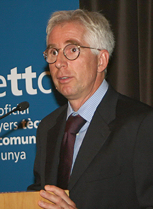
Opening remarks by Alan Cameron, editor and publisher of GPS World
Everyone at this great conference is actively engaged in innovation: new approaches, new combinations, new integrations, new methodologies.
Our sponsors are not only innovators, they are active in building those innovations in the field, installing the cornerstones of GPS and GNSS technology. Harris Corporation has been building the GPS satellite payloads since the beginning of time, Rockwell Collins has built so much user equipment, historically and currently, and Spirent Federal Systems has been enabling the development and testing of much user equipment by many companies in this room.
Just to give you an idea of who else is seated among you at the tables, we have NovAtel, Spectracom, IFEN, Septentrio, Satelles, Syntony, Unicore, u-blox, ComNav, RaceLogic, Rohde & Schwarz, ublox, Locata, GMV, Leica, Thales, Boeing, Broadcom, Qualcomm, Google, Apple, Intel, MITRE and Aerospace Corporation; the U.S. Air Force GPS Directorate, the U.S. State Department, the European Space Agency, the European GNSS Agency and the European Commission, NASA, the French and German aerospace agencies; the Institute of Navigation and the Royal Institute of Navigation; and universities and research institutes almost too many to number.
This is a great industry to be part of, and I feel lucky to be kind of a spectator, a commentator in it without the benefit of the scientific upbringing that everybody else in this room has had. I still get to participate in the excitement and the developments and for that I am truly grateful.
Satellites Leadership Award
Galileo Builder
Wolfgang Paetsch
Director of Navigation and Member of the Executive Board, OHB
For his leadership in setting up the routine production of the Galileo satellites leading to Galileo constellation deployment, including thequadruple Ariane 5 launch in November 2016.
Paul Verhoef (right), director of the Galileo Programme and Navigation-related Activities, European Space Agency, accepted the award and delivered remarks on behalf of Wolfgang Paetsch. (Right photo: Melanie Beus)
Introduction by Rob Scott, Rockwell Collins
“Forty years ago, Rockwell Collins celebrated the first receipt of a GPS signal,using a six-foot tall, two-person receiver. Now we have something something 1 by 1-1/4 inches that is far more capable. It’s amazing to see how technology has advanced.”
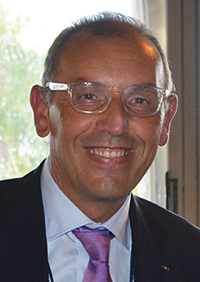
Remarks by Wolfgang Paetsch
I must admit I am rather at fault for Wolfgang not being here, because I keep him rather busy producing satellites, as OHB is completing the last of 22 satellites under contract from ESA. We are going to launch again in December, as you know we have had a few problems, which I’m glad to say we have solved. The issues are behind us, and the Swiss clocks are working fine now, which is great.
On Dec. 12 we are going to launch. The first two satellites are in Kourou already, the next ones are going in two weeks [as of Sept. 28; all satellites are now in Kourou. — Ed.] We’re going to go up on an Ariane 5 again, with these four satellites. Next summer we are doing another four, so it brings the whole Galileo constellation from 18 to 26, and then we are fully operational.
In this business it is quite a challenge to keep up the pace. I think OHB, with Wolfgang in the lead, has done very well in the past years to set up indeed a very impressive production line and keep all the machinery ticking over. It has been a big challenge for them, as they had been a relatively small player in the space business, while at the same time they have been able to win other competitions in the space business in other areas. OHB has been doing very well and we are glad of course that they are doing well because it was important to get Galileo up and running.
OHB has managed to win recently another contract, good for them, we are about ready to give them the first options on that contract, so we will have a total of 14 satellites under contract with them, in addition to the 22 they are completing. These satellites will further complete the constellation and they will already start replacing the first IOV satellites which we have put up. So you see the cycle is rather quick. Of course we are waiting a bit to see what the real lifetime of the satellites is going to be. We don’t know that yet but we will find out in the next couple of years.
Looking Ahead. So what are the challenges for us in the next years? We are currently working with colleagues from the European Commission and the European GNSS Agency on what the next constellations are going to do. Obviously there is a lot of pressure for further innovation, for further improvements. The user community over the last couple of years has become more outspoken about what they want and what they expect, which is nice. Obviously we need to take care of the legacy users, and we are having to see what new technology would allow us to do. At the end of the day there is then also a small thing called budget, which needs to have its play in these things.
In any case, the plan is by the end of the year we will start the procurement of the next batch of satellites. This will take a while to do, this procurement, as it concerns new developments, but then we are going to go for the next constellation.
So let me finish by paying a tribute to Wolfgang and his team. It has been a real challenge for them. I know that he was pretty amazed, and after that pretty proud, of this prize he has gotten, and I will carefully carry this back to him in Europe.
Alan, thank you very much.
Services Leadership Award
Global Educator
Patricia Doherty
Director and Senior Scientist, Institute for Scientific Research, Boston College
For initiating and leading the African GNSS Outreach program since 2009, to help developing countries derive social and economic benefits from satellite-based PNT.
Frank van Diggelen (left, above), an African Outreach faculty member and principal software engineer, Google, introduced and conferred the award to Pat Doherty. (Photo: Melanie Beus)
Introduction by Frank van Diggelen
“I had the great honor and privilege of teaching in the African GNSS Outreach program. If you are approached to participate in this, seize the opportunity! It’s a fabulous thing, with people from all over Africa, and you’ll learn far more than you think.”
Remarks by Patricia Doherty
I would like to thank GPS World for this Leadership Services Award. I am sincerely honored and humbled by this recognition. Serving the GNSS community with the African Outreach Program has been a joy and a privilege that I am personally grateful for every day.
This program began in 2009. The idea was conceived at a G8-UNESCO World Forum that I was fortunate to attend in 2007. At that forum, leaders from developing nations of Africa described the need for assistance in developing science and technology in their countries, technologies that would lead the way to socio-economic transformation and integration into the world economy. As all of us here know, GNSS is a space technology that can change the world with applications that can increase food security, monitor natural resources, manage wildlife conservation, improve emergency location services, and provide greater precision and safety in land, sea and air navigation — just to name a few of the possibilities.
Thus the goal of the African Outreach Program was to encourage the use of GNSS for societal and economic development and for scientific exploration in Africa. The way to do that was to help build a knowledgeable African GNSS workforce. I am glad to report that the program has been quite successful. To date, we have hosted 9 workshops. In those workshops, we have introduced the art and science of GNSS navigation to over 450 professors and students from at least 23 of the 54 countries in Africa. Many of the African participants have gone on to do great things: hosting local workshops, developing GNSS programs in their universities, gaining government confidence and interest in GNSS technology and building infrastructure that enabled the use of GNSS.
One of the prime reasons for this success are the sponsors who support us and the lecturers who generously share their time, their knowledge and their zeal for GNSS to teach at the workshops. Many of these lecturers are here tonight. So thank you all. Many of these lecturers have expressed that their lives were enriched by this program. Others have told me that they have never seen a more attentive audience and that just having the opportunity to meet and work with people from the developing world in Africa is a gratifying experience. Several of our lecturers, including myself, are now involved in collaborations with scientists in the developing world.
More to come. Although this sounds like we have done our job, there is still so much to do. Change is slow in Africa. Our plans for the future include building on our success by hosting additional workshops where we will try to reach additional countries in Africa and strengthen current programs and infrastructure in countries where that has been slow to develop. We are also opening the program to other developing countries around the world, as there has been much interest from Central America, South America and Asia. Finally, we are working to bring more workshops to the African continent, where we can reach more students, have an effect on local universities and speak to the local government about the benefits of using GNSS as an enabling technology for societal betterment and economic growth.
In closing, I am honored to receive this award and I look forward to continuing our work to support the use of GNSS in developing nations. Thank you, GPS World, and thank you to our sponsors, lecturers and our African participants for making this program a success.
Signals Leadership Award
Spectrum Advisor
Chris Hegarty
Director for Communications, Navigation and Surveillance Engineering and Spectrum, The MITRE Corporation
For contributions to the U.S. Department of Transportation’s GPS Adjacent Band Compatibility Assessment.
Chris Hegarty (Photo: Melanie Beus)
Introduction by Joe Rolli, Harris Corporation
“On behalf of the Harris Corporation and the team I work with in the Precision Navigation and Timing Business Area, providing the world with GPS signals from space for over forty years, I am pleased to present this year’s Leadership Signals Award.”
Remarks by Chris Hegarty
Thank you very much. I really appreciate this. The truth be told, of course, the Adjacent Band Compatibility (ABC) study has had many contributors. I’m honored to receive this award, but equally deserving are many others including Karen Van Dyke at DOT, Steve Mackey and Hadi Wassaf at DOT’s Volpe Center, Karl Shallberg at Zeta, and too many others to list at DOT, the Air Force, NASA, other federal partners and their contractors.
Looking forward, for those of you who have not been following this issue, the GPS spectrum is being challenged. The spectrum is highly valued and of course there are companies that would like to use that spectrum.
I think that it’s safe to say that no one would really want to stop them from using that spectrum if it didn’t have an impact on GPS, but the unfortunate reality is that it appears the deployment of a 4G network or other potential use of the bands adjacent to GPS with similar transmitter power levels would disrupt the operations of many hundreds of thousands of receivers. To ignore the issue would really be a mistake for our industry.
This issue unfortunately isn’t going to go away. The pressure on spectrum is going to continue to grow — until someone figures out how to communicate without using electromagnetic waves. So this is going to be a persistent problem.
I think we can build receivers, in the future, that can deal with some new systems in adjacent bands, but it’s going to be imperative for a long transition period to protect the investments made by many people in the room here and the folks that we support.
That’s all I wanted to say, thank you again very much.
Products Leadership Award
Advanced Capability Developers
Charles Abraham, Andreas Warloe and Javier de Salas
Vice President of Engineering, Senior Director of Engineering, and Director of Software Engineering, respectively, Broadcom
For developing the first dual-frequency L1/L5 E1/E5 GNSS chip for smartphones, ushering in a new era of high-precision GNSS in mass-market products.
Charles Abraham and Andreas Warloe, with Javier de Salas (not shown); Ellen Hall (left), CEO of Spirent Federal Systems, introduced and conferred the award. (Photo: Melanie Beus)
Introduction by Ellen Hall, Spirent Federal
“As pioneers in GNSS satellite simulation, beginning in 1985, we’re really proud of our heritage. We’re also really proud of Broadcom.They are a user of Spirent equipment as well, so that makes us doubly happy to award this to them.”
Remarks by Andreas Warloe
Thank you to GPS World and the sponsors and supporters of this event, from Charlie Abraham, Javier de Salas, myself and the Broadcom marketing and engineering teams, for this award. We are very honored that our efforts to provide the best possible GNSS to as many people as possible have been recognized in this way.
A few years back, we had completed receiver support for a fifth GNSS L1 system and asked ourselves “What’s next?” At that time, technology nodes were getting to a point where a single chip L1/L5/E1/E5 receiver could be contemplated, and the Galileo launch schedule was picking up speed. An old outlandish idea suddenly didn’t seem as outlandish any more.
Many or most of you in this room are experts in the business of perfection; the business of perfecting and pushing performance boundaries for GNSS. As designers of mass-market devices, we have instead become experts in the art of compromise: If we can achieve good performance at 10mA, then how about 5mA? If we can implement a 16-bit data path with 0.1dB losses, how few bits can we get away with for 0.2dB losses? How can we add support for new GNSS systems without growing RF, digital hardware or software? It is this extreme frugality that now has enabled us to put a complete single chip L1/L5 system in the hands of phone and wearables manufacturers, with smaller size and lower power consumption than the previous L1-only generations.
Competition in our market is fierce, but we are excited about this opportunity to work together with our competitors to promote this new level of precision to our common customers. We have taken initiative in this area by forming the Dual Frequency Alliance. There is an investment that has to be made in phones, with antenna and filtering support for the new band. Only when these investments are made will we be able to bring this new performance level to hundreds of millions of people. Only then will we start seeing new applications built on high-precision — applications that haven’t even been envisioned yet. Once those applications are available, there will be pressure to expand L1/L5 technology from flagship phones to truly mass-market phones.
L5 support enables high-accuracy GNSS, but it does not guarantee it. To go from multi-meter precision to sub-meter precision requires advanced software. GNSS chip manufacturers can provide a good starting point, but once GNSS measurements are made available, GNSS students and experts alike can supply clever applications, professional software tools and infrastructure to further advance GNSS technology. Our job is to work together to push the L1/L5 technology into phones, to provide a new platform for GNSS development.
In summary, we would like to work as an industry to make L1/L5/E1/E5 the new standard for GNSS performance, and to make these measurements available in phones for as many engineers as possible to either monetize their existing IP or develop entirely new IP.
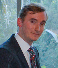
UAVs Revolutionizing Aviation: Exciting Challenges for the PNT Community
Sherman Lo, accepting Leadership Award from Mark Stewart.
Sherman Lo, Senior Research Engineer and Associate Investigator (APNT), Stanford University. One of the architects of eLoran and a worldwide thought leader on alternative PNT.
Remarks
I’m not very good at predicting the future but I know what is exciting to an aviation nerd like me — UAVs. I believe that unmanned autonomous vehicles will revolutionize aviation’s role in society.
UAVs have expanded the community of participants in aircraft development from solely the realm of large defense firms to individuals. The makers amongst us can fabricate custom parts for custom designs and order electric engines from across the sea. Our students have a class where they design and build sub-100-gram autonomous UAVs. They allow for rapid development and prototyping of technologies. All sorts of new crazy business models will be developed for their use.
This is significant for the PNT world because the proliferation of UAVs and what we are able to do with them is enabled by GNSS. That being said, for the good of the community, we also need to take steps to allow UAVs to fully realize their benefit to society. UAV navigation is a rich field.
Navigation improvements can significantly benefit UAV operations. For example:
A robust alternative navigation capability would continue to fly in case of GNSS loss.
An ability to authenticate the UAV’s location would be useful for delivery confirmation and other services.
The ability to range/sense/share information is needed for UAVs to collaboratively and safely use the airspace.
The solution may come in the form of using existing signals, new signals, inertial, vision, all of the above, or none of the above.
UAVs comes in all shapes and sizes, from the little one that our kids play with to the 10-kilogram octocopter in our lab, to even larger ones planned for package delivery to the Globalhawks, with wingspans larger than a 757’s, that I was fortunate to come face to face with at Edwards Air Force Base. There is no one-size-fits-all as UAVs are being developed in all shapes and sizes for many varied missions. I think that is a fun, interesting, and exciting challenge for the PNT community.
Introduced by…
Mark Stewart, Lockheed Martin VP of Navigation Systems, introduced the Satellite Leadership Award.
“I’ve been in the space business for 30 years, and I’m very honored to be part of this navigation community. One of our roles as technical leaders, all of us here, is to educate and coach the young engineers to take over this business as we move on.
“In that context, I reflect back on one of the tests that I had to take to enter college. One of the very simple questions, to start the test, was ‘Where does milk come from? A cow, a carton, a rock, or the moon?’ And I, being raised on a dairy farm in upstate New York, obviously circled cow. When we were graded, all of us received a letter back in the mail from the testing institution. It stated they were going to give credit for two answers, depending on where you came from. If you came from an inner city, in fact milk did come from a carton, so they gave credit for that.
“As an educator, I felt I wanted to go through my life educating people as to where things really come from. where they originate, and who to thank for those things they bring into our life.
“So, as a teaching moment here: the next test that comes up, probably in our children’s lives, will be ‘Where does GPS come from?’ One of the answers will be, undoubtedly, ‘a cell phone.’ Why do we need GPS when we have it in our cell phones, right? However, the correct answer is going to be — circle this — ‘All of you.’ We have GPS because of all of you in this room, the leadership you provide to your teams and all those team members we have back at home.
“So. I want to thank you all for being part of the GPS community and doing what you do so well, for the warfighter and for the civilian population as well. I thank you from the deepest part of my heart for what you do.
“I also want to thank all the award winners here tonight, and congratulations on their significant accomplishments.”
SATELLITES
Galileo’s Top Five for the Future: Accuracy, Robustness, Ephemerides, Time to First Fix, and Authentication
Javier Benedicto Ruiz
Javier Benedicto Ruiz, Galileo Project Manager, Directorate of Galileo Programme and Navigation-related Activities, European Space Agency. For directing a program that produced initial signal results better than the design specifications. (Accepted on his behalf by Marco Falcone, ESA’s Galileo System Manager).
Remarks
On behalf of Javier Benedicto, I would like to thank GPS World for this award. Javier feels really honored by this award you have decided to grant to the Galileo achievements of the last year. We are proud of what has been achieved, despite the difficulties — and believe me, we are very professional in addressing the difficulties in these days — we are fully determined to bring the Galileo system into full deployment, and the diverse services to GNSS users worldwide.
Javier wants to emphasize that the merit of our achievement is thanks to every single individual of an excellent team we have in the Galileo Project Office at the European Space Agency.
From a satellite system perspective, I will give a vision of the directions of the future from 2020 onwards. I have for you the Top Five issues that GNSS should address in the future.
Marco Falcone
The first one is better ranging accuracy, to a level of 10 to 15 centimeters. This would allow techniques to support more closely PPP instantaneous ambiguity resolution. For that, we need stable clocks and clock ensembles onboard.
Second, enhanced robustness and availability to reach PNT solutions everywhere. This can be done through signal-in-space encoding, interleaving, satellite diversity to be implemented not only at the level of the satellite systems, in fact I expect there will also be a lot of work to be done by receiver manufacturers to manage all these types of signals available from the different constellations.
Number three, long-term ephemerides with a validity up to one week, even up to 14 days. This is a very important point. How to achieve it? Through stable orbits without station-keeping, reducing station-keeping as much as possible, and highly stable clocks, like the new generation of hydrogen masers that we have onboard Galileo satellites at the moment.
Fourth, a faster time to first fix, up to one to two seconds for single/dual frequency users, using navigation message-aided information on top of ephemerides loaded with a duration up to 14 days.
Number five was discussed today by many papers in the conference: authentication, at the level of the navigation message, or at the level of ranging, with a clear identification of what will be the requirements of the future.
I have a bonus on top of the five: that is timing accuracy to a level of a service of 5 nanoseconds. I believe this is possible. We are already able today to reach up to 7 to 10 nanoseconds. This would allow at the end to have real-time universal time available to all users.
This is our message for the future. I thank you a lot for this award, for all the members of our great team.
Introduced by…
Lori Thompson
Exelis Geospatial Systems Vice President Lori Thompson helped introduce this year’s GPS World Leadership Award recipients at the dinner honoring engineers and scientists. Prior to the introductions, Thompson discussed the importance of innovation across the field of position, navigation, and timing, and the Exelis commitment to the ongoing advancement of timing and location technologies.
Exelis is on the Lockheed Martin GPS IIR & IIR-M team, which recently celebrated supporting the U.S. Air Force with 200 years of on-orbit success. Exelis is also supporting Lockheed Martin on the GPS III program, developing a new next-generation navigation payload.
“We take a great deal of pride in our core role with the Air Force GPS program,” Thompson said. “The Air Force mission is our mission. Ensuring the availability of the GPS signal to support day-to-day activities and critical operations is the reason Exelis continues to innovate in PNT.”
Thompson talked about the company’s ongoing initiatives to assure the GPS signal, specifically technology called Signal Sentry that helps detect and geolocate sources of interference.
SERVICES
High Precision in High Volumes: From a Circuit Card in a Handheld Computer to RTK in Your Mobile Phone
Eric Gakstatter, Contributing Editor for Survey and Geospatial Solutions, GPS World. For several widely read columns on what it will take to see large-scale consumer adoption of centimeter-accurate positioning.
Eric Gakstatter
Remarks
I have to say, I’m thoroughly embarrassed and deeply humbled to be up here. I’ve written about all of you or some of you at some time along the way, or at least the work that you’ve done.
I’d like to talk for a minute about history. I began my GPS career back in 1990. I was a 27-year-old product manager, and my boss came up to me and slapped a copy of GPS World magazine on my desk and said, “We need to do this.” It was a full page advertisement by Magnavox with a six-channel GPS engine, which was just a circuit card. We made handheld computers at that time. So we decided, hey, let’s take one of these boards and engineer it inside one of our handheld computers and make a data collector out of it for surveying and mapping.
I spent the next two years pretty much living at the office trying to make this happen. We ended up introducing some products, and several more after that. A few points of interest I recall:
I don’t know if Ron Hatch or Rich Keegan are here, but I remember running down to their office in Torrance and visiting with them about this whole concept; Tom Stansell was there at that time, too. Just to give you an indicator: the cost of that receiver board — I remember we paid $510 for a six-channel receiver, code and carrier, and I tell you the measurements on that receiver were tremendous back then. It’s really the basis, I think, for the WM101, which five years earlier was selling for $50,000 for a four-channel receiver.
So we get to today. I was listening to a panel this morning about low-cost, high-precision receivers, and a gentleman from China was talking about his prediction that at the year 2020, an RTK GNSS chipset would be about $20, and an RTK GNSS module about $100.
I tend to agree with him. I think it’s going in that direction. I’ve written a lot about, not necessarily the commoditization of high precision or RTK GNSS, but certainly a much wider audience for it. And if you watched that panel, you noticed that of all the people on that panel, he’s the one who talked about a broad audience: this high-precision GNSS making it, not maybe to the mass market, but certainly in the millions and maybe tens of millions of folks.
As far as predictions go, I think it’s just a matter of time before this happens. I appreciate what Todd Humphreys said a couple of years ago at this dinner, where he predicted RTK in your mobile phone by the year 2020. I’m onboard with that, and I’ll promote it as much as I can, and I hope that someone brings this to fruition. If it’s 2022 or 2021 or 2019, I think it’s just a matter of time before that happens.
Last, I’d just like to thank all of you for creating some great content and making it easy for me to write. Thank you.
Introduced by…
Matthew Gilligan
Matthew Gilligan, Raytheon Program Manager for the GPS Next Generation Operational Control System, introduced the Services Leadership Award.
“It is great to be here with men and women who understand the history and power of GPS, and it’s an honor for me to be here to help celebrate the GPS World Leadership Award winners.
“For the past 30 years, GPS has ensured weapons have found their targets, and ships at sea have returned to port. GPS has enabled the deployment of UAVs and has made sure that military missions of all kinds have been a success. GPS is a life-saving technology, ensuring soldiers come home safely.
“Today, GPS continues to grow in importance. Embedded sensors, mobile devices, and the interconnected technologies that are defining a new era of technology and our economy through the Internet of things — all enabled by GPS’s positioning, navigation and, so importantly, timing.
“To everyone in this room today, I want to say thank you for ensuring the mission evolves and continues.
“I have been asked to speak because I am leading Raytheon’s partnership with the Air Force in modernizing the ground segment — what we like to call the brains of GPS. My program, OCX, is at the core of the Air Force’s GPS modernization initiative. OCX will bring unprecedented new capabilities to GPS users worldwide:
enabling operational availability of all new civil and military signals,
protecting GPS against current and emerging cyber threats — setting the bar for information assurance at an unprecedented level,
improving system accuracy and integrity,
securely sharing information with net-connected users, and
providing flexibility and evolvability to meet future mission needs.
“OCX represents new approaches to emerging and even unimaginable changes and threats. And we are glad to recognize so many of you who are making it possible.
“We are excited to be here tonight with our partners, our customers, and even our competimates as we plan for and look forward to the future.”
PRODUCTS
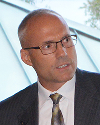
Bringing SatNav Future into View: A Platform for Early Familiarization with New Constellations
Oliver Montenbruck
Oliver Montenbruck , Head, GNSS Technology and Navigation Group, DLR, German Space Operations Center. The principal driver behind the IGS Multi-GNSS Experiment project, whose free, real-time products could be a game changer for inexpensive multi-constellation RTK.
Remarks
Being selected for this prestigious award fills me with great pride and happiness, as well as deep gratitude. I would foremost like to thank you and GPS World, but also the unknown colleague who nominated me. However, it is the community that participated in the poll and ultimately selected me in this highly competitive contest. Thanks as well to all of you: your trust in my work and your recognition is truly appreciated!
Unfortunately, I can’t be here today to accept the award and to thank you in person, but have asked my colleague André to do so on my behalf. I’m presently staying in the Southern Hemisphere, which is not a fault of my GPS device, but was already planned some time before I learned about today’s event. Nevertheless, my thoughts are with you in Florida on this memorable evening.
I would like to elaborate a bit on the IGS Multi-GNSS Experiment, its background and status.
André Hauschild
The International GNSS Service, IGS, is a volunteer organization with more than 200 participating institutions worldwide. Over the past 20 years it has been the premier source of highest quality GNSS data, products, and related standards and conventions. There is hardly any student, engineer, or scientist in the field of GNSS that has not made use of IGS resources. Through its work, IGS supports a wide range of GNSS-related applications for the benefit of the scientific community and society as a whole.
The IGS has traditionally focused on GPS and GLONASS, but it is obvious that the world of GNSS is rapidly changing these days. With BeiDou, we already have a third operational satellite navigation system offering an at least regional service. Europe is actively pursuing the build-up of Galileo, which will offer another global navigation system with advanced performance features and new service types. And, last but not least, Japan and India are in good progress to establish QZSS and IRNSS as independent regional systems.
The new systems come with a multitude of new frequencies and a plethora of new signals. Industry has already done a great job, and nowadays offers a wide range of receivers and antennas for multi-frequency, multi-constellation tracking. However, we are only at the verge of making full use of the capabilities offered by the new GNSSs, and we still have a stony path ahead, before we can arrive at a “system of systems” as Günther Hein once phrased it.
In view of a rapidly changing GNSS landscape, the IGS decided three years ago to launch the Multi-GNSS Experiment, MGEX, as a platform for early familiarization with the new constellations. Within three years, the MGEX network has grown from zero to more than 100 globally distributed stations and presently supports tracking of all GNSSs with the sole exception of IRNSS. MGEX data have helped to gain experience and to characterize the new signals. They also served as a basis for pioneering work and various discoveries. The GPS L5 signal and CNAV navigation message, the Galileo high-performance hydrogen masers, and the BeiDou triple-frequency signals are just a few highlights that could be investigated in detail thanks to the MGEX network.
Building up on MGEX observations, a set of core products is now available for Galileo, BeiDou, and QZSS. These include precise orbit and clock solutions, differential code biases, as well as cumulative broadcast ephemerides. More products and a quality-control process will be implemented as we proceed and as we are able to gain new volunteers and workforce. All MGEX data and products are freely available to the community and will certainly form a starting point for excellent research and many Ph.D. theses at universities around the world.
It is a great honor for me to lead the MGEX project for more than two years now. Numerous achievements have already been made in that period, but we are also determined to make further progress as more and more satellites are launched and as we learn to better understand the “dirty details” of multi-GNSS processing. It has been a great pleasure to lead an experienced and highly motivated team, and it is actually they who should be awarded for their great work. I take this award today as an encouragement to pursue our work and to expand the IGS to a full featured Multi-GNSS Service for everyone’s benefit.
Thank you once more, and enjoy this fantastic evening.
Introduced by…
Ed Baron
Ed Baron, Director, Braxton Technologies, introduced and awarded the Products Leadership trophy.
“I’d like to thank Alan and his GPS World team for organizing this dinner allowing us to take the time to recognize tonight’s recipients.
“I have the good fortune to be here representing Braxton, a small business dedicated to delivering innovative capabilities on the GPS Program along with our partners; Lockheed, Exelis, and Raytheon.
“We are honored to help congratulate the recipients. This is a competitive area, and to be recognized in this field is a tremendous achievement. A strong ‘Well done!’ to every one of you.”