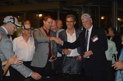
Invited guests at the annual GPS World Leadership Dinner, a special event held September 11 during ION GNSS+ in Tampa, Florida, heard perspectives from sponsors Lockheed Martin, Exelis, Raytheon, and Braxton Technologies, as well as visions of GNSS progress from our four award winners.
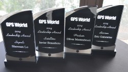
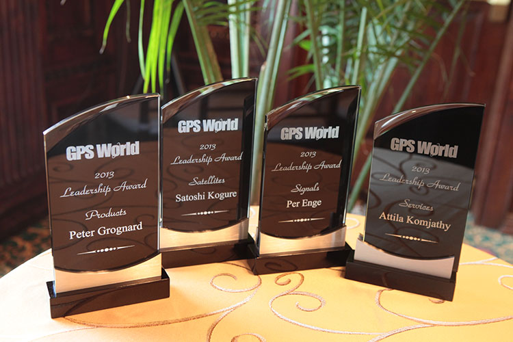
Leadership Awards were given to Javier Benedicto Ruiz, Galileo Project Manager, European Space Agency (Satellites category); Sherman Lo, senior research engineer and associate investigator (APNT), Stanford University (Signals category); Eric Gakstatter, contributing editor for survey and GIS, GPS World (Services category); and Oliver Montenbruck, head of GNSS Technology and Navigation Group, DLR, German Space Operations Center (Products category).
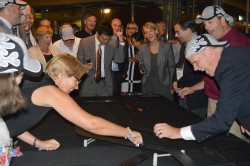
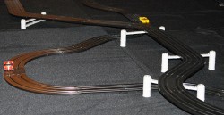
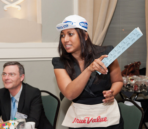
Over dessert, each table rose to the challenge of creating a phenomenal GNSS product or service and then competed in car races at the track.
More coverage of the awards will appear in the December issue.
The Dinner and Awards Ceremony was attended by 150 VIPs from industry, government, and research: top-level GNSS networking.
The 2014 leadership awards, determined by a poll of 40 industry professionals, await the start of the ceremony.
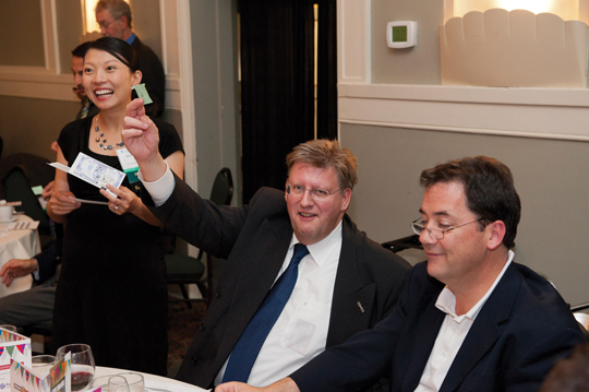
Eric Gakstatter (right) congratulates Todd Humphreys on a successful lap as Peter Grognard (center) looks on. At left are GPS World’s Kevin Stoltman and Tony Murfin. Photo: ION GNSS+
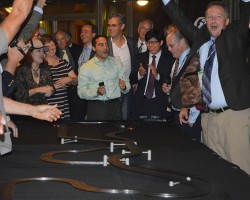
One lucky/skillful team with the highest combined product launch and race score took home trophies. Photo: ION GNSS+
Teams competed at the races, with a driver and pit crews to get cars quickly back on the track after spinouts. Photo: ION GNSS+
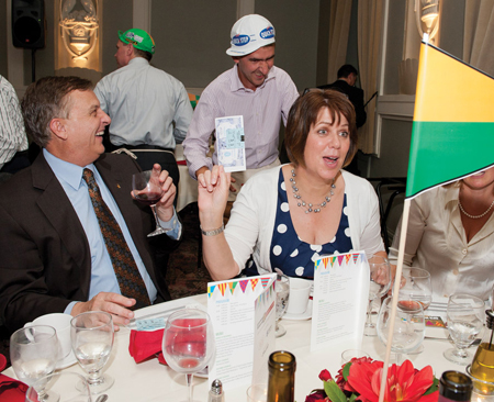
Victory at the finish line after a wild 20 seconds, as 14 teams competed in a double-elimination tourney — 23 races in all! Photo: ION GNSS+
The track pits two cars driven by two teams against each other in a double-elimination tourney. Photo: ION GNSS+
This article reproduces the acceptance speeches given by the winners of GPS World’s 2013 Leadership Awards, at the Leadership Dinner in Nashville in September.
Nominations for the 2013 Leadership Awards came from the Editorial Advisory Board of GPS World, from the 2012 Award winners, and from a select handful of industry executives. A similar group of GNSS community members, roughly double in size, voted for the final Award winners presented here.
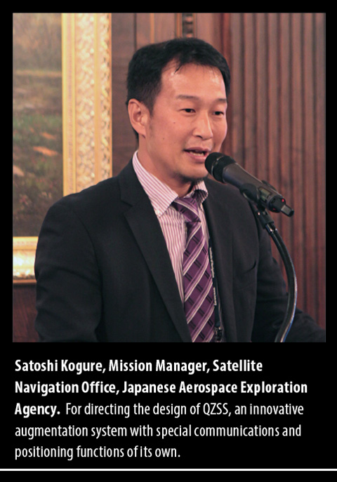
Success with a New System, QZSS
Japanese Government Approves a Four-Satellite Constellation
It is my great honor to receive this GPS World Leadership Award 2013 on behalf of my team. I’d like to express my gratitude to my family, my colleagues, and especially my team members. We jointly developed the first satellite of the Quasi-Zenith Satellite System in Japan.
The project was established after long discussion between the Japanese government, industries, and user communities, as well as other GNSS providers. QZSS is now providing GPS availability and capability enhancement to Asia and the Oceania region as a regional augmentation system. We are very proud of a great achievement on the first satellite technical validation. Our first satellite can provide the same signal-in-space user range error performance as the latest GPS Block IIR-M and IIF space vehicles.
As a result, considering our achievement, the Japanese government has decided to proceed with the QZSS program to the second phase. So we will have three additional satellites by 2017 and we’ll start the augmentation service surrounding Japan, East Asia, and the Pacific region from 2018, using the four-satellite constellation.
The Japanese government is conducting the system design for the operational QZSS, and the Japanese Aerospace Exploration Agency is continually supporting the government’s activity. We expect that QZSS will bring great social benefits to life in the Asia-Pacific region in a wide variety of fields.
Again, on behalf of all the people who have been involved in the QZSS project, I give my sincere appreciation for this reward. I would also like to acknowledge everybody in this room, because we have learned so many things from this wonderful society. So it is my great pleasure to share my gratitude with you. Thank you very much.
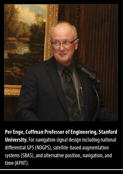
The One Constant: New Challenges
Jamming, Spoofing, Squeezing, Security, and More
First and foremost, thank you for this wonderful award. It caused me to reflect on all of the wonderful people that I have worked with over the years. This morning, I tried to list these people for NDGPS, WAAS, and APNT; and the lists were too long to repeat in five minutes. For WAAS alone, the list includes people from the Federal Aviation Administration, Stanford University, AJ Systems, RTCA, Raytheon, Zeta, Inc., and the Mitre Corporation. This beautiful award reflects on the efforts of everyone on these long lists.
These lists also remind me of the remarkable community that is GNSS today — all of us. Apparently, we still have our work cut out for us. After all, I understand from this very conference that:
GNSS is blocked;
GNSS is jammed;
GNSS spectrum will be squeezed;
GNSS is spoofed;
GNSS is scintillated;
GNSS is too expensive;
GNSS is Swiss cheese (thank you, Nunzio).
Honestly, I was not really aware that GNSS is all that fragile. It seems to work fine to me. But let us take the point: these threats are worth our worry, and mitigation will require the full strength of our far-flung community.
Spoofing is worth some special mention. It is certainly interesting, and the theory will be gorgeous. However, I remind you of Faflick’s theorem:
“In your professional life, you will work on many interesting projects. With luck, you will work on some important projects; those will be important to your company, your nation to the global community. However, (Faflick asserts) you will never ever work on any projects that are both interesting and important.”
Well, it seems that GNSS and WAAS are exceptions. But two such small exceptions should not cause us to turn our back on a theorem as powerful or persuasive as the one provided by Faflick. If we apply the theorem, then spoofing cannot be important, because it is interesting. However, I think spoofing is also an exception to Faflick’s theorem.
After all, today’s e-security is based on three security factors: what we know (passwords), what we carry (key fob), and what we are (fingerprints, iris scan). And it is not enough. For example, our health records will soon be online, and the damage caused by losing control of these health records would be great. To meet this challenge, we need to rejuvenate the original security factor: location. In the past, transactions were secured by our presence. In the world of e-commerce, this factor has disappeared, and we must use GNSS to approximate this ancient and effective security factor.
All of this will require the best effort of this precious community of ours.
Science Powers New Applications
Radio Occultation Techniques May Warn of Natural Disasters
I am deeply honored to receive GPS World’s GNSS Leadership Award this year. Many thanks to the magazine and the international group of GNSS experts for recognizing my contributions to the GNSS community with this prestigious distinction.
I have been privileged to receive support and guidance from a great number of colleagues and friends over the years — too many to list, but I thank them all. If I am a good researcher, it is because I had excellent mentors. Chief among them is Professor Richard Langley of the University of New Brunswick, sitting in the audience, who believed in me and taught me to leave no stones unturned in my research and to continue questioning myself along the way.
Professors George Born and Penina Axelrad also had immeasurable influence on me at the University of Colorado in becoming a GNSS researcher. I am greatly indebted to Tony Mannucci and Brian Wilson at NASA’s Jet Propulsion Laboratory for creating a stimulating, conducive, and rewarding research environment in my group at JPL. I would like to thank my wife Katie and sons David and Adam who have been most patient and who have supported me all these years.
At the early stages of my career, working with GPS data at the University of New Brunswick, we routinely had access to about 40–50 GPS receivers worldwide, and this was after a laborious process of hunting down individual RINEX files. Now, we process data from about 1,200 GPS and GLONASS stations daily in an automated fashion including daily, hourly, and streaming GPS sites. Data centers including ours at JPL generate real-time products to retrieve three-dimensional electron densities using global assimilative ionospheric modeling and other techniques. As computational power increases, I envision that we will see new scientific discoveries evolving with real-life applications and tangible benefits to society. These emerging applications already include the detection of small perturbations in the ionosphere using GNSS real-time measurements that may be indicative of natural hazards generating acoustic and gravity waves in the atmosphere.
Why is this important to us, other than being of scientific interest?
The advances in GNSS ionospheric measurements may soon be capable of augmenting tsunami early-warning systems, for instance. Other potential applications include detecting volcanic eruptions in remote corners of our planet using GNSS data. Less innocent yet equally important may be detecting nuclear tests using GNSS ionospheric measurements.
Another scientific application in the works is the creation of three-dimensional coupled ocean-atmosphere-ionosphere modeling capabilities. These models are at the initial phases of development, running on supercomputers including one at JPL. In a few years, we expect to see that coupled physics-based modeling will help detect and confirm natural hazards and artificial explosions on the Earth’s surface.
In a not too distant future, I anticipate that we will see natural hazard-generated signatures detected using low-Earth orbiting satellites. Initial results suggest that some of the largest events including large earthquakes, tsunamis, and meteor events may be detected in radio occultation measurements. I expect to see a fleet of low-Earth orbiters monitoring Earth’s ionosphere in real time, looking for signatures of tsunamis, earthquakes, volcanic eruptions, meteor events, large forest fires, or nuclear tests.
It is also tempting to use this technology and associated algorithms to claim ionospheric precursors of earthquakes. While I am not convinced about the technical feasibility of ionospheric earthquake precursors, it is a fascinating research area, which has generated heated debates in the community over the years.
With the abundance of different constellations including GPS, GLONASS, BeiDou, QZSS, and others using ground and space-based observations, we are clearly entering a new era when mid-ocean 10-centimeter-level tsunami waves may be detected in the ionosphere at 400 kilometers altitude in real time! Could you have imaged even only 10 years ago that by looking at real-time ionospheric measurements we could infer 10-centimeter-level tsunami waves well before they reach a shoreline? This might help decision makers to save human lives and potentially billions in material damages.
In closing, let me repeat that I am deeply honored to have received the GPS World Leadership Award. I look forward to continue pushing the boundaries of scientific and technical discoveries using GNSS technologies.
Thank you very much.
Getting to the Plus in GNSS
Multi-Constellation, Environments, Multi-Sensors
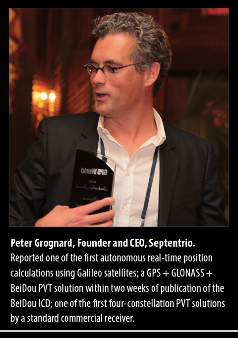
Dear friends, dear colleagues, it is with pride that I receive this award tonight, in this very town where I attended ION GPS for the first time in 1998, and where I met some of you for the very first time.
Septentrio didn’t formally exist then, but while at the Interuniversity Microelectronics Center IMEC in Belgium, and just returning from a four-year assignment in the United States, where I witnessed the beginning of civil GPS, I was preparing the creation of the company that I am so proud of, and that is first and foremost a very international family of unique, talented people that I enjoy working with every day!
Hence, my first words of gratitude go to my world-class team that for 15 years now has been at the forefront of advanced GNSS receiver development.
I also take the opportunity to thank some of our long-standing customers and partners, who all those years have given us their business and confidence. In particular, let me thank here tonight the European Space Agency, with whom we have worked hand in hand for more than 10 years. Thank you for your confidence and business — it is a tremendous honor to work with you, and we have enjoyed the truly historic milestones on the Galileo program as much as you have.
As the motivation for tonight’s award, a number of important new developments were mentioned, as achieved by Septentrio throughout an already very busy year:
the successful position/velocity/time (PVT) calculation using BeiDou satellites in a three-constellation solution on a commercial PolaRx4 platform just days following the official release of BeiDou’s Interface Control Document;
the first autonomous real-time Galileo PVT calculation. The standalone position was calculated from in-orbit navigation messages using a standard PolaRx4 GNSS receiver equipped with commercially released firmware;
the first four-constellation PVT performed by a standard commercial receiver. The 3D-position fix happened shortly after the Galileo IOV satellites began transmitting, for the first time ever, a fully usable navigation message as part of an ESA experiment;
and last, but certainly not least, the first Galileo PRS-only positioning for European Secured Navigation using only the encrypted Galileo Public Regulated Service (PRS) signals broadcast by the four Galileo In-Orbit Validation satellites.
I’ll share with you some future directions for us, outlining three major themes running across our developments.
When we first met here 15 years ago, the focus of our industry was all about GPS. Today, our favorite yearly rendezvous has been rightly renamed ION GNSS PLUS. GPS is not alone anymore. Not alone, because who today would give up the great signal availability that multi-constellation reception brings us? Not alone, because who would claim that GPS can survive in its own bubble of safety without considering the environmental conditions it lives in?
Finally, not alone because modern positioning and navigation require multi-sensor fusion to perform at their best.
Multi-Constellation Reception. Septentrio has, from its very beginning, focused on developing multi-frequency, multi-constellation receivers, at a time when this was far from common. Our first proprietary ASIC was a highly integrated GPS-GLONASS-SBAS chip, which we used as the core of the first generation of Septentrio multi-system/multi-frequency receivers.
“All the signals in the sky” was, is, and will always remain one of our key leitmotifs. We follow with great interest the new developments around the world, for instance for future-generation EGNOS and Galileo systems. As a practical example, I’d like to mention the work that we conduct with European partners on EGNOSv3.
Also, it’s my pleasure to announce here tonight the development of our fourth-generation correlator ASIC, GReCo4: all–in-view, all-signals, all-Septentrio!
The consistent focus on multi-system, multi-frequency receivers was obviously driven by the desire to make very powerful, robust GNSS receivers that would provide high-precision PVTs under the widest range of circumstances.
Our unwavering support for Galileo from the early days was also based on the fact that we could, at the turn of the century, easily receive 15–20 satellites: GPS+GLONASS+EGNOS.
Environments. Obviously, no matter how many independent systems are combined, GNSS remains vulnerable and sensitive to all kinds of interfering sources, human-made and made by Mother Nature. That’s why in recent years, we have been investing a lot of effort in understanding and mitigating the environmental disturbance that affects GNSS receivers.
While we must be humble for, and cannot (completely) tame the forces of Mother Nature, Septentrio has spent a lot of effort on ionospherical receivers. These developments have been conducted by a Septentrio-led consortium of European and Brazilian partners, with as a tangible outcome the Septentrio PolaRxS receiver, aimed at measuring the ionosphere. This unique state-of-the-art receiver is being deployed worldwide by our customers and partners, which helps us improve our understanding of ionopheric behaviour and its impact on GNSS receivers. Our goal: making the most robust professional receivers in the world.
With respect to interference, both intentional and unintentional, Septentrio will continue to improve and expand its solutions. Septentrio’s state-of-the-art Advanced Interference Mitigation (AIM) is AIMed at providing our customers the most robust reception under adverse and hostile conditions.
Multi-Sensors. “All of the signals in the sky” only works if your receiver sees the sky. If there are no satellite signals — for instance, because of blockage of the signals in a container terminal — one obviously needs other sensors to take over and guarantee the continued availability of a PVT-solution.
For several years, we have been offering combined GNSS-INS solutions for a variety of applications, such as management of container terminals. One of our very first customers was the Port of Singapore Authority.
Septentrio will continue to work along these three exciting axes. We look forward to communicating new trends and developments to you wonderful, global GNSS+ community!
At the magazine’s annual Leadership Dinner, held during the ION-GNSS Conference, we gave the first GNSS Leadership Awards to four individuals for their respective work in the four fields of satellites, signals, services, and products. We asked each recipient to give us a vision of the future: upcoming work, whether that’s something they plan to undertake or they think someone else should get going on, new directions for the industry, and so on. I asked them to ruminate as speculatively and as far into the future as they wished to go. Here’s what they told us.
These are not lifetime or career achievement awards, but recognition of significant contribution in the last year or two. Think of them as the Oscars, the Academy Awards of GNSS, if you will, for significant recent achievement.
Several people were nominated in each category by a small group, then voted on by a larger group of about 40, including the magazine’s Editorial Advisory Board, the contributing editors, and a dozen industry executives.
Here are the award recipients, followed by their remarks to an audience of 200 GNSS international VIPs attending the GPS World dinner.
In the Satellitescategory: Martin Unwin and the Surrey Satellite Technology Team
Principal engineer, SSTL.
For work on the GIOVE-A and Galileo IOV satellites, and on space-borne receivers
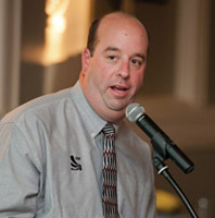
In the Signalscategory: Todd Humphreys
Director, Radionavigation Laboratory, and assistant professor, University of Texas at Austin.
Leader of several seminal studies on spoofing and jamming; testified this summer before Congress on the subject.
In the Servicescategory: Waldemar Kunysz
Senior staff engineer, NextNav LLC.
Forwork on Wide Area Positioning System (WAPS) design and implementation in the continental United States.
In the Products category: Robert Lutwak
Chief scientist, Symmetricom.
For practical advances to overcome the intrinsic physical barriers to affordable chip-scale atomic clocks, enabling precision time and time transfer in mobile GNSS and communications systems.
Now, their remarks.
Martin Unwin, honoree in the Satellites category.
Martin Unwin
Principal Engineer, Surrey Satellite Technology Team
“I feel privileged and honoured to receive this award from GPS World.
“With respect to the achievements in GIOVE-A and Galileo, I cannot claim this award on behalf of myself, but I will claim it on behalf of the people in SSTL who made the projects possible, and to those in the team here who have been working tirelessly to make the payloads and satellites happen. We are of course partnered with others in Europe that have been labouring equally hard, so it has been a true team effort.
“With respect to the spaceborne GPS and GNSS activities, my achievements have only been possible thanks to the top class staff we have in the receivers team, and thanks are also due to the support we have had from the rest of SSTL.
“In the 20 years I have been in the company, Surrey Satellite Technology Ltd has grown from a small University-based department to a major player in the international space scene, and I am immensely proud to have been part of this story.
“A few words for the future:
“Whilst it cannot quite match the early heady days of GPS, I still think nevertheless we are entering an exciting time in the GNSS world. We have two operational systems, and within a few years, we will be seeing two more reaching operational capability. Dual-, even triple-frequency civil signals will soon become operationally available, and some very wide bandwidth signals will be sent down, in particular, by Galileo. There is bound to be a steep learning curve in understanding how to exploit these new signals, with a few crevasses to be negotiated during the climb. But these new signals are bound to lead to an expanded vista of increased accuracy and robustness, and undoubtedly some unexpected destinations.
“Taking perhaps the highest perspective, spaceborne remote sensing is a good example that has surprising relevance to the rest of us still on the ground. In this case, GNSS satellites are used as radar sources, and all that is required on a low Earth orbiting satellite to change the world is a GNSS receiver. GPS Radio-Occultation measurements from low Earth orbit are now already the third most important data source for our global weather forecasts, thanks to the like of the COSMIC and MetOp satellites. Furthermore a new constellation of satellites called CYGNSS has recently announced by NASA that will be using ocean-reflected GPS signals to probe inside hurricanes and typhoons, and for the first time will enable the sensing of the wide-scale ocean roughness, leading to improved global wind and wave knowledge.
“By adding to this spaceborne receiver the ability to accommodate signals from Glonass, Galileo and Compass, plus any other available GNSS-type signals, the number of measurements is instantly quadrupled, and a new capability in sensing the atmosphere, waves and even ice and land is likely to be seen. Meteorologists already view GPS as an emerging utility for weather and climate sensing, but I think this new role for GNSS will be reinforced and expanded into yet another area where GNSS incontrovertibly, if indirectly, makes such a significant difference to our daily lives.
“As with many other applications where GNSS has become important or even critical to our modern world, this is, at the same time, both a blessing and a matter for some caution.”
Todd Humphreys, honoree in the Signals category. (credit: Mark Cowart)
Todd Humphreys Director, Radionavigation Laboratory,
and Assistant Professor, University of Texas at Austin
“It’s a genuine honor to receive this award. I’d like to thank Alan Cameron and all the contributors to GPS World. GPS World plays an essential role in building our GNSS community and keeping it together, providing GNSS news, instruction, and, indispensably, gossip!
“I’d also like to thank my students at the University of Texas Radionavigation Lab. Much of the credit for this award goes to them
“The futurist Ray Kurzweil spoke at a conference I attended back in 2001. Maybe some of you have heard of Ray. He’s regarded variously as a prophet, or a crackpot. He’s taking hundreds of vitamins every day to keep himself alive until the singularity arrives, at which point he’ll download himself onto a robot and live forever, or at least he’ll have his head cryogenically frozen so that he can be downloaded and live forever later on.
“In that 2001 talk Ray made some bold predictions. One, in particular, I remember well. “Within the decade,” Ray assured us, “we’ll all be wearing special contact lenses that give us a permanent Internet feed directly to our eyeballs.” Nonsense, I thought, and indeed it was nonsense. Here we are in 2012 and no such contact lenses exist, never mind their being in widespread use.
“I resolved back then that if I were ever called on to peer into the future and tell what I see, as Alan has asked me to do tonight, I’d be more modest about it.
“So tonight I’m going to make a modest prediction, and only one of them. I predict that by the GPS World dinner in 2020 carrier-phase differential GNSS, or, if you prefer an adjective for what should be a noun, Real-Time Kinematic, will be cheap and pervasive. We’ll have it on our cell phones and our tablets. There will be app families devoted to decimeter- and centimeter-level accuracy. The consequences will be fantastic. And this will be enormously disruptive to the current precision navigation industry. This will be the commoditization of centimeter-level GNSS.
“Now you may very well object to this prediction. You might point out that integer ambiguities will be difficult to resolve in the face of the near-field effects around and poor placement of the GNSS antenna in handheld units. You might also argue that the increased power requirements of carrier-phase techniques will be a dealbreaker for mobile devices. That’s all fine. I agree that those are hard problems. My students and I are looking into them, trying to overcome them.
“But please don’t make as one of your objections the one that I’ve heard so many times: “Why would anyone ever want cm-accurate positioning in their cell phone?” Because I’ll object that your objection lacks imagination.
“To see one example of what could be done with commoditized centimeter-accurate GNSS, I invite you all to a presentation by my students Daniel Shepard, Ken Pesyna, and Jahshan Bhatti tomorrow in the F5 Session (Millimeter-accurate Augmented Reality Enabled by Carrier-Phase Differential GPS). They’ll show off a crude box that we’ve built, through which, if you peer, you can see a sandcastle that’s not really there. And you can walk around the sandcastle and see it from all sides with centimeter accuracy.
“Imagine when this technology is in our tablets! Or, better yet, when it’s in our glasses — or, I suppose, our contact lenses. Not that I’m making any predictions about contact lenses…”
Waldemar Kunysz, honoree in the Services category. (credit: Mark Cowart)
“Ladies and gentlemen: I am much honored to receive this award and recognition. It means a lot to me.
“I would like to thank people that made difference in my career, without them it would not be possible to be here.
“First I am grateful to Dr. Maurice Meyer, former MIT professor. He taught me the black magic of antenna engineering.
“I am quite sure that his spirit guided me when I invented GPS/GNSS “Pinwheel” antenna when working at Novatel for which I received 6 patents. I also would like to thank Prof. Gerard Lachappelle and Dr. AJ Van Dierendock for teaching me GPS technology and to Dr. Phillip Ward to provide very useful insight to subject of interference. That knowledge saved me countless hours when troubleshooting some system level issues when designing the current and past GPS/GNSS products.
“Currently I am working at, LLC developing a new terrestrial based Wide Area Positioning System (WAPS). NextNav is a start-up company based in Silicon Valley that already, in its short life, has designed a new system that is being deployed in 40 major urban cities in the continental USA. This system will allow receiving a GPS look like signal in the areas where the coverage is weak or non-existent like indoors and dense urban developments (i.e. downtowns, urban canyons, etc.). We have already over 50 beacons installed in the San Francisco area that allows indoor and outdoor positioning anywhere from San Francisco to San Jose.
“As we know all major terrestrial systems have been shut down in the past several years such as Loran, Omega, Decca, etc. We became very dependent on satellite based services such as GPS and Glonass without any terrestrially based back-up. Any major solar storm in future could be very disruptive to this service so having a terrestrial based system that is in sync with satellite based system will fill that void.
“The future looks very bright for the positioning service industry. In my opinion, by 2020 it will become another utility such as phone or power. I’d like to agree with my other awardee and predict that in 2020 we will be able to have a carrier-based positioning accuracy anywhere and anytime available from any devices including handheld units. You will know where all your assets are and you won’t need to post a question to your wife: “ Honey, did you see where my tie is?”, your personal digital assistant will locate it for you.
“Thanks again everyone for being here.”
Robert Lutwak, honoree in the Products category. (credit: Mark Cowart)
Robert Lutwak
Chief Scientist, Symmetricom
“Thank you, Alan, for the introduction. Thank you also to the awards committee and especially to the individual who nominated me.
“Alan requested, repeatedly and forcefully, that we keep the sentimentality to a minimum, but I would be remiss if anyone left here with the impression that the development of the Chip-Scale Atomic Clock was in any way a solo effort.
“On the contrary, while I have had the privilege of being the “front man,” the success of this program can be attributed entirely to the fantastic collaboration between three highly disparate groups, from very different industries and cultures, including our Research Group at Symmetricom’s Technology Realization, in Beverly, Massachusetts, the MEMS group at The Charles Stark Draper Laboratory, led by Mark Mescher and Matt Varghese, and the optoelectronics group at Sandia National Laboratories, led by Darwin Serkland. If any of these groups and people had been anything less than extraordinary, both technically and personally, I would not be standing here this evening.
“With this introduction I can say, with little loss of humility, that the Chip-Scale Atomic Clock is a really cool device. Depending on where you’re coming from, it’s either 100X lower size, weight, and power (SWAP) than traditional atomic clocks or it’s 100X more accurate than quartz oscillators with comparable SWAP. Regardless of your perspective, it clearly represents a disruptive technology and paradigm shift for portable battery-powered navigation, communication, and timing applications. For comparison, the CSAC can run for a day on a full cellphone battery charge whereas the next lowest power clock of comparable performance will run down a car battery in an hour. The CSAC is not an evolutionary improvement in SWAP, it is revolutionary in that it enables previously untenable system architectures, mission scenarios, and network topologies.
“Since Symmetricom introduced the first commercial CSAC, roughly 2 years ago, the market response has been overwhelming. Despite having done our due diligence to predict the market demand and despite having nearly doubled our manufacturing output every quarter, our shipment backlog remains strong and I am frequently surprised by innovative customer applications that we had not envisioned at the product launch. We have to date shipped many thousands of CSACs to over a hundred different customers, representing vastly different markets and applications. While many of the novel applications are still in the early stages of prototype development and evaluation, it is clear that CSACs will be ubiquitous across diverse applications within the decade.
“I am fortunate, in my position, to interact directly with the technical integrators of the CSAC and learn the details of many of the applications. My general impression is that the timing and frequency stability performance of the CSAC is adequate for most of the emerging applications. The most common requests that I hear from customers are for reduced cost, power consumption, and size, in that order. It is not surprising that size is at the bottom of the list — in most applications, the batteries are still larger and heavier than the CSAC, so small improvements in power consumption are generally more valuable to reducing system SWAP than size reduction of the CSAC itself. As in any new technology, the cost will come down naturally with increased volume and improved manufacturing efficiencies, both at Symmetricom and at our vendors. While it is unlikely that you will get a CSAC in your next free cellphone, I do expect that the cost will progressively decrease over the next several years and the technology will become cost-viable to an exponentially increasing spectrum of applications. Similarly, we continue to evolve our electronics and algorithms for improved power consumption, aided by external advancements in microwave and microprocessor electronics driven by the smart-phone industry. It is my expectation that a factor of 2X improvement in power consumption is likely within the next three- to five-years.
“To date, most of the commercial products that have emerged, based on CSAC technology, have been in the timing and frequency calibration space. It is not surprising to me that the time and frequency community was the first to adopt and exploit the technology as many of them have been closely monitoring the development program and had the internal expertise and experience to rapidly exploit it.
“I admit, though, that I am a bit disappointed to see that there are no papers with “CSAC” in their titles at the 2012 ION-GNSS, but I am confident that this will change in the years to come. Adoption of CSAC by the navigation community has lagged behind the timing community in large part, I believe, because the technology has caught the community somewhat off-guard and the benefits of the CSAC to INS and GNSS are just now beginning to be realized.
“The most obvious and straightforward application of CSAC to GNSS is rapid P(Y) acquisition and we have demonstrated 15s time-to-subsequent-fix (TTSF) after two hours of GPS denial. This was a fairly simple demonstration that simply consisted of jamming time into an unmodified GPS receiver, but I believe that this is just the tip of the iceberg. With access to the core navigation algorithms within the receiver, precise knowledge of time could improve the receiver performance and reliability on other levels, including (at least):
Improved uncertainty of the navigation solution
Navigation with less than four (or less than three) satellites
Anti-spoof and anti-jam detection
Seamless co-integration of GNSS and INS systems
“Another navigation area that I believe is ripe to benefit from CSAC technology is in self-assembling navigation systems, e.g. a local ad hoc GNSS-like network which self-assembles from handheld timing beacons/receivers. Such a system would have value for safety-of-life applications in GPS-denied environments, such as indoor firefighting and mine safety.
“Thank you again for the recognition and opportunity of this award.”
GPS World’s eighth annual Leadership Dinner took place during ION-GNSS in Portland, and was sponsored by Litton Consulting Group, Sigtem Technology, and JAVAD GNSS. Excerpts from some of the speakers’ remarks appear here, as well as photos from the “You Bet Your System” after-dinner game, the first GNSS Sweepstakes, a group exercise in probabilistic and equestrian studies.
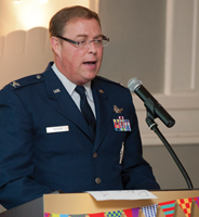
■ Col. Robert Hessin, National Coordination Office for Space-Based PNT.
From my perspective, we have not communicated well enough at a national level a vision for the future of spectrum management and customer access to emerging wireless technologies. The bottom line is, had we planned in 2001 to go deliberately down this path with MSS spectrum, I’m confident we would have found a way to co-exist by 2014.
■ Col. Bernard Gruber, GPS Directorate.
The NPEF test conducted in April was robust and comprehensive, involving over 100 receivers from 24 organizations, spanning military, government, aviation, precision agriculture, automotive, and general use communities. The results demonstrated empirically that the LightSquared terrestrial signals in their original deployment plan interfered with all types of receivers tested. The military results were consistent with results obtained by commercial GPS industry organizations such as Trimble, Garmin, and John Deere through their own independently conducted tests.
We stand ready to work with the NTIA and LightSquared to complete additional testing on the newly proposed deployment plan and receiver filter designs. We are conducting additional tests of cellular and general navigation devices on the LightSquared “Lower 10” MHz terrestrial and handset signals. We are also prepared to test filters proposed as mitigations for high-precision GPS receivers when they become available. As General Shelton stated in his recent congressional testimony, AFSPC remains open to ideas on mitigation strategies that will ensure continued GPS service to billions of users worldwide.
■ Günter Heinrichs, IFEN GmbH.
We in Europe follow very closely — and not without worry — the situation with regard to LightSquared difficulties. It would be very shortsighted for us to say that this problem will not concern us in Europe. Because all of us eventually sit in the same boat. Galileo signals will also be affected by the LightSquared problem — and not only in the USA. Due to the worldwide scarce frequency resources, the times are past that one can look at an application for a certain frequency spectrum in isolation. Decision-makers must sharpen their awareness of the effects their decisions will have on the surroundings, worldwide. In the future, avoidance or minimization of such problems can only be managed by unity and increased coordination of the different responsible stakeholders. We live in a globalized world — this must be taken into account at all future decisions. An early cooperation and coordination between all parties involved at all levels will be essential — also across border.
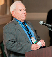
■ Jim Litton, Litton Consulting.
I want to speak of my pride in our industry, which is confronted with a manmade threat from forces that have support from politically and financially powerful special interests. My former colleagues in NavCom and John Deere have been highly instrumental in this effort. In this crisis, with its unreasonable time-line demands, the industry has pulled together, and competitors have worked with each other to meet the threat with evidence-based, scientifically sound testing and analysis as opposed to the obfuscation, historical distortion, backdoor influence, and fact-denial seemingly characteristic of the ethics of hedge-fund operators. Even some in our industry who are ambivalent about the trade-offs between the integrity of legacy systems and opportunity for new sales have acted with propriety, openness, and respect for the truth. Millions have been spent, and program schedules delayed, to respond in this manner.
■ Greg Turetzky, CSR.
The basics of the problem are that the current rules in the FCC do not provide sufficient protection for GPS. Lightsquared is not the first group to go to the FCC and propose a change to the plan that meets the rules, but still degrades GPS performance. Remember UWB? If we don’t want to have to keep raising our hand and saying, “I know it follows the rules, but we are special,” we should work to change the rules. I would like to see our industry get together and propose any changes that are needed to the FCC. Let’s not forget that this is an international problem. As Tony Pratt reminded me, we could also take this to the ITU. The rules were created to protect one communication system from another. The rules we need would protect a below-the-noise navigation system from a high-power communication system.
■ Javad Ashjaee, JAVAD GNSS.
Spectrum is getting congested, and we cannot assume the luxury that we had can continue any longer. We should not be selfish and expect all others to stay away from us because their smell bothers us! Every GNSS receiver should put in a good filter so that others can coexist near us.
LightSquared is a very nice complement to GNSS. It can provide a nice communication channel for our RTK. If military receivers cannot tolerate LightSquared, how can they survive electronic warfare? If an enemy puts LightSquared-like transmitters in the theater of operation, our military equipment gets affected? Military units with P-code are more sensitive than JAVAD receivers that use encrypted P-code? Starting today, everything JAVAD GNSS ships will be LightSquared-hardened, or eligible for free upgrade later.
Mike Swiek (U.S. GPS Industry Council) and Stuart Riley (Trimble).
You Bet Your System
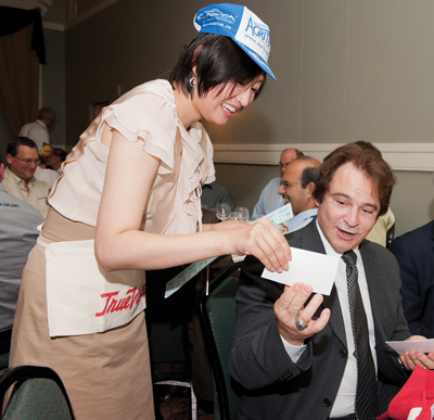
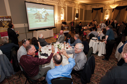
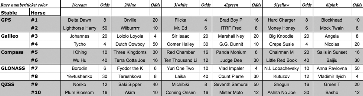
Over dessert and coffee, 150 VIP dinner guests played the ponies: six races, with horses from five GNSS racing stables.
Track stewards Ismael Colomina (Institut de Geomàtica) and Allison Kealy (University of Melbourne) get instructions and prepare to sell tickets.
Mike Shaw (Lockheed Martin) appreciates Jane Wilde’s (European PNT Industry Council) all-in bet.
Tom Hunter (JAVAD GNSS) sees his horse lose by a nose.
Sherman Lo (Stanford), Logan Scott (consultant), and Alan Grant (UK General Lighthouse Authorities) peruse the racing card: “We devised a betting strategy that left us flat broke.”
Compass delegates Yuanxi Yang (China National Administration of GNSS and Applications) and colleague Jing Tang enjoyed the evening — and now plan a GNSS racing event in China — with Fang Sheng (Raytheon).
Gard Ueland (Kongsberg Seatex and Galileo Services) holds a winning ticket, flanked by Grace Gao (Stanford) and Gordon Dale (NovAtel).
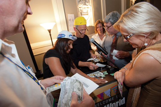
Eric Gakstatter counts his winnings as Allison Kealy and Alan Cameron frantically make payouts to Antje Tucci (IFEN GmbH), Rick Hamilton (CGSIC), and Dorota Brzezinska (Ohio State University).
Track stewards Sasha Mitelman (consultant), Fabio Dovis (Politecnico di Torino), and Michael Glutting (JAVAD GNSS).
Mitch Narins (FAA) puts his last dollar down on a bet with Di Qiu (Sigtem).
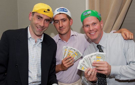
Col. Bernie Gruber (GPS Directorate) and Ron Hatch (NavCom) celebrate their onscreen winner; trackmaster Sam Pullen (Stanford) at the controls on right.
I wish to second Jim Spilker’s comments in his recent letter to the editor regarding the two wonderful GPS history articles by Brad Parkinson. My endorsement of his comments also includes those about the origins of the L5 signal with reference to the 1999 paper by Spilker and Van Dierendonck, “Proposed New Civil GPS Signal at 1176.45 MHz.” Jim commented in the letter that “. . . . the work I did in designing the GPS L5 signal was performed as a gift to the U.S. Air Force, Federal Aviation Administration, and our country, . . .” It was a generous contribution, and I applaud it.
However, this leads me to comment on other very important but underreported gifts to L5 and subsequent signal developments. A small indication of the L5 contributions is given in the brief acknowledgement at the end of the referenced paper, “The authors wish to acknowledge the contributions of Dr. C.R. Cahn and Thomas Stansell in the selection of this signal.” It also is important to recognize that the L5 signal structure was formulated within an RTCA committee of mostly volunteers. Among other key participants, in addition to A.J., was Dr. Chris Hegarty.
The L5 signal design included several innovations which influenced subsequent development of modernized GPS signals and of signals for other GNSS. My ranking of the most important L5 innovations is:
Center frequency of 1176.45 MHz in an ARNS band
Two signal components, one with a data message and the other without (pilot signal)
Forward error correction (FEC) (first GPS use, borrowed from WAAS)
Overlay code to frame symbols and eliminate need for bit synchronization
CNAV message structure for better accuracy and more flexibility
The list doesn’t include the 10.23 MHz code clock rates or having two signals in phase quadrature, which were included in the first GPS satellite launched in 1978. The new center frequency was recommended by Karl Kovach (then with ARINC and now with Aerospace) and adopted before the signal design began, but it was central to the L5 purpose of having a civil signal in an ARNS band. This same center frequency also will be provided by Galileo and Compass, so it was a vital innovation. Although forward error correction had been adopted for WAAS, the first use on GPS was the L5 design. In one form or another, it too will be used on most if not all other GNSS signals.
The second and fourth innovations in the list above were contributed by Dr. Charlie Cahn with help and encouragement from Richard (Rich) Keegan and myself. Having a dataless or pilot signal provides a significant boost to performance and has been adopted for almost every subsequent GNSS signal. The problematic C/A bit synchronization process has been eliminated by the data symbol overlay code (or equivalent) in all subsequent signals. The CNAV message format was principally developed by Karl Kovach with significant help from Art Dorsey of Lockheed Martin.
In summary, Brad Parkinson helped memorialize many of the early “GPS Heroes” who made GPS what it is today. Other heroes have contributed to GPS modernization, and credit should be given where credit is due. Brad mentioned Charlie Cahn, one of my real heroes, who helped shape the 621B and early GPS signals and has continued to contribute in many ways. In addition to the very significant innovations mentioned above, Charlie was key to similar improvements made in the subsequent L2C, M-code, and L1C signal designs.
— Tom Stansell
Kauai, Hawaii
An Advisor Bids Farewell
Paul Cross
Many thanks for the kind invitation to GPS World’s Leadership Dinner. I have to decline as I won’t attend ION-GNSS this year. I will retire from University College London at the end of September. I don’t plan to remain active in the world of GNSS after my retirement so this would be a good time for me to step down from the Editorial Board. I’ve very much enjoyed my association with GPS World and have benefited enormously from it.
I wish you and the magazine continued success. You have come a long way over the past twenty years or so and you are now, and have been for some time, the premier source of news (and very useful gossip!) relating to GNSS worldwide. I don’t know anyone of any significance who doesn’t read GPS World every month. Your highly accessible technical articles have been of enormous help to many cohorts of students here at UCL, and all over the world.
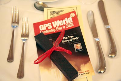
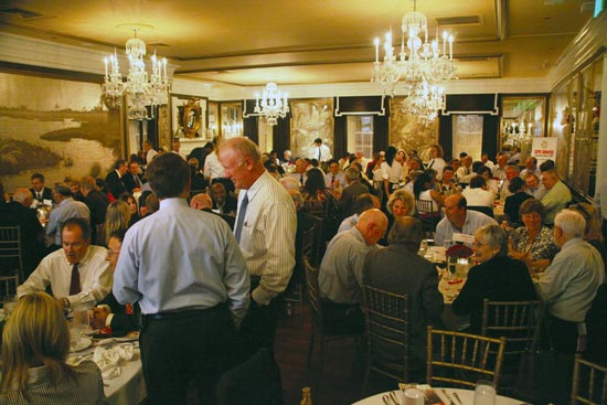
Photos from the GPS World Leadership Dinner 2009, September 24
ION GNSS 2009 Conference, Savannah, Georgia
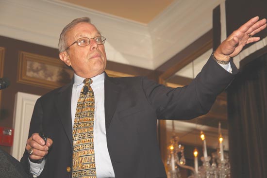
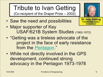
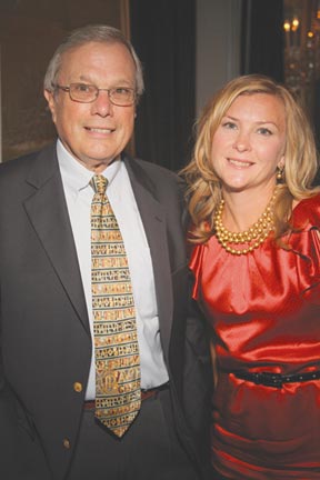
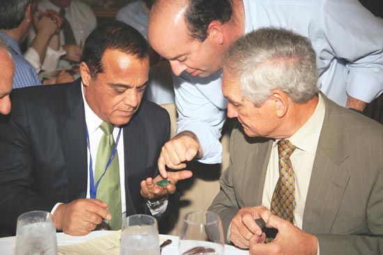
Bradford W. Parkinson, the first GPS Program Office director, chief architect, and advocate for GPS, relates “The True Story of the Origins of the Global Positioning System” and pays tribute to many of the people he worked with during that time.A slide from Parkinson’s presentation, which drew from previously classified reports as early as 1964–66. A text version of his history lesson will appear in an upcoming GPS World magazine.Keynote speaker Brad Parkinson with the evening’s hostess, publisher Kristina Panter.It’s hard to tell which shines brighter, the crystal chandeliers in Savannah’s Olde Pink House ballroom, or the many GNSS luminaries in attendance. Also sponsoring the Leadership Dinner were ITT and Spirent (Silver), and Trimble (Bronze).Greg Turetzky of SiRF Technology shows off his newest chip to Javad Ashjaee and Tom Hunter of JAVAD GNSS.
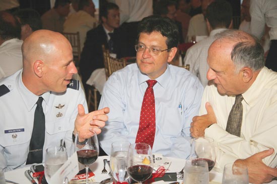
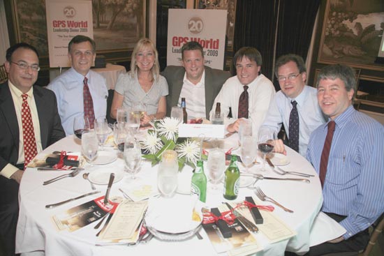
Col. David Goldstein, GPS Wing, converses with Art Gower of Lockheed Martin and Len Jacobson, Global Systems and Marketing (both members of GPS World’s Advisory Board).Lockheed Martin Space Systems was a Gold Sponsor of the dinner. From left are Todd Bender, Mike Shaw, Nancy Fitzgerald, Dan Hennessey, Bob Wright, Tom Hollenbach, and Daniel Reigh.
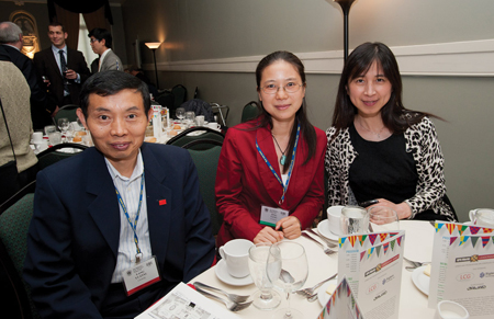
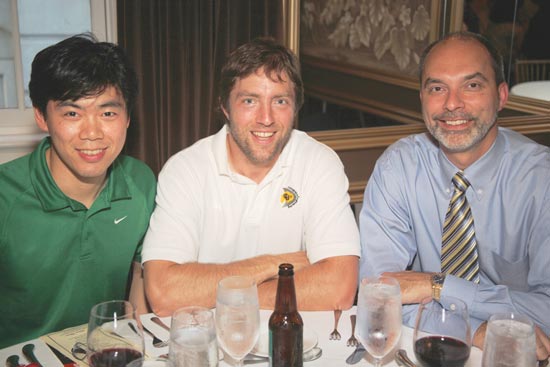
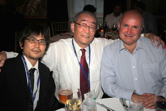
(from left) Sherman Lo, Stanford; Dennis Akos, U. Colorado/CSR; Mikel Miller, U.S. Air Force, ION president.(from left) Tomoya Shibata, Copla Corp.; Hiroshi Nishiguchi, Japan GPS Council; John Wilde, DW International.(from left) Carl Andren, ION; Donna Reay, Galileo Supervisory Authority; Hermann Ebner, European Commission, Galileo Unit.(from left) Attila Komjathy, JPL; Thomas Pany, iFen GmbH; Chaminda Basnyake, GM; Tom Nagle, GPS Wing.