By Michael J. Dunn, Space Systems Command, Capability Area Integrator for Positioning, Navigation and Timing
The Global Positioning System is the premier positioning, navigation and timing (PNT) source for more than six billion users worldwide. It is vital to the function of all 16 of the United States’ essential critical infrastructure components. Life as we know it relies on the essential services that GPS provides.
The United States Space Force (USSF) is committed to maintaining a healthy GPS constellation that continues to deliver the “gold standard” of PNT availability and reliability throughout the world. Continuous improvements in equipment and performance have been a hallmark of the enterprise since its inception. 2021 was no exception, with a continued record-setting delivery of new capabilities.
Space Systems Command (SSC) at Los Angeles Air Force Base in El Segundo, California, is laser-focused on delivering the most important modernization in GPS history. The government and industry team are committed to bringing major upgrades to the space, control and user-equipment segments. It is an exhilarating time for the GPS enterprise. The specific updates within each segment cement the continued evolution in GPS and the USSF commitment to delivering advanced capabilities to the nation and the world.
Space Segment
Currently, 37 GPS satellites are on orbit, with 29 satellites set healthy. The baseline constellation requirement is 24 satellites. The system continues to perform in stellar fashion, providing an average 48-centimeter position accuracy throughout 2021.
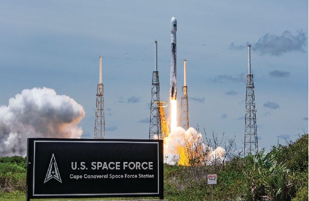
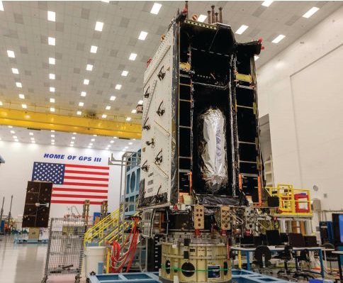
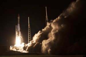
Orbital systems modernization is focused on the GPS III satellite fleet, and the program continues to deliver peerless capabilities. GPS III space vehicles (SV) 1–4 were all operationally accepted in 2020. In 2021, the most notable event was the launch of GPS III SV05 in June. The satellite successfully achieved operational acceptance and mission-capable status for USSF in just under two weeks: a new record. SVs 6–8 are available for launch and are awaiting their launch windows. SV09 system-level testing is in progress. SV10 component deliveries continue. GPS III provides up to eight times better anti-jam and a new L1C signal to improve user connectivity.
For the GPS IIIF program, the long-range picture remains bright as the contract for GPS IIIF SVs 15–17 was awarded in October 2021. The delivery of the first GPS IIIF is expected early in 2026. GPS IIIF will build upon the tremendous increase in capability provided by GPS III with the addition of a search-and-rescue payload, a laser retroreflector array for precise ranging, a fully digital navigation payload, and a Regional Military Protect capability that will provide 60 times greater anti-jam for operations in electromagnetically hostile environments.
GPS III space vehicle 05 (GPS III-SV05) launched in June 2021 from Cape Canaveral Space Force Base, Florida, aboard a SpaceX Falcon 9 launch vehicle. (Photo: SpaceX)
Control Segment
The next-generation Operational Control System (OCX) continues to execute within its program baseline. OCX will provide enhanced command and control capabilities, modernized architecture, robust information assurance and cyber security.
OCX’s incremental development approach began with OCX Block 0, which is the launch and checkout system (LCS) for GPS III. The LCS successfully supported the launch and checkout of GPS III SV 01–05. OCX Blocks 1 and 2 will control all legacy GPS III satellites and both legacy and modernized signals.
Despite barriers presented by the global COVID-19 pandemic, all 17 global OCX monitoring station installations were completed in July 2021. Most of the remaining equipment was fielded throughout December 2021. System integration and verification continues with transition to operations scheduled for early 2023.
The Next Generation OCX 3F contract was awarded in April 2021. The program will modify OCX to launch and control GPS IIIF satellites with enhanced capabilities. Acquisition Milestone B is expected in 2022, and operational acceptance is planned for 2027.
MGUE: The future warfighter’s battlespace edge. (Image: Space Systems Command Production Corps)
User Equipment Segment
Millions of GPS receivers are fielded, but very few of them can use the military code (M-code) signal that is being broadcast by 24 GPS SVs. To keep our competitive advantage against the adversary, the GPS enterprise is focused on developing modernized GPS user equipment (MGUE) that takes advantage of these signals. The MGUE program is a joint service program developing modernized, M-code-capable military GPS receivers. The program is broken into two increments (Inc 1 and Inc 2). Both are designed to deliver secure PNT performance, allow navigation warfare operations, enhance anti-jam, anti-spoof and anti-tamper, and enable Blue Force Electronic Attack.
MGUE Inc 1 achieved a major milestone in September 2021 with successful testing on the Marine Corps Joint Light Tactical Vehicle (JLTV). The event took place in an electromagnetically degraded GPS environment at White Sands Missile Range, New Mexico. The JLTV is a pathfinder lead platform for the MGUE program. Lead platforms for the other services, the Army Stryker combat vehicle, Air Force B-2 bomber, and Navy Arleigh-Burke Class Guided Missile Destroyer, will commence integration testing in FY23 and FY24.
MGUE Inc 2 development continues to make progress in maturing the next generation ASIC technology required for all weapon-system platforms to provide functionality and backward compatibility. It will deliver a miniature serial interface card in CY26 to support handheld and ground applications. Eventually, MGUE receiver cards will be loaded onto hundreds of Department of Defense (DOD) weapon systems.
GPS III SV04 in Highbay (Photo: Lockheed Martin)
Partner Community
The GPS enterprise is committed to cooperation on a global basis. It works closely with the DOD, the armed services, the U.S. Coast Guard, other federal agencies, the International Civil Aviation Organization and all the other global and regional navigation satellite systems toward the development of PNT in the global commons.
A highlight of this cooperative work is GPS enterprise involvement in the National Executive Committee for Space-Based PNT (PNT EXCOM), which supports the interests of the various federal bodies, especially the Department of Transportation (DOT) and the Federal Aviation Administration (FAA). The PNT EXCOM is applying GPS technology to a broad variety of governmental activities, including the development of the Next Generation Air Transportation System and intelligent transportation systems.
The GPS enterprise commitment to international partners is unwavering. Our support to the North Atlantic Treaty Organization (NATO) is ongoing with support to the Capability Panel 2 for Navigation working toward the integration of MGUE and compatibility arrangements with Europe’s Galileo system. A highlight this year was the first delivery of MGUE loan equipment to the United Kingdom, Canada, Germany, and the Republic of Korea. Germany is the first country to purchase MGUE equipment.
Conclusion
GPS is the foundation of global PNT and a cornerstone of modern life. Improvements to the enterprise are continual. As the nation moves into the complex and dynamic world of the coming decades, the dedicated military, civilian and industry professionals that provide this world-changing capability will continue their challenging and rewarding work. Semper Supra!
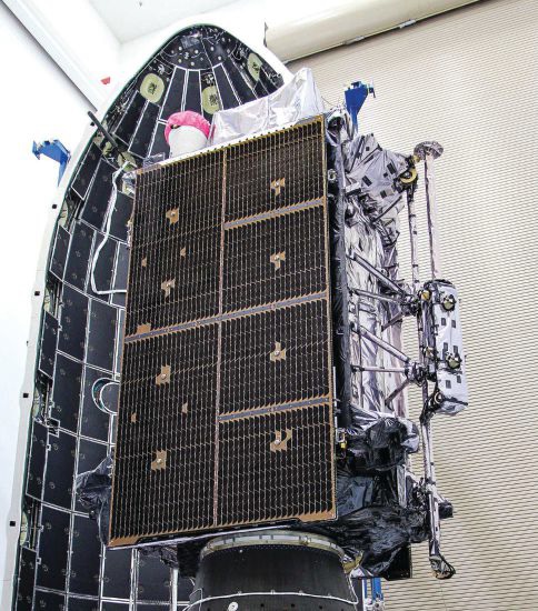
The “encapsulation” of a GPS satellite. (Photo: U.S. Department of Defense)
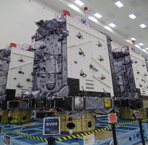
The U.S. Space Force’s Space Systems Command recently declared GPS III SV06, SV07 and SV08 satellites “Available for Launch.” Here, the space vehicles await official call up for launch in Lockheed Martin’s GPS III Processing Facility in Waterton, Colorado. (Photo: Lockheed Martin)
The U.S. Space Force’s Space Systems Command has declared the eighth GPS III satellite “Available for Launch.” This milestone marks the third space vehicle within the GPS III program to be declared available for launch in the past three months.
The next three GPS III satellites — SV06, SV07 and SV08 — are now awaiting official call up for launch in Lockheed Martin’s GPS III Processing Facility in Waterton, Colorado.
“SV06, SV07, and SV08 AFL milestones in just three months prove that GPS III production continues to benefit from efficiencies with each satellite delivery,” said Col. Edward Byrne, chief of SSC’s Space Production Corps’ Medium Earth Orbit Space Systems Division.
The first of the three recently completed satellites, SV06, is scheduled to launch in 2022 and will join the operational constellation of 31 GPS satellites.
GPS III satellites deliver enhanced performance and accuracy through a variety of improvements, including increased signal protection and improved accuracy.
GPS III also expands the civilian L5 signal, dubbed the “safety-of-life” signal, currently broadcast by the 12 GPS IIF satellites, but not yet operational, and delivers a new L1C signal designed to grant interoperability to similar international space-based position, navigation and timing (PNT) systems around the world.
As a crucial technological foundation for internet, financial, transportation and agricultural operations, GPS delivers the gold standard in positioning, navigation, and timing services supporting U.S. and allied operations worldwide.
Space Systems Command, located at Los Angeles Air Force Base in El Segundo, California, is the U.S. Space Force’s Center of Excellence for acquiring and developing military space systems. SSC’s portfolio includes space launch, global positioning systems, military satellite communications, a defense meteorological satellite control network, range systems, space-based infrared systems, and space domain awareness capabilities.
The U.S. Space Force will host the 2021 Public Interface Control Working Group and Open Forum in September and November. The meetings are open to the public in person and virtually on Wednesday, Sept. 29, 8:30 a.m. to 4 p.m., and Tuesday, Nov. 19, 8 a.m. to 4 p.m. (Pacific Time).
The meeting and forums will discuss the following documents:
The purpose of the meeting is to update the public on GPS public document revisions and collect issues and comments for analysis and possible integration into future GPS public document revisions.
The meeting will be held in person at
Los Angeles Air Force Base
Great Room, -PCT Campus
100 Sepulveda, Blvd.
El Segundo, CA 90245
Attendees are highly encouraged to participate virtually. It can be accessed at this link or at this link.
The official public notice in the Federal Register provides further information, including how to register, submit comments and dial in on the telephone.
Lt. Gen. John F. Thompson, commander of the Space and Missile Systems Center (SMC), will retire Aug. 1. A ceremony celebrating his career and achievements took place July 27 at Los Angeles Air Force Base, California, where SMC is based.
Thompson, who is the longest serving three-star commander for SMC, retires after a 36-year career with the U.S. Air Force, having served in various roles leading defense acquisition programs, strategic systems and lifecycle management.
Brig. Gen. D. Jason Cothern, current vice commander of SMC, will serve as the SMC commander while the center awaits a confirmation of a three-star general officer.
SMC includes the positioning, navigation and timing (PNT) mission, in which professionals acquire, deliver and sustain reliable GPS capabilities to America’s warfighters, allies and civil users.
“Lt. Gen. Thompson’s exemplary career has made the nation safer, stronger and better secured against an increasingly contested space environment, and earned the well-deserved opportunity to enjoy this next chapter in his life,” stated a press release from SMC.
As the commander of SMC, he led more than 6,300 military, government service and contract employees nationwide, and oversaw an annual budget of $9 billion, which accounts for 85 percent of the nation’s space budget.
In the past 18 months, Lt. Gen. Thompson tirelessly led the groundwork for the stand-up of the U.S. Space Force’s newest Field Command, Space Systems Command, which will lead the Force in the development, delivery and acquisition of innovative space warfighting capabilities.
Having completed his four-year tour as the SMC commander, his retirement will not affect the timeline of the SSC stand-up — a complex process requiring activities and approvals at the highest levels before implementation.
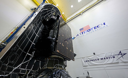
The fifth GPS III satellite was encapsulated within a SpaceX payload fairing on June 9 in preparation for its June 17 launch.
The U.S. Space Force’s Space and Missile Systems Center’s Lockheed Martin-built GPS III Space Vehicle 05 satellite was encapsulated within a SpaceX payload fairing at Astrotech Space Operations Florida facility on June 9 in preparation for launch, scheduled for June 17 from Cape Canaveral Space Force Station.
The 15-minute launch window opens 12:09 p.m. EDT. If SpaceX provides a live feed to view the launch, it will be available here.
Encapsulation of the satellite within the payload fairing protects the satellite from the impact of dynamic pressure and aerodynamic heating during its harrowing journey through the earth’s atmosphere, and supports the ability to communicate with the satellite until separation from the launch vehicle on orbit.
“The GPS III program continues to make strides in modernizing the GPS constellation for the United States Space Force, maintaining the ‘gold standard’ for position, navigation and timing,” said Col. Edward Byrne, Medium Earth Orbit Space Systems division chief, “SV05 is not only the first-ever USSF satellite launched on a previously flown booster, but also is the 24th military-code (M-xode) satellite introduced to our constellation, the last needed to bring M-code to full operational capability.”
GPS III SV05 will join the current 31-satellite operational constellation to continue to provide the gold standard in positioning, navigation and timing services for more than four billion users worldwide.
The Space and Missile Systems Center, located at Los Angeles Air Force Base in El Segundo, California, is the U.S. Space Force’s center of acquisition excellence for acquiring and developing military space systems. Its portfolio includes the development of advanced space and launch capability and systems, global navigation satellite systems, military satellite communications, defense meteorological satellites, space launch and range systems, satellite control networks, space-based infrared systems, and space situational awareness capabilities.
GPS III SV05 is encapsulated within a SpaceX payload fairing at Astrotech Space Operations Florida in preparation for its June 17 launch. (Photo: Lockheed Martin)
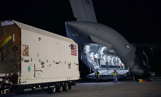
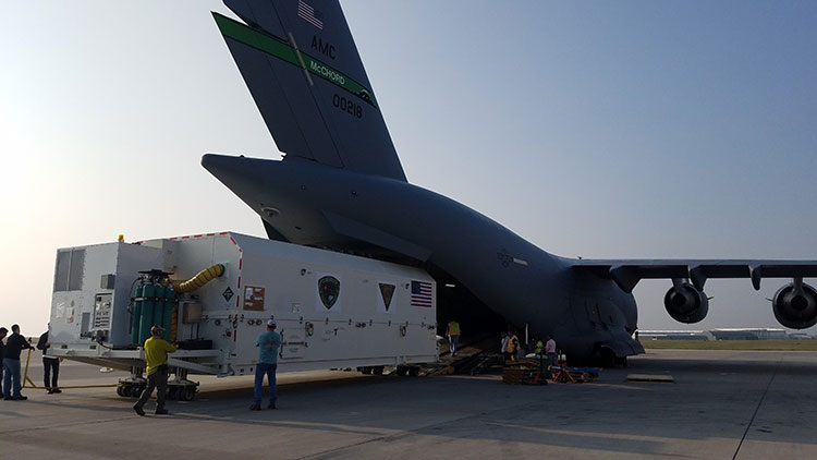
The first GPS III satellite has been delivered to Florida for launch in December on a SpaceX rocket.
On Aug. 20, Lockheed Martin shipped GPS III SV01 to Cape Canaveral. GPS III SV01 is the first of 10 new GPS III satellites being built under U.S. Air Force contract and in full production at Lockheed Martin.
Designed and built at Lockheed Martin’s GPS III Processing Facility near Denver, the satellite was transported in a custom container from the Buckley Air Force Base in Colorado to the cape on a massive Air Force C-17 Globemaster III aircraft originating from Joint Base Lewis-McChord, Washington. On Aug. 21, it arrived at the Space Coast Regional Airport in Titusville, Florida.
The first GPS III satellite is loaded aboard a U.S. Air Force C-17 at Buckley AFB, Colorado, to begin processing for a December launch aboard a SpaceX rocket from Cape Canaveral. (Photo: U.S. Air Force/Lt. Col. Erin Gulden)
Start the Clock. The delivery of Satellite Vehicle 01 (SV01) starts the clock for final testing and checkout of the space vehicle prior to launch. The satellite will be processed at the Astrotech Space Operations Florida facility.
A government and contractor team will ensure the integrity of the satellite after shipment by performing a Mission Readiness Test to verify the health and safety of the vehicle, as well as communication compatibility with the ground operations center.
The team will then prepare for propellant loading and encapsulate the satellite in its protective fairing. At the completion of these activities, the satellite will be headed for a first-of-its-kind horizontal integration with the SpaceX Falcon 9 launch vehicle.
GPS III improvements. GPS III will be the most powerful and resilient GPS satellite ever put on orbit. Developed with an entirely new design, for U.S. and allied forces it will have three times greater accuracy and up to eight times improved anti-jamming capabilities over the previous GPS II satellite design block, which makes up today’s GPS constellation.
GPS III also will be the first GPS satellite to broadcast the new L1C civil signal. Shared by other international global navigation satellite systems, like Galileo, the L1C signal will improve future connectivity worldwide for commercial and civilian users.
“The shipment of the first GPS III satellite to the launch processing facility is a hallmark achievement for the program,” said Lt. Gen. John F. Thompson, U.S. Air Force’s Space and Missile Systems Center (SMC) commander and program executive officer for Space. “The modernization of GPS has been an outstanding collaborative effort and this brings us another step closer to launch.”
Vespucci. The satellite is dubbed “Vespucci” in honor of Amerigo Vespucci, the Italian explorer for whom the Americas were named.
The transportation crew consisted of both contractor and government personnel who oversaw the entire operation to ensure that the conditions of the transport environment would not damage any of the satellite’s sensitive components, the Air Force said.
“While the launch of the last GPS IIF satellite marked the end of an era, the upcoming GPS III launch will be the start of a brand new one,” said Col. Steven Whitney, director of the GPS Directorate. “It is the first of our new GPS III satellites, first to integrate with a SpaceX rocket, first to interact with elements of GPS’ Next Generation Operational Control System (OCX) Block 0, and first to have spacecraft acquisition and on-orbit checkout from Lockheed Martin facilities. We are excited to be at this point and we are ready for the upcoming launch of Vespucci.”
December Launch. The modernized GPS III SV01 is slated to launch in December. It will augment the current constellation of 31 operational GPS satellites. GPS delivers the gold standard in positioning, navigation, and timing services supporting vital U.S. and allied operations worldwide, and underpins critical financial, transportation and agricultural infrastructure that billions of users have come to depend on daily.
“Once on orbit, the modern technology of this first GPS III space vehicle will begin playing a major role in the Air Force’s plan to modernize the GPS satellite constellation,” said Johnathon Caldwell, Lockheed Martin’s program manager for navigation systems. “We are excited to start bringing GPS III’s new capabilities to the world and proud to continue to serve as a valued partner for the Air Force’s positioning, navigation and timing mission systems.”
The U.S. Air Force has awarded a GPS III satellite launch contract to SpaceX. This is the third GPS III launch contract awarded; the previous two also were awarded to SpaceX.
SpaceX will receive a $290,594,130 firm-fixed-price contract for launch services to deliver three GPS III missions (1 base and 2 options) to the intended orbit using two Evolved Expendable Launch Vehicles (EELVs).
A SpaceX Falcon 9 rocket lifts off from Space Launch Complex 4E at Vandenberg Air Force Base, California, Jan. 14, 2017. (Photo: SpaceX)
The launch contract provides the government with a total launch solution for the GPS III mission, including launch vehicle production, mission integration, launch operations and spaceflight certification. The launches will take place from Cape Canaveral Air Force Station or Kennedy Space Center, Florida.
The GPS III missions are planned to launch between late 2019 and 2020.
“The three GPS III missions will deliver sustained, reliable GPS capabilities to America’s warfighters, our allies and civil users,” the U.S. Air Force said in a statement. GPS provides positioning, navigation and timing service to civil and military users worldwide.
In a second launch services contract, United Launch Alliance has been awarded a $351,839,510 firm-fixed-price contract for launch services to deliver Air Force Space Command (AFSPC)-8 and AFSPC-12 satellites to the intended orbit.
This is the fourth competition under the current Phase 1A procurement strategy. Both launch service contract awards strike a balance between meeting operational needs and lowering launch costs through reintroducing competition for National Security Space missions, according to Los Angeles Air Force Base, which made the announcement.
“The competitive award of these two EELV launch service contracts directly supports Space and Missile Systems Center’s mission of delivering resilient and affordable space capabilities to our nation while maintaining assured access to space,” said Lt. Gen. John F. Thompson, U.S. Air Force Program Executive Officer for Space and SMC commander.
SpaceX won two previous GPS III launch contracts, one awarded in March 2017 and one in April 2016.
The U.S. Air Force released two technical reports demonstrating that the Global Positioning System (GPS) continues to deliver exceptional performance to civilian users around the world, reported the Los Angeles Air Force Base.
Operated by the 50th Space Wing at Schriever Air Force Base, Colorado, the GPS constellation provides precise PNT services worldwide 24-hours a day, seven days a week.
The 2014 and 2015 performance reports confirm that the GPS Standard Positioning Service (SPS) satisfied nearly all measurable performance commitments documented in the GPS SPS Performance Standard, furthering the status of GPS as the “Gold Standard” for PNT.
The GPS Directorate at the U.S. Air Force’s Space and Missile Systems Center commissioned the GPS SPS performance reports to enhance public transparency of the real-world performance of civil GPS.
The GPS Directorate at the U.S. Air Force’s Space and Missile Systems Center commissioned the GPS SPS performance reports to enhance public transparency of the real-world performance of civil GPS. The reports confirm that GPS met all of the evaluated commitments for calendar years 2014 and 2015 with one exception.
This exception was that the reporting notification commitment for scheduled GPS satellite interruptions during calendar year 2014 was only met in 29 of 30 cases (96.7 percent). The vast majority of GPS users were not impacted by this single delayed notification. In this single case, the U.S. Air Force only provided 17 hours of advanced notice, as opposed to the SPS PS commitment of at least 48 hours advanced notice, before the scheduled satellite interruption.
The commitments evaluated in the reports include those of accuracy, integrity, continuity, and availability of the GPS signals-in-space. For example, the signal-in-space ranging accuracy of the GPS civil signals was significantly better than the published standard of “7.8 meters or better at the 95th percentile.” This metric represents a key component in the total “user range error” that GPS receivers experience.
Most impressively, the oldest GPS satellites still provided an average signal-in-space accuracy of 2.8 meters during their worst performing month of 2015 – surpassing the target accuracy metric by over 300 percent. On average, the signal-in-space accuracy of the GPS constellation in 2015 was 1.4 meters, which is a 0.4 meter improvement over the accuracy in 2013.
The GPS SPS performance reports are generated by Applied Research Laboratories, the University of Texas at Austin (ARL:UT), which is a Department of Defense University-Affiliated Research Center. Using data from 33 GPS monitoring and reference stations located around the globe, the ARL:UT team assesses GPS performance against the commitments defined in the 2008 GPS SPS Performance Standard. The ARL:UT reports focus on those commitments that can be verified by anyone with knowledge of standard GPS data analysis practices, familiarity with the relevant signal specifications, and access to a Global Navigation Satellite System data archive.
“The GPS Directorate remains committed to providing highly accurate and reliable PNT services to our users around the globe. The use of published standards to transparently guide data-driven decision making is how we have become the ‘Gold Standard’ in PNT,” said Col. Steven Whitney, director of the GPS Directorate. “The GPS Directorate is working every day on improved capabilities to ensure users receive the maximum benefit of the PNT services offered by GPS.”
ARL-UT expects to complete the 2016 SPS performance report later this year. The 2013, 2014 and 2015 reports are publicly available for free download. The National Coordination Office for Space-Based PNT maintains the GPS.gov website to provide official information about GPS to the public.
Air Force Space Command’s Space and Missile Systems Center, located at Los Angeles Air Force Base in El Segundo, California, is the U.S. Air Force’s center of excellence for acquiring and developing military space systems. Its portfolio includes GPS, military satellite communications, defense meteorological satellites, space launch and range systems, satellite control networks, space-based infrared systems and space situational awareness capabilities.
CBS’s 60 Minutes will air a special two-part segment on Air Force Space Command (AFSPC) this coming Sunday, April 26, reflecting a broad array of AFSPC missions — launch, satellite operations, missile warning, acquisition, and the Joint Space Operations Center.
The GPS Directorate is a joint service effort directed by the United States Air Force and managed at the Space and Missile Systems Center (SMC), Air Force Space Command, Los Angeles Air Force Base, Calif.
“The show seldom uses two-part segments, and the producers expressed that the visually interesting nature of the mission and intellectual heft of the interviews was the deciding factor in expanding the segment beyond the normal 12 minutes,” reads an email from the Retiree Activities Office of Los Angeles Air Force Base.
Included in the segment is an interview with Brigadier General Bill Cooley, director of the GPS Directorate. Cooley was interviewed at the Boeing facility in front of a GPS IIF satellite, and will discuss the foundational nature of space to the military and economy, as well as emerging threats and how the Air Force is responding.
60 Minutes airs on CBS at 7 p.m. ET/PT. Check local listings for specific times and channels.
Col. William Cooley, Director, U.S.A.F. Global Positioning Systems Directorate.
Colonel William “Wild Bill” Cooley, director of the GPS Directorate at Space and Missile Systems Center, discusses CNAV signals, GPS IIF launches, and the OCX with Defense Editor Don Jewell.
There is probably no busier United States Air Force officer than Colonel William “Wild Bill” Cooley, Ph.D., the director of the GPS Directorate at Space and Missile Systems Center (SMC), Air Force Space Command (AFSPC), Los Angeles AFB, California. He is the driving force for all things dealing with acquisition and development for GPS. Currently, he is juggling so many objects, it is amazing that he is not totally overwhelmed. Consider the issues with the Next-Generation Operational Control System (OCX), GPS IIF, GPS III, and military government user equipment (MGUE), plus a plethora of classified endeavors we can’t even discuss here. He is one busy man, but even with all that, he found time to sit down and answer a few questions in an effort to bring us all up to speed on GPS and PNT.
Don Jewell (DJ): One of the hot topics at all the symposia lately, here and abroad, has been the broadcasting of additional civilian navigation signals and messages. The U.S. Department of Transportation (DOT) originally objected and sent a strongly worded and probably unadvisable letter to General Shelton (AFSPC/CC) on the matter, but sanity prevailed, and the GPS navigation signals on L2C- and L5C-capable satellites began broadcasting with full navigation messages on April 28. However, we understand DOT still insists some restrictions be put in place for the L5C signal. Can you provide us with an update and a status on that program? Plus, what can users expect in the way of improved accuracy and signal availability?
Colonel “Wild Bill” William Cooley (WBC): As of April 28, the civil navigation message (CNAV) broadcast was implemented on all operational GPS satellites capable of transmitting the L2C and L5 signals. Currently, seven GPS IIR-M satellites broadcast L2C, and six GPS IIF satellites broadcast L2C and L5. On average, users may expect at least one L2C-broadcasting satellite to be in view at all times.
The CNAV message content now includes the minimum message set needed to support the positioning, navigation, and timing mission, namely Broadcast Message Types (MT) 10, 11, 30, and 33, which contain information about the satellites’ position, clock, health, and corrections, in lieu of the previously transmitted MT-0 placeholder or default message.
The Air Force intends to broadcast L2C messages with the health bit set healthy and L5 messages with the health bits set unhealthy until sufficient monitoring capabilities are available for the L5 signal. We expect the accuracy to be slightly less than the Legacy Navigation Message (LNAV) because we are only updating the satellites two times each week. The accuracy should improve to be slightly better than LNAV beginning this December, when we begin updating the CNAV message on each satellite daily.
DJ: The M-code (military code) and MNAV (military navigation) signals are also being broadcast on M-code-capable satellites. So, the same questions apply: what can our warfighters and government users expect as far as M-code availability and accuracy? What can you say about the multiple messaging capabilities both on the civilian and military (CNAV and MNAV) signals?
WBC: Like the civil CNAV message, the modernized military-data message MNAV will enable military users to take advantage of all of the performance improvements offered by a modernized military signal. We can expect continued accuracy improvements as newer satellites replace aging satellites.
MNAV broadcast testing will continue occasionally in support of developmental test events for the next-generation military GPS receiver cards.
DJ: I know we can get in sensitive territory here in a hurry, but since we are discussing the military signals, can you give us an update on the long-running MGUE and M-code program? When can government users expect to see an actual signal and a receiver with M-code chips and/or modules that utilize the military only signals? Plus — and here’s where we have to be careful — what can you say about the security, availability, and accuracy of the military signal?
WBC: The M-code-capable military receiver (MGUE) modules in development have successfully acquired and tracked M-code during live-sky tests, and we have many more tests scheduled. MGUE is expected to begin fielding by 2017, at which point at least 18 M-code-capable GPS satellites are expected to be on orbit, providing global four-in-view coverage of full M-code capabilities.
In the meantime, the most recent GPS IIF satellite launches have raised the total number of M-code-capable modernized GPS spacecraft to 14 (seven GPS IIR-M and seven GPS IIF). This provides four or more M-code satellites in view globally at least 50 percent of the time, and at least one M-code satellite in view continuously. This increasing M-code satellite signal coverage will enable effective, realistic, developmental and operational testing of MGUE receivers.
The new GPS III block of satellites will provide an M-code signal with greater security, and higher power, comparable availability, and accuracy when compared with the GPS IIF satellites, allowing users to operate closer to jammers and under trees, as well as with greater resistance to jamming and spoofing. Also OCX will offer significantly improved crypto protection and cyber security.
DJ: Recently, the U.S. Air Force successfully launched the fifth, sixth, and seventh SVs in the GPS IIF family of satellites in less than seven months. Quite a feat! Congratulations are in order for that milestone. However, in the past, the checkout times averaged approximately 30 days. In fact, speed in initializing the IIF SVs and declaring them operational seemed to be an unofficial goal. On GPS IIF-5, however, the rapid checkout timelines have been extended considerably. Can you enlighten us concerning the checkout program and what the government hopes to achieve?
WBC: There are three key dates with regard to checkout timelines: completion of on-orbit checkout, the transfer of Satellite Control Authority (SCA), and the Operational Acceptance of the vehicle. Measured from launch, the nominal on-orbit checkout timeline is 21 days. The nominal checkout for SCA transfer is 28 days. For the IIF-5 mission, the on-orbit checkout occurred in six days and the SCA in 11 days, a record for the IIF program!
The operational acceptance was completed 60 days later, following an on-orbit observation validating a requirement to see if the vehicle works as expected without receiving any commands from the ground segment in that time period.
This may explain the perceived extended checkout, which is in reality a delayed operational acceptance.
The average time to SCA transfer for the first four vehicles is 42 days. The average is inflated due to a long checkout of the first GPS IIF space vehicle, which took 88 days. From IIF-2 to the present, the average SCA transfer time has been 21 days.
Using SCA transfer time makes the most sense, because that is the time it took the SPO to go through the entire process (to include meetings and documentation) to hand over the vehicle.
DJ: Can you give us a status update on the entire GPS IIF family of satellites? How are the SVs faring in orbit, and are the clocks proving to be as stable and accurate as forecast?
WBC: The first seven of 12 GPS IIF satellites are currently on-orbit and meeting all mission requirements. Of the remaining satellites, one is being prepared for launch in October 2014, one is being prepared for shipment to Cape Canaveral AFS, two are in storage, and one is completing production. The oldest satellite is now four years old. The legacy GPS satellites have remained operational well past their design lives, demonstrating the high-quality engineering and mission-assurance practices used on this program. The clocks are improving the overall accuracy of the constellation with the best-ever day (measured in Signal-in-Space User Range Error) in June 2013 of 46.6 centimeters and the best week in April 2014 of 64.6 centimeters.
DJ: What exactly do the IIFs mean to the GPS modernization program, for the average user and for the GPS constellation and program as a whole?
WBC: The 12 Boeing-built GPS IIF satellites will provide improved signals that will enhance the precise global positioning, navigation, and timing (PNT) services supporting both the warfighter and the growing civilian needs of our global economy. The next-generation satellites will provide improved accuracy through advanced atomic clocks, a longer design life than previous GPS satellites, and a new operational third civil signal (L5) that benefits commercial aviation and safety-of-life applications. It will also continue to deploy the modernized capabilities that began with the modernized GPS IIR satellites, including a more robust military signal.
The anomalies that we have seen on orbit have been resolved either through rework at the factory or through modifications in flight software.
GPS IIF Launch. The seventh of the follow-on generation, rising August 1.
DJ: Bill, that’s comforting, but what about the clocks on the IIF SVs? There were serious problems with the Cesium clocks on the first couple of launches. Are the operators now able to utilize or activate either the Rubidium or the Cesium atomic reference systems?
WBC: Don, the answer is yes. The system has triple redundancy with two Rubidium frequency standard clocks and one Cesium frequency standard.
DJ: What about signal strength and stability on the IIF birds?
WBC: In addition to an increased number of signals, GPS IIF provides more than the legacy power levels, and all signals on GPS IIF meet stability requirements. For reference, the GPS IIR-M series introduced one new L1 and two new L2 signals, while GPS IIF introduced the new L5 signal. All of these signals are part of the GPS IIF navigation payload and provide information including GPS date and time, satellite health, satellite ephemeris (for individual satellite positioning), and almanac information (for information on other satellites in the constellation).
The L1 frequency carries the L1 C/A code for civil users, and the L1 P (Y) code and L1 M-code for military users. The L2 frequency carries the first modernized civil signal, L2C, and the L2 P (Y) code and L2 M-code for military users. Finally, the L5 frequency carries the newest modernized civil signal.
Modernized GPS civil signals provide dual-frequency signals to all GPS users, enabling ionospheric corrections that greatly improve the accuracy. The new L5 signal will be used for safety-of-life applications, including aviation. In addition to an increased number of signals, GPS IIF provides more than the legacy power levels, and all signals on GPS IIF meet stability requirements.
DJ: Let’s move to the ground segment. OCX, the next-generation GPS Command and Control (C2) system, has literally moved to the right on the schedule timeline for every month it has been in existence since it was awarded in 2010. The end date just keeps getting farther and farther away. OCX is also currently exceeding the original contract budget by a large margin.
What’s the problem? Is OCX more difficult or complicated than originally planned? Is there any good news to report to users on OCX? What can users expect in the future?
Just so our readers know, just what is it that OCX brings to the GPS arena that cannot be provided by the current Architecture Evolution Plan (AEP) C2 system? Why do we need OCX? And in your opinion is it still a viable option? Are there contingency plans?
My apologies — that is about eight questions in one, but hopefully you can bring us up to speed on OCX.
WBC: Actually, the primary drivers of schedule delays for OCX are related to:
issues with the integration and testing of Block 0 on the cyber-hardened infrastructure; and
the concurrent systems engineering approach for Block 1 and Block 2, which drove a high rate of rework and inefficient staffing.
The OCX program is a pathfinder for many of the U.S. Air Force’s and Department of Defense’s most rigorous Information Assurance (IA) and Cyber Security requirements, which have turned out to be more complex to implement than anticipated.
OCX is a challenged program, but there is progress to report. Raytheon completed a hardware compatibility and integration test with the non-flight test bed of the Lockheed Martin GPS III space vehicle. This test validated the network infrastructure’s ability to communicate between the Lockheed Martin Launch and Checkout Capability and the Raytheon Launch and Checkout System, sending commands to the full-sized, functional satellite prototype test bed.
In addition, Raytheon and Lockheed Martin completed the third of five planned launch and early orbit exercises to demonstrate launch readiness. This exercise used new installments of the Raytheon OCX software and network infrastructure to demonstrate space-ground communications for initial acquisition, orbit-raising maneuver planning and execution, and basic anomaly detection and resolution.
Another recent accomplishment was the merging of the Cyber Security hardware and software baseline with the Block 0, Launch and Checkout System, mission applications. The completion of this merge allowed the program to enter formal integration and test activities, which are ongoing.
The full capabilities of OCX provide more than a dozen new capabilities for the GPS mission. OCX enables the full capabilities of the modernized navigation signals: adding L2C and L5 for civil users, M-code secure signal for military users, an internationally compatible L1C, as well as worldwide monitoring of these modern signals for quality and integrity.
OCX enables operation of the new GPS III satellites. As we discussed previously, OCX will provide the USAF’s most rigorous cyber-security capabilities, built in from the OCX foundation.
Raytheon just completed implementation of a program re-plan, which implemented lessons learned to date to correct many of the development challenges encountered, and created a lower risk schedule for delivery. With these changes, the program remains a viable and important component of the modernized GPS enterprise.
DJ: With that in mind, when do you currently plan on having the first GPS III OCX-controlled launch? Original schedules called for a late 2014 date, then it was 2015, and now we are hearing 2016 or as late as 2018 for OCX. Are there viable alternatives, and if so, can you tell us what they are and if they are being pursued?
WBC: OCX and GPS III are synchronized to support launch of the first vehicle in the second half of 2016, conditioned upon launch manifest availability. Contingency plans are being developed, but will only be implemented if warranted by the risk.
DJ: Now, Bill, I am not asking you to blow your own horn here, but frankly we have heard nothing but good reports from SMC and the GPS Directorate since you arrived about 14 months ago. That is a short period of time, but evidently you have made your presence felt and have had a major impact on the GPS program overall. What have you done differently that seems to work so well? To what do you ascribe your success so far?
WBC: Thank you, Don. I’m very happy to hear the reports are positive, but the credit goes to the men and women of the GPS Directorate, our federally funded Research and Development Center personnel, and our contractors. My job is to continually assess the challenges and barriers that slow modernization. I help resolve the challenges or get additional resources if needed to enable the team to accomplish their important mission.
I am incredibly fortunate in that the GPS team is passionate about our mission to maintain the Gold Standard for position, navigation, and timing (PNT) for the world. The entire directorate understands the critical role we play for civilian and military users worldwide, and that knowledge motivates and energizes us every day!
I’m the luckiest colonel in the Air Force because I get to work alongside this terrific team of government and contractor professionals on one of the most important missions in the U.S. Air Force.
DJ: Obviously you are proud of your team, and you know what it means to be a great leader. In closing, do you have any final comments?
WBC: Don, just that the GPS Directorate and our contractor team, along with our partners at the 2nd Space Operations Squadron (2SOPS) who fly the GPS constellation 24/7, take our job seriously and understand the important mission we have: to provide reliable and precise position, navigation, and timing services for America’s warfighters, our allies, and civilian users around the globe. GPS is the Gold Standard for space-based PNT today, and we are modernizing to ensure GPS is the Gold Standard for the future.