Tag: mapping software

  • Launchpad: digital FOG, wind prediction, drone tracker

    Launchpad: digital FOG, wind prediction, drone tracker

    A roundup of recent products in the GNSS and inertial positioning industry from the April 2022 issue of GPS World magazine.


    OEM

    GNSS+5G Antenna

    9-in-one combination antenna with dual-band GNSS

    Photo: Taoglas
    Photo: Taoglas

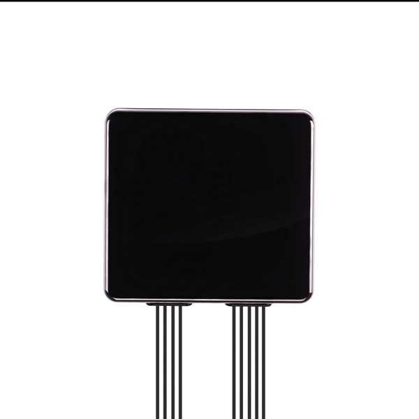
    The Taoglas MA990 Guardian antenna is a 9-in-1 combination antenna with dual-band GNSS (L1/L2) and globally supported cellular (5G/4G). It has been designed to support emerging market demand for modules that cover specific 5G/4G bands. Two of its eight cellular MIMO antennas cover from 600 Mhz to 6,000 MHz, while another two are optimized for 3,000 MHz to 6,000 MHz to cover high-band 5G and C-band/CBRS applications. The customizable antenna is designed to operate on all global carrier networks and is future-proofed to work with the latest 5G routers on the market. Housed in a low-profile, robust, IP67-rated waterproof, adhesive-mount external enclosure, the MA990 is designed for space-constrained, mission-critical applications, including asset and vehicle tracking, first-responder vehicles and high-definition video sources such as surveillance cameras.

    Taoglas, taoglas.com

    Digital FOG

    Fiber-optic-gyroscope inertial navigation system

    Photo: Advanced Navigation
    Photo: Advanced Navigation

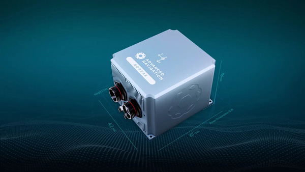
    The Boreas fiber-optic-gyroscope inertial navigation system (INS) is an ultra-high accuracy, strategic-grade INS offering a reduction in size, weight, power and cost. It is based on Advanced Navigation’s new digital fiber-optic gyroscope (DFOG) technology. The Boreas is targeted at applications requiring always-available, ultra-high accuracy orientation and navigation including marine, surveying, subsea, aerospace, robotics and space. It delivers strategic-grade bias stability of 0.001 deg/hr. This allows it to achieve ultra-high roll/pitch accuracy of 0.005 degrees and heading accuracy of 0.006 degrees. The Boreas allows for full independence from GPS with dead-reckoning accuracy of 0.01% of the distance traveled with an odometer or Doppler velocity log. In addition, the Boreas features ultra-fast gyro compassing, taking only two minutes to acquire heading in both stationary environments or on the move. Gyro compassing allows the system to determine a highly accurate heading of 0.01 degrees secant latitude without relying on magnetic heading or GPS.

    Advanced Navigation, advancednavigation.com

    Ceramic-patch Antennas

    Support all four global constellations

    Photo: Linx Technologies
    Photo: Linx Technologies

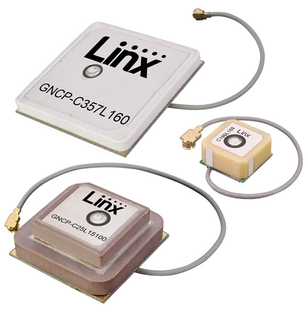
    Seven new GNSS active ceramic-patch antennas support global GNSS applications including GPS, Galileo, GLONASS, BeiDou, NavIC and QZSS systems in the L1/E1/B1, L2/E5/B2B, and L5/E5/B2A bands. Each antenna integrates a high-gain low-noise amplifier (LNA) and right-hand circular polarization (RHCP) to provide a high-performance solution for GNSS signal reception. Each active GNSS antenna has either a 60-mm or 100-mm coaxial cable terminated in a MHF1/U.FL-type plug (female socket) connector. They also meet the need for multi-band L1/L2, L1/L5, and L1/L2/L5 GNSS offerings.

    Linx Technologies, linxtechnologies.com
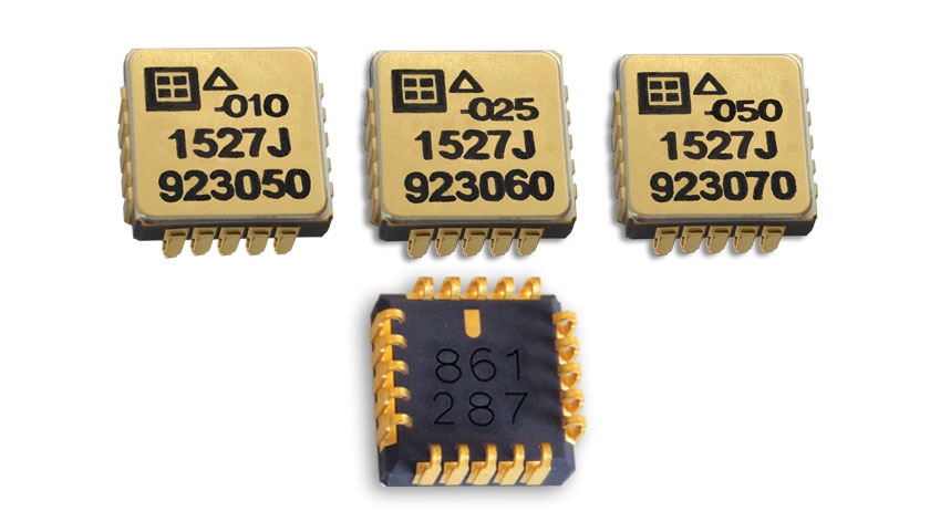
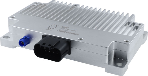
    Tactical-Grade IMU

    Designed for high performance in harsh conditions

    Photo: SBG Systems
    Photo: SBG Systems

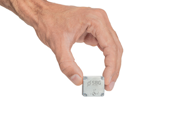
    The Pulse-40 inertial measurement unit (IMU) is a tactical-grade IMU designed for high performance in harsh conditions but miniaturized for applications where precision and robustness matter in all conditions. Use cases include warfare systems, satellite communications, robotics, lidar devices, gimbals, cameras and inertial navigation systems (INS). The Pulse-40 IMU provides six degrees of freedom. It integrates micro-electromechanical (MEMS) three-axes accelerometers and gyroscopes in a unique redundant design that allows the device size to shrink while pushing performance to its maximum. Among the performance specifications, the Pulse-40 features excellent gyro and accelerometer bias instability of 0.8°/h and 6 µg respectively, enabling long dead-reckoning and maintaining excellent heading performance. With sensors featuring extremely low vibration rectification error (VRE), the Pulse-40 can sustain high vibration environments, up to 10 g root-mean-squared. An embedded continuous built-in-test ensures data reliability during operation, a key parameter for critical applications. Features include 12 grams, 0.3W power consumption; ultra-low noise gyro (0.08°/√h) and excellent gyro bias instability (0.8°/h); high-precision accelerometers (6 µg); MIL-STD 810-qualified for shocks and vibrations; high bandwidth (480 Hz) and high data rate (2 KHz); highly tested and calibrated from –40° C to 85° C; and no export restrictions.

    SBG Systems, sbg-systems.com


    SURVEYING & MAPPING

    Surveying App

    Adds online services for field surveying and mapping

    Photo: CHC Navigation
    Photo: CHC Navigation

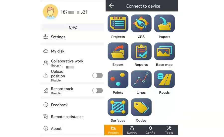
    LandStar version 7.3.7 adds cloud-based services and remote support features to simplify surveyors’ daily tasks. Online data storage and file sharing greatly facilitates interactions within a company and between field operators. LandStar 7’s remote assistance feature allows support personnel to take control of the field crew’s devices. Users simply provide a remote code to grant control of their data controller and be guided efficiently to the solution. The new version of LandStar 7 further improves support for CAD files and operates faster when importing 20MB DWG or 200MB DXF basemap files. Users can directly click on points, lines and blocks to stake out. In addition, object symbols and colors are displayed in the same way as in the original CAD design, making it easier for users to identify them.

    CHC Navigation, www.chcnav.com

    Android Software

    Surveying, mapping and data-collection software

    Photo: Juniper Systems
    Photo: Juniper Systems

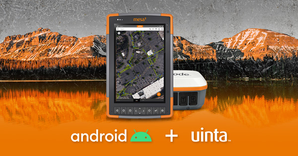
    Uinta is now available for devices running on Android. This is particularly valuable for workers who prefer to use an Android tablet or smartphone as a data collector. Uinta’s intuitive and customizable user workflow makes land measurement and asset mapping easier for data collection in the field. Uinta can now be used on a range of smartphones and tablets, including Juniper Systems’ Cedar CT8X2 and Mesa 3 rugged tablets running on Android. When using Juniper’s Geode GNSS receiver and running Uinta on an Android phone or tablet, users create a total mapping solution. They can collect high-accuracy GNSS data on the Geode, record the data in Uinta software, and see the data on a mobile or tablet. The intuitive software includes project templates that can be modified to meet individual project needs. Uinta is commonly used in utility mapping; commercial and agricultural irrigation; industrial asset inspections and rounds; and numerous environmental sciences in forestry, wetlands, wildlife and vegetation mapping.

    Juniper Systems, junipersys.com

    3D City Data

    Visualize the present and simulate the future of Scottish cities

    Photo: Bluesky
    Photo: Bluesky

    Scottish cities Edinburgh and Glasgow have been added to the growing coverage of MetroVista 3D city models. The data is available as ultra-high resolution 5-centimeter aerial photography with 16 points per meter (ppm) lidar. The data also is being processed to create a fully rendered mesh model suitable for use in a range of GIS, CAD and modeling software packages Acquired using the Leica CityMapper aerial sensor that simultaneously captures vertical and oblique imagery together with high-point density lidar, MetroVista data is becoming increasingly popular for smart city applications. Providing a geographically accurate and detailed 3D representation of the urban environment, MetroVista data provides insight for applications such as urban design, defense and security modeling, insurance assessments and utility and telecom planning.

    Bluesky, bluesky-world.com

    Wind Prediction

    App provides forecasts to firefighters

    Photo: WindNinja
    Photo: WindNinja
    Photo: WindNinja
    Photo: WindNinja

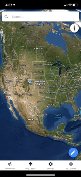
    WindNinja is a high-resolution wind modeling app created for firefighters who need to quickly compute and visualize wind direction and speed simulations. The simulations provide them with situational awareness, help keep them safe, and help them conduct work such as burnout operations. The mobile app, developed using ArcGIS AppStudio from Esri, provides high-resolution, near-surface wind forecasts that include wind speeds and directions displayed on a map. The user selects an area of interest of 50 square kilometers or less, names the simulation, chooses a forecast duration of up to 15 hours, selects whether to receive an email or SMS notification when the simulation is ready to view, and then submits the request. The user also can select from a variety of basemaps and turn on data layers — vegetation, atmospheric, oceanic, land-surface imagery — collected by NOAA satellites.

    WindNinja, www.firelab.org/project/windninja


    TRANSPORTATION

    eBike Positioning

    Intelligent control system meets urban transport requirements

    Photo: Xiaoan Technology
    Photo: Xiaoan Technology

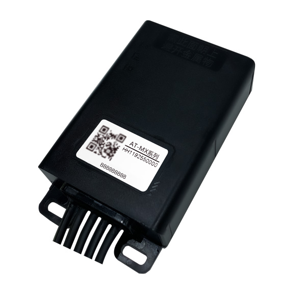
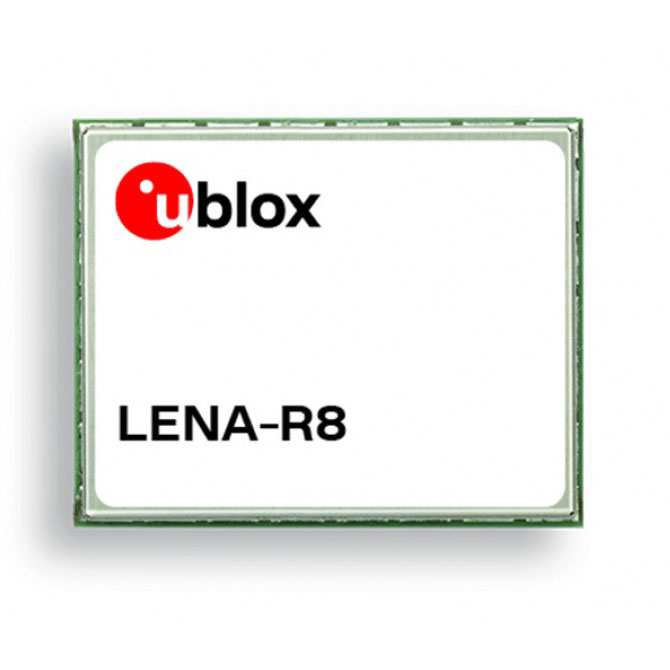
    The AT-MX intelligent control system for shared electric bicycles uses the latest ultra-low-power u-blox M10 GNSS technology to enhance the positioning performance of their fleet for improved compliance with increasingly stringent Chinese policy requirements. The growing popularity of shared micromobility solutions for short-distance urban travel has led municipal authorities around the world to introduce new legislation to mitigate their perceived negative impacts, for instance, with restrictions on where users can drive and park their vehicles. Meanwhile, vehicle operators and maintenance personnel need to efficiently locate vehicles requiring maintenance and gather reliable vehicle usage data to balance bicycle placement and operational safety. Enforcing regulatory compliance and optimizing operations both require the safe, accurate and efficient bicycle positioning solutions.

    Xiaoan Technology, xiaoantech.com; u-blox, www.ublox.com

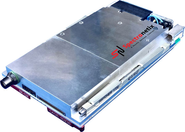
    GNSS+INS Integration

    Ensures safe operations through reliable, robust and continuous positioning

    Image: Hexagon
    Image: Hexagon

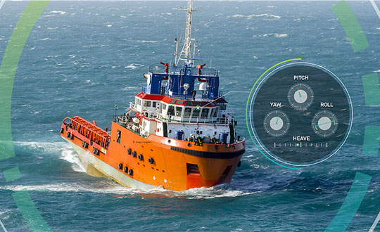
    SPAN technology delivers a deeply coupled GNSS and inertial navigation system (INS) that provides robust, reliable and continuous centimeter-level positioning for operators to maintain safety and maximize uptime. Now available for the dynamic positioning of vessels, the GNSS+INS solutions can bridge outages in GNSS tracking and through short periods of radio-frequency interference, jamming or spoofing. It provides vessels with an added layer of resiliency and achieve continuous centimeter-level accuracy across all conditions. SPAN GNSS+INS technology is compatible with commercial inertial measurement units (IMUs) and scalable with the LD900 GNSS receiver, Quantum visualization software and APEX correction services. Features include continuous centimeter-level positioning made more robust and reliable through enhanced GNSS tracking and deep coupling of inertial measurements; rapid reacquisition of GNSS signals after outages or interruptions through a deep coupling process; constant monitoring of GNSS absolute positioning combined with heading, velocity and attitude measurements; and added positioning redundancy with system robustness against potential signal outages, interference or disruptions.

    Hexagon | Veripos, veripos.com


    UAV

    Drone Tracker

    GNSS-based device secures infrasturcutre

    Photo: Ibtechar
    Photo: Ibtechar

    Ibtechar, one of Qatar’s top providers of practical innovation and turnkey solutions, has developed a drone tracker and a GPS-based system that ensure the safety and security of critical infrastructure, VIP residents, national borders, and military facilities. The customized solution is made by a Qatar-based team of researchers and technologists with extensive knowledge and expertise in applied research and counter-drone systems. It aims to secure airports, power lines, and other vital assets that can be targets for drone attacks. Prototypes have gone through 487 flight tests in 19 locations, as well as 676 drive and walk tests. Features include compatibility with GPS, GLONASS and BDS; real-time tracking, popup notifications and SMS alerts; smart geo-fencing; drone whitelists/blacklists; base-station triangulation (cell ID); IMU, tilt, vibration sensor, and NFC; and offline mode. The new tracking system can identify the operating drones by displaying the drone itself, its serial number, the commercial frequency used, and motion details (speed, altitude, azimuth, path, etc.).

    Ibtechar, ibtechar.com

    Mapping Software

    User-friendly, cloud-based software

    Photo: DroneDeploy
    Photo: DroneDeploy

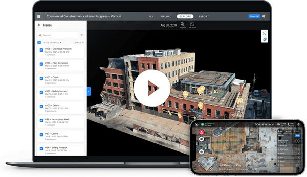
    DroneDeploy lets users capture, process and analyze data in one platform. Users can create high-resolution 2D and 3D interior and exterior maps and models accurate to between 1 cm and 5 cm. It is designed for individuals, teams or enterprises and is suitable for all use cases and industries. However, primary markets include agriculture, construction, mining, energy, roofing and inspection. Features include Mobile Flight App to capture images directly from
    an iOS or Android device; Live Map to create real-time, sharable
    2D maps; Autonomous Flight to preprogram routes; as well as
    360 Walkthrough for a 360-degree, virtual tour through a 3D model of a site. Industry-specific features are available, such as Plant Health to help farmers measure crop health and viability.

    DroneDeploy, dronedeploy.com

  • Launchpad: Mapping software, MEMS accelerometers

    Launchpad: Mapping software, MEMS accelerometers

    A roundup of recent products in the GNSS and inertial positioning industry from the February 2022 issue of GPS World magazine.


    OEM

    GNSS Receiver

    For tracking, telematics

    Photo: u-blox
    Photo: u-blox

    The LENA-R8 GNSS receiver is based on the u-blox M10 platform. The compact module balances cost and performance with a single antenna and primarily targets customer deployments in the Europe, Middle East, Africa, Asia, and South America regions. Designed for tracking and telematics, the module series was designed to minimize material costs and data charges. The LENA-R8 supports a broad range of frequency bands with 2G fallback, providing maximum roaming coverage for global tracking applications using a single stock keeping unit (SKU).

    U-blox, u-blox.com

    Helical Antenna

    For UAVs and other applications

    Photo: Tallysman
    Photo: Tallysman

    The low-profile triple-band HC997EXF embedded helical GNSS antenna features eXtended Filtering (XF). It is designed for precise positioning, covering the GPS/QZSS-L1/L2/L5, GLONASS-G1/G2/G3, Galileo-E1/E5a/E5b, BeiDou-B1/B2/B2a, and NavIC-L5 frequency bands. It also covers regional satellite-based augmentation systems (WAAS, EGNOS, MSAS, GAGAN) and L-band correction services. It is packaged in a light (11 g), compact form factor (60 x 25 mm). Its precision-tuned, high-accuracy helical element provides an excellent axial ratio and operates without a ground plane, making it suitable for lightweight unmanned aerial vehicle (UAV) navigation and a wide variety of precision applications.

    Tallysman Wireless, tallysman.com

    A-PNT Card

    High precision for defense

    Photo: Spectranetix
    Photo: Spectranetix

    The SX-124 ruggedized 3U OpenVPX high-performance positioning, navigation and timing (PNT) card can provide timing and positioning information in a GPS-denied environment through sensor fusion. It is designed for highly integrated systems with a requirement for the U.S. Army’s C5ISR Modular Open Suite of Standards (CMOSS) and alignment with the Open Group Sensor Open Systems Architecture (SOSA) technical standard. The SX-124 can accept external sources or use its onboard GNSS receivers as reference inputs for timing and positioning data. The positioning data can be fused with internal and external inertial measurement units.

    Spectranetix, spectranetix.com

    MEMS Accelerometers

    Radiation tested for space

    Photo: Silicon Designs
    Photo: Silicon Designs

    The Model 1527 series is a family of miniature, radiation-tested, tactical-grade micro-electromechanical (MEMS) accelerometers. Offered in three full-scale acceleration ranges — ±10 g, ±25 g and ±50 g — the series is designed to support a variety of critical space electronics testing requirements, including those of spacecraft, satellites and CubeSats. Their small bias and scale-factor temperature coefficients, excellent in-run bias stability and zero cross-coupling make the Model 1527 series particularly well-suited for spacecraft electronics testing applications requiring low power consumption (+5 VDC, 6.5 mA), low noise, long-term measurement stability in –55° C to +125° C environments, and performance reliability under intermittent radiation exposures.

    Silicon Designs, silicondesigns.com

    Automotive Receiver

    Guidance for advanced driver assistance systems

    Photo: STMicroelectronics
    Photo: STMicroelectronics

    The STA8135GA automotive-qualified GNSS receiver is designed to deliver the high-quality position data needed by advanced driving systems. Part of the Teseo V family, the STA8135GA integrates a triple-band positioning measurement engine. It also provides standard multi-band position-velocity-time (PVT) and dead reckoning. The multi-constellation receiver delivers raw information for the host system to run any precise-positioning algorithm, such as PPP/RTK (precise point positioning/real-time kinematic). The receiver can track satellites in the GPS, GLONASS, BeiDou, Galileo, QZSS and NAVIC/IRNSS constellations.

    STMicroelectronics, st.com


    Surveying & Mapping

    Software Upgrade

    Improvements support photos, 2.5D data capture

    Photo: 1Spatial
    Photo: 1Spatial

    Survey application 1Edit now has increased support for photos and 2.5D data. 1Edit 3.1 allows users to attach feature photos, including automated geotagging, which enables surveyors to visualize assets and fine tune observations. Also included are new validation functions and improved handling for heights (2.5D data), typically useful for detailed asset and land-management surveys. Enhanced styling, including bitmap fills and dashed lines, make it easier to identify and classify different asset types during surveys. Additional control of editable layers and fields provides protection for non-editable data and protects the data quality. Significant improvements to rendering of thematic mapping enhances the speed and fluidity of the intuitive user interface.

    1Spatial, 1spatial.com

    Mapping Software

    Map-making functionality improved

    Photo: Golden Software
    Photo: Golden Software

    The latest version of Surfer surface mapping software has improved map-making functionality and data exporting capabilities. Surfer is used by more than 100,000 people worldwide, many involved in oil and gas exploration, environmental consulting, mining, engineering and geospatial projects. It provides fast and powerful contouring algorithms, enabling users to model data sets, apply an array of advanced analytics tools, and graphically communicate the results. Frames now have outlines and background fill colors to make them easier to read when placed on top of maps and attribute data can now be exported as numeric data.

    Golden Software, goldensoftware.com

    RTK/PPP Device

    Multi-sensor fusion on a single board

    Photo: ANavS
    Photo: ANavS

    The Multi-Sensor (MS-) RTK/PPP device is a turnkey system easily integrated into surveying applications. The module includes up to three multi-frequency, multi-GNSS (GPS + Galileo + Glonass + BeiDou) receivers, a MEMS IMU, a barometer, a CAN interface for reception of vehicle data (wheel odometry and steering angle), and an LTE module for reception of RTK/PPP corrections. ANavS sensor fusion performs tight coupling of all sensor data with an Extended Kalman Filter (EKF). Various interfaces can connect additional sensors (such as camera or lidar) or output position information.

    ANavS, anavs.com

    Auto Mapping

    Increases lane-level accuracy

    Photo: Asensing
    Photo: Asensing

    The HD-MapBox integrates high-precision map data based on high-precision positioning. Fusing data from a GNSS receiver, IMU, ADAS camera, vehicle dynamics and HD maps, the HD-MapBox can achieve a lateral error of less than 8 inches (0.2 meters) and a longitudinal error of less than 6.5 feet (2 meters) with a 95% confidence interval, providing an accurate reference for highway pilots and automated valet parking. Even if both GNSS and lane line detection are not available, the HD-MapBox can still enable vehicles to keep inside the lane for at least a quarter mile (400 meters).

    Asensing, asensing.com

    Positioning System

    Adds location data inside buildings

    Photo: Esri
    Photo: Esri

    Esri ArcGIS IPS is an indoor positioning system that adds a blue dot to indoor maps, enabling users to locate their current position inside a building in the same way GPS enables outdoor location indicators. It uses an alternative technology to enable real-time positioning and navigation inside buildings. It also provides live location sharing and tracking, location data capture and analytical insights. ArcGIS IPS is available for users of ArcGIS Indoors, an indoor mapping system for smart building management, and ArcGIS Runtime SDKs, which enable the indoor positioning capability in custom-built apps.

    Esri, esri.com

  • 1Spatial unveils new survey capabilities in 1Edit

    1Spatial unveils new survey capabilities in 1Edit

    Screenshot: 1Spatial
    Screenshot: 1Spatial

    1Spatial has extended the capability of its survey application 1Edit, increasing support for photos and 2.5D data.

    1Edit 3.1 allows users to attach feature photos, including automated geotagging, which enables surveyors to visualize assets and fine-tune their observations. The latest version now includes new validation functions and improved handling for heights (2.5D data), typically useful for detailed asset and land-management surveys.

    Enhanced styling, including bitmap fills and dashed lines, make it easier to identify and classify different asset types during surveys. Additional control of editable layers and fields provide protection for non-editable data and protects the quality of data. Significant improvements to rendering of thematic mapping further enhances the speed and fluidity of the intuitive user interface.

    1Edit also now supports the storage of photographs as an attribute on a feature. The photos can be captured from the front or rear camera and are stored as a Label object.

    “1Edit’s new survey capabilities further expands our customers’ ability to collect trusted, validated data that is right first time,” said Robert Chell, chief product officer. “By increasing the number of validation options available during a survey, we improve both the quality and accuracy of data, and the effectiveness of survey processes.”


  • SimActive releases Correlator3D version 8.5

    Version 8.5 of SimActive's Correlator3D mapping software allows users to share and visualize projects in the cloud. (Photo: SimActive)
    Version 8.5 of SimActive’s Correlator3D mapping software allows users to share and visualize projects in the cloud. (Photo: SimActive)

    SimActive has launched version 8.5 of its Correlator3D mapping software. According to the company, this new version users to share and visualize projects in the cloud. More specifically, results can be exported to the cloud directly from the software interface, and shareable links are automatically created for online visualization.

    Version 8.5 also features tools for the calibration and processing of multispectral imagery. Calibrated reflectance panels and sun sensors can be used to produce reflectance maps, with multispectral bands perfectly registered, the company said.

    “Our software attracts a variety of clients, with a wide range of needs,” said Louis Simard, CTO at SimActive. “This new version brings advantages to customers having data exploitation requirements such as online viewing, and to users processing imagery from highly sophisticated sensors.”

    SimActive, founded in 2003 and based in Montreal, Quebec, develops photogrammetry software. Its Correlator3D software, is a patented, end-to-end photogrammetry solution for the generation of high-quality geospatial data from satellite and aerial imagery.

  • Esri provides mapping software for organizations fighting COVID-19

    Communities in need of resources can access location intelligence technology at no cost with six-month trial

    Logo: EsriLocation intelligence company Esri is making its software available to public and private sector organizations fighting the coronavirus (COVID-19) pandemic.

    The COVID-19 outbreak has escalated rapidly across the globe, and with municipalities struggling to respond, Esri has built out resources to help organizations understand the potential impact of the disease on public health, as well as potential community risk areas and their capacity to respond.

    A COVID-19 GIS Hub site provides much of this essential data, including case locations and social vulnerability, that communities and health organizations can use to inform their response.

    To help public health agencies and other organizations jump-start their response, Esri is providing the ArcGIS Hub Coronavirus Response template at no cost through a complimentary six-month ArcGIS Online subscription with ArcGIS Hub. The template includes examples, materials, and configurations to rapidly deploy a local ArcGIS Hub environment. ArcGIS Hub is a framework to build a website to visualize and analyze the crisis in the context of an organization’s or community’s population and assets.

    “Esri has always prioritized assisting communities during large-scale emergencies and natural disasters,” said Jack Dangermond, Esri founder and president. “For the past 25 years, our Disaster Response Program provides data, software, configurable applications, and technical support for emergency operations. We consider it part of our mission to provide these services free of cost during this time of national crisis.”

    For more information on the complimentary software and the disaster relief support, visit esri.com/disaster.

  • NavVis now uses SLAM to remove point cloud artifacts

    The latest software release for the SLAM-based NavVis M6 Indoor Mobile Mapping System (IMMS) automatically detects and removes point cloud artifacts, including moving objects in static scenes, the company said.

    This image shows what an object looks like where the laser beam has hit an edge, before and after the algorithm has been applied. (Image: NavVis)
    This image shows what an object looks like where the laser beam has hit an edge, before and after the algorithm has been applied. (Image: NavVis)

    NavVis is a global provider of indoor spatial intelligence solutions. The latest IMMS release removes artifacts from point clouds during the post-processing of scan data.

    Fringe points and dynamic objects are two common types of point cloud artifacts that affect all 3D laser scanning devices. Fringe points arise when a laser beam hits the edge of an object as well as its background. This scattered beam ultimately appears as a “fringe” around the edge of the object in the point cloud.

    The second type of point cloud artifact results when dynamic objects, such as humans walking through a scan, are captured by the laser scanner and then appear as artifacts in the point cloud.

    A point cloud before and after the algorithm has been applied to a dynamic object. (Image: NavVis)
    A point cloud before and after the algorithm has been applied to a dynamic object. (Image: NavVis)

    According to the company, the NavVis M6 IMMS is a simultaneous localization and mapping (SLAM)-based system that uses laser scanners to capture a high volume of measurement points of an environment. As SLAM-based mobile mapping systems move through the environment while scanning it, objects are observed from multiple different angles and positions.

    With the latest software update, the algorithms applied during the post-processing of scan data use those multiple observations to detect whether measurement points actually exist in the physical space. If it is determined that the point does not exist and is instead resulting from the laser beam hitting an edge or an object moving through the space, this point is automatically removed.

    The result is a much cleaner, crisper point cloud that requires less clean up time in point cloud editing software and that is easier to use for applications such as BIM modeling, the company said.

    “We have been working hard to develop a very precise SLAM technology that significantly improves the quality of point clouds captured by a mobile device,” said Georg Schroth, NavVis co-founder and CTO. “As this latest software feature shows, SLAM offers a lot of potential for laser scanning and AEC professionals who are looking for technology that not only speeds up the capture of data but also delivers high quality point clouds. We see a lot of potential in this technology and look forward to sharing future innovations.”

  • Datumate offers updated imagery software

    Datumate offers updated imagery software

    Datumate's DatuSurvey 5.5 software offers 2D vectorized measurements and 3D point clouds models. (Screenshot: Datumate)
    Datumate’s DatuSurvey 5.5 software offers 2D vectorized measurements and 3D point clouds models. (Screenshot: Datumate)

    Datumate, a photogrammetry solution and 3D mapping software developer, has released its updated DatuSurvey 5.5 software, which offers 2D vectorized measurements and 3D point cloud models.

    According to the company, with the updated software, users can now process thousands of images locally in an accelerated mode while maintaining survey-grade accuracy and professional engineering results. Organizations can also deploy Datumate’s solutions on single or multiple computers and take advantage of the accelerated and user-friendly processing of the project field data.

    In addition, DatuSurvey 5.5 can process large amounts of drone imaging data locally and quickly. The software can also achieve survey-grade accuracy and geo-reference the model quickly and easily, the company added. Finally, it can plan and execute consecutive drone missions on unmapped and frequently changing areas.

    According to Datumate, its team improved the geo-referencing workflow of the software when using ground control points. Users can now quickly and easily mark ground control points using zoomed-in image projections.

    The company also added the ability to import coordinates to DatuFly Professional in addition to on-site or on-map mission planning. This will enable an efficient and accurate drone mission execution on specific and designated areas without depending on satellite and map source views, Datumate said.

  • Caliper releases country package for Maptitude mapping software

    The 2018 DACH Country Package for Maptitude includes 4th quarter 2017 map content for Germany, Austria, Switzerland and Liechtenstein. (Photo: Caliper)
    The 2018 DACH Country Package for Maptitude includes 4th quarter 2017 map content for Germany, Austria, Switzerland and Liechtenstein. (Photo: Caliper)

    Caliper has lunched a 2018 DACH Country Package for its Maptitude mapping software. According to the company, Maptitude country packages bring the power and flexibility of its Maptitude product suite to a global audience and enable its customers to make geolocation-based decisions internationally.

    The 2018 DACH Country Package includes fourth quarter 2017 map content for Germany, Austria, Switzerland and Liechtenstein. The updated map includes refreshed streets and landmarks, as well as updated travel times and improved address matching.

    According to the company, users can seamlessly switch between the countries purchased, and doing so will refresh the Maptitude interface with country-specific tools, such as those for territory and sales mapping, finding, pin mapping, routing, displaying demographics and Create-a-Map Wizard.

    Caliper develops geographic information systems software, and its Maptitude software is designed to be a cost-effective, professional mapping software product. Maptitude also enables organizations to leverage their location-based data to improve decision making and planning, while minimizing expenditure through competitively priced solutions, the company added.

  • Esri Releases ArcGIS 10.3.1 with Smart Mapping, 3D Content Sharing

    Complex-3D-objects
    3D Web Scenes.

    Esri has released ArcGIS 10.3.1, bringing new capabilities.

    Smart Mapping is an innovative approach for creating maps that is available through ArcGIS Online. Users can quickly style the features of a map to create useful and visually stunning maps every time, Esri said.

    3D Web Scenes allow users to view, create, and share 3D web scenes in a browser. Available in ArcGIS for Server and Portal for ArcGIS, users can share these scenes within their own infrastructure or make them public.

    With the ArcGIS 10.3.1 release, ArcGIS for Server with Portal for ArcGIS can now host web scenes and layers that include multipatch–based 3D models and symbology, such as photo-realistic buildings, trees, and visibility domes.

    For more details about what’s new in ArcGIS 10.3.1, visit the ArcGIS blog.

  • Avenza Releases MAPublisher 9.1 for Adobe Illustrator

    New ability to export HTML5 web maps and enhanced MAPublisher LabelPro features.

    Avenza Systems Inc., producers of the PDF Maps app for iOS and geospatial plugins for Adobe Creative Suite, including Geographic Imager for Adobe Photoshop, has released  MAPublisher 9.1 for Adobe Illustrator.  MAP Web Author now has the ability to export HTML5 web maps (in addition to the already available Flash output), which are suitable for mobile devices such as tablets and smartphones. In addition, the MAPublisher LabelPro extension has been updated to include the ability to use label filters and expressions for even more detailed labeling as well as a redesigned and more flexible user interface.

    “MAPublisher 9.1  now supports the export of HTML5 web maps. We’ve seen a growth in online mapping and the upward trend of using HTML5 technology to make websites more interactive and interesting. More importantly, map makers and webdesigners alike can extend their HTML5 web maps to smartphone and tablet browsers without the need for additional plug-ins,” said Ted Florence, President of Avenza. “With this new version, we are seeing increased labeling performance, detail, and flexibility.”

    Enhancements and new features of MAPublisher 9.1: MAP Web Author HTML5 export; MAPublisher LabelPro redesigned interface, new label filters feature, and improved performance; Various user interface and performance enhancements to improve usability

    MAPublisher for Adobe Illustrator is powerful map production software for creating cartographic-quality maps from GIS data. MAPublisher tools leverage the superior graphics design capabilities of Adobe Illustrator to manipulate GIS data and to produce high-quality maps with accuracy and efficiency.