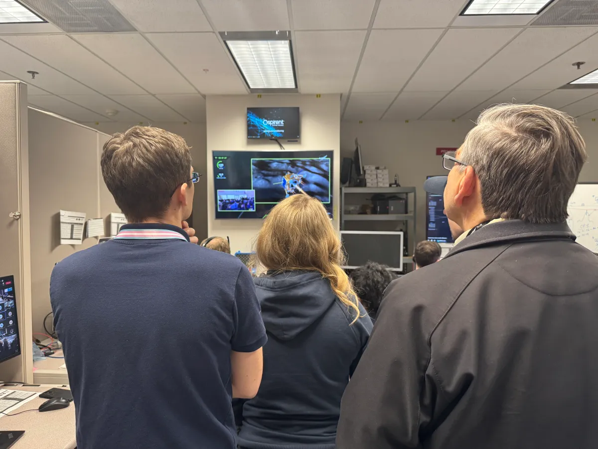
During a public workshop at the Italian Space Agency on Oct. 14-15, the Lunar GNSS Receiver Experiment (LuGRE) project team celebrated the closure of the project and released the data collected to the scientific community.
LuGRE, developed in partnership by NASA and the Italian Space Agency (ASI), flew to the Moon a GNSS receiver manufactured by the Italian company Qascom. The receiver was hosted aboard the Firefly BGM1 mission.
LuGRE demonstrated that signals from GNSS satellite constellations can also be used for positioning, navigation and timing (PNT) on the Moon.
The Navigation Signal Analysis and Simulation of the Dept. of Electroncis and Telecommunications of Polytechnic University of Turin processed the data received during the mission and contributed to all the science team activities, including the validation of the data and the processing of the initial set of scientific results.
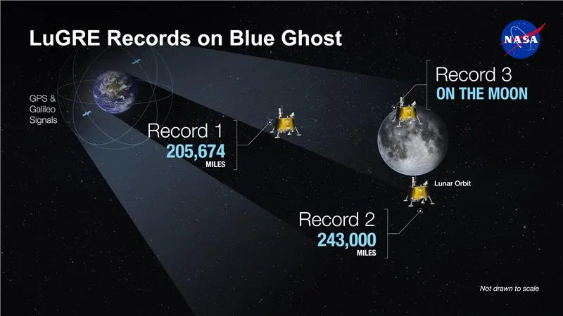
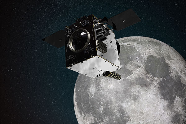
An artist’s concept of the LuGRE payload on Blue Ghost and its three main records in transit to the Moon, in lunar orbit and on the Moon’s surface. (Image: NASA/Dave Ryan)
Launched on Firefly Aerospace’s Blue Ghost lander in January, LuGRE became the first payload to use Earth’s GNSS to calculate a navigation fix on the lunar surface and in lunar orbit. The experiment set a series of distance records on its journey to the Moon, demonstrating that GNSS technology can complement other navigation tools as far as 247,520 miles (398,350 km) from Earth.
These results point to a future where lunar astronauts, rovers and spacecraft can rely on the same satellite-based navigation systems we use every day to augment their navigation capabilities.
“It is a very important milestone for the satellite navigation community,” said Fabio Dovis, Politecnico di Torino, Italian Space Agency, of the project. “For the first time we have the recording of signal of the GPS and Galileo constellation collected in space and on the Moon surface. Already during the LuGRE mission we proved the feasibility of using satellite systems originally designed to be used on Earth up to lunar distances. Now the entire scientific community can use them to ‘re-play’ the space environment as well as analyze them in depth, for example, to retrieve information about the Earth atmosphere crossed by the signal themselves.”
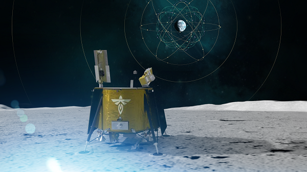
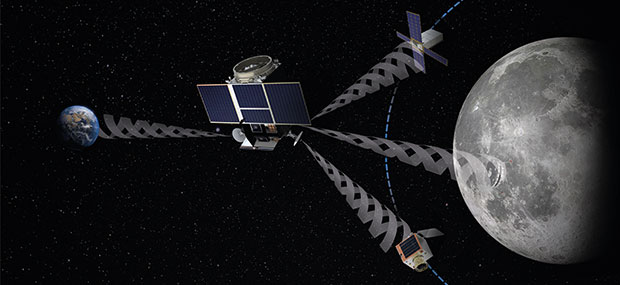
Artistic rendering of LuGRE and the GNSS constellations. In reality, the Earth-based GNSS constellations take up less than 10 degrees in the sky, as seen from the Moon. (Image: NASA/Dave Ryan)
The data release includes the actual GPS and Galileo radio signals LuGRE captured during its journey and on the lunar surface. The raw recordings — called in-phase and quadrature (I/Q) samples — allow researchers to analyze GNSS signal strength, noise and interference under lunar conditions for the first time. Engineers and scientists will use these results to model and refine the next generation of GNSS-based signal receivers and improve our understanding of how navigation signals operate at the Moon.
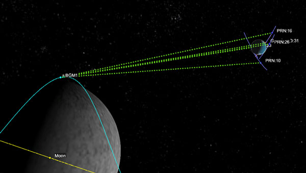
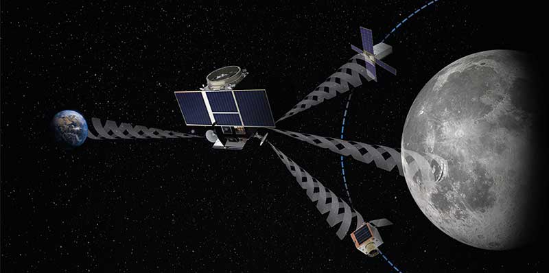
Graphic representation of the relative geometry of Earth-Moon-acquired GNSS satellites. (Image: Agenzia Sapaziale Italiana)
Artist’s impression of the Lunar Pathfinder satellite built by Surrey Satellite Technology Ltd. (SSTL) that will provide communications and navigation services for the Moon.
NASA and its international partners are planning a return to our natural satellite. The following three papers — presented at the Institute of Navigation (ION) GNSS+ conference Sept. 20–24, 2021 — discuss the role of GNSS in lunar exploration. The full papers are available at www.ion.org/publications/browse.cfm.
Using GPS for Time Transfer
NASA and the European Space Agency have conceptualized the initial framework for a GPS-like constellation for the Moon, which will ensure uninterrupted navigation and communication services for future lunar missions. The authors designed a smallsat-based Lunar Navigation Satellite System (LNSS) with time-transfer from Earth-GPS to alleviate the size, weight and power (SWaP) and timing stability requirements of the onboard clocks. A timing filter corrects the lower grade clock when Earth-GPS signals are available and propagates these clock estimates forward in time when no Earth-GPS signals are available. The authors analyzed their proposed time-transfer technique using high-fidelity simulations of an LNSS satellite with an onboard chip-scale atomic clock for three cases of elliptical lunar frozen orbits.
Bhamidipati, Sriramya, Mina, Tara, Gao, Grace, “Design Considerations of a Lunar Navigation Satellite System with Time-Transfer from Earth-GPS,” https://doi.org/10.33012/2021.18021
GNSS Nav for Moon Missions
The authors show the potential of autonomous GNSS signal-based navigation for a set of Moon scenarios. This technology could be a game changer for the future of lunar exploration, representing an extremely low cost and effective alternative for Moon navigation. Results show that not only autonomous GNSS navigation for lunar orbiters is possible, but it also delivers good navigation performance. In fact, navigation with root-mean-square (RMS) errors on the order of 50–100 meters were obtained for scenarios of high interest, such as for the planned Lunar Pathfinder and near-rectilinear halo orbit of the Lunar Gateway space station around the Moon.
Mangialardo, Marco, Jurado, María Manzano, Hagan, David, Giordano, Pietro, Ventura-Traveset, Javier, “The full Potential of an Autonomous GNSS Signalbased Navigation System for Moon Missions,” https://doi.org/10.33012/2021.18040
Finding the best lunar orbit
A continuous and reliable lunar positioning and timing system, such as a GNSS-like constellation, is considered essential infrastructure for lunar exploration. The authors focus on halo orbits with the aim of defining an optimal halo constellation for supporting and delivering a navigation service on the Moon. This paper shows the performance of a GNSS-like constellation deployed in Halo orbits around Earth-Moon L1 and L2 collinear libration points. Different phases have been considered, from a minimum number of satellites able to provide a local PNT service on the South Pole (Initial Operational Capability), to a final, extended constellation able to cover the whole lunar surface (Final Operational Capability).
Musacchio, Daniele, Iess, Luciano, Carosi, Mattia, Capolicchio, Jacopo, Eleuteri, Massimo, Stallo, Cosimo, Di Lauro, Carmine, “Design of Earth Moon Halo Orbits for a Global Lunar PNT Service,” https://doi.org/10.33012/2021.18020
Europe’s Lunar Pathfinder mission to the Moon will carry an advanced satellite navigation receiver to perform the first satellite navigation positioning fix in lunar orbit. The experimental payload marks a preliminary step in an ambitious European Space Agency (ESA) plan to expand reliable satnav coverage — as well as communication links — to explorers around and ultimately on the Moon during this decade.
Due to launch by the end of 2023 into lunar orbit, the public-private Lunar Pathfinder comsat will offer commercial data-relay services to lunar missions, while also stretching the operational limits of satnav signals.
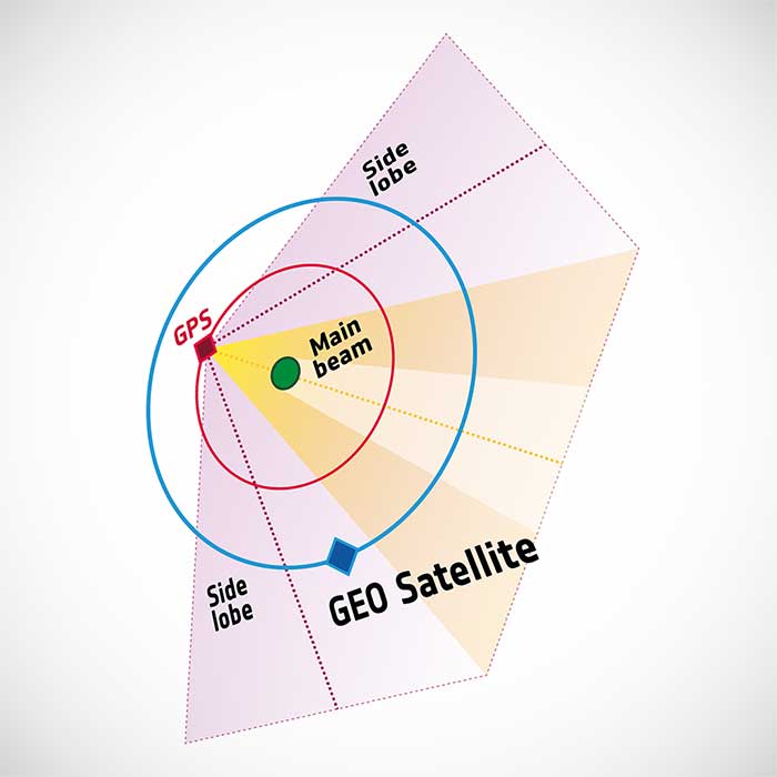
Navigation satellites like Europe’s Galileo constellation are intended to deliver positioning, navigation and timing services to our planet, so most of the energy of their navigation antennas radiates directly towards the Earth disc, blocking its use for users further away in space.
“But this is not the whole story,” explains Javier Ventura-Traveset, leading ESA’s Galileo Navigation Science Office and coordinating ESA lunar navigation activities. “Navigation signal patterns also radiate sideways, like light from a flashlight, and past testing shows these antenna side lobes can be employed for positioning, provided adequate receivers are implemented.”
Just like people or cars on the ground, satellites in low-Earth orbit rely heavily on satnav signals to determine their orbital position, and since ESA proved higher orbit positioning was possible, a growing number of satellites in geostationary orbit today employ satnav receivers.
But geostationary orbit is 35,786 km up, while the Moon is more than ten times further away, at an average distance of 384 000 km. In 2019 however, NASA’s Magnetospheric Multiscale Mission acquired GPS signals to perform a fix and determine its orbit from 187,166 km away, close to halfway the Earth-Moon distance.
“This successful experimental evidence provides us high confidence since the receiver we will embark on Lunar Pathfinder will have a significantly improved sensitivity, employ both Galileo and GPS signals and will also feature a high-gain satnav antenna,” Javier added.
The main challenge will be overcoming the limited geometry of satnav signals all coming from the same part of the sky, along with the low signal power.
The high-sensitivity receiver’s main antenna was developed through ESA’s General Support Technology Programme, with the receiver’s main unit developed through ESA’s Navigation Innovation and Support Programme, NAVISP.
The receiver project is led by ESA navigation engineer Pietro Giordano. “The high sensitivity receiver will be able to detect very faint signals, millions of times weaker than the ones received on Earth. The use of advanced on-board orbital filters will allow for unprecedented orbit determination accuracy on an autonomous basis,” Giordano said.
Lunar Pathfinder’s receiver is projected to achieve positioning accuracy of around 100 meters — more accurate than traditional ground tracking.
Once in a stable elliptical orbit over the lunar south pole, Lunar Pathfinder will relay signals from other Moon missions. (Image: ESA)
The availability of satnav will allow the performance of ‘Precise Orbit Determination’ for lunar satellites, said Werner Enderle, head of ESA’s Navigation Support Office. “Traditional orbit determination for lunar orbiting satellites is performed by radio ranging, using deep space ground stations,” Enderle said. “This Lunar Pathfinder demonstration will be a major milestone in lunar navigation, changing the entire approach. It will not only increase spacecraft autonomy and sharpen the accuracy of results, it will also help to reduce operational costs.”
While lunar orbits are often unstable, with low-orbiting satellites drawn off course by the lumpy mass concentrations or mascons making up the Moon, Lunar Pathfinder is planned to adopt a highly stable “frozen” elliptical orbit, focused on the lunar south pole – a leading target for future expeditions. Earth — and its satnav constellations — should remain in view of Lunar Pathfinder for the majority of testing. The main challenge will be overcoming the limited geometry of satnav signals all coming from the same part of the sky, along with the low signal power.
Lunar Pathfinder’s demonstration that terrestrial satnav signals can be employed to navigate in lunar orbits will be an important early step in ESA’s Moonlight initiative. Supported through three ESA Directorates, Moonlight will establish a lunar communication and navigation service.
“Over this coming decade, ESA aims to contribute to building up a common communications and navigation infrastructure for all lunar missions based on dedicated lunar satellites,” explained Bernhard Hufenbach, managing commercialisation and innovation initiatives for space exploration at ESA. “Moonlight will allow to support missions that cannot use Earth satnav signals, such as landers on the far side and is planning to cover the current gap towards the needs expressed by the Global Exploration community, targeting positioning accuracy below 50 meters.”
As well as facilitating lunar exploration, these satnav signals might one day become a tool for science in their own right, used, for example, to perform reflectometry across the lunar surface; sounding the scant dusty exosphere that surrounds the Moon or by providing a common time reference signal across the Moon, to be used for fundamental physics or astronomy experiments.
Javier noted that Lunar Pathfinder’s satnav experiment also will have larger consequences. “This will become the first-ever demonstration of GPS and Galileo reception in lunar orbit, opening the door to a complete way to navigate spacecraft in deep space, enabling human exploration of the Moon,” he said.
To pinpoint a location accurately, a receiver — in smartphones or on a spacecraft — needs to collect and combine signals from at least four navigation satellites. The receiver determines its distance from each of the satellites by measuring the time that it takes for the signal to travel from the satellite to the receiver.
Navigation satellites aim their antennas directly at Earth. Satellites orbiting above the navigation (GPS in this image, but Europe’s own navigation system is Galileo) constellation could only hope to detect signals from Earth’s far side. Now spacecraft can make use of signals emitted sideways from navigation antennas, within what is known as “side lobes.” Just like a torch, they shine energy to the side as well as directly forward.
Navigation satellites orbit 22,000 kilometers above Earth’s surface. As they point in the direction of Earth, any spacecraft between them and Earth are served well by their signal. But around 10 years ago, engineers started demonstrating that spacecraft outside the orbit of navigation satellites could also navigate in space using “spill over” signal from the satellites.
Then in 2012, two discovery and preparation studies explored a seemingly radical question: could this spillover signal even be used to navigate our way around the moon, and if so, what kind of receiver would we need to build to be able to use these signals?
The studies found that the signal from navigation satellites orbiting Earth could be used to navigate the moon’s surface. But with the signal being so weak, they found that a new type of receiver would need to be built, and at the time there was no clear application for this.
Eight years later, ESA invested in the development of such a receiver, and is exploring whether it could be demonstrated on the Lunar Pathfinder mission. ESA is collaborating with Surrey Satellite Technology Ltd. and Goonhilly Earth Station on this mission, which will provide exciting new opportunities for science and technology demonstration. In particular, it will help lay the groundwork for providing navigation services around the moon, currently studied through two ESA NAVISP activities and culminating in the Moonlight initiative.
“We have now accurate simulation results that show that navigation signals may be used at moon orbit and provide good performances,” said Dr. Javier Ventura-Traveset, head of the Galileo Science Office and in charge of coordinating all GNSS moon activities for ESA’s Navigation Directorate. “And with an innovative receiver in Lunar Pathfinder, we could have the first ever experimental evidence of this.
Artist’s impression of the Lunar Pathfinder mission. (Image: SSTL)
“Furthermore, we are also studying how existing navigation constellations may be complemented by additional moon-orbiting satellites, providing additional ranging signals for an optimal navigation service including moon landing and moon surface operations. This is being done as part of the ESA NAVISP program and through the ESA Moonlight initiative.”
“The discovery and preparation studies have been eye-openers and they are currently being followed up by a NAVISP activity aiming to develop the highly sensitive spaceborne navigation receiver planned to fly on board Lunar Pathfinder,” said ESA Radio Navigation Engineer Pietro Giordano. “This technology will enable improved performances and much more cost-effective ways to navigate and operate missions to and around the moon.”
I was inspired by the 50th anniversary of the Moon landing on July 16 and our focus on mapping this month to look into imagery of the Moon.
Only recently have we learned that the lunar orbiters that photographed the Moon in the 1960s sent back images that were stunningly high resolution (HR), even by today’s standards. The actual resolution was presumably kept secret because the imaging technology was also used in our Cold War spy satellites.
Under the Lunar Orbiter Program, satellites took photographs of the Moon’s surface to identify suitable landing sites for the Apollo Program. Managed by the Langley Research Center, five Lunar Orbiters were successfully flown in 1966 and 1967, mapping 99% of the Moon’s surface with a resolution of 60 meters or better.
The first three missions were dedicated to imaging 20 potential landing sites, and were flown at low-inclination orbits.
The fourth and fifth missions were devoted to broader scientific objectives and were flown in high-altitude polar orbits. Lunar Orbiter 4 photographed the entire nearside and 95% of the farside, and Lunar Orbiter 5 completed the farside coverage and acquired medium (20-meter) and high (2-meter) resolution images of 36 pre-selected areas.
In that pre-digital era, the Lunar Orbiters had an ingenious imaging system, which consisted of a dual-lens camera, a film processing unit, a readout scanner and film-handling apparatus. Both lenses, a 610-mm narrow angle HR lens and an 80-mm wide-angle medium resolution (MR) lens, placed their frame exposures on a single roll of 70-mm film.
The axes of the two cameras were coincident so the area imaged in the HR frames were centered within the MR frame areas.
The film was moved during exposure to compensate for spacecraft velocity, which was estimated by an electric-optical sensor. The film was then processed, scanned, and the images transmitted back to Earth. Based on these images, the NASA Apollo Site Selection Board would name five candidate landing sites in February 1968.
GPS could be used to pilot in and around lunar orbit during future Artemis missions.
A team at NASA is developing a special receiver that would be able to pick up location signals provided by the 24 to 32 operational GPS satellites. Such a capability could soon also provide navigational solutions to astronauts and ground controllers operating the Orion spacecraft, the Gateway in orbit around the Moon and lunar surface missions.
The advanced GPS receiver would be paired with precise mapping data to help astronauts track their locations in space between the Earth and the Moon, or on the lunar surface.
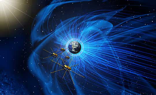
Artist’s concept of NASA’s Magnetospheric Multiscale mission consists of four identically equipped observatories that rely on Navigator GPS to maintain an exacting orbit that is at its highest point nearly halfway to the Moon. (Image: NASA)
Navigation services near the Moon have historically been provided by NASA’s communications networks. The GPS network could help ease the load on NASA’s networks, freeing up that bandwidth for other data transmission.
“What we’re trying to do is use existing infrastructure for navigational purposes, instead of building new infrastructure around the Moon,” said engineer and principal investigator Munther Hassouneh at Goddard Space Flight Center in Greenbelt, Maryland.
NASA has been working to extend GPS-based navigation to high altitudes, above the orbit of the GPS satellites, for more than a decade. The agency now believes its use at the Moon, which is about 250,000 miles from Earth, can be done.
“We’re using infrastructure that was built for surface navigation on Earth for applications beyond Earth,” said Jason Mitchell, chief technologist for Goddard’s Mission Engineering and Systems Analysis Division. “Its use for higher altitude navigation has now been firmly established with the success of missions like Magnetospheric Multiscale mission (MMS) and the Geostationary Operational Environmental Satellites (GOES). In fact, with MMS, we’re already nearly halfway to the Moon.”
Navigator GPS
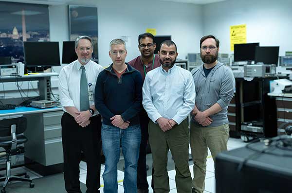
The team developing a GPS receiver for use in and around lunar orbit (from left): Jason Mitchell, Luke Winternitz, Luke Thomas, Munther Hassouneh and Sam Price. (Photo: NASA/T. Mickal)
The lunar GPS receiver is based on the Goddard-developed Navigator GPS, which engineers began developing in the early 2000s specifically for NASA’s MMS mission, the first-ever mission to study how the Sun’s and Earth’s magnetic fields connect and disconnect. The goal was to build a spacecraft-based receiver and associated algorithms that could quickly acquire and track GPS radio waves even in weak-signal areas. Navigator is now considered an enabling technology for MMS.
Without Navigator GPS, the four identically equipped MMS spacecraft couldn’t fly in their tight formation in an orbit that reaches as far as 115,000 miles from Earth’s center — far above the GPS constellation and about halfway to the Moon.
“NASA has been pushing high-altitude GPS technology for years,” said Luke Winternitz, the MMS Navigator receiver system architect. “GPS around the Moon is the next frontier.”Extending the use of GPS to the Moon will require some enhancements over MMS’s onboard GPS system, including a high-gain antenna, an enhanced clock and updated electronics.
“Goddard’s IRAD (Internal Research and Development) program has positioned us to solve some of the problems associated with using GPS in and around the Moon,” Mitchell said, adding that a smaller, more robust GPS receiver could also support the navigational needs of SmallSats, including a new SmallSat platform Goddard engineers are now developing.
Building on NavCube
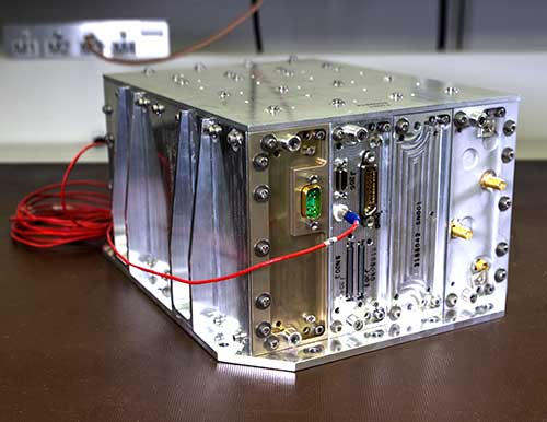
NavCube, which will be tested aboard the International Space Station later this year, is being used as a baseline for a lunar GPS receiver. (Photo: NASA/W. Hrybyk)
The team’s current lunar GPS receiver concept is based on NavCube, a new capability developed from the merger of MMS’s Navigator GPS and SpaceCube, a reconfigurable, very fast flight computer platform. The more powerful NavCube, developed with IRAD support, was recently launched to the International Space Station where it is expected to employ its enhanced ability to process GPS signals as part of a demonstration of X-ray communications in space.
The GPS processing power of NavCube combined with a receiver for lunar distances should provide the capabilities needed to use GPS at the Moon. Earlier this year, the team simulated the performance of the lunar GPS receiver and found promising results. By the end of this year, the team plans to complete the lunar NavCube hardware prototype and explore options for a flight demonstration.
“NASA and our partners are returning to the Moon for good,” Mitchell said. “NASA will need navigation capabilities such as this for a sustainable presence at the Moon, and we’re developing enabling technologies to make it happen.”
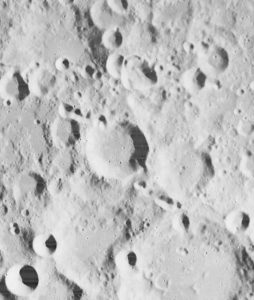
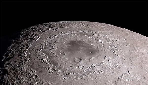
The Orientale Basin in a 4K NASA video of the lunar surface using observations from the Lunar Reconnaissance Orbiter. (Photo: NASA)
Russian positioning satellites could circle the Moon by 2040.
In a draft document describing Russia’s program for lunar exploration, plans include deployment of navigational and communications satellite groupings in lunar orbit.
The document, adopted at a Nov. 28 joint meeting of Roscosmos and Academy of Sciences officials, was obtained by Russian news agency Sputnik, which described it here.
According to the document, the tasks described for 2025-2030 include “the delivery to the Moon of a series of spacecraft for orbital research and the establishment of a global communications and positioning system.”
The concept envisions the deployment of a lunar satellite navigation constellation between 2036 and 2040.
Russia’s Earthly navigation constellation is GLONASS.
A Roscomos press release Nov. 28 says a moon base is the agency’s top priority. “The interest of mankind to the moon is associated primarily with the fact that unique regions with favorable conditions for the construction of lunar bases were discovered on the satellite. The implementation of the lunar program will be held in several stages until 2040.”
Russia will reportedly implement its new strategy in three phases: the launch of an orbital station, a manned mission to the surface, and the eventual construction of a permanent base.
The European Space Agency has issued an intriguing Intended Invitation To Tender, “Weak GNSS Signal Navigation on the Moon.” The study will investigate use of weak-signal GPS/GNSS — and of course ESA is interested primarily in the use of Galileo — for real-time position, navigation and timing information to various future lunar assets such as automated landers, rovers, Earth-Moon transportation vehicle, in-situ navigation, and so on.
Does ESA have a lunar exploration agenda? This I did not know, but with only my own ignorance to thank, I quickly found out that ESA has had a lunar orbiter, SMART-1 (Small Missions for Advanced Research in Technology), since 2004, equipped with an Advanced Moon Imaging Experiment (AMIE) micro-camera and a mission, at least in part, to zero-in on suitable study sites for potential future lunar exploration missions.
Since the conclusion of that project, ESA now plans to land a spacecraft in 2018 near the Moon’s south pole, a region full of dangerous boulders and high ridges. The aim is to probe the moonscape and test new technology — and now we know this includes GNSS — to prepare for future human landings. “The region may be a prime location for future human explorers because it offers almost continuous sunlight for power and potential access to vital resources such as water-ice.”
“Although the visibility geometry is not always favorable,” the current ESA Invitation to Tender states, “it would result in 100-500m position accuracy as estimated in a NASA JPL/Ohio University paper. For lunar navigation applications, GPS/Galileo signals could be used if receivers complemented with advanced processing signal and filtering techniques, are capable of acquisition and tracking in the order of 15dBHz signal to noise ratios. Today latest developments show that these values are feasible. The PNT performance figures could also be improved with a GNSS-based system on a lunar relay satellite orbiting the moon as analyzed in [RD3]. The hardware required is equivalent to GPS space-based receivers and a high gain antenna.”
The invitation to tender, to the tune of 200,000–500,000 euros, closes on April 23.
GNSS use in space exploration, novel as it seems, has been outlined and partially explored in previously published articles in GPS World.
In September 2008, Jim Miller and A.J. Oria brought us all up to date on the U.S. National Aeronautics and Space Administration’s (NASA’s) plans to use GPS in the great dark out-there.
“NASA has engaged with the Department of Defense (DoD) to define the performance parameters to support navigation services in a Space Service Volume (SSV) designated from 3,000 kilometers to GEO altitude to approximately 36,000 kilometers,” they wrote in “NASA’s Vision for Space.”
“This type of navigation requires specialized software to process the side-lobes of GPS signals coming over the earth’s limb, as well as the increased attenuation and tracking of a very few satellites at a time. Once tracking is initiated. however, one can begin to imagine a future where GPS-in-space may also include syncing GPS positioning and timing with spacecraft and beacons broadcasting other “GPS-like” signals near celestial bodies such as the moon and Mars.
“Transition from terrestrial-based radar tracking of space vehicles to space-based radiometric data from GPS is well underway at NASA. Simulations demonstrate GPS Navigator receiver applications could be performed almost to the moon. An ongoing effort is developing the TDRSS Augmentation Service for Satellites (TASS) to disseminate differential corrections from the Global Differential GPS (GDGPS) network to users in LEO. The Communication, Navigation, Networking, reConfigurable Testbed (CoNNeCT) on the ISS will use software-defined radios to process GPS/GNSS signals and waveforms.’
Also, in “GPS Goes Martian: Nav/Com for a Red Planet,” a 2004 article by Susan Skone, Kyle O’Keefe, and Gerard Lachapelle, the authors describe plans for a network of satellites to be placed in orbit around our eerie solar-system sibling for the purpose of GPS-like navigation.
Finally, way back in 2002, a group of authors proposed “Formation Flight in Space.” Russell Carpenter, Michael Moreau, Jonathan How, Lesse Leitner, Frank Bauer and David Folta described how distributed spacecraft systems are developing new GPS capabilities, on the drawing boards, at least.
“Scientists have just begun to understand the full potential of space vehicle formation flying. In the last few years, this technology has gone from a space oddity — and a high risk one at that — to a concept fully embraced by earth and space scientists around the world. Prior to the selection of the New Millennium Program Earth Orbiter-1 (EO-1) mission in 1996 (the first autonomous formation flying earth science mission), the National Aeronautics and Space Administration (NASA) had only one or two formation flying concepts under consideration. Now 35 mission sets fill that list.”
If any young and adventurous engineers out there have been lamenting the dearth of new frontiers for them to explore GNSSively, cry no more.