Tag: mountain climbing

  • Steep Questions: How Tall is K2?

    A Mountaineering Survey Team Determines K2’s Actual Height

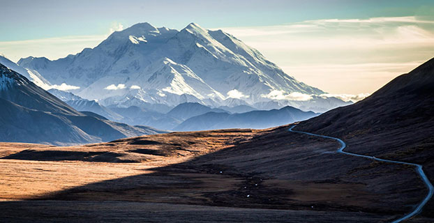
    Surveying the world’s highest peaks is a daunting task. One international survey team set out to measure the Himalaya’s K2 peak, the second highest in the world after Mount Everest.

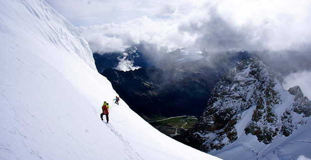
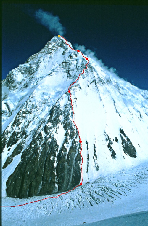
    In 2004, 50 years after an Italian team led by Ardito Desio first summited, a team tried to measure K2 with GNSS surveying equipment, but the attempt to bring the GNSS receiver to the top failed when a climber fell.

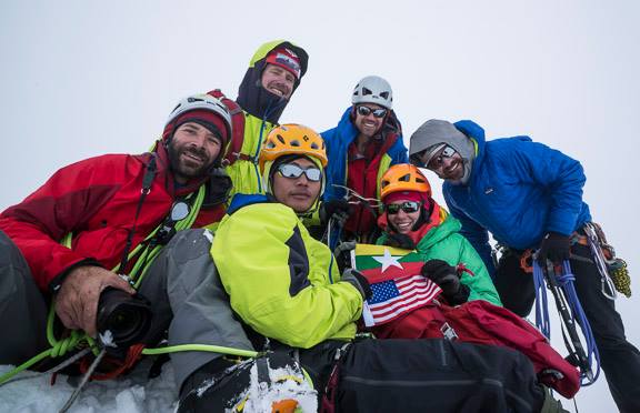
    For the most recent attempt, a Pakasti-Italian team took along a rugged industrial survey system 60 years after the first summiting, in June–August 2014.

    The team performed measurements at five different climbing campsites and on the K2 summit, using GNSS technology to collect the most accurate measurements ever made of K2.

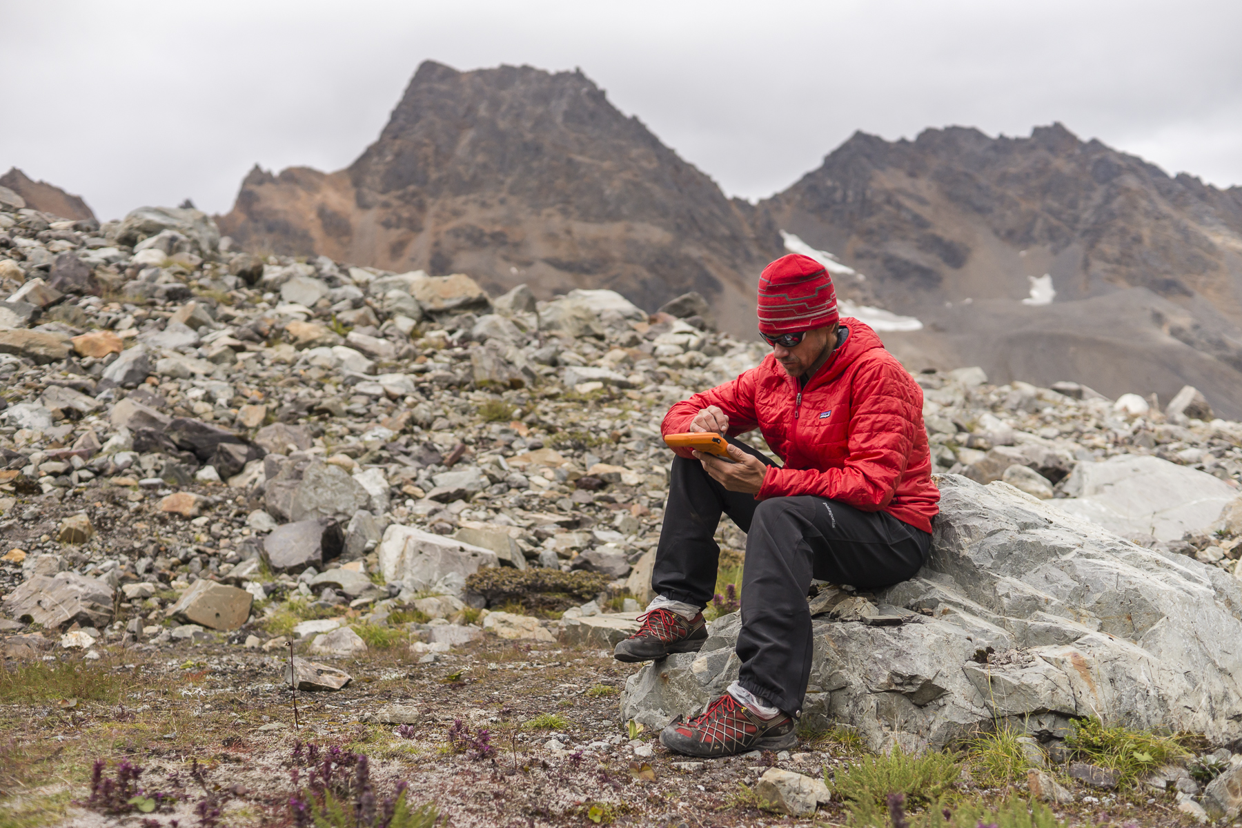
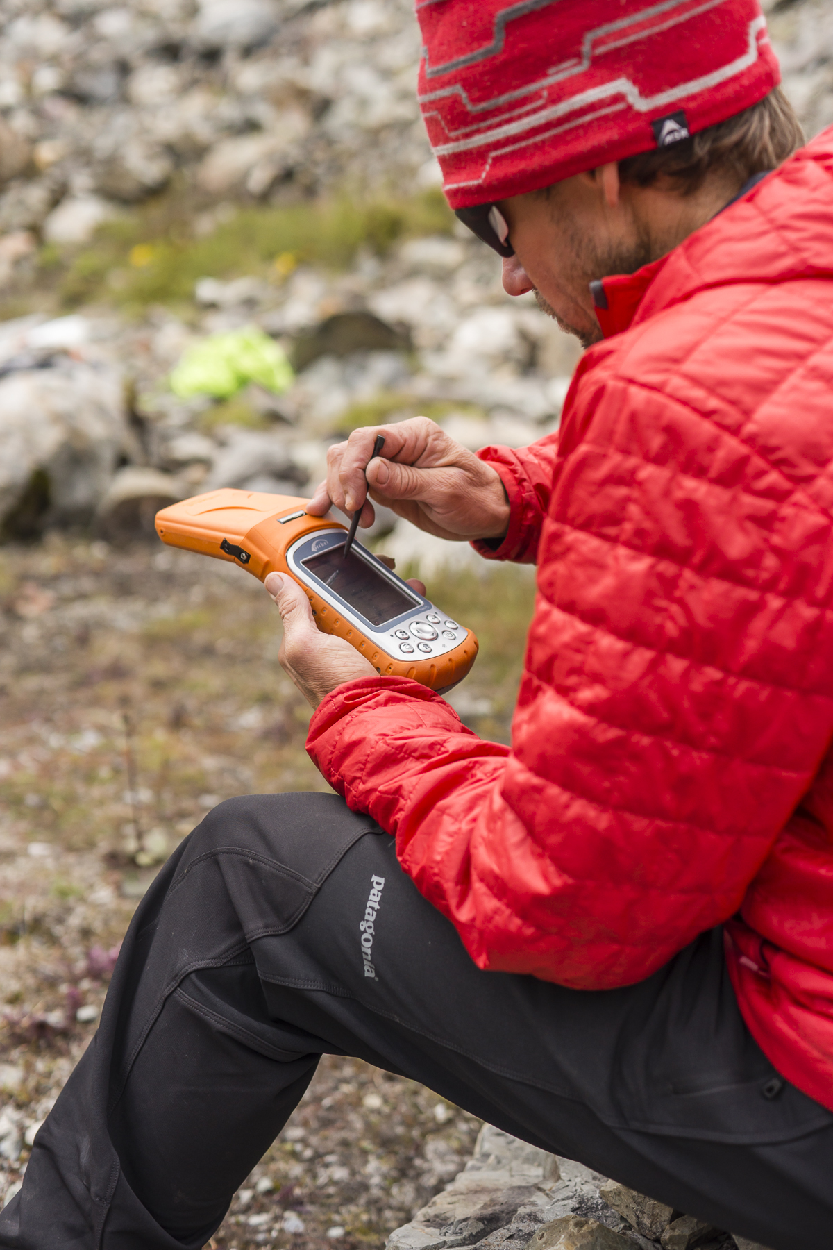
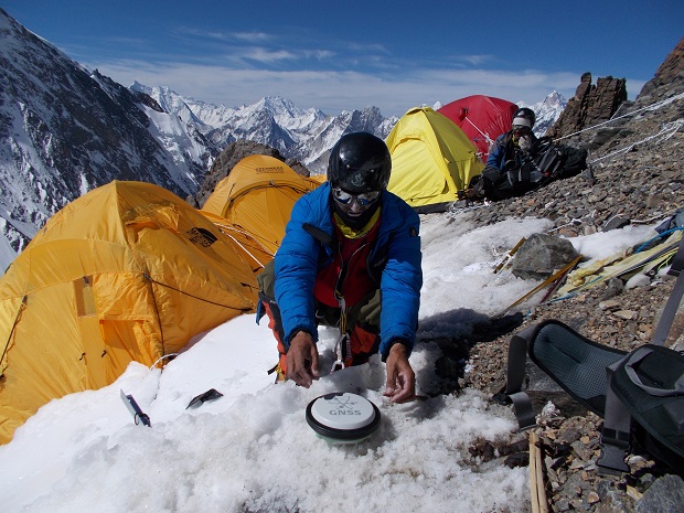
    The measurements were accomplished by Pakistan’s Rehmat Ullah Baigh and Italy’s Michele Cucchi, who set up the receiver at each stop and allowed it to remain for approximately 20 minutes to collect the latitude, longitude and altitude of each point from the available satellites.

    Setting up camp also meant setting up a GNSS receiver to gather data.
    Setting up camp also meant setting up a GNSS receiver to gather
    data.

    One reference receiver was permanently positioned by team technical leader Maurizio Gallo close to the K2 Base Camp at the Gilkey Puchot Memorial, which is dedicated to climbers who died on K2. A second reference receiver was placed in Skardu, a final stop before heading up the mountains. At Skardu, computer expert Fida Hassain from Central Karakorum National Park helped install and process the transmitted data along with researcher Aamir Asghar and Giorgio Poretti, professor at the University of Trieste. The coordinated network of two permanent GNSS stations allowed data from the summit to be processed with excellent precision and is still in operation today.

    After the climb, the data was downloaded from the receivers and analyzed. The GNSS survey results lowered K2’s height from its previous altitude of 8,610.34 meters (28,248.03 feet) to 8,609.02 meters (28,244.75 feet) — 1.5 meters (3.3 feet) shorter than previously believed.

    The route to K2’s summit.
    The route to K2’s summit.

    Yet the biggest surprise was at K2’s Camp Four on the Abruzzi Spur, where expeditions on this route begin their final ascent to the summit. Previous measurements stated that the route began at 7,900 meters (25,920 feet). The new data collected proves that the route starts at 7,747.029 meters (25,416.667 feet), making the climb 150 meters (492 feet) longer than previously recorded. This is a challenging difference for K2 climbers, who at this point are struggling for weeks with the weakening effects of altitude sickness
    and the stress of staying focused.

    The team also plans to climb Mount Everest, where a reference station is located very close to the EVK2CNR’s Pyramid International Laboratory on the Nepali side of Mount Everest.

    Manufacturer

    The survey team used the Leica Viva GS14 GNSS receiver and two GX1230+ reference receivers and antennae provided by Leica Geosystems. Leica Geosystems used the opportunity to test its equipment’s portability, resistance to very low temperatures and rugged use on rough tracks.

    Adapted from an article by Katherine Lehmuller and Marco Mozzon in the Reporter (#72), the Leica Geosystems customer magazine, and other sources.
  • Highest Peak in North America to be Surveyed

    Highest Peak in North America to be Surveyed

    At 20, 320 feet, Mount McKinley is North America’s highest peak. (Photo courtesy of Todd Paris, UAF).
    At 20, 320 feet, Mount McKinley is North America’s highest peak. (Photo courtesy of Todd Paris, UAF).

    A new GPS survey of Mount McKinley, the highest point in North America, will update the commonly accepted elevation of McKinley’s peak, 20,320 feet. The last survey was completed in 1953.

    The USGS, along with NOAA’s National Geodetic Survey (NGS) and the University of Alaska Fairbanks (UAF), are supporting a GPS survey of the Mount McKinley apex. Surveying technology and processes have improved greatly since the last survey and the ability to establish a much more accurate height now exists, the USGS said.

    The Mount McKinley survey team, and their equipment, are expected to face temperatures well below zero, high winds and frequent snow. Current forecast, courtesy of NOAA. (Photo courtesy of Todd Paris, UAF).
    The Mount McKinley survey team, and their equipment, are expected to face temperatures well below zero, high winds and frequent snow. Current forecast, courtesy of NOAA. (Photo courtesy of Todd Paris, UAF).

    An experienced team of four climbers, one from UAF and three from CompassData, will start the precarious trek to the summit with the needed scientific instruments in tow, in the middle of June. They plan to return on or before July 7 and begin work with the University of Alaska Fairbanks and NGS processing the data to arrive at the new summit elevation.

    With the acquisition of new elevation (ifsar) data in Alaska as part of the 3D Elevation Program, there have been inquiries about the height of the summit. The survey party is being led by CompassData, a subcontractor for Dewberry on a task awarded under the USGS’ Geospatial Products and Services Contract (GPSC).

    Using modern GPS survey equipment and techniques, along with better gravity data to improve the geoid model in Alaska, the partners will be able to report the summit elevation with a much higher level of confidence than has been possible in the past.

    According to CompassData, the survey equipment includes two Trimble R10 antennas and one Trimble Net-R9 with a Zephyr-2 antenna. Also being taken up the mountain is a 10-meter specialized glacier avalanche probe and a Ground Penetrating Radar (GPR), courtesy of the University of Alaska Fairbanks.

    It is anticipated the newly surveyed elevation will be published by the National Geodetic Survey in late August.

    Climbing Mount McKinley, North America’s highest peak, is a daunting task for even the most experienced mountaineers at Denali National Park in Alaska. (Photo courtesy of National Geographic).
    Climbing Mount McKinley, North America’s highest peak, is a daunting task for even the most experienced mountaineers at Denali National Park in Alaska. (Photo courtesy of National Geographic).

  • Juniper Systems’ Archer Field PC Records Elevation of Remote Himalayan Peak

    Juniper Systems’ Archer Field PC Records Elevation of Remote Himalayan Peak

    Juniper_Archer_on_Mountain
    Photo credit: Mark Fisher at www.fishercreative.com, Instagram: @fishercreative; via Juniper.

    Juniper Systems’ Archer Field PC has beenused to record the elevation of a never-before-climbed peak in the remote Myanmar Himalaya. The peak, Mount Gamlang Razi, has historically been known as the second highest peak in Southeast Asia, but a joint American-Myanmar-led expedition set out on a mission last September to hopefully prove that it is in fact the tallest. Read the whole story on Juniper Systems’ blog.

    Standing at a reported 5,881 meters tall, Mount Hkakabo Razi has long been known as Southeast Asia’s highest peak. In recent years, however, the legitimacy of the elevation of Hkakabo Razi has come into question. Current digital analysis suggests that initial surveys of Mount Hkakabo Razi were overstated and its actual elevation is as much as 100 meters lower than originally believed. At the same time, digital analysis suggests that virgin-peak Gamlang Razi may in fact be the taller peak. This controversy prompted Idaho resident and experienced climber Andy Tyson to lead an American-Myanmar expedition team on a three-week approach through 150 miles of cobra-riddled, mosquito-infested jungle, and from there up to the peak of Gamlang Razi to measure its elevation in person.

    Tyson needed a device that could accurately record the elevation at the summit, while being able to withstand the extreme conditions of the hot, wet jungle and the frozen mountaintop. With this in mind, Tyson requested from Juniper Systems a top-of-the-line rugged handheld. In response, Juniper Systems provided the team with an Archer Field PC with Hemisphere GPS XF101 receiver, along with training to record the GPS data they needed.

    Setting up the Archer Field PC to collect GPS data. Photo credit: Mark Fisher at http://www.fishercreative.com. Instagram: @fishercreative
    Setting up the Archer Field PC to collect GPS data. Photo credit: Mark Fisher at http://www.fishercreative.com/Instagram: @fishercreative/via Juniper.

    After a 35-day journey, Tyson and the team successfully summited Gamlang Razi, with the Archer Field PC in hand. After collecting GPS data at the top, the data was sent via satellite phone to Juniper Systems for analysis. After post-processing the data against terrestrial base stations in Lhasa, Tibet, and confirming the results with Effigis in Montreal, Canada, Juniper Systems concluded that the elevation of Gamlang Razi was 5,870 meters, ±2 meters. This suggests that Gamlang Razi is taller than nearby Hkakabo Razi by approximately 112 meters and should be considered Southeast Asia’s new highest peak.

    However, there are many — particularly natives to Myanmar — who are not ready to accept changes to Hkakabo Razi’s original elevation measurement. This was made apparent in a letter Myanmar’s president, Thein Sein, wrote to Tyson and the team after their successful summit, congratulating them for summiting Southeast Asia’s second-tallest peak.

    Tyson remains firm in his assertion that Gamlang Razi is the country’s highest peak, but some have suggested that the debate may not be over until someone actually climbs Hkakabo Razi and measures it in person. Juniper Systems said they have a handheld for the job, should that time come.

    The expedition team. Photo credit: Mark Fisher at http://www.fishercreative.com. Instagram: @fishercreative
    The expedition team. Photo credit: Mark Fisher at http://www.fishercreative.com. Instagram: @fishercreative/via Juniper.