The Munich Satellite Navigation Summit program is now online and registration for the event is open. The summit will be held online March 7-8.
The Munich Satellite Navigation Summit focuses on satellite navigation in the present day and future, featuring global speakers and highlighting the latest developments in the field of GNSS. This year’s theme is “AI in GNSS – Intelligence brought to Navigation”.
The summit will feature 12 sessions from industry experts, including sessions on the following topics:
First and Second Generation of the European Satellite Navigation System Galileo
Modernization of the US Global Positioning System
Status and modernization of the Russian Global Satellite Navigation System GLONASS and the Chinese Beidou System (BDS)
Developments of regional systems like the Japanese QZSS and the Indian IRNSS and the Korean Positioning System (KPS)
Use of AI within the navigation world and its implications
Organizers stated, “In light of the current situation caused by the coronavirus as well as related travel restrictions and resulting cancellations we unfortunately are forced to cancel the Munich Satellite Navigation Summit 2020 as we are no longer able to provide a well-ordered and appropriate program.”
Those who were attending are asked to be patient as the event organizers proceed to “sort out all necessary administrative issues.”
The summit brings together experts in industry and government; this year, it was go take place in Alte Kongresshalle, Munich, Germany.
Attendees are also told it may be possible to transfer their registration to the 2021 conference.
The 2019 Munich Satellite Navigation Summit, which will take place March 25-27 in Munich, Germany, will offer a number of educational sessions to attendees.
One of the sessions will key in on the future use of the Galileo public regulated service (PRS). According to show organizers, this session will discuss the deployment of the Galileo ground- and space-segment — including the PRS relevant components — which will reach full operational capability in the next years. The session will also cover PRS-receiver developments and PRS testing.
Other sessions offered by the conference will include legal aspects on selected topics in the field of GNSS; augmented reality meets high-accuracy positioning; GNSS program updates; satellite and terrestrial navigation trends; and more.
According to organizers, the Summit is part of the efforts of the Bavarian government and the cluster on aerospace and satellite navigation to stimulate applications and services in this high-tech field.
Experts from all over the world will discuss positioning, navigation and timing (PNT) and their role for augmented/mixed reality at the Munich Satellite Navigation Summit 2019. The summit will take place March 25-27, 2019, at the Alte Kongresshalle in Munich, Germany.
“Augment Yourself with GNSS…” is the theme of the 2019 summit. The organizing Institute of Space Technology and Space Applications (ISTA) of the Universitaet der Bundeswehr Muenchen will invite experts to talk about the latest GNSS and PNT news and their role for augmented/mixed reality as well as other up-to-date technologies.
The conference starts on March 25 with the Exhibition Opening and Champagne Reception at 16:00 hours, followed by the Opening Plenary Panel at 16:45 hours. Afterwards, a reception provides opportunities for high-level networking with experts from industry, science and government.
Trending topics of the 2019 summit:
First- and second-generation of the European satellite navigation system Galileo
Modernization of the U.S. Global Positioning System
Status and modernization of the Russian Global Satellite Navigation System GLONASS
Developments of new global and regional systems like the Chinese Beidou (BDS), the Japanese QZSS and the Indian IRNSS
Augmented/mixed reality and the use of Android raw measurements
Autonomous systems
Civil use of the Public Regulated Service
GNSS satellites and the Space Service Volume
Legal aspects on selected topics in the field of GNSS.
Here’s a panorama in broad strokes across the range of GNSSs, garnered from top system spokespersons at the Munich Satellite Navigation Summit. It’s been several years since breaking news was aired at this annual late winter/early spring event, but it’s always good for a wide-ranging update, recalibrating levels, so to speak.
GPS. With 31 operational satellites (24 is baseline) and an estimated 3 billion receivers in use worldwide, what more needs to be said about the gold standard? Its best week ever for accuracy logged a signal-in-space performance average of 45.3 centimeter. The next-generation ground control system OCX “survived quite a struggle” and has emerged from Nunn-McCurdy breach, back on track and seemingly ready for future action. Or at least for future pre-certification tests. SV1 of the GPS III generation has completed all tests and is in storage, awaiting the first GPS III launch in spring 2018. SV02 and 03 are in assembly and integration, SV04 thru 08 are in box-level assembly, and 09 and 10 are on contract. Technical challenges with payload have been resolved.
(Click to enlarge.) Galileo satellite top-level block diagram. OHB Systems AG as prime contractor and Surrey Satellite Technology (SSTL) have teamed for production of the navigation satellites. OHB is responsible for the concept, the satellite platforms and the satellite-level inegration and test. SSTL supplies the satellite payloads and supports OHB on system level. OHB also supports the customers during launch preparation and in-orbit testing. (Image courtesy OHB)
Galileo. With 18 on-orbit satellites (15 operational), the European GNSS can be termed a coming thing. Performance statistics are based on only 11 of these satellites however; the four most recently launched in November 2016 are not yet included. Nevertheless, the system is logging 80-centimeter ranging accuracy. Eight more await launch: four in 2017, and four in 2018. The constellation is broadcasting the Open Service, the Public Regulated Service, and the Search and Rescue (SAR) signal. The SAR service will officially launch in early April — on April 6, because 406 MHz is the Emergency Position Indicating Radio Beacon frequency. Galileo has improved the historic SAR location performance from 3 hours to 10 minutes. The Commercial Service is still in preparation, and will be available in 2020. Spoofing is seen as a very real threat to GNSS overall by the Galileo authorities, as exemplified by the recent bloom of amateur spoofers encouraged by Pokemon go.
GLONASS. The Russian system will undertake three or four launches this year; one of them will be a triple-satellite launch. There have been several disruptions to efforts to decrease the offset between GLONASS system time and Universal Coordinated Time but the initiative perseveres. English versions of four system interface control documents (ICDs), to include the new CDMA signal, are promised for Q2 2017; Chinese versions are coming, too. Russian-language ICDs are available at glonass.aic.ru.
BeiDou. With the addition of three new satellites in the past year, China’s system is enjoying improved system performance. Hydrogen clocks are succeeding rubidium clocks, bring an order-of-magnitude improvement in timing accuracy. A BeiDou white paper was published last June, and a revised ICD appeared in November.
In the massive Chinese mass market, 30 percent of smartphones sold in China now have BeiDou capability; that’s out of a 700–800 million total. Huawei multi-function chip LX1101 is a key driver behind this. Unistrong has released a phone with RTCM input for professional use, blurring the line between mass and professional markets.
Six to eight satellites will be launched this year, and 10 to 12 in 2018. BeiDou is in a “very ambitious and aggressive race with time to complete the global system.”
ICG. The United Nations’ International Committee on Global Navigation Satellite Systems will meet in Japan in December of this year, in China next year, and in India in 2019. This can be interpreted as vigorous international interest and “a desire to advance and promote their respective systems’ visibility” worldwide. All pertinent documents can be found at unoosa.org.
EGNOS. The European Geostationary Navigation Overlay Service has two operational geosynchronous Earth-orbit satellites (GEOs) in operation, plus one in test and one in deployment, ready to swap in. It is extending its Ranging and Integrity Monitoring Stations (RIMS) to several new countries, notably Israel and the Ukraine. EGNOS.v3 is coming and will introduce dual-frequency (L1 and L5) service, and also Galileo with GPS, for multi-constellation corrections. The new system’s qualification is planned for 2022.
QZSS. This year, Japan’s Quasi-Zenith Satellite System will launch the second and third of the figure-eight inclined geosynchronous orbit (IGSO) satellites of the Michibiki type, to become operational in 2018. A GEO bird will also be launched. A seven-satellite system is the ultimate goal.
Among other announcements of note made during the course of the Summit, although not by the GNSS operators’ spokespersons:
(Click to enlarge.) Key features of the Galileo satellites.
• OHB, the Galileo satellite manufacturer, said its customer has decided to refurbish the clocks on eight satellites in preparation. “Satellite navigation is nothing but comparison of very precise clocks.”
• Airbus announced a new concept for train positioning integrity: “virtual valises” to correct train position that will replace or augment current trackside valises that are very expensive to build and maintain.
• Munich Aerospace (munich-aerospace.de), a public-private non-profit venture between DLR, the German space agency, Bauhaus Luftfahrt and two technical universities, will mount a Ph.D-level education and research program for 70 individuals, with candidates from 27 nations. This will be located in “the Bavarian Silicon Valley.” It will also undertake a global effort with several other organizations.
• One of the above technical universities, the Federal Armed Forces University in Munich, announced that it is investigating Lidar for potential use in an asteroid mining project for future space exploration. It also has underway initiatives concerning Lidar + GNSS and inertial + GNSS for autonomous vehicles.
2016 has already been dubbed as “The Year of Galileo.” That was the clear message from the Munich Satellite Navigation Summit in early March. The Munich summit covers all GNSS systems, but the focus this year was squarely on Galileo.
I think it is fair to say that come hell or high water we will see Galileo Initial Services debuting in October 2016. Representatives from all parties to the Galileo initiative – the European Commission, ESA and GSA – stressed the importance of getting those first services in place.
12 satellites currently in orbit (despite one being definitely broken and two in sub-optimal orbits) will be sufficient to deliver the service, and this will not depend on any of the six satellites to be launched during 2016. Extensive system testing will take place during the spring and summer to ensure all is ready.
The Munich Satellite Navigation Summit 2016
Watching the traditional high-level opening plenary session in Munich’s marvellous Allerheiligen-Hofkirche (Court Church of All Saints), it is clear that a more collaborative era has entered the European GNSS scene. The body language of the various European parties on stage was so much more relaxed than at previous summits. For me this is the good news that Johann-Dietrich “Jan” Woerner has brought as the new Director General of ESA.
The working title of this 13th Munich Summit was “GNSS — creating a global village” but the focus was squarely on Galileo. From the European Commission, Pierre Delsaux thanked Jan Woerner for shuffling the ESA launch schedule to enable the extra Soyuz launch for two Galileo satellites in May and anticipated global coverage by 2020. He also emphasized the need to show value for EU taxpayers and unleash space-based services, new applications and jobs for global citizens. It was also confirmed that Galileo launches were now insured.
Deliver, deliver, deliver
Jan Woerner himself praised the collaboration with the Commission, saying during the panel discussion that there was “no power struggle at all.” He said that the Director General of the Commission’s DG GROWTH, Lowri Evans, had the motto: “Don’t discuss: deliver, deliver, deliver.” He agreed that the roles of the various players needed refinement but this should never be to the detriment of the Galileo programme.
Carlo des Dorides, Executive Director of the GSA, was also optimistic. He said GSA is now taking its full place in the GNSS world. He focused on what Galileo will bring to the Internet of Things (IoT), and digital infrastructure in general, and emphasised the better accuracy and availability of the European GNSS, especially in urban-canyon environments, and also its proposed authenticated open signal. “The (Galileo) revolution is an appointment that cannot be missed for success in digital infrastructure,” he concluded.
Higher levels of authentication and trust that are to be provided by Galileo signals give the appearance of a distinct market differentiator for the system. Most importantly, one that the market and applications in mobility, finance and the IoT want to see.
The Jewel in the Crown
Later in the summit Imogen Ormerod, Head of Galileo Policy at the UK Space Agency, described the Galileo Public Regulated Service (PRS) as the “Jewel in Galileo’s crown.” insisting that PRS was unique and that the ability to have confidence in the signal would be ground-breaking. Done right, PRS has “unique and unchallenged commercial potential,” she concluded.
As provision of authentication is clearly not on the civil GPS horizon at the moment, “unchallenged” appears to be the appropriate word.
During a session on authentication, Harold “Stormy” Martin, Director of the National Coordination Office for Space-Based Positioning, Navigation, and Timing in Washington, stated that the United States has no plans for civil authentication in the current-generation GPS satellites or in GPS III. However, he said the U.S. was interested in EU developments and would continue to explore possibilities for future.
Next Generation
Paul Flament, Head of Unit for Galileo and EGNOS – Programme Management at the European Commission issued further warm feelings for Galileo on the Wednesday morning. His update on Galileo status confirmed the news hinted previously that the two Galileo satellites delivered into the wrong orbits will be used for the Galileo Search and Rescue function and would probably also be available for the Open Service. Testing with receiver manufacturers has already shown that their signals are compatible.
He also talked about the new tender for eight further satellites that has been issued by the Commission. This would procure the four extra satellites now needed to reach a 30-satellite constellation and four for spare. The winning bidder could be known by September and definitely by the end of the year.
Commission rules require that a contract of this size must be put out to tender, but as the satellite specification is pretty much identical to that now being successfully rolled off the OHB production line, it would be bizarre — although not beyond the mystery that is EU space politics — for the tender to be awarded anywhere else.
The GSA competition to select the operator of Galileo services will also be known by the end of 2016. Consultation on what will be required for the second generation of Galileo FOC satellites beyond 2020, perhaps with an emphasis on cost reduction, will open sometime this year.
EGNOS over Africa
The potential extension of the European SBAS EGNOS over Africa was discussed in a session that emphasised the global village dimension of GNSS. Julien Lapie from the Agency for Aerial Navigation Safety in Africa and Madagascar (ASECNA), based in Dakar, gave an update on the programme that is looking to establish a cooperative management system of a single sky of over 16.1 million square kilometres — around 50 percent larger than Europe.
ASENCA is developing a programme and resources for deployment of EGNOS in Africa with the objective of African ownership of the infrastructure, control and provision of a signal-in-space and autonomous provision of services to users. A first step was to provide early EGNOS-based services by 2019/20, and then provision of full services from 2023 onwards. One technical issue had been the need for more and better information on ionospheric effects over Africa to characterise and optimise the EGNOS model for SBAS. Results here were very encouraging, and Lapie said that this was no longer a problem for L1 service on SBAS. He hoped for an ASECNA-EU international agreement as soon as possible. Such a system will need a space-based component and this will have to be subject to an open tender, Lapie told me after his presentation.
On obvious contender for the tender is already in orbit: NigComSat-IR. John A. Momoh of the Nigerian National Space Research and Development Agency described the characteristics of this satellite that was primarily launched to provide communications services but also carried L1 and L5 transponders designed for SBAS. These had been commissioned and showed “close to GPS performance and a signal in space that is compatible with GNSS.” Momoh said that the satellite could be a core component of an Africa SBAS.
Time gentlemen – please!
One new potential wrinkle for Galileo was hinted at during the Munich session on legal issues around GNSS timing. A recent GPS timing issue caused numerous problems for digital broadcasters and financial networks around the world on 26 January, when a data upload went slightly awry. This introduced a 13.7 millisecond error in one of the timing signals: the static offset for GPS time compared to Coordinated Universal Time (UTC). It led to some receivers exhibiting “different and unwanted behaviour” – a very polite description!
Fortunately the issue was resolved swiftly, and correct data uploaded. The extent of any financial losses and how any legal proceedings (if any) to recover damages might pan out are still unclear. However what is clear is that while GPS time has a clear link to legal time, Galileo does not. Dr. Andreas Bauch from the German Physikalisch-Technische Bundesanstalt (PTB) — one of Germany’s “Time Lords” — described the underlying legal basis of GNSS time.
U.S. GPS time is traceable and legally defined to national time and UTC through the National Institute of Standards and Technology (NIST). In Europe most Member States, but not all, have legal time defined in legislation. Galileo System Time (GST) is not linked to a single institution but to an average derived from a network of European standards institutions including PTB. From the presentations it was not clear to me if GST currently has a water-tight legal definition.
Talking to legal and technical experts after this session, it became clear that the legal basis for GST does need to be clearly defined in European legislation — and soon — if Galileo PNT services are to be a commercial reality in the near future. The Commission needs to get on the case for this one pronto.
Tracking Everything
On a lighter note I had great pleasure in chairing a GPS World session at the Summit on the final day with the title of “‘GNSS and Sciences for Life.” This small but perfectly formed session presented three different applications of GNSS used to track people, animals and assets. Walter Naumann of the Max Planck Institute for Ornithology showed, via a series of videos, his remarkable work in the ICARUS project tracking the migration of animals from locusts to elephants via a payload on the International Space Station. GNSS tags that weigh 5 grams or less enable accurate tracking of even the smallest beast.
Stefan Thurner of the Institute of Agricultural Engineering and Animal Husbandry in Freising, Germany described his use of GNSS tags to track cattle and other farm animals in alpine summer pastures, enabling farmers to monitor their herds from a distance. Finally Oliver Trinchera of Kinexon told us about developments at this Munich-based winner of the 2013 Galileo Masters competition. Kinexon technology is used to track people and assets worldwide and has its own proprietary solution for accurate indoor positioning providing a low-cost, scalable solution.
In the same general field as Kinexon one of my favourite young companies — and also a winner at the 2013 European Satellite navigation Competition — Johan Sport has had a great March so far. The month marked the commercial launch of company’s EGNOS-enabled sports tracking products and the launch of a crowdfunding campaign via the Dutch Symbid site. The company was seeking € 150 000 to scale up production and hire a couple more employees. The new funding for 5 percent of the company’s shares values Johan Sport at two million Euros and was oversubscribed within four days! “We are indeed very pleased,” says CEO Jelle Reichert. “Now full throttle to the market!”
The Johan Sport system is seen as the first affordable and reliable performance monitoring system for professional field sports. And with the global market for sports analytical equipment predicted to grow to some $4.7 billion by 2021, there is plenty to play for!
Year of UAVs too?
The unmanned aerial vehicle (UAV) sector is a dynamic GNSS-enabled sector globally, and Europe is no exception. In January I attended a UAV event at the Royal Military Academy in Brussels. The focus of the two-day meeting was on small commercial and recreational remotely piloted aircraft systems (RPAS) that are rapidly populating Europe’s airspace.
Currently, there is no European legislation that governs their use in conjunction with general aviation and, typically, national legislation varies across the member states. Regulators are trying to play catch-up.
One interesting EU project trying to tackle this situation is DroneRules.EU. Philippe Carous of SpaceTec Partners said the project’s main objective was to raise general awareness of the rules governing RPAS across the commercial sector and the general public. Speaking as an occasional drone operator – I own a Parrot 2.0 – I must admit I was oblivious of the legal minefield I am potentially entering every time I fly my ‘Boy’s Toy’ around the garden!
The project covers three main areas: privacy and data protection; safety and operation; and insurance and liability. The plan is to establish a set of useful tools on a web portal including awareness, training tools and online resource covering rules at national level plus regulatory developments. The website should be available mid-2016 at http://www.drone-rules.eu.
Rachel Finn of Trilateral Research, a partner in the DroneRules.eu project, talked about privacy and data protection issues which bring some complex rules and liabilities into play as drones are increasingly becoming data collection devices. The company undertook a survey of users for the European Commission and identified private users as the least regulated and most at risk of breaching the rules. Commercial users were seen as medium risk. “Using the same drone with the same payload in different contexts can raise different or new privacy and data protection issues,” Rachel said. Each mission may need to be individually risk assessed.
Listening to the discussion here, it seemed to me that privacy issues could effectively turn any urban area into a ‘no-go’ zone for civil drones let alone other considerations on safety and so on.
The Brussels conference was organised by UVS International whose president Peter van Blyenburgh is a blunt-speaking and passionate advocate for the civil RPAS operating community in Europe.
On 4 March a further workshop took place at EUROCONTROL headquarters in Brussels with the purpose of discussing the future working arrangements and work programme for the development of RPAS standards. Peter van Blyenburgh tells me that not a single RPAS operator had been invited to air their views at this forum.
From the discussions at the workshop it was clear, according to van Blyenburgh, that international, European and national standards organisations are not coordinating their work and consequently there is significant duplication and wasted effort. However it was decided that a single working group will be established to tackle standards work for all sizes of RPAS and terms of reference for this group should be finalised by the middle of June 2016.
During the workshop van Blyenburgh expressed his views on the absolute necessity that RPAS operators and new disruptive technology companies must participate in the work on standards and as there was a large number of light RPAS (<25 kilograms) already flying, it was also imperative to tackle the standards applicable to them as a priority.
Van Blyenburgh takes the view that if the RPAS community is not careful and proactive, their commercial future may be set by standards produced by the traditional airspace players that are not directly involved with their specific community, nor really understand it. It is hard to disagree with his views here.
“Of course, at the same time, the RPAS communities should both remember that airspace safety is a common responsibility that should be proportionately shared by all RPAS community members,” he adds. “Defining this proportionality will be one of the keys to success.”
Polish solution?
If regulations are lacking, technical solutions are ready to roll. One European initiative based in Poland seems to have a viable monitoring and control system developed for drones/ RPAS: The Drone Monitoring System (PSMD) was presented by Justyna Zdanowska of the Grupa Dron House S.A.
The Polish solution can monitor drones in near real-time (the company claims a maximum delay of one second) using GSM and/or GPS technologies and has the ability to manage the drone online through an application. They say this is the first successful development of such technology that is operational and ready for implementation. It has already attracted the interest of some major aerospace players, drone users and the authorities as the system could solve the issue of uncontrolled flights and other problems.
“We offer a complete, ready-to-use system that will radically improve the safety of air traffic, because the drone market is developing at a dynamic rate in an uncontrolled manner,” says Justyna Zdanowska.
The technology also has a huge capacity with up to 18 000 devices controlled and/ or monitored by a single base station at a given location. This should allow full monitoring and identification of unmanned devices.
2016 Masters
Finally I am looking forward to the 2016 Galileo and Copernicus Masters competitions that will launch soon in Europe. These annual high-profile competitions showcase some of the best emerging applications and ideas for GNSS and Earth Observation in Europe, and globally.
As mentioned above the ideas behind both Kinexon and Johan Sport won big at previous Masters events and the 2016 competition launches on 1 April. You can find out more, here.
Reynolds is director of Inta Communication Ltd. and a long-term Brussels observer writing on many aspects of European government policy and implementation for a range of clients and publications. He is the contributing editor for GPS World’s new quarterly e-newsletter, EAGER: the European GNSS and Earth Observation Report.
The annual summit, held in the historic Munich Residenz, is an conference with global impact dealing with satellite navigation. The one-of-a-kind convention of high-ranking worldwide speakers from industry, science and governments provides the participants with a broad overview and different perspectives on the latest developments in the field of GNSS.
Reynold’s session, GNSS and Sciences for Life, will cover maritime search and rescue (SAR), precision agriculture and livestock management, personal fitness and emergency medical attention.
Other sessions include:
GNSS Program Updates — Global systems, chaired by Hank Skalski, Department of Transportation, DOT Liasion to Air Force Space Command, Peterson Air Force Base, USA
GNSS Program Updates — Regional and augmentation Systems, chaired by Dr. Todd Walter, Stanford University, CA, USA
GNSS in the Southern Hemisphere and Equatorial Regions, chaired by Prof. Vidal Ashkenazi, Chief Executive of U.K.-based Nottingham Scientific Ltd, Nottingham, UK
Precise Positioning Technology in Agriculture and Forestry, chaired by Dr. Herbert Landau, Managing Director, Trimble Terrasat GmbH, Hoehenkirchen, Germany
Legal Issues of GNSS Timing, chaired by Dr. Ingo Baumann and Dr. Oliver Heinrich, Partner, BHO Legal, Cologne, Germany
Plus, expect a brand-new conference format for this session:
The GNSS Knowledge Triangle: Tying the Knot Between Education, Research and Industry, chaired by Dr. Fabio Dovis, Associate Professor, Politecnico di Torino, Turin, Italy
The summit is part of the efforts of the Bavarian government and the cluster on aerospace and satellite navigation to stimulate applications and services in this high-tech field.
Galileo Growth, Constellation Updates, and Jamming
I used to spend quite a lot of time in Munich working on a multi-national, multi-role fighter aircraft program, so returning for this year’s Munich Satellite Navigation Summit stirred some good memories for me.
Held in the opulent Residenz Muenchen March 25-27, the conference always has a special atmosphere that these historic 1385 surroundings convey to the attendees. The former royal palace of Bavarian monarchs, the whole complex has ten courtyards and 130 rooms. The summit was held in the Max-Joseph Hall, which took a little bit of work to find at first, wandering around the huge complex. One wing of the building hosts a theater, and the mainhall is the primary concert venue for the Bavarian Radio Symphony Orchestra. Overall, this is a delightful setting.
Munich is in the Southern German state of Bavaria, and Bavaria has taken a real interest in the promotion and success of Galileo; witness the extensive Bavarian booth at recent European and North American GNSS conferences. Germany has, of course, been one of the principle nations providing significant funding for Galileo from its inception.
Ilse Aigner
So with this backdrop, the summit brings together people involved with GNSS from around the world to report on the current status of GNSS and to relate how their participation in satellite navigation has progressed. And, of course, Europe, Germany, Bavaria and the European GNSS industry, which is now recognized around the world, all take the opportunity to present their capabilities and successes.
The plenary session on the first evening covered GNSS, Earth Observation (EO) and Telecommunications — with the panel headed by Ilse Aigner, Bavarian State Minister of Economic Affairs and Media, Energy and Technology — an extensive mandate, even for a state-certified engineer who used to work for Eurocopter.
Dr. Merith Niehuss, speaking at the opening of the summit. (copyright: Munich Satellite Navigation Summit).
The host of the summit is actually the University of the German Army in Munich, and we received a warm welcome from two leading professors: Dr. Bernd Eissfeller and Dr. Merith Niehuss, the president. The theme of the summit was to move from implementation to utilization, and in typical European form, all parties were looking to shower potential users with funded solutions to problems of which users are not yet aware — so users clearly need government-provided education, pilot projects and funding. Not exactly a North American concept, where we tend to encourage users to buy our innovative stuff by demonstrating how it can save them money or earn them more revenue.
The European Commission, ESA, DLR, European GNSS Agency (GSA), Airbus, OHB, and Telespazio were also represented. The minister did indeed associate with and praise the local area, claimed 1,000 jobs created related to Galileo through an incubation center at Oberpfaffenhofen, and declared Bavarian support for satellite navigation.
Other important things mentioned by the panel at the plenary included an €11B budget for Galileo/EGNOS and Copernicus (EO project) under the Horizon 2020 program, and an intent to declare Early Service for Galileo before the end of this year with two or three dual Galileo satellite launches — the first two FOC (production) SVs should go to the European launch center in Kourou in April in preparation for launch around June. I heard in a corridor that launches may be planned for June, October and December, but an EU spokesman later said that there would only be two launches this year. OHB now has the contract to build 22 FOC Galileo SVs, each with a design life of 14 years, and they are bullish on their ability to deliver on time and budget.
The program continued the following day with constellation updates from GPS, Galileo, Beidou and the UN International Committee on GNSS (ICG) — GLONASS delegates were notably absent. There was much speculation that they declined to attend due to the Crimean situation, and one U.S. delegate even inferred that they were “uninvited.”
Constellation Updates
GPS: It’s estimated that there are ~2B GPS receivers in use, and there may be ~10B by 2020. A return on investment (ROI) analysis is currently underway, but a rough guess is that costs are in the tens of billions, while annual returns are of the order of $60-100B/year. Another IIF satellite (SV) launched last month, bringing the total to five SVs transmitting L1, L2C and L5, with seven more to come, and multiple launches are expected this year. There are 30 operational SVs on orbit, signal performance significantly exceeds the specs, and consistent, dependable performance has been provided for more than 20 years.
Galileo: First fix was achieved March 12, 2013, with four SVs, two (maybe three?) launches of two SVs each planned for 2014, and early operational capability to be declared by end of this year. €7B in funding is provisioned for 2014-2020, with 16-24 operational ground stations, Commercial Service (CS) planned by 2016 (more on this later), and a long-term evolution plan being worked up during this year.
BeiDou: Fourteen SVs are on orbit — five GEO, four MEO and five Inclined Geosynchronous Orbit (IGOS) satellites, providing dual-frequency services. Thirty total SVs are planned, and the intent is to provide open, compatible, interoperable signals with other GNSS free of charge. There was not much other news to report, other than that China intends to invest significantly in BeiDou to keep improving services.
United Nations ICG: Nine nations and European Union = International Committee on GNSS (ICG), with 20 other associate and observer States. Activities include GNSS compatibility/interoperability, GNSS enhancements, information sharing, and reference frames, timing and applications — lots of upcoming meetings and activities.
Regional and Augmentation Updates
WAAS: Phase IV is underway with GEO replenishment begun, introduction of L5 to replace L2, and replacement of obsolete component parts. One hundred GIII receivers were ordered with L1/L2C and L5 capability for delivery by September this year — and have capacity to also add Galileo. GIII receivers have already been fielded in six locations as part of initial integration testing. The Safety computer will also be upgraded starting this year. 3,912 LP/LPV approaches have been approved, of which 3,379 LPVs serve 1,667 airports. GBAS CAT I is progressing with four U.S. airport installations. System design approval began in January this year, and United Airlines has begun equipping over 90 B737/B787 for GPS approach and landing. Alternative Positioning, Navigation and Timing (APNT) investigations are underway (as a backup to GPS) with a hybrid DME-pseudolite configuration currently favored. Stanford University subsequently presented this and other concepts.
EGNOS: A €1.58B budget has been approved, and EGNOS V3 evolution is underway, with L1/L5 and GEO (SES 5 and Astra 5B) replenishment, a requirement to expand East and West and to the North to provide full coverage to all EU States.
About 100 EGNOS LPV approaches are approved — this year, it’s hoped to add 150 more.
QZSS: The operational concept has been proven with the first IGOS SV (Michibiki), so Japan is moving forward quickly to add another three SVs (3xIGOS and 1xGEO) and ultimately would like to have a total of seven SVs in orbit providing QZSS services. L1/L1C/L2C/L5 signals are identical to GPS, and L1s/L5s are augmentation signals, while L6 is proposed to be similar to Galileo E6, providing centimeter-level PPP-type service. QZSS essentially is intended to provide higher elevation satellites to improve urban navigation in dense cities.
IRNSS: Coverage extends 1500 km beyond India. The target is <20-meter accuracy, and signals are in L5 and S band and can be used independently or in dual-frequency combinations. A second IRNSS-1B GEO satellite is scheduled to launch on April 4.
GAGAN: The Indian SBAS was commissioned and certified in February this year with a number of ground stations, redundant uplinks and two on-orbit GSAT 8 and 10 GEOs. Gagan is now qualified to provide RNP0.1 (navigation accuracy to 0.1 miles).
QZSS and Japan’s Space Policy
This session provided some detail on how changes in Japan’s Basic Space Law has lead to efforts to expand the use of space and derive further economic benefits that this provides.
Munich Highlights
A collection of examples of Bavarian GNSS innovations followed in a very interesting session led off by an overview of Business Incubation Centers and their collaboration with government agencies and research centers. Small business start-ups are apparently encouraged to apply during four annual time-slots, and receive two years’ incubation support and cash incentives. This has lead to 81 new ventures and has apparently been the source of the 1,000 new jobs mentioned by the Minister of Economic Affairs. The annual European Satellite Navigation Competition and Galileo Masters competition have also generated a whole bunch of ideas and concepts (8,000), some of which have found support through this incubation process.
Airbus Defence gave a short overview of the testing work it accomplished in supporting the first Galileo fix and has prepared several vehicle test platforms, ready to take the next phase of Galileo testing to the streets in realistic, real-world environments.
DLR provided insights into a number of its activities, namely:
Iono mapping
Signal distortion
Multipath
Jammer mitigation – adaptive antenna and processing
GNSS repeaters – how they can become unintentional jammers
Spoofer and Multipath inbvestigations
Antenna designs
GNSS evolution – Maser and clock combination benefits
Army University of Munich discussed radio science experiments in the Solar System and experiments using Mars Express (above) in polar orbit around Mars and resulting measurements of the moon Phobos. Internal and external outreach efforts with numerous organizations were also mentioned.
IFEN provided more down-to-Earth information on the on-going activities at the GATE ground-based pseudolite range, which has enabled realistic outdoors testing of Galileo receivers, well in advance of signals from orbiting satellites. Recent testing has now been able to include the four operating Galileo SVs on orbit with GATE pseudolite signals. GATE will continue to evolve over the next few years to keep up as more Galileo orbital signals come on-line.
Fraunhofer presented information on its 40-channel GPS/Galileo/GLONASS chip-receiver (above) – claiming 1-meter accuracy, low-cost, robust reliable position solution, small form-factor and low-power. Following PRS test-bed development efforts, Fraunhofer has now received a contract to also deliver 20 pre-operational Galileo PRS receivers for use in initial pilot projects.
GNSS Interference
Vidal Ashkenazi, in his inimitable form, lead a panel discussion on interference, jamming (in particular Personal Privacy Devices, or PPD) and spoofing, and coaxed his panel members to provide a whole bunch of information on what’s being done, mitigation capabilities and potential enforcement. Unlike all the other sessions, Vidal’s panel members didn’t use presentations, but rather responded to wide-ranging questions on the subject from the session chair.
David Turner, representing the U.S. State Department, indicated that the ICG will meet shortly in Geneva hosted by the International Telecommunication Union (ITU) to focus on interference, jamming and mitigation. The recourse that nations have for use of PPDs by their people is the law — jammers are illegal, sale and purchase of them is illegal — however, Internet sales are very difficult to police. So detection and mitigation are required to find and shut them down. Dave’s presentation on the GPS.gov website indicates that the ICG is working on an education program for states to inform about GNSS sensitivity to interference and the threat to critical infrastructure if they are allowed to operate. The ICG also has a task force on detection, reporting and systems development.
ISRO indicated that PPD jammers in India are restricted, but permitted for gatherings such as at churches where personal safety may be an issue. Ground-based detection is needed, as well as stronger legal protection that may well prohibit use of PPDs altogether.
Japan Aerospace Exploration Agency (JAXA) indicated that it is working on “signal proofing” for QZSS.
BeiDou said it is building a monitor network in China that will detect jamming.
There was a general discussion on whether receiver manufacturers should be mandated to make receivers that are resilient to jamming – many thought that there have already been significant advances in that direction by manufacturers. The normal approach would be to develop requirements with industry, agency and user inputs, publish them, and call up the requirements in equipment specifications. In the U.S., the Department of Homeland Security is seeking an approach to detection and location.
Legal Impacts of Personal Privacy Devices (PPDs)
While the audience may have had high hopes that the legal eagles could come up with some magic prevention and prosecution solution, the next session was more of a legal background briefing without any concrete conclusions (quite similar to other discussions I’ve had with some lawyers in the past, actually).
The first briefing was from the European Commission/European Union, who indicated that the EU doesn’t own the frequency rights to Galileo (Oh Oh…). They have to operate through a member state, which gets the rights through the International Telecommunication Union (ITU) and then licenses use to the EU — the bottom line being that EU enforcement of jamming protection laws maybe be difficult, as the legal framework only exists at the national level for each state. The EU is trying to get recognition under another class of ITU membership.
EU regulations were presented that state that GNSS re-transmitters can only be operated legally by governments or government contractors. Or can be used indoors for indoor navigation, but only for emergency services at fixed sites which are pre-approved. Pseudolites can only be operated indoors, and there should be no interference to other systems. Jammers are forbidden and cannot be placed on the market for sale.
Eurocontrol had a lot to say about the impact on aviation navigation infrastructure and receivers on aircraft. Existing ground nav aids have limitations, the worldwide equipment infrastructure is becoming quite old — aviation has generally moved away to GNSS and inertial based navigation and uses ground navaids as backup. There is a conflict between regulating GNSS heavily for aviation and how people want to use it in the commercial world. We may have to consider a trade-off between heavily restricted GNSS operations, and wide open commercial GNSS applications.
David Sobel, from Electronic Frontier Foundation in the U.S., presented the contrary case for individual privacy. His argument is that sale of tracking devices is unregulated and can readily be purchased, so people may presumably use them to track others, thereby infringing their privacy. So why shouldn’t people be able to “defend their privacy” by use of PPDs?
Say an employer insists that a vehicle you are driving have a tracking device so he knows where you are. Isn’t the driver also justified in trying to protect his privacy? Since the police in the U.S. can no longer place tracking equipment on suspect vehicles without a warrant, tracking appears to be down to private individuals or companies, who it would appear, have the legal ability to attach tracking devices under most circumstances. So the argument goes that if people have a legitimate concern about privacy, there should be acceptable provisions to allow them to disrupt tracking.
If there is a service such as road tolling, there is an incentive for people to avoid these costs. So systems should be robust enough to avoid disruption. Enforcement is a problem — should police chase people they suspect have jammers, or should they rather chase criminals or help and protect citizens? Mitigation systems need testing, so to test these systems there has to be jamming transmission — which needs to be controlled and regulated. Restricting the import of bad devices into a country might be desired, but the manufacturing countries don’t tend to want to restrict exports as exports help their economy. Again, the argument seems to be that of personal privacy over potential risks and damages to society.
No solutions, but a healthy discussion of views from a legal perspective.
Precise Point Positioning (PPP)
The group discussing PPP options consisted of the GSA (charged with exploitation of Galileo services), several principle industry service providers of PPP, and the federal agency, which provides PPP-like services in Germany.
The GSA presented its ideas concerning the provision of high-accuracy PPP corrections over the Galileo E6 signal – the so-called Commercial Service (CS). The intent, however, would not be to disrupt the commercial marketplace. Nevertheless, GSA is proposing a public-funded service to be sold to users within a market that is already well served by commercial worldwide service providers who charge users for cm-level PPP service.
And while Trimble made a polite presentation on the many levels of capabilities of its TerraSat services, as did Veripos and to some extent Fugro, it was clear that the commercial providers are not eager to find competition in their market from a government entity. NovAtel also chimed in on this conflict as it will be involved in Veripos/TerraStar, following its acquisition by Hexagon. Fugro appeared to be interested in acquiring rights to distribute CS on behalf of GSA.
The German Federal agency promoted open data, source and standards from the IGS network to which it contributes: IGS is supported by numerous national agencies around the world. Orbit and clock PPP service is available 24/7 from multiple sources. However, the service is offered on a best efforts basis without a service guarantee, and cannot achieve the accuracies or convergence times of commercial services.
I talked subsequently with Michael Ritter, CEO of NovAtel, to learn the background to the Veripos/TerraStar acquisition. It’s clear that providing PPP services means added value to NovAtel when they sell receivers with PPP capability, so they will quickly discontinue offering Omnistar subscriptions and will shortly launch NovAtel Correct, offering Veripos (marine) and TerraStar (land) PPP subscription services. NovAtel is making significant inroads in the agriculture segment, and they see PPP service as an essential element of this and other businesses. The acquisition was worth something on the order of $200 million, so there is a vested interest in making these services pay and discouraging GSA entry into this market. Veripos will continue supplying other GNSS OEM receiver manufacturers — notably Septentrio, who use TerraStar services, now also NovAtel, and potentially another major GNSS manufacturer.
Future of GNSS in User Segment
Chaired by Greg Turetzky of Intel, this session opened the third day of the Summit. The presenters offered their concepts for current and future GNSS equipment and systems.
Stanford University outlined its work with FAA on an alternate PNT system to be used as a back-up to GNSS. It used to be that GNSS systems were designed to overcome space-weather effects and faults in equipment design or manufacture — nowadays, there are “bad guys” out there and we need to “protect, toughen and augment” these systems. Antennas can be built that impart a specific signature to the signals they transmit, and this may aid in finding and prosecuting the bad guys, but the main focus of work is development of a hybrid system using Distance Measuring Equipment (DME) and a pseudolite.
Tests have demonstrated good performance, and these prototype efforts could lead to aviation requirements (MOPS) development by 2018 and deployment by 2020.
Septentrio has been involved in Galileo since it began and was the first company with Galileo receivers. Nowadays, they have receivers fielded in multiple commercial applications, including machine control, maritime, aviation, automation, and measurement, delivering accuracies from a meter down to a centimeter. They will add E6 to their AsteRx family of multiple-channel, multi-frequency, multi-constellation receivers, and have developed a number of hardware and software mitigation techniques to combat jamming, interference and multipath, and to integrate receivers with inertial units for aiding.
Furuno is interested in resilient PNT for marine applications, and has examined the use of eLoran as an alternative to GPS, but has moved towards a system of radar beacons that detect radar pulses from passing ships and transmit their positions, enabling position determination. In tests, accuracies of around 2 meters have been obtained with two beacons.
Quascom’s approach is to add firewalls inside receivers, which toughen the processing and prevent distortion of position information. Quascom believes this will be necessary until authentication can be added into the GNSS system itself, so that any data received is validated and is known to be good.
Chris Rizos from the University of New South Wales, Australia, drew attention to the “holes” that exist in GNSS, and reviewed a number of possible “Band-Aid” fixes, such as Wi-Fi especially for indoor location. However, his solution seems to be to establish terrestrial networks transmitting GNSS-like signals.
Eurocontrol indicated that aircraft currently use inertial and DME extensively as a back-up to GNSS navigation. By 2030, there will be multiple constellations, and dual-frequency use should become commonplace in aviation, so GNSS navigation should be much more robust. Aircraft approaches are required to be in conformance with Required Navigation Performance (RNP), so would it be possible to develop RNP procedures for DME and inertial to be used as back-up during approaches in the event GNSS is disrupted?
To conclude the session, Airbus provided a “starter course” overview on inertial systems – how they work, the range of different types available, what they can achieve, costs, strengths and weaknesses and integration with GNSS.
The summit continued with subsequent sessions on:
Space technologies and users
GNSS monitoring of Earth and disaster management
Copernicus – Earth Observation
GNSS Education
Unfortunately, my deadline didn’t allow me to attend these equally interesting presentations.
There is also a manufacturers’ exhibit area at the summit that just fits into a couple of corridors near the main hall – around 20 booths. I talked with several of the manufacturers, including Spirent who has launched its latest GSS9000 multi-frequency-constellation simulator, with a four-fold increase in system iteration rate over the previous model. Exhibitors appeared to be pleased to be at the summit and by the level of interest shown by the attendees.
So, as this year’s Munich Summit concludes, where does this leave us? We’ve learned some new things about several GNSS topics and heard some interesting new concepts. Europe appears to be now focused on users and applications, to ensure there is market growth and use of Galileo. What stands out for me is the contrast between how European governments go about GNSS and how North America and the commercial world does the same thing without as much direct influence. This is nothing new, of course, it’s just the European way…
The hounds of spring are on winter’s traces. As Galileo emerges from its long, cold slumber, the energy of a new constellation radiates through the skies to encourage blossoms across Europe. ESA’s recent declaration of in-orbit validation means the downstream satnav market can now truly get going.
If a lot of demand has yet to be demonstrated, certainly a lot of pioneer applications have been developed, and the pent-up current is about to flow. Witness a plethora of GNSS and geospatial conferences in March, April, May, and June, from Munich to Rotterdam to Geneva to London, and on to Prague. The presentations at these gatherings no longer lean so heavily on academic and technical projections and predictions, but embody real-world applications and actual products. Long awaited, Europe’s GNSS spring has finally sprung.
Brad Parkinson, the chief and original architect of GPS, fittingly kicked off the season this month in London, where he told a UK conference that GNSS needs to be made more robust to ensure worldwide availability of services to users. His concerns over signal availability relate to threats such as the loss of authorized frequency spectrum (implicitly creating licensed jammers), space weather due to hyperactive ionospheric conditions, and deliberate or inadvertent jamming of GNSS signals. Parkinson made his remarks as the keynote speech at GNSS Vulnerabilities and Resilient PNT 2014, hosted by the Royal Institute of Navigation.
Coming up soon, Dr. Parkinson will also deliver the keynote address for the European Navigation Conference on April 15 in the Netherlands — but more on that anon.
Munich Satellite Navigation Summit, Munich, March 25–27
The scene now shifts southward to Bavaria, where the long-running Munich Summit gathers government, financial, industrial, and scientific dignitaries for high-level perspective on all GNSS, certainly with a Galileo emphasis but prominently featuring GPS, GLONASS, BeiDou, QZSS, IRNSS, and SBAS.
The technical program of the Munich Satellite Navigation Summit includes a multitude of panel discussions involving invited speakers on further topics such as the legal issues of privacy devices and GNSS re-transmitters, achieving precise point positioning (PPP) on a global scale, the role of other autonomous sensors in future navigation, monitoring of climate and natural disasters, and integrated applications of GNSS and Earth observation.
The summit will also officially open the European Satellite Navigation and provide a parallel track on Copernicus, the European Commission´s Earth observation program.
GPS World’s contributing editor Tony Murfin will file a complete report on the Munich Summit in the inaugural issue of EAGER, the European GNSS and Earth Observation Report. Subscriptions are free to this new quarterly email newsletter at the preceding link.
EAGER will feature news of European industry, agency, and scientific developments in satellite-based positioning, navigation, and timing; geospatial technology; Earth observation from space; digital mapping; and location-based services. EAGER focuses on the EU programs Galileo, EGNOS, and Copernicus along with their applications, but also encompasses European involvement in the other GNSSs and their geospatial applications of all kinds. Knowledgeable reporting from European sources, and interviews with and articles by European GNSS/geospatial community leaders. The latest technologies, launch schedules, applications, equipment, and industry and policy developments.
ENC GNSS 2014, Rotterdam, April 14–17
More than 120 technical papers will be presented at the European Navigation Conference (ENC 2014), under the thematic header Technology, Innovation, Business. As previously mentioned, Bradford Parkinson will deliver one of the two keynotes on “Assured PNT – Assured World Economic Benefits,” joined on the podium by Prof. Erik Theunissen of Delft Technical University, speaking on “So You Think You Are Safe.”
The program continues with a Galileo session, in which ESA will present the latest results of Galileo IOV and future plans for FOC.
Preliminary meetings will be held by the European Maritime Radionavigation Forum (EMRF), the Resilient PNT Forum, EUGIN, IAIN, and European Journal of Navigation. On Tuesday, another kick-off (!!) of the European Satellite Navigation Competition (ESNC) 2014 will take place.
The Netherlands Institute of Navigation’s organizing committee chair Jac Spaans (also a long-time Editorial Advisory Board member of this magazine, and furthermore a knight in the Order of Orange-Nassau) is pleased to invite all satnav enthusiasts to the conference, taking place the week before Easter, allowing you to extend your stay and enjoy the tulip fields, the windmills, and other objects of interest in The Netherlands. Host-city Rotterdam, one of the biggest ports in the world, gives proof the Dutch saying, “In Rotterdam they do not sell shirts with long sleeves, because they roll them up anyway.”
Another of GPS World’s contributing editors, Don Jewell, will attend and report on the conference, either in his Defense PNT newsletter in May or as a guest columnist in this GNSS Design & Test newsletter of that month. To be sure, his column will also appear prominently in the second (June) issue of EAGER, the European GNSS and Earth Observation Report. Subscriptions are free to this new quarterly email newsletter at the preceding link.
Geospatial World Forum, Geneva, May 5–9
Now in its sixth edition, the Geospatial World Forum concentrates on geographic information systems (GIS) in mapping, remote sensing, satellite navigation as applied to the electricity sector and energy distribution; architecture, engineering, and construction; sustainable agricultural industrialization; smart cities, municipal management; disaster preparedness and coping, natural hazard monitoring; big data as a competitive business asset, business intelligence, and market analysis; multi-sensor integration for monitoring; geospatial’s role in healthcare; global peace and prosperity; and last but by no means least, in fact probably the most important in our long term, climate change.
Next up on our busy travel schedule — and nothing says an industry is growing like the launch of another new conference — comes GEO Business, primarily an exhibition but also conference featuring industrial training and demonstrations featuring the technology and services used by those working with spatial data.
GEO Business boasts that it was born out of consultation with key industry leaders, and as a result the show is organized in collaboration with the Chartered Institution of Civil Engineering Surveyors (ICES), the Royal Institution of Chartered Surveyors (RICS), The Survey Association (TSA), and the Association for Geographic Information (AGI). This is a joint cooperative event involving major players, both organizational and industrial, in the geospatial community.
Presentations will be given by Leica Geosystems (Mobile GIS), Esri UK, Carlson Software, Fugro (Advanced airborne survey), Trimble, GeoPlace (spatial addressing), Altus Positioning Systems (single- and dual-frequency data collection), Topcon (global-scope monitoring), Spectra Precision, Ordnance Survey (geospatial data management), iXBlue, and others.
By this point, I should start charging a subscription fee to anyone who has failed to sign up for EAGER.
European Space Solutions 2014, Prague, June 11–13
photo: European Space Solutions
Finally, the European Space Solutions conference in Prague has yet to be formally announced by the European GNSS Agency, but a pre-registration page is open.
The 2013 generation of this conference featured sessions on indoor location-based services and solutions, environmental protection, emergency response and disaster management, mobile applications, sustainable energy, road and traffic management, and the future of the Galileo Public Regulated Service, an encrypted navigation service designed to be more resistant to jamming, involuntary interference and spoofing, designated for authorized users.
Tim Reynolds, GPS World’s newest contributing editor, will likely report from Prague on this, as he will from several of the earlier spring shows. Based in Brussels for the last decade-plus, Tim will provide in-depth and up-close perspective on Galileo, Copernicus, and all things Europe connected with space and satellite navigation. His main public forum will be EAGER, the European GNSS and Earth Observation Report, but he will also furnish regular stories for the Navigate! e-newsletter and this one.
Registration is now open for Munich Satellite Navigation Summit 2014, which will be held March 25-27, 2014, at the Residenz Muenchen in Munich, Germany.
The summit will have a booth (Booth H) in the exhibit hall at the ION GNSS+ conference next week in Nashville, Tennessee. The conference is offering a special ION rate for those who register no later than October 21.
The summit has been established as the European and International conference with global impact featuring invited high-ranking worldwide speakers from industry, science and governments dealing with the directions of satellite navigation now and in the future.
The summit starts on March 25 with the Exhibition Opening and Champagne Reception at 16.30 hrs. The technical programme of the conference starts with the Opening Plenary Panel discussing the topic “GNSS – New Challenges” at 17.15 hrs. Afterward, the Bavarian State Reception in the famous Residenz München provides opportunities for networking.
The technical program includes plenary discussions among invited speakers and presents a concise update on the main activities in worldwide satellite navigation systems, in particular:
Implementation of the European satellite navigation system Galileo
Modernization of the U.S. Global Positioning System (GPS IIF, GPS III)
Status and modernization of the Russian Global Satellite Navigation System GLONASS
Developments of new global and regional systems like the Chinese COMPASS, the Japanese QZSS and the Indian IRNSS
Space-Based Augmentation systems (SBAS)
Legal issues of privacy devices and GNSS re-transmitters
Getting the centimeter on global scale (Precise Point Positioning)
Design of future navigation systems: Will autonomous sensors come to the fore
GNSS monitoring of the system earth and natural disasters
Integrated applications of GNSS and Earth Observation
The Munich Satellite Navigation Summit will further highlight the creation of new applications and services in satellite navigation, in combination with telecommunication and information technology, in particular geo-information technology.
Various sessions will feature discussions among invited panellists talking about perspectives and critical issues in various rapidly growing application scenes of satellite navigation, in particular with Galileo. Brief presentations and statements of the panelists are initiating each session. An interactive question and answer period with the auditorium is closing the topic.
In 2014:
An exhibition for industry and institutions is taking place during the conference.
The European Satellite Navigation Master competition will be announced.
The summit includes a parallel track on Copernicus the European Commission’s Earth Observation Programme. Alongside technical and political updates, the sessions will also give insight into services and applications enabled by the programme.
The Summit is part of the efforts of the Bavarian government and the cluster on aerospace and satellite navigation to stimulate applications and services in this high-tech field.
For more information, contact +49-89-6004-3425 or e-mail [email protected].
“This is an event where one gets one’s goals for the next year.” Paul Verhoef, program director for satellite navigation programs of the European Commission, may have exaggerated for effect, and for the benefit of his audience and hosts at the Munich Satellite Navigation Summit in March. But not by much.
The conference, now in its eighth year, has assumed increasing importance on the international circuit of GNSS policymakers and communicators. Although with a decidedly European bent, it draws representatives from most if not all systems to mingle and present. A 16-member delegation from China’s Compass system furnished one of the liveliest topics of conversation — and speculation.
“When we started in 2003, there were many technical conferences on the one side, and we saw a niche for the institutional and political side of satellite navigation,” said Berned Eissfeller of the Institute of Geodesy and Navigation, German Federal Armed Forces University, conference director and host. You can watch video clips of Eissfeller and other speakers.
GNSS came in for a check-up, a sort of self-examination this time. The 2009 conference was titled “The GNSS Race,” but this year it was “GNSS — Quo Vadis?” The Latin phrase means “Where are you going?” Following program updates, sessions focused on safety-of-life, compatibility, legal/intellectual property, and privacy issues.
Galileo. Paul Verhoef continued his remarks that open this story. “I have been given [my goal]: Galileo must succeed.
“You know the world today is not what it was a year ago. It means obviously the financial crisis has had an impact on our economies, on public finance, and therefore I would not be surprised it may leave its mark on satellite navigation. The reason is simple: the systems that are either operating or being deployed are being publicly financed. Galileo is the only system that is financed from a purely civilian budget. All the systems need more than ever to demonstrate their public utility.
“I put it to you that this is an opportunity. As we’ve already heard, there is much to be gained in this market. After the PC, mobile communications, and Internet, satellite navigation is the next breakthrough technology. There are enormous revenues foreseen and already present in this market. There are many jobs possible for those who want to get it, and we think from the European side we have an enormous chance of capitalizing on this among other things by investing in this technology. Therefore, Galileo- and EGNOS-based innovation is certainly politically of interest.
“Obviously, it is not a path of roses. There will no doubt be many more critical questions during these days. However, from our side, we have set our goals. I think they are modest, but they are firm. We want to be the second system of choice. At least in the first instance, we will see where we will go after that. Obviously, this is going to cost a bit of time. I shall invite you, if you get impatient, if the public gets impatient, to look at the history of the other systems. Developing and deploying these other systems is costing time.
“We think that Galileo will meet its deadlines. I think one of the important messages this year, and you have seen it, we are putting things in place. There are contracts in place, there are satellites on order, there are launches on order, there are installations being built — Oberpfaffenhoffen, Fucino, there are others around the world — EGNOS is operational, we’re going to declare the safety-of-life of EGNOS later this year. So we are really moving forward at good speed at the moment.
“We need to win the hearts of the users, the application providers, and the service providers. At the downstream market is the real challenge for these systems. We need to help do that. We are addressing this among other things by providing a more and more reliable schedule for availability of Galileo and EGNOS services.”
Galileo ICD Soon. “We are about to publish in the next couple of weeks the so-called signal-in-space Open Service interface control document, which I know a number of you have waited for a long time.
“We need also to move forward at a political level. In this case, no GNSS system can be credible if it is not backed by a long-term political commitment particularly by its owner. So after the decision of the Parliament and the Council to deploy the system, these two institutions are now clearly called upon to provide us such political long-term commitment that is credible in the eyes of the users.”
GPS. Anthony Russo, director of the U.S. National Space-Based PNT Coordination Office, said “Keeping cards close to the chest in a competitive situation can well become a liability, creating a future need for a re-work or undoing if you paint yourself into a technological corner.” This appeared to refer to China and its Compass system; information has been singularly difficult to obtain on almost every aspect of this budding constellation.
Regarding the April 2009 U.S. General Accountability Office report that forecast gaps in constellation availability, Russo stated, “The GAO will revise its report somewhat. They were using a model that was a little too cautious, one used by the [GPS] Wing. But satellites on orbit have been performing past estimated life. Further, we can turn off secondary payloads to conserve energy onboard satellites [and thus extend life] if needed.”
The next morning, Lt. Col. Liz Roper, Air Force Space Command, gave a status and modernization briefing; the most eagerly awaited development is the launch of the first Block II-F satellite, scheduled for some time in May. She alluded to “a few setbacks” from the August 2009 launch of SVN49 with its well-documented signal problems, but emphasized the episode’s “positive aspects: the relationships we’ve been able to build in seeking solutions to that situation.”
GLONASS. Grigoriy Stupak, deputy general director and general designer on GLONASS systems, briefed the audience in fluent Russian. For a recent launch update, see story below.
Compass. Two of the Chinese delegates spoke in the opening session. Jiao Wenhai from China Satellite Navigation Office did elaborate the basic principles of the Beidou (Compass) system:
openness (“China will widely and thoroughly communicate with other countries on satellite navigation issues.”)
independence
compatibility (“China will pursue solutions to realize compatibility and interoperability with other satellite navigation systems.”)
the frequencies Compass will use: 1561.098, 1207.14, and 1268.52 Mhz in Phase II until 2012; and 1575.42, 1191.795, and 1268.52 in Phase III by 2020.
the general development plan: five geosynchronous, five inclined geosynchronous, and four mid-Earth orbit satellites providing a Chinese regional service using mainly Compass Phase II signals; then development of a global service broadcasting mainly Compass Phase III signals from five GEO, three IGSO, and 27 MEO satellites.
The Chinese speakers displayed a certain disingenuousness in giving verbally and in their slides the location of the January launch, Beidou G1 geostationary satellite, as 160 degrees East, somewhere over the open Pacific. When GPS World pointed out that NORAD satellite tracking shows G1 has been repositioned to a slot at 144.5 degrees East longitude, they huddled for several minutes before stating that yes, it had moved to that position and was undergoing in-orbit testing. That spot was previously occupied by Beidou 1D, apparently decommisioned about a year ago due to power problems. 1D currently orbits in graveyard above geostationary altitude.
A personage civilly associated with the U.S. Air Force confirmed the actual G1 location to the magazine, and could only speculate that it was more advantageous to Chinese ground control for monitoring and testing. As to why spokespersons misstated the location, that remains inscrutable.
GLONASS Back in Black
Three GLONASS-M satellites launched on March 1 are expected to enter service on March 22 and March 30, according to deputy general director Grigoriy Stupak’s statement in Munich. This would bring the constellation, according to his calculations, to 23 operational satellites, though two of those are held in reserve.
With 21 satellites broadcasting signals, the system claim 98.5 percent global availability. Block 42 (three more satellites) has an August 2010 launch date, and Block 43 one for November 2010. By December, Stupak predicted 24 active satellites on orbit, for 99.5 percent global availability.
The GLONASS-M satellites have a stated seven-year lifetime. CDMA signals will begin with next-generation GLONASS-K satellites, while FDMA signals continue in parallel. The Russians plan to “reach 5-meter accuracy by 2017, almost equal to accuracy of other GNSS,” and are “paying more attention to differential corrections for integrity monitoring.”
ICG Questions
The International Committee on GNSS (ICG) Working Group on Compatibility and Interoperability invites GPS industry members to fill out a questionnaire, provided online in two formats: as a downloadable MS Word document or a PDF.
The Industry and User Community Questionnaire is designed to obtain worldwide input from industry, academic institutions, and other representatives of the GNSS user community with technical expertise regarding GNSS signals and other system characteristics that aid or hinder the combined use of the signals in applications, equipment, or services. For instance, respondents are asked to grade certain signal characteristics as to their importance in overall interoperability considerations for a particular type of application.
Respondents are asked to e-mail completed questionnaires to the ICG by May 28.
I gave this talk at the Munich Satellite Navigation Summit, in a concluding session titled “Bridging the Gap: A Journalistic View on Progress and Problems of GNSS.”
__________
Before telling you what I came here to say today, I should really attempt to answer the question posed by our moderator:Is the world ready for new GNSS applications and services?
If by that we mean system modernization and newly envisioned applications, the cutting edge, I say: No. What the world has a crying need for are older GNSS applications and services, ones that we in this room may take for granted, perhaps even view as somewhat passé. But the vast majority of the world knows nothing of them, and has yet to experience their benefits.
Giving a journalist’s perspective could be difficult because journalists aren’t supposed to have perspective. Our task is to report the news, just the facts.
In satellite navigation, governed by physics and radio frequency, one might expect facts to prevail.
Not always.
Of course in the technical articles at the core of the magazine, facts rule.
But in the news that I write, The System, in effect GNSS Quo Vadis — in the news, facts may be in short supply.
This news is filled with projections, timelines, trends, expectations, a triumph or two, some disappointments, budgets, negotiations, market readiness. Facts come in a distant second.
Because I cover new developments in constellations on orbit, in ground control and monitoring, in plans and policies and rivalries. All these are created by people.
By you, in fact. You and your colleagues. The global navigation community — living and working within the global community.
These maps, courtesy of Todd Walter and his colleagues at Stanford, show aircraft landing capability and its development over time. You saw them twice yesterday, maybe three times, if you read the magazine in your bag.
But I use them here to illustrate availability and benefits of high-precision PNT of all kinds.
Global positioning is available globally, everywhere. Pull out a receiver in the middle of the Sahara, you’ll get a position. What good does that do you, you and your nomad band, if you live in the Sahara? Not much good, if you don’t have a map, or a frame of reference of some kind.
If you are a small industry, a local government, a market economy, any manifestation of a society, you need a reference network to get an advantage from your position, no matter how precise.
And in this white expanse, by and large, no such networks exist. The people living in these white areas are beyond the pale, outside the realm of the marvelous benefits of global positioning.
Patricia Doherty writes in this magazine, “The leading problems that continue to cripple much of Africa include hunger, extreme poverty, erosion of natural resources, and natural disasters. GNSS can help address these problems. GNSS applications can increase food security, manage natural resources, provide efficient emergency location services, improve surveying and mapping, and provide greater precision and safety in land, water, and air navigation.”
This holds true not just for Africa, but across the Southern Hemisphere and swathes of the northern: often known as the Second and Third Worlds – coincidentally, all the white space on this map.
Why should we, the GNSS community living happily in our First World, the color on the map, care about this? I put it to you that it is in our own best self-interest to do so.
We’re very busy using GNSS to solve our problems of dense air traffic, and road congestion, hazardous material transport, extracting more from agriculture, finding our way in urban canyons, finding our friends, finding coffee, rescuing people.
Yes, we have problems. They may be a higher quality of problem than the rest of the world experiences.
The rest of the world has poverty, hunger, disease, disaster. When I hear “Bridging the Gap,” the title of our session – this is the gap that jumps immediately to mind.
From these problems global conflict arises: terrorism and persistent war in troubling regions. Violent ideologies are born and nurtured in impoverished circumstances. Our prosperous societies will not know lasting peace until all the world shares some kind of equity in terms of quality of life. There will always be differences. But as long as abject poverty and hunger and unaided disaster exist, as long as a wide, deep gap persists, there will never be peace, lasting peace, or tranquility.
GNSS can help solve these problems. But it’s moving awfully slow. These charts don’t have dates, but they imply that by 2018 or 2025 or perhaps later, an aircraft can land with precision in central Africa. The charts don’t offer anything for the people living there at that time.
How can we ensure that the spread of this marvelous capability applies not only to pilots and passengers, but to all people?
One way, one suggestion, is to inform our governments and legislators, to insist that every foreign aid program, every school-building project, every hospital or roadbuilding project, shipment of foodstuffs and medical aid, must be accompanied by the hardware for a reference frame, for a regional or portable RTK network, and by the training to install it and maintain it.
We know that GNSS leverages other technologies. It is a multiplier.
These regions lack infrastructure. GNSS can provide the infra inside that infrastructure. A road network, regional development plan, transportation plan to foster local markets and economic development, exploration and extraction of natural resources — these things go better with GNSS.
Put the power of GNSS where it can do the most good – for everyone. Let’s remember — and honor — Ivan Getting, the visionary who launched the very first GNSS. His vision: “lighthouses in the sky, for the benefit of all mankind.”
I’m a journalist. That’s my perspective.
Thank you.
Sleep was what I wanted, you know what I got. Wide awake, staying up late, wishing I was not.


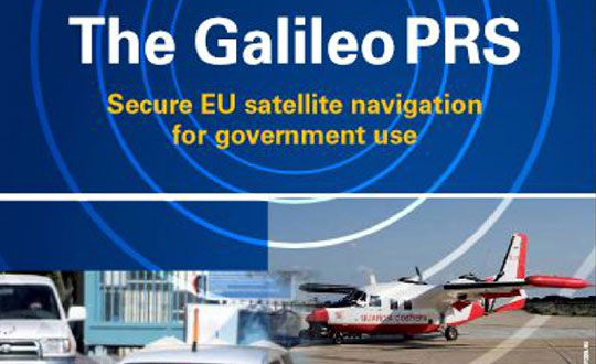


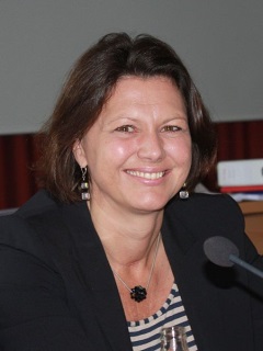


 Three GLONASS-M satellites launched on March 1 are expected to enter service on March 22 and March 30, according to deputy general director Grigoriy Stupak’s statement in Munich. This would bring the constellation, according to his calculations, to 23 operational satellites, though two of those are held in reserve.