Tag: nanosatellites

  • An overview of the latest PNT satellite launches

    An overview of the latest PNT satellite launches

    History of the program: NTS-1, 2 and 3. (Illustration: Lt. Jacob Lutz, AFRL Space Vehicles Directorate)
    Satellites NTS-1, 2 and 3. (Illustration: Lt. Jacob Lutz, AFRL Space Vehicles Directorate)

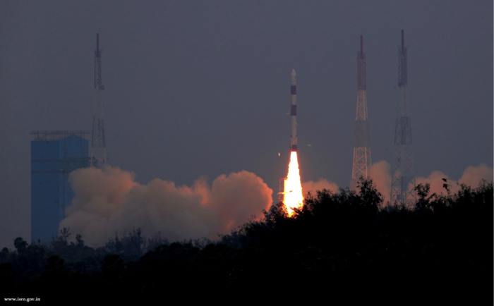
    Just last month we celebrated the kickoff of the GPS III campaign, reporting on the launch of the first space vehicle of that generation in the closing days of 2018. A new era had begun, heralded by a rocket’s blazing path, bearing aloft a new “lighthouse in the sky serving all humankind.”

    Turn around and­ — whoa! Where did all these other new PNT satellites come from?

    We attempt to chronicle them all in this issue, though I’m not sure we haven’t still missed some.

    For years we’ve been talking about the Iridium constellation, a low-Earth orbit telecommunication network that can also deliver timing services to improve accuracy, and signal acquisition in urban environments. Were it not for the fact that 10 more of its satellites just launched in January, bringing the total of its second-generation NEXT constellation to 75, this would practically qualify as old news.

    But let’s move on to the real new news. NTS-3 is the new kid on the block most closely related to the GPS family. In fact, integrally a part of it. This third Navigation Technology Satellite will go even beyond GPS III —­ whose capabilities, mark you, are not yet online — to investigate new experimental antennas, flexible and secure signals, increased automation and use of commercial ground assets.

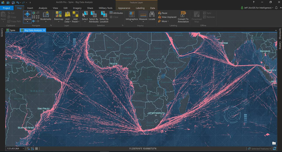
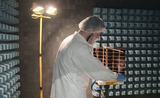
    Learn about 72 nanosatellites of the Spire constellation piggybacking on Galileo signals to offer GNSS radio occultation products for the weather community. This may not be exactly direct-to-user PNT, but it’s a derivative.

    Finally, absorb the latest on Hawkeye 360 formation-flying Pathfinders, designed to detect and geolocate radio frequency (RF) signals, and use the data in search-and-rescue as well as commercial maritime operations.

    Don’t stop there! Read about Planet, the breadloaf satellites, current population 300 with more coming, beaming down 1.2 million high-resolution Earthly images per day, useful for agriculture, defense, mapping and GIS, and a few other industries.

    If a group of satellites is a constellation, what do you call a group of constellations? If we are to follow astronomy’s lead, I’ve just learned that the proper technical term is an asterism. However, I think galaxy will be easier to handle.

  • Galileo now predicts the weather

    Galileo now predicts the weather

    Image: Spire
    Image: Spire

    Spire Global, a space-to-cloud analytics company, is now using Galileo to offer GNSS radio occultation (GNSS-RO) products for the weather community. Radio occultation is the process of using satellites to measure how GNSS signals are refracted by the Earth’s atmosphere.

    Two of Spire’s nanosatellites are the first to use Galileo signals to measure GNSS-RO profiles, a service now available to Spire’s global user base as a new tier of data for advanced weather prediction. The satellites launched on Nov. 29, 2018, from Sriharikota, India.

    The satellites are part of the collaborative European Space Agency ARTES Pioneer Space-as-a-Service program, which aims to prove the value of using nanosatellites for space-based GNSS-RO.

    With Galileo, Spire’s weather observation satellites can harvest approximately 25 percent of the total GNSS-RO profiles available from the existing GNSS satellite constellations in orbit today.

    Spire operates 72 nanosatellites — also known as “cubesats” — and more than 30 ground stations throughout the world. The nanosatellites are developed, assembled and tested at Spire’s production facility in Glasgow, Scotland.

  • ESA’s Pioneer mission sends GNSS-RO nanosatellites into orbit

    ESA’s Pioneer mission sends GNSS-RO nanosatellites into orbit

    News from the European Space Agency (ESA)

    Two tiny GNSS-RO nanosatellites now circle the Earth, ready for action. The first European Pioneer mission lifted off Nov. 29 from Sriharikota, India, to put the satellites into orbit.

    One of Spire's Satellite Manufacturing Technicians (Tomasz Chanusiak) tests the Radio Frequency capabilities of a LEMUR2 nanosatellite in Spire's cleanroom in Glasgow, Scotland. (Photo: ESA)
    One of Spire’s Satellite Manufacturing Technicians (Tomasz Chanusiak) tests the Radio Frequency capabilities of a LEMUR2 nanosatellite in Spire’s cleanroom in Glasgow, Scotland. (Photo: ESA)

    The shoebox-sized satellites were launched at 04:27 GMT into low Earth orbit by the Indian Space Research Organisation’s PLSV launcher, and opened their first communication windows with their owner, Spire Global, less than an hour after they separated from the rocket.

    Both satellites were developed under ESA’s ARTES Pioneer programme, and will aim to prove the value of using nanosats for space-based GNSS Radio Occultation (GNSS-RO).

    GNSS-RO. GNSS-RO is the process of using satellites to measure how GNSS signals are refracted by the Earth’s atmosphere. Experts can use these measurements to glean temperature, pressure and humidity information for weather forecasting and climate change monitoring.

    In contrast, weather data gathered by weather balloons and aircraft can only reach certain altitudes, leaving the higher atmospheric layers untouched.

    Satellites have no such restrictions. They can gather massive amounts of this data from the ground up to the mesosphere as they fly over the Earth. This is usually done by large satellites. Spire’s nanosatellites weigh just 5 kg each, and were assembled and tested entirely by Spire in under three months, at their headquarters in Glasgow, Scotland.

    Named “Space as a Service,” the Spire Pioneer mission intends to prove that nanosat GNSS-RO is a commercially viable alternative to traditional methods.

    Photo:
    Two nanosatellites built by Spire Global were launched into low Earth orbit Nov. 29. (Photo: ISRO)

    The two tiny satellites will collect and distribute GNSS-RO data during their commissioning phase, after which they will go into full commercial data production mode, gathering weather information for meteorological institutions, maritime and aviation customers on demand.

    ESA’s Pioneer initiative partners with companies like Spire to help them provide this kind of in-orbit demonstration and validation for third parties.

    “We saw a gap in the market for what we call space mission providers: companies that offer all aspects of a space mission to validate a new technology or service for the benefit of others,” said ESA Pioneer Programme Manager Khalil Kably. “ESA is always looking to champion innovation in the space industry, and the idea of Pioneer is that these space mission providers can help this by being a one-stop shop for in-orbit demonstration and therefore reduce the barriers and complexity that can stifle new ideas.”

    “Spire has been focused on developing unique data sources with high frequency updates for the entire Earth and has over 60 LEMUR-2 class satellites deployed in space complimented with a global ground station network,” Spire Global CEO Peter Platzer said. “Under Pioneer, we can offer our extensive experience in manufacturing and managing small spacecraft like these to those who cannot afford to waste money and time doing it themselves. This work with ESA helps further support the global development of commercial aerospace’s potential to make space access universal.”

    “These incredibly clever shoebox-sized satellites built in Glasgow could slash the complexity and cost of access to space, presenting an exciting opportunity for the UK to thrive in the commercial space age,” UK Space Agency Chief Executive Graham Turnock said. “Through our £4m development funding, the government’s Industrial Strategy and by working closely with our international partners, we are helping UK businesses transform their ideas into commercial realities, resulting in jobs, growth and innovation.”