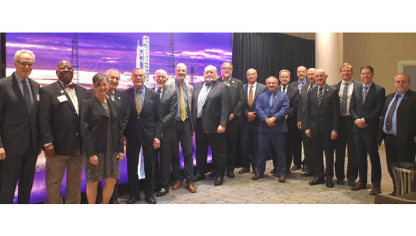
The National Space-Based Positioning, Navigation, and Timing Advisory Board continued its discussions on how best to protect, toughen and augment GPS at its 31st meeting, which took place Dec. 4-5 at the Sonesta Redondo Beach and Marina in Redondo Beach, California. The meeting was convened by James J. Miller, of NASA, who is the board’s executive director, and chaired by retired Adm. Thad Allen of the U.S. Coast Guard.
On the first day, after hearing reports from its six subcommittees, the board heard the following presentations:
Karen Van Dyke, director, PNT & spectrum management, Department of Transportation (DOT), on DOT’s IDM and complementary PNT work.
Maj. Christine Bonniksen, retired from the U.S. Air Force, deputy director for flight projects, NASA Langley Research Center, and Shachak Pe’eri, Ph.D., acting director, National Geodetic Survey, National Ocean Service, National Oceanic and Atmospheric Administration (NOAA), on NOAA’s implementation of a GDGPS-based GPS High Accuracy and Robustness Service.
Anh Nguyen, Ph.D., NASA flight opportunities program (Bryce Space and Technology, LLC) and Lisa Valencia, NASA Space Communications and Navigation Program (Overlook Systems Technologies, Inc.) on the SpaceLoft 15 multi-GNSS flight experiment (see the article on p. 16).
Allison Kealy, Ph.D., director of the Innovative Planet Research Institute, Swinburne University, Australia, on resilient PNT.
Brad Parkinson, Ph.D., the board’s first vice chair, on a comparison of GPS with the other GNSS.
Satoshi Kogure, senior chief officer of satellite navigation technology, Japan Aerospace Exploration Agency on Japan’s Quasi-Zenith Satellite System (QZSS).
Moon Beom Heo, Ph.D., executive director of KPS R&D Directorate, Korea Aerospace Research Institute on the Korean Positioning System (KPS).
Matt Higgins, international engagement subcommittee chair on Galileo.
Cordell DeLaPena, executive officer, MilComm & PNT, Space Systems Command, USSF on the status of the GPS program, including L5, OCX, civil signal monitoring, resilient-GPS and low-Earth orbit PNT.
On the second day, the board held a roundtable discussion, then heard updates from its international members and representatives. For video of the proceedings, go to youtube.com/@nationalpntboardmeetings822/streams.
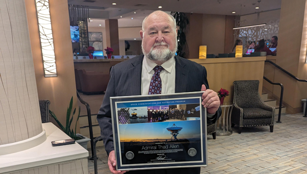
To celebrate Allen’s long service as this board’s chair, NASA conferred a beautiful plaque to him, bearing the following text:
“PRESENTED TO Admiral Thad Allen
With our deepest gratitude, the NASA community and our many partners are very thankful for the friendship and dedicated leadership you have provided as the Chair of the National Space-Based Positioning, Navigation, and Timing Advisory Board. Your advocacy on behalf of GPS users worldwide will always be remembered and cherished. December 2024
Kevin Coggins
Deputy Associate Administrator, Space Communications and Navigation
NATIONAL AERONAUTICS AND SPACE ADMINISTRATION”
Join the Resilient Navigation and Timing Foundation for a reception with the President’s National Space-based Positioning, Navigation, and Timing Advisory Board on April 23 at The Antlers Hotel in Colorado Springs. The event begins at 6:00 PM. General David Thompson, U.S. Space Force (retired) will discuss his experience as the first Vice Chief of Space Operations, the state of GPS, and the future of PNT.
For more information and to RSVP, contact [email protected] by April 17.
The May 4-5 meeting of the National Space-Based Positioning, Navigation and Timing Advisory Board focused on its mantra to “protect, toughen and augment” (PTA) GPS. The meeting included three great presentations that bear directly on the A of that mantra.
CAST
The electric grid used to be simpler: regional operators flowed power unidirectionally from stations to customers basing the load on past usage. Now, the grid is becoming a wide-area network — with regional inter-connects, multi-directional flows, and load based on real-time data and predictive analysis, requiring sensors time-synchronized within 1 microsecond from UTC. Yet, this critical infrastructure’s timing applications depend entirely on vulnerable GPS technology.
“If we can provide an authoritative, trusted synchronization source across the interconnected grid, its operators have a much better opportunity to understand the interdependencies and movement of power across their networks,” said Carter Christopher of Oak Ridge National Laboratory. He described the lab’s Center for Alternate Synchronization and Timing (CAST), which provides a redundant and resilient satellite-based service backed up by a network of terrestrial master clocks. CAST is precise, traceable and secure from jamming, spoofing, cyberattacks and physical attacks.
HARS
Attila Komjathy and Larry Romans of NASA’s Jet Propulsion Laboratory (JPL) proposed a GPS high-accuracy and resilience service (HARS) based on global differential GPS (GDGPS). It would provide corrections to GPS orbit and clock errors, and encrypted navigation data bits over the internet. It would match Galileo in accuracy, they said, pointing out that Galileo, QZSS and BeiDou provide high-accuracy services in their broadcast signals. HARS would improve the accuracy of consumer GPS receivers of 3–5 m to 1 m and help ensure that multi-constellation GNSS chips would continue to rely on GPS first.
HARS could be implemented by having commercial providers—such as Apple, Google and cellular carriers—distribute GDGPS corrections generated by JPL and supported by government partners. Private industry, Komjathy and Romans pointed out, provide service for RTK, centimeter and decimeter apps, but only governments (the U.S. Coast Guard’s DGPS service and Galileo’s HAS) provide corrections for about one-meter accuracy. Therefore, HARS would not compete with industry and would create additional opportunities for it to create value-added products.
αPNT
David Castiel and Cyrus Langroudi, of Virtual Geosatellite LLC, proposed αPNT, a virtual geostationary satellite system with elliptical orbits that would provide active PNT in a distributed architecture integrated with a blockchain. The system, they said, would be able to provide very accurate geographical position, precise timing and guidance with a minimum number of satellites on the horizon. It would rely on two-way links between transceivers and satellites to protect against jamming or spoofing.
While GPS’s success makes it a critical and ubiquitous infrastructure, its vulnerabilities require and stimulate exciting new R&D. Stay tuned.
The Global Positioning System (GPS) is “still a significant single point of failure in our country,” said Caitlin Durkovich, National Security Council director for Response and Resilience.
Her remarks were made at the Dec. 9 meeting of the president’s National Space-based Positioning, Navigation and Timing (PNT) Advisory Board.
Durkovich’s remarks were made in the context of a larger national resilience message. She cited recent incidents such as Hurricane Ida, the Colonial Pipeline hack, the winter failure of the Texas electrical grid, and disrupted supply chains. She said everyone is responsible to ensure they, their systems and the nation are able to safely weather adverse events and bounce back better than before.
The interconnectedness of so many vital services such as electrical power and other vital systems like PNT make a holistic approach necessary. The administration is developing a set of resilience principles to support that, she said. It is also ensuring as funds go out to states and localities from the infrastructure bill that making American infrastructure more resilient to climate change and “all hazards” is a priority.
Because “positioning, navigation and timing is foundational to our life,” she said, “resilience is more important now than ever.” Disruptions could lead to “cascading effects.”
Durkovich cited the administration’s Space Priorities Framework as evidence of White House concern. Released this month, it says in part:
“Space systems are an essential component of U.S. critical infrastructure — by directly providing important services and by enabling other critical infrastructure sectors and industries. The United States will enhance the security and resilience of space systems that provide or support U.S. critical infrastructure from malicious activities and natural hazards.”
She also indicated that the Biden administration was following through on two Trump administration policies as important steps to resilience.
Executive Order 13905, “Strengthening National Resilience Through Responsible Use of Positioning, Navigation, and Timing Services,” among other things, calls on all users to avoid over-reliance on GPS. It also calls for the federal government to require PNT resilience to be considered when selecting contractors.
Space Policy Directive 7 “The United States Space-Based Positioning, Navigation, and Timing Policy” outlines a number of research and other efforts. It also says the nation will:
“Invest in domestic capabilities and support international activities to detect, mitigate, and increase resilience to harmful disruption or manipulation of GPS, and identify and implement, as appropriate, alternative sources of PNT for critical infrastructure, key resources, and mission-essential functions.”
Several board members asked about the Federal Communications Commission’s (FCC) order authorizing Ligado Networks to broadcast in frequencies adjacent to those used by GPS. She said the administration was concerned and both the National Economic Council and National Security Council were in discussion. Engagement with the FCC, though, may pend confirmation of a full board of commissioners.
One of the board members asking about the Ligado issue followed up with a comment that adjacent-band concerns pale in comparison to recent Russian threats to GPS satellites. Durkovich responded that there wasn’t much she could say on that topic in public except that it had the attention of the president and his senior advisors.
Durkovich was also asked about the administration’s commitment to execute the 2018 National Timing Resilience and Security Act. The law’s requirement to establish a terrestrial, wireless source of coordinated universal time to back up GPS signals by December 2020 was ignored by the Trump administration.
Her reply was to reaffirm her earlier statement that “assuring positioning, navigation and timing, and the economic and strategic benefits it brings to this nation, is a priority for this administration.”
Video of the entire advisory board meeting is available on YouTube. MS Durkovich’s remarks begin at approximately 1:37:00. A link to the video is also posted as part of the agenda on the board’s website.
The stated goal of a recently published RAND study was to answer a question from Congress about what should be done to back up and complement the nation’s GPS. One of its findings was that the government should consider investing in a national timing network.
Yet the study’s report emphasizes the wrong things, according to some. So much so that it is working against establishment of a timing network to reinforce GPS.
Report Misleading
“The main thrust of the study’s report is that we don’t need another GPS-like, system,” said Pat Diamond. “That has always been fairly obvious. I don’t know anyone who has ever advocated for duplicating GPS.” Diamond is CEO and founder of a network company and is a member of the president’s National Space-based Positioning, Navigation, and Timing (PNT) Advisory Board.
“By pounding so hard on the ‘don’t duplicate GPS’ drum, RAND hides its more important findings,” he said. “The public message comes across as there is no need to do anything.”
Diamond thinks the study should have better highlighted the things the federal government should do. “That is really the question Congress wanted answered,” he said.
RAND’s study supports four federal initiatives that “… appear to be cost-effective or close to cost-effective.” Included are a “timing-only” GPS-backup and support of high performance “geographically limited” systems.
Timing Essential, GPS Backup Needed
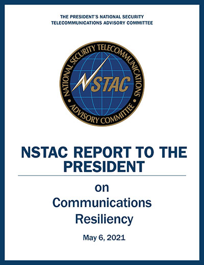
Cover: NSTAC
GPS timing signals are used in a wide variety of technologies including cell phones, IT networks, digital broadcast, first responders’ hand-held radios, and to synchronize electrical grids. Yet these signals from space are weak and easily disrupted.
A timing backup for GPS is also a long-standing recommendation of the president’s National Space-based PNT Advisory Board.
“There are few things more important to tech infrastructure today and tomorrow than timing,” according to Marc Weiss who was a lead researcher at the National Institutes of Standards and Technology for 35 years.
The RAND study was a cost-benefit analysis, which some have argued was not the best approach.
“Cost-benefit is always tricky,” says Greg Winfree, Director of the Texas Transportation Institute. “There are always a lot of assumptions. Small changes to any of the inputs can radically change the outcomes.” Winfree led civil PNT efforts during the Obama administration as an official at the Department of Transportation (DOT).
“One of my big concerns is that GPS is so important to so many things in America, that it is one of the most attractive targets for our adversaries. At least one alternate PNT that most people can access takes the bullseye off GPS,” Winfree said.
Scott Pace, director of the Space Policy Institute at George Washington University (GWU) agrees a diversity of PNT sources is important. At a recent GWU event, Pace commented having an alternative to GPS will contribute to national security and improve global stability. It will “lower the pressure on us to escalate and respond” should GPS satellites be damaged, or services disrupted. Pace was the Executive Secretary of the National Space Council in the Trump administration.
In the book The Russia Trap, author George Beebe has similar concerns, citing the lack of a backup for GPS as a technology resilience gap. Russia, China, and Iran all have terrestrial backups for PNT signals from space while the United States does not. Beebe says this is a weakness that can be exploited and could lead to an escalating series of exchanges resulting in all-out war.
Government Investment in Location Services
The RAND study suggestion for the government to invest in highly accurate PNT services in some limited geographic areas cited emergency responders’ needs for precise location. Federal investment will likely be required, it says, as commercial entities cannot make a business case everywhere service is needed.
GWU economics professor Diana Furchtgott-Roth has written that the federal government needs to provide a complement to GPS. She served as a Deputy Assistant Secretary at DOT from 2019 to 2021 leading civil PNT issues for the government.
“Without federal participation, commercial providers won’t ensure adequate resilient services for everyone. Some sectors, such as finance, will have it, but others won’t. This is a matter of national and homeland security. The RAND report did not emphasize this sufficiently.”
Questionable Timing and Motivation
“This is a particularly bad time for a confused message,” said a congressional staff member speaking about the RAND study. “Congress mandated a timing backup for GPS in 2018, though the project was never funded. There is real momentum this year to provide that funding, but the way this study reads works against that.”
Others see the structure of the study’s report and the timing of its release as a deliberate effort to derail budget negotiations. One retired Department of Homeland Security (DHS) official sees a pattern but is at a loss to explain the motivations behind it.
“RAND’s study was completed in 2019, and it was used as the basis for a DHS report to Congress in April 2020. But DHS didn’t tell Congress about RAND’s findings on a timing network and other actions the government should take,” they said.
“The study being made public now saying ‘do not back up GPS’ smells like a deliberate attempt to derail funding for the timing system. Something two presidential advisory boards, telecom leaders, RAND and so many others agree is needed.”
“Why would someone want to do that?” they asked. “Why would they want to keep America’s PNT so much weaker than China’s, Russia’s, and those of other countries?”
The meeting will be open to the public up to the seating capacity of the room. Visitors will be requested to sign a visitor’s register.
The agenda for the meeting includes the following topics:
Examine methods to protect, toughen and augment (PTA) access to GPS/GNSS services in key domains for multiple user sectors.
Examine emerging trends and requirements for PNT services in U.S. and international fora through PNT Advisory Board technical assessments, including backup services for terrestrial, maritime, aviation and space users.
Update on U.S. Space-Based PNT Policy and GPS modernization.
Explore opportunities for enhancing the interoperability of GPS with other emerging international GNSS.
Prioritize current and planned GPS capabilities and services while assessing future PNT architecture alternatives with a focus on affordability.
Assess economic impacts of GPS/GNSS on the United States and in select international regions, with a consideration towards effects of potential PNT service disruptions if radio spectrum interference is introduced.
Review the potential benefits, perceived vulnerabilities, and any proposed regulatory constraints to accessing foreign Radio Navigation Satellite Service (RNSS) signals in the United States and subsequent impacts on multi-GNSS receiver markets.
Meeting times are 8:30 a.m. to 5:30 p.m. Eastern Time on Thursday, June 6; and 9 a.m. to 1 p.m. ET on Friday, June 7.
Meeting address:
Westin Hotel Alexandria Old Town
400 Courthouse Square
Alexandria, VA 22314
Full details on the meeting can be found in the Federal Register Notice. For more information, contact James J. Miller, designated federal officer, Human Exploration and Operations Mission Directorate, NASA Headquarters, Washington, DC 20546, (202) 358-4417, fax (202) 358-4297, or [email protected].
The National Space-Based Positioning, Navigation, and Timing Advisory Board (PNT Board) will take part in a public teleconference on spectrum issues on Aug. 6.
The meeting will be held via teleconference and WebEx. The teleconference will take place Monday, August 6, from, 12-4 p.m. Eastern Time.
This meeting will be open to the public telephonically and by WebEx. Any interested person can call the toll-free (in the U.S.) conference-call number at 1–844–467–4685 or the local toll number at 1–720–259–7012 using passcode: 106724 to participate in the meeting by telephone.
The WebEx link is https://nasa.webex.com/, the meeting number is 995 034 805, and the password is uuU7bDX* (case sensitive).
This meeting was agreed to at the 21st session of the National Space-Based PNT Advisory Board, held May 16–17 in Baltimore. The public can follow the discussions by dial-in or the web link provided.
The agenda includes the following topics:
Finalize and approve the National Space-Based PNT Advisory Board topics paper
Finalize and approve the National Space-Based PNT Advisory Board Memorandum on Spectrum Issues to the National Space-Based PNT Executive Committee, Carol J. Hamilton, acting advisory committee management officer, NASA.
Presentations from the 20th meeting of the National Space-Based Positioning, Navigation, and Timing Advisory Board (PNTAB), held Nov. 15-16, are now available online at GPS.gov.
Ligado and its predecessors have sought to install high-powered ground transmitters that have been shown to harm and overwhelm GPS signals and receivers in their general vicinity. The controversy has simmered for at least eight years without resolution.
PNTAB provides independent advice to the U.S. government on GPS-related policy, planning, program management, and funding profiles in relation to the current state of national and international satellite navigation services.
Ligado Networks will appear and present at the National Space-Based Positioning, Navigation and Timing Advisory Board’s (PNTAB) meeting on Nov. 15 in Southern California.
Ligado and its predecessors have sought to install high-powered ground transmitters that have been shown to harm and overwhelm GPS signals and receivers in their general vicinity. The controversy has simmered for at least eight years without resolution.
That final resolution will ultimately be taken by the Federal Communications Commission (FCC), although congressional participation is also conceivable, since national infrastructure security is involved.
Meeting Locale. The PNTAB meeting will take place Wednesday, November 15, 2017, 9:00 a.m. to 5:00 p.m.; and Thursday, Nov. 16, 9 a.m. to 1 p.m., at the Crowne Plaza Redondo Beach & Marina Hotel, 300 North Harbor Drive, Redondo Beach, California, approximately a half hour’s drive south of Los Angeles International Airport. The meeting will be open to the public up to the seating capacity of the room. Visitors will be requested to sign a visitor’s register.
From June 28, 2017, PNTAB presentation by Brad Parkinson.
The central issue in this long-running fight is the as-yet unknown — though uniformly predicted by the various rounds of testing over the last eight years — effects of Ligado signals on a huge installed industrial and governmental base of GPS receivers, some of which are essential to the nation’s critical infrastructure.
Ligado Networks, the current-day incarnation of once-bankrupt LightSquared, seeks FCC permission to apply the satellite-based frequency licenses it owns to be broadcast from a ground-based network. This would put a powerful nearby signal immediately adjacent to the much weaker, more distantly emanating GPS signals, and by the way, those from other GNSS as well. Tests in 2011 and further testing in 2016 demonstrated these powerful signals interfering with GPS receivers.
Brad Parkinson
The Ligado appearance comes in response to an open letter, posted on Oct. 10 by PNTAB First Vice-Chair Brad Parkinson, inviting Ligado CEO Doug Smith to speak to the Advisory Board. That invitation itself emerged after a season of what have been termed “attack” statements issued in various forums by Ligado, which were in turn stimulated by two early-summer letters:
1. A June 27 letter from the American Geophysical Union, Aerospace Industries Association, American Meteorological Society, Aircraft Owners and Pilot s Association, Airlines for America, General Aviation Manufacturers Association, International Air Transport Association, Iridium Communications, Thales USA and other organizations (totaling 22) to the FCC opposing Ligado’s request.
“The undersigned organizations . . . write to reiterate that the threat of harmful interference from Ligado’s proposed ancillary terrestrial component (“ATC”) service remain real and persistent. Contra ry to the assertions in Ligado’s FCC advocacy and recent media blitz, its proposed terrestrial operations continue to pose a significant interference risk to numerous parties . . . . The risks to these critical services are very real and, consistent with the public interest, cannot be brushed aside.
That letter further notes that “Ligado seeks the ability to sell its spectrum to the highest bidder, underscoring the uncertainty of any prospective value of the services it has on previous occasions suggested it may provide. There is a clear effort by Ligado to downplay the significance of the technical concerns it continues to receive from numerous directions.”
2. A July 5 letter from the PNT Advisory Board to Deputy Secretary of Defense Robert O. Work and Deputy Secretary of Transportation Jeffrey A. Rosen, the co-chairs of the National Executive Committee for Space‐based Positioning, strongly opposing the Ligado proposal.
From June 28, 2017, PNTAB presentation by Brad Parkinson.
“The revised [Ligado] proposal to the FCC is fundamentally unchanged from a previous proposal reviewed in 2011. Extensive government testing in 2011 and in 2016, clearly shows that both proposals cause definitive harmful interference to many classes of GPS receivers.”
“All GPS stakeholders should be wary of any incremental approaches to deploying mobile broadband services in the mobile satellite systems (MSS) band. For example, initial services could operate at reduced power levels on a temporary basis to protect only a subset of GPS users, before moving to full — power levels that will cause widespread interference to many other classes of GPS users. Regulatory decisions must be based on the ultimate end-state of any systems proposed for operation in the bands adjacent to GPS, and must protect all classes of GPS users. Unfortunately, the latest industry proposal does not acknowledge the legitimacy of, and the need to protect, dozens of precise applications of great national importance.”
From June 28, 2017, PNTAB presentation by Brad Parkinson.
Round Two. The struggle has been a prolonged one, with many twists and turns, however coalescing into two main periods of activity:
2011-12, when the first round of tests showed then-LightSquared’s proposed network would overload the vast majority of GPS receivers. The Federal Communications Commission (FCC) tabled the proposal, and the company, holding spectrum licenses whose value could range far into the billions of dollars, filed for bankruptcy.
2016–18. LightSquared emerged from Chapter 11 in 2015 as Ligado Networks, positing a modified network plan, but one whose organizing concept remains unchanged, causing deep and continued alarm over GPS interference. 2017 tests, conducted by a firm and a government organization hired by Ligado, essentially reconfirmed the 2011 results. The tests found that the proposed ground towers would significantly interfere with GPS receivers as far away as 4 to 5 kilometers, “killing them dead” in the words of one expert who reviewed the test data.
Parkinson’s October 10 letter invites Ligado CEO Doug Scott “to provide the committee with clear up-to-date design information. . . . How might the system as now envisioned be deployed? How many ground terminals are needed, for example, and where would they be?”
Previous LightSquared and Ligado presentations have been long on promise but short on details. In fact, sound technical underpinning has not been communicated.
From June 28, 2017, PNTAB presentation by Brad Parkinson.
Parkinson writes “we would therefore encourage you to specifically describe your implementation plan , with a corresponding test plan address ing the issues we have openly raised . We request you specifically focus on those regarding the potential for interfering with any GPS /GNSS services that operate in the protected Space – to – Earth L band (1559 – 1610 MHz) . Included should be all modes of operation and the use of all current and future GNSS sign als. Without these specific technical details and corresponding evaluations, we can only conjecture as to what you are really proposing .”
Later, he affirms “our focus is to provide advice based on deep engineering and related expertise . As you know, interference to GPS/GNSS can adversely affect numerous safety – of – life systems , other vital national assets, and applications comprising over $60 billion of annual U.S. productivity benefits .”
Parkinson and the PNTAB have had better luck securing a Ligado appearance than did GPS World magazine. In August of this year, Ligado’s senior vice president and chief engineer for radio access technologies thrice declined an invitation to give a brief Expert Opinion for the September issue on the question: How can the safety, security, and full utility of GNSS applications be ensured while evolving best, most efficient use of limited, very valuable electromagnetic spectrum?
Just a Refresher. The PNTAB meeting will be held Wednesday, November 15, 2017, 9:00 a.m. to 5:00 p.m.; and Thursday, November 16, 2017, 9:00 a.m. to 1:00 p.m., at the Crowne Plaza Redondo Beach & Marina Hotel, 300 North Harbor Drive, Redondo Beach, CA, approximately a half hour’s drive south of Los Angeles International Airport. The meeting will be open to the public up to the seating capacity of the room. Visitors will be requested to sign a visitor’s register.
Ligado is by no means the only item on the Committee’s docket, but is very likely to be the pièce de résistance. The full agenda for the meeting includes:
Update on U.S. Space-Based Positioning, Navigation and Timing (PNT) Policy and Global Positioning System (GPS) modernization.
Prioritize current and planned GPS capabilities and services while assessing future PNT architecture alternatives with a focus on affordability.
Examine methods in which to Protect, Toughen, and Augment (PTA) access to GPS/Global Navigation Satellite Systems (GNSS) services in key domains for multiple user sectors.
Assess economic impacts of GPS/GNSS on the United States and in select international regions, with a consideration towards effects of potential PNT service disruptions if radio spectrum interference is introduced.
Review the potential benefits, perceived vulnerabilities, and any proposed regulatory constraints to accessing foreign Radio Navigation Satellite Service (RNSS) signals in the United States and subsequent impacts on multi-GNSS receiver markets.
Explore opportunities for enhancing the interoperability of GPS with other emerging international GNSS.
Examine emerging trends and requirements for PNT services in U.S. and international fora through PNT Board technical assessments, including back-up services for terrestrial, maritime, aviation, and space users.
Possibly during the course of last month’s editorial here, “‘Nearly Perfect’ Not Nearly,” in which I called out the U.S. Air Force for lauding itself a bit much, I veered across the line separating vehemence from over-vehemence. Just possibly. Over-vehemence is a professional hazard of journalism. A gentle reader wrote in to suggest as much. He began, in his polite way, with “As always, I enjoyed your article and it made me think.” Then he offered a few of his thoughts for me in turn to consider.
First, he urged me to weigh all three GPS segments. The space and control segments operate almost flawlessly, he averred. Except, I can’t refrain from riposting, for the times that they don’t.
The user segment, we can all agree, is a different story. Most current GPS user equipment can be jammed and spoofed, sometimes very easily, and some have difficulty handling leap seconds and GPS week rollovers.
The U.S. Air Force and the GPS program office cannot fix the problem with user equipment. This is up to those who manufacture, purchase, install and maintain the user equipment.
Fair enough.
Let’s not even get into mapping and guidance algorithms and obsolete data that generate multitudinous stories in mass media about drivers led astray and into danger “by GPS.” Those are the fault, not of the user equipment per se, but of software conjoined to a receiver in a navigation device or smartphone.
My column in June’s GNSS Design & Test enewsletter covered the same ground and then tackled the potential costs of GPS disruption, citing a study done by Innovate U.K., the U.K. Space Agency and the Royal Institute of Navigation. This included a pie chart of potential economic losses in the U.K. that would stem from a prolonged GNSS disruption. I really should have correleated these with, or at least mentioned in the same breath, the reports done for the National Space Based-PNT Advisory Board by Irv Leveson, because there were several mismatches. In particular, the PNT Advisory Board study concluded that more than 50 percent of the value of GPS to the U.S. economy lies in high-precision uses — substantially higher than estimated in the U.K.
Regardless of statistics, we should think, my correspondent reminded me, about the performance needs of different uses. It’s not just whether you have PNT or you don’t. The degree to which you have it is the key: accuracy, coverage, 3D versus 2D positioning and other factors determine if a technology can perform to meet a given need. Aviation requires 3D positioning for some operations. Surveying and machine control require submeter accuracy. Road use requires meter accuracy now, and submeter in the future for autonomous driving. Almost 50 percent of the U.K. pie chart, and more than 50 percent of GPS value to the U.S., requires meter or better accuracy. Except for other satnav systems, what known technology can provide this kind of performance over an area the size of a nation, whether U.K. or U.S.?