While farmers work on growing and gathering their crops in the most efficient ways possible, other people key to the agriculture industry are hunters. These hunters seek the most efficient and groundbreaking ways to carry out such tasks as plowing, planting, fertilizing, weeding and, finally, gathering.
This month, among other machine-control applications, we focus on using GNSS technology to improve agricultural efficiency. According to research firm MarketsandMarkets, the precision farming market is estimated to be $7 billion in 2020 and is projected to reach $12.8 billion by 2025, growing 12.7% every year between.
Factors driving growth include increasing farm mechanization in developing countries, rising labor costs, increasing strain on the global food supply, substantial cost savings associated with smart farming techniques, and government initiatives to adopt modern agricultural techniques. For a look at today’s technology, see our cover story.
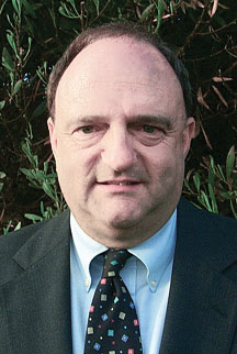
James Litton
Sadly, this month we also say goodbye to a pioneer in the precision ag field. James D. Litton founded NavCom Technology in 1995 with three partners, Ron Hatch, KT Woo and Jalal Alisobhani.
Litton’s career began at Magnavox in the early days of GPS, where he worked on the original proposal for GPS Phase I and helped develop new and advanced commercial navigation and survey receivers for both the Navy’s TRANSIT system and the Air Force’s GPS.
In 1992, Litton opened a consulting firm, and in 1994, he and his partners founded NavCom with Litton as CEO. Under contract, NavCom developed a single-frequency WAAS-capable GPS aircraft navigation receiver.
“His work transformed agriculture into a data-driven, technological industry.” — Brad Parkinson
NavCom also began a relationship with Deere & Company, supporting more efficient and productive agriculture. This relationship was so successful that Deere, which recognized GNSS tech as a smart investment, purchased NavCom in 1999.
Litton continued to lead the company and serve as part of Deere’s senior management team for eight more years.
Among his many contributions to the GNSS field, his impact on global agriculture might well have been his greatest, according to Brad Parkinson, the original chief architect for GPS and Editorial Advisory Board member.
“His work transformed agriculture into a data-driven, technological industry that was incredibly more efficient,” Parkinson said. “The cost savings and increases in productivity have impacted billions around the world.”
Litton also authored several articles for GPS World.
James D. Litton, GPS pioneer and founder of NavCom Technology Inc., died over the weekend at his home in California with his family at his side. He was 89 years old.
Litton was an early contributor to the development of GPS user equipment. He also played a pivotal role in the GPS-driven transformation of global agriculture that has greatly benefited humanity.
Litton was the director of engineering at Magnavox Research Labs when researchers were working on using CDMA for range measurements, a precursor to the GPS system. He also worked on the original proposal for GPS Phase I.
Later, as general manager of Magnavox’s Marine and Survey Systems Division, he helped develop new and advanced commercial navigation and survey receivers for both the Navy’s TRANSIT system and the Air Force’s GPS.
His team developed the first microprocessor-based commercial satellite navigation receivers and the first commercial GPS survey software. This led to Magnavox eventually having more than a 90 percent share of the survey receiver market.
The firm eventually held more than two dozen patents for improvements in GPS technology.
In 1992, Litton left Magnavox to start a consulting business. Two years later, with Ron Hatch, K.T. Woo and Jalal Alisobhani, he founded NavCom Technology Inc. With Litton as CEO, NavCom became a significant player in the GPS marketplace. Among its achievements was development — under contract — of a single-frequency WAAS-capable GPS aircraft navigation receiver.
NavCom also began a relationship with Deere & Company, supporting more efficient and productive agriculture. This relationship was so successful that Deere purchased NavCom in 1999. Litton continued to lead the company and serve as part of Deere’s senior management team for eight more years.
In recognition of his many achievements to the field, Jim Litton was presented the Institute of Navigation’s Hays Award in 2006.
Among his many contributions, his impact on global agriculture might well have been his greatest, according to Brad Parkinson, the original chief architect for GPS.
“His work transformed agriculture into a data-driven, technological industry that was incredibly more efficient,” Parkinson said. “The cost savings and increases in productivity have impacted billions around the world.”
Jim’s family has created a memorial fund at Doctors Without Borders for those wishing to make a donation in honor of his life and many good works. Click here.
A roundup of recent products in the GNSS and inertial positioning industry from the January 2020 issue of GPS World magazine.
OEM
Heavy-duty antenna
For challenging environments
AT311 antenna. (Photo: CHC Navigation)
The heavy-duty CHCNAV AT311T is designed for demanding applications subject to shocks and vibrations. With advanced filtering and robust signal tracking, it provides survey-grade GNSS signals to enhance position reliability for marine applications, machine control, precision agriculture and industrial automation. Features include multi-constellation GNSS tracking using GPS, GLONASS, BeiDou, Galileo, QZSS, IRNSS and SBAS. Its IP68 water-resistant design makes it safe to use in extreme conditions with a wide temperature range (–40° C to +85° C). Its internal stacked structure enhances performance in high-interference environments, and the 40-dB signal gains, advanced signal filtering and multipath rejection design provide superior and robust GNSS signal tracking in challenging surroundings.
The UAS1 GNSS receiver module has been designed for UAV/UAS applications requiring centimeter accuracy in a small package.(Photo: Trimble)
The UAS1 compact, high-precision GNSS board was designed for unmanned aerial systems (UAS). It allows UAS system integrators to add upgradeable GNSS-based positioning using rugged connectors and Trimble’s software interface. Its 336-channel GNSS engine is capable of tracking L1/L2 frequencies from GPS, GLONASS, Galileo and BeiDou for centimeter-level, real-time kinematic (RTK) positioning. The compact board provides capabilities from high-accuracy GPS-only to full GNSS features. The receiver supports fault detection and exclusion (FDE) and receiver autonomous integrity monitoring (RAIM). System integrators also have the ability to detect interference with an RF spectrum monitoring and analysis tool embedded in the receiver.
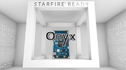
The Onyx multi-frequency GNSS OEM board offers integrated StarFire/real-time kinematic (RTK) GNSS capabilities. It features 255-channel tracking, including multi-constellation support for GPS, GLONASS, BeiDou and Galileo. It provides high performance in GNSS receiver sensitivity and signal tracking as well as patented multipath mitigation, interference rejection and anti-jamming capabilities. Through software options, the Onyx ,allows upgrades from free differential GPS signal sources such as WAAS, to increased accuracy services such as StarFire and RTK Extend. The software-enabled features are sold in bundles, but can also be purchased individually to suit changing application needs.
The OSA 5401 and OSA 5405 now enable power utility and broadcast networks to achieve sub-microsecond synchronization. (Photo: Business Wire)
The OSA 5401 and OSA 5405 upgraded PTP grandmaster clocks deliver precise, robust timing in a compact form factor. Oscilloquartz PTP timing technology enables power utility and broadcast networks to achieve sub-microsecond synchronization. The pluggable OSA 5401 is a small PTP grandmaster clock, and the OSA 5405 is an integrated PTP grandmaster with dual GNSS antenna and receiver. With spoofing and jamming detection capabilities, they also provide high availability. The OSA 5401 and 5405 provide new levels of accuracy and resilience for infrastructure and support emerging bandwidth-intensive, latency-sensitive applications. With sub-microsecond synchronization, smart grids can perform flexible, real-time decision making, as well as monitoring and automated maintenance. The OSA 5401 and OSA 5405 comply with the latest PTP profiles for time, frequency and phase synchronization in both power utility and broadcast networks. These include the IEC/IEEE 61850-9-3 Power Utility Profile for precise time distribution and clock synchronization in electrical grids with an accuracy of 1μs, and SMPTE 2059 for synchronizing video and audio equipment over packet networks.
The SBAS-capable CMA-5024 GPS has received U.S. Federal Aviation Administration (FAA) approval for installation on Boeing 737 Next-Generation aircraft. It enables B737NGs to comply with worldwide ADS-B Out mandates as well as SBAS/GPS navigation, enabling the first localizer performance with vertical guidance (LPV) approaches for B737NGs. The CMA-5024 GPS is a cost-effective alternative to replace a multi-mode receiver (MMR). The approved DO-260B ADS-B Out positioning source can be paired with any DO-260B compliant transponder, allowing operators to meet FAA and EASA ADS-B Out requirements, the UAE’s ADS-B Out and RNP requirements mandated by GCAA as well as India’s GAGAN requirements.
The U.S. Federal Aviation Administration (FAA) has approved the VTU-20 automatic dependent surveillance – broadcast (ADS-B) transmitter for airport surface management. Adhering to the performance and design assurance specifications of FAA-E-3032, the externally mounted VTU-20 ensures integration and interoperability with Airport Surface Detection Equipment, Model X (ASDE-X), Airport Surface Surveillance Capability (ASSC) and ADS-B receiver surveillance solutions for airport. The VTU-20 can be permanently or magnetically mounted to all airside vehicles, including utility, emergency, snow-removal and maintenance equipment. Each vehicle is clearly and uniquely identified, providing an essential addition to any surface movement guidance and control system.
Skyward’s Advanced Airspace Intelligence drone airspace maps provide airspace data combined with essential ground intelligence including 3D views of key structures, transmission lines, and more than a million vertical obstacles. The platform also provides access to LAANC, the Low Altitude Authorization and Notification Capability program provided by the U.S. Federal Aviation Administration. Data available for situational awareness includes vertical structure obstacles, power lines, airports, runways, national parks, stadiums, hospitals and schools.
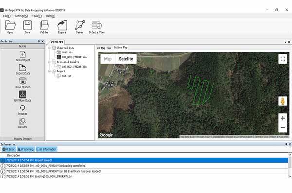
Hi-Target PPK GO precision add-on enables Phantom 4 RTK drones to achieve the accurate and reliable camera positioning data in any coordinate system without measure targets or ground control points. With 2-centimeter accuracies on XYZ, the output text file with position information or geotagged images can be used directly in major photogrammetric mapping or 3D survey software. The add-on allows selection of GPS/GLONASS/Beidou/ Galileo L1+L2+L5 and further parameter adjustments for position calculation in the PPK process to ensure the most reliable and accurate camera positioning even in poor single satellite system signals.
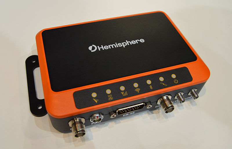
The R620 GNSS receiver is a complete refresh of Hemisphere’s previous version, the R330. (Photo: Allison Barwacz)
The next-generation R620 receiver is designed for land and marine applications requiring high-precision positioning. It is a complete refresh of the previous version (R330) and has a new low-profile ruggedized enclosure. Customers can start with sub-meter positioning accuracy and upgrade the receiver through activations and subscriptions to add functionality and improve performance capability to centimeter-level accuracy. Powered by the Vega series, the R620 GNSS receiver processes and supports more than 1,100 channels. It simultaneously tracks GPS, GLONASS, BeiDou (including Phase 3), Galileo, QZSS, IRNSS, SBAS and Atlas L-band corrections. It has status LEDs , a powerful WebUI, UHF (400-MHz and 900-MHz) radio, cellular modem, Bluetooth, Wi-Fi, Ethernet (including power over Ethernet), CAN, serial and USB.
For land surveying and geospatial information systems (GIS)
Photo: Geneq
The rugged SXPad 1500 data collector features an alphanumeric keypad and long-range Bluetooth, and was designed to meet the rigorous IP67 standard for challenging field conditions. It has a 5-inch sunlight-readable touchscreen. The SXPad 1500 can be connected to any GNSS receiver or compatible robotic total station. Driven by a 1-GHz processor and the Windows Mobile 6.5 operating system, providing the power to work with maps and large data sets in the field. Its integrated cellular modem and Wi-Fi provides wireless connectivity for internet access and GIS data transfer — helpful for configuring a real-time kinematic (RTK)-compatible GNSS receiver. Equipped with an internal memory of 1 GB (memory can be expanded to 16 GB with an SD card), the SXPad 1500 provides enough storage space for data recording. Its high-performance lithium battery allows uninterrupted field operation for up to eight hours.
The LT700H RTK Android tablet is designed to increase efficiency and productivity of the mobile field workforce in applications requiring centimeter-to-decimeter positioning accuracy. Portable, rugged and versatile, the LT700H enables precision GIS data collection, forensic mapping, construction site layout, environmental surveys, landscaping and earthmoving jobs. Powered by 184-channel high-performance GPS, GLONASS, Galileo and BeiDou module and a superior tracking GNSS helical antenna, the LT700H provides position availability in demanding environments. Its integrated 4G modem ensures seamless communication from field-to-office and robust connectivity to RTK correction networks.
The Trimble Alloy GNSS reference receiver now supports BeiDou Generation III (BDS-3) signals. This will enable operators to meet the ongoing demand from surveyors, mapping professionals and precision farmers for accurate, reliable corrections derived from real-time networks. Released in 2018, the Alloy has the processing power needed for high-quality data from multiple constellations. Alloy version 5.42 firmware tracks all available and planned GPS Block IIIA L1C and BDS-3 signals.
Hexagon showcased the Leica DSX utility detection solution at Intergeo 2019. (Photo: Allison Barwacz)
The Leica DSX utility detection solution can be used together with Leica GPS/GNSS systems to generate highly accurate, georeferenced maps. The DSX uncovers utilities for repair and maintenance, civil engineering and surveying projects. The ground-penetrating radar system includes portable hardware and software that automates data analysis and creates a 3D utility map.
NavCom Technology Inc., a wholly owned subsidiary of Deere & Company, has released the Onyx multi-frequency GNSS OEM board.
Offering integrated StarFire/RTK GNSS capabilities, Onyx features 255-channel tracking, including multi-constellation support for GPS, GLONASS, Beidou and Galileo. It also provides high-performance in GNSS receiver sensitivity and signal tracking as well as patented multipath mitigation, interference rejection and anti-jamming capabilities.
Photo: NavCom
The new Onyx GNSS OEM board is a fully upgradeable GNSS receiver, allowing the receiver to be upgraded from free differential GPS signal sources such as WAAS to increased accuracy services with integrated features with StarFire, through software optioning alone.
The software-enabled features are sold in convenient software bundles, but can also be purchased individually, to suit changing application needs. Integrated StarFire is now simply activated via an over-the-air licensing system that sends a StarFire license via satellite directly to the StarFire-capable receiver from NavCom’s StarFire operations center.
StarFire, NavCom’s global satellite-based augmentation system (SBAS), provides real-time global 5-centimeter accuracy without a base station.
“The release of Onyx advances NavCom’s ability to grow products and services meeting the customer driven demands of uptime, accuracy, and feature rich capabilities,” said Steve Ault, NavCom’s GNSS product marketing manager. “NavCom continues to innovate the StarFire technology through the advanced capabilities inherent to Onyx which will be fully realized over the life of this new product.”
Yes, there are drones everywhere. Drones of every size from mini electronic insects to a rather nice Zeppelin remake that is cruising around Hall 4 at the Hamburg Messe. Will Intergeo 2016 mark “peak drone?” I’m thinking not.
The two main drivers of this year’s Intergeo conference are digitization and smart data, including Building Information Modelling (BIM). Hamburg itself is working at becoming a smart city, and the role of geodata and geospatial information is key to achieving the city planners dream of fast and efficient services for its “e-citizens.”
Remarkably, this key role is not always initially appreciated by ‘smart city’ innovators. Nigel Clifford, CEO of the UK’s venerable Ordnance Survey pointed out in the plenary conference session that the perception of the value derived from geospatial data is changing as location data “uniquely unlocks value in others’ data.” He also coined the term Geovation – something we will be hearing more about in years to come I am sure.
At the Trends in GNSS Positioning session, I was surprised to hear (or at least this how the translation came over) that both Herbert Landau of Trimble Terrasat GmbH and Bernhard Richter of Leica Geosystems were suggesting that if you bought their latest RTK/ PPP systems, you would never need to buy another one! Both had similar reasons: their systems had a “gazillion channels” for receiving positioning data, were equipped for multiple communication modes (terrestrial and satellite-based), had low power requirements but powerful computing on board, were easily portable, and the fact that in the near future some 120-140 GNSS satellites would be in the sky. This plethora of signals and multiple frequencies will allow a whole range of new possibilities.
Along these lines, NavCom Technology announced the release of its Onyx multi-frequency GNSS OEM board. Offering integrated StarFire/RTK GNSS capabilities, Onyx features 255-channel tracking, including multi-constellation support for GPS, GLONASS, BeiDou and Galileo.
Galileo Coming On Strong. Talking of new signals in space, what is the news on Galileo Initial Services? Reinhard Blasi of the European GNSS Agency (GSA) gave an update at the conference, and we can expect to see Initial Services by “the end of 2016.” Reinhard thinks that once services are established, Galileo will be in a leading position as GPS is between system upgrades and the E5 signal has some unique features.
Figure 2.2: Normalized autocorrelation functions for different modulations: BPSK of GPS L1, BOC of Galileo E1 with simplified demodulation4, CBOC of Galileo E1 and AltBOC of Galileo E5 signals5. Source: [Silva et al., 2012]Galileo for Mass Market. This belief was supported at the ceremony for the Young Surveyors competition organised by the Council of European Geodetic Surveyors (CLGE) at the end of the first day at Intergeo. In the Galileo, EGNOS and Copernicus category the winner was Cecile Deprez from the University of Liege. She had looked at the possibilities for greater precision in mass market applications that might be possible by accessing the Galileo E5 AltBLOC. And the answer is yes it can. In fact she described the performance as “outstanding” compared to other GNSS signals. Which is probably fair comment.
See what you think. Along with Desprez “Relative Positioning with Galileo E5 AltBOC Code Measurements,” you can find all the papers entered for the award on the CLGE website: http://www.clge.eu.
NavCom’s Luke Wilson talks about the company’s StarFire network and GNSS receivers at INTERGEO 2015, held Sept. 15–17 in Stuttgart, Germany. To learn more about the StarFire network visit http://bit.ly/1iNejWy.
NavCom’s StarFire Network is a global satellite-based augmentation system (GSBAS) that provides five centimeter positioning accuracy on a worldwide basis. (more…)
The United States Civil GPS Service Interface Committee (CGSIC) has issued a notice about a problem some receivers are having implementing the correct time. The U.S. Coast Guard Navigation Center has received reports of synchronization issues since the implementation of a leap second on Jan. 21. Users experiencing this problem should contact the receiver manufacturer for a firmware or software update. Here is the text of the CGSIC notice:
All CGSIC: 2015 GPS Future Leap Second Implementation
The GPS 50 bit-per-second navigation message transmitted by each GPS satellite (specifically Page 18, subframe 4) includes the parameters needed to relate GPS time to UTC (Coordinated Universal Time).That relationship is maintained through leap second implementation transitions by IS-GPS-200 compliant user equipment.For leap second transition, user equipment must utilize the notice regarding a scheduled future delta time due to leap seconds (ÄtLSF), together with the week number (WNLSF) and the day number (DN), at the end of which the leap second becomes effective.
On or about Jan. 21, 2015, those GPS navigation messages began to include futurevleap second data which indicates an increase in the leap second to become effective at the end of June 2015.IS-GPS-200 revision H, dated 24 Sep 2013 paragraph 20.3.3.5.2.4 Coordinated Universal Time (UTC), documents the appropriate algorithm details to ensure correct utilization of the parameters above (including all potential truncated week number transitions and variations in time of processing relative to satellite upload timing near the future leap second effectivity).
The data upload for the June 30 leap second, initiated with SVN48/PRN07 at 18:33:56z on Jan. 21, was correctly executed. However, there are several receivers brands/models that seem to be mishandling this information and applying the leap second now. This is creating a negative one-second offset in faulty receivers. The U.S. Coast Guard Navigation Center has reports of these receivers causing synchronization issues with radios, computer systems, and data logging equipment.
Users experiencing issues with GPS receivers that began on Jan. 21 should contact the receiver manufacturer to determine if the latest firmware or software patch can correct the issue.
The third and fourth Galileo Full Operational Capability (FOC) satellites are a confirmed “fit” for their Arianespace Soyuz launch March 27, having made initial contact with the mission’s dual-payload dispenser in French Guiana, according to Arianespace.
The fit check was completed over a two-day period inside the Spaceport’s S1A payload preparation building. The two satellites were installed separately, with the Flight Model #3 (FM3) spacecraft integrated on — and subsequently removed from — the dispenser on Feb. 9. Flight Model #4 (FM4) underwent the same process the following day.
The payload dispenser for Galileo was developed by RUAG Space Sweden for Arianespace, and carries one satellite on each side. It will deploy the spacecraft during the Soyuz launch by firing a pyrotechnic separation system to release them in opposite directions at the orbital insertion point.
Final integration on the dispenser will be performed during upcoming processing at the spaceport, and will be followed by the completed unit’s installation on Soyuz.
The March 27 mission — designated Flight VS11 in Arianespace’s numbering system — will be the company’s fourth launch carrying spacecraft for the Galileo constellation.
Air Force Orders Two More GPS III Satellites
The United States Air Force plans to order two more GPS III satellites from contractor Lockheed Martin. Lockheed Martin is under contract to build eight GPS III satellites, with the first planned to be launched in 2016. The contract includes options for up to four more satellites.
However, the Air Force plans to open up construction of subsequent GPS satellites for competitive bidding with GPS III space vehicle 11. The satellites are part of the Air Force’s $167.3 billion budget request for fiscal 2016, up from $152.8 billion provided by Congress for fiscal 2015.
The Air Force also intends to buy only one GPS satellite — from Lockheed Martin or a different contractor — in 2017 rather than the three included in the current budget blueprint.
NavCom’s StarFire RTK receivers enable fast and precise GPS/GNSS data collection, according to the company. Its suite of RTK tools — Ultra RTK and RTK Extend — allow users to achieve RTK accuracy from 40 kilometers away while coasting through radio communication outages. The StarFire Network provides global 5-centemeter-level, real-time accuracy without the need for local ground base stations, NavCom says.
Besides my family and friends, two major influences have guided my life. One is GPS, and the other is flying, although I’m not a pilot. Most of the flying was on business trips for GPS. I’ve been writing a book about my experiences and how I helped in a small way to bring GPS to the world. I estimate I’ve spent about eight months aboard airplanes, logging almost 2.5 million miles. During that time, I visited many places throughout the world, acting as a catalyst to promote the use of GPS and to obtain GPS business for my employers and for myself. I kept an extensive log of my travels and it enabled me to recreate much of what happened, and my impressions of why events occurred.
In 1968, after two engineering degrees and five years working in communications systems, I met a business development director from Magnavox, which had teamed with Hughes Aircraft, where I worked, on a study contract. We both attended a briefing on the contract status; that day was my first encounter with what would become known as GPS.
I attended one more meeting about the 621B satellite program. The U.S. Air Force had no funding for a full-up 621B, so instead it focused on proving that the technology was viable. We were asked to bid on supplying a receiver that would precisely measure a half-mile of cable using a spread-spectrum signal. I vividly recall a Hughes VP stating that 621B would never go anywhere, and besides, Hughes was only interested in building synchronous satellites. Our 621B competitor, TRW, agreed take the follow-on contract. TRW was acquired by Northrop Grumman in 2002. The Air Force felt it needed two competitors in case one failed, so it offered a second contract to Magnavox. The company took the contract, which became its first hardware entry in the world of GPS.
Before long, I received an offer from Magnavox to join the world’s leading experts on implementing anti-jam communications systems using then-classified, direct-sequence spread-spectrum technology. Magnavox had been working in the field since it was formed in the early 1960s, building the first anti-jam modems for the Initial Defense Communications Satellite Program (IDCSP) and now pursuing a follow-on program. Its main business areas were satcom, tactical communications, and positioning programs such as the 621B receiver. There also was a group building Transit satellite receivers for the Navy. Transit was really the first navigation satellite, growing out of experiments at Johns Hopkins University Applied Physics Lab, using Sputnik signals to determine one’s position on Earth by tracking the Doppler signal of a satellite in a known orbit. Besides the Naval Research Lab, Magnavox built the only Timation receivers, an early competitor to GPS for solving military positioning needs using a satellite system.
While I was still working at Magnavox on satcom, the 621B receiver was completed and we proved you could use a spread-spectrum signal to accurately measure distance. Once again, the Air Force did not have funds to launch navigation satellites so it proceeded with a new effort called “621B User Equipment Definition and Experiments Program.” The prime contractor was Grumman Aircraft. The idea was to put four transmitters on the ground and have an aircraft with a receiver fly over them and try to determine the aircraft’s position. The signals were to look as if they came from four satellites and were received by an antenna on the bottom of the plane. Grumman decided to use a receiver built by Hazeltine, which had some experience in spread spectrum but nowhere near as much as Magnavox. For this reason, the Air Force leased another receiver from us, asking how much? We came up with the number $450,000, our development and build cost. They agreed, and we called the receiver the MX450. It flew beside the Hazeltine receiver on the NC-135 aircraft at the White Sands Missile Range. Most of the usable test data came from the MX450, showing residual errors between the aircraft solution and the range tracking system to be less than five feet. This data was crucial in getting DoD approval in 1973 to proceed with Phase 1 of GPS. But we should have called it the MX495 because we overran the cost by $45,000.
A Tale of Two Contracts
The procurement for Phase 1 GPS came together as two major contracts. There would be a small number of satellites that Rockwell would win competitively and would lead to many years and billions of dollars in future GPS satellites, as it became part of Boeing Corp. ITT would build its own payload and go on to be the major supplier of GPS payloads to this day. The other contract, a study contract, was awarded to three companies: General Dynamics Electronics (GDE), Philco-Ford, and Grumman. Two of the contractors performing that study, which ended in proposals for the design of the ground network and several types of user equipment (GPS receivers), would be chosen to create the designs. Then one of the two would be selected to actually implement Phase 1 of GPS.
After the first round down-select, we were now playing in the big leagues, GDE/Magnavox against Philco/TRW. The Philco leader, Jim Spilker, and our guru, Charlie Cahn, had to work together along with Rockwell engineers to define a common signal for GPS. The product of their work is still in use as it was defined then, at least for the civil C/A GPS signal. There were tradeoffs and compromises. The length of the short code was a contentious issue. TRW had built a 512-bit correlator, and Philco pushed that for the C/A-code. Cahn wanted 2048 bits to minimize inter-satellite signal interference. They compromised on 1024 bits. Charlie wanted a serially transmitted short code/long code for the military signal to enable long-code acquisition, a technique we had used in all our modems. But Spilker pushed for the codes to be transmitted in phase quadrature, a more elegant solution that prevailed. The need for a short code arose because the receiver could not acquire the long military signal unless it knew time to microseconds accuracy. The military code was very, very long. By first acquiring the short, repetitive C/A signal, the receiver could read its data and determine time close enough to make a long-code acquisition search practical.
The GDE/Magnavox team won the Phase 1 contract, and we were developing the first military and civil GPS user equipment (UE). Our Phase 1 UE contract included quantities of a 4-channel, high dynamics set for the F-4 fighter aircraft; a 2-channel aircraft set for the bigger and slower C-141 and helicopters; a manpack; and a civil aircraft set that looked like a TACAN and used only the C/A GPS signal. The three aircraft sets were called the X-set, Y-set and Z-set, respectively. Before long, Col. Brad Parkinson, director of the Joint Program Office, decided that there should also be a competitive high-dynamics set and another manpack, and awarded a contract to Texas Instruments. The USAF avionics laboratory wanted a piece of the GPS action so it awarded a what it called a “high technology” GPS UE contract to Rockwell Collins.
For various reasons, many not of its own making, Collins eventually became the number-one supplier of military GPS UE, long after Magnavox faded from the scene. (Hughes and then Raytheon eventually acquired the Magnavox GPS crew, where some of my former colleagues still work today.) The Collins unit flew in the C-141. Our X-set flew in a pod under the F-4. The complement of equipment, GPS receiver, navigation computer, power supply, and so on, was too big to be installed into the aircraft, so it was housed in the pod.
Building the Crew
To staff the contract required hiring many new engineers. We scoured our competitors and prior employers that had people experienced in the needed hardware and software disciplines, and were able to create a crew that went on to become major contributors to GPS developments for decades. Some started their own GPS companies, like Min Kao who, with Garry Burrel of King radio, later became the MIN and GAR in GARMIN. Another GPS company started by Magnavox people is CAST Navigation, a GPS simulator manufacturer.
The Magnavox Marine Division developed commercial Transit receiver and integrated shipboard navigation systems and survey systems. Later on, it pioneered GPS-based marine navigation systems and eventually split off into another company called Navcom, formed by Jim Litton, which later became part of John Deere. Several notable GPS experts from that Magnavox cadre like Tom Stansell, Ron Hatch (still with Navcom), and Jerry Knight are actively consulting today. So with all modesty, I have to say that I too was part of that original group who can claim some degree of fatherhood for GPS user equipment and receivers.
Over the next several years, I became an ambassador for GPS, traveling the world, particularly to visit potential military GPS users in NATO and at other allies. In the late 1970s, Magnavox and Collins were awarded the Phase 2 user-equipment developments. About a year before the production contract was awarded to Collins, I had left Magnavox to join Interstate Electronics (IEC), now a major part of L-3 Communications, to lead its efforts to become a military GPS user-equipment supplier. IEC had a unique technology for tracking submarine-launched ballistic missiles using a GPS translator tracking system. We succeeded in applying it to the DOD test ranges and for Trident missile tracking and submarine navigation. In my later years there, we eventually miniaturized the GPS receiver to the point where it could be applied to guiding missiles and projectiles.
After nine years at IEC, I decided to go out on my own as a consultant and formed Global Systems and Marketing, Inc. For the next 20 years I worked on various assignments from most of the major GPS companies and several small businesses that were trying to find a position in the GPS market. I also participated as an expert witness in many legal cases involving GPS, from patent disputes to accident reconstruction to parolee tracking.
Looking back now from the beginning of my retirement, I can obviously say I’ve learned a lot. Two things stick out in my mind:
Never believe the schedule and budget anyone offers up, because new developments will likely take longer and cost more than originally estimated;
When you stop being better, you stop being good.
I know the future holds more miraculous applications of GNSS technology because of all the brilliant, innovative people working in the field that I have met, and those that I haven’t met but have read about in places like GPS World. You are all very fortunate to be part of what I call the most important dual-use system (after the Internet) ever invented.
Len Jacobson is a retired GPS consultant, having worked in the field since 1968. He is still active in the Institute of Navigation, having been Western regional vice president twice and held leadership roles in several of its conferences. He lives in Long Beach, California. Visit his site at www.lenjacobson.com.
NavCom Technology, Inc., a wholly owned subsidiary of Deere & Company, announced the release of new software for its Sapphire-based receivers, including the SF-3050, SF-3040, and LAND-PAK. The multi-frequency GNSS (GPS+GLONASS) receivers are now capable of supporting NavCom’s new StarFire Rapid Recovery feature, which allows users to quickly regain StarFire accuracy after short GNSS signal blockages caused by shading, bridges or other similar constraints. Other new features include support for proprietary GLONASS RTK correction messages from third party base stations and a new web server interface for the SF-3050.
“The functionality and capabilities gained from these new features allow our customers improved productivity in the field,” said Steve Ault, NavCom’s Product Manager. “Previously, users would have to wait out the traditional 45-minute pull-in delay when they lost the GNSS signal, but now, StarFire Rapid Recovery helps users ride through short GNSS signal outages of up to three minutes and regains 5cm StarFire accuracy within two minutes after entering StarFire mode. Our customers are now up and running within five minutes with StarFire Rapid Recovery, thereby increasing the maximum possible uptime.”
NavCom’s StarFire Network, a Global Satellite Based Augmentation System, provides five centimeter horizontal accuracy worldwide and the freedom and flexibility that a DGPS solution offers, NavCom said. Starfire offers 99.999% uptime, a seven-satellite constellation, and StarFire over IP (SFoIP) delivery for redundancy to ensure system availability and position accuracy.
StarFire Rapid Recovery and third-party GLONASS RTK are options available via a software update for all current StarFire receivers offered by NavCom’s global dealer network.


![Figure 2.2: Normalized autocorrelation functions for different modulations: BPSK of GPS L1, BOC of Galileo E1 with simplified demodulation4, CBOC of Galileo E1 and AltBOC of Galileo E5 signals5. Source: [Silva et al., 2012]](https://stage.globalpositioningnews.com/wp-content/uploads/2016/10/DesprezFig1-300x219.jpg)