Tag: navigation warfare

  • APNT/Space team aims to advance navigation capabilities

    APNT/Space team aims to advance navigation capabilities

    APNT/Space modernization gives U.S. Army a clearer view of multi-domain battlefield

    U.S. Army soldiers experiment with new assured PNTT/space equipment during the 2021 PNT Assessment Exercise at White Sands Missile Range, New Mexico. (Photo: U.S. Army/Austin Thomas, Army Futures Command)
    U.S. Army soldiers experiment with new assured PNTT/space equipment during the 2021 PNT Assessment Exercise at White Sands Missile Range, New Mexico. (Photo: U.S. Army/Austin Thomas, Army Futures Command)

    News from U.S. Army Futures Command

    The Assured Positioning, Navigation and Timing/Space Cross-Functional Team — APNT/Space CFT — takes a multi-dimensional approach to understanding and preparing for future warfare.

    The team — based at Redstone Arsenal, Alabama — is dedicated to advancing the Army’s tactical and navigational capabilities and ensuring tomorrow’s soldiers  have the modern situational tools they need to maneuver with the utmost accuracy, safety and skill.

    The CFT is making significant progress toward this goal by leveraging iterative developments, remaining open to new technologies and committing to continuously evolving PNT equipment and systems to meet changing threats and needs.

    “Our cross-functional team will continue to assess and strengthen the future of our operational environments, emerging threats and technologies to ensure our Army is prepared for 2030 and beyond. We will continue to support the requirement development and delivery of trusted solutions to the soldier,” said Michael C. Monteleone III, director of the APNT/Space CFT, reiterating the team’s focus on nimbly and steadfastly enabling the success of future warfighters.

    According to Army planners, the likelihood of future operations spanning diverse domains — air, land, sea, space, cyberspace and the electromagnetic spectrum — means soldiers will need more flexible and far-ranging resources to inform their movements and operations.

    To facilitate this, the APNT/Space CFT conducts rigorous field experimentation and prototype assessment and drafts detailed requirements for state-of-the-art materiel solutions, which the Army can then further develop and employ to improve information gathering and data precision without disrupting or adding extra burden to soldier operations.

    Experimentation for APNT/Space happens on the ground and in the air, including along the electromagnetic spectrum — sometimes referred to as the “invisible battlefield” — and in the low Earth orbit of space.

    Within these frequently interwoven domains, the APNT/Space CFT investigates alternative GPS capabilities and other navigation resources already in use, while also evaluating how to best integrate new anti-jamming functions, electronic support, inertial navigation systems and vision-based navigation platforms.

    The CFT coordinates regularly with industry, joint partners and other government agencies to identify and explore solutions that are modular, scalable and an excellent fit for multiple platforms, as well as the upgrades and adjustments that occur to equipment and systems over time.

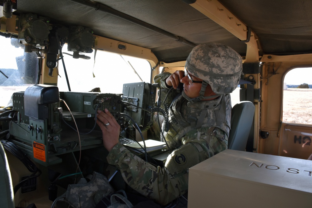
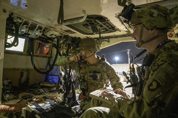
    Modern PNT tools being developed and fielded include mounted, dismounted and alternative navigation systems, situational awareness devices, and next-generation sensors that allow for optimum flexibility and performance against threats.

    Within the realm of space, the CFT is shaping a strategy to provide survivable, responsive and resilient intelligence, surveillance and reconnaissance and communications capabilities in low Earth orbit, complete with the ability to share information rapidly and securely with tactical commanders on the ground.

    The team’s experts are also focused on understanding and preparing for the future of navigation warfare, or NAVWAR, which will require sophisticated offensive and defensive systems to produce tactical advantages and enable overmatch. To encourage synchronization of efforts on this front, the CFT is working closely with Army partners to draft an overarching NAVWAR strategy that aligns with U.S. Department of Defense NAVWAR plans but is also tailored to unique Army needs.

    By studying and preparing for multi-domain operations and experimenting with the newest technologies available, the APNT/Space CFT is playing an integral role in helping the Army to equip soldiers with more mobile, scalable and interoperable navigation devices, in turn strengthening the agility of the future force.

  • GNSS simulation critical for NAVWAR testing

    GNSS simulation critical for NAVWAR testing

    The BroadSim Advanced GNSS Simulator (Photo: Orolia)
    The BroadSim Advanced GNSS Simulator (Photo: Orolia)

    Orolia Defense & Security offers a range of solutions that support critical positioning, navigation and timing (PNT) systems for Navigation Warfare (NAVWAR) domains. Orolia is approved to work on the full spectrum of U.S. government classified and unclassified projects and is positioned to support strategic partnerships in the development of key positioning, navigation and timing (PNT) technologies for the defense market.

    BroadSim Advanced GNSS Simulator. Powered by the Skydel software engine, BroadSim provides software-defined features and benefits, with additional capabilities and specifications for applications requiring maximum security and compliance. With 100+ units fielded, BroadSim is trusted by the U.S. government, military and industry.

    Broadsim supports encrypted signals (Y-code, M-AES, and M-MNSA) and provides advanced jamming and spoofing simulation. Scalable configurations for testing CRPA/antenna electronics systems (anechoic and wavefront) are available. BroadSim has four independent RF outputs and runs on a custom Linux operating system.

    Interference Detection & Mitigation (IDM). Orolia’s IDM technology is patented, rigorously tested and field proven for more than a decade, while regularly updated to conform to new and emerging threats. BroadShield provides embedded GPS jamming and spoofing detection, serving as a kill switch. BroadSense offers mobile detection for situational awareness, and ThreatBlocker provides protection with in-line detection and suppression.

    Resilient PNT. Orolia’s resilient PNT solutions improve the reliability, performance and safety of customers’ mission-critical operations for air, land, sea and space applications.

    The 8230 AJ GPS/GNSS anti-jam outdoor antenna is a high-gain (40-dB) GNSS outdoor antenna with a unique conical pattern that rejects interference from the horizon. IP67-rated, it is designed for harsh environments.

    The VersaPNT provides a rugged and resilient PNT source. The all-in-one customizable system delivers accurate, software-configurable PNT signals and high-performance for mobile applications in GNSS-degraded and denied environments.

  • SMDC takes lead in Army’s navigation and PNT operations

    SMDC takes lead in Army’s navigation and PNT operations

    News from the U.S. Army Space and Missile Defense Command/Army Forces Strategic Command

    The secretary of the United States Army has designated the U.S. Army Space and Missile Defense Command/Army Forces Strategic Command as the Army’s representative to identify and advocate for positioning, navigation and timing (PNT) information as well as establish and formalize joint navigation warfare, or NAVWAR, requirements.

    “Navigation warfare is really about taking a look at different position, navigation, and timing signals and figuring out how the signals flow; the potential for adversaries to disrupt our ability to use them in the future; and how can we not only protect ourselves from the enemy denying us with those abilities, but also how can we do the same to our enemies and affect them and disrupt them in a multi-domain operational environment,” said Col. Timothy G. Dalton, USASMDC/ARSTRAT U.S. Army Training and Doctrine Command, or TRADOC, Capabilities Manager for Space and High Altitude, or TCM SHA.

    Soldiers in the field learn how to operate in a NAVWAR environment. (Photo: U.S. Army)
    Soldiers in the field learn how to operate in a NAVWAR environment. (Photo: U.S. Army)

    What NAVWAR Does. NAVWAR allows the Army to take deliberate defensive and offensive actions to assure U.S. forces PNT information through coordinated employment of space, cyberspace and electronic warfare operations. PNT data enables the Army to precisely move, shoot and communicate; extend its operational reach; control the tempo of operations; and perform mission command, all without adversarial interruption.

    NAVWAR capabilities include electronic protection which includes systems and capabilities required to defend platforms and systems against electronic acts in the GNSS electromagnetic spectrum.


    The Army has more than 250,000 GPS-dependent systems.


    Additionally NAVWAR provides electronic support to sensors and software used to search for, intercept, identify, locate or localize, and report sources of intentional and unintentional radiated GNSS electromagnetic interference for mitigation and planning future operations.

    NAVWAR can also provide electronic attack with capabilities to seize and sustain the initiative by actively degrading or denying the GNSS electromagnetic spectrum to adversaries in multi-domain operations.

    The Army is dependent on the use of this data with a typical brigade combat team depending on more than 28 different systems and 600 total systems that leverage PNT. The Army has more than 250,000 GPS-dependent systems.

    “As the Army goes forward in multi-domain operations, what we see the battlefield becoming is a contested environment,” Dalton said. “What that means is there are adversaries that will look to challenge the United States across all operational phases and domains. These enemies will have the capability to disrupt signals, like GPS, that can impact a wide range of military and civilian activities.

    New NAVWAR Concept. SMDC is developing a TRADOC-sponsored Army NAVWAR concept that will be used to establish a baseline for how the Army will execute the NAVWAR fight.

    The Army is highly dependent on the use of GPS-delivered PNT data. NAVWAR prevents the use of GPS by hostile forces while ensuring unimpeded use for U.S. forces and allies.

    “In the command’s advocacy role we work with the joint and Army communities to examine what the Army needs to be able to accomplish the mission through navigational warfare,” Dalton said. “We work with a community of interest to determine the requirements that will build capability and reduce shortfalls in this mission area.

    “This includes activities like updating doctrine, our organizational structure, ability to train the force, and ultimately determine if we need additional equipment, or holistic solutions to protect capabilities and disrupt the enemy on the navigation warfare side,” he added.

    Training and Research. SMDC, in conjunction with U.S. Forces Command and the Joint Navigation Warfare Center, supports training events under degraded GPS conditions. The goal is to enable tactical formations to develop and train tactics, techniques and procedures that enable Army formations to work.

    “We help develop and focus the capability requirements for the Army,” Dalton said. “But we are integrating with a larger community, led by the Assured Positioning, Navigation and Timing Cross-Functional Team that is focused on modernizing the Army in this mission area.”

    SMDC is the Army lead for institutional unity of effort on NAVWAR with several research, development, test and evaluation and capability integration efforts working on the issue independent of one another.

    “It is definitely an exciting time for NAVWAR,” Dalton said. “The Army, services and Department of Defense, as a whole, have started to embrace the importance of this mission area and understand the competitive advantage the U.S. and our partners can gain while denying the adversary the ability to conduct operations with respect to navigational warfare.”