| Cast Navigation | IFEN GmbH |
Racelogic | Skydel | Spectracom | Spirent Federal Systems |
|---|
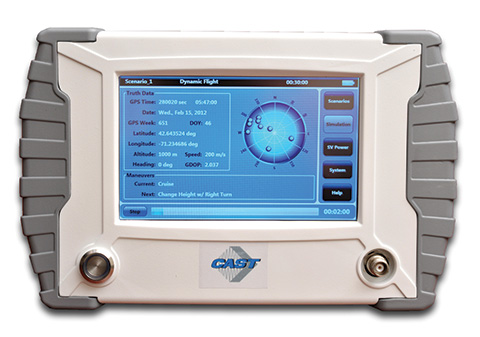
Cast Navigation
CAST-3000: Complete GPS/INS Integration Testing
 CAST GNSS/INS simulators generate high-fidelity GNSS RF signals along with the coherent digital inertial signals that allow for the precise stimulation of the next generation of GNSS/INS navigation equipment. CAST’s GNSS/INS systems provide the highly precise system performance that is required to aid in the integration and testing of the next-generation of GNSS navigation system technologies. The 35-year-old company’s business focus is supplying GNSS/INS simulators, GNSS/INS test equipment, and GPS/INS support services to government and military avionics laboratories, prime contractors, GNSS receiver manufacturers and system integrators.
The CAST-3000 fully supports integration testing of GPS/INS navigation systems where the inertial sensor and GPS receiver are either tightly or ultra-tightly coupled. The CAST-3000 produces GPS RF signals coincident with simulated IMU sensor data that provide dynamic testing in the laboratory environment for military and government applications. CAST has worked closely with both Honeywell and Northrop Grumman over the past two decades in the development of the CAST-3000, which
-
- provides strapdown IMU measurement data synchronized with GPS RF data to the navigation system under test.
- contains a mature avionic sensor simulation Barometric Altimeter model.
- includes high rate inertial measurements with very high degree of fidelity to support testing of high-performance coupled systems.
- simulates sensors to provide the necessary fully coordinated, dynamic vertical channel aiding needed to maintain Kalman filter stability of the navigation system.
- includes years of development and refinement of the precise GPS/INS synchronization capability needed for simulation of aircraft dynamics.
- includes a complete 6-DOF motion generation capability.
www.castnav.com
phone: 978 858-0130
email: [email protected]
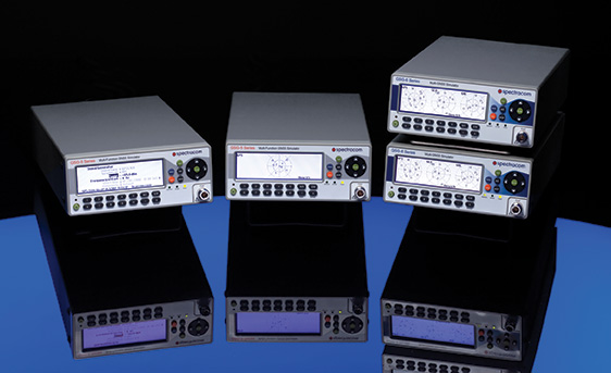
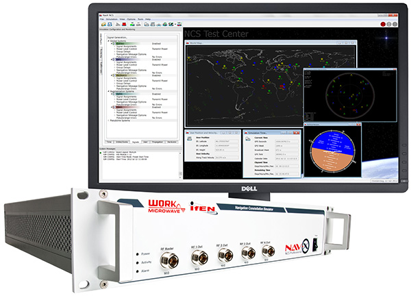
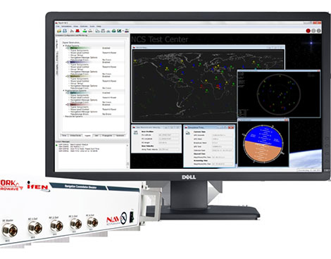
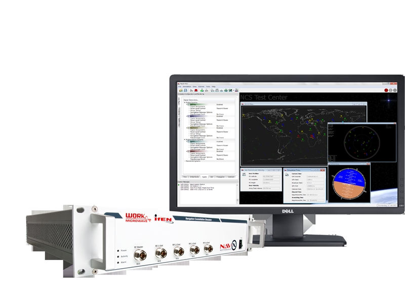
Ifen GmbH
NavX-NCS Professional GNSS Simulator
NavX-NCS Essential GNSS Simulator
 The flexibility of the NavX-NCS Professional GNSS Simulator allows it to be configured with up to 108 channels and all of the following signals:
- GPS L1/L2/L5 C/A and P-code and L2C
- GLONASS G1/G2 standard and high-accuracy codes
- Galileo E1/E5/E6 (BOC/CBOC/AltBOC)
- BeiDou B1/B2/B3
- SBAS L1/L5 (WAAS, EGNOS, MSAS, GAGAN, SDCM)
- IRNSS L5/S-band
- QZSS L1 and L1-SAIF
- IMES
The user can assign signals freely to any of the RF modules fitted to the simulator. This allows the same hardware to be used in a range of different configurations.
Signals can be added by software license with no need to return the hardware for upgrade.
Up to four independent RF outputs can be fitted, enabling the user to simulate multiple antenna locations simultaneously (allowing simulation of multiple antennas on one vehicle, multiple vehicles simultaneously, a mixture of static locations and mobile vehicles, and multiple antenna elements for Controlled Reception Pattern Antenna [CRPA] testing).
The comprehensive and easy-to-use Control Center operating software allows the operator to quickly create realistic test scenarios for effective testing of user equipment.
IFEN also offers the NavX-NCS Essential GNSS Simulator, which is available with 21 or 42 channels and is capable of simulating GPS L1 (including SBAS L1), GLONASS G1, Galileo E1, BeiDou B1, QZSS L1 and IMES. The simulator is also supplied with Control Center operating software for comprehensive scenario generation.
www.ifen.com
For USA and Canada:
Mark Wilson
phone: 951-739-7331
email: [email protected]
For Rest of World:
Dr. Guenter Heinrichs
phone: +49-8121-2238-20
email: [email protected]
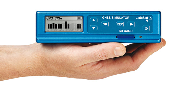
Racelogic
LabSat 3 and LabSat Real-Time
 LabSat 3 from Racelogic is a low cost, stand-alone, battery-powered, multi-constellation, RF record and replay device, designed to assist GNSS engineers in the development and testing of their products. By capturing live-sky RF signals, it enables repeatable and realistic testing to be carried out under controlled conditions, and is available as a record and replay, or replay only version; either one, two or three constellation types generate a single, dual or triple constellation file.
With standalone operation, LabSat 3 can be used in any outdoor location to create real-world scenarios for eventual replay back in the lab. As well as being able to simultaneously record or replay GPS, GLONASS, BeiDou, QZSS, Galileo and SBAS signals, it can log CAN bus, serial or digital data, embedded alongside the satellite information. This additional information can then be replayed alongside the GNSS output, with synchronization to within 60 nanoseconds. A 1 PPS signal can also be generated using the internal GPS receiver.
LabSat 3 can be used as a replay system out of the box with a set of 60 pre-recorded scenarios supplied as part of the package, recorded from various locations around the globe.
Additionally, SatGen software allows for scenario generation of user-defined trajectories, with precise control over velocity, heading, height and constellation profiles, giving the test engineer the ability to develop their product using simulations that would be difficult or impossible to record due to geographic location or safety constraints. NMEA and KML imports are supported.
New for 2016 is LabSat Real-Time, which allows for bench testing of GNSS devices where a current time stamp is required. SatGen V3 PC software generates a live signal stream to a LabSat RT unit which up converts the RF data from digital to analogue with less than one second latency. LabSat RT operates on any two of the three constellations of GPS, GLONASS and BeiDou.
www.labsat.co.uk
phone: +44 (0)1280 823803
Skydel
SDX: Software-Defined GNSS Simulator
Software-Defined Innovation
 Skydel brings a new generation of GNSS simulators to the market. With the SDX simulator, signals are modulated by the graphics processing unit (GPU) as opposed to dedicated FPGAs found in traditional simulators. This allows new possibilities, such as adding signals and constellations without resorting to additional hardware. This design offers many benefits:
- The number of channels is defined by the GPU, eliminating the need to buy additional proprietary FPGA-based hardware whenever more channels are needed.
- Price per simulated channel is greatly reduced by using powerful, mass-produced off-the-shelf hardware such as graphic cards and software-defined radios. Moreover, the same hardware can be repurposed for numerous applications.
- Numerous hardware configurations provide flexibility ranging from single software-defined receiver (SDR) setups to racked instruments multi-element systems.
- SDX can be distributed over many computers, GPUs and signal generators to expand its capabilities.
Turnkey or Software-Only Solutions
SDX users can reuse their own SDR with the software-only solution, or choose a turnkey solution that comes with all the required hardware and a preconfigured laptop or desktop. Skydel can customize turnkey solutions to meet special requirements.
SDX Key Features
-
- Real-time signal generation for multiple GNSS constellations
- Directional jammers
- Multi-element antenna with better than 1 degree of phase offset
- SDK for GNSS signal customization (injection and modification of navigation message and code)
- 1000-Hz update rate: realistic high-dynamic trajectories
- High-quality and precise GNSS signal
- Hardware-in-the-loop (HIL) integration
- Generate Python automation scripts from the simulator’s graphical user interface (GUI)
- Powerful Python, C++ and C# API to configure and control the simulator remotely
- Windows and Linux compatible
SDX is designed for military, research, industrial and consumer applications.
www.skydelsolutions.com
[email protected]
Spectracom
All Constellations, All Frequencies
 Spectracom GSG-5/6 series simulators are easy-to-use, feature-rich and affordable, offering value compared to the limitations of testing from “live sky” signals. The Spectracom platform approach allows users to buy what they need today and upgrade later. The adaptability of the GNSS RF generation platform can extend it to applications for intelligent repeating and meaconing.
Test Solutions
- Position accuracy and dynamic range/sensitivity
- Simulate movements/trajectories anywhere on or above Earth
- Sensitivity to GPS impairments: loss of satellites, multipath, atmospheric conditions, interference, jamming and spoofing
- Conducted or over-the-air RF
- GPS time-transfer accuracy
- Effect of leap-second transition
- Multi-constellation testing
- Modernization signals/ frequencies
- Keyless military SAASM and dual-frequency and survey-grade receiver testing
- Application packages for RTK, A-GPS, CRPA (controlled radiation pattern antennas)
- Hardware-in-the-loop (HIL) integration
Infrastructure Possibilities
- Zone-based indoor location (intelligent repeating)
- Other meaconing applications
GSG-6 Series 64-channel multi-frequency, advanced GNSS simulator is powerful enough for any cutting-edge test program. GPS, GLONASS, Galileo, Beidou, QZSS and IRNSS signals are available across multiple frequencies. The GSG-6 is designed for military, research or professional applications.
GSG-5 Series 16-channel multi-constellation L1-band GNSS simulator is designed for commercial development/integration programs. If the user is developing commercial products with GNSS capability, the GSG-5 will shorten test programs with confidence.
GSG-51 single channel signal generator is designed for one purpose — fast, simple Go/No-Go manufacturing test and validation, ensuring the manufacturing line is operating at full capacity with confidence in quality.
spectracom.com
email: [email protected]
phone: +1-585-321-5800
Spirent Federal Systems
GSS9000 simulator, CRPA Test System, GSS6425 RPS
 Spirent Federal provides simulators that cover all price points, from high-end research and development, to integration/verification, to single-channel production testing.
GSS9000. The Spirent GSS9000 multi-frequency, multi-GNSS RF constellation simulator can simulate signals from all GNSS and regional navigation. The GSS9000 offers a four-fold increase in RF signal iteration rate (SIR) over Spirent’s GSS8000 simulator.
The GSS9000 SIR is 1000 Hz (1ms), enabling higher dynamic simulations with more accuracy and fidelity. It includes support for restricted and classified signals from the GPS and Galileo systems, as well as advanced capabilities for ultra-high dynamics. It can evaluate resilience of navigation systems to interference and spoofing attacks, and has the flexibility to reconfigure constellations, channels and frequencies between test runs or test cases.
Hardware changes can be made in the field, supported by the new on-board calibrator module. The GSS9000 is extensible and can support the widest range of carriers, ranging codes and data streams for the Galileo, GPS, GLONASS, and BeiDou systems, as well as regional/augmentation systems. Multi-antenna/multi-vehicle simulation for differential GNSS and attitude determination, and interference/jamming and spoofing testing, are also supported.
CRPA Test System. Spirent’s Controlled Reception Pattern Antenna (CRPA) Test System generates both GNSS and interference signals. Users can control multiple antenna elements. Null-steering and space/time adaptive CRPA testing are both supported by this comprehensive approach.
GSS6425. The Spirent GSS6425 RPS quickly and simply records complex real-world RF environments, capturing both GNSS signals and atmospheric/interference effects. These environments can then be replayed repeatedly to the hardware software under test, reducing project, travel and engineering costs.
www.spirentfederal.com
phone: 801 785 1448; fax: 801 785 1294
email: [email protected]
Key contacts:
Jeff Martin, Sales East
Kalani Needham, Sales West