Tag: Netherlands

  • Industry Day: Find out how to take part in low-orbit satnav testing

    Industry Day: Find out how to take part in low-orbit satnav testing

    The European Space Agency (ESA) is in search of European companies interested in taking part in the in-orbit demonstration of a low-Earth-orbit (LEO) satellite navigation constellation utilizing novel frequencies and capabilities.

    Those interested in participating are encouraged to attend ESA’s LEO-PNT Industry Day on March 7 at the ESTEC technical center in the Netherlands. The LEO-PNT Industry Day will give an overview of the project to companies, research institutions and ESA delegates from Member States.

    A detailed invitation will be issued soon, covering all aspects of the LEO-PNT Orbit Demonstrator, including the space and ground segments, operations, launchers, the test user segment, experimentation, and segment demonstration.

    Registration by Feb. 27 is required. To learn more, visit atpi.eventsair.com.

    LEO satellites would supplement the existing Galileo constellation. (Image: ESA)
    LEO satellites would supplement the existing Galileo constellation. (Image: ESA)
  • 2023 European Navigation Conference scheduled for May/June

    2023 European Navigation Conference scheduled for May/June

    The 2023 European Navigation Conference (ENC) will take place May 31-June 2 with a focus on resilient navigation. This conference, which will welcome professionals from the positioning, navigation, and timing (PNT) field, is organized by the Netherlands Institute of Navigation, a member of the European Group of Institutes of Navigation (EUGIN).

    Given the growing vulnerability of satellite-based position and timing, the conference will focus on resiliency, which requires redundancy in the signal domain, terrestrial and space infrastructures, and on-board implementation — as well as addressing vulnerabilities in navigation functions, data, and guidance control.

    Thanks to the hospitality of the European Space Agency, the ENC will be held at the ESTEC site in Noordwijk, The Netherlands, where the Galileo satellite system is designed and where navigation satellites are tested before launching.

    Photo: extravagantni/iStock/Getty Images Plus/Getty Images
    Photo: extravagantni/iStock/Getty Images Plus/Getty Images
  • NAVITEC 2018 focuses on PNT opportunities, new applications

    NAVITEC 2018 focuses on PNT opportunities, new applications

    The ninth Workshop on Satellite Navigation Technologies, NAVITEC 2018, will be held Dec. 5-7 at the European Space Research and Technology Centre (ESTEC) in Noordwijk, the Netherlands.

    The workshop, themed “Golden opportunities for PNT,” is organized by the Radio Navigation Systems Implementation & Verification Section of the Directorate of Technical and Quality Management, European Space Agency (ESA).

    NAVITEC 2018 will include the GNSS Signals and Signal Processing Workshop in coordination with CNES, DLR and the University of the Federal Armed Forces Munich.

    The aim of the workshop is to provide an open forum to space and terrestrial satellite navigation technology designers, developers, integrators, users, universities and agency representatives.

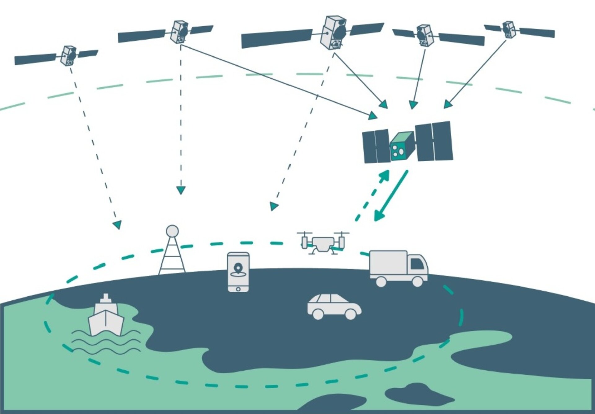
    “We are now seeing an explosion of new applications using position and time,” stated an ESA event announcement. “People expect PNT to be available always and everywhere. Solutions require reliable service outdoors and indoors, high-accuracy and able to survive in challenging environments with new security threats. All this at ever lower prices. These solutions require innovative technologies such as integration with other sensors, cloud processing, low power technologies, all with the latest security measures.”

    Participants will have the opportunity to share their technical expertise and experiences by formal presentations, informal discussions and round tables. The workshop will provide an overview of satellite navigation technologies that are available, or being developed, especially in the frame of current research and development programmes.

    Scope and topics of interest

    The scope of the workshop will include navigation equipment and techniques: receivers, payloads, signals, navigation algorithms, signal processing techniques and applications of GNSS (terrestrial and space).

    A call for papers will be issued soon. The papers should describe new equipment developments and systems concepts, innovative technologies and designs, testing/validation procedures, linked to the topics that are listed below.

    • Mass-market GNSS/Galileo results
    • GNSS in IoT (low-power & snapshot processing)
    • Positioning and Timing for 5G
    • Cloud and collaborative positioning techniques and applications
    • Precise Positioning in challenging environments
    • Augmentation services
    • Interference, Spoofing and Authentication and Cyber Security
    • GNSS signal design
    • Alternative PNT systems (LEO and HAPS)
    • Space & Scientific Applications

    Learn more at the NAVITEC website.

  • Netherlands employs GNSS monitoring for rail

    Netherlands employs GNSS monitoring for rail

    train-netherlands-w

    The Dutch state-owned rail company NS Groep N.V. is deploying a real-time remote diagnostics monitoring system. As a core component of NS’ overall real-time monitoring architecture, the system allows railway operators to streamline maintenance costs and provide efficiencies across their fleet by automating manual tasks.

    NS in the Netherlands will join a growing number of large rail operators that have implemented GNSS solutions, in this case the Trimble R2M system. Others using R2M include South West Trains in the United Kingdom, Irish Rail, SNCF France, SBB Switzerland and VR Finland.

    R2M processes diagnostic data from rail vehicles in real time. It provides a comprehensive view of the overall fleet’s status including specific vehicle faults. The system also identifies potential faults that may arise while analyzing and detecting anomalies in on-vehicle component behavior to identify component issues and the possible impact this behavior may have on the vehicle and overall fleet.

    With the R2M software, NS will be able to aggregate data from a range of on-train and wayside sources and provide real-time information to the NS Train Helpdesk to monitor the fleet status. Information will also be available to fleet analysts, work-planning engineers and mechanics to support the operational repair process of NS in real time.

  • Spectracom adds resiliency for military communications system

    eloran_diagram_631px

    Secondary receiver uses eLoran to back up GPS time

    Spectracom has been selected to provide Interference, Detection and Mitigation (IDM) capability to its SecureSync precision time and frequency reference system to support Rohde & Schwarz Benelux B.V. and the Netherlands Ministry of Defence for secure long-range military communications systems.

    The upgrade, which is based on a secondary receiver that extracts precision timing signals from the eLoran system when GPS signals are not available, will increase the reliability of the overall communication system by further enhancing the resiliency of the precision timing core.

    As part of its expanding set of resilient PNT solutions, Spectracom systems synchronize to a variety of precision references whenever and wherever available.

    In this deployment, signals from the eLoran system are constantly monitored and act as the primary reference when GNSS signals are not available due to interference or jamming. This new capability supports the goal of a sustainable and reliable network for ongoing global operations.

    The modularity of the SecureSync precision time and frequency platform allows customers and integrators to easily and incrementally increase system capabilities, such as multiple reference signals, as they become available.