Brian Thompson, the CEO of UnitedHealthcare, was shot to death on Dec. 4 outside the New York Hilton Midtown in Manhattan, where the company was hosting an investor day. The suspect fled northward on 6th Avenue on a bike toward Central Park and is still unidentified.
Police initially believed the suspect fled on a Citi Bike, which is equipped with GPS tracking devices. However, it was later clarified that the suspect used a regular electric bike, not a Citi Bike, eliminating the possibility of GPS tracking through the bike-sharing system.
Many e-bikes do not come with built-in GPS trackers. While some newer models have integrated GPS units, aftermarket trackers must be installed separately on most e-bikes.
Even if the e-bike had a GPS tracker, its effectiveness would depend on whether it was active and connected to a cellular network to transmit location data.
Despite this setback, investigators are still utilizing various technological methods to track the suspect. Police are analyzing video from street cameras and other sources to trace the suspect’s escape route. Additionally, a cell phone was recovered from the alley where the suspect fled, which could potentially provide valuable information. The suspect was spotted on surveillance video carrying an e-bike battery less than two hours before the shooting, which might offer additional leads.
While GPS tracking through the bike is no longer an option, law enforcement is leveraging other technological resources and traditional investigative methods to locate the suspect.
“Seen & Heard” is a monthly feature of GPS World magazine, traveling the world to capture interesting and unusual news stories involving the GNSS/PNT industry.
Batman only wishes he had one
New miniature GPS “backpacks” are making it possible to track tiny desert bats, providing insight into their lives. Tiny 1-g GPS tags showed University of Helsinki researchers that Africa’s yellow-winged bats struggle during dry periods. The species is one of the few desert bats large enough to carry the tag. Researchers placed GPS trackers on 29 bats, 15 in the rainy season and 14 in the dry season, for one week each, and recorded their positions every 30 to 60 minutes each night.
Photo: iStock/ MBPROJEKT_Maciej_Bledowski
The wheels on the bus need GPS
All New York City public school buses will provide GPS tracking by the first day of class this fall. The city has teamed up with Via to install the equipment and provide an app for real-time tracking of the nearly 10,000 buses. The city council approved the tracking program after a sudden snowstorm in November 2018 left buses stranded in traffic for hours, and parents couldn’t reach their kids.
Keep on truckin’
Shipping company UPS is investing in autonomous deliveries, specifically in TuSimple, a robot-trucking startup. UPS is testing self-driving tractor trailers on a route between Phoenix and Tucson, Arizona, to help it understand requirements for Level 4 autonomous trucking. TuSimple completed a two-week pilot with the U.S. Postal Service in May, hauling mail between Phoenix and Dallas. All TuSimple trucks operate with two technicians in the cab, with the aim to operate without drivers within two years.
A+ for GPS Cows
High-school students interested in agricultural professions can now learn about the use of GPS for monitoring livestock, and even make their own GPS collars. The collaborative GPS Cows program brings together industry researchers, professionals and educators from the U.S. and Australia. GPS Cows is fighting the misperception that ag-focused students don’t need digital literacy, and is engaging them in agri-tech, specifically tools and systems that provide animal location and behavior data.
Who better to know about connections than a GIS professional whose very job is discovering them? Weaving a thread through time from decades ago isn’t a typical geospatial connection, but this one is, and it is connected by a person.
Let’s reflect on who we are as a profession and how we, the geospatial community, has made the world a better place.
Let’s also take a moment to learn about one of the leaders who led the way and what he had to overcome to help us appreciate who and what we are. It is an oft-repeated refrain: “Those who do not know the past are condemned to repeat it”, and, my personal favorite, “The future flows through us becoming the past so that we remember it and do not repeat it.”
Jack Maple. (Photo: Newsday Photo, 1986 / Bruce Gilbert)
In 1961, the trend in crime began climbing. Many people lived in fear, especially in big cities. New York captured many of the nation’s headlines in a long, tragic list of brutal, horrible crimes. Hope was bleak. It was expected to get worse. But, it didn’t. The fever had broken. It peaked in 1991. The crime spree lasted 30 years.
By contrast, the Vietnam War lasted 20 years. The total number of troops serving on active duty during Vietnam was 9.1 million troops and 58,318 lost their lives in combat, yet fewer people died on the streets of America during the same period. In fact, on average, during the 30-year crime wave, every 22 days the number of victims of violent crime in the United States equaled the total number of soldiers killed in Vietnam. America was a battlefield and ground zero was New York City.
What happened in 1991? What stemmed the tide? That year, a new type of hero emerged, a crime fighter, unlike any before.
It began at ground zero, in the most dangerous areas of New York City — the subways, referred to as the “caves.” Thugs, rapists, murders and thieves roamed the depths. Police could do little. They were outnumbered and operated under strict rules. It was preferable to be a regular police officer, above ground, dealing with routine crimes, even the murders, rather than be a transit cop covering a beat in the dark, rough, unforgiving underworld of the subway. Only four types of people dwelled there: criminals, victims, transit cops, and those who got away.
Sometimes, transit cops or criminals were the victims. Transit cops were difficult to recruit, but New York needed more of them. This provided an opportunity for those with few other choices. Sometimes, those who have no other options are the ones who make the most of an opportunity. They work the hardest because it is their only way out. Success lies with the willing — those incendiary hearts waiting to be ignited by a challenge that gives them purpose. Life is too often fraught with peril and strife. It is vision and the courage to pursue them that manifests dreams into reality.
This new hero didn’t fit the caricature. He was short, balding, overweight and lacked a high school diploma. He was street smart, cocky, unpolished and would rather fight than prove his point. He didn’t come from a privileged background. He just had his wits. He knew right from wrong and had the courage to stand his ground. He took on the criminal element lurking in the subterranean worlds. He worked hard, earning his GED at night. It served him better that way like a badge of honor, the hard way being its own reward.
His name was Jack Maple, the crime fighter, and he understood the streets in ways others didn’t. He knew, like a hunter knows, to find the deer trails. Animals are creatures of habit. They prefer to stay where they know the area, the smells, the rhythms, the sounds, where the food is, and where to run for cover. Criminals measure their risks too. They prefer familiar places. They are territorial and keen to their surroundings. Jack knew if you look for their patterns, you’ll find them. He covered his walls with subway maps, placing pins where and when the crimes happened.
The criminal’s habits and behaviors began taking shape. With this knowledge, Jack had become the hunter. Knowledge is power, but real power is action, and Jack took it. He would not have become the hero otherwise. He staked out their patterns of place and time, setting traps and luring them in with their weaknesses.
One by one, and group by group, he reclaimed New York’s subways. Crime dropped by 69% over the next five years. Putting that in perspective, two of every three victims were spared. Unfortunately, 629 people were still murdered in New York City, but it was a drastic departure from the peak of 1,946 just five years before, meaning 1,317 men, women and children did not suffer a violent crime that year or any other year thereafter.
The values of crime are most often represented as a 1:100,000 scale ration; however, this chart shows three different categories, each represented by a different order of magnitude. (Data from Disastercenter.com)
Rudy Giuliani, then mayor of New York, recognized the value of what Maple had developed. Maple called his maps the Charts of the Future. His colleagues called it wallpaper. The mayor called it amazing and gave Jack Maple his full support, praising him by saying, “One of the truly great innovators in law enforcement, who helped make New York City the safest large city in America.” Maple was promoted to Deputy Police Commissioner of Crime Control Strategies.
Maple founded CompStat, Computerized Statistics, calling it his electronic pin maps to support his four precepts: accurate and timely intelligence, rapid deployment of forces, effective tactics, and relentless follow-through.
New York’s CompStat program for the NYPD.
CompStat changed policing to a data-driven business. GIS professionals will recognize CompStat as a geographic information system, and Jack as a self-trained geospatial developer and analyst. Geospatial science was still a very niche technology at the time.
Jack Maple’s success continued to grow. Two men, William Bratton and John Timoney, both police commissioners and senior to Maple in the police hierarchy, became evangelists of Maple’s CompStat, spreading it to other cities throughout the world, and through those two men, predictive policing and crime mapping evolved.
Maple, Bratton and Timoney became independent consultants helping cities worldwide establish their own CompStat programs.
His success did not end there. Based on his experiences fighting criminals on the streets and fighting change in the antiquated police system, he wrote the book, The Crime Fighter: How You Can Make Your Community Crime Free. The book is an excellent read and readily available online. He also co-wrote the TV series The District, based on his exploits in the book.
If you haven’t seen the series, the show is worth watching. Season 1, Episode 3, shows a 1990s projector screen with a large GIS display and the city’s police chiefs being held to account for telling their district’s crime stories in accordance with the map.
Jack Maple was a modern-day rags to riches story and a pioneer of the GIS profession. When he passed away in 2001, he had become a beloved character in New York. When he died, each of the major New York City publications covered the story of his life crediting him for reducing crime and giving the citizens back their city. The CompStat room at 1 Police Plaza CompStat, New York, was renamed after him in tribute. Craig Horowitz, writer for New York Magazine, penned a worthy tribute.
CompStat would be further developed with more advanced crime mapping and crime analysis methods, predictive analytics, environmental criminology and geographic profiling. Kim Rossmo coined the term geographic profiling, based on his patented Rossmo Formula, which is a form of predictive analytics that takes location, time, social behavior and the psychology of criminals into account and turns it into a mathematical equation that can be fed into a GIS. This narrows down the probable location of a suspect, allowing investigators and police to better focus their resources.
Geographic profiling was used during the D.C. sniper case. The Rossmo Formula was featured on the TV series Numb3rs. I hope to write a future article on Dr. Rossmo complete with interviews.
The trend in crime has continued decreasing ever since the peak in 1991. Crime in New York City has now dropped back to 1940s levels as of 2017 and continues to decline.
The power to change the world lies with those fervent, intrepid souls — the unrelenting dreamers, who seek a better world and through innovation, creativity and courage, and manifest it into reality.
It is a great time to be in the geospatial profession. The United States leads the world in geospatial science. Take heart, because opportunities abound in this industry. I hope you become a hero in the field, and someday I have the opportunity to write about you.
General Motors’ self-driving unit Cruise Automation is applying to begin the first sustained testing of vehicles in fully autonomous mode in New York state — specifically in Manhattan — in early 2018.
“Autonomous vehicles have the potential to save time and save lives, and we are proud to be working with GM and Cruise on the future of this exciting new technology,” said New York State Governor Andrew Cuomo.
Testing in New York will accelerate the timeline to deploying self-driving cars at scale, according to Kyle Vogt, CEO of Cruise Automation. “New York City is one of the most densely populated places in the world and provides new opportunities to expose our software to unusual situations, which means we can improve our software at a much faster rate.”
GM is also doubling the size of its test fleet in San Francisco, California, from 30 to 100 as part of its effort to develop software capable of navigating congested and chaotic urban environments. GM has reported more run-ins between its self-driving cars and human-operated vehicles and bicycles. Its vehicles were involved in six minor crashes in September, all of which were caused by the other vehicle.
Lidar Acquisition. GM announced Oct. 9 that it has acquired lidar company Strobe. Strobe’s engineering staff joins GM’s Cruise Automation team to define and develop next-generation lidar solutions for self-driving vehicles. Lidar images provide a more accurate view of the world than cameras or radar alone, information needed by autonomous cars.
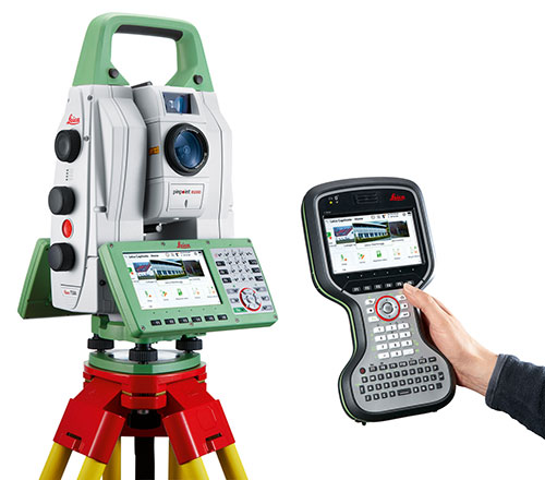
When the new Extell luxury high-rise building goes up at 217 West 57th Street in Manhattan, the vertical alignment of the core-wall structure will be crucial to success. This internal core structure will rise almost 1,500 feet above the ground and will be the reference for all other building construction, making its construction one of the most mission-critical aspects of the entire project, according to Leica Geosystems.
Pinnacle Industries, the concrete contractor responsible for building the structure, has invested in an innovative core-wall alignment system. Consisting of advanced GNSS and robotic total station solutions, the Vertical Alignment System from Leica Geosystems will be used as each floor is constructed to ensure the overall vertical geometry of the structure. High-end training from Leica Geosystems will provide the support and knowledge transfer needed to achieve successful adoption of this innovative approach.
The project is noteworthy for a number of reasons. With an overall roof height of 1,479 feet (1,775 feet to top of spire), the new building will dominate the Midtown skyline and will be the tallest residential building in the world. It will also mark the introduction of Nordstrom Inc. to New York City. The architect of record, Adrian Smith + Gordon Gill Architecture, is the firm behind Dubai’s Burj Khalifa, the tallest commerical building in the world.
According to David Rutledge, director of structural monitoring for Leica Geosystems’ Monitoring Solutions business in North America, Pinnacle Industries chose the Leica Geosystems Vertical Alignment System for its ability to reliably and quickly make alignment adjustments to the forming traveler that will be used to construct each floor. The Leica GM10 GNSS instruments in particular were chosen for their ability to produce highly accurate 3D position coordinates.
“It’s very exciting to be involved with the soon-to-be tallest residential building in the world,” Rutledge said. “Pinnacle is an industry leader in this type of construction, and we feel honored to have been selected by the team. Leica Geosystems’ solutions provide exceptionally high accuracy and outstanding performance, making them ideally suited for the high productivity demanded on projects like this. We’re thrilled to be able to play a supporting role in this significant and historic project.”
MemSQL, which specializes in real-time databases for transactions and analytics, has announced new geospatial capabilities for its in-memory, distributed SQL-based database. By bringing together geospatial and operational data in the same high speed database, customers can achieve unprecedented agility for geospatial analysis, MemSQL said.
Unlike segregated solutions, MemSQL integrates geospatial data as a primary data type, making it as easy to use and operate at scale with as much speed and high throughput as any other class of data.
Previously, enterprises were forced to segregate their geospatial data into separate data stores. With the rise of IoT and mobility, nearly all data is location-specific. As data volume increases, maintaining geolocation information outside of the primary datastore leads to longer latency and synchronization challenges.
By integrating geospatial functions, MemSQL enables enterprises to achieve greater database efficiency with a single database that is in-memory, linearly scalable and supports the full range of relational SQL and geospatial functions. With MemSQL, geospatial data no longer remains separate and becomes just another data type with lock-free capabilities and powerful manipulation functions.
Taxi Scenario with Esri.Working with MemSQL and Apache Spark, Esri analyzed data compiled from 170 million real-world New York City taxi rides around the GPS coordinates of pickups and dropoffs, as well as distance and travel time. Slicing by hour of the day, Esri can calculate the average speed of a taxi ride and find the best and worst places for traffic jams. Slicing by day of the week, the ebb and flow of traffic during workdays and weekends becomes visible.
For a city planner, this data insight can be used to redirect traffic at specific times in an effort to unclog traffic congestion. For the taxi business, this data can improve efficiency with supply and demand of cabs during times of high or low traffic for any given region.
“MemSQL is enabling companies to consolidate many niche solutions into fewer, more capable multi-purpose solutions. By making geospatial data a primary part of in-memory, operational databases, our customers can rely on one solution to make their data more valuable,” said Eric Frenkiel, MemSQL co-founder and CEO. “We’re delivering on our promise of easy access to database innovation and are quickly becoming the go-to-company to help enterprises operationalize analytics.”
MemSQL will showcase the MemSQL, Apache Spark and Esri demonstration at Spark Summit East 2015 on March 18-19 at The Sheraton New York Times Square Hotel. Visit MemSQL at Booth 13 during show expo hours.
The early access MemSQL geospatial capabilities are available now and will be generally available in calendar Q2. Read the technical blog post here.


 His success did not end there. Based on his experiences fighting criminals on the streets and fighting change in the antiquated police system, he wrote the book,