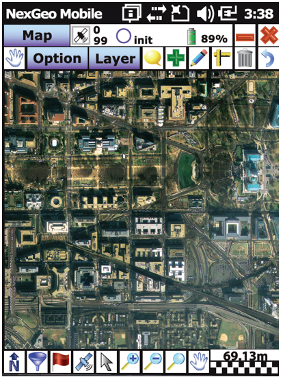
 Nexteq Navigation has release the newest version of its NexGeo software line-up: NexGeo Mobile, NexPos and NexGeo Office. Optimized for Nexteq handhelds, NexGeo Mobile integrates Nexteq Freedom, i-PPP, and RTK positioning augmentation technology into a more reliable, user-friendly data collection software, the company said. With easy display of features, background images, labeling and attributes, data is readily collected, accessed and edited. The tracking feature now allows for efficient communication and management between field workers and the office. Raw data recorded in NexGeo Mobile can be used for post processing in NexGeo Office.
Those using third-party software with a Nexteq handheld are not left behind. NexPos was created with the intent of allowing freedom in benefitting from Nexteq position augmentation technology, the company said. The NexPos software acts as a bridge, applying Freedom, i-PPP, or RTK algorithms to GPS measurements. The final positions are transferred to third-party software via virtual COM port, allowing users to benefit from improved position accuracy while NexPos runs discreetly in the background. Raw data can also be recorded and used for post processing in NexGeo Office.
On the desktop, NexGeo Office ties together collected data, attributes, and post-processing information to provide efficient project management capabilities, data organization, live field monitoring and integration with a wide variety of other software, Nexteq said. Building and maintaining a project specific database is easy using NexGeo Office: import existing data, build on the project using a Nexteq handheld and transfer it back to the office for editing. Exporting the project to ESRI or AutoCAD file formats allows for users to seamlessly continue expanding.
NexGeo software suite is available and included with all Nexteq Navigation handhelds.