Colorado Springs, Colorado, and its vicinity are home to several key U.S. military organizations.
To the northwest is the U.S. Air Force Academy, which educates cadets for service in the officer corps of the United States Air Force and United States Space Force.
To the southwest, deep inside Cheyenne Mountain, is the North American Aerospace Defense Command (NORAD), a United States and Canadian organization charged with detecting, validating and warning of attacks against North America, whether by aircraft, missiles, or space vehicles. In a crisis, the four-star general in command of NORAD would pick up a direct line to the White House and tell the president whether nuclear armed missiles were on their way to the United States. He also commands the United States Northern Command, which is charged with defending the continental United States and Alaska.
I visited these two facilities 35 years ago, when I was a graduate student in international security at MIT. (The Air National Guard flew our group of MIT and Harvard students from Hanscom Air Force Base, near Boston, to Colorado Springs, with a stop at Offutt Air Force Base, home of the U.S. Strategic Command. One of the first Northrop B-2 Spirit, aka the Stealth Bomber, was there, under a tarp. A Harvard student decided to use the stop to go for a run. The MPs promptly arrested him and his professor had to bail him out, much to the amusement of us MIT students.)
In the southeast corner of the city is Peterson Space Force Base. To the east is the one that is of greatest interest to readers of this magazine: Schriever Space Force Base, the home of the GPS Master Control Station.
I recently visited the MCS at the invitation of Lt. Col. Robert O. Wray, Commander, 2nd Space Operations Squadron, which operates it. You can read excerpts of my interview with him here.
Wray gave me a tour of the MCS operations floor. During the tour, I was able to look at the dozens of computer monitors used by the GPS operators and to ask them many questions about their jobs. At any moment, 10 of them are on duty — eight uniformed military personnel and two civilian contractors. Later, I followed up with two members of the GPS Warfighter Collaboration Cell, which supports warfighters, combatant commands and, through the U.S. Coast Guard Navigation Center, more than four billion global civilian users.
Near the end of the tour, Wray surprised me with a question: “Would you like to send a command to a GPS satellite?” You can imagine my prompt answer. A moment later, I was seated at one of the consoles and entering an alpha-numeric string that I was copying from one of the screens. I was so delighted by the opportunity and so focused on entering the sequence correctly that I forgot to ask what command I was sending! Whatever it was, I assume it will help you get to your destination.
Feb. 4 saw the news networks alive with sometimes wild reports about UFOs, UAVs and then a balloon. Balloons are used for weather forecasting on a regular basis, launched daily into the stratosphere with payloads gathering wind speed and direction, temperature, humidity, pressure and, of course, position.
Synchronized twice a day at about 900 locations around the world, balloons are released into the stratosphere gathering essential atmospheric data to feed our weather forecasts. Reaching altitudes of 20 miles, these balloons often drift on winds as far as 125 miles from the release point, broadcasting measurements from their onboard sensors.
At first, maybe North American Aerospace Defense Command (NORAD) thought the balloon crossing into Alaska’s airspace was just one of these high-altitude weather prediction vehicles. Aircraft were apparently scrambled, and initially it was decided there was no threat, so the balloon was allowed to continue and enter Alaskan airspace. It was detected and subsequently tracked by both the United States and Canada for some time as it continued to drift on the jet stream over the border into the lower 48. Then, people in and around Billings Montana (home to one of the nation’s three nuclear missile silo fields at Malmstrom Air Force Base) started to send in reports of a very large balloon high overhead — according to one observer with a high-resolution camera, it even seemed to be stationary for 35 minutes.
Apparently, by the time the good folks in Montana were looking up, the Pentagon had decided the balloon was a Chinese surveillance vehicle. To get this detail, one or more U-2 high altitude reconnaissance aircraft had been dispatched to investigate. The collected U-2 information spotted markings of a Chinese manufacturer on the 200-foot-tall balloon. A payload the size of a small passenger jet dangled some 20 feet below the balloon canopy. It had several antennas of various configurations. A huge solar panel was attached — presumably to power its suite of surveillance sensors.
The Federal Aviation Administration (FAA) ordered a ground stop for all aircraft traffic at the Billings airport while decisions were made about downing the balloon or allowing it to proceed.
Meanwhile, it may seem obvious that both the United States and China have developed, launched and make use of surveillance satellites. I imagined that a couple of dozen of these space vehicles would be buzzing over not only each other’s landmass, but also surveilling dozens of other countries as they orbit the whole planet.
What I found was a report that China had at least 260 such orbital observation platforms in 2022, and the United States has even more. Isn’t that enough without resorting to lower-tech balloons?
It’s possible that some electronic transmissions are short range and would not be detected by surveillance satellites operating in geosynchronous orbit (22,000 miles out), or even at 300 miles where the International Space Station (ISS) and most surveillance satellites hang out. So, a slow-moving balloon at 20 miles up might be ideal to “sniff” ground transmissions from sensitive military installations, and if you could control the balloon to hover, all the better to pick up radio signals. Could the gathering of transmission data somehow be used to geo-locate the source? It’s something the U.S. military may be working on, too, as it is reportedly also building a fleet of autonomous dirigibles and balloons.
According to press reports, the United States decided not to immediately take down the balloon, even though it subsequently discovered its surveillance capabilities. Not only was there concern over debris falling on populated areas but allowing the balloon to continue its flight over the United States provided an opportunity to observe its behavior and gather useful information. U.S. bases along its path apparently shut down all communications in sequence, as the balloon passed overhead.
The balloon was apparently found to be transmitting – presumably reporting on where it was and what it had detected. But, at some time transmissions ceased, possibly when U.S. Air Force activity was detected nearby.
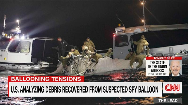
The take-down off Myrtle Beach
An F-22 flew to almost the same altitude as the balloon and fired an AIM-9X Sidewinder missile into it, leaving the payload to tumble from 60,000 feet into the shallow (50-foot deep) Atlantic Ocean off Myrtle Beach, South Carolina. Recovery boats were already on hand to pick up the collapsed canopy, and to begin locating the electronics payload on the seabed. At time of writing, the U.S. recovery effort has yet to inform us on finding the key electronic payload, which would go a long way to confirming the intended mission for the balloon.
Image: Screenshot of CNN news coverage
Strange, but a couple of days later over Canada, F-22s were again in action to take down a “cylindrical object” detected at 40,000 feet — an altitude posing a danger to airline traffic. Little has been released on what this object might have been — could it possibly be a re-entering piece of space debris? Again, debris recovery and analysis is underway, and we patiently wait for a public report about what this was all about.
What have we learned?
Both China and the United States operate huge fleets of surveillance satellites gathering intelligence daily about each other’s capabilities and those of other countries. Both China and United States have also invested in surveillance balloons, but China is the only country to send one over U.S. territory.
There may have been earlier balloon incursions, which are only now being reported. The U.S. response was initially to determine the configuration of the balloon and its payload, then to allow its journey along the jet stream to continue. The United States has said the balloon did not uncover anything already available by other means, but recovery and analysis of the payload would presumably confirm this announcement.
China is not happy about the U.S. takedown of a harmless, stray weather balloon. And what the heck were F-22s shooting at in Canada?
We’ll tell you more when we learn more….
Tony Murfin
GNSS Aerospace
Editor’s Note: Since the initial instance of an unidentified object floating across U.S. airspace — later identified as a Chinese surveillance balloon — three additional unidentified aerial objects were spotted in North American airspace. One was spotted in Alaska, one in northern Canada and one over the Great Lakes region. All three were shot down by U.S. fighter jets out of caution.
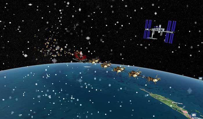
Santa Claus will be performing a ceremonial fly-by of the International Space Station (ISS) on Dec. 24. The visit will honor the 20th anniversary of continuous life on the ISS, a milestone achieved in November.
The official NORAD Santa Tracker at NoradSanta.org will allow users to track Santa’s journey all day on Dec. 24. New for this year, visitors will be able to see the ISS orbiting the planet in its precise real-time location by zooming out on the 3D Santa Tracker app. Other updates include additions to Santa’s traditional garb, including a face mask and space helmet.
Santa’s sleigh flying past the International Space Station on a precise digital twin of the Earth built by Cesium. (Photo: Cesium)
“The ISS is a spectacular example of what humans can accomplish when we work together,” said Hannah Pinkos, lead developer of the app. “2020 has been a tough year, but I think this special trip is Santa’s way of reminding us to believe in ourselves.”
NORAD, the North American Aerospace Defense Command, is a United States and Canada bi-national organization that defends North America by tracking objects flying in and around its airspace 24 hours a day using radar, satellites and fighter jets. Each year, it joins corporate partners in taking on a special mission to also track Santa’s sleigh. The app shows Santa’s position reflected on a digital twin of the Earth provided by Cesium, a Philadelphia-based geospatial software company.
“Cesium is rooted in aerospace, so it’s especially meaningful to us that our technology will allow millions of people to enjoy this event in real-time from the safety of their homes,” added Cesium CEO Patrick Cozzi.
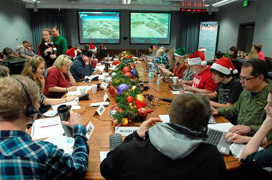
NORAD employees volunteer for Santa tracking and response duty.
NORAD is celebrating the 60th Anniversary of tracking Santa’s yuletide journey through an interactive website, smartphone apps and social media.
NORAD, the North American Aerospace Defense Command, is based in Colorado Springs.
The NORAD TracksSanta website, launched Dec. 1, features Santa’s North Pole Village, which includes a holiday countdown, games, activities and more. The website is available in eight languages: English, French, Spanish, German, Italian, Japanese, Portuguese and Chinese.
Official NORAD Tracks Santa apps are also available in the Windows, Apple and Google Play stores, so parents and children can countdown the days until Santa’s launch on their smartphones and tablets. Tracking opportunities are also offered on Facebook, Twitter, YouTube and Google+. Santa followers just need to type “@noradsanta” into each search engine to get started.
Also new this year, the website features the NORAD Headquarters in North Pole Village, and highlights of the program over the past 60 years.
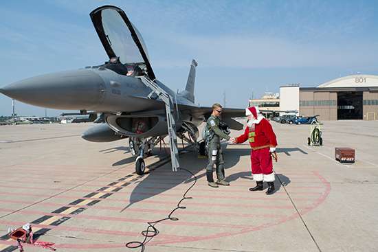
Santa visits NORAD.
Starting at 12:01 a.m. MST (2:01 a.m. EST) on Dec. 24, website visitors can watch Santa make preparations for his flight. NORAD’s “Santa Cams” will stream videos on the website as Santa makes his way over various locations. Then, at 4 a.m. MST (6 a.m. EST), trackers worldwide can speak with a live phone operator to inquire as to Santa’s whereabouts by dialing the toll-free number 1-877-Hi-NORAD (1-877-446-6723) or by sending an email to [email protected].
Any time on Dec. 24, Windows Phone users can ask Cortana for Santa’s location, and OnStar subscribers can press the OnStar button in their vehicles to locate Santa.
NORAD Tracks Santa is a global experience, delighting generations of families everywhere. This is due, in large part, to the efforts and services of numerous program contributors.
It all started in 1955 when a local media advertisement directed children to call Santa — only the number was misprinted. Instead of reaching Santa, the phone rang through to the crew commander on duty at the Continental Air Defense Command Operations Center, the predecessor to NORAD. Thus began the tradition, which NORAD has carried on since the agency was created in 1958.
Orbit Logic announced that their SpyMeSat iPhone app is now available on the Apple App Store. The SpyMeSat app provides notifications when imaging satellites are overhead and may be taking your picture. A dynamic map shows orbit tracks and the location of satellites with upcoming passes over the user-specified location.
SpyMeSat iPhone App
According to the announcement, this is Orbit Logic’s first app targeted for consumers outside their standard customer base in the aerospace, defense, and government intelligence communities.
“This app is for everyone.” said Alex Herz, president of Orbit Logic. “Whenever I talk to people outside the aerospace industry about what I do they have so many questions. I realized there was a place for an app to provide information, education and awareness about imaging satellites to a wider audience. And it’s fun for aerospace industry insiders too!”
The SpyMeSat app uses NORAD orbit data published online by www.celestrak.com and available public information about commercial and international imaging satellites to compute and dynamically display satellite overflights and imaging pass information. The app user can drill down to see additional details about each imaging opportunity, and the app provides a page describing each satellite for those who want to learn more.
SpyMeSat users can configure the app to enable or disable individual satellites, change the location of interest, enable or disable various notification options, and specify the resolution limit for computed passes. Orbit Logic can create custom SpyMeSat solutions for any constellation of satellites. With a custom SpyMeSat solution, authorized users can make satellite tasking requests directly from the mobile device.