Tag: Nottingham Scientific

  • GMV NSL launched: GMV merges UK company with Nottingham Scientific

    GMV NSL launched: GMV merges UK company with Nottingham Scientific

    GMV-NSL logoGMV Innovating Solutions Limited — the U.K. aerospace company belonging to the Spanish technology multinational GMV — has signed a merger agreement with Nottingham Scientific Limited (NSL).

    GMV trades in the aerospace, defense, ICT and intelligent transportation systems markets, while NSL is a U.K. leader in satellite navigation and critical applications.

    After the agreement, GMV becomes sole shareholder of NSL and sets up the company GMV NSL, to be integrated seamlessly into GMV’s set of companies. NSL was founded in 1998 by Vidal Ashkenazi, a former member of GPS World’s Editorial Advisory Board.

    Headshot: Vidal Ashkenazi
    Vidal Ashkenazi

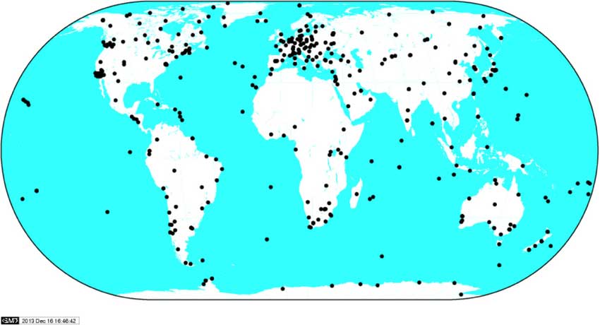
    In 2013, as part of its international expansion, GMV rolled out a business development strategy in the U.K. This involved setting up a new company, which came on stream in late 2014 to join the suite of companies and offices in Spain, USA, Germany, France, Poland, Portugal, Romania, The Netherlands, Malaysia and Colombia.

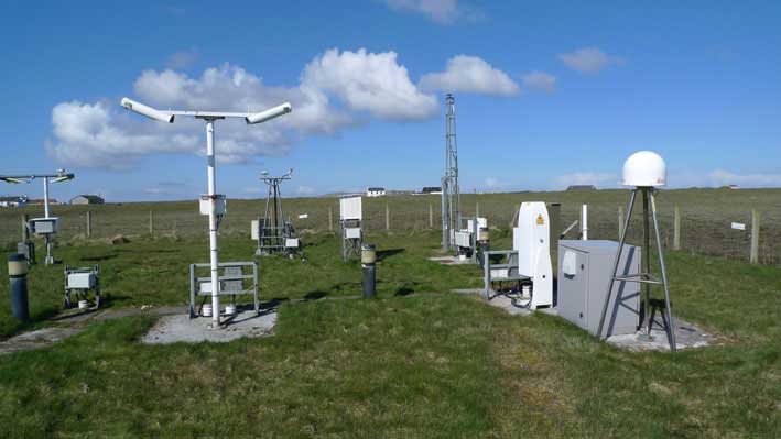
    Working from its Harwell innovation center in Oxfordshire, GMV’s main U.K. business is Earth observation, space debris tracking, mission planning, flight dynamics, navigation, autonomy and robotics. Its principal clients include the European Space Agency (ESA) and the European Commission (EC), as well as U.K.’s space agency (UKSA), the Defence Science and Technology Laboratory (DSTL), Innovate UK, ASUK, Satellite applications Catapult and the Science Technology Facility Council (STFC).

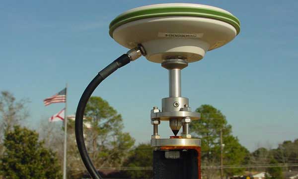
    Set up in 1998 and with a solid and acknowledged track record in high-tech projects, NSL is a U.K.-based SME specializing in satellite navigation and critical applications. From its Nottingham head office in the East Midlands, NSL offers GNSS-based services, systems, solutions and intellectual property, helping to ensure that navigation and positioning are precise and reliable, secure and protected, resistant and robust. NSL’s major clients include UK Space Agency, ESA, U.K. Government departments, QinetiQ, Inmarsat, and the European Commission.

    GMV NSL, 80 strong, will be integrated into GMV’s set of companies, which closed 2019 with a staff of 2,176 and a turnover of more than €236 million. Membership of the GMV powerhouse will enable GMV NSL to rise to even greater challenges and tap into the opportunities offered by the U.K. market, especially the space market, not only in satellite navigation and in critical applications, but also in Earth observation, telecommunications and new technologies, with the overarching aim of winning pole position in Britain’s space sector.

    Jesús B. Serrano, GMV CEO (Photo: GMV)
    Jesús B. Serrano, GMV CEO (Photo: GMV)

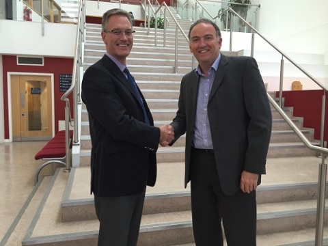
    “This merger will enable the resultant firm to tap into significant commercial, technological and operational synergies, boosting GMV NSL’s rate of growth and winning it a place in the space programs of both the U.K. and Europe as a whole,” said Jesús B. Serrano, GMV CEO.

    “In our different ways, GMV and NSL are regarded as world leading space companies and this agreement will expand our capabilities and capacity enabling us to successfully tackle even greater challenges and consolidate GMV NSL’s position as the benchmark space company,” Mark Dumville, co-founder and director of NSL, added.

    The sheer quality of both teams and the like-mindedness of GMV and NSL on company values, heritage, technological excellence and client satisfaction were all deal clinchers in this merger agreement.

  • ESA to use CORS networks for global error mapping

    ESA to use CORS networks for global error mapping

    News from the European Space Agency

    There are more than five billion satnav devices on Earth. Along with smartphones and mobile receivers, this figure includes networks of fixed receiver stations, used to improve accuracy. An ESA-led project will harness these networks to provide an ongoing overview of satnav performance from the global to national and regional scale.

    <b>CORS station:</b> The CORS network is a multi-purpose cooperative endeavor involving government, academic and private organizations. The sites are independently owned and operated. Each agency shares its data with NGS, and NGS in turn analyzes and distributes the data free of charge. (Photo: NOAA)
    CORS station: The CORS network is a multi-purpose cooperative endeavor involving government, academic and private organizations. The sites are independently owned and operated. Each agency shares its data with NGS, and NGS in turn analyzes and distributes the data free of charge. (Photo: NOAA)

    “The general assumption is that Global Navigation Satellite System (GNSS) services can always be relied on, which is true 99% of the time,” commented Michael Pattinson of Nottingham Scientific Ltd. in the United Kingdom, which is developing this new project for ESA.

    “That’s fine for the ordinary smartphone user, but for safety-critical applications, in particular, we need to know exactly when systems are not performing optimally, and why.

    “Current performance monitoring is often partial, based around individual signal frequencies or constellations, carried out by the service operators themselves. With our new COLOSSUS — Crowd-Sourced Platform for GNSS Anomaly Identification, Isolation and Attribution Analysis — data platform, we’ll be creating the most detailed possible picture of overall performance from the user side, covering all satellite constellations, signal frequencies and receiver types.

    OS Net Station: A CORS station in Tiree, the Hebrides, part of the Ordnance Survey's 110-strong OS Net network. (Photo: ESA)
    OS Net Station: A CORS station in Tiree, the Hebrides, part of the Ordnance Survey’s 110-strong OS Net network. (Photo: Ordnance Survey)

    “The aim is to immediately identify system failures, faults and other errors on an immediate, autonomous basis. And we’ll do this by harnessing a resource that is already out there: gathering and analysing positioning data from networks of ‘continuously operating receiver stations’, known as CORS for short.”

    There are many hundreds of these CORS stations across the globe. By performing positioning continuously at a fixed site in the landscape, they can be used as a standard, serving to identify and subtract measurement errors to boost positioning accuracy on a localised basis.

    Many CORS networks have been established for scientific uses, such as the worldwide International GNSS Station (IGS) network, used as a standard geographical reference and to measure shifts in the solid Earth, oceans and ice.

    Others have been set up by national mapping agencies, such as the Ordnance Survey in the UK. There are also private-sector networks, employed for improving the accuracy of services such as land surveying, air service providers, road charging or driverless cars.

    IGS Global Network: the worldwide International GNSS Station (IGS) network of CORS stations is used as a standard geographical reference and to measure shifts in the solid Earth, oceans and ice.(Image: ESA)
    IGS Global Network: the worldwide International GNSS Station (IGS) network of CORS stations is used as a standard geographical reference and to measure shifts in the solid Earth, oceans and ice.(Image: ESA)

    “Each network is different,” added Pattinson. “Some make their data freely available, others involve registering or payment. We’re talking to operators to allow us to access their data in exchange for sharing our results, and they’re very interested in accessing such performance metrics.

    “With measurements from so many sites, when a failure does occur we’ll be able to pin down its likely source almost immediately. Is it localised interference, or does it have a wider impact? Is it atmospheric disturbance? Is only a single model of GNSS receiver affected, or multiple types? Is it a problem with a single satellite, multiple satellites or even multiple constellations?”

    The company is also deploying its own CORS receivers as an additional data source, at the same time as it develops and tests its processing algorithms. The aim is to begin testing the cloud-based COLOSSUS towards the end of 2019 and bring the service online in the first few months of 2020.

    “Once the service starts, it will run continuously, just like the CORS stations themselves,” Pattinson said. “Our goal is for COLOSSUS to become a key player in GNSS performance monitoring, building up a database of all anomalies that occur and their consequences in terms of constellations, geographical regions and receiver types, to give users, service providers, and regulators an informed sense of how much ‘trust’ to place in these systems.”

    This project is supported through ESA’s Navigation Innovation and Support Programme, NAVISP, applying ESA’s hard-won expertise from Galileo and Europe’s EGNOS satellite augmentation system to new satellite navigation and — more widely — positioning, navigation and timing challenges.

  • Spirent helps civil aviation industry respond to GNSS interference threats

    Spirent Communications plc is offering a solution that enables the civil aviation industry to evaluate the growing threat of GNSS interference, jamming and spoofing.

    The new GSS200D Interference Detector was developed as part of Spirent’s partnership with Nottingham Scientific Limited.

    Spirent’s GSS200D interference detector.

    As skies and airports become more congested, there is increasing pressure on airports to be safely accessible at all times — which cannot be achieved by relying solely on non-precision approaches with high minimums or on today’s expensive and rigid ground-based infra­structure such as ILS (Instrument Landing Systems).

    Ground-Based Augmentation System (GBAS) and instrument approach procedures based on Satellite Based Augmentation Systems (SBAS), such as Localizer Performance with Vertical Guidance (LPV) and Required Navigation Performance (RNP), provide Air Traffic Management with flexible, cost-effective alternatives while providing equivalent operational performance.

    For example, the European Geostationary Navigation Overlay Service (EGNOS) launched the LPV-200 service in Europe that enables aircraft approaches without the need for visual contact with the ground until a height of only 200ft. above the runway.

    With this service, accessibility, sustainability, efficiency and safety of the landing are greatly improved, especially in bad weather conditions.

    Spirent’s new GSS200D solution monitors the radio bands used by EGNOS, as well as other GNSS augmentation systems such as the Wide Area Augmentation System (WAAS) or the GPS Aided Geo Augmented Navigation system (GAGAN), to ensure awareness of interference that could compromise positioning information.

    Since local interference near the runway in the GNSS bands could degrade position accuracy or lead to a total loss of the navigation service, it is critical to continuously monitor and understand the RF environment and level of interference around airports.

    The GSS200D collects quantitative data on interference allowing assessment of the risks, so that robust mitigation plans can be created. The new Spirent solution has been trialed at a number of European airports, and has collected numerous interference signatures from both unintentional man-made interference and intentional jamming.

    “As more airports begin to use GNSS-based instrument approach procedures, they need to know what could be affecting their GNSS signals,” said Martin Foulger, general manager of Spirent’s positioning business. “With this latest solution we can detect interference in the key radio bands, based on levels defined by the United Nations International Civil Aviation Organization and European Organisation for Civil Aviation Equipment. This enables the aviation industry to gain a much better understanding of the electronic environment, helping to avoid dangerous situations going forward.”

    For more information on Spirent’s GNSS testing solutions, visit the website. To learn how to test receivers of GPS, Galileo and other GNSS, download Spirent’s latest eBook.

  • NSL CEO Vidal Ashkenazi honored with Queen’s OBE

    Headshot: Vidal Ashkenazi
    Vidal Ashkenazi

    Vidal Ashkenazi, founder and CEO of Nottingham Scientific Ltd (NSL), has been awarded an OBE in the 2017 New Year’s Honours List for Services to Science.

    An OBE is a Queen’s honor given to an individual for a major role in any activity such as business, charity or the public sector. OBE stands for Officer of the Most Excellent Order of the British Empire.

    “I am absolutely delighted to have been awarded an OBE,” Ashkenazi said. “However, even more importantly, at long last this award recognizes the contribution of scientists and technologists to society in terms of satellite positioning, navigation and timing.

    Vidal has been involved with the geodetic aspects of positioning by using satellites from the earliest days. In 1976 he was invited by the U.S. National Geodetic Survey (NGS) to assist with the development of geodetic coordinate systems, the framework that is still used today by satellite navigation (satnav) and mapping systems.

    Ashkenazi was an academic at the University of Nottingham from 1965 to 1998, and the founding director of the Institute of Engineering Surveying and Space Geodesy, one of the leading space geodesy research institutes in the world. He supervised around 50 doctoral (Ph.D.) students, many of whom now occupy senior positions in universities and industry around the world.

    In the late 1990s, Ashkenazi became aware that, although GPS was designed and developed as a military system, its main advantage to the U.S. was economic. This was the message he delivered when he was invited in 2003 to address the Industry, External Trade, Research and Energy (ITRE) Committee of the European Parliament in Brussels, and hence the need for the European Union to have its own satellite navigation system. Europe’s Galileo system entered into service in December 2016.

    Following his academic career, Ashkenazi founded Nottingham Scientific Ltd (NSL) to commercialize the innovation and expertise developed and Nottingham and other UK universities.

    Vidal Ashkenazi, who has doctorates in philosophy and physical science from Oxford University, is a member of a large number of professional organizations, and has received distinction awards from several of them, most notably the Royal Institute of Navigation.

    He has published several hundred papers in professional journals, and acted as a consultant to a large number of government and commercial organizations in North and South America, Europe, the Middle East and Asia.

    Vidal Ashkenazi is a recognized figure on the international scene of conferences and congresses, to which he is invited regularly either to deliver keynote presentations or to organize and chair round-table panel discussions.

    He is also a long-standing member of the GPS World Editorial Advisory Board.

  • Spirent Partners with Nottingham Scientific for Robust PNT

    Spirent Partners with Nottingham Scientific for Robust PNT

    Spirent Communications has entered into a strategic partnership with Nottingham Scientific Limited (NSL) to enable the detection, characterization and regeneration of threats to GNSS receiver systems.

    NSL is one of the companies in Europe involved in satellite navigation, specializing in developing reliable and robust GNSS technologies for a variety of applications, such as those that impact safety or are critical in terms of business, finance and security. NSL has carried out many successful GNSS research programs within the UK and internationally for government organizations, regulators and policy makers, Spirent said.

    Martin Foulger (left), general manager at Spirent Communications, meets with Mark Dumville, general Manager of NSL, at NSL's headquarters in Nottingham, UK. (Photo: Spirent)
    Martin Foulger (left), general manager at Spirent Communications, meets with Mark Dumville, general Manager of NSL, at NSL’s headquarters in Nottingham, UK. (Photo: Spirent)

    The combination of NSL’s acknowledged expertise in the research of GNSS vulnerabilities with Spirent’s leadership in GNSS simulation and test development enables the provision of a range of planned robust positioning, navigation and timing (PNT) solutions.

    “Threats to GNSS and related PNT applications are becoming more orchestrated and coordinated, with the motivation to disrupt or cause financial loss becoming the driving factor,” said John Pottle, marketing director at Spirent’s Positioning division. “Real-world threats are wide-ranging and affect navigation and timing system performance differently. Our partnership with NSL enables not only detection, but also regeneration, of real threats in the lab. This allows users to understand which threats are most relevant to them, and informs decisions on improving robustness.”

    “NSL and Spirent share a vision that building robust position, navigation and timing systems is enabled through evaluating system performance against a real threats baseline” Mark Dumville, general manager at Nottingham Scientific Ltd, said. “By auditing system performance, decisions on how to improve resilience can be based on facts, not guesswork.”

  • Galileo Maritime Tests Followed Route of Viking Ships

    Galileo Maritime Tests Followed Route of Viking Ships

    Belgian frigate Leopold I-F930 in rough water off Norway during Galileo maritime testing. In December 2013 the frigate participated in the first maritime trials outside mainland Europe of the Galileo satellite navigation system.
    Belgian frigate Leopold I-F930 in rough water off Norway during Galileo maritime testing. In December 2013 the frigate participated in the first maritime trials outside mainland Europe of the Galileo satellite navigation system.

    Results are being processed from the first Galileo maritime trials outside of mainland Europe. The long-range, high-latitude testing spanned the North Sea, following the same historical sailing route that Viking dragon-ships used 1200 years ago.

    Ancient manuscripts record Viking navigators relied on “sunstones” to find their way — archaeologists believe these may have been polarizing crystals to pinpoint the Sun even in overcast skies.

    By contrast, Belgian frigate Leopold I-F930, participating in the end-of-year trials, carried the most up-to-date equipment possible, with multiple Galileo receivers for both its public Open Service (OS) and secure Public Regulated Service (PRS).

    “Galileo is in a transition between its In-Orbit Validation (IOV) phase and follow-on Full Operational Capability phase,” said Miguel Manteiga Bautista, head of ESA’s GNSS Security Office. “This means we are engaging in all kinds of experimental demonstrations of all Galileo services, in particular PRS, which offers the most highly accurate positioning and timing performance, but with access strictly restricted to authorized users.”

    The recorded course of Belgian frigate Leopold I-F930  during the first high-latitude trials of Europe's Galileo satellite navigation system. The frigate sailed first from the Dutch marine base of Den Helder on 4 December 2013 to Stavanger in Norway. From there it progressed north in very rough seas with 10-m high waves, coming close to the Arctic circle on December 17 — a first for Galileo PRS observations — before heading homeward.
    The recorded course of Belgian frigate Leopold I-F930 during the first high-latitude trials of Europe’s Galileo satellite navigation system. The frigate sailed first from the Dutch marine base of Den Helder on 4 December 2013 to Stavanger in Norway. From there it progressed north in very rough seas with 10-m high waves, coming close to the Arctic circle on December 17 — a first for Galileo PRS observations — before heading homeward.

    The frigate sailed first from the Dutch marine base of Den Helder on December 4, 2013, to Stavanger in Norway. From there it progressed north in very rough seas with 10-meter-high waves, coming close to the Arctic circle on December 17 — a first for Galileo PRS observations — before heading home.

    The testing provided tangible in-situ evidence of Galileo signal stability across both its operating frequencies up at high latitudes, equaling low satellite elevations in the local sky.

    Following the completion of earlier road, then flight, testing last summer and autumn, the last challenge for Galileo’s IOV phase was to engage in a long-term maritime trial into high latitudes. The testing was performed as part of the PRS Participants to IOV project jointly managed by ESA and the European Commission, in collaboration with the European GNSS Office Agency and several Member States possessing PRS test receiver technology.

    The trials were performed by the Royal Military Academy of the Belgian Ministry of Defence, the UK Space Agency in collaboration with Nottingham Scientific Ltd. and ESA, to ensure PRS signals were available whenever the four Galileo satellites in orbit came into view.

    Two receivers, seen either side of the main antenna, were carried by Belgian frigate Leopold I-F930 during high-latitude testing of both Galileo's publicly-available Open Service and secure Public Regulated Service in December 2013.
    Two receivers, seen either side of the main antenna, were carried by Belgian frigate Leopold I-F930 during high-latitude testing of both Galileo’s publicly-available Open Service and secure Public Regulated Service in December 2013.

    A dual-test setup was fitted to the frigate at Den Helder. Belgium connected a PRS receiver and an OS receiver, both manufactured in Belgium by Septentrio NV, to a common antenna. The PRS receiver recorded raw PRS measurements on both frequencies while the OS receiver logged data from openly available Galileo, GPS and GLONASS signals at one-second intervals.

    Nottingham Scientific installed its Ultra system configured to record radio-frequency samples, allowing the detailed post-processing of Galileo OS and PRS signals.

    “As this was a first use of PRS equipment outside EU borders, the security issues were quite challenging,” said Bruno Vermeire, head of the Belgium Competent PRS Authority (Federal Public Service of Foreign Affairs). “Several partners from different countries and industries were involved. At all times the necessary security was assured, though this could not have been possible without the dedicated joint commitment of all partners.”

    David Parker, head of the UK Space Agency, commented, “This test is a significant milestone on the road to demonstrating early PRS capability across a range of platforms. It should serve as a model for wider international collaboration between national governments and industry to prove and demonstrate PRS in different applications.”

    Belgian frigate Leopold I-F930 at Den Helder dockyard in the Netherlands.
    Belgian frigate Leopold I-F930 at Den Helder dockyard in the Netherlands.

    Alain Muls, professor of the Royal Military Academy of Belgium, faced the challenge of coordinating the maritime trial without interfering with the normal operations of the frigate. “Thanks to the cooperation of with the Maritime Component of the Belgium Defence, in particular that of the frigate’s commander and crew, preliminary results look very promising. Reception of Galileo’s OS and PRS navigation services have been practically demonstrated under severe maritime conditions with waves of up to 10 meters in height.”

    “This activity is a truly collaborative effort at all levels. The trial involved UK and Belgian governments and industry partners with support from different European bodies as well as officials from the Netherlands and Norway,” said Mark Dumville, Nottingham Scientific general manager. “This team effort has enabled the concept of radio-frequency sampling processing of Galileo PRS signals to be tested in real-world operational environments. We have confirmed that the prototype receiver is now ready to support European governments and associated PRS applications.”

    The collaborative nature of this trial was formally recognized as the Leopold I-F930 reached Stavenger. Under the supervision of Belgium’s CPA, Jochen Devadder, the country’s Ambassador to Norway Michel Godfrind provided a Norwegian delegation with details of the testing.

    Results from the trial will guide future Galileo developments for years to come.