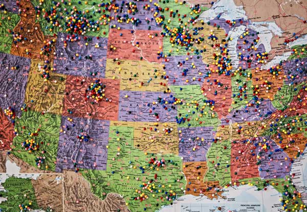
“Addresses are created by local address authorities in city, county, and tribal agencies,” explained NSGIC Executive Director Molly Schar. “The data support delivery of services like utilities and emergency response, so getting it right is absolutely critical. NSGIC advocates the process of rolling up local address point records to the state to aggregate and then to the national level to save lives, reduce costs, avoid duplication, increase revenues, improve service and foster efficient and effective government.”
The roll-up process is at the heart of an effort led by the U.S. Department of Transportation and supported by NSGIC to develop a National Address Database. Only 23 states have provided statewide address data to the national database, with five states providing partial data, and three states in the queue.
For this publication, NSGIC tapped state geospatial information officers in Kansas, Massachusetts, Minnesota, New Mexico, New York, Utah and Vermont to identify key factors to the successful organization and coordination necessary to create and maintain strong address programs. These honor roll states scored in the top of the country in the area of address data in NSGIC’s 2019 Geospatial Maturity Assessment (GMA).
NSGIC recently finalized an interactive GMA geospatial web map application with dashboards customized for each data theme allows users to take a deeper dive into the 2019 results, interacting with individual state and collective national results to bring to life the visual patterns and trends in the data.
Geospatial data dashboards have become much more familiar to the public in recent months as most states and municipalities have adopted the interactive platforms to transparently display coronavirus information.
Launched in 2009 to document geospatial development practices and uses, the GMA has provided a biennial snapshot of each state’s geospatial maturity. Inspired by the National Spatial Data Infrastructure theme grading undertaken by the Coalition of Geospatial Organizations (of which NSGIC is a founding member), an entirely new process was developed for the 2019 GMA.
Nine-grade “report cards” were produced for individual state spatial data infrastructures and state geospatial coordination, in addition to overall theme and topical analysis.
Over the next 18 months, additional focused guidance will be issued in the areas of overall statewide coordination and the key datasets for next generation 9-1-1, transportation, parcels, hydrography, elevation, and orthoimagery.
“Collaboration, transparency, and increased efficiency in government are hallmarks of mature state GIS programs,” Schar said. “Through the Geospatial Maturity Assessment research and products, NSGIC is helping states set goals, identify opportunities for collaboration, shine a light on areas requiring attention, and build resources.”
The National States Geographic Information Council (NSGIC) has released a joint statement on the value of GIS during the COVID-19 pandemic, alongside its partners the MidAmerica GIS Consortium (MAGIC), Open Geospatial Consortium (OGC), Urban and Regional Information Systems Association (URISA), and American Association of Geographers (AAG).
Joint Statement on the Value of GIS in the Pandemic
The spread and effects of COVID-19 can be best understood considering space and time.
As governments are responding to COVID-19, more leaders are recognizing the value of “knowing the where.” The importance of knowing where the outbreak is growing, where high risk populations are, where the hospital beds and important medical resources are, and where to deploy resources is essential. “Knowing the where” informs better decision-making.
In an effort to better understand the where, governments are recognizing the value of geospatial information and technologies and are engaging geospatial professionals to help them better understand the where to help them in their decision-making and response.
Geospatial professionals bring unique analytical and visualization skills to the table that help responders and decision-makers visualize where the pandemic is spreading more quickly and can make the important decisions regarding where response and resource needs need to be focused. The value of telling the story through a map coupled with a geospatial dashboard provides a view of the event not readily seen in a table such as a spreadsheet.
Beyond visualizing existing data, we can connect data from a location perspective, which enhances the value of the data sources being integrated. Equally important in this event is data on COVID-19 cases and testing packaged and shared in a way useful to scientists.
GIS (geographic information systems) is experiencing an unprecedented level of use. Historically, GIS was deployed following a disaster to help respond and recover. Today, GIS is used as a disaster is unfolding. The COVID-19 event is an outstanding example of how effective GIS is when robust data is available. Governments are realizing the value of investing in these systems and the people who run them.
The information necessary to empower all partners already exists.
Current nationwide models and response efforts may not benefit from the details of local geographic parameters. Local or statewide models and response efforts may not fully take advantage of the data from other areas of the country. Hospitals are surveyed by both federal and state agencies, and the results of those surveys are not readily available to the hospitals working together to care for patients. Nationwide geospatial data will empower a coalition of participants with a better understanding of the spread and impacts of COVID-19 and improve mitigation actions.
The same data can be made available in different forms to empower people playing different roles in the response. Researchers — epidemiologists — will benefit from nationwide COVID-19 testing data and data describing factors impacting the spread. This data needs to be as disaggregated as permissible under HIPAA and in a form readily digestible in models.
The case data could be aggregated to the same units of geography as a wealth of existing demographic data (Census tracts), which could explain and quantify local variances in the spread. Policy makers and those in emergency management can benefit from map and tabular dashboards, harnessing the power of the where by integrating data for analytics.
The emergency response, public health and geospatial communities must come together to understand COVID-19 in the U.S. and mitigate its spread and overall impact.
By geo-enabling public health and emergency response data, we can better:
understand the spread — with COVID case data, movements of people, and symptoms
understand the impact on individuals — with data including age, disease, obesity, and medical treatments
understand how to tailor outreach — by age, language, engagement with government, and lifestyle choices
understand the needs of the healthcare industry — by facility, day, bed capacity, type of care, ventilators, and PPE
understand the impact on the local economy — by county, day, unemployment, and bankruptcies
understand the societal impacts — by census tract, domestic violence, alcohol consumption, child abuse, animal abuse, elder abuse, mental health crises, 3-1-1 calls and firearm sales
We are committed to beginning the national conversation about leveraging the best available data to better understand the spread and impacts of COVID-19.
The National States Geographic Information Council (NSGIC) has released a joint statement on the value of GIS in the pandemic, alongside its partners the MidAmerica GIS Consortium (MAGIC), Open Geospatial Consortium (OGC), Urban and Regional Information Systems Association (URISA), and American Association of Geographers (AAG).
Joint Statement on the Value of GIS in the Pandemic
The spread and effects of COVID-19 can be best understood considering space and time.
As governments are responding to COVID-19, more leaders are recognizing the value of “knowing the where.” The importance of knowing where the outbreak is growing, where high risk populations are, where the hospital beds and important medical resources are, and where to deploy resources is essential. “Knowing the where” informs better decision-making.
In an effort to better understand the where, governments are recognizing the value of geospatial information and technologies and are engaging geospatial professionals to help them better understand the where to help them in their decision-making and response.
Geospatial professionals bring unique analytical and visualization skills to the table that help responders and decision-makers visualize where the pandemic is spreading more quickly and can make the important decisions regarding where response and resource needs need to be focused. The value of telling the story through a map coupled with a geospatial dashboard provides a view of the event not readily seen in a table such as a spreadsheet.
Beyond visualizing existing data, we can connect data from a location perspective, which enhances the value of the data sources being integrated. Equally important in this event is data on COVID-19 cases and testing packaged and shared in a way useful to scientists.
GIS (geographic information systems) is experiencing an unprecedented level of use. Historically, GIS was deployed following a disaster to help respond and recover. Today, GIS is used as a disaster is unfolding. The COVID-19 event is an outstanding example of how effective GIS is when robust data is available. Governments are realizing the value of investing in these systems and the people who run them.
The information necessary to empower all partners already exists.
Current nationwide models and response efforts may not benefit from the details of local geographic parameters. Local or statewide models and response efforts may not fully take advantage of the data from other areas of the country. Hospitals are surveyed by both federal and state agencies, and the results of those surveys are not readily available to the hospitals working together to care for patients. Nationwide geospatial data will empower a coalition of participants with a better understanding of the spread and impacts of COVID-19 and improve mitigation actions.
The same data can be made available in different forms to empower people playing different roles in the response. Researchers — epidemiologists — will benefit from nationwide COVID-19 testing data and data describing factors impacting the spread. This data needs to be as disaggregated as permissible under HIPAA and in a form readily digestible in models.
The case data could be aggregated to the same units of geography as a wealth of existing demographic data (Census tracts), which could explain and quantify local variances in the spread. Policy makers and those in emergency management can benefit from map and tabular dashboards, harnessing the power of the where by integrating data for analytics.
The emergency response, public health and geospatial communities must come together to understand COVID-19 in the U.S. and mitigate its spread and overall impact.
By geo-enabling public health and emergency response data, we can better:
understand the spread — with COVID case data, movements of people, and symptoms
understand the impact on individuals — with data including age, disease, obesity, and medical treatments
understand how to tailor outreach — by age, language, engagement with government, and lifestyle choices
understand the needs of the healthcare industry — by facility, day, bed capacity, type of care, ventilators, and PPE
understand the impact on the local economy — by county, day, unemployment, and bankruptcies
understand the societal impacts — by census tract, domestic violence, alcohol consumption, child abuse, animal abuse, elder abuse, mental health crises, 3-1-1 calls and firearm sales
We are committed to beginning the national conversation about leveraging the best available data to better understand the spread and impacts of COVID-19.
The funding enables continuation of a national effort by state government geospatial information officers and coordinators to work with other state agencies, local elections officials and state elections offices, national GIS (geographic information system) and elections organizations, and federal partners to identify opportunities to leverage this powerful technology to strengthen elections management and citizen engagement.
“As an organization made up of GIS leaders in state government, NSGIC is uniquely positioned to leverage the innovative work of states to use GIS for elections data,” said Molly Schar, NSGIC executive director. “We have enlisted those innovators to contribute and advise throughout the project. Collaboration has been key to the success of the project. Relationships built in the first phase of the project will be invaluable to the work of the second phase as the project seeks to increase engagement and, ultimately, impact.”
Two more years. The Geo-Enabled Elections project was launched in October 2017 and will now continue for an additional two years. The project aims to help strengthen electoral systems by supporting states in the adoption of GIS.
In practical terms, this means encouraging state governments to replace non-spatial address-file systems with election precinct and voter data in a GIS format, leveraging that format’s inherent visual and analytical advantages.
With its second phase, the project turns to focus on working hands-on with up to 10 more states through the pilot program, developing a curriculum for elections officials on foundations of GIS in elections, increasing awareness of the benefits of geo-enabling elections systems among elections stakeholders, and developing policy guidance and advocacy tools to support integration of GIS in elections.
“Accurate boundary lines and efficient voter placement are the building blocks of our elections and are tantamount to the integrity of the democratic process,” said Tammy Patrick, senior advisor at Democracy Fund Voice. “Democracy Fund Voice is a proud sponsor of efforts such as NSGIC Geo-Enabled Elections as a way to further ensure that the American electorate is well served.”
A report of the work done in the first phase of the project is now available.
Accomplishments in the first two years include:
developing an inventory of state implementations of GIS-based elections systems
giving workshops and presentations at national conferences
publishing detailed reports sharing the state of GIS in elections from the perspective of election officials and state GIS leaders
five pilot and case studies
development of a best-practices guide (both in detail and brief versions) was developed
Also, an inaugural Elections GeoSummit in August convened stakeholders from the national, state, and local levels to discuss best practices for geo-enabling elections in the United States.
These documents and other important resources can be found in a PDF format on the NSGIC website.
United States’ election directors are interested, but “less than halfway,” in terms of implementing GIS to strengthen the nation’s electoral system
The National States Geographic Information Council (NSGIC) has released its findings from its first survey of state election directors, seeking to determine the current status of the implementation of GIS in elections.
A number of states have championed the use of this technology in recent years to strengthen the accuracy and reliability of their electoral systems. NSGIC’s Geo-Enabled Elections project was created to assist states and other election authorities in this process.
According to the new Election Director Report, state election directors indicate knowledge and interest in GIS technology. However, the report’s findings also suggest that most states have a long way to go to fully utilize geospatial information in elections.
Do you have access to GIS maps and shapefiles for each of your voting districts from a government source? (Image: NSGIC)
Five out of six election directors interviewed stated that they are familiar with GIS and have access to a GIS expert. However, fewer than one in three could say with confidence that their voter registration system is capable of supporting GIS data.
Moreover, when asked to assess their state’s degree of progress towards full integration of geospatial data in elections, the answer was four, on average, on a scale from 1 to 10, where 10 represented full GIS integration.
“We’re very encouraged by the interest and enthusiasm we’ve encountered among election directors,” said Molly Schar, NSGIC executive director. “Few state election offices in the United States are fully GIS integrated. However, election directors, on the whole, are motivated to deploy the technology to increase accuracy and gain efficiencies in their election data management processes.”
Why does using geospatial data offer a critical advantage to electoral systems? In short, it ensures that the right ballot is given to the right voter so that voters’ voices are heard in the right electoral contests. Recently, some well-publicized errors in voter placement have undermined the reliability of election results and may have hurt voter confidence.
Additionally, replacing cumbersome voter lists and verbal definitions of voting districts with technology that allows election officials to view voters as pinpoints on a map — and voting district boundaries as geometrical shapes that surround those pinpoints — offers some very concrete advantages.
The verification that voters have, in fact, been placed into the right voting district becomes much easier, as does quality control — both as part of a periodic review and after significant changes, such as the modification of voting district boundaries.
Currently, many states use GIS technology for other matters, such as emergency response systems, land use, or utility management, and often have a Geographic Information Officer (GIO) within state government. Part of the Geo-Enabled Elections project’s mission is to promote a stronger dialogue between GIOs and election directors in state government.
The project’s next steps for furthering the use of GIS in elections include six case studies from states already using GIS in elections, as well as five state-wide pilot studies among states working to expand their GIS integration, with the goal of delivering a set of best practices to support states wishing to start the process towards full GIS integration.
The Geo-Enabled Elections project, phase one, runs from Oct. 1, 2017, to Sept. 30, 2019, with the aim to help strengthen electoral systems by supporting states in the adoption of GIS. Concretely, this means encouraging state governments to replace non-spatial ‘address file’ systems with election precinct and voter data in a GIS format, leveraging that format’s inherent visual and analytical advantages.
Includes first draft of best practices for implementing GIS in elections.
Photo: iStock.com/YinYang
The National States Geographic Information Council (NSGIC) has released the first-year report of phase one of its Geo-Enabled Elections project, highlighting the project’s accomplishments in the first 12 months. These include completing a baseline assessment of how far states have come, to date, in terms of integrating geographic information systems (GIS) with electoral systems, as well as assembling a team of leaders and experts to help guide the project.
The project team has also facilitated conversations with a wide range of stakeholder groups, aimed at raising awareness of the importance of using geospatial technology to increase reliability and accuracy in elections.
The Geo-Enabled Elections project, phase one, runs from Oct. 1, 2017, to Sept. 30, 2019, with the aim to help strengthen electoral systems by supporting states in the adoption of GIS. Concretely, this means encouraging state governments to replace non-spatial “address file” systems with election precinct and voter data in a GIS format, leveraging that format’s inherent visual and analytical advantages.
The Geo-Enabled Elections project is partly funded by the bipartisan Democracy Fund Voice.
“During this first year, we’ve been encouraged to learn that while most voter data across the country is still kept in ‘address file’ tables, many state election directors are interested in the benefits that GIS can bring. Additionally, since most state governments have a geographic information officer (GIO) or equivalent on staff, the prospects for strengthening elections through the integration of GIS into electoral systems are very good,” said Dan Ross, NSGIC president and GIO for the State of Minnesota.
As part of the Geo-Enabled Elections project, NSGIC has been able to help build stronger connections between state officials responsible for the electoral system and state-level GIS subject matter experts, a critical first step towards the successful implementation of GIS in elections.
The organization, which is quickly becoming recognized as the center of expertise for how GIS can be deployed to strengthen electoral systems, also released the first draft of its best practices for how states may go about enhancing election accuracy using GIS. The five identified best practices are:
Convene a team of specialists
Collect and sustain a statewide voting unit GIS layer
Adopt and implement a statewide geocoding strategy
Assemble and provide best Available contextual GIS layers
Define and implement data validation processes
These draft best practices will be put to the test and further refined in five state-wide pilot studies taking place during the project’s second year. The best practices can be viewed in full as part of the first-year report.
NSGIC’s report also outlines the work that lies ahead for the project, as well as opportunities to impact geo-enabled elections in phase two of the project (pending funding).
“The benefits of geospatial technology are truly untold. However, when our federal agencies use geospatial data, different agencies can acquire duplicative information and waste precious taxpayer resources in the process. I am glad House leadership listened to industry stakeholders and included the Geospatial Data Act in the FAA Reauthorization Bill of 2018. This will streamline the collection of this data across the federal government while saving money, improving information accuracy, and providing a more modern system for collecting and sharing geospatial data.”
— Rep. Bruce Westerman, Arizona, introducing the Geospatial Data Act to the House of Representatives, 115th Congress
On Oct. 3, I was at a crowded after-hours event with friends in Washington, D.C., standing in a darkened corner of the room where I could both see and hear the speaker. A man approached me, a featureless silhouette in the dark tapping me on the shoulder. He introduced himself as an employee of the U.S. Geological Survey, and said he heard I was with the Federal Aviation Administration.
He asked if I knew anything about the FAA Reauthorization Bill because it had language from the Geospatial Data Act in it. His mention was the first I had heard of it. It came as a surprise. I expected a few passages from the Bill but nothing more; and, in fact, I did not expect it to even come up for a vote this year because of the divisive political atmosphere.
Two days later, on Friday, Oct. 5, President Donald Trump, along with 11 high ranking officials, signed the FAA Reauthorization Bill into law with overwhelming support. The Senate passed it 93-6, and the House passed it 398-23. The bipartisanship of this bill should have made the news – both sides of the contentious isles coming together to pass so important a piece of legislation. It happened without fanfare or recognition aside from certain circles, but within H.R. 302 was contained the entire Geospatial Data Act 2018.
An email from the Maryland State Geographic Information Committee (MSGIC) alerted me. Not even the FAA sent an email praising the aspects of the bill beyond what immediately applied to the FAA. If the stranger from USGS had not forewarned me I would not have been keen to the press release and overlooked its significance.
Most people are unaware that the Geospatial Data Act (GDA) is now law. Even fewer realize that the GDA applies not only to the FAA, but to all government agencies except for the Department of Defense and the intelligence community.
The Long and Winding Road of the Geospatial Data Act
Attempts at creating a unifying federal geospatial policy can be traced to shortly after the Civil War. There was no powerful, central, national unifying authority before then. The states were sovereign entities with their own maps, and place names did not have to be agreed upon between states.
This is visible today in the names of Civil War battles, many of which are named differently by each warring side; for example, the bloody Battle of Antietam is the same as the Battle of Sharpsburg, and the Battle of Bull Run is the same as the Battle of Manassas. Upon those hallowed grounds so many died that the dual names exist because they were paid for in blood.
War drives the need for intelligence. Geography is of paramount importance for generals. The 1860s was a boom time for surveyors and cartographers because of the Civil War and the American Indian Wars.
Additionally, in the 1860s Alaska was purchased from Russia and America built the first transcontinental railroad. Those geopolitical events changed the country, and the government needed to inventory the emerging nation.
Many companies were employed to do the work, but they were not coordinated, costing excess amounts of money. This prompted the establishment of the United States Geological Survey (USGS) in 1879 to oversee the survey companies.
Roosevelt on a digging machine during construction of the Panama Canal, circa 1908. (Photo: Library of Congress, Prints and Photographs Division)
Problems were identified among the many maps created. Place names and spelling changed from map to map. The country needed a coordinated effort to deal with these discrepancies. President Benjamin Harrison addressed this with Executive Order 28 (27-A) in 1890, establishing the Board of Geographic Names.
In 1906, during the middle of building the Panama Canal, President Theodore Roosevelt — who had direct experience with survey and mapping companies — signed Executive Order 493 renaming the Board of Geographic Names to the U.S. Geographic Board and adding to its purpose reducing duplicative survey and mapping efforts.
In 1956 the National Interstate and Defense Highways Bill was signed, beginning the interstate network we enjoy today. Building the interstates was a huge expense, and like before, many survey companies were involved. Anticipating these challenges in 1953 President Eisenhower, the Office of Management and Budget wrote Circular A-16, which identified better coordination acquiring geographic information and reducing duplicate efforts as ways to reduce costs and improve efficiency.
In 1990 during the months leading up to Gulf War I, which showed geospatial precision’s awesome power and forever changed the face of war, also brought changes to OMB Circular A-16 for more domestic purposes. The circular was revised, reflecting the influence of the digital era and establishing the Federal Geographic Data Committee (FGDC) to promote the coordination of geospatial data.
Recognizing the importance of geospatial information systems (GIS), on April 11, 1994, President Clinton signed Executive Order 12906: Coordinating Geographic Data Acquisition and Access: The National Spatial Data Infrastructure (NSDI). The executive branch continued to lead the government’s efforts to advance a unified geospatial policy.
When 9/11 Happened
Seven years later, in June 2001, Congress attempted to pass its first federal geospatial policy, but Sept. 11 changed everything. The greatest terrorist attack in U.S. history made everything else pale by comparison. National security and intelligence became the focus.
Congress tried again in 2003, the same year the National Imagery and Mapping Agency (NIMA) changed its name to the National Geospatial Intelligence Agency (NGA), but Gulf War II and the Global War on Terrorism stole center stage.
In 2005, Congress tried again, but to no avail. The bill changed names several times. The contents evolved. Attempts to introduce the bill went dormant until 2012 when it stalled again without support. Proponents continued reintroducing the bill under various names in 2013, 2014 and 2015.
In 2015 it made a second debut with the name Geospatial Data Act (GDA) and maintained that name going forward. The GDA was reintroduced in 2016, twice in 2017 and again in 2018. In total, the bill was introduced more than a dozen times since 2001. Finally, 139 years since the founding of USGS, a federal geospatial policy is now the law of the land.
You Have an Opportunity
“This legislation will significantly address how location intelligence is organized and disseminated and will foster continued strength in our industry’s partnership with government users.” — Jack Dangermond, Esri founder and CEO
It takes courageous leadership to get legislation passed. We can all breathe a sigh of relief. This great “tech-tonic” shift happened during our working lives. We can all say we were there when the world changed. This is a golden opportunity. Knowledge is power; however, knowledge is only potential power — real power is action. Step up, volunteer, and lead the change. Your agency needs you. The country needs you. Don’t let this opportunity pass you by.
Your first step is to read the Geospatial Data Act 2018 contained within the FAA Reauthorization Act, Title VII, Subtitle F: Geospatial Data, Sections 751-759. Become familiar with the GDA. Learn who the points of contact are for your agency. Make yourself known. Be a leader. When others see chaos, leaders see opportunity.
Economic Impact of the Geospatial Data Act 2018
“The economic benefits of smart infrastructure investment are long-term competitiveness, productivity, innovation, lower prices, and higher incomes, while infrastructure investment also creates many thousands of American jobs in the near-term.”
— White House, National Economic Council and the President’s Council of Economic Advisers, July 2014
Since Roger Tomlinson first created a geographic information system in the 1960s, GIS has become a multi-billion dollar global industry. By 2020, it is forecast to be nearly a half-trillion dollars annually. The global GIS market is expected to double in seven years.
GeoBuiz estimates that GIS influences 20 percent the world’s entire $80.7 trillion global annual production. According to the Countries Geospatial Readiness Index, the United States leads the world in GIS. What is amazing is that all these estimates were made prior to the passage of the GDA — the gale force winds that have thus far blown will soon become a hurricane.
The sweet spot of opportunity is the forward edge of a growing industry. In the mid-90, the growth of the geospatial industry was led by state and local government (See GeoIntelligence Insider: In Jack Maple’s Steps – Fighting Crime with GIS, May 2018). In the mid-2000s, growth accelerated due to the intelligence and military communities. The next big boom in GIS begins now as the federal government complies with the GDA. There will be an even longer growth trend internationally as other countries make their own conversions.
It is a common adage that forecasts usually overestimate the near term and underestimate the long-term, especially in regard to technology. Consider how one man’s idea to sell books online in 1995 made him the wealthiest man in the world 23 years later, or how a simple search engine in 1998 is now a global behemoth. Of course, those references are to Jeff Bezos of Amazon and to Google.
And, consider the impact GPS has made since May 1, 2000, when President Clinton discontinued Selective Availability, opening GPS to the masses. Four years later, in June 2005, Google Earth was launched. The iPhone came out two years later. Then, a year later, Google Maps with real-time navigation was released.
Businesses like Uber that depend on GPS and GIS began in 2012. Now, industries such as drones and autonomous vehicles are on the verge of exponential growth.
Apply a similar trajectory to GIS and combine it with smart technologies like the internet of things (IoT), open data, data science, artificial intelligence, augmented reality, and other emerging technologies and the growth potential is unprecedented, not to mention the infrastructure rebuild of America about to take place.
An Economic Analysis of Transportation Infrastructure Investment – White House, July 2014, National Economic Council and the President’s Council of Economic Advisers. (Image: WhiteHouse.gov)
Smart technologies will play a huge role in rebuilding the United States infrastructure like sensors, advanced materials, self-aware neural networks, IoT devices, energy recapture systems, smart lighting, and more; many such technologies will be connected geospatially.
This will require an advanced 3D Smart Grid Reference System (3D SGRS), a term I coined in 2015 when I worked at the Department of Transportation and began developing a crowdsource application for the National Address Database. I saw it becoming the framework for a 3D SGRS, enabling pinpoint accuracy of locations in X-Y-Z.
I can cover the 3D SGRS in a future article. I write about it here because it will be required in order to modernize America’s infrastructure.
Before passing any infrastructure bills, it is necessary to have a sound geospatial policy to avoid the misspending identified by the previous administrations mentioned earlier. The GDA, in essence, is the first step to modernize America. A brief overview of proposals sitting before Congress is an indicator of the economic tsunami about to be unleashed now that the GDA has been established.
Legislation has been introduced for establishing infrastructure bonds and banks for investing in infrastructure projects. Individual bills are for railroads, land, air, and sea ports; intermodal freight transfer stations, highways, critical infrastructure, rural development and stormwater systems, including water retention ponds and reservoirs that make up a large part of city and suburban green space. There are bills to fund pollution prevention programs.
Infrastructure cybersecurity is also addressed. There are bills for job creation, including employing disabled veterans in transportation. There is even a bill for proclaiming a National Infrastructure Week.
Once these legislative efforts begin getting passed, a tsunami of economic growth will be released unlike few alive have ever seen.
The Geospatial Data Act – A Matter of Necessity
“The Geospatial Data Act will save taxpayer dollars, increase government efficiency, and unlock innovation in the public and private sectors.” — Congressman Seth Moulton, Massachusetts, co-signer of the Geospatial Data Act to the House of Representatives, 115th Congress
Rebuilding America is one of the boldest, grandest and costliest undertakings the country has seen. Being one of the costliest, one has to ask where the money is going to come from.
The GDA will create entrepreneurs, new products and services, and job growth, which will generate revenue. Many infrastructure-related bills have tax incentives built into them. Money will come from the economic restructuring of trade deals currently taking place with many of the United States’ trading partners. Money will also come from America’s oil and gas renaissance.
Outline of the Geospatial Data Act 2018
This article put the Geospatial Data Act into context, but it would not be complete if it did not at least outline the major provisions of the new law.
These are the primary tenets of the GDA:
It establishes the Federal Geographic Data Committee (FGDC)
It establishes the National Geospatial Advisory Committee (NGAC)
It establishes the National Spatial Data Infrastructure (NSDI)
It establishes the National Spatial Data Asset data themes (NSDI-dt)
It establishes GeoPlatform as the clearinghouse for geospatial data
It sets Geospatial Data Standards.
Senator Orrin Hatch, who introduced the bill to the Senate four times since 2015, called it, “…a good-governance bill that will bring structure and Congressional oversight to federal geospatial data spending, accounting, and usage. The GDA will:
Dramatically reduce duplicative spending and, according to the Government Accountability Office, save the federal government billions of dollars;
Bolster federal emergency response capabilities by enabling smarter, more efficient disaster relief;
Improve infrastructure planning nationwide by providing state and local governments with access to higher-quality, more robust data.
The bill is supported by over 65 universities, industry groups, trade associations, companies, and state and local stakeholders, including the National Association of Counties and National League of Cities.”
Some of the stakeholders Sen. Hatch referred to are Bert Granberg, president of the National States Geographic Information Council (NSGIC), who stated, “From transportation, to natural resources, to homeland security, map-based digital information has quietly become mission critical to how work gets done and to future economic growth. We need an efficiency and accountability framework to build, sustain and share geographic data assets for the entire nation. The GDA delivers just that, and our members appreciate Representative Westerman’s leadership.”
Molly Schar, executive director of NSGIC, shared her thoughts, saying, “The Geospatial Data Act has been a top legislative priority for NSGIC for several years. We have worked with state governments, Congressional offices, federal agencies, and many other stakeholder groups committed to building more resilient communities by ensuring they will have access to the consistent high-quality data they need to do their jobs,”
And, after the bill’s passage she proclaimed, “It was a big win for the entire geospatial community and quite a team effort!”
For more information
This report has given you the background and the context of the Geospatial Data Act. To become intimately familiar with the GDA, I highly recommend reading the Congressional Research Service Report about GDA 2018, released Oct. 22.
A voter enters a polling place. (Image: iStock.com/YinYang)
With the mid-term elections coming ever nearer, states are turning to geographic information systems (GIS) to help manage them.
Digital geographic representation of precinct boundaries within a GIS allow for transparency and ease of use for voters, candidates and electoral management, according to the National States Geographic Information Council (NSGIC).
GIS also enables the optimal siting of polling places for both voter access and the cost efficiency of operating polls.
Finally, GIS provides a platform for automated quality-control processes that ensure accurate voter precinct assignments.
“An electoral system with integrity — enhanced by accurate, authoritative geographic data and presented clearly and transparently — has never been more important,” said NSGIC President Andy Rowan.
Why GIS is an improvement over address files
NSGIC’s Geo-Enabled Elections project brings together geographic information systems (GIS) leaders in state government, local elections officials and state elections offices, national GIS and elections organizations, and federal partners to identify opportunities to integrate GIS into elections systems across the country.
The overall goal is to strengthen elections management and citizen engagement. The project aims to provide the impetus for replacing non-spatial “address file” tables with the visual and analytical advantages of election precinct and voter data in a natively GIS format.
Geo-enabled elections overcome the four fundamental challenges with the existing address list approach to precinct management, according to Rowan.
In the address list approach, Rowan said,
No actual boundaries are stored explicitly in the systems,
Quality control is difficult without a method to visualize precinct assignment using aerial photography and boundary information that can change frequently,
There is no efficient method for applying large-scale precinct boundary updates, and
The process is usually not aligned efficiently with other state and local address or boundary-management processes.
To this end, the project conducted a nationwide survey on elections data in the first half of this year. More than two-thirds of states responded.
Here are key takeaways from the baseline survey.
Addresses
The survey found that 55 percent of responding states confirm voter registration addresses against a database of known addresses such as a driver’s license or state ID database, a statewide point address set, a master address database used for 911 call routing, or a commercially available address database.
“The results indicate a need to advocate for coordination between state agencies (such as the state elections department and the department of motor vehicles) and encourage integration of the voting system and other systems,” said Jamie Chesser, the Geo-Enabled Elections project manager.
Election Precincts
More than half of responding states indicated they maintain statewide mapping of precincts. Within this group, 40 percent also maintain a layer of sub-precincts in digital mapping systems.
“There remains a need to develop local precinct data content and procedural standards to examine the relationship between precincts, local and state boundaries, and residential structures,” Chesser said.
Other Data
In all, 82 percent of states keep up-to-date spatial data of city and county boundaries, which is essential for computer-based mapping of precincts.
“Statewide spatial data — especially city, county, school, and special district boundaries – are essential to mapping precinct boundaries across the state,” Chesser said. “The survey reflected, however, that accuracy of current city and county boundary mapping varies
considerably.”
A substantial majority, 79 percent of respondents, confirm their mapping of state-level district-based elected offices are accessible online in a digital mapping format.
Survey responses were coordinated by state government representatives who focus on the development and deployment of mapping data and systems across state agencies and local governments.
Later this year, NSGIC will release the results of a study probing the spatial approach to elections management from the perspective of state elections officials.
The two-year Geo-Enabled Elections project, underwritten by the bipartisan Democracy Fund Voice, convenes a wide variety of stakeholders to explore ways geographic information systems and related processes can enhance elections management and citizen engagement across the U.S.

 A report issued by the National States Geographic Information Council (NSGIC) targets a key dataset for state governments. “Best Practices for State Geospatial Maturity: Addresses” is available now.