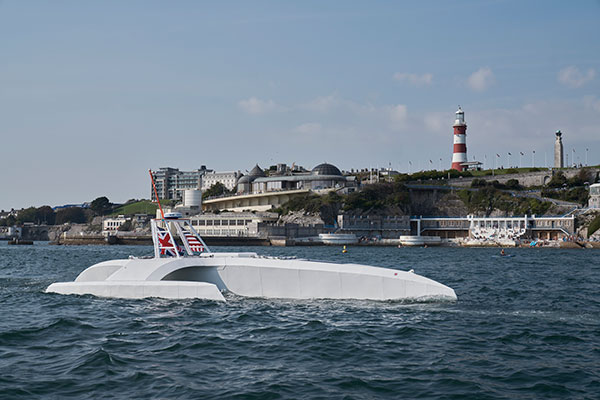
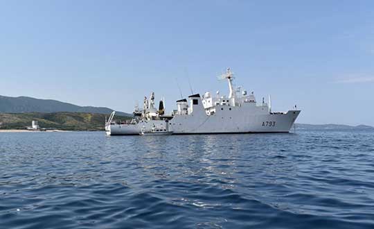
Tag: oceanography

  • Seabed 2030 and Kongsberg Maritime to map ocean floor

    Seabed 2030 and Kongsberg Maritime to map ocean floor

    Seabed 2030 logoThe Nippon Foundation-GEBCO Seabed 2030 Project and Kongsberg Maritime have entered a memorandum of understanding (MOU) in support of the global initiative to produce the complete map of the ocean floor. Under the terms of the MOU, the two parties will work together to advance understanding of ocean bathymetry. The effort complements the goals of the United Nations Decade of Ocean Science for Sustainable Development.

    Seabed 2030 is a collaborative project between The Nippon Foundation and GEBCO to inspire the complete mapping of the world’s ocean by 2030 and to compile all bathymetric data into the freely available GEBCO Ocean Map. GEBCO is a joint project of the International Hydrographic Organization (IHO) and the Intergovernmental Oceanographic Commission (IOC) and is the only organization with a mandate to map the entire ocean floor.

    Kongsberg Maritime provides solutions for safe, efficient, and sustainable maritime operations. The solutions are suitable for offshore energies, seaborne transportation, hydrography, science, navy, coastal marine, aquaculture, training services and more. Kongsberg Maritime is the largest business area within Kongsberg Gruppen ASA. The Group has an integrated portfolio of solutions for businesses, partners and nations operating from the depths of the sea to outer space and to the digital frontier.

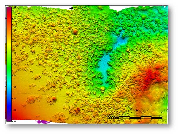
    All data collected and shared with the Seabed 2030 Project is included in the GEBCO global grid, which is free and publicly available.

    The Nippon Foundation-GEBCO Seabed 2030 Project is a collaborative project between The Nippon Foundation and GEBCO. The Seabed 2030 Project, launched at the United Nations Ocean Conference in 2017 by Chairman Sasakawa of The Nippon Foundation, coordinates and oversees the sourcing and compilation of bathymetric data from different parts of the world’s ocean through its five centers into the freely-available GEBCO Grid.

    Kongsberg Maritime is a global marine technology company providing technology solutions for all marine industry sectors including merchant, offshore, cruise, subsea and naval.

  • New autonomous Mayflower launches from Plymouth to gather ocean data

    New autonomous Mayflower launches from Plymouth to gather ocean data

    Photo: Tom Barnes for IBM
    Photo: Tom Barnes for IBM

    An autonomous ship launched Sept. 16 on a mission to traverse oceans and gather vital environmental data, guided by GNSS and inertial measurement units (IMUs).

    Ocean research non-profit ProMare joined with IBM on the Mayflower Autonomous Ship (MAS) — an artificial intelligence (AI) and solar-powered marine research vessel. Following two years of design, construction and training of its AI models, the fully-autonomous trimaran was launched from Plymouth, England.

    The ship is guided by both GNSS and IMU technology. It uses two Hexagon | Veripos LD8 receivers, each with two V560 marine antennas. The onboard IMUs include an iXBlue Octans and two Silicon Sensing AMU30s.

    Designed to provide a safe, flexible and cost-effective way of gathering data about the ocean, the new-generation Mayflower promises to transform oceanography by working in tandem with scientists and other autonomous vessels to help understand critical issues such as global warming, micro-plastic pollution and marine mammal conservation.

    ProMare is coordinating the scientific studie,s working with IBM Research and leading scientific organizations.

    MAS features an AI captain built by ProMare and IBM developers that gives MAS the ability to sense, think and make decisions at sea with no human captain or onboard crew. The new class of marine AI is underpinned by IBM’s latest advanced edge computing systems, automation software, computer vision technology and Red Hat Open Source software.

    “Able to scan the horizon for possible hazards, make informed decisions and change its course based on a fusion of live data, the Mayflower Autonomous Ship has more in common with a modern bank than its 17th century namesake,” said Andy Stanford-Clark, Chief Technology Officer, IBM UK & Ireland. “With its ability to keep running in the face of the most challenging conditions, this small ship is a microcosm for every aspiring 21st century business.”

    Photo:
    Artie — short for Artemis and artificial Intelligence — is a stowaway hitching a ride on the Mayflower who answers questions about the ship, the ocean or himself on mas400.com. (Photo: IBM)

    Interactive web portal follows voyage

    To enable followers around the world to stay updated with MAS as it undertakes its various missions, IBM and ProMare have also launched an interactive web portal. Built by IBM iX (the business design arm of IBM Services), the MAS400 portal is designed to provide real-time updates about the ship’s location, environmental conditions and data from its various research projects.

    Live weather data is streamed from IBM’s The Weather Company, as MAS receives forecast data and insight from the new IBM Weather Operations Center.

    ‘Octopus’ aboard answers questions

    The portal even features a seven-armed, stowaway octopus chatbot called Artie, who claims to be hitching a ride on the ship. (With seven arms, he’s technically a septopus.) Powered by IBM Watson Assistant technology and created in partnership with European startup Chatbotbay, Artie has been trained to provide information about MAS and its adventures in a lively, and accessible format.

    “MAS400.com is one of the most advanced ocean mission web portals ever built,” says Fredrik Soreide, Scientific Director of the Mayflower Autonomous Ship project and Board Member of ProMare. “Protecting the ocean depends on our ability to engage the public in important matters affecting its health. This MAS400 portal is designed to do exactly that and tell people where the ship is, what speed it’s travelling at, what conditions it’s operating in and what science we are conducting. Users can even help Artie the Octopus fish out surgical masks, cigarette butts and other increasingly common forms of ocean litter from a virtual ocean of facts and data.”

    MAS will spend the next six months in sea trials and undertake various research missions and voyages before attempting to cross the Atlantic in Spring 2021. MAS’s transatlantic voyage will be based on a similar route and pioneering spirit to the 1620 Mayflower which made the same crossing 400 years ago.

  • French hydro office selects SBG Systems for inertial fleet

    French hydro office selects SBG Systems for inertial fleet

    Shom, the French national hydrographic and oceanographic office, selected SBG Systems’ inertial navigation systems to renew its fleet.

    The office chose the Navsight Apogee inertial navigation systems (INS) for its speedboats and survey vessels for both shallow and deep-water real-time bathymetric surveys and Qinertia PPK software for post-processing tasks.

    As a public institution, Shom (Service hydrographique et océanographique de la marine) has three major objectives: national hydrography and cartography, defense support in hydro-oceanographic fields, and support in maritime geospatial products and services for public policies on the sea and the coast.

    Shom’s fleet is based in Brest. It is composed of eleven boats, including seven speedboats, and three 59-meter long BH2 survey vessels. They operate on shallow and deep water in France, Africa, the Indian Ocean and in the Caribbean Sea. Shom also uses a fleet based in New Caledonia composed of two boats, one speedboat and a buoy-laying vessel used part of the time for hydrographic surveys.

    French agency Shom's survey vessel. (Photo: Shom)
    French agency Shom’s survey vessel. (Photo: Shom)

    Renewing the fleet. When it came to renewing the fleet’s INS, Shom looked at INS complying with standards set by the International Hydrographic Organization (IHO) for bathymetric surveys, with a focus on roll and heave that have the biggest impact on the multibeam echo-sounder data compensation.

    After having conducted several tests in their official test zone where each element’s location is strictly and precisely known, Shom selected SBG Systems for replacement of its INS.

    Shom first acquired a Navsight Ekinox (0.02° roll) for shallow-water survey in New Caledonia, and then decided to outfit the fleet in Brest with the Apogee (0.008° roll).

    “The BH2 is highly versatile; it fits both deep and shallow water requirements. Having a homogenized fleet of sensors for speedboats and the BH2 is easier to maintain,” said Rémi Labonde, who is in charge of positioning and hydrographic equipment at Shom.

    A seafloor survey conducted by Shom. (Image: Shom)
    A seafloor survey conducted by Shom. (Image: Shom)

    Navsight Apogee INS

    Designed for hydrographers, the Navsight Apogee is composed of a GNSS receiver and a processing unit enabling real-time fusion of inertial and navigation data.

    Navsight provides connections to external equipment such as echo sounders and computers. With its titanium enclosure, the Apogee sensor can be installed in the floodable engine compartment, close to the multibeam echo sounder.

    Navsight marine solution. (Photo: SBG Systems)
    Navsight marine solution. (Photo: SBG Systems)

    Navsight Apogee is a high-performance cost-effective inertial navigation system based on state-of-the-art micro-electrical mechanical (MEMS) technology, and therefore requires no annual maintenance. The SBG solution includes free unlimited firmware updates and technical support.

    Once connected through Ethernet, the Navsight web interface guides the installation. For example, a 3D view of the boat shows the entered parameters so that the user can check the installation in real-time.

    The embedded filter also controls and validates lever arms and antenna alignment during this procedure, which can be a plus if the Shom needs to calibrate a new system abroad. “We are big fans of SBG’s web interface. It is modern, extremely clear, and easy to use; it really makes a difference in our team’s work,” Labonde said.

    Qinertia post-processing software. Navsight Apogee INS accepts real-time corrections from real-time kinematic (RTK) or precise point positioning (PPP).

    In its daily surveys, Shom uses PPP positioning, which doesn’t require installation compared to RTK. It also allows offshore surveying, or even near shore when no RTK correction is available.

    SBG Systems’ in-house post-processing software Qinertia fixes data issues due to communication cut-outs. The onboard team checks the data and corrects it with Qinertia if needed.

  • Ocean mapping, exploration inventions honored with XPRIZE

    With more than 80 percent of the world’s oceans unmapped, the deep ocean is one of the last unknown areas on Earth. On May 31, teams with unique exploration solutions were honored with the Shell Ocean Discovery XPRIZE.

    XPRIZE is a global competition to advance ocean technologies for rapid, unmanned and high-resolution ocean exploration and discovery. The teams invented new technologies for rapid, unmanned and high-resolution ocean exploration and discovery.

    The results were revealed at an awards ceremony hosted at the Oceanographic Museum of Monaco, part of the Oceanographic Institute, Prince Albert I of Monaco Foundation.

    The grand prize winner, receiving a total of $4 million, was GEBCO-NF Alumni, an international team based in the United States, while KUROSHIO, from Japan, claimed $1 million as the runner-up.

    GEBCO-NF Alumni was led by Rochelle Wigley, Ph.D., and Yulia Zarayskaya, Ph.D. The 14-nation team integrated existing technologies and ocean-mapping experience with a robust and low-cost unmanned surface vessel, the SeaKIT, along with a novel cloud-based data processing system that allows for rapid seabed visualization, to contribute towards comprehensive mapping of the ocean floor by 2030.

    Runner-up was KUROSHIO, from Yokosuka, Japan, led by Takeshi Nakatani, Ph.D. The team integrated technologies from their partners to create a surface vessel and software platform that can operate with different autonomous underwater vessels, which increases the versatility of their technology.

    Field Testing. To determine winners, the panel of independent judges reviewed data from field testing conducted in Kalamata, Greece, and Ponce, Puerto Rico. In Kalamata, teams had up to 24 hours to map at least 250 square kilometers of the ocean seafloor at five meters horizontal resolution or higher.

    The gold-standard high-resolution baseline maps, against which the team maps were judged, were provided by Ocean Infinity and Fugro, while Esri, the global leader in geographic information system (GIS) software and geodatabase management, donated its ArcGIS Online platform for the teams and judges to use.

    NOAA Prize. The $1 million National Oceanic and Atmospheric Administration (NOAA) Bonus Prize went to teams for developing technology that could detect a chemical or biological signal underwater and autonomously track it to its source. The award was split between junior high school team Ocean Quest from San Jose, California, which claimed $800,000 as the winner, and Tampa Deep Sea Xplorers, from Florida, taking $200,000 as runner-up.

    Additionally, the judges unanimously recommended a $200,000 Moonshot Award for Team Tao from the United Kingdom for its unique approach to seafloor mapping, even though they did not meet the criteria of the competition.

    As part of the total $7 million prize purse, four teams opted to compete for the $1 million NOAA Bonus Prize. In a field test in Ponce, Puerto Rico, teams needed to demonstrate that their technology can “sniff out” a specified object in the ocean by first detecting and then tracing a biological or chemical signal to its source.

    The judges determined that no single team was able to trace the signal to its source in the timeframe allowed, so the prize was divided among the two teams that came the closest. In 2018, nine finalist teams were awarded an equal share of the first $1 million of the $7 million prize purse, in recognition of their progress-to-date and to support the teams’ continued technological development.

    Seabed 2030 and science fiction. As part of its post-prize impact work, XPRIZE announced a partnership with Seabed 2030, a collaborative project between The Nippon Foundation and The General Bathymetric Chart of the Oceans (GEBCO) to inspire the complete mapping of the world’s ocean by 2030 and to compile all bathymetric data into the freely-available GEBCO Ocean Map.

    Additionally, and in anticipation of World Oceans Day on June 8th, XPRIZE will launch a science fiction ocean anthology featuring 19 original short stories and artwork set in a future when technology has helped unlock the secrets of the world’s oceans.

  • Colossal North Atlantic wave recorded

    The World Meteorological Organization (WMO) announced the highest wave on record: a behemoth that towered 19 meters (62.3 feet, or about five building storeys) above the North Atlantic. Examination of data sent by an automated buoy showed the monster wave rose on Feb. 4, 2013, at a remote spot between Britain and Iceland.

    The mighty wave occurred after a strong cold front came through the area, producing winds up of 43.8 knots (81 kilometers, 50.4 miles per hour). The previous record height for a wave was 60 feet in December 2007, also in the North Atlantic.

    Automated buoys are vital tools for oceanographers, sending back data on sea currents, temperatures and swells for seafarers, climate researchers and others. Many buoys are GPS-equipped to measure water height. We suspect this one was, though it has not been confirmed. GPS World carried a story about NavCom GPS-equipped ocean buoys in May 2006.

    The North Atlantic, from the Grand Banks underwater plateau off Canada to south of Iceland and west of Britain, is the world’s biggest breeding ground for giant waves.

    Details of the new record and definition of significant wave height are available here.

  • US, Cuba agree to improve maritime navigation safety

    President Obama’s trip to Cuba this week marks a historic milestone in the normalization process between the U.S. and Cuba. At the same time, the two countries are working to improve maritime navigation safety and related areas of mutual interest to protect lives and property at sea.

    Ambassador Jeffrey DeLaurentis, the chief of mission at the U.S. Embassy in Havana, and Col. Candido Alfredo Regalado Gomez, chief of Cuba’s National Office of Hydrography and Geodesy (ONHG), signed a Memorandum of Understanding (MOU) on maritime navigation.

    The MOU calls for cooperation in the areas of hydrography, oceanography, geodesy and related services of mutual interest. One of the major focuses will be to improve maritime navigation safety including efforts to ensure the accuracy of both electronic and paper charts, eliminate charting overlaps and fill in gaps in navigational chart coverage.

    In addition to updating data on domestic charts like the NOAA chart above, the U.S. and Cuba agreed to work together on a new international paper chart which will cover south Florida, the Bahamas and northern Cuba. (NOAA)
    In addition to updating data on domestic charts like the NOAA chart above, the U.S. and Cuba agreed to work together on a new international paper chart which will cover south Florida, the Bahamas and northern Cuba. (NOAA)

    In February 2015, less than two months after President Obama announced the United States’ new approach toward Cuba, the National Oceanic and Atmospheric Administration (NOAA) and the ONHG, through a set of reciprocal exchanges, launched what became a year-long effort to formulate the technical exchange that is a normal course of affairs between most of the other maritime nations of the world. Both agencies are working on plans for monitoring and forecasting tides and currents for ports and improving positioning networks among other related scientific and technical activities.

    “NOAA has a strong interest in both improving navigational safety and in protecting the marine environment in the heavily travelled and vibrant waters between our two countries in the Straits of Florida,” said Russell Callender, Ph.D., assistant NOAA administrator for the National Ocean Service. “We welcome this agreement and the progress it represents.”

    “Improved navigation services are important for commercial mariners and individual boaters alike,” said Ambassador DeLaurentis, “and it is particularly important as authorized trade and authorized travel increase between the two countries.”

    “This MOU will allow us to fill gaps in essential navigational data, working on a practical level with our Cuban counterparts,” said Kathryn Ries, deputy director of NOAA’s Office of Coast Survey. “The U.S. works with hydrographic offices of all nations that have waters adjacent to the United States and our territories, and this agreement improves the exchange of charting information with Cuba as well.”

    The MOU is the first step in what is expected to be a long-term collaboration between the two countries.

    In addition to aligning each country’s navigational charts, NOAA and ONHG are sharing data for the creation of a new international chart (known in mariner’s parlance as “INT chart”) 4149, which will cover south Florida, the Bahamas, and north Cuba. NOAA plans to publish the new chart this year.

  • USGS Offers New Series of California Offshore Maps

    Map of sediment thickness in state waters offshore of San Francisco. About 21,000 years ago, sea level in this area was about 125 m lower and the shelf offshore San Francisco was an emergent land surface. At that time, the Sacramento River drained through the Golden Gate and eroded a valley ("the San Francisco paleovalley”) that was filled with sediment during subsequent sea-level rise. The thickest young sediment in the region occurs in the “San Andreas graben,” a basin that formed by crustal down dropping along the offshore section of the San Andreas fault. There is very little sediment on the shelf offshore of southern Ocean Beach (a pattern that extends south to Pescadero), a factor important for understanding and forecasting coastal erosion in this area.
    Map of sediment thickness in state waters offshore of San Francisco. About 21,000 years ago, sea level in this area was about 125 m lower and the shelf offshore San Francisco was an emergent land surface. At that time, the Sacramento River drained through the Golden Gate and eroded a valley (“the San Francisco paleovalley”) that was filled with sediment during subsequent sea-level rise. The thickest young sediment in the region occurs in the “San Andreas graben,” a basin that formed by crustal down dropping along the offshore section of the San Andreas fault. There is very little sediment on the shelf offshore of southern Ocean Beach (a pattern that extends south to Pescadero), a factor important for understanding and forecasting coastal erosion in this area.

    Three new sets of maps detail the offshore bathymetry, habitats, geology and submarine environment of the seafloor off the coast of San FranciscoDrakes Bay and Tomales Point.

    Critical for resource managers, the maps are part of the California Seafloor and Coastal Mapping Program, a series of maps published by the U.S. Geological Survey with support from the California Ocean Protection Council, NOAA and 15 other state and federal partners. The maps are designed to be used by a large stakeholder community and the public to manage and understand California’s vast and valuable marine resources.

    “OPC is proud to be a partner in this interagency effort,” said California’s Secretary for Natural Resources and OPC Chair John Laird. “These maps are critical to the state’s innovative approach to coastal resource management. USGS’s products form the foundation for assessing the performance of our Marine Protected Area network and preparing for climate change impacts such as sea-level rise.”

    “NOAA is pleased to be partnering in this integrated ocean and coastal mapping project. By working with partners from across federal, state, academic, and private sectors, we are able to combine data resources and maximize our efficiency in applying a ‘map once, use many times’ approach that benefits all,” said Rear Admiral Gerd F. Glang, director NOAA’s office of coast survey.

    The program was initiated seven years ago with the goal of comprehensively surveying and mapping all of California’s state waters. The vision was tremendously ambitious — comparable mapping on this scale has not been attempted anywhere else in the world, the USGS said. Each of the three publications includes 10 map sheets, a pamphlet and a digital data catalog.

    The maps and mapping data have a large range of applications. They provide:

    • a foundation for assessing marine protected areas and habitats;
    • baselines for monitoring coastal change and sea-level-rise impacts;
    • critical input data for modeling and mitigation of coastal flooding;
    • a framework for understanding coastal erosion and developing regional sediment management plans;
    • contributions to earthquake and tsunami hazard assessments;
    • more accurate maps for safer navigation;
    • and essential information for planning, siting, or removing offshore infrastructure.

    The new “Offshore of San Francisco” maps document the complex submarine environments along the inlet to San Francisco Bay formed by strong tidal currents, including spectacular sand waves, a deep scour pool beneath the Golden Gate, and the dynamic offshore San Francisco mouth bar and “Potato Patch” shoal.

    Sediment distribution maps reveal only a thin sediment cover offshore of the Ocean Beach (San Francisco) erosional hotspot (a pattern extending south to San Gregorio), indicating that today’s present coastal erosion will be a continuing problem, likely to be exacerbated by continuing sea-level rise.

    Geologic maps incorporating subsurface data document the location and geometry of the San Andreas, San Gregorio and Point Reyes fault systems, and show how their interactions led to uplift of Point Reyes and development of a deep sediment-filled basin.

    The Drakes Bay and Vicinity, and Offshore of Tomales Point maps reveal the diverse and complex range of seafloor habitats typical of the California coast, ranging from the rugged granitic bedrock along the high-energy west coast of Point Reyes, to smooth sand and mud in the more protected Drakes Bay environment that includes the Point Reyes State Marine Reserve.

    “There is a ‘WOW!’ factor to the new high-resolution datasets and maps,” said Sam Johnson, the USGS project lead. “They’re allowing scientists to pose new questions and are having a significant role in stimulating research.  We’re also seeing a positive impact on public education and awareness.”

    To date, 12 map sets and catalogs have been published. Ten additional map sets are now being formatted for publication, which will complete coverage in the Santa Barbara Channel (Oxnard to Gaviota) and from Marina northward to beyond the Russian River.

    The maps are created through the collection, integration, interpretation, and visualization of swath sonar data, acoustic backscatter, seafloor video, seafloor photography, high-resolution seismic-reflection profiles, and bottom-sediment sampling data.

    The California Seafloor and Coastal Mapping Program is a collaborative effort supported by the USGS, the California Ocean Protection CouncilNOAACalifornia State University at Monterey BayMoss Landing Marine Laboratories, and other academic, government, and industry partners.

    Map of offshore sediment thickness in State Waters between Drakes Bay and Salt Point, north of the Russian River. The thickest sediment in the region occurs offshore of the Russian River, and in a large bar along the south flank of Point Reyes Head. There is a relative lack of offshore sediment between Bodega Head and Point Reyes, where the shelf is characterized by abundant rocky habitat and much of the coastal sediment is trapped in large onshore dune fields.
    Map of offshore sediment thickness in State Waters between Drakes Bay and Salt Point, north of the Russian River. The thickest sediment in the region occurs offshore of the Russian River, and in a large bar along the south flank of Point Reyes Head. There is a relative lack of offshore sediment between Bodega Head and Point Reyes, where the shelf is characterized by abundant rocky habitat and much of the coastal sediment is trapped in large onshore dune fields.
    Perspective view looking to the southeast over entrance to San Francisco Bay. Golden Gate Bridge is to left (east) of this view. The large sand-wave field lies within Golden Gate channel, and formed from sediment transported out of the Bay by strong tidal currents. Profile A–A’ shows that the larger bedforms can reach heights of over 7 m and are asymmetrical with steeper sides towards the open coast. A smaller field of sand waves to south near Baker Beach shows the opposite symmetry (steep sides toward the Bay) indicating that the strongest tidal currents in that local area are directed eastward.
    Perspective view looking to the southeast over entrance to San Francisco Bay. Golden Gate Bridge is to left (east) of this view. The large sand-wave field lies within Golden Gate channel, and formed from sediment transported out of the Bay by strong tidal currents. Profile A–A’ shows that the larger bedforms can reach heights of over 7 m and are asymmetrical with steeper sides towards the open coast. A smaller field of sand waves to south near Baker Beach shows the opposite symmetry (steep sides toward the Bay) indicating that the strongest tidal currents in that local area are directed eastward.
    “Seafloor character” map of the San Francisco Region. This is a type of habitat map that classifies the seafloor based on surface hardness and roughness. Such maps are used in various types of ecosystem assessments and seafloor zoning, such as delineation or monitoring of marine protected areas.
    “Seafloor character” map of the San Francisco Region. This is a type of habitat map that classifies the seafloor based on surface hardness and roughness. Such maps are used in various types of ecosystem assessments and seafloor zoning, such as delineation or monitoring of marine protected areas.
    Bathymetry bounding Tomales Point. Rugged and massive granite outcrops extend offshore from Tomales Point to water depths of as much as 60 meters. Offshore sedimentary rock outcrops (lower left part of image) form distinctive “ribs” on the seafloor and have a notably different appearance. There is minimal sediment on this part of the California shelf because the watersheds draining the west flank of Tomales Point are very small and because Tomales Point and Tomales Bay block sediment transport from the north. Rocky-shelf outcrops and rubble are excellent habitats for rockfish and lingcod, recreationally and commercially important species. Tomales Bay, approximately 20-km long and 1- to 2-km wide, formed along a submerged portion of the San Andreas Fault (very shallow water depths preclude collection of high-resolution bathymetric data at the mouth of Tomales Bay).
    Bathymetry bounding Tomales Point. Rugged and massive granite outcrops extend offshore from Tomales Point to water depths of as much as 60 meters. Offshore sedimentary rock outcrops (lower left part of image) form distinctive “ribs” on the seafloor and have a notably different appearance. There is minimal sediment on this part of the California shelf because the watersheds draining the west flank of Tomales Point are very small and because Tomales Point and Tomales Bay block sediment transport from the north. Rocky-shelf outcrops and rubble are excellent habitats for rockfish and lingcod, recreationally and commercially important species. Tomales Bay, approximately 20-km long and 1- to 2-km wide, formed along a submerged portion of the San Andreas Fault (very shallow water depths preclude collection of high-resolution bathymetric data at the mouth of Tomales Bay).

    Maps: USGS