By Karen Parrish, DoD News, Defense Media Activity
An Air Force program that will provide a vital new command system for the global positioning system satellite constellation in the shortest time possible will continue despite cost growth, Defense Department officials have confirmed.
Frank Kendall, undersecretary of defense for acquisition, technology and logistics, announced Oct. 12 the continuation of an over-cost program supporting the global positioning system. Here, Kendall is briefed by Jose Romero-Mariona on cybersecurity science and technology during Kendall’s visit to Space and Naval Warfare Systems Center Pacific in San Diego, Aug. 24. (Navy photo by Aaron Lebsack)
The next-generation operational control system, known as OCX, reached what is called a Nunn-McCurdy breach on June 30. The Nunn-McCurdy provision applies to weapons programs and requires the military services to notify Congress if a program’s cost per unit increases 25 percent or more over the current baseline estimate.
But well before June 30, defense acquisition experts began working with Raytheon, the contractor for OCX, to resolve program issues. In December 2015, Undersecretary of Defense for Acquisition, Technology and Logistics Frank Kendall directed in-depth quarterly reviews, including a series of “deep dives” overseen by him. Certification activities began in July 2016, and culminated with Kendall certifying the program to Congress yesterday, thus allowing the program to continue.
Next-Generation GPS
James MacStravic, acting assistant secretary of defense for acquisition, discussed OCX and its importance with DoD News.
“This is what the controllers on the ground are going to use to make sure that all the satellites are talking to each other, that they’re exchanging the same information [and] that they’re where they’re supposed to be,” he said.
The OCX system will command all modernized and legacy GPS satellites, manage all civil and military navigation signals and provide improved cybersecurity and resilience for the next generation of GPS operations.
The OCX program includes the following phases: Block 0, to perform launch and checkout of GPS-III satellites; Block 1, to command all navigation signals, including the modernized military signal; and Block 2, for additional enhancements to signal assurance and navigation warfare capabilities. The ground segment capability not only supports military forces, but also civil, commercial and scientific uses. The current total program cost estimate for OCX is $5.46 billion.
OCX will consist of:
A master control station and alternate master control station;
Dedicated monitor stations;
Ground antennas;
GPS system simulator; and
Standardized space trainer
Turning the Program Around
Defense officials said factors in the OCX cost growth included late recognition of the magnitude of information assurance work that was required, concurrent systems engineering that drove significant rework, inconsistent configuration management of the program baselines, immature software and a lack of automation across the program. These issues drove schedule slips, which in turn increased the cost of the program, leading to the breach.
MacStravic described the efforts defense officials and Raytheon have made to turn the program around. He emphasized the work has included the personal involvement of Kendall, Air Force Secretary Deborah Lee James and Raytheon’s chief executive officer.
“What we spent the summer doing was making sure … does this program have the right management resources, the right financial resources and an appropriate schedule to succeed?” MacStravic said.
Officials report that after three on-site quarterly reviews, Kendall’s assessment is that Raytheon is making substantial progress on the program, but that some additional schedule increase has occurred and that there is risk of more schedule increases.
Progress has been sufficient to support certification under the Nunn-McCurdy process, officials said. Kendall’s office will continue the OCX quarterly reviews begun in March 2016, which to date have included the secretary and principal deputy acquisition chief of the Air Force, the program executive officer and Raytheon’s chief executive officer.
The alternatives to certifying the program included several options, including program termination, but this was deemed simply unworkable, due to the extended time it would require to design and field a new ground system for the vital GPS III network.
According to officials, the future of the OCX program will depend upon Raytheon’s ability to demonstrate that it can deliver the needed capability to the Air Force at acceptable cost and within an acceptable time.
The next-generation GPS ground-control system, known as OCX.
The White House budget request for the Next Generation Operational Control System (OCX) comes to $393.3 million for fiscal year (FY) 2017.
The updated OCX budget appears as the Air Force officially acknowledges a two-year delay in the program, which could slide as late as 2023 for implementation.
The total cost for OCX now amounts to $4.81 billion.
In a cautionary move meant to span a suddenly yawning gap in ground control capabilities, the GPS Directorate awarded a $96 million contract modification to Lockheed Martin Space Systems to provide GPS III Contingency Operations services (COps).
By the end of 2019, Lockheed will “modify the current GPS control segment to operate all GPS III satellites that are launched prior to the transition” to OCX, as well as GPS III satellite vehicle simulation modules, a GPS simulator and updates to the GPS Positional Training Emulator.
Late delivery of OCX Block 1 “puts GPS constellation sustainment at risk since the current control segment cannot operate GPS III satellites,” according to a Pentagon statement.
The Air Force will “re-phase the GPS III space vehicle procurement profile,” delaying procurement of the 11th and all following GPS IIIs to FY18.
User Equipment. In contrast, the Pentagon substantially increased its request for developing user equipment to $278.2 million for FY17.
The added funds for Military GPS User Equipment (MGUE) seek to speed platform integration of M-code capability for munitions, warfighters, armored vehicles, planes and all military platforms: a stronger signal and data authentication capability.
OCX must navigate latest acquisition reforms
Acquisition reform mandated by Congress for the U.S. military, and known as Better Buying Power 3.0 guidance and initiatives, poses a tough new challenge for the Pentagon, not least for the Air Force and GPS.
This comes in the face of an impending (some say already underway) cyberwar targeting core infrastructure, much of it controlled or metered to some extent by GPS.
Under-Secretary of Defense for Acquisition, Technology and Logistics Frank Kendall stated in 2014 that the United States is “under attack in the cyber world” and “we’ve got to do a better job protecting our things.”
The cyber realm changes and innovates much faster than the material weaponry realm to which the acquisition cycle is obsolescently tied. Currently, funding, developing and fielding a new capability is a multi-year cycle.
At the heart of this storm is OCX, a new ground control system for GPS that is meant to be cyber-hardened.
“The dynamic nature of the cyber threat, the catastrophic implications to attacks on our GPS-related infrastructure, and the relatively slow acquisition cycle demands the Air Force follow through with added funding to OCX,” wrote Robert Newton, a retired Air Force acquisition officer, in Defense News.
“Consideration of scrapping such an important program may sound politically correct, but would be disastrous and place us years behind an already escalating threat,” Newton said.
In the longer term, Newton wrote, both the Pentagon and Congress must develop new methods and closer cooperation to quickly anticipate and counter threats before they fully materialize.
GPS OCX will be a key test of the government’s and the military’s joint sability to function.
LightSquared testing: The sequel
The U.S. Department of Transportation (DoT) announced in March that testing for the Adjacent Band Compatibility (ABC) Assessment will start in April. Conducted at the U.S. Army Research Laboratory, White Sands Missile Range, the tests seek to determine power limits for spectrum bands near the GPS L1 signal.
Later tests will focus on potential interference with the L5 signal and frequencies of other satellite navigation constellations.
In 2012, after tests at that time demonstrated that the proposed LightSquared network of ground-based transmitters would interfere with GPS, the Federal Communications Commission (FCC) denied LightSquared’s petition while authorizing further tests — never conducted until now.
Testing will take place across a 200-megahertz band spanning 1575.42 MHz, GPS L1. An interference tolerance mask is defined as the point at which the interference test signal power level causes a one-decibel degradation in the signal-to-noise ratio.
GPS and GNSS receivers designed for aviation (noncertified), cellular, general location/navigation, precision, timing, network-, and space-based application will be run through the high-powered gauntlet.
“The Department requests voluntary participation in this study by any interested GPS/GNSS device manufacturers or other parties whose products incorporate GPS/GNSS devices.” the DOT said.
Ligado, the renamed LightSquared company from 2012, came to separate legal settlements with GPS companies Garmin, Trimble and John Deere in 2015; the terms have not been disclosed.
“Use of a defined change in the noise floor (1 dB),” wrote a Deere attorney to the FCC, “provides a readily identifiable and predictable metric that all interested parties can take into account now and in the future.”
Lift-off of IRNSS-1F.(Photo: ISRO)
IRNSS nears completion
The sixth satellite in the Indian Regional Navigation Satellite System (IRNSS) launched on March 10, and all subsequent orbital steps proceeded according to plan. IRNSS-1F was injected to an elliptical orbit very close to its intended final orbit.
The Indian Space Research Organization’s (ISRO’s) Master Control Facility (MCF) at Hassan, Karnataka, took over the control of the satellite. Maneuvers will position the satellite in geostationary orbit at 32.5 degrees East longitude.
IRNSS-1F is the sixth of the seven satellites constituting the space segment of the Indian regional system. All five previosly launched satellites are functioning satisfactorily from their designated orbital positions.
A complete constellation of seven is planned for the second half of this year.
The first IRNSS position fix announced by ISRO, providing longitude, latitude and altitude, took place in April 2015. Since then, position fixes using stand-alone IRNSS receivers have obtained accuracies of better than 15 meters for a minimum of 18 hours in a day over India.
The regional SBAS broadcasts navigation signals in the L5 and S-band frequencies, and computes user position solutions for a restricted service and a standard positioning service.
GLONASS special K
A new-generation Russian GLONASS-K satellite began regular broadcasts on Feb. 15.
The K model line transmits five navigation signals in the GLONASS L1, L2, and L3 bands and carries a COSPAS-SARSAT payload for international search and rescue.
K satellites will gradually replace the GLONASS-M generation, bringing with them new CDMA civil signals compatible with GPS and Galileo.
Eleven new K satellites will take to space starting in 2018, using European and Chinese components as well as those being developed under an accelerated Russian import substitution program.
As I write this, the 31st Space Symposium (SS) will kickoff in just 5 days, on April 13 at the incomparable Broadmoor Resort in Colorado Springs, Colo., at the foothills of the beautiful Rocky Mountains.
Neil deGrasse Tyson (courtesy of PBS)
If you haven’t figured it out already, the 31st SS is not a WWII German unit designation, but the 31st Space Symposium, which Dr. Neil deGrasse Tyson, famed astrophysicist, bestselling author, director of the Hayden Planetarium and host of the hugely successful television series Cosmos: A Spacetime Odyssey, simply calls “the most awesome symposium in the world.” Very high praise indeed, and a sentiment with which I totally agree.
Breaking Records
This year’s Space Symposium, which is sponsored by the Space Foundation, will be the largest ever held in terms of venue, size (number of exhibitors and speakers) and attendance. Approximately 10,000 space enthusiasts are expected to attend, and I hope you are one of them. My sources tell me the classified sessions (Cyber 1.5 and classified space sessions) are filled to overflowing — no new registrations allowed there. The exhibitor space at the Ball Aerospace Exhibit Center and Pavilion is bursting at the seams. The organizers are turning exhibitors away, so better luck next year. But if you just want to attend the greatest space symposium in the world, bar none, there is still time to register.
By the way, if you haven’t figured it out already, this is a truly international event. My sources at the Space Foundation stated that the 31st Space Symposium will have more international participation than ever, including more than 150 exhibits of the world’s latest space technology, products and services. The Ball Aerospace Exhibit Center will host more than 30 first-time exhibitors with more than a dozen countries represented, including: Austria, Canada, Denmark, France, Germany, Japan, New Zealand, Norway, Scotland, Sweden, Turkey, the UK and the U.S. The symposium is expected to attract space leaders from more than 25 countries, representing all sectors of the global space community.
Everyone who is anyone in the space world will probably be there or be represented. Consequently, the networking capabilities are unparalleled. Not to mention just being able to avail yourself of the world-famous Broadmoor Resort hospitality, plus the crisp, clean and cool mountain air at 6,000 feet.
Event Preparation
For many years, the event was known as the National Space Symposium. It outgrew that moniker many years ago, and is now simply known as the Space Symposium.
Every year before I attend the Space Symposium, I make a “ToDoToDay” list of topics I want to explore, both as a journalist and in my senior space analyst profession. Plus, of course, I make a list of people I definitely want to talk with or interview. This year, I thought I would share some of those to-dos with you, because you may indeed have some of the same interests.
GPS III
Mark Stewart, Lockheed Martin GPS III program manager (courtesy of Lockheed Martin)
Wearing my subject matter expert (SME) hat, so to speak, I recently had the honor of touring the Lockheed Martin (LMCO) Space Systems facility in Waterton Canyon (far West Denver), Colorado, where the GPS III satellites are built, integrated and otherwise readied for launch. I took the opportunity to chat with Mark Stewart and his crew. Mark is vice president for manufacturing and space systems and program manager for GPS III.
I learned that the first GPS III space vehicles (SVs) is much farther along than most everyone thinks. The problematic MDU (Mission Data Unit — the heart of the system) from Exelis has been fully tested and integrated into the payload. GPS III SV1 was only three days from being totally integrated or mated, as they say, with the on-orbit propulsion portion of the payload (the remainder of the LMCO A2100 bus) and beginning its months-long testing, certification and verification process. According to Mark, GPS III SV-01 — which powered on initially in February 2013 — now is in integration and test flow leading up to final delivery to the Air Force.
While it was thrilling to see everything finally coming together, I will also tell you candidly that the next milestone everyone is asking about, the first GPS III launch date, is probably as fluid as the Snake River in Spring. So, while I do not feel comfortable quoting a first launch date, and LMCO would not give me a firm date for delivery of the first GPS III SV, I do feel comfortable making this prediction: Barring any unforeseen major issues during testing, LMCO will be ready to deliver to the U.S. government the first ready-to-launch GPS III satellite by the end of this calendar year. That’s right, in my humble opinion the first GPS III SV will be ready to deliver to the Air Force by December 2015. When it will actually be launched is anybody’s guess; obviously, the sooner the better. Apropos of the Boeing IIF initial launches and critical on-orbit anomalies, the sooner the LMCO GPS III is put into orbit for full-scale operational and mission analysis tests the better.
LADO and OCX
The critical question of course is: Will the U.S. Air Force (USAF) have a ground control system that can successfully and reliably launch and support a full-up GPS III SV by the end of 2015? Certainly not if they stay the course with OCX, but there are alternatives, and you know who you are! Can you say LADO, Launch/Early Orbit, Anomaly Resolution, Disposal and Operations System?
Consider that LADO has been utilized to launch GPS satellites as far back as the GPS IIR-M family of satellites, also produced by LMCO, one of which was successfully launched on October 17, 2007, using the then-new LADO system. That milestone ensured the GPS program continued to provide superior space-based navigation for billions of users, military, civilian and commercial, around the globe using industry-leading highly modified (Aces Premier) commercial launch technology. This significant achievement was the culmination of outstanding teamwork between the USAF, Braxton Technologies, the engineering firm and the prime contractor.
The LADO system formed and is still the backbone of the new GPS Command and Control (C2) functionality implemented by the prime contractor. It known today as the Advanced Architecture Evolution Plan (AEP). Subsequently, LADO is now the primary launch system for all current and future (IIR-M, IIF and possibly GPS III) satellites, which should allow the U.S. Air Force to retire some outdated legacy GPS ground support and command and control systems.
The first successful 2007 LADO launch and control of an operational GPS IIR-M satellite, and the 1SOPS and 2SOPS operators’ acceptance of the GPS LADO system, was proof that commercial software can be deployed effectively even in a militarily critical mission system, saving the government both cost and schedule without sacrificing mission-unique capabilities.
In my humble opinion, that is where we need to go today. Let’s return to the tried-and-true LADO and prime contractor partnership and launch the first GPS III SV by the end of this year, or certainly by early 2016. Please notice I have not made any statements concerning scrapping the hugely expensive, 100-percent-over-budget-and-schedule (years behind) OCX program of record. Under Secretary of Defense for Acquisition, Technology and Logistics (USDATL) Frank Kendall recently announced the controversial decision that OCX as the program of record would go forward under strict scrutiny with definite milestones that must be met. Scrutiny is a fickle mistress, and historically on the OCX program, milestones are there to be missed. Meanwhile, the USAF requires a tried, proven and utterly reliable capability to launch GPS III SVs as soon as the first few become available. The USAF must place several GPS IIIs on orbit for a full checkout to ensure there are no major anomalies. Currently, LADO had an eight-year proven track record with no failures, and it remains the only program that can initiate, control and dispose of residual GPS satellites — including the IIAs, which are the longest lived GPS satellites on orbit today.
Beware, there will be many naysayers in government circles, and you may meet some of them at the symposium, that will tell you it is just not possible. But just stop by and talk candidly with LMCO Space Systems and Braxton Technologies personnel, and see what they have to say. You may be surprised by what you hear.
Then stop by the Raytheon booth and check on the status of OCX.
Lynn Dugle (courtesy of Raytheon)
Female Executives in the News
Speaking of OCX and Raytheon, Lynn Dugle retired from Raytheon on March 2, 2015. Historically, Lynn has been a very capable executive. She is the former president of Raytheon’s Intelligence, Information and Services (IIS) business, which handles several key U.S. Air Force space contracts, including OCX, the current program of record for the next-generation ground system for GPS III. Dugle served as president of the division beginning in 2009.
David Wajsgras (your guess is as good as mine), Raytheon’s former senior vice president (SVP) and chief financial officer (CFO), has replaced Dugle. Wajsgras served as SVP and CFO of Raytheon Company from March 2006 to March 2015.
David Wajsgras (courtesy of Raytheon)
As a member of Raytheon’s senior leadership team, he directed Raytheon’s overall financial strategy. In my humble opinion, he has his work cut out for him. He will need all of his financial expertise and acumen to make OCX a success — financially and, hopefully, operationally. The program is grossly over budget, several years behind schedule, and reportedly, my sources tell me, far less capable than originally planned. Good luck, David.
As long as we are still speaking primarily of female executives with great track records, USAF Lieutenant General Ellen Pawlikowski, who I have had the honor of knowing and working with for the past 25 years, was recently nominated for her fourth star. General Pawlikowski successfully commanded the SMC (Space and Missile Systems Center) and served as Program Executive Officer (PEO) for Space for three years at Los Angeles Air Force Base in California. Among her many successful space acquisition programs, she was responsible for GPS procurement during her tenure.
Lt. Gen. Ellen Pawlikowski, USAF (courtesy of the USAF)
Currently, General Pawlikowski serves on the East Coast in the Pentagon as the military deputy to William LaPlante, Ph.D., the assistant secretary of the Air Force for acquisition. In other words, LaPlante is the Air Force’s Service Acquisition Executive, responsible for all Air Force research, development and acquisition activities. Previously, just to add to her mystique, General Pawlikowski spent more than one tour at the super secret National Reconnaissance Office.
When confirmed, General Pawlikowski will be only the third female four-star general in U.S. Air Force history. A well-deserved honor and one that certainly merits acknowledgement. General Pawlikowski is scheduled to speak several times at the Space Symposium, so when you see her, congratulate her on a job well done and on being nominated for her fourth star, and wish her luck in her new assignment as the head (four-star commander) of Air Force Materiel Command.
Before we leave the female leader category, my sources tell me that USAF Colonel DeAnna Burt, commander of the 2nd Space Operations Squadron (2 SOPS, the GPS squadron) from 2008 to 2010, will in June 2015 become only the third female commander of the 50th Space Wing at Schriever AFB, Colorado — home to 2 SOPS. She follows in the very capable footsteps of then-Colonel Suzanne (Zan) Vautrinot, who was the first female wing commander at the50th Space Wing followed by then-Colonel Teresa (Terry) Djuric. Note that both Suzanne and Terry, who are now retired from active duty, went on to become general officers in the USAF.
Commander AFSPC – Gen. John Hyten (courtesy of the USAF)
Currently, Colonel Burt serves as director of the Air Force Space Command (AFSPC) Commander’s Action Group for General John Hyten. General Hyten, the current commander of AFSPC, is himself a former 50th Space Wing commander, and he will also be speaking several times at the space symposium. Here’s a big hint: As a four-star general, General Hyten has morphed into quite a forceful, informative, entertaining and engaging speaker. You won’t want to miss any of his presentations.
If you see Colonel Burt at the Space Symposium, please congratulate her on her new assignment, and you might offer her your prayers for the incredible amount of responsibility she is about to assume. I’m betting she can handle it.
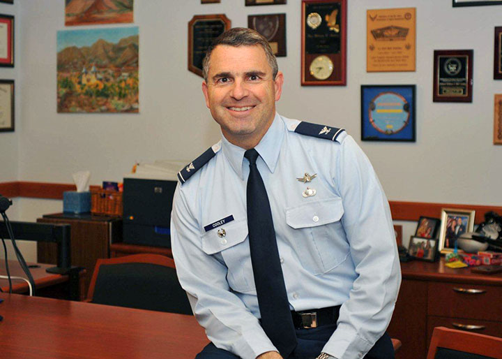
GPS Directorate
Another USAF general officer you are sure to run into at the Space Symposium is a newly minted brigadier general known by some as Wild Bill Cooley. General Cooley, who is currently the director of the GPS Directorate at SMC, was pinned on just a few weeks ago and will be speaking several times at the symposium. Wild Bill also deserves your congratulations. By all accounts, he is doing a great job and has more stars in his future.
The Place to Be
So, while there are several points to be made, a key one appears to be that if you are heavily involved with the GPS program inside and outside the USAF and you do a good job, it can work wonders for your career. If you want to hear from those who have been successful, the 31st Space Symposium is the place to be.
I hope to see you at the Broadmoor April 13-16. Come early and wear your walking shoes. Please stop by the GPS World booth and say hello to everyone. I will be there for sure.
As I wind up this to-do list, I will tell you about another Space Symposium event where it is important, even critical, to be seen. Everyone who is anyone will be attending the Connecting Colorado private function on Wednesday evening, April 15. The event is hosted by the Braxton Science and Technology Group; this is the third year for the coveted event. As I have stated before, I have attended 26 of the 31 Space Symposiums, and I have never been to an after-hours function during that time that even approaches the quality and class that Connecting Colorado exudes. It is a first-class event in a visually stunning venue, where private access passes are required to enter and guards are serious about keeping out gatecrashers. If history is any guide, it promises to be an amazing evening of fine wines, sumptuous food, quality cigars, roaring fireplaces and professional camaraderie that can’t be beat. Plus, the networking opportunities are endless. In other words, the Connecting Colorado event is what all the other after-hours Space Symposium events long to be or wish they could emulate. I can’t wait. I hope to see you there, and at the 31st Space Symposium. By the way, April in the Rocky Mountains means dress appropriately — warmly works for me.
Until next time, Happy Navigating, and remember: GPS is brought to you courtesy of the United States Air Force.
The ground control system (OCX) that Raytheon is developing for the next-generation GPS program has passed a Pentagon review, reports Reuters. The program will be monitored to ensure it stays on track, a senior Air Force official said on Feb. 6 as reported by the news service.
Major General Roger Teague, director of space programs for the Air Force acquisition chief, said a review by chief arms buyer Frank Kendall went well, but program officials and the contractor got “tough marching orders” to stick to schedule and cost targets.
Raytheon’s program manager Matt Gilligan said the review provided the company with “clear direction, the best technology, and appropriate resources to…deliver OCX on a schedule that meets GPS enterprise needs.”
Kendall had ordered the review after an Air Force restructuring that increased the cost of the program by 80 percent to $1.6 billion.
Col. William Cooley, Director, U.S.A.F. Global Positioning Systems Directorate.
Colonel William “Wild Bill” Cooley, director of the GPS Directorate at Space and Missile Systems Center, discusses CNAV signals, GPS IIF launches, and the OCX with Defense Editor Don Jewell.
There is probably no busier United States Air Force officer than Colonel William “Wild Bill” Cooley, Ph.D., the director of the GPS Directorate at Space and Missile Systems Center (SMC), Air Force Space Command (AFSPC), Los Angeles AFB, California. He is the driving force for all things dealing with acquisition and development for GPS. Currently, he is juggling so many objects, it is amazing that he is not totally overwhelmed. Consider the issues with the Next-Generation Operational Control System (OCX), GPS IIF, GPS III, and military government user equipment (MGUE), plus a plethora of classified endeavors we can’t even discuss here. He is one busy man, but even with all that, he found time to sit down and answer a few questions in an effort to bring us all up to speed on GPS and PNT.
Don Jewell (DJ): One of the hot topics at all the symposia lately, here and abroad, has been the broadcasting of additional civilian navigation signals and messages. The U.S. Department of Transportation (DOT) originally objected and sent a strongly worded and probably unadvisable letter to General Shelton (AFSPC/CC) on the matter, but sanity prevailed, and the GPS navigation signals on L2C- and L5C-capable satellites began broadcasting with full navigation messages on April 28. However, we understand DOT still insists some restrictions be put in place for the L5C signal. Can you provide us with an update and a status on that program? Plus, what can users expect in the way of improved accuracy and signal availability?
Colonel “Wild Bill” William Cooley (WBC): As of April 28, the civil navigation message (CNAV) broadcast was implemented on all operational GPS satellites capable of transmitting the L2C and L5 signals. Currently, seven GPS IIR-M satellites broadcast L2C, and six GPS IIF satellites broadcast L2C and L5. On average, users may expect at least one L2C-broadcasting satellite to be in view at all times.
The CNAV message content now includes the minimum message set needed to support the positioning, navigation, and timing mission, namely Broadcast Message Types (MT) 10, 11, 30, and 33, which contain information about the satellites’ position, clock, health, and corrections, in lieu of the previously transmitted MT-0 placeholder or default message.
The Air Force intends to broadcast L2C messages with the health bit set healthy and L5 messages with the health bits set unhealthy until sufficient monitoring capabilities are available for the L5 signal. We expect the accuracy to be slightly less than the Legacy Navigation Message (LNAV) because we are only updating the satellites two times each week. The accuracy should improve to be slightly better than LNAV beginning this December, when we begin updating the CNAV message on each satellite daily.
DJ: The M-code (military code) and MNAV (military navigation) signals are also being broadcast on M-code-capable satellites. So, the same questions apply: what can our warfighters and government users expect as far as M-code availability and accuracy? What can you say about the multiple messaging capabilities both on the civilian and military (CNAV and MNAV) signals?
WBC: Like the civil CNAV message, the modernized military-data message MNAV will enable military users to take advantage of all of the performance improvements offered by a modernized military signal. We can expect continued accuracy improvements as newer satellites replace aging satellites.
MNAV broadcast testing will continue occasionally in support of developmental test events for the next-generation military GPS receiver cards.
DJ: I know we can get in sensitive territory here in a hurry, but since we are discussing the military signals, can you give us an update on the long-running MGUE and M-code program? When can government users expect to see an actual signal and a receiver with M-code chips and/or modules that utilize the military only signals? Plus — and here’s where we have to be careful — what can you say about the security, availability, and accuracy of the military signal?
WBC: The M-code-capable military receiver (MGUE) modules in development have successfully acquired and tracked M-code during live-sky tests, and we have many more tests scheduled. MGUE is expected to begin fielding by 2017, at which point at least 18 M-code-capable GPS satellites are expected to be on orbit, providing global four-in-view coverage of full M-code capabilities.
In the meantime, the most recent GPS IIF satellite launches have raised the total number of M-code-capable modernized GPS spacecraft to 14 (seven GPS IIR-M and seven GPS IIF). This provides four or more M-code satellites in view globally at least 50 percent of the time, and at least one M-code satellite in view continuously. This increasing M-code satellite signal coverage will enable effective, realistic, developmental and operational testing of MGUE receivers.
The new GPS III block of satellites will provide an M-code signal with greater security, and higher power, comparable availability, and accuracy when compared with the GPS IIF satellites, allowing users to operate closer to jammers and under trees, as well as with greater resistance to jamming and spoofing. Also OCX will offer significantly improved crypto protection and cyber security.
DJ: Recently, the U.S. Air Force successfully launched the fifth, sixth, and seventh SVs in the GPS IIF family of satellites in less than seven months. Quite a feat! Congratulations are in order for that milestone. However, in the past, the checkout times averaged approximately 30 days. In fact, speed in initializing the IIF SVs and declaring them operational seemed to be an unofficial goal. On GPS IIF-5, however, the rapid checkout timelines have been extended considerably. Can you enlighten us concerning the checkout program and what the government hopes to achieve?
WBC: There are three key dates with regard to checkout timelines: completion of on-orbit checkout, the transfer of Satellite Control Authority (SCA), and the Operational Acceptance of the vehicle. Measured from launch, the nominal on-orbit checkout timeline is 21 days. The nominal checkout for SCA transfer is 28 days. For the IIF-5 mission, the on-orbit checkout occurred in six days and the SCA in 11 days, a record for the IIF program!
The operational acceptance was completed 60 days later, following an on-orbit observation validating a requirement to see if the vehicle works as expected without receiving any commands from the ground segment in that time period.
This may explain the perceived extended checkout, which is in reality a delayed operational acceptance.
The average time to SCA transfer for the first four vehicles is 42 days. The average is inflated due to a long checkout of the first GPS IIF space vehicle, which took 88 days. From IIF-2 to the present, the average SCA transfer time has been 21 days.
Using SCA transfer time makes the most sense, because that is the time it took the SPO to go through the entire process (to include meetings and documentation) to hand over the vehicle.
DJ: Can you give us a status update on the entire GPS IIF family of satellites? How are the SVs faring in orbit, and are the clocks proving to be as stable and accurate as forecast?
WBC: The first seven of 12 GPS IIF satellites are currently on-orbit and meeting all mission requirements. Of the remaining satellites, one is being prepared for launch in October 2014, one is being prepared for shipment to Cape Canaveral AFS, two are in storage, and one is completing production. The oldest satellite is now four years old. The legacy GPS satellites have remained operational well past their design lives, demonstrating the high-quality engineering and mission-assurance practices used on this program. The clocks are improving the overall accuracy of the constellation with the best-ever day (measured in Signal-in-Space User Range Error) in June 2013 of 46.6 centimeters and the best week in April 2014 of 64.6 centimeters.
DJ: What exactly do the IIFs mean to the GPS modernization program, for the average user and for the GPS constellation and program as a whole?
WBC: The 12 Boeing-built GPS IIF satellites will provide improved signals that will enhance the precise global positioning, navigation, and timing (PNT) services supporting both the warfighter and the growing civilian needs of our global economy. The next-generation satellites will provide improved accuracy through advanced atomic clocks, a longer design life than previous GPS satellites, and a new operational third civil signal (L5) that benefits commercial aviation and safety-of-life applications. It will also continue to deploy the modernized capabilities that began with the modernized GPS IIR satellites, including a more robust military signal.
The anomalies that we have seen on orbit have been resolved either through rework at the factory or through modifications in flight software.
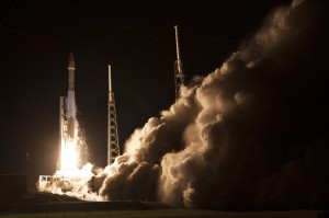
GPS IIF Launch. The seventh of the follow-on generation, rising August 1.
DJ: Bill, that’s comforting, but what about the clocks on the IIF SVs? There were serious problems with the Cesium clocks on the first couple of launches. Are the operators now able to utilize or activate either the Rubidium or the Cesium atomic reference systems?
WBC: Don, the answer is yes. The system has triple redundancy with two Rubidium frequency standard clocks and one Cesium frequency standard.
DJ: What about signal strength and stability on the IIF birds?
WBC: In addition to an increased number of signals, GPS IIF provides more than the legacy power levels, and all signals on GPS IIF meet stability requirements. For reference, the GPS IIR-M series introduced one new L1 and two new L2 signals, while GPS IIF introduced the new L5 signal. All of these signals are part of the GPS IIF navigation payload and provide information including GPS date and time, satellite health, satellite ephemeris (for individual satellite positioning), and almanac information (for information on other satellites in the constellation).
The L1 frequency carries the L1 C/A code for civil users, and the L1 P (Y) code and L1 M-code for military users. The L2 frequency carries the first modernized civil signal, L2C, and the L2 P (Y) code and L2 M-code for military users. Finally, the L5 frequency carries the newest modernized civil signal.
Modernized GPS civil signals provide dual-frequency signals to all GPS users, enabling ionospheric corrections that greatly improve the accuracy. The new L5 signal will be used for safety-of-life applications, including aviation. In addition to an increased number of signals, GPS IIF provides more than the legacy power levels, and all signals on GPS IIF meet stability requirements.
DJ: Let’s move to the ground segment. OCX, the next-generation GPS Command and Control (C2) system, has literally moved to the right on the schedule timeline for every month it has been in existence since it was awarded in 2010. The end date just keeps getting farther and farther away. OCX is also currently exceeding the original contract budget by a large margin.
What’s the problem? Is OCX more difficult or complicated than originally planned? Is there any good news to report to users on OCX? What can users expect in the future?
Just so our readers know, just what is it that OCX brings to the GPS arena that cannot be provided by the current Architecture Evolution Plan (AEP) C2 system? Why do we need OCX? And in your opinion is it still a viable option? Are there contingency plans?
My apologies — that is about eight questions in one, but hopefully you can bring us up to speed on OCX.
WBC: Actually, the primary drivers of schedule delays for OCX are related to:
issues with the integration and testing of Block 0 on the cyber-hardened infrastructure; and
the concurrent systems engineering approach for Block 1 and Block 2, which drove a high rate of rework and inefficient staffing.
The OCX program is a pathfinder for many of the U.S. Air Force’s and Department of Defense’s most rigorous Information Assurance (IA) and Cyber Security requirements, which have turned out to be more complex to implement than anticipated.
OCX is a challenged program, but there is progress to report. Raytheon completed a hardware compatibility and integration test with the non-flight test bed of the Lockheed Martin GPS III space vehicle. This test validated the network infrastructure’s ability to communicate between the Lockheed Martin Launch and Checkout Capability and the Raytheon Launch and Checkout System, sending commands to the full-sized, functional satellite prototype test bed.
In addition, Raytheon and Lockheed Martin completed the third of five planned launch and early orbit exercises to demonstrate launch readiness. This exercise used new installments of the Raytheon OCX software and network infrastructure to demonstrate space-ground communications for initial acquisition, orbit-raising maneuver planning and execution, and basic anomaly detection and resolution.
Another recent accomplishment was the merging of the Cyber Security hardware and software baseline with the Block 0, Launch and Checkout System, mission applications. The completion of this merge allowed the program to enter formal integration and test activities, which are ongoing.
The full capabilities of OCX provide more than a dozen new capabilities for the GPS mission. OCX enables the full capabilities of the modernized navigation signals: adding L2C and L5 for civil users, M-code secure signal for military users, an internationally compatible L1C, as well as worldwide monitoring of these modern signals for quality and integrity.
OCX enables operation of the new GPS III satellites. As we discussed previously, OCX will provide the USAF’s most rigorous cyber-security capabilities, built in from the OCX foundation.
Raytheon just completed implementation of a program re-plan, which implemented lessons learned to date to correct many of the development challenges encountered, and created a lower risk schedule for delivery. With these changes, the program remains a viable and important component of the modernized GPS enterprise.
DJ: With that in mind, when do you currently plan on having the first GPS III OCX-controlled launch? Original schedules called for a late 2014 date, then it was 2015, and now we are hearing 2016 or as late as 2018 for OCX. Are there viable alternatives, and if so, can you tell us what they are and if they are being pursued?
WBC: OCX and GPS III are synchronized to support launch of the first vehicle in the second half of 2016, conditioned upon launch manifest availability. Contingency plans are being developed, but will only be implemented if warranted by the risk.
DJ: Now, Bill, I am not asking you to blow your own horn here, but frankly we have heard nothing but good reports from SMC and the GPS Directorate since you arrived about 14 months ago. That is a short period of time, but evidently you have made your presence felt and have had a major impact on the GPS program overall. What have you done differently that seems to work so well? To what do you ascribe your success so far?
WBC: Thank you, Don. I’m very happy to hear the reports are positive, but the credit goes to the men and women of the GPS Directorate, our federally funded Research and Development Center personnel, and our contractors. My job is to continually assess the challenges and barriers that slow modernization. I help resolve the challenges or get additional resources if needed to enable the team to accomplish their important mission.
I am incredibly fortunate in that the GPS team is passionate about our mission to maintain the Gold Standard for position, navigation, and timing (PNT) for the world. The entire directorate understands the critical role we play for civilian and military users worldwide, and that knowledge motivates and energizes us every day!
I’m the luckiest colonel in the Air Force because I get to work alongside this terrific team of government and contractor professionals on one of the most important missions in the U.S. Air Force.
DJ: Obviously you are proud of your team, and you know what it means to be a great leader. In closing, do you have any final comments?
WBC: Don, just that the GPS Directorate and our contractor team, along with our partners at the 2nd Space Operations Squadron (2SOPS) who fly the GPS constellation 24/7, take our job seriously and understand the important mission we have: to provide reliable and precise position, navigation, and timing services for America’s warfighters, our allies, and civilian users around the globe. GPS is the Gold Standard for space-based PNT today, and we are modernizing to ensure GPS is the Gold Standard for the future.
In consulting my notebooks for the spring of 2014, I find many remarkable cases that engaged the attention of my intimate friend Mr. Sherlock Holmes. Among them stand out the tragedy of the ancient British barrow, the disappearance of Pemblestoke the magician, and the curious facts associated with the giant rat of Sumatra, a tale for which the world is still not prepared. Perhaps none of these so well illustrate, however, the advanced technical insights and consultative powers of the great detective as did the intrigue into which we were drawn by the brilliant young American scientist, Geo. P. Hess.
“Watson, we have a new client,” Holmes announced over breakfast, “a friend, actually, upon whom I have depended for many years. He has always proved reliable, helping me navigate the highways and by-ways all across the land.”
“His name?” I inquired.
“The Right Honorable George Parkinson Hess from California, Colorado, Pennsylvania, Florida, and doubtless many other parts of the American nation. I have watched G.P. Hess grow these last 36 years into a prodigiously successful entrepreneur, known the world round for his ubiquity, openhanded generosity to all, and, equally, his devotion to his own country. Now it seems he needs my advice, and I cannot refuse him.“
“I wonder that an American should be able to find his way here this morning,” I replied. “There’s a beastly fog about, and London streets are no friendly environment under the best of conditions.”
“Have no fear, Watson,” Holmes chuckled. “I have never known G. P. Hess to be late for any function. Since a lad he was always on time, right to the second. You can set your watch by him, and as far as I know he has never been lost. He has an uncanny sense of direction and is indeed a fount of knowledge concerning maps and directions. I believe I hear his ring at the bell even now.”
Mrs. Hudson ushered in our American visitor, and Holmes introduced us. “It is always good to see you, G.P. How are you — in good health, I presume?”
“Indeed, Mr. Holmes, things are neither as well they may seem on the surface, nor as well as they could be. I am troubled of late, severely troubled by potential gaps in my future. Not to mention the seismic activity lately in Los Angeles. In the last 18 months, the magnitude of the tremors has grown from 3.1 to 5.1 on the Richter scale. I just can’t understand why they thought to have our major acquisition headquarters in a place that is constantly threatened by tremors, outright quakes, wild fires, floods, landslides, and tsunamis. Not to mention the traffic. It would have been much better to co-locate acquisition with the main headquarters in Colorado. All they have to worry about there are blizzards, high winds, and an occasional wildfire.
“While I could not agree with you more, G.P., I fail to see what I can do, try as I might, about Mother Nature.”
Fire in Florida
“Right you are, Mr. Holmes. I’ll get to the heart of the matter. I am deeply concerned about several of our business ventures: expansion and modernization efforts, if you will. You may have heard about a small but rather serious fire at the U.S. Air Force’s Cape Canaveral radar tracking facility and the subsequent launch delays. That small fire at a single tracking facility has already delayed a National Reconnaissance Office (NRO) launch, and a resupply mission to the International Space Station, currently manned by U.S. and Russian crews who, whether or not they are still speaking to one another, really need the replenishments. Now we aren’t allowed use Russian engine cores for space launch any more. A blessing, actually, as the Russians have put more malfunctioning GLONASS satellites into salt water lately than into the vacuum of space, when they aren’t simply blasting them to kingdom come.
“With all the troubles besetting Cape Canaveral, Elon Musk is burning figure eights in his Tesla, and SpaceX is a very happy company — in the right place at the right time, what? Able to launch its Falcons and Falcon Heavies from Vandenberg as well as Canaveral.
“Imagine, one little fire has caused the cancellation of several space launches, and those still on the manifest are moving to the right daily. We had hoped to put into orbit four new IIF models this year, but that looks next to impossible now. Plus it appears the GPS III payload has hit a snag. It is delayed six to nine months.”
GPS III Delay
“A delay in GPS III had not been looked for, had it?” queried Holmes.
“No sir, it had not. Everything was proceeding smoothly, but now the satellite payload is in question. Subcontractor Exelis has provided every GPS payload since 1978 and all have worked marvelously well, some of them for more than 23 years. But now — there is a problem. Some say it is signal crosstalk, some say it is with the new rubidium clocks. One thing for sure, it is demoralizing. I am given to understand the powers that be in Colorado Springs and Los Angeles are calmly but firmly looking for some competition or even an alternate payload provider.
OCX Delay
“And then there is the GPS ground segment. It has moved one month to the right for every month it has been in existence, it has gone over budget, and now is on its third program manager in three years. Whatever happened to the days when a capable leader conducted a program from beginning to end, knew it intimately from top to bottom, from soup to nuts? What is this world coming to? Where are our leaders?
“And don’t get me started on the effects of ‘seques-castration’!” fumed the young man.
“And the Chinese!” he continued, gathering steam. “Just who do they think they are? Do you know they called their regional system a PNT gold standard? Gold standard! Don’t make me laugh!”
“Now G.P., don’t despair,” soothed Holmes. “There are still excellent leaders out there, you just have to look a bit harder nowadays. In the space arena, Elon Musk, General William Shelton, Wild Bill Cooley, Frank Kendall, and Keoki Jackson are just five of many that come immediately to mind. Of course I would not want to play poker with any of them, but I digress.”
Solutions Appear
“I have been reading and thinking about the alternative payload issue,” the detective continued, “and I have other sources of information as well. Dr. Watson calls them my Baker Street Irregulars, and they are both resourceful and quite knowledgeable. These sources tell me there is another Colorado company, with excellent leadership, that is really on the ball, can move mountains (or huge boulders, anyway), and mark my words, they have top-notch crews, expertise, and even some past performance where an alternative GPS payload is concerned. They might be worth watching.
“As far as OCX goes, frankly I am hearing there are indeed backups and alternatives. My sources have confirmed the existence of a bracket of applicable technologies belonging to a small residual company, run by an Irish clan, believe it or not, with considerable past performance and expertise. Once officially launched to work on the real-time issues, they should be able to help the ground-segment team get back on the fast track.
“As for as the Chinese and their claims, all I can say is no one believes their gold standard rhetoric, although it obviously has a purpose.”
“Mr. Holmes, I hope you are right,” the American replied with an assuaged look. “I knew that if I talked with you I would feel better about these perplexing issues.
“I must resume my journey to Rotterdam, where I will hear a lot more about the Galileo program meeting its launch dates — or not — and the GLONASS outage. As rough a shape as we are in, we’re still far better off than the rest! In the meantime, I’ll pop over to Greenwich to synch up and universally coordinate with those folks before I move on to the Continent.”
G.P. Hess carefully scrutinized his pocket watch. “Now Mr. Holmes, Dr. Watson, I must depart. As you know I have a reputation to maintain: always precisely on time, never lost, and as far as I know, I have never blacked out. Cheerio!”
“What a remarkable fellow, Holmes!” I said after our client had left. “He is certainly full of energy.”
“Yes,” my friend replied, “energetic and very successful. If you had observed him more closely, Watson, you would have noticed his pocket watch. Ah, you did not remark upon it? Standard-issue, atomic-reference version, crafted of solid gold. You might say, and rightly so, that where time is concerned, G.P. Hess is the undisputed holder of the Gold Standard.”
So ends our brief visit with Holmes and the illustrious Watson. Stay tuned for further adventures, and until next time, Happy Navigating! G.P. Hess and I hope to see you all next week in Rotterdam, the Netherlands, at the European Navigation Conference, ENC-GNSS 2014. Drop by and say Hello!
If you can’t drop by and say hello in Rotterdam, the Netherlands, then please join me at the 30th Space Symposium, which is slated for May 19-22, 2014, at The Broadmoor Hotel in Colorado Springs. The Space Symposium is considered by many of us in the Space business to be the premier gathering of space professionals in the world.
In June, I will be attending the 39th NIST Time and Frequency Seminar. It has a great lineup of speakers this year to include: Judah Levine who is the NIST civilian time leader, David Allan who is the original creator of the famous Allan variance, and Neil Ashby, an expert in relativistic timing effects. The seminar takes place in Boulder, Colorado, June 3-6, 2014.
What Is Don Reading?
I had very little time for reading this month, or so I thought — then I had a brief but enlightening correspondence and conversation with local author George E. Nolly, who also lives in Colorado. George sent all four of his wonderful books direct to the Kindle app on my iPad. I had told George I was so swamped I would save his books to read on the airplane on my way to Rotterdam and report on them after the European Navigation Conference.
Then I read just one chapter of the first book and I was hooked. There was nothing for it but to devour all four volumes of the escapades of young Vietnam era USAF pilot, Hamilton “Hamfist” Hancock. Hamfist Out: The Chill Is Gone; Hamfist Over Hanoi: Wolfpack on the Prowl; Hamfist Down! Evasion, Survival and Combat in the Jungle; Hamfist Over The Trail: The Air Combat Adventures of Hamilton “Hamfist” Hancock
It will be like going back in time for many readers of a similar age. George Nolly writes with such an easy-going grace and fluidity that reading of these often stressful and life-threatening times, while sitting in my lounge chair, was, for me anyway, indeed a pleasure.
Certainly I can remember undergoing many of the same flying and ground ordeals, and Nolly tells his tales with such honesty and clarity that it brought back vivid memories. In fact I have never read such accurate descriptions of what it was like to fly the old T-29 with radial engines and all that entails. George actually brought back the unforgettable sound and smell of those two Pratt & Whitney R-2800 radial, air-cooled engines. They are from a long-forgotten era of aviation, but those of us who heard them will never forget them.
T-29A Aircraft, Vietnam era, restored. Courtesy of CONVAIR T29A.
George also makes wonderful plugs for GPS, possibly without knowing it, when he describes using LORAN maps under red lights in a cramped cockpit. This, along with all the time he spent just trying to figure out where he was or where the target was located, just screams for a GPS solution. In truth, in the Vietnam era we airmen spent a great deal of time trying to figure out exactly where we were, where our target was, and where the enemy was located, especially if he was shooting at us. Today all those tasks are made infinitely simpler with the use of GPS and modern electronics. However, this also highlights the amazing feats of airmanship accomplished in the Vietnam era, all while being constantly targeted by the enemy, all the more incredible.
Radial engine.
Just between us veteran airmen, the author relates the tales with such clarity and detail I suspect many of them are autobiographical. George E. Nolly, after graduating from the U.S. Air Force Academy here in Colorado Springs, served as a pilot in the United States Air Force, flying 315 combat missions on two successive tours of duty in Vietnam, winning three Distinguished Flying Crosses and 24 Air Medals, flying O-2A and F-4 aircraft, so he knows whereof he writes.
Even if you are a few generations younger than George Nolly and me, and don’t undergo a nostalgic experience as you read, you will certainly enjoy these fabulous books. Be sure to read them in order, as they are actually one running story that brings to life the trials, tribulations, and joys of Hamilton “Hamfist” Hancock for all of us and vividly recreates the way things were back in the 1960s and ’70s in the United States, the USAF, and what it was like flying in combat in Southeast Asia. I highly recommend these tales. I hope there are more to come.
Upcoming Conferences
If you can’t drop by and say hello in Rotterdam, the Netherlands, then please join me at the 30th National Space Symposium, which is slated for May 19-22, 2014, at The Broadmoor Hotel in Colorado Springs. The National Space Symposium is considered by many of us in the Space business to be the premier gathering of space professionals in the world.
In June I will be attending the 39th NIST Time and Frequency Seminar. It has a great lineup of speakers this year to include: Judah Levine who is the NIST civilian time leader, David Allan who is the original creator of the famous Allan variance, and Neil Ashby, an expert in relativistic timing effects. The seminar takes place in Boulder, Colorado, June 3-6, 2014.