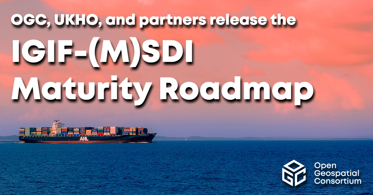
The Open Geospatial Consortium (OGC) has released the first iteration the Integrated Geospatial Information Framework (IGIF)-M (Marine) Spatial Data Infrastructure (SDI) Maturity Roadmap for both marine and terrestrial domains.
“The IGIF-MSDI maturity roadmap is an important step that supports a holistic understanding of data-exchange and processing environments,” said OGC Chief Technology Innovation Officer, Ingo Simonis.
According to the OGC, the core of the IGIF-(M)SDI Maturity Roadmap is formed by the World Bank SDI Diagnostic Toolkit where, with contributions from IHO and OGC, its terrestrial heritage was augmented to maximize its benefits to the marine domain.
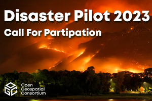
The Open Geospatial Consortium (OGC) is calling for participants in Disaster Pilot 2023, which aims to reduce disaster preparation time and accelerate transforming data into decisions. All responses are due by Feb. 17.
Disaster Pilot 2023 aims to enable key decision makers and responders to discover, manage, access, share and exploit location-based information to support disaster preparedness and response. The focus of this year’s pilot is to update the OCG Disaster Readiness Guides on flooding and landslides to include information on wildfires and droughts.
The pilot provides the opportunity for participants to collaborate with a range of disaster stakeholders, including Earth observation data providers, relief organizations and field responders. The goal of the pilot is to help shape the future of disaster management systems through user-centric interoperability arrangements, identification of critical data sharing challenges, and the delivery of cloud computing scale and agility to field personnel and relief organizations.
The Disaster Pilot 2023 is being conducted under OGC’s Collaborative Solutions and Innovation Program.
A Q&A session is available on Feb. 1 for interested participants. For more information, visit the Disaster Pilot 2023 page.
New process simplifies task of computational geospatial processing accessible via web services
The Open Geospatial Consortium (OGC) seeks public comment on a new draft OGC API standard: OGC API – Processes – Part 1: Core. Comments are due by Oct. 19.
The draft OGC API – Processes Standard specifies a Web API that enables the execution of computing processes and the retrieval of metadata describing their purpose and functionality. For example, these processes could combine raster, vector, coverage and/or point cloud data with well-defined algorithms to produce new raster, vector, coverage and/or point cloud information.
The draft OGC API – Processes Standard builds on the Web Processing Service (WPS) 2.0 standard and defines the processing standards to communicate in a RESTful manner using JSON encodings. This API is a newer and more modern way of programming and interacting with resources over the web while allowing better integration into existing software packages.
In many cases, location data, including data from sensors, must be processed before the information can be effectively used. OGC API – Processes, just like the OGC WPS Interface Standard, provides a standard interface that simplifies the task of making simple or complex computational geospatial processing services accessible via web services.
Such services include well-known processes found in GIS software as well as specialized processes for 2D/3D/4D modeling and simulation. The API also makes it easy for developers to implement microservices that can handle location data.
The draft OGC API – Processes Standard provides a similarly robust, interoperable, and versatile protocol for process execution across the Web. OGC API – Processes supports both immediate processing for computational tasks that take little time and asynchronous processing for more complex and time-consuming tasks.
As with other OGC APIs, OGC API – Processes consists of optional parts that each provide extra functionality. This specification, Part 1: Core, is intended to be a minimal useful API for the execution of processes from the geospatial domain. There are no constraints on the types of processes that can be published through the API. Examples of processes that have been demonstrated during the development of the draft API standard include routing, contour generation, buffering, coverage processing and several others. The API is therefore expected to be applicable to several domains.
The National States Geographic Information Council (NSGIC) has released a joint statement on the value of GIS during the COVID-19 pandemic, alongside its partners the MidAmerica GIS Consortium (MAGIC), Open Geospatial Consortium (OGC), Urban and Regional Information Systems Association (URISA), and American Association of Geographers (AAG).
Joint Statement on the Value of GIS in the Pandemic
The spread and effects of COVID-19 can be best understood considering space and time.
As governments are responding to COVID-19, more leaders are recognizing the value of “knowing the where.” The importance of knowing where the outbreak is growing, where high risk populations are, where the hospital beds and important medical resources are, and where to deploy resources is essential. “Knowing the where” informs better decision-making.
In an effort to better understand the where, governments are recognizing the value of geospatial information and technologies and are engaging geospatial professionals to help them better understand the where to help them in their decision-making and response.
Geospatial professionals bring unique analytical and visualization skills to the table that help responders and decision-makers visualize where the pandemic is spreading more quickly and can make the important decisions regarding where response and resource needs need to be focused. The value of telling the story through a map coupled with a geospatial dashboard provides a view of the event not readily seen in a table such as a spreadsheet.
Beyond visualizing existing data, we can connect data from a location perspective, which enhances the value of the data sources being integrated. Equally important in this event is data on COVID-19 cases and testing packaged and shared in a way useful to scientists.
GIS (geographic information systems) is experiencing an unprecedented level of use. Historically, GIS was deployed following a disaster to help respond and recover. Today, GIS is used as a disaster is unfolding. The COVID-19 event is an outstanding example of how effective GIS is when robust data is available. Governments are realizing the value of investing in these systems and the people who run them.
The information necessary to empower all partners already exists.
Current nationwide models and response efforts may not benefit from the details of local geographic parameters. Local or statewide models and response efforts may not fully take advantage of the data from other areas of the country. Hospitals are surveyed by both federal and state agencies, and the results of those surveys are not readily available to the hospitals working together to care for patients. Nationwide geospatial data will empower a coalition of participants with a better understanding of the spread and impacts of COVID-19 and improve mitigation actions.
The same data can be made available in different forms to empower people playing different roles in the response. Researchers — epidemiologists — will benefit from nationwide COVID-19 testing data and data describing factors impacting the spread. This data needs to be as disaggregated as permissible under HIPAA and in a form readily digestible in models.
The case data could be aggregated to the same units of geography as a wealth of existing demographic data (Census tracts), which could explain and quantify local variances in the spread. Policy makers and those in emergency management can benefit from map and tabular dashboards, harnessing the power of the where by integrating data for analytics.
The emergency response, public health and geospatial communities must come together to understand COVID-19 in the U.S. and mitigate its spread and overall impact.
By geo-enabling public health and emergency response data, we can better:
understand the spread — with COVID case data, movements of people, and symptoms
understand the impact on individuals — with data including age, disease, obesity, and medical treatments
understand how to tailor outreach — by age, language, engagement with government, and lifestyle choices
understand the needs of the healthcare industry — by facility, day, bed capacity, type of care, ventilators, and PPE
understand the impact on the local economy — by county, day, unemployment, and bankruptcies
understand the societal impacts — by census tract, domestic violence, alcohol consumption, child abuse, animal abuse, elder abuse, mental health crises, 3-1-1 calls and firearm sales
We are committed to beginning the national conversation about leveraging the best available data to better understand the spread and impacts of COVID-19.
The National States Geographic Information Council (NSGIC) has released a joint statement on the value of GIS in the pandemic, alongside its partners the MidAmerica GIS Consortium (MAGIC), Open Geospatial Consortium (OGC), Urban and Regional Information Systems Association (URISA), and American Association of Geographers (AAG).
Joint Statement on the Value of GIS in the Pandemic
The spread and effects of COVID-19 can be best understood considering space and time.
As governments are responding to COVID-19, more leaders are recognizing the value of “knowing the where.” The importance of knowing where the outbreak is growing, where high risk populations are, where the hospital beds and important medical resources are, and where to deploy resources is essential. “Knowing the where” informs better decision-making.
In an effort to better understand the where, governments are recognizing the value of geospatial information and technologies and are engaging geospatial professionals to help them better understand the where to help them in their decision-making and response.
Geospatial professionals bring unique analytical and visualization skills to the table that help responders and decision-makers visualize where the pandemic is spreading more quickly and can make the important decisions regarding where response and resource needs need to be focused. The value of telling the story through a map coupled with a geospatial dashboard provides a view of the event not readily seen in a table such as a spreadsheet.
Beyond visualizing existing data, we can connect data from a location perspective, which enhances the value of the data sources being integrated. Equally important in this event is data on COVID-19 cases and testing packaged and shared in a way useful to scientists.
GIS (geographic information systems) is experiencing an unprecedented level of use. Historically, GIS was deployed following a disaster to help respond and recover. Today, GIS is used as a disaster is unfolding. The COVID-19 event is an outstanding example of how effective GIS is when robust data is available. Governments are realizing the value of investing in these systems and the people who run them.
The information necessary to empower all partners already exists.
Current nationwide models and response efforts may not benefit from the details of local geographic parameters. Local or statewide models and response efforts may not fully take advantage of the data from other areas of the country. Hospitals are surveyed by both federal and state agencies, and the results of those surveys are not readily available to the hospitals working together to care for patients. Nationwide geospatial data will empower a coalition of participants with a better understanding of the spread and impacts of COVID-19 and improve mitigation actions.
The same data can be made available in different forms to empower people playing different roles in the response. Researchers — epidemiologists — will benefit from nationwide COVID-19 testing data and data describing factors impacting the spread. This data needs to be as disaggregated as permissible under HIPAA and in a form readily digestible in models.
The case data could be aggregated to the same units of geography as a wealth of existing demographic data (Census tracts), which could explain and quantify local variances in the spread. Policy makers and those in emergency management can benefit from map and tabular dashboards, harnessing the power of the where by integrating data for analytics.
The emergency response, public health and geospatial communities must come together to understand COVID-19 in the U.S. and mitigate its spread and overall impact.
By geo-enabling public health and emergency response data, we can better:
understand the spread — with COVID case data, movements of people, and symptoms
understand the impact on individuals — with data including age, disease, obesity, and medical treatments
understand how to tailor outreach — by age, language, engagement with government, and lifestyle choices
understand the needs of the healthcare industry — by facility, day, bed capacity, type of care, ventilators, and PPE
understand the impact on the local economy — by county, day, unemployment, and bankruptcies
understand the societal impacts — by census tract, domestic violence, alcohol consumption, child abuse, animal abuse, elder abuse, mental health crises, 3-1-1 calls and firearm sales
We are committed to beginning the national conversation about leveraging the best available data to better understand the spread and impacts of COVID-19.
The Open Geospatial Consortium (OGC) published the outcomes of its biggest research and development initiative of 2019, Testbed-15. Key outcomes, including engineering reports, presentations and videos, are available on the Testbed-15 website.
According to OGC, Testbed-15 research was conducted across several fields, including Earth observation data models, applications, catalogues and process delivery; data security in geospatial environments using encrypted containers; federated cloud environments incorporating OGC Open Web Services; secure delta updates to geospatial data in denied, disrupted, intermittent and limited situations; an open portrayal framework and APIs for sharing portrayals of geospatial content; and machine learning models and outputs integrating with OGC Open Web Services.
OGC Testbeds, an annual activity of OGC’s Innovation Program, are multi-vendor, collaborative efforts where participants follow a rapid prototyping approach to design, develop and test solutions to sponsors’ location-related problems. OGC Testbed results, documented in engineering reports, are provided to OGC’s Standards Program, where they are reviewed, revised, and potentially advanced as new international open standards.
Alongside the sixteen engineering reports, Testbed-15 resulted in advancements to the suite of draft OGC APIs, including APIs related to styles, maps, tiles, records and the OGC API-Common building block, OGC said.
OGC Testbed-15 was sponsored by the Defence Science and Technology Laboratory, the European Space Agency, Natural Resources Canada, the U.S. Geological Survey and NASA.
The Open Geospatial Consortium is an international consortium of more than 530 businesses, government agencies, research organizations and universities driven to make geospatial information and services findable, accessible, nteroperable and reusable.
The Open Geospatial Consortium (OGC) is inviting members and non-members to participate in its 3D IoT Platform for Smart Cities Pilot.
The goal of the pilot, which is sponsored by the Korea Land and Housing Corporation, is to advance the use of open standards for integrating environmental, building and internet of things (IoT) data in smart cities. It will focus on two scenarios: real-time monitoring of indoor occupancy and real-time monitoring of micro-dust air pollutants.
According to OGC, participants in this pilot will connect their technology and expertise with real city needs while collaborating with other participants to advance open standards for smart cities. OGC hopes the outcomes of the pilot will help facilitate and standardize the access to environmental, building and IoT data in smart cities.
This Initiative is being conducted under OGC’s Innovation Program, the research and development laboratory of OGC. Under OGC’s Innovation Program, sponsors and OGC members come together to address geospatial IT challenges.
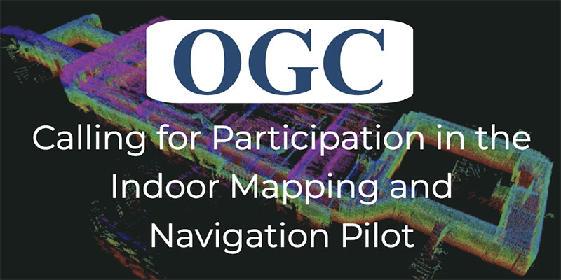
According to OGC, the Indoor Mapping and Navigation Pilot Initiative, sponsored by the Public Safety Communications Research Division of the National Institute of Standards and Technology (NIST), will create and advance solutions to complex geospatial challenges related to indoor mapping and navigation for first responders.
First responders typically survey high-risk facilities in their jurisdiction at least once per year as part of a preplanning process. The preplanning process can be time-consuming and inefficient, according to OGC, so the Public Safety Communications Research Division of the NIST Communications Technology Laboratory has identified mobile 3D light detection and ranging (lidar) as a potentially transformational technology for first responders. Using lidar and 360-degree camera imagery coupled with advanced software processing, first responders could efficiently capture 3D point clouds and a wealth of other information, both observed and derived, while walking through buildings as part of their routine preplanning operations, OGC said.
In addition to creating point clouds for visualization and mapping, 3D lidar can be used in localization, object classification, integration with virtual/augmented reality solutions, change detection and more. OGC’s Pilot Initiative will call upon a diverse array of leading organizations in the field and leverage standardized, open GIS frameworks, data models and data exchange formats to stimulate the rapid generation of prototypes and demonstrations for these activities.
According to OGC, best practices and lessons learned from the Pilot Initiative shall be captured in engineering reports or other means and, where appropriate, forwarded to the respective standards committees under the OGC and International Standards Organization for consideration.
Participation is only open to OGC members; however, proposals from non-members will be considered provided that a completed application for OGC membership (or a letter of intent to become a member) is submitted prior to (or with) the proposal.
The Open Geospatial Consortium (OGC) is hosting the second Disasters Concept Development Study Workshop July 24-25 at the NOAA Auditorium in Silver Spring, Maryland.
Organized by OGC, the workshop is sponsored by the Department of Homeland Security, the Federal Geographic Data Committee, the U.S. Geological Survey (USGS) and other government agencies.
The workshop is part of the OGC’s Disaster Concept Development Study, and will shape future activities to be led by OGC regarding disaster preparedness and response, and to inform development of potential disaster spatial data infrastructures (SDI).
According to NOAA, in 2017 in the United States there were 16 major natural disasters with costs that exceeded 306 billion dollars, shattering previous annual records.
The workshop asks whether more lives can be saved and damages reduced by providing better discovery and access to data that will improve mitigation, preparedness, response and recovery from disasters.
The ability to effectively share, use and reuse geospatial information and applications across and between governments and non-government organizations in support of disaster response and resilience depends on having a spatial data infrastructure in place when disaster strikes.
The OGC is bringing together key stakeholders in the natural hazards disaster communities to advance the emerging Disaster SDI by conducting a study and developing a set of pilots over the coming years. OGC’s Disasters Interoperability Concept Development Study (CDS) will assess the current state of data and product exchange technologies as used in disaster planning, response, and recovery. The information gained in the CDS will aid in developing a series of future pilots that will in turn advance the state of SDIs that support disaster risk reduction across the globe.
For more information on the Disasters CDS Workshop, including the agenda and how to register, visit the event page on the OGC website. Registration for the workshop is free but mandatory.
The Open Geospatial Consortium (OGC) is seeking interested sponsors to define the challenges for Phase 2 of its Future Cities Pilot Project.
As the operation and planning of cities increasingly relies on 3D geo-information in their processes, and apply Building Information Models (BIM) paradigms to their information management approach, efficient information flow in both directions between geospatial systems (GIS) and the architecture/engineering/construction (AEC) systems becomes increasingly important. This requires data to be interoperable, which requires common — and ideally open — standards.
Completed in 2017, the Future City Pilot, Phase 1 (FCP1) demonstrated that interoperability between CityGML and BIM Industry Foundation Classes (IFC) works well in practice, and showed clear benefits in three use cases: urban planning; social care; and flood modelling. However, to achieve success, a significant amount of manual intervention needed to be employed.
Phase 2 of the Future City Pilot (FCP2) aims to improve the automation of the flow of data, as well as address a number of related interoperability challenges, including:
Comparing data conversion with data linking approaches;
Looking at tools that consume both CityGML and BIM structured data;
Data structures that support the seamless integration of GIS data and BIM data;
Linking real-time sensor information with 3D City Models encoded as CityGML;
Security models to protect the sensor readings, including Single-Sign On (SSO) methodologies to protect parts of the 3D City Model;
Understanding where and how we must capture location and time information: the ability to correlate location in different coordinate reference systems (CRS) such as local, regional, global, and understand if, and how, the integrity of the location data has changed through that process (Survey4BIM use case); and
Data linking to facilitate asset management over dispersed geographies.
Below is a video summary of FCP1.
The Engineering Reports documenting the main outcomes of FCP1 are available.
Sponsorship of the Future City Pilot will provide the following benefits to sponsoring organisations:
Assess and affect market direction based on sponsor needs;
Visibility as global leader in information technology critical to deploying smarter cities;
Amplification of funding by multiple sponsors’ to solve common/similar problems;
Leveraging effort up to 3.5 times based on participant in-kind;
Accelerated process – workable interface specifications in 4-6 months;
Follow-on procurements using standards-based architecture proven in the pilot;
These Innovation Program pilots help feed into the consensus standards process of OGC’s Standard Program; and
Leading the way to safer and more efficient cities.
There are three main deliverables resulting from an OGC pilot:
Testing of running software from several organizations to ensure interoperability of the independently developed implementations based on open standards;
Demonstration of policy-oriented scenarios with the deployed code. These scenarios show the previously unavailable capability from a non-technical point of view;
Documentation of the results of the architecture, testing, and demonstration. The reports may then become the basis of procurement activities of the operational system.
The scope of this pilot as currently planned will include the demonstration of a common architecture and data model in multiple cities. The number of cities used for the demonstration will depend upon the sponsor requirements.
If you want an innovative solution to your organisation’s Geospatial & BIM data interoperability problem, OGC urges you to contact Bart De Lathouwer, director of OGC’s Innovation Program.
The membership of the Open Geospatial Consortium (OGC) has approved GeoSciML as an OGC Standard. The OGC GeoSciML Standard defines a model and encoding for geological features commonly described and portrayed in geological maps, cross sections, geological reports and databases.
GeoSciML provides a mechanism for storage and exchange of a broad range of geologic data enabling users to generate geologic depictions (such as maps) in a consistent and repeatable fashion.
The model was developed by the IUGS CGI (Commission for the Management and Application of Geoscience Information), and version 4.1 is the first version officially submitted as an OGC standard. This standard describes a logical model and GML/XML encoding rules for geological map data, geological time scales, boreholes, and metadata for laboratory analyses.
“Earlier versions of GeoSciML have been used for several years by geological data sharing projects around the world when GeoSciML was only an IUGS (International Union of Geological Sciences) standard. These include OneGeology, INSPIRE, the US Geoscience Information Network (USGIN), and the Australian AuScope and AusGIN projects,” said Ollie Raymond, chair of the GeoSciML SWG.
“Having GeoSciML version 4 ratified as an official OGC standard is a huge step forward for GeoSciML, particularly to reassure application developers that GeoSciML is the way forward for geoscience data transfer,” Raymond said. “The collaboration of the previous IUGS GeoSciML working group and OGC has been a great example of effective cooperation between standards organisations.”
“The formal documentation and approval of the GeoSciML 4.1 standards by OGC allows us to expand the exchange of highly interoperable geoscience data throughout the South American continent with the support of the OneGeology standards support network and allowed us to achieve the maximum 5 stars of OneGeology interoperability,” said Maria Glícia da Nóbrega Coutinho. head of the International Affairs Office of CPRM (The Geological Survey of Brazil) and OneGeology Board representative for South America.
The GeoSciML standard includes a Lite model, used for simple map-based applications; a basic model, aligned with INSPIRE, for basic data exchange; and an extended model to address more complex scenarios. The standard also provides patterns, profiles (most notably of OGC Observations and Measurements; also ISO 19156), and best practices to deal with common geoscience use cases.
The Open Geospatial Consortium (OGC) is requesting information from interested parties to inform a Concept Development Study (CDS) that will assess the current state and future direction of information standards for modeling, mapping and managing underground infrastructure. Organizations with an interest in underground infrastructure are invited to respond before March 15.
According to OGC, the study will define the scope of a multi-phase underground infrastructure interoperability project. It will also provide an in-depth understanding of the components necessary to enable infrastructure data interoperability and standards in an underground environment.
The CDS is initially focused on urban landscape, but it is extendable, OGC adds. This request for information is the first step in the CDS process.
“In a digitally based society, the lack of comprehensive and reliable data relating to above and particularly below ground assets, will prove to be a barrier to the effective operation of those assets through digital systems,” says Rollo Home, strategic product manager for Ordnance Survey. “We recognize that establishing data as an infrastructure capability will be key to managing assets within an open, secure context. Geospatial data, in particular, can act as the framework within which the inter-relationships across these domains can be identified, modeled and managed.”


 The workshop is part of the OGC’s