Aero Drop Systems (ADS) has developed Pathfinder, a proprietary autonomous navigation framework designed to reduce dependence on GNSS-based positioning. Pathfinder is signal-resilient, capable of maintaining precision even in complete GNSS dead zones and unaffected by deceptive interference.
At the core of Pathfinder lies an array of sensors and advanced self-regulating logic driven by machine learning. Unlike traditional systems that treat GPS as a singular source of truth, Pathfinder fuses a constant stream of information from multiple internal and external domains and dynamically rebalances itself in real time as it evaluates, cross-verifies, and refines its positional understanding based on an algorithm that classifies the trustworthiness of each data stream.
The result is a self-correcting navigation intelligence that can anticipate changing conditions, isolate false data, and continue to perform when other systems cannot. This allows Pathfinder to sustain highly accurate navigation during satellite connection or radio frequency outages or when being targeted with jamming or spoofing.
Designed as a modular framework, Pathfinder can be integrated across a range of fully autonomous platforms operating on land, at sea, or in the air. Its flexible architecture makes it suitable for both commercial logistics and defense applications, where navigation integrity is critical to mission success.
Currently in the testing phase, Pathfinder is part of ADS’s broader initiative to develop resilient, autonomous logistics technologies capable of performing in contested and complex environments. ADS has confirmed that Pathfinder will serve as the core navigation technology for the platform Aerocrate. Aerocrate is a disposable, autonomous aerial delivery system that enables precise, reliable resupply without requiring recovery operations, staging areas, or active communication with the platform.
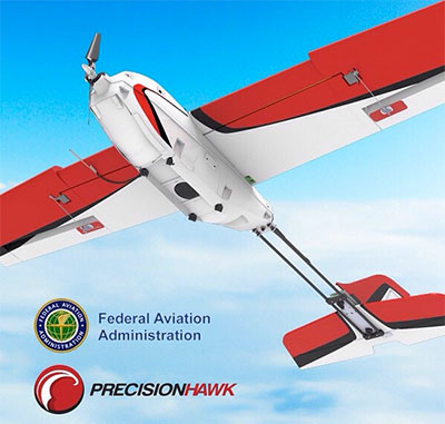
New risk-based “bow-tie” zones will help protect aircraft using PrecisionHawk’s Low Altitude Traffic and Airspace Safety (LATAS) platform.
DJI is improving its geofencing technology to refine the airspace limitations for drone flights near airports, providing smarter protection for airplanes in critical areas.
DJI has updated Geospatial Environment Online (GEO) Version 2.0, and will phase it in starting in November when the revised zones will take effect for airspace around airports in the United States. Upgrades in other regions will follow.
Image: DJI
The new system allows GEO to create detailed three-dimensional “bow-tie” safety zones surrounding runway flight paths, and to use complex polygon shapes around other sensitive facilities, rather than simple circles.
The new restrictions better reflect the actual safety risk posed in those areas, while allowing more flights to the side of runways where risk is substantially lower.
Runway exclusion zones. DJI’s new geofencing also incorporates the principles of Section 384 of the recently enacted U.S. Federal Aviation Administration (FAA) Reauthorization Act designating the final approach corridor to active runways at major airports to be “runway exclusion zones” for unauthorized drones. DJI customers should update their DJI GO 4 flight control app and aircraft firmware to ensure these improvements are implemented.
To obtain reliable geospatial information for the enhanced shapes in GEO 2.0, DJI has chosen a new data provider that can provide highly accurate details such as the exact locations of airport runways and facility boundaries.
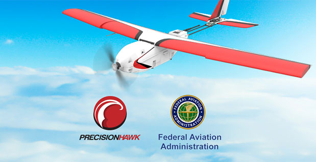
PrecisionHawk’s LATAS. In North America, DJI will use data from PrecisionHawk Inc., replacing DJI’s previous geospatial data provider AirMap. Under a partnership agreement, PrecisionHawk’s Low Altitude Traffic and Airspace Safety (LATAS) platform will provide DJI customers with critical airspace information that will position them to fly safely in North America.
DJI will be able to refine airspace limitations for drone flights near airports, providing smarter protection for drones in critical areas and clarifying restrictions, PrecisionHawk said.
“PrecisionHawk has a corporate commitment to safely integrating drones into the airspace and enabling complex operations,” said Diana Cooper, senior vice president of policy and strategy at PrecisionHawk. “Through our work under the FAA Pathfinder Program, we have shown how technology can play a critical role in unlocking advanced operations, including beyond visual line of sight flight.”
GEO 2.0 Development. DJI first created No-Fly Zones for its drones in 2013 and introduced the more refined GEO system three years later, adding live updates and new zones for prisons and nuclear power plants, while providing flexible self-unlocking for professionals.
Both systems recognized that the overwhelming majority of drone pilots want to fly safely and responsibly, and want an easy-to-use guide to help them understand the airspace so they can do so.
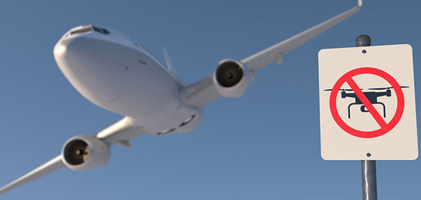
Artist’s rendering of a no-drone sign near an airport. Image: PixOne/Shutterstock.com
To develop GEO 2.0, DJI collaborated with general aviation pilots through the Aircraft Owners and Pilots Association (AOPA) and with airports through the American Association of Airport Executives (AAAE) to incorporate their expertise and guidance about air traffic and airports into DJI’s new geofencing methods.
DJI geofencing uses GPS and other navigational satellite signals to automatically help prevent drones from flying near sensitive locations such as airports, prisons, nuclear power plants and high-profile events.
In certain locations, a DJI drone cannot take off or fly in a geofenced area without special authorization. Drone pilots with verified DJI accounts can unlock some areas if they have legitimate reasons and necessary approvals, but the most critical areas require special action from DJI to unlock them.
DJI has streamlined the approval process so professional drone pilots with authorization to fly in sensitive locations can receive unlocking codes within 30 minutes.
The GEO System. The GEO system previously geofenced a 5-mile circle around airports, with enhanced restrictions in a smaller circle encompassing the airport area.
GEO 2.0 applies the strongest restrictions to a 1.2 kilometer- (3/4 mile)-wide rectangle around each runway and the flight paths at either end, where airplanes actually ascend and descend. Less strict restrictions apply to an oval area within 6 kilometers (3.7 miles) of each runway.
This bow-tie shape opens more areas on the sides of runways to beneficial drone uses, as well as low-altitude areas more than 3 kilometers (1.9 miles) from the end of a runway, while increasing protection in the locations where traditional aircraft actually fly.
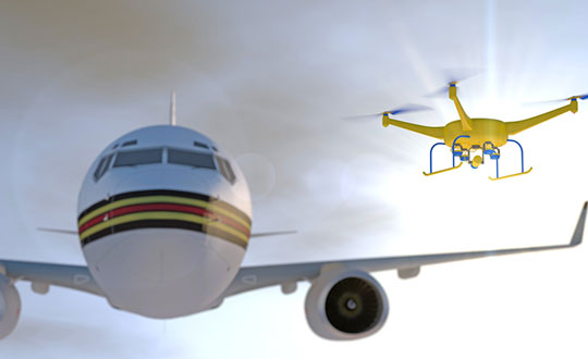
Artist’s concept of a drone approaching a commercial airliner. Image: PixOne/Shutterstock.com
Aviation Parameters. DJI’s new boundary areas around airport runways are based on the International Civil Aviation Organization’s Annex 14 standard for airspace safety near runways and the FAA’s Part 77 parameters for “imaginary surfaces” and air navigation obstructions.
DJI’s categorization of airports is based on traffic volume principles defined in statutes such as U.S. Title 49 section 47102, and the FAA’s criteria developed in 2012 for categorizing general aviation airports.
Using these aviation parameters, DJI has aligned its geofencing safety feature to broader understandings of airspace and airport risk. This chart demonstrates how GEO 2.0 applies those detailed, risk-based airspace boundaries to the airspace around airports that can be considered to involve relative high, medium, and low risk (see graphic).
LATAS. Through its work under the FAA Pathfinder Program, PrecisionHawk has shown how technology such as LATAS can play a critical role in unlocking advanced operations, including beyond visual line of sight flight. LATAS was tested under the Pathfinder Program to facilitate safe beyond visual line of sight operations.
LATAS brings a combined set of geospatial and software tools to the market. In addition to providing improved geospatial data, the LATAS platform features specialized display elements, including telemetry and access to the Harris real-time manned aircraft feed. Using these elements pilots can easily observe the relative altitude and horizontal separation of intruding aircraft and other mission-critical measures.
This week, the Federal Aviation Administration (FAA) and the Department of Homeland Security (DHS) are conducting drone-detection research in the vicinity of Denver International Airport. The work is part of the FAA’s Pathfinder Program for UAS Detection at Airports and Critical Infrastructure.
The work in Denver is one of six technical evaluations scheduled over an 18-month period.
The State of Nevada and State of North Dakota UAS Test Sites conducted flight operations for the Denver evaluations. Industry partners involved in the Denver flights included CACI International, Liteye Systems and Sensofusion.
The FAA plans to capture the data and findings from the evaluations and draft recommendations for standards. These standards will guide the selection of drone-detection systems for airports nationwide.
Other evaluation sites include Atlantic City International Airport, JFK International Airport, Eglin Air Force Base, Helsinki Airport and Dallas-Fort Worth International Airport.
In addition to DHS, the FAA’s federal research partners include the Department of Defense, FBI, Federal Communications Commission, Department of the Interior, Department of Energy, NASA, Department of Justice, Bureau of Prisons, U.S. Secret Service and U.S. Capitol Police.
The House Report accompanying the Fiscal Year 2016 federal appropriations law and the FAA Extension, Safety, and Security Act of 2016 both directed the FAA to continue research into detecting unmanned aircraft in airport environments.
The Federal Aviation Administration (FAA) is expanding the part of its Pathfinder Program that focuses on detecting and identifying unmanned aircraft systems (UAS) flying too close to airports.
On Monday, the FAA signed Cooperative Research and Development Agreements (CRDAs) with Gryphon Sensors, Liteye Systems Inc. and Sensofusion. The FAA will evaluate procedures and technologies designed to identify unauthorized UAS operations in and around airports. This research effort, part of the FAA’s Pathfinder Initiative, addresses one of the significant challenges to safe integration of UAS into the nation’s airspace.
“Sometimes people fly drones in an unsafe manner,” said Marke “Hoot” Gibson, FAA Senior Advisor on UAS Integration. “Government and industry share responsibility for keeping the skies safe, and we’re pleased these three companies have taken on this important challenge.”
“Gryphon Sensors, LLC is excited to collaborate with the FAA on utilizing technologies that detect, track and identify errant or hostile UAS in and around our nation’s airports and sensitive areas. Detecting these threats is challenging because most of them are very small, fly low to the ground and can be pre-programed to fly autonomously,” said Gryphon Sensors President Tony Albanese.
“Our AUDS team is very excited to join the FAA’s efforts to counter rogue UAVs,” stated Thomas Scott, President of Liteye Systems. He added, “As the legitimate use of unmanned vehicles becomes more prevalent in many industries, unfortunately this large number of aircraft also makes them readily available for illicit use. With the right technologies we can assist the UAV operator to conduct his mission, while protecting against those who wish us harm.”
“We first developed the technology to detect, locate, track and gain control over UAS three years ago as a military project and operated it with three European armies under NATO,” said Sensofusion CEO Tuomas Rasila. “Fast forward to the present time, and AIRFENCE is now protecting various customer sites in Europe, including prisons, high profile government buildings, police, and military sites. Since the technology is software based, it improves with over-the-air updates, ensuring that we are always ahead of the commercial UAS market.”
The companies’ prototype UAS sensor detection systems will be evaluated at airports selected by the FAA. The agency and its federal government partners — particularly the Department of Homeland Security (DHS) — will work with the companies to study how effective their respective technologies are, while ensuring they do not interfere with the safety and security of normal airport operations.
The CRDAs with Gryphon, Liteye and Sensofusion expand upon collaborative efforts with industry to develop system standards to identify unauthorized UAS flights near airports, which could pose a hazard to manned aircraft. The agency has seen a steep increase in reports of small UAS close to airports over the last two years.
The FAA has also partnered with DHS and CACI International on similar research to explore how that company’s prototype detection technology may help detect UAS.
The FAA supports DHS in an inter-agency effort to meet the threat of unauthorized UAS from a “whole of government” perspective. Other participating federal agencies include: the Department of Defense, Department of Energy, U.S. Secret Service and the Federal Bureau of Investigation.
Insitu and BNSF officials launch ScanEagle in support of the FAA’s pathfinder initiative (Photo: Insitu)
Insitu and PrecisionHawk have formed a strategic alliance to provide UAS solutions that help commercial enterprises achieve safe unmanned flight for extended and beyond-visual-line-of-sight operations. Insitu is a provider of information and unmanned aircraft systems (UAS) for commercial, civil and military operations, and PrecisionHawk is an aerial data provider.
Both companies are exhibiting at this week’s AUVSI Xponential 2016 show in New Orleans.
The alliance also leverages the extensive research and testing capabilities of two of the participants of the Federal Aviation Administration (FAA) Pathfinder Program, which is dedicated to expanding the use of UAS within the nation’s airspace.
“While our businesses are diverse, the areas where we intersect have tremendous potential for creating new opportunities in the commercial industries we both serve,” said Ryan M. Hartman, Insitu President and CEO. “This alliance ensures that more businesses will explore what unmanned technology can offer.”
Thanks to the integration of each company’s proprietary platforms, hardware and software, Insitu and PrecisionHawk plan to deliver even more data insights.
“Our customers are always pushing us to bring more advanced and comprehensive solutions, and we go above and beyond to make sure we are developing tools that serve their specific needs,” said PrecisionHawk president Christopher Dean. “We believe this alliance with Insitu will help us deliver on our promise even more.”
The emphasis of the U.S.-based alliance is on providing business intelligence support for commercial operations, including asset protection, property preservation, safety enhancement and environmental monitoring.
Launching at a tower site near Vaughn, New Mexico, Insitu accomplished a commercial beyond-visual-line-of-sight operation with an unmanned aerial system (UAS).
The Oct. 25 event marked the beginning of a week-long series of flights with BNSF Railway designed to show how UAVs can enhance the safety of critical infrastructure by aiding with inspections.
During the 14 hours of flyovers, the Insitu ScanEagle targeted problems such as washouts and bridge damage. The information gathered was then fed back to Insitu personnel on the ground in real time.
Insitu and BNSF officials launch ScanEagle for the historic first flight. (Photo: Insitu Inc.)
The flights were part of the U.S. Federal Aviation Administration’s (FAA’s) Pathfinder program announced on May 6. For Pathfinder, the FAA selected three companies — CNN, PrecisionHawk and BNSF — to explore commercial use of drones beyond operations proposed in its draft UAS rule published in February.
The FAA tasked BNSF Railway, the second-largest freight railroad network in North America, with inspecting rail infrastructure beyond visual line of sight. BNSF operates 32,500 miles of track.
BNSF selected the Scan-Eagle because it carries an FAA certification for commercial applications. The UAV is capable of providing 3D rendering as well as high-resolution video magnification.
In its first day of operations, the ScanEagle UAV provided real-time video covering 64 miles of the 132-mile stretch of track that BNSF has designated for the exercise. The ScanEagle is capable of flying for up to 24 hours at speeds of up to 80 knots.
The exercise demonstrated how, in addition to a railway company’s traditional methods of track monitoring, unmanned aircraft can not only improve inspections, but keep employees out of harm’s way and harsh conditions.
Insitu, a subsidiary of The Boeing Company, creates and supports unmanned systems and software technology for collecting, processing and understanding sensor data.
Under Pathfinder, CNN is researching visual line of sight operations for newsgathering in urban areas, and working with Georgia Tech University to improve newsgathering for all organizations. PrecisionHawk is investigating agricultural operations for rural areas, flying outside line of sight.
The Federal Aviation Administration (FAA) has entered into a Pathfinder agreement with CACI International Inc. to evaluate how the company’s technology can help detect Unmanned Aircraft Systems (UAS) in the vicinity of airports.
In testimony today before the House Aviation Subcommittee, FAA Deputy Administrator Mike Whitaker said that flying an unmanned aircraft near a busy airfield poses an unacceptable safety hazard. During the hearing “Ensuring Aviation Safety in the Era of Unmanned Aircraft Systems,” Whitaker told the congressional panel the FAA signed an agreement this week to assess the safety and security capabilities of CACI’s product within a five-mile radius of airports, and the agency also will collaborate with its government partners.
A steep increase in reports of small unmanned aircraft in close proximity to runways is presenting a new challenge for the FAA. It is the agency’s responsibility to identify possible gaps in safety and address them before an incident occurs.
CACI’s prototype UAS sensor detection system will be evaluated at airports selected by the FAA. The agency and its federal government partners will work with the company to evaluate the effectiveness of the technology, while also ensuring that it does not interfere with the safety and security of normal airport operations.
The CACI partnership is part of the larger UAS Pathfinder Program, which the FAA announced in May. Pathfinder is a framework for the agency to work closely with industry to explore the next steps in unmanned aircraft operations beyond those proposed in February in the draft small UAS rule.
“Safety is always the FAA’s top priority, and we are concerned about the increasing number of instances where pilots have reported seeing unmanned aircraft flying nearby,” said Whitaker. “We are looking forward to working with CACI and our interagency partners to identify and evaluate new technologies that could enhance safety for all users of the nation’s airspace.”
“CACI is proud to partner in the FAA’s Pathfinder cooperative research and development agreement to address the escalating Unmanned Aircraft Systems safety challenges that airports are facing nationwide,” said John Mengucci, CACI’s CEO and president of U.S. operations. “The agreement provides a proven way to passively detect, identify, and track UAS — or aerial drones — and their ground-based operators, in order to protect airspace from inadvertent or unlawful misuse of drones near U.S. airports. This CACI-built solution will help ensure a safe, shared airspace while supporting responsible UAS users’ right to operate their aircraft.”
The U.S. Department of Transportation’s Federal Aviation Administration (FAA) today announced a partnership with industry to explore the next steps in unmanned aircraft operations beyond the type of operations the agency proposed in the draft small unmanned aircraft systems (UAS) rule it published in February.
“Government has some the best and brightest minds in aviation, but we can’t operate in a vacuum,” said U.S. Transportation Secretary Anthony Foxx. “This is a big job, and we’ll get to our goal of safe, widespread UAS integration more quickly by leveraging the resources and expertise of the industry.”
FAA Administrator Michael Huerta announced the initiative today at the Association for Unmanned Vehicle Systems International Unmanned Systems 2015 conference in Atlanta, Ga. See more coverage of the show from Geospatial Solutons.
The FAA is working with industry partners on three focus areas, including:
Visual line-of-sight operations in urban areas: CNN will look at how UAS might be safely used for newsgathering in populated areas.
Extended visual line-of-sight operations in rural areas: This concept involves UAS flights outside the pilot’s direct vision. UAS manufacturer PrecisionHawk will explore how this might allow greater UAS use for crop monitoring in precision agriculture operations.
Beyond visual line-of-sight in rural/isolated areas: BNSF Railroad will explore command-and-control challenges of using UAS to inspect rail system infrastructure.
“Even as we pursue our current rulemaking effort for small unmanned aircraft, we must continue to actively look for future ways to expand non-recreational UAS uses,” Huerta said. “This new initiative involving three leading U.S. companies will help us anticipate and address the needs of the evolving UAS industry.”
The three companies reached out to the FAA to work on research continuing to expand use of UAS in the nation’s airspace. CNN and the FAA already have been working together through a Cooperative Research and Development Agreement (CRDA). BNSF has a draft CRDA that is nearly complete and PrecisionHawk has been working with the FAA on a possible research partnership.
Further developing these operational concepts supports the FAA’s overall strategy to expand UAS access, which currently includes rulemaking, reviewing operational data from the six national UAS test sites, expanding commercial operations via the Section 333 exemption process, and issuing operational authorizations for type-certified UAS.
The FAA published a proposed rule for small UAS on February 23, 2015 and received nearly 4,500 public comments by the end of the comment period on April 24. The agency will work as quickly as possible, but must address all the comments submitted before finalizing the rule. The number and complexity of the comments will play a role in determining the timeline for a final rule.
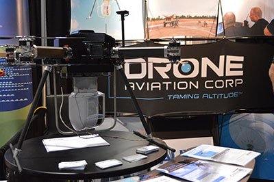
CNN will use Drone Aviation’s tethered drones to gather footage in in urban areas from never-seen-before angles and heights. The company’s WATT-200 was unveiled at the AUVSI this week.
Federal Aviation Administration (FAA) Administrator Michael Huerta announced two new initiatives related to unmanned aircraft systems (UAS) today at the Association for Unmanned Vehicle Systems International (AUVSI) Unmanned Systems 2015 conference in Atlanta, Ga.
Administrator Huerta told the large gathering of national journalists, “The unmanned aircraft industry is changing faster than any segment in the aircraft industry. A new project to harness that energy, the Pathfinder program, is partnering with three leading U.S. companies to expand unmanned aircraft operations in the United States.”
The FAA is working with industry partners on three focus areas:
CNN (Cable News Network) will research visual line of sight (LOS) operations for newsgathering in urban areas. CNN will continue working with Georgia Tech University to improve newsgathering for all organizations.
PrecisionHawk will investigate agricultural operations for rural areas, flying outside LOS.
BNSF Railway, second-largest freight railroad network in North America, will undertake inspection of rail infrastructure, also beyond visual LOS.
Huerta said that the partners, collectively, “are trying to push the envelope, what can we accommodate, accommodate safely, and what can we learn from that. We’ll test a little, learn a little, then test some more. How do we see a staged implementation? To integrate unmanned aircraft, but to do it safely, as directed by Congress. We’re trying to push the edges of what we can allow, working with partners who have specific uses and resources that they will apply to those.”
When asked for a timeframe to reach new UAV regulations, he replied, “I can’t comment a lot on the rule itself, but it’s fair to say that in the rulemaking comment process [which closed on April 24], we received more than 4,500 comments. It’s too early to say how those comments will shape what the final rulemaking will take. Assessment will be done in the coming months, perhaps by the end of the year, but that’s an aggressive timetable. This effort will go on as long as the partners want us to go on doing it. That’s not accomplished in six months, nor should it take a million years.”
As to LOS restrictions, and beyond LOS, he replied, “The framework of the previously published rule was focused on LOS, and on the use of visual observers in addition to the operator. Now we’re taking the next step, to explore beyond LOS uses. What are reasonable applications for that, and what mitigations for safety should be put in place for that? Everyone wants to get there. It’s important to figure out how we get there safely.”
What mitigations will be put in place for beyond LOS? A vice president of BSNF Railway said that the company is “working with FAA and several vendors around command and control infrastructure. This is yet to be fully defined. The railroad is a very safe an unforgiving environment. This doesn’t replace anything we’re doing today, it’s an addition.” He defined the operating environment as ” a 300 or 400-mile capability, to fly looking for broken rail, etc., beyond the visual, on-the-ground inspections that rail crews already do. ” He anticiated the use of “sense-and-avoid technology [for the UAVs], not using chase planes but perhaps using communications capabilities from cell towers and railway infrastructure along the right of way.”
The CEO of PrecisionHawk commented similarly, “We’re not changing much of our operational flow, just extending the baseline for it. We will implement a traffic-management technology, called Lattice, leveraging to ensure safety and reliability beyond the operator’s LOS.”
Gregory Agvent, CNN’s director of News Operations, said he looked forward to “some camera shots that were previously impossible for us, that now we’re going to be able to do.” Under the terms of the Certificate of Authorization (COA), Agvent said that “We’re capable of doing it [undertaking UAV missions] without asking for (FAA) permission” for specific flights.
The three industry participants concurred that they will work with their [UAV] partners in parallel with the rules to develop a certification process, so that the FAA can determine their vehicles are uniformly safe, the same way the y do with piloted aircraft currently. Both the railroad and PrecisionHawk have one currently operating flight platform each, and are looking at others, as theirs do not fit all applications.
“These are not exclusive [agreements],” emphasized Huerta, “limited to particular platforms or applications. This is a practical research effort to apply, learn, and integrate on the broadest scale.” When asked about possible further participants in the Pathfinder project, Huerta indicated the three companies represented on the briefing platform with him: “They came to us. You can interpret that as an invitation. We’re casting a very wide net. How do we et to a broader integration and implementation? We need multiple ways to gather information.”
Agvent urged, “It’s critical for manufacturers to come to the table, to get certified by make as opposed to individual models, to get free access to the sky.”
Huerta concluded, “We are learning together, as an industry and as a regulator. How can we collectively, as an industry, learn more in order to see a much more robust integration of unmanned aircraft into our aviation industry? We’re all interested in pushing the boundaries, and sharing the information broadly across the industry.”
The surprise preview of the pending announcement drew scores of curious and concerned industry representatives and exhibitors at the massive AUVSI show, who gathered anxiously outside the press briefing room, to which they were not admitted.
“The FAA is moving ahead with safe integration of UAS into the busiest, most complex airspace in the world,” according to an FAA statement issued prior to the briefing.”Even as the agency proceeds with rulemaking for small UAS, it continues to look at new ways to foster safe UAS operations by both hobbyists and businesses.”