Tag: Perseverance

  • NASA’s Perseverance doesn’t need GNSS to find itself on Mars

    NASA’s Perseverance doesn’t need GNSS to find itself on Mars

    News from NASA’s Jet Propulsion Laboratory

    A new technology called Mars Global Localization lets Perseverance determine precisely where it is, without human help.

    Imagine you’re all alone, driving along in a rocky, unforgiving desert with no roads, no map, no GPS, and no more than one phone call a day for someone to inform you exactly where you are. That’s what NASA’s Perseverance rover has been experiencing since landing on Mars five years ago. Though it carries time-tested tools for determining its general location, the rover has needed operators on Earth to tell it precisely where it is — until now.

    A new technology developed at NASA’s Jet Propulsion Laboratory in Southern California enables Perseverance to figure out its whereabouts without calling humans for help. Dubbed Mars Global Localization, the technology features an algorithm that rapidly compares panoramic images from the rover’s navigation cameras with onboard orbital terrain maps.

    Running on a powerful processor that Perseverance originally used to communicate with the Ingenuity Mars Helicopter, the algorithm takes about two minutes to pinpoint the rover’s location within some 10 inches (25 centimeters). Mars Global Localization was first used successfully in regular mission operations on Feb. 2, then again Feb. 16.

    “This is kind of like giving the rover GPS. Now it can determine its own location on Mars,” said JPL’s Vandi Verma, chief engineer of robotics operations for the mission. “It means the rover will be able to drive for much longer distances autonomously, so we’ll explore more of the planet and get more science. And it could be used by almost any other rover traveling fast and far.”

    This panorama from Perseverance is composed of five stereo pairs of navigation camera images that the rover matched to orbital imagery in order to pinpoint its position on Feb. 2, 2026, using a technology called Mars Global Localization. (Credit: NASA/JPL-Caltech)
    This panorama from Perseverance is composed of five stereo pairs of navigation camera images that the rover matched to orbital imagery in order to pinpoint its position on Feb. 2, 2026, using a technology called Mars Global Localization. (Credit: NASA/JPL-Caltech)

    The upgrade is especially valuable given how well Perseverance’s auto-navigation self-driving system has been working. Enabling the rover to re-plan its path around obstacles en route to a preestablished destination, AutoNav has proved so capable that the distance Perseverance can drive without instructions from Earth is largely limited by the rover’s uncertainty about its whereabouts. Now that it can stop and determine its exact location, Perseverance can be commanded to drive to potentially unlimited distances without calling home.

    Implementation of Mars Global Localization comes on the heels of another innovation from the Perseverance team: the first use of generative artificial intelligence to help plan a drive route by selecting waypoints for the rover, which are normally chosen by human rover operators. Both technologies enable Perseverance to travel farther and faster while minimizing team workload.

    Beyond visual odometry

    Unlike on Earth, there is no network of GPS satellites in deep space to locate spacecraft on planetary surfaces. So missions — whether robotic or crewed — must come up with other ways to determine their location.

    The Mars Global Localization algorithm runs on a fast commercial processor in the Helicopter Base Station — the upper, gold-colored box that was integrated into NASA’s Perseverance rover in a clean room. Perseverance used the base station to communicate with the now-retired Ingenuity Mars Helicopter. (Credit: NASA/JPL-Caltech)
    The Mars Global Localization algorithm runs on a fast commercial processor in the Helicopter Base Station — the upper, gold-colored box that was integrated into NASA’s Perseverance rover in a clean room. Perseverance used the base station to communicate with the now-retired Ingenuity Mars Helicopter. (Credit: NASA/JPL-Caltech)

     As with NASA’s previous Mars rovers, Perseverance tracks its position using what’s called visual odometry, analyzing geologic features in camera images taken every few feet while accounting for wheel slippage. But as tiny errors in the process add up over the course of each drive, the rover becomes increasingly unsure about its exact location. On long drives, the rover’s sense of its position can be off by more than 100 feet (up to 35 meters). Believing it may be too close to hazardous terrain, Perseverance may prematurely end its drive and wait for instructions from Earth.

    “Humans have to tell it, ‘You’re not lost, you’re safe. Keep going,’” Verma said. “We knew if we addressed this problem, the rover could travel much farther every day.”

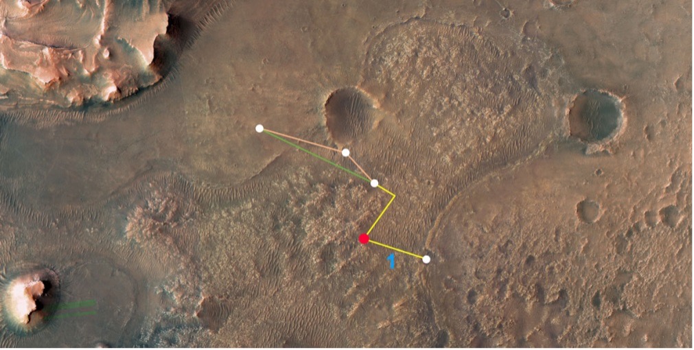
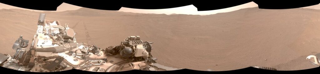
    After each drive comes to a halt, the rover sends a 360-degree panorama to Earth, where mapping experts match the imagery with shots from NASA’s Mars Reconnaissance Orbiter (MRO). The team then sends the rover its location and instructions for its next drive. That process can take a day or more, but with Mars Global Localization, the rover is able to compare the images itself, determine its location, and roll ahead on its preplanned route.

    “We’ve given the rover a new ability,” said Jeremy Nash, a JPL robotics engineer who led the team working on the project under Verma. “This has been an open problem in robotics research for decades, and it’s been super exciting to deploy this solution in space for the first time.”

    The small team began working in 2023, testing the accuracy of the algorithm they’d developed using data from 264 previous rover stops. The algorithm compared rover panoramic photos to MRO imagery and correctly pinpointed the rover’s location for every single stop.

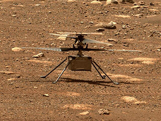
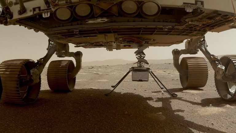
    How Ingenuity helped

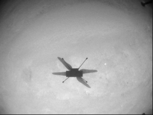
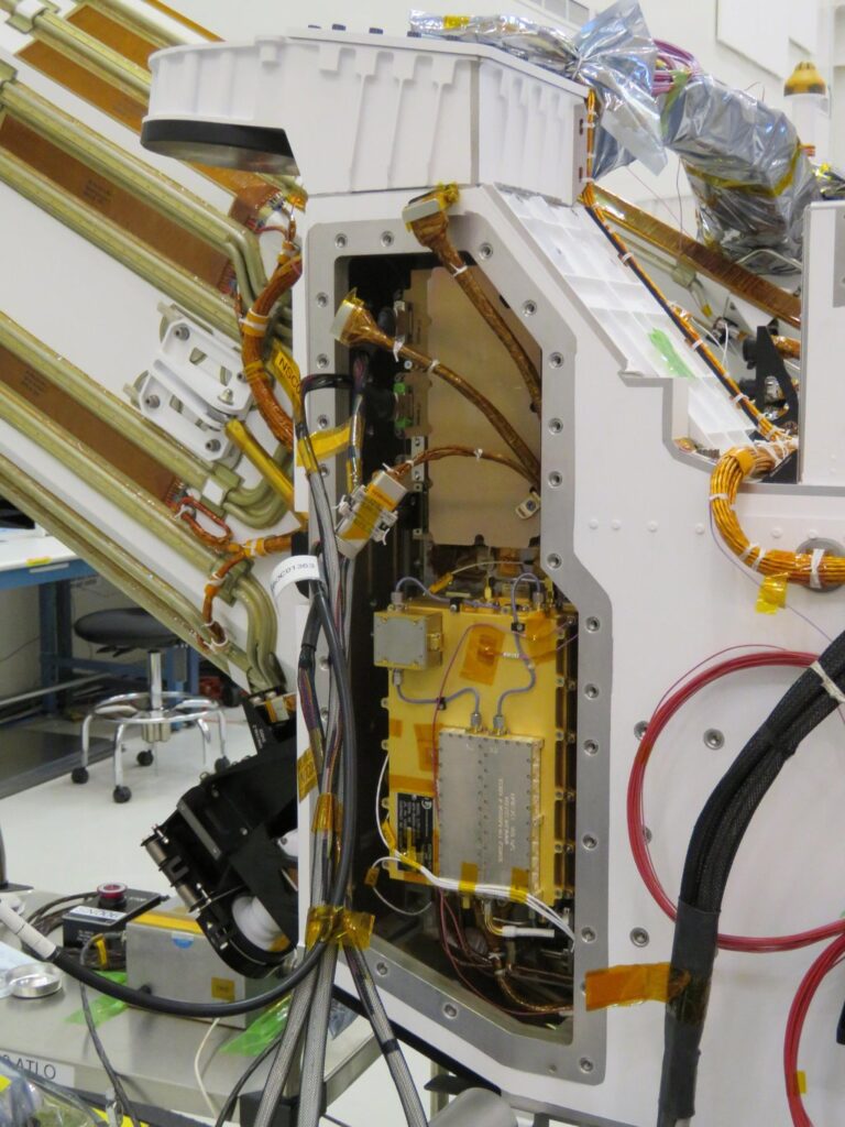
    Key to Mars Global Localization is the rover’s Helicopter Base Station (HBS), which Perseverance used to communicate with the now-retired Ingenuity Mars Helicopter. Equipped with a commercial processor that powered many consumer smartphones in the mid-2010s, the HBS runs more than 100 times faster than the rover’s two main computers, which, built to survive the radiation-heavy Martian environment, are based on hardware introduced in 1997.

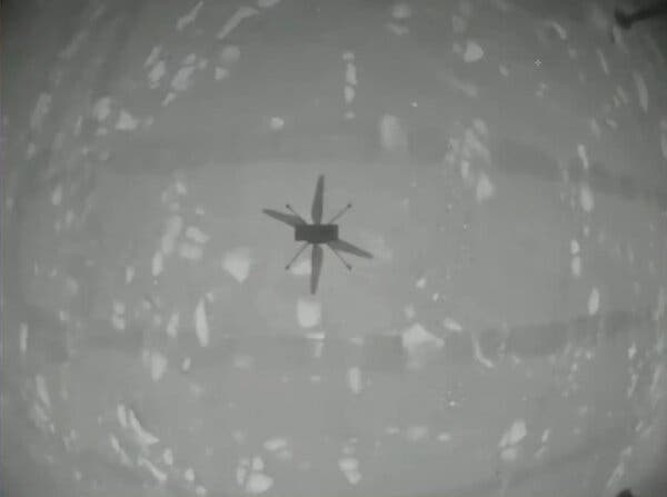
    As a technology demonstration designed to test capabilities, the Ingenuity mission was able to risk employing more powerful commercial chips in the HBS and the helicopter even though they hadn’t been proven in space. It paid off: Expected to fly no more than five times, the rotorcraft completed 72 flights.

    The power of the HBS processor inspired Verma to look for ways the Perseverance mission might harness it. “It’s almost like a gift. Ingenuity blazed the trail, proving we could use commercial processors on Mars,” Verma said.

    Tapping into the HBS computer has had its challenges. To address reliability, the team developed a “sanity check”: The algorithm runs on the HBS multiple times before one of the rover’s main computers checks to ensure the results match. During testing, the team repeatedly found the rover’s position was off by 1 millimeter. They discovered damage to about 25 bits — a minuscule fraction of the processor’s 1 gigabyte of memory — and developed a solution to isolate those bits while the algorithm runs.

    Alongside the broader Mars Global Localization process, the team’s sanity check and memory solutions are expected to find new uses as faster commercial processors are employed in future missions. In the meantime, the team has already turned their sights to the Moon, where difficult lighting conditions and long, cold lunar nights make knowing exactly where spacecraft are located all the more critical.

    More about Perseverance

    NASA’s Jet Propulsion Laboratory, which is managed for the agency by Caltech, built and manages operations of the Perseverance rover on behalf of NASA’s Science Mission Directorate in Washington, as part of NASA’s Mars Exploration Program portfolio. Learn more about Perseverance.

  • Reapers used to fight California wildfires

    Reapers used to fight California wildfires

    This month, we look at new applications that might interest even the most tech-savvy. From military Reaper unmanned vehicles being turned into civilian fire-fighters, through continuing drone flights on Mars, to e-scooters monitored by AI-system, the autonomous arena continues to grow. 


    Reaping Disaster-Response Benefits

    The General Atomics Reaper unmanned aerial vehicle (UAV) is usually a weapon of war. Most of us picture them loaded with missiles to be fired on terrorist hideouts, with video of the impact appearing on the six-o’clock news. Soldiers in small control shacks guide these worldwide attacks, while politicians watch the outcomes remotely with their own direct TV coverage. This is how we tend to think of these destructive systems.

    However, Reapers recently have been helping fight the huge fires devastating the California landscape — a more humanitarian, supportive role for a military asset.

    General Atomics Reaper UAV on patrol and remote pilots (Photo: California Air National Guard)
    General Atomics Reaper UAV on patrol and remote pilots (Photos: California Air National Guard)

    The California Air National Guard (ANG) has been assisting firefighters for many years by using helicopters and fixed-wing aircraft to determine the intensity of large California fires and to plot their boundaries.

    In the past 10 years, with the availability of large reconnaissance UAVs and assistance from the Federal Aviation Administration to develop and approve operational procedures, an approach has been formulated to employ Reapers, with the potential to reduce costs and greatly improve response times.

    Having large UAVs at altitude in civilian airspace requires an accompanying chase plane to ensure safe operation. With proven onboard detect-and-avoid capability and visibility through crew monitoring, the chase aircraft only monitors the Reaper’s climb to operational altitude. Using infrared and video from onboard cameras, data is downlinked and post-processed to create fire maps. Artificial intelligence (AI) automates this procedure to provide incident commanders with a near-real-time situational overview.

    Besides mapping the fire, the incident commander can keep track of firefighters on the ground and gain a clearer picture of the fire’s intensity, rate of growth and direction. With a high altitude view of the landscape, Reaper pilots also help determine the best evacuation routes. Video downlinks provide real-time fire dynamics to commanders and even to firefighters on the ground who carry handheld devices.

    When equipped with long-range fuel tanks, Reapers can remain on task for up to 18 hours. The pilot and systems operator in their remote mission-control shack can hand over control to a new crew for such a long mission. The new crew can even be in a different location when it assumes control.

    The experience gained in California regarding flight approvals, operations and use of data is being shared with remote UAV crews and emergency-response controllers in other U.S. jurisdictions as well as other countries. The procedures can be used not only for firefighting, but also for earthquake, flooding and hurricane response.

    Our Martian Adventure

    NASA has extended the mission on Mars of its Ingenuity UAV, which arrived on the planet attached to the belly of the Perseverance rover. The original mission was to establish that controlled flight on the planet’s surface was possible.

    Ingenuity has now spent more than one year on the surface of Mars and has 21 flights under its belt. The diminutive copter has taken on an extended role of scouting out potential routes for its SUV-sized mother ship.

    Integrity runs ‘wiggle test’ of its rotor-blades prior to flight. (Photo: NASA/JPL-Caltech/ASU)
    Integrity runs a “wiggle test” of its rotor blades prior to flight. (Photo: NASA/JPL-Caltech/ASU)

    Ingenuity’s 21st flight is the first of at least three needed to transverse the Séítah region to reach its next base. From there, it will make flights to examine an old river delta. The whole relocation trip will cover about 1,150 feet as Integrity navigates around a large hill. While flying these investigative routes, the NASA team continues to gently push the drone’s capabilities to better understand improvements that can be applied to future Mars UAV designs.

    Proposed route to reach river delta. (Photo: NASA/JPL-Caltech/University of Arizona/USGS)
    Proposed route to reach river delta. (Image: NASA/JPL-Caltech/University of Arizona/USGS)

    Once at the river delta, Ingenuity will encounter higher ground — up to 130 feet above the floor of the Jezero Crater, where it previously flew. The new area is expected to present significant obstacles: jagged cliffs, angled surfaces, rocky outcroppings and sand-filled traps. These obstacles could hamper the Perseverance rover or tip over the small drone on landing. But it’s also a place NASA thinks could harbor evidence of past life.

    On arriving at the delta, Ingenuity’s first task will be to help decide which of two river channels Perseverance should take to climb to the delta. Data from the drone will also pick out science targets that Perseverance could investigate on the way. Once established in the delta region, NASA also hopes to fly Ingenuity to scout other features the rover might not be able to reach, but which might be accessible on future missions.

    NASA has uploaded several upgrades to Ingenuity. They enabled higher, faster and longer flights and speed changes. The upgrades also have improved the drone’s perception of landing areas. Potential upgrades include adding terrain elevation maps and a hazard-avoidance capability for safer landing.

    E-Scooters Adopt Pedestrian Defense

    An outfit that rents e-scooters in more than 60 cities worldwide is adopting a “pedestrian defense” AI upgrade to prevent renters from abusing others around them and keep them riding within acceptable rules of operation.

    LINK e-scooter (Photo: Superpedestrian)
    LINK e-scooter. (Photo: Superpedestrian)

    Previous efforts have only give riders visual and audio warnings that they should not enter a sidewalk. This new e-scooter active defense system slows the scooter to a stop and will not allow it to resume operation until it is moved outside the prohibited area.

    Other unsafe behaviors — riding the wrong way up one-way streets, parking in the wrong place or aggressively swerving — also can be detected and actively deterred.

    Sensors on the scooter provide data that relates location and activity to onboard stored city maps and geofenced areas. This enables application of enforcement commands within a second of them being detected.

    The system provides cities and operators with visibility for the whole fleet of scooters. It shows what renters are doing within existing street safety restrictions, allowing both city and rental company officers to address perceived operational issues.

  • The Mars helicopter: What’s it up to now?

    The Mars helicopter: What’s it up to now?

    The Ingenuity UAV is still buzzing around on Mars, well past its anticipated evaluation/test lifetime, and is still providing intriguing video and photographic coverage of the surface. Having established that it can fly in the Martian atmosphere and having achieved all its own test objectives, its role is now that of a “pathfinder” — in the truest form of the word — scouting out routes for its big brother Perseverance rover.

    The principle objective of the mission remains the search for signs of life, and this is now being performed by the SUV-sized land-bound ground unmanned vehicle (GUV) rover. The project is managed by NASA/Jet Propulsion Laboratory (JPL).

    Since our earlier stories covered the phenomenal achievements of the little 2 Kg UAV, it’s reasonable that we provide details of its development and design, largely by JPL and AeroVironment.

    Talking with the Ben Pipenberg, the AeroVironment engineering lead for the Ingenuity program, it was clear that the company’s role had been to bring its extensive unmanned experience to the requirements for flight on the red planet. It turns out flying high-altitude pseudo-satellite unmanned aircraft at up to 90,000 feet teaches you a lot about vehicle dynamics in very thin air, and AeroVironment has been doing that for many years. The company developed Ingenuity’s rotor and rotor-drive systems, and the minimal weight structure of the vehicle.

    JPL developed the flight-control systems, power system, telecoms and electronics that enabled communications, navigation, guidance, video and control of Ingenuity on Mars.

    Mars is cold, especially at night, reaching as low as –148 °F. It has few clouds, is a long way from the sun, and has a very thin atmosphere. When JPL decided to use mostly off-the-shelf components, the added task of keeping the electronics warm using minimal power became absolutely essential. Power is provided by a lithium-ion battery pack with its own heaters and temperature control, which is recharged by a small solar photo-electric panel mounted on the top of the vehicle above the rotors.

    Integrity's lithium-ion battery, heaters and temperature sensors. (Diagram: Aerovironment)
    Integrity’s lithium-ion battery, heaters and temperature sensors. (Diagram: Aerovironment)

    Principle vehicle elements. (Diagram: Aerovironment)
    Principle vehicle elements. (Diagram: Aerovironment)

    The electronics are carried in the electronics core module (ECM), which is mounted inside the insulated box and mechanically attached to a central, hollow, structural tube, on which the flight motors, rotors and landing legs are all attached. The electronics box has a 3-cm gap between the skin and the ECM, which is filled with inert, insulating carbon dioxide gas — heat retention and power management are the basics for survival on the Mars surface. Keeping the batteries above –15 °C is the design goal for the temperature control system, which also enables the electronics and sensors to survive and operate.

    Principle vehicle elements. (Diagram: Aerovironment)
    Principle vehicle elements. (Diagram: Aerovironment)

    The avionics and interface boards. (Diagram: Aerovironment)
    The avionics and interface boards. (Diagram: Aerovironment)

    The avionics boards are wrapped around the heated battery-pack with the battery interface board at the bottom, along with the FPGA/flight controller board (FFB), the NAV/servo controller board (NSB), the telecom board (TCB) and the helicopter power board (HPB) mounted vertically. The navigation camera (NC) and the return-to-Earth (RTE) camera are both slung from the front, lower (direction of flight) side of the ECM, peering through a clear window in the insulated box.

    The FPGA basically runs the show, managing most tasks, especially two redundant flight controller microprocessors. An additional CPU controls power through several interfaces to the vehicle systems, including the motors driving the rotors. The CPU also runs control software that initiates mode changes based on external commands, and guidance/navigation — using data from the inertial measurement unit (IMU), the nav camera and altimeter — limiting position, velocity and attitude drift. The telecom module manages communications and some power functions, and the power board manages vehicle power.

    Off-the-shelf sensors are interfaced to the FPGA and include the nav camera, two dual redundant three-axis micro-electro-mechanical (MEMS) IMUs, an inclinometer for IMU calibration on the surface, and an altimeter. These sensor outputs are used to produce a velocity solution, derived helicopter position and attitude. The nav camera provides images compared frame by frame to stored topography to derive an estimate of vehicle velocity while airborne.

    The FPGA is responsible for flight and attitude control, waypoint guidance, maintenance of system time, running a motor-control loop and fault management, as well as providing power management and some thermal control. The FPGA also manages multiple redundant interfaces between the various subsystems, and telemetry communications back to the rover during flight. It also operates the two redundant flight control processors, determining when to switch from one to the other, and provides stored critical data to each processor whenever power is cycled.

    As anyone involved in space electronics knows, one of the main design constraints for Integrity was to minimize the effects of single-event upsets (SEUs). SEUs are largely due to cosmic ray effects on electronic components that are not specifically hardened against them. This means most of the electronics used on this particular unmanned vehicle may be susceptible to SEU failures, even though MIL-SPEC, extended-temperature-range components were used wherever possible. Nevertheless, there are dual-redundant IMUs, so one is kept on standby, and the key FPGA is MIL-SPEC, radiation tolerant and has three parallel, duplicated channels. Other components were pre-selected for tolerance to latch-up; a current monitor helps detect such latch-ups with power cycling used to clear these events.

    Meanwhile, on Mars Integrity completed its 13th flight on Sept. 4, taking photos toward the southwest of the South Seítah region of Jezero Crater, and flying slower and lower than in previous expeditions. The object was to gather more detail of raised ridges and outcrops from a different angle than the 12th flight — an area in which the science team may have particular interest. It’s possible that the Perseverance rover may soon find itself exploring this area.

    Integrity photographs the South Séítah region during its 12th flight. (Photo: NASA/JPL)
    Integrity photographs the South Séítah region during its 12th flight. (Photo: NASA/JPL)

    As unremarkable as this scene might appear to us laymen, there is a ridgeline in the middle of the above shot where the team may soon decide to send Perseverance to dig, drill and scoop.

    Integrity takes a shadow "selfie" during its13th flight. (Photo: NASA/JPL)
    Integrity takes a shadow “selfie” during its13th flight. (Photo: NASA/JPL)

    Tony Murfin
    GNSSAerospace


    Acknowledgements

    Aerovironment: Ben Pipenberg, the company’s extensive role in the Ingenuity project is summarized in a presentation for the recent AUVSI Xponential convention in Atlanta.

    NASA/JPL: Integrity’s development is described in depth in NASA/JLP paper “Mars Helicopter Technology Demonstrator,” which is a principle source of material for this article.

  • Ingenuity makes historic flight on Mars

    Ingenuity makes historic flight on Mars

    Only if you have been living under a rock will it be a surprise to hear that the unmanned helicopter called Ingenuity has arrived on Mars attached to the SUV-sized rover called Perseverance. Both have been on the Red Planet since they landed on Feb. 18.

    NASA has since then been in checkout and test mode for both rover and UAV, but Perseverance got a pretty clean bill of health and was commanded to motor over to a flat piece of adjacent Jexero crater — now referred to as the airfield or heliport. There, Ingenuity was detached from the underbelly of Perseverance. Then the little bird lost its power feed from mama rover. Now it has to rely on its own batteries and a small solar panel. The big SUV rover pulled away to a safe 215-foot distance ,and the folks at NASA set about preparing Ingenuity for flight.

    This article was written during the period when things were proceeding with some hesitancy and delay, so things in the article unfold in the same sequence as we all experienced them while we eagerly awaited Integrity’s maiden flight.


    The Ingenuity waits to take its first flight. (Photo: NASA)
    The Ingenuity waits to take its first flight. (Photo: NASA)

    Countdown to Flight

    At only 4 pounds (weighing 1.5 pounds on Mars), the Ingenuity UAV is small, but it’s packed with electronics that allow it to communicate via top-mounted antennas with the rover.

    It carries a lithium ion battery recharged by a small solar panel mounted on top (350 watts is required for a 90-second flight). The UAV also contains heaters to maintain the avionics through the cold of the Martian night. It carries two cameras — a black-and-white navigation camera and a high-density color imager — plus sensors for image processing, data collection and storage, navigation processing and vehicle control.

    One of the objectives for this first flight demonstration is the miniaturization and weight reduction of all these electronics. The NASA website is a little obscure about how the UAV navigates, but perhaps it uses some form of terrain matching/image processing in conjunction with an onboard inertial sensor and laser altimeter.

    Early Shutdown. The UAV had already survived a few nights on its own at around -117F when NASA began to spool up the two four-foot long blades to around 50 rpm during the checkout, and all seemed well until April 9, when a full-speed 2400 rpm spin-test began, and there was an early shut-down due to a watchdog timer — intended to shut things down if something wrong was detected prior to flight. None of this was learned in real time, as radio signal commands take more than 15 minutes to travel the 173-million-miles from Earth to Mars, with the same delay to send back data from what has already happened.

    The density of atmosphere on Mars is only 1% that of Earth, so getting Ingenuity off the ground is more complicated than on Earth. The four-foot-long composite carbon blades have much more surface area than here on Earth for a typical UAV. The two contra-rotating blades spin at around 2400 rpm — a drone on Earth would typically spin its rotors at around 450 rpm.

    Testing on Earth. NASA tested this configuration in a huge vacuum chamber with 1% air density, and Ingenuity flew just fine. The lower gravity on Mars — about 38% that of on Earth — will also help compensate for the lower level of lift available from the Martian atmosphere.

    Because of the radio link delay to and from Mars, Ingenuity can fly and land autonomously only once commands are received. Onboard sensors provide data to enable the vehicle to execute the stored flight profile. The navigation camera provides guidance, and the 13-megapixel color-imaging camera can record the scene. Data and video collected are sent back to the rover for transmission to Earth via the Mars Reconnaissance Orbiter, an Mars satellite that acts as a data relay.

    Ingenuity left the rover and rested on the surface of Mars, while NASA ran a slew of preflight checks. (Photo: NASA)
    Ingenuity left the rover and rested on the surface of Mars, while NASA ran a slew of preflight checks. (Photo: NASA)

    The First Hop. The first‘ hop  was planned to last only a few seconds, but subsequent flights promise to be 165-foot plus, at more than 16 feet above the surface. If things go well, NASA might get more adventurous for the planned fourth and fifth flights.

    All these flights are supposed to happen during the first month of Ingenuity’s flight activity; then Perseverance has to move on with its real task — searching for signs of ancient life on Mars. With no communications possible without the rover, the current plan is to abandon the little bird, even though it may still be fully functional.

    Working to Clear the Watchdog Timer. NASA worked to clear the watchdog-timer problem and give Ingenuity clearance to fly. Over the weekend of April 10–11, the Ingenuity team came up with a fix for flight software. which overcomes the watchdog-timer issue.

    However, before the new software could be uploaded to the ground station on Earth and sent to the Perseverance rover for onward transmission to Ingenuity, extensive testing and validation of the software change was necessary. The existing flight software had not been changed for more than two years, so it’s  understandable that NASA wanted to be sure before uplinking new software.

    Past the April 14 Date. The initially predicted flight date of April 14 came and went, and we still awaited news of the outcome of the next rotor spin-up test. Lift-off and autonomous flight and landing were still to come.

    Meanwhile, another team member came up with a fix to the sequencing of commands that would transition Ingenuity from ground to flight mode, the place in the sequence where things had previously hung up. The revised sequence was sent to Mars and on April 16. The subsequent spin test went off successfully with the contra-rotating blades turning at the anticipated flight speed of 2400 rpm. Apparently, the work on the new version of flight control software was still proceeding, but NASA had decided they have sufficient confidence to set a new flight date of April 19.

    Monday April 19 — The Integrity photographs its shadow while airborne. (Photo: NASA)
    Monday April 19 — The Integrity photographs its shadow while airborne. (Photo: NASA)

    Maiden Flight

    Then, while we all slept, on April 19 at 3:30 a.m. Eastern Time, Integrity executed the command. It  autonomously took off, hover edat a height of 10 feet for around 60 seconds, and then returned to its Martian airfield.

    Above is a picture Integrity took of its own shadow while airborne. it was around noon on Mars in bright sunlight, hence the clear, well-defined shadow. Data received some time later via Perseverance and the Mars Reconnaissance Orbiter contained laser altimeter readings that confirmed this first flight. The color video from Perseverance also shows the spinning rotors and the UAV taking off, hovering at 10ft, descending and landing.

    A small patch that Integrity carries is from the Wright Brothers’ flimsy, powered Wright Flyer, which flew for the very first time on Earth on Dec. 17, 1903. Now we have the very first powered flight on another planet. NASA has scheduled another four or five flights for Integrity, so we may soon even see moving panoramas of Mars from Integrity.

    So now we can chalk up the first powered flight on another planet as another major human achievement — discounting, of course, that maybe some other species has done it eons ago. But, nah, we all know Mars is a dead planet, now.

    Tony Murfin
    GNSS Aerospace