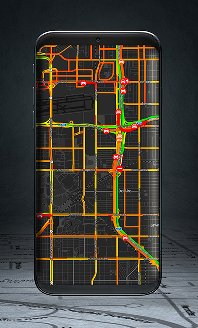
Swift’s first-of-its-kind, cross-continental drive demonstrates the performance of Skylark. (Image: Swift Navigation)
Swift’s first-of-its-kind, cross-continental drive demonstrates the performance of Skylark.
Swift Navigation, a San Francisco-based tech firm redefining GNSS and precise positioning technology for autonomous vehicles, has completed a cross-country drive test.
The goal of this first-of-its-kind drive, from San Francisco to New York and back, was to measure the efficacy of Swift’s recently expanded Skylark cloud corrections service and to demonstrate true nationwide lane-level GNSS correction coverage at the accuracy, reliability and availability levels required by Swift customers.
The drive took the Swift team across 26 states and Washington, D.C., with 6,614.7 miles (10,645.4 km) driven over 116 hours and 14 minutes logged. A Swift vehicle was equipped with 20 different GNSS devices, tested using six unique chipsets that included: Swift’s Piksi Multi, Duro and multiple leading GNSS silicon providers.
The results of the drive confirmed that Swift’s precise positioning solution — composed of Skylark and the Starling positioning engine — delivers consistent lane-level accuracy at continental level. Skylark delivered 100% availability, with sub-decimeter accuracy, over the entire United States, wherever cellular coverage was available.
Performance highlights from the drive:
+Sub-meter horizontal accuracy (2-sigma) achieved across all environments
100% Skylark availability
Highly repeatable results with Starling + Skylark across variety of dual-frequency GNSS chipsets
“This is the longest continuous GNSS-based precise positioning drive test of its kind and we are proud of the engineering team at Swift for undertaking this ambitious task,” said Anthony Cole, executive vice president of engineering. “The results show that Skylark performs as intended and expected in both open sky and urban environments and demonstrate that Skylark is truly a cross-continental corrections network delivering the high integrity and high availability required by automotive OEMs, last-mile applications, rail, mobile and micro-mobility companies.”
In addition to full contiguous U.S. (CONUS) coverage, the Skylark corrections service is now available in Europe and is being built out to support autonomous applications across the globe.
Download a complete write-up of the cross-country drive test at www.swiftnav.com.
Two companies have integrated GPS/PNT tech into a growing autonomous vehicle market: driverless shuttles for retirement communities. Powering the service, a cloud-based GNSS corrections system delivers centimeter-level accuracy without deploying and maintaining a GNSS network. This leading-edge application targets autonomy at scale and enables high-precision positioning for mass-market automotive and autonomous vehicle applications.
Photo: Voyage
For many seniors, retirement communities offer the best of both worlds: the freedom to live in their own homes and access to immediate assistance when they need it.
Driverless cars are an option several retirement communities have embraced to better serve residents who no longer have the ability or desire to drive, but want to retain the ability to come and go as they please.
“Autonomous vehicles are a great fit for any community where the environment is well-understood, less complex than dense urban areas, and the transportation demand is high,” said Justin Erlich, vice president of strategy, policy and legal for Palo Alto, California-based Voyage, a company that employs existing technology to develop fleets of autonomous vehicles. “Retirement communities satisfy all of these characteristics.”
Serving Seniors
Voyage deployed driverless shuttles to serve 130,000 retirees at The Villages, a massive retirement community encompassing more than 50 square miles in Sumter County, Florida.
“The community’s residents enjoy an extremely active lifestyle, but often face challenges getting around,” Erlich said. “Autonomous vehicles are perfectly suited to meet this demand.”
The six vehicles in the fleet stay within the confines of the retirement community, where all roads have been precisely mapped, speed limits are lower and traffic patterns are more clearly defined than in a typical city. The vehicles travel over a network of roads that span 750 miles.
THE VILLAGES
Location: Sumter County, Florida Area: 50 square miles Road span: 750 miles Number of retiree residents: More than 130,000 Number of Voyage autonomous vehicles: 6
To request one of Voyage’s autonomous vehicles, a resident can summon the shuttle on-demand with a smartphone. Voyage is working with residents on the possibility of using other shuttle-request options, including text messages, phone calls and well-marked pickup zones in crowded downtown areas, Erlich said.
All passengers ride with Voyage safety drivers in the front seat. The drivers take note of any “events” during rides so Voyage can investigate how to improve the riding experience.
Photo: Voyage
Eventually, residents will be the only passengers in the vehicles. If they need assistance during a ride, they will be able to communicate with remotely located Voyage employees, Erlich said.
Testing and rolling out fleets of driverless vehicles in private communities like The Villages allows Voyage to develop and perfect the autonomous vehicle technology it uses. As a result, the company can deliver the service to new clients in mere months.
Voyage, which has been working on its autonomous technology for more than two years, uses daily customer feedback to constantly adjust to its technologies to better serve riders.
“Feedback collected during test drives is one of the biggest factors in shaping our technology roadmap,” Erlich said. “Driving data — collected across all sensors and traffic scenarios — is automatically processed each night, highlighting interesting ‘events’ for our engineering team to analyze and review.”
During Voyage’s beta test process at The Villages, residents applied to be part of the company’s Pioneer Program for early access to the autonomous vehicles and the ability to offer feedback early on. Riders who test the service complete scorecards after each trip to help improve the experience for all riders.
Europe Takes the Lead
(Tire photo: iStock.com / TANAPHONG)
Autonomous vehicle technology is taking off in Europe, shows a study published by the European Patent Office and conducted with the European Council for Automotive Research & Development. From 2011 to 2017, European patent applications related to automated driving increased 20 times faster than other technologies in recent years. The “Patents and self-driving vehicles” study reveals automated driving patent applications at the European Patent Office rose 330%, compared with 16% for all technologies during the same time.
“As one of the only self-driving car companies that are picking up actual passengers as a part of our Pioneer Program, we believe we can learn a lot from the feedback we hear from our initial Pioneer riders as we try to make this the best service for The Villages,” said Oliver Cameron, co-founder and CEO of Voyage. “We are excited to see so much interest from other residents to become a part of this program.”
When developing autonomous technology, safety is Voyage’s top priority, Erlich said. Every change to the hardware and software used undergoes a multi-stage validation process. Company engineers perform “on-desk” tests of every change using unit tests, functional tests and a driving simulation environment. Then, an operations team runs suites of real-world traffic and validation tests in a completely controlled environment at a closed-course testing facility in San Jose, California
“Voyage makes extensive use of simulation testing and closed-course validation before any of our vehicles are driven in our partner communities,” Erlich said. “All changes must pass these closed-course tests before making their way onto the roads of our partner communities.”
Vehicle design also ensures riders stay safe. “Our fleet vehicles have been designed with multiple levels of safety redundancies for braking, steering and power, and leverage an advanced diagnostics system to automatically detect anomalies and safely stop the vehicle,” he explained. “In addition, we have developed a remote teleoperations solution that allows the vehicle to request additional help when a driver is not physically in the vehicle.”
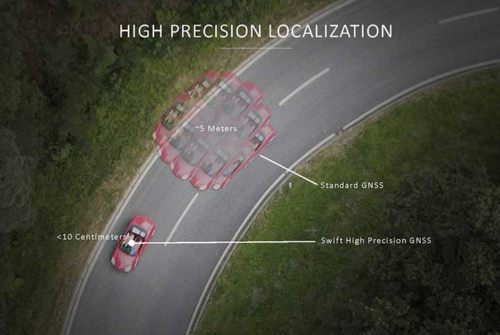
Skylark provides high-precision localization. (Image: Swift Navigation)
Making Autonomous Work
When building an autonomous system, localization — knowing exactly where you are in the world — is critical. Erlich said it’s often difficult to estimate your position within an accuracy of several feet when using more traditional GPS solutions.
“For autonomous driving, you need to be able to estimate within several centimeters,” he added.
Voyage uses Swift Navigation’s GNSS receivers and Skylark network as one of the primary inputs into its localization solution.
Swift Navigation is a San Francisco-based tech firm that develops GPS technology to power autonomous vehicles. It is working to extend the Skylark network across the contiguous United States, and then plans to expand globally.
“Coupled with high-definition maps, odometry sensors and other inputs, we’ve been able to use Swift Navigation’s differential GPS solution to achieve the localization results we needed to deliver a true autonomous driving service,” Erlich said.
Voyage’s autonomous vehicles are equipped with a suite of sensors on their roof racks that includes the Swift Navigation Piksi Multi GNSS receiver, lidar devices, cameras, radar and an inertial measurement unit. They create and constantly update a 3D map of the vehicle’s surroundings.
Swift Navigation’s Duro is one of two GNSS receivers Voyage uses for its autonomous vehicles. (Photo: Swift Navigation)
A computer in the trunk integrates all sensor signals and uses the vehicle’s Controller Area Network (CAN) bus to operate steering, braking and other functions.
Skylark, Swift Navigation’s cloud-based GNSS corrections service, provides Voyage’s autonomous vehicles with precise positioning to eliminate the complexity of deploying and maintaining GNSS networks.
Skylark offers a plug-and-play experience that delivers convergence times measured in seconds. Its positioning algorithms provide a continuous data stream to individual devices from the cloud. This data stream allows for quick positioning and high reliability and availability.
The correction service enables receivers to connect to a constantly adapting, cloud-based model to obtain GNSS observations. Dependence on base stations in each area of deployment is eliminated, increasing the geographic area in which they can travel. Skylark works seamlessly with both of Swift Navigation’s GNSS receivers — Piksi Multi and Duro.
In addition to Piksi Multi and Duro, Voyage uses third-party receivers and microprocessors that benefit from the lane-level positioning Skylark delivers.
Equipment Specs
Photo: Swift Navigation
GNSS receiver one. Swift Navigation — Piksi Multi
• Dual-frequency and multi-constellation
• Up to 20-Hz solution rates
• Raw data outputs from on-board MEMS IMU GNSS receiver two. Swift Navigation — Duro
• IP67 rated
• Centimeter-level positioning
• Raw data outputs from on-board MEMS IMU Lidar devices. Velodyne — VLS-128
• 128 channels
• Up to 300-meter range
• Up to 360-degree surround view Cameras. iDS — Global-Shutter units Proximity sensors. Chrysler OEM Inertial measurement unit. Xsens — MTi-300
• 375-Hz bandwith for accelerometers
• 415-Hz bandwith for gyroscopes Antenna. Swift Navigation — Mini-survey for the Duro RTK unit
• 1 L1/L2 GPS/GLONASS/BeiDou mini-survey
The Swift product suite delivers centimeter-level localization —important to riders who may have mobility issues that require vehicles with smooth starts and stops.
Skylark was built specifically to deliver the speed, security, precision and reliability demanded by automotive manufacturers with autonomous and safety applications architected to support ASIL-rated (Automotive Safety Integrity Level) systems.
Because Skylark is a network, it is fault tolerant. In the unlikely event an individual cloud reference station goes offline, Skylark’s positioning algorithms will continue to provide a continuous stream of corrections.
Once connected, Skylark creates a precise and constantly adapting model of the atmosphere and related errors affecting GNSS. Connected users simply turn on their devices to get the precise positioning data they need.
Safety Drivers
As drivers get older, their mental and physical health can affect their ability to operate vehicles safely. Vision and hearing loss keep many older drivers off the road. Fear of driving at night or in the rain also can be a problem for older drivers. According to the Centers for Disease Control and Prevention (CDC), about 7,400 adults over the age of 65 died as a result of car accidents in 2016. That same year, more than 290,000 of adults over the age of 65 were treated in emergency departments for injuries sustained in motor vehicle accidents.
Residents at The Villages who have used the autonomous vehicles report positive feedback, Erlich said. They consider the service a major improvement to their day-to-day activities because it’s convenient. Plus, they prefer the ability to be more carefree during happy hour, fewer hassles with traffic and parking, and lack of interactions with poor drivers.
Being on the cutting-edge of a generational technology also is a positive for many residents, Erlich said. “Autonomous vehicles create a clear path to safer, more accessible, and reliable transportation for everyone. From a safety perspective, autonomous vehicles have the potential to significantly reduce the more than 37,000 deaths attributed each year to driving. From a lifestyle perspective, there are also huge opportunities: from reclaiming daily commute time, to providing a reliable means of transportation to people with mobility challenges.”
Positioning Intelligence Key to Autonomous
Hexagon’s Positioning Intelligence (PI) division is an integral partner in many autonomous vehicle development projects, providing technologies such as SPAN (GNSS+INS technology), TerraStar-X corrections, and Automated Research and Development Platforms from its brands including NovAtel, VERIPOS and AutonomouStuff.
NovAtel hardware and software products, along with engineering support, address the need for accurate, reliable and robust GNSS positioning. TerraStar-X correction services deliver worldwide coverage and assured positioning with continuous availability, and provide the accuracy and rapid convergence needed to achieve lane-level precision for safe autonomous operation.
For developers of autonomous consumer transportation, integrated research and development automotive platforms from AutonomouStuff accelerate time to market.
Making It Safe. For large-scale automotive production, safety is the main focus. The Hexagon PI software positioning engine and TerraStar-X technology are being developed to ASIL-B (Automotive Safety Integrity Level B) standards to provide precise positioning for lane-level performance in autonomous applications.
Image: Trimble
Road Corrections
Incorporating precise and consistent absolute location information is an essential component of enabling advanced driver assistance (ADAS) and autonomous driving (AD) technology for vehicles.
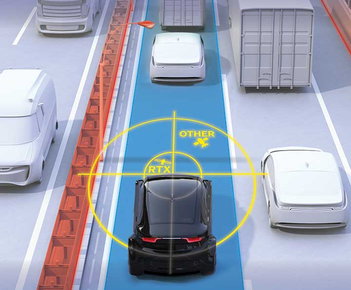
To help meet this need, Trimble recently released Trimble RTX Auto. The Trimble RTX Auto correction service provides a precise point position (PPP) solution that can be used to correct the position of any auto grade GNSS chipset. RTX Auto works in parallel with other on-vehicle sensors to deliver a positioning solution that satisfies ADAS and AD requirements.
Absolute position contributes to many features:
Lane centering. Systems designed to keep a car centered in a lane, relieving the driver of the task of steering, is often achieved with cameras and absolute position data. Absolute position can be used when lines disappear, or weather prevents them from being seen.
Map aiding. a combination of precise map and location data helps to navigate junctions, lane changes, roundabouts or intersections where lane information is essential to safe driving.
Prediction of future road structure. Both allow a vehicle to begin slowing in advance of a bend in the road and to avoid harsh braking that would happen if the system only relied on short range sensors.
Adhering to the speed limit. This helps drivers anticipate changes in speed limits when a downpour prevents cameras from seeing the speed limit signs or when they might be obscured by natural surroundings or another vehicle.
RTX Auto is both Automotive Safety Integrity Level (ASIL) and Automotive Software Process Improvement and Capability Determination (ASPICE) certified. These certifications validate that Trimble RTX Auto meets functional safety requirements for ADAS and autonomous applications in the auto industry.
Super Cruising. Trimble is on the road today providing RTX-based absolute positioning within General Motors’ Super Cruise driver assistance feature, a hands-free driving system for the freeway. For more information on Super Cruise, visit www.cadillac.com/world-of-cadillac/innovation/super-cruise.
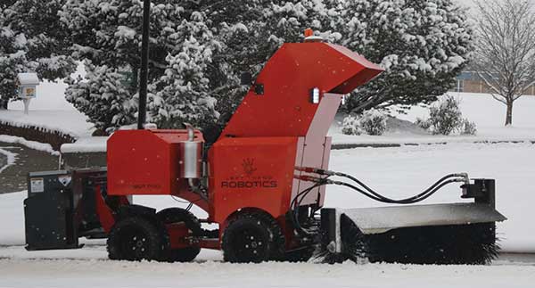
The autonomous SnowBot Pro is ready to clear your walkways. Offered by Left Hand Robotics and guided by Swift Navigation, it is a commercial-grade, robotically driven product for snow removal.
Driving autonomously, SnowBot Pro clears snow from walkways with a 56-inch-wide rotating brush, reducing the number of hand shovelers or snow blower operators needed by up to 80 percent, the companies said. Various front and rear attachments allow for a multitude of tasks, such as snow removal in the front and deicing in the rear. It also reduces potentially costly slip and fall insurance claims.
The SnowBot is programmed and controlled remotely from the cloud via an online dashboard or mobile app, and follows its programmed path using GPS, accelerometer and gyroscope technologies for navigation.
Sensors detect any obstacles and can instruct the robot to stop to avoid collisions and send instructions about how to bypass obstacles. Location, weather and robot status data is recorded in real time, along with before and after photos. The detailed recording helps minimize insurance and risk-management costs while providing customers with proof of work.
The robot has to navigate precisely, avoiding potentially damaging landscaping, walls, curbs and other obstacles along sidewalks and walkways. Centimeter-level GNSS ensures it avoids obstacles and stays on its designated route. Finding a reliable real-time kinematics (RTK) GNSS solution was critical given that many sidewalks are near buildings and underneath trees.
After evaluation, Left Hand Robotics chose Swift Navigation’s Piksi Multi. Its centimeter-level accuracy keeps the robot in its designated path and allows its base robot platform to navigate in a variety of environments, whether in lines (sidewalks, bike paths) or large open areas (fields, parks). The Piksi Multi also retains a GNSS fix in challenging conditions and environments.
Once Swift’s ruggedized Duro receiver was launched — and could be used by customers as a base station that was required for RTK — Left Hand Robotics had a complete offering for customers, which it launched in the winter of 2018–2019.
A Piksi Multi is installed in each SnowBot Pro, and its Path Collection Tools (tools customers use to collect the initial path data the robot will follow) and Duro is used as the base station controlling the SnowBot Pro robot.
A roundup of recent products in the GNSS and inertial positioning industry from the October 2018 issue of GPS World magazine.
OEM
Anti-spoofing
Provides mitigation and reporting
Photo: Regulus
The Pyramid GNSS allows detection, mitigation and reporting of spoofing of the GNSS system, while still providing accurate positioning (jamming protection will be available in a future version). Version 2 of the Pyramid GNSS adds a software-only version, making it available to numerous applications and enabling GNSS to perform seamlessly under spoofing and jamming conditions. The device is designed for any system depending on GNSS navigation or precise timing, including cars, drones, ships, robots, financial institutions and stationary infrastructure, such as power plants and power grids. The Pyramid GNSS connects externally and integrates seamlessly with existing GNSS receivers, adding reliability and protection to the system. It offers full GNSS support including for BeiDou, Galileo and GLONASS.
Swift Navigation has upgraded the firmware of its flagship product — the Piksi Multi GNSS receiver. This marks the sixth major release to Piksi Multi since it was launched in February 2017. The upgrade is available free of charge to Swift customers. The firmware release also enhances Duro, the ruggedized version of the Piksi Multi receiver housed in a military-grade, weatherproof enclosure for long-term outdoor deployments. Firmware Release 2.0 for Piksi Multi and Duro supports two additional major satellite constellations — Chinese BeiDou (B1/B2) which, once completed, will contain 37 satellites, and Europe’s Galileo (E1/E5b), which will eventually consist of 30 satellites. Piksi Multi’s performance will further improve for future satellites. The addition of BeiDou and Galileo creates more robust positioning in a variety of challenging sky-view environments.
The G300D gyro is a three-axis, inertial rate system gyroscope. Measuring 0.67 cubic inches, it features low power and high speed, making it suitable for image stabilization applications. The G300D has message timing under 150 microseconds and output data rates up to 8 kHz with external sync. A micro-electro-mechanical gyroscope, it has an ARW of <0.0028 degrees/sec/√Hz and an option for both 24 and 32-bit LSB for exceptional resolution. Users can configure the G300D using a software development kit or through software protocols to simplify the integration process. The G300D gyro is non-ITAR.
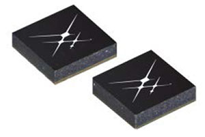
Two new GNSS low-noise amplifier (LNA) front-end modules, the SKY65933-11 and SKY65943-11, integrate Skyworks’ proprietary TC-SAW filters. The modules are designed specifically for internet of things (IoT) applications including smartwatches, action cameras, drones, asset trackers and personal navigation devices. They are designed for wireless module and IoT device manufacturers, providing a turnkey GNSS connectivity solution in a compact form factor. Both solutions offer integrated pre- and post-filter LNA and matching to reduce printed circuit board (PCB) area versus a discrete implementation; single DC supply for design flexibility and simplicity; multi-GNSS compatibility to cover GPS, GLONASS, Galileo, BeiDou and QZSS receiver applications in the 1559–1606 MHz frequency range; extremely low leakage current (1 uA max) benefitting battery-powered IoT devices; and highly manufacturable and low-cost surface-mount technology in a 2.5 x 2.5-millimeter multi-chip module package.
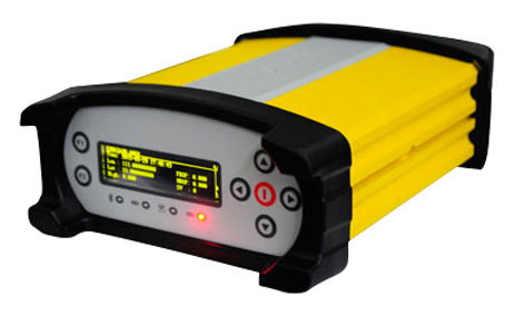
The Net20 Pro provides high-quality data for users interested in the proximity and reliability of a reference station while eliminating real-time kinematic (RTK) corrections service charges. It uses multi-frequency, 555-channel technologies in a rugged casing to deliver accurate and effective positioning data even in harsh environments. It can be configured for correction data reception in client mode to calculate a fixed RTK position and to monitor the antenna position while continuing to work as a GNSS reference server. With NTRIP Caster software, the Net20 Pro provides superior connectivity with an unlimited number of mount points. Users can have permanent transmission of RTK corrections with a local internet connection. Its 32-GB internal and 32-GB external memory is enough for permanent recording even at a 100-Hz high data sampling rate. Its web user interface features upgrade, status and settings management as well as data downloading via smartphone, tablet or other internet-enabled device.
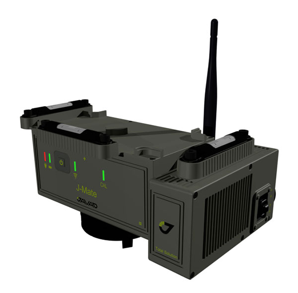
The J-Mate measurement module combines conventional measurement via laser scanning and photographic imagery with the multi-constellation location accuracy of the Triumph-LS receiver. It utilizes precision horizontal and vertical encoders for angular measurement, while the high-definition camera and laser module combine to locate the USB-powered target for accurate measurements. The target rests on top of the receiver and lights up for better visibility to the camera and sensor. The lighting power comes through the USB cord connected to the receiver. Coupled with the onboard data collector screen of the Triumph-LS, operation of the module is done visually with the LS mounted on top of the module or remotely on the J-Pod pole used for GNSS data collection. The module and software is also designed to be an efficient staking application.
The Trimble R10 Model 2 GNSS System is designed to help surveyors work more effectively by enabling reliable, fast and accurate data collection in the field. Enhancements in Model 2 include a custom Trimble survey GNSS ASIC with 672 GNSS channels including GPS, GLONASS, BeiDou, Galileo, QZSS and IRNSS as well as the full range of SBAS. It also will support planned GNSS signals. It has improved reliability against interference and spoofed signals, improved power management by 33 percent, and increased internal memory (6 GB) to store more than 10 years of raw observations. Support for Android and iOS platforms allow field crews to use their own mobile devices. The Trimble R10 Model 2 supports the recently released Trimble TSC7 controller and Trimble Access 2018 field software.
The TerraStar-C PRO correction service provides multi-constellation support, including GPS, GLONASS, Galileo and BeiDou. Combined with NovAtel’s OEM7 positioning technology, TerraStar-C PRO cuts initial convergence times by nearly 60 percent and offers 40 percent better horizontal accuracy than the current TerraStar-C service. In challenging signal conditions, it offers multipath, shading, interference and scintillation. High-rate TerraStar-C PRO corrections provide reconvergence in less than 60 seconds following brief GNSS signal interruptions. Corrections are generated using TerraStar’s proprietary global network of more than 100 GNSS reference stations. The data is delivered worldwide through overlapping geostationary satellites directly to a NovAtel receiver or via cellular IP network.
The C3UBE Command Center enables unmanned beyond-visual-line-of-sight (BVLOS) data collection and near real-time data streaming from almost any point within any critical infrastructure network. The mobile command and distribution center allows for the flight of unmanned aerial systems and is designed to not only allow AviSight to reach the maximum BVLOS distances permitted today, but also to expand its range for UAS operations as limits increase in the national airspace. In addition, it enables near-real-time transmission of data and imagery, which can be disseminated live to anywhere in the world via its proprietary distribution network located at Switch’s Tier 4 data center. It is aimed at the oil, gas, power, transportation and telecommunications sectors.
SimActive has updated its Correlator3D end-to-end photogrammetry software to include tools for users to generate precise statistics on mining activities, with improved volumetric calculation. The integrated tools allow users to generate precise statistics on mining activities. The Correlator3D software performs aerial triangulation and produces dense digital surface models, digital terrain models, point clouds, orthomosaics and vectorized 3D features. Applications like mineral extraction monitoring can be done seamlessly within the software. Users can process raw drone data, produce point clouds and DSMs, and perform volumetric calculations in the same Correlator3D workflow.
The improved TruPulse 360 laser features LTI’s TruVector 360° Compass Technology. The rangefinder measures slope distance, inclination and azimuth; instantly calculates horizontal and vertical distances; and calculates 3D missing line values. The enhanced device offers 33 percent increased distance accuracy, 25 percent better target acquisition and a higher azimuth accuracy of 0.5° root mean squared (RMS). Other features include reflectorless technology that enables data capture to any surface type; advanced targeting modes to achieve accurate, repeatable results of the intended target; seven-power superior optics technology that displays all measured and calculated solutions; and smart technology that recognizes adverse measurement conditions and prompts recalibration. Uses include forestry, utilities, construction and GIS mapping.
Synthetic aperture radar imagery from Maxar’s MDA RADARSAT-2 satellite is now available to SecureWatch subscribers. SecureWatch is DigitalGlobe’s powerful, cloud-based geospatial intelligence platform. The service has added the radar imagery to its high-resolution optical imagery, enabling defense and intelligence analysts to deliver actionable insights to decision makers regardless of weather and light conditions. The satellite will refresh hundreds of global sites on a weekly basis using a wide-ultra-fine format (3-meter resolution, 50-kilometer scene width). RADARSAT-2 imagery allows users to observe features and changes that go undetected using other imaging techniques, and provides day and night coverage regardless of weather. SecureWatch users can access timely RADARSAT-2 imagery using current subscription plans. When combined with 30-cm optical imagery, analysts will have a powerful and reliable toolset to make decisions with confidence.
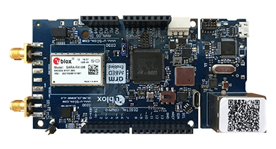
U-blox has introduced a toolset comprising the u-track software and the C030-R410M application board. The toolset is a rapid-prototyping platform that lets product designers test and optimize the position accuracy and power consumption of wireless location tracking applications that use LTE-M and NB-IoT cellular networks, as well as GNSS technology. The toolset targets product engineers working on battery-powered applications such as sport, people and asset trackers. An increasing number of battery-powered consumer and industrial products feature integrated GNSS receivers. These products include virtual reality headsets, smartwatches and devices to track elderly people, containers or parcels. With the ongoing roll-out of low power wide-area cellular networks (LPWAN) such as LTE-M and NB-IoT technologies around the world and the extremely low power consumption they enable, the range of use cases for wireless location trackers is expected to expand further. The u-track software runs from embedded firmware on the new u-blox C030-R410M application board. The board, specifically designed to rapidly prototype applications for the internet of things (IoT), includes an ultra-small, low-power u-blox ZOE-M8B GNSS receiver and a size-optimized SARA-R410M LTE-M/NB-IoT cellular communication module, and u-track includes a PC software application that lets users log, retrieve, and visualize power consumption, accuracy, and other important values, such as the GNSS time to first fix.
Add-on to AT&T Fleet Complete platform or for separate use
Photo: AT&T
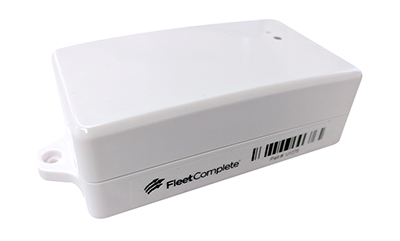
The new GPS Asset Tracker One (AT1) from AT&T and Fleet Complete can track transportation as well as agriculture, food services, pharmaceuticals and emergency services. Users can monitor their assets through the Fleet Complete mobile app. Besides tracking location in near real-time, it also captures humidity, temperature, light exposure and more. AT&T’s nationwide LTE-M network is designed for devices that require low-cost, extended battery life, coverage underground and inside buildings, and carrier-grade security. Two high-capacity Lithium AA batteries power the AT1. They can last up to five years with a once-a-day use.
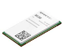
The MC90 is a quad-band GSM/GPRS/GNSS/Wi-Fi module that supports hybrid positioning technologies including GNSS, Cell ID and Wi-Fi aided positioning. It integrates the multi-GNSS system, including GPS, GLONASS, Galileo and QZSS, which makes it suitable for urban areas with high-rise buildings and complex environments. The MC90 also adopts Wi-Fi hotspot positioning technology for blind spots and satellite coverage. It integrates multi-aiding positioning technologies to offer customers with optimized GNSS performance. It also supports EPO technology, which provides predicted Extended Prediction Orbit to speed up TTFF without the need of an extra server. The MC90 features a compact design and lower power consumption, and supports dual SIM single standby function.
TomTom will offer free maps and traffic tiles on its mobile software developer kit (SDK) in both Android and iOS. With global coverage, the Mobile Maps SDKs and its free map tiles will guide developers of mobility and ride-sharing apps. The TomTom Maps APIs (application programming interfaces) also play a role in the internet of things, where traffic data is needed to enable self-driving cars and smart city planning.
MAGNET Inspect is designed for UAV data collection. (Photo: Topcon)
MAGNET Inspect software is designed to facilitate the data-processing workflow for UAV (unmanned aerial vehicle) infrastructure inspection by efficiently managing large UAV data sets to create inspection reports. It allows operators to visually navigate UAV photos, aligning 3D reality meshes with raw georeferenced images in one location and filtering them based on selected criteria including field of view. When combined with Intel Falcon 8+ Drone – Topcon Edition and Topcon ContextCapture, powered by Bentley Systems, the software enables operators to navigate, annotate and create reports with inspection photos, creating a strong end-to-end inspection workflow.
Site Scan Esri Edition is a custom version of the Site Scan iOS app for drone flight planning and data capture that works seamlessly with Esri’s ArcGIS Online and Drone2Map for ArcGIS. The Site Scan Esri Edition app complements Esri’s Drone2Map for ArcGIS software by providing full drone project mission planning and a simple workflow for transferring drone captured data into Esri ArcGIS. Users will be able to connect to ArcGIS Online with an Esri sign-in. The app will allow users to directly use Esri data layers from ArcGIS Online as base and reference data for their drone flight planning mission. Esri customers can use any drone supported by Site Scan, including a variety of DJI drones. Site Scan also supports a custom version of the new Yuneec H520 commercial drone by 3D, which is based on the Dronecode PX4 software and designed to be an open and secure drone option for use on U.S. government projects.
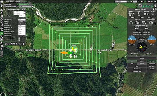
UAS mission-planning software company UgCS has joined with disaster response expert Airborne Response to develop a comprehensive search capability for drones. The search-pattern software, a new feature of the UgCS platform, allows remote pilots to more effectively conduct search-and-rescue operations. Customizable search patterns such as the “expanding square” and “creeping line” can be deployed. Based on the flight altitude input by the operator, the UgCS software will automatically calculate the course heading and track spacing necessary to provide the prescribed coverage area for a search target. UgCS software allows central management of all types and manufacturers of unmanned vehicles, enabling a user to control one or a fleet of drones on a single mission in multi-operator mode and multi-platform environments. Airborne Response will offer the UgCS mission planning software and associated training to public safety and emergency response professionals throughout the U.S.
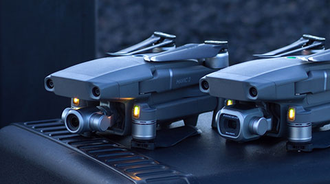
The Mavic 2 Pro is designed for professionals, aerial photographers and content creators. With a folding design, the Mavic 2 is a powerful platform with new gimbal-stabilized cameras and advanced intelligent features like Hyperlapse and ActiveTrack for easier and more dynamic storytelling. Flight time is 31 minutes. Co-engineered in partnership with Hasselblad, the Mavic 2 Pro houses a 1-inch CMOS sensor with a 10-bit Dlog-M color profile. It can capture 20-megapixel aerial shots with utmost color accuracy using the Hasselblad Natural Color Solution (HNCS) technology, while an adjustable aperture from f/2.8-f/11 provides control across a wide variety of lighting conditions.
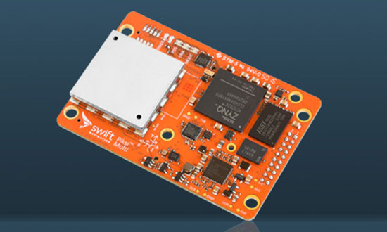
The Piksi Multi GNSS receiver. (Photo: Swift Navigation)
Swift Navigation has upgraded the firmware to its flagship product — the Piksi Multi GNSS receiver. This marks the sixth major release to Piksi Multi since it was launched in February 2017.
The upgrade is available free of charge to Swift customers.
The firmware release also enhances Duro, the ruggedized version of the Piksi Multi receiver housed in a military-grade, weatherproof enclosure for long-term outdoor deployments.
Swift Navigation is a San Francisco-based tech firm building centimeter-accurate GNSS technology and a cloud-based corrections service to power a world of autonomous vehicles, the company said.
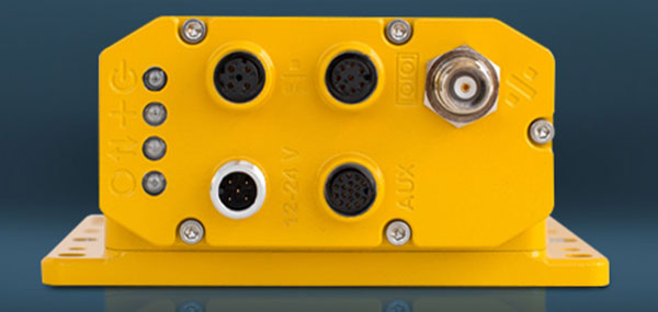
The Duro enclosure. (Photo: Swift Navigation)
Firmware Release 2.0 for Piksi Multi and Duro supports two additional major satellite constellations — the Chinese constellation (BeiDou B1/B2) which, once completed, will contain 37 satellites and the European Union-based constellation (Galileo E1/E5b), which will eventually consist of 30 satellites.
Adding to the existing GPS, GLONASS and SBAS constellations already supported by Swift’s GNSS receivers means that users will have more access and visibility from satellite systems across the globe.
Piksi Multi’s performance will further improve over time as the total of 136 satellites planned for these major constellations are fully deployed.
The addition of BeiDou and Galileo constellations creates more robust positioning performance in a variety of challenging skyview environments and puts Piksi Multi on par with leading industry receivers costing up to ten times a much.
With this 2.0 release, Piksi Multi is feature-complete, and Swift’s engineering team has delivered on planned product features on the Piksi Multi Product Summary.
MSM Messages 4-7. The new firmware adds support for RTCM 3.2 Multi Signal Messages (MSM). Though Swift devices already support RTCM 3.1, the addition of MSM allows for another flavor of differential corrections supported by BeiDou and Galileo, while also supporting both GPS and GLONASS with MSM new messages. MSM also allows for interoperability with other existing third-party GNSS receivers for all modern signals and constellations.
Fix Improvements. Firmware 2.0 provides Piksi Multi and Duro improvements on fixing in long base lines in poor atmospheric conditions, making the devices more resilient to Ionospheric effects during periods of high Ionospheric activity.
Higher Baud Rate Support for UART. New baud rates were added including 460800 and 921600.
Acquisition Improvements. Enhancements made allow Piksi Multi and Duro to power on to a usable signal more quickly and acquire satellites in start-up mode faster, by several seconds.
“The growing Swift engineering team has been hard at work developing Piksi Multi to its full potential,” said Samir Kapoor, executive vice president of engineering and product at Swift Navigation. “With support for all modern satellite constellations and multiple performance improvements, Piksi Multi offers unmatched affordability, priced at ten times the savings yet on par with other leading GNSS receivers.”
“Swift’s vision of making GNSS devices that are centimeter-accurate, with fast RTK convergence times and robust positioning performance all at highly-competitive prices has come to fruition,” Kapoor said. “With Piksi Multi feature complete, we look forward to adding to our line of products with additional offerings later this year.”
Swift Navigation has issued a new firmware upgrade to its flagship product Piksi Multi GNSS module.
This marks the fifth major point release to Piksi Multi and is available free of charge to Swift customers. The most recent provided GLONASS support, among other features.
The firmware release also enhances Duro, the ruggedized version of the Piksi Multi receiver housed in a military-grade, weatherproof enclosure designed for long-term outdoor deployments.
Duro – Piksi enclosure.
Firmware Release 1.5 for Piksi Multi and Duro supports four regional Satellite Based Augmentation Systems (SBAS) — the United States-based Wide Area Augmentation Systems (WAAS), the pan-European Union-based European Geostationary Navigation Overlay Navigation System (EGNOS), the Japanese Multifunctional Transport Satellites (MTSAT) Satellite Augmentation System (MSAS) providing coverage for Japan and Australia and the GPS-Aided GEO Augmented Navigation (GAGAN) regional system operated by the Indian government.
These four regional satellite systems are used to improve the overall performance of GNSS such as GPS and GLONASS, both of which are supported by Swift’s receivers.
SBAS support is particularly relevant for Swift customers located in places where cell phone coverage is sparse or is not available, such as rural areas where precision agriculture operations are taking place or alternatively in marine locations, lakes, in-land waterways and up to approximately 100 miles off shore where cellular or internet coverage may not be feasible.
Applications using SBAS do not require a local reference station, allowing rovers such as drones, combines and other agricultural equipment and marine vessels to benefit from satellite corrections accurate to a sub-meter, when centimeter-accuracy is not required and where internet or cell coverage is spotty or absent.
SBAS Support — The new firmware adds support for WAAS + EGNOS + MSAS + GAGAN regional satellite constellations and augments standard positioning performance for GLONASS (G1/G2) + GPS (L1/L2C) for use with Swift Navigation products.
Acquisition Improvements — Firmware 1.5 allows Piksi Multi and Duro a faster time to first fix and once a signal has been acquired, improves accuracy and availability. Time to first RTK fix was improved by 21 seconds.
Standard Positioning Performance (SPP) Enhancements — Time to first SPP improved by 7 seconds.
Increased Satellite Count for RTK — Increased satellite count used in the RTK engine improves RTK performance in all environments, particularly those where skyview is partially obscured and/or rapidly changing.
“The addition of four regional satellite constellations for our devices enhances reliability and improved position accuracy in challenging or remote environments where autonomous vehicles may have limited or no cell coverage. Essentially, SBAS provides a free corrections service, allowing our precision agriculture, marine and other customers to receive satellite corrections without a base station,” said Anthony Cole, Ph.D., director of the measurement and positioning team at Swift Navigation. “Being hardware-ready means that Piksi Multi and Duro users simply download the 1.5 firmware at no additional cost, to get the latest features and performance improvements.”
Swift Navigation, a San Francisco-based tech firm that is building centimeter-accurate GPS technology for autonomous vehicles, has released the latest firmware upgrade to its flagship product, the Piksi Multi GNSS module.
Firmware update 1.4 is the fourth improvement since Piksi Multi began shipping one year ago.
Duro – Piksi enclosure.
The firmware release also enhances Duro, the ruggedized version of the Piksi Multi receiver housed in a military-grade, weatherproof enclosure designed specifically for outdoor deployments.
The upgrade is available at no cost to Piksi Multi and Duro users and provides full support for GLONASS, in addition to the GPS satellite constellation. Access to dual constellations greatly improves availability, reliability and range between GNSS base and rover devices, the company said.
According to Swift Navigation, the firmware release also adds NMEA GGA output capability to existing NTRIP (Networked Transport of RTCM via Internet Protocol), enabling Piksi Multi and Duro to seamlessly position by sending and receiving data from CORS (Continuously Operating Reference Station) base stations over the Internet.
GLONASS + GPS support. The new firmware provides full and reliable integer ambiguity resolution for GLONASS (G1/G2) + GPS (L1/L2C) for use with Swift Navigation products and most third-party base stations.
RTCM 1230 and 1033 interoperability. Thisallows Piksi Multi and Duro to communicate with many third-party industry-standard receivers.
NTRIP NMEA GGA support. This enables network RTK solutions and virtual base network (VBN) services.
Additional Fundamental Improvements
Full position and velocity covariances now published for advanced users for use in autonomous systems.
Carrier phase reacquisition was improved by seconds.
Fix reliability and availability was enhanced for extremely precise positioning accuracy in SPP mode was increased when RTK is not available.
“The 1.4 firmware release is a step change improvement for our customers deploying Piksi Multi and Duro,” said Fergus Noble, CTO of Swift Navigation. “The addition of a second GLONASS satellite constellation enhances reliability and centimeter-accurate positioning in challenging environments, better supporting ground applications in precision agriculture, robotics and autonomous vehicles. Best of all, our customers benefit from new features delivered as a software update, at no additional cost and with no changes to their Piksi Multi or Duro hardware, underscoring Swift’s commitment to continuous improvements in our product lines.”
Swift Navigation’s Rob Hranac gives GPS World an overview of the company’s Piksi Multi RTK GNSS receiver and Duro, a ruggedized version of the Piksi Multi, at Intergeo 2017, which took place Sept. 26-28 in Berlin, Germany.