Tag: pipeline

  • Asteri Navigation launches X-series of wearable GNSS receivers

    Asteri Navigation launches X-series of wearable GNSS receivers

    Asteri Navigation will introduce a new line of rugged, compact and fully integrated GNSS receivers on Nov. 15 at the 2016 Autodesk University in Las Vegas, Nevada.

    Photo: Asteri Navigation
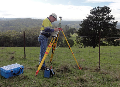
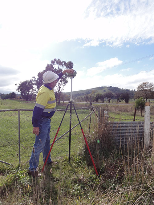
Suitable for geospatial field data collection and inspection applications that require high accuracy positioning, the Asteri X-Series receivers are light enough to be mounted to external sensors or worn on the body or arm.

    Asteri Navigation will debut the affordable X-1 and X-2 receivers in booth No. 1783 at Autodesk University, which runs from Nov. 15-17 at The Venetian in Las Vegas. The X-3 is scheduled for release in December.

    The compact Asteri receivers were designed with safety and ease of use in mind. Each device weighs just 11.3 ounces with the 12-hour lithium battery. Their 2.8-inch by 5.4-inch size allows them to fit safely in shoulder or arm pouches.

    The internal single-frequency antenna enables users to capture accuracies of well under 10 centimeters with RTK/VRS corrections. This integrated design allows users to work in difficult terrain without worrying about equipment and antennas getting snagged or broken.

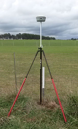
    Engineered to provide centimeter-level accuracy with Real-Time Kinematic (RTK) or Virtual Reference Station (CRS) correction when connected to an external antenna, the Asteri GNSS receivers support a generic NMEA 0183 GNSS data protocol. This makes them compatible with data collection and field mapping applications supporting the same protocol and ideal for users who want to develop their own software applications for inspection and GIS data capture activities.

    The new receivers can communicate via Bluetooth or cable with most popular devices used for field data collection, including utility line locators, ground penetrating radar, data loggers, laser rangefinders, smartphones, and tablets.

    Asteri expects the X-Series will be used extensively in mapping and survey applications related to asset management, pipeline operation, utility construction, forestry, electric staking, and underground utility location.

    For users needing higher accuracy, an external multi-frequency antenna can be added to the provided port on the receiver. In addition, the Asteri X-3 will be compatible with Atlas GNSS satellite-based real-time correction services worldwide.

    The three products in the X-Series provide varying levels of accuracy:

    • X-1 provides sub-meter accuracy out of the box.
    • X-2 offers accuracy of 1 meter down to 1 centimeter with RTK/VRS.
    • X-3 will achieve 1 centimeter with RTK/VRS, 30 centimeters with Atlas H30, 4-10 centimeters with Atlas H10.
  • Calgary Company Switches from GPS Handhelds to TerraGo

    Calgary Company Switches from GPS Handhelds to TerraGo

    The Trans-Alaska Pipeline System in Interior, Alaska
    The Trans-Alaska Pipeline System in Interior, Alaska.

    Enmapp, a pipeline services company based in Calgary, Alberta, Canada, has replaced its proprietary GPS handhelds with TerraGo Edge and Eos Arrow receivers. TerraGo Edge is a mobile GPS data collection platform that integrates with the Eos Arrow series of GNSS receivers to bring advanced sub-meter and centimeter real-time accuracy to any smartphone or tablet.

    Enmapp provides data collection services to energy companies for pipeline construction and maintenance. Before TerraGo Edge, Enmapp relied on all-in-one GPS handheld devices, but became convinced the cost, features and performance were increasingly out of line with the mobile revolution fueled by Apple and Android solutions. After an extensive evaluation, Enmapp selected TerraGo Edge and Eos Arrow 100 receiver for a field trial so they could compare their performance against the GPS handhelds.

    Eos Positioning's Arrow 200 Bluetooth receiver now supports Hemisphere's Atlas correction service,
    Eos Positioning’s Arrow 200 Bluetooth receiver now supports Hemisphere’s Atlas correction service,

    After downloading the app on the crew’s iPads and pairing the Eos Arrow 100 via Bluetooth, they were up and running within minutes. “The results were astounding,” reads a TerraGo press release. “Not only did the Eos GPS receiver meet the GPS handheld’s accuracy requirements, in some cases it was much better. The efficiency of the crews was far superior with the native iPad features of TerraGo Edge, versus the old-style stylus and PDA screens of the legacy equipment. The labor costs were also reduced because they were able to use real-time GPS from the Eos Arrow 100 and reduce post-processing. Enmapp declared TerraGo Edge and Eos the clear winner, and have now deployed TerraGo Edge on all field personnel iPads, along with a Bluetooth-connected, sub-meter GPS receiver, the Eos Arrow 100.”

    “The hardware savings are enormous with the new GPS kit at less than $10,000 compared to the old kit which was over $70,000. But the ongoing reduction of project labor costs is even more valuable over time,” said Lance Fugate, program manager at Enmapp. “The cost reductions and efficiency improvements are a game-changer for us. As our industry continues to look for innovation from its service providers, TerraGo Edge enables us to deliver more efficiently. We can pass these savings directly to our customers with each and every future project.”

    The TerraGo Edge is available for either iOS or Android.

    Below is an exclusive interview with John Timar about TerraGo Edge from the GEOINT 2015 conference.

    Jean-Yves Lauture of Eos Positioning discusses the Arrow 200 GNSS receiver at the Esri User Conference.

  • FOIF GNSS Receivers Aid with Australian Pipeline Survey

    Photo: FOIF GNSS Receivers

    Three years ago, engineering survey company G & C Sadlier Design was engaged to perform a route selection and centerline pegging survey for a gas pipeline duplication between Somerton in Victoria and Young in New South Wales, Australia. To accomplish the work, G & C Sadlier Design turned to FOIF GNSS receivers.

    So far, about 225 kilometers have been surveyed and constructed, with 306 kilometers still to be surveyed, designed and built, according to surveyor Greg Sadlier. The current focus is a 100-kilometer section in Victoria and a 70-kilometer section in New South Wales. Recently completed are two linear static control surveys over 80 kilometers in Northern Victoria and 70 kilometers at the end of the project near Young in New South Wales.

    Photo: FOIF GNSS Receivers

    “These surveys have been done using a FOIF F60 Base GNSS receiver and two FOIF A30 Rover receivers. (Two one-man survey crews are used),” Sadlier said. The procedure is to set up the F60 base over a point with known coordinates and elevation, approximately in the center of the alignment to be surveyed.

    The base was set first, to record 1-second data to the datacard over the duration of the survey. One surveyor started the base, and surveyed forward to the end of the alignment, and the other rover crew started at the beginning of the alignment and surveyed towards the base. The rovers were also set to record 1 second data to the datacard.

    “The control points were 0.75-m steel star pickets driven flush with the ground surface, and witnessed with a galvanized 1.5-m steel star picket,” Sadlier explained. “Each rover point was surveyed for 20 minutes plus 1 minute per kilometer of the distance to the base. That is, a point that is 35 Km from the base will be occupied for 55 minutes or 3300 epochs. With the control points at easy accessed positions, usually roads crossing the alignment, at intervals of about 8 kilometres mean that the survey of 80 Km is completed in one day.

    Photo: FOIF GNSS Receivers “We have found the FOIF GNSS receivers are very easy to use, and the epoch readout on screen is very reassuring that the data is being stored, and easily confirms that the correct amount has been stored. The data is easily downloaded from the card and converted to Rinex format with FOIF RnxTransform. The data was post processed by a third party.”

    The control survey results were adjusted (Helmert adjustment) onto check Permanent Marks at both ends. “This made a rotation of 0°00’00.001” and a shift of 0.007 meters E and 0.005 meter N. An elevation difference of .035 meters was manually adjusted out over the 80 kilometers,” Sadlier said.

    “We are now using the control survey while surveying the route selection and features survey,” Sadlier said. “We have two RTK base locations at the 25-kilometer mark and 52-kilometer marks, and using our VHF radio solution have coverage over the entire job with a 10-kilometer overlap in the center.

    “We have found that RTK observed control readings of 180 epochs return residuals of less than 010 meters for both coordinate and elevation for all the static control points. Very impressive results considering the length of the survey,” Sadlier said.

    The engineering firm has yet to process the New South Wales data, but expects the same or better, Sadlier said, as the overall length is a little less and the surveyed control points were in more open country with less tree cover.


  • FAA Grants Topcon UAS Exemption for Sirius

    FAA Grants Topcon UAS Exemption for Sirius

    Sirius-Topcon-UAS-O

    Topcon Positioning Systems has received a national exemption from the Federal Aviation Administration (FAA) that allows for operation of its unmanned aerial system (UAS) in the United States. The exemption covers the operation of the Sirius Basic and Sirius Pro for aerial data collection.

    In early April, the FAA issued 30 more commercial exemptions, bringing the total to 99. That number has since grown to 235.

    The Sirius Pro and Sirius Basic systems are designed to produce accurate solutions for the automated mapping of a wide range of sites — regardless of terrain — including construction sites, mines and quarries. The UAS are designed for land surveying, transmission line and pipeline inspection, and agricultural operations such as field mapping and livestock management. With the Sirius Pro model, Topcon eliminates the need for ground-control points by combining real-time kinematic (RTK) GNSS solutions with precision timing technology to provide accurate mapping results, Topcon said.

    “This exemption is exciting news for the U.S. marketplace,” said Eduardo Falcon, executive vice president and general manager of the Topcon GeoPositioning Solutions Group. “It allows Topcon to be a resource for end-users and provide UAS demonstrations and training. Aerial data collection has a strong impending impact on all the industries we serve, and the possibilities for survey, construction, and agricultural applications are seemingly limitless.

    “Building on the success the Sirius models have already seen in the European and Australian markets, this exemption allows Topcon to expand on that momentum in the U.S.,” Falcon said.

  • LandWorks Tightens Integration with Esri in Land Management Software Upgrades

    Landworks-webmaps-spain2

    LandWorks Inc., a developer of innovative land management solutions, has introduced Release 5.20 of its three primary software suites — LandWorks Property Management, LandWorks GIS, and WebMaps Enterprise GIS. All three have been re-written for easier use, enhanced industry-specific functionality, and tighter integration with Esri GIS solutions.

    “In Release 5.20, we rebuilt the software from the ground up with a combination of C# [Sharp] .NET and a service-oriented architecture,” said LandWorks President Jerry Bramwell. “This modern architecture allows for integration of live Esri GIS maps and builds a foundation for hosting in the cloud.”

    Deployed extensively for land asset management and mapping in the oil and gas, utility, mining, pipeline, renewable energy and government sectors, the upgraded LandWorks software suites are expected to appeal to an even wider audience. In addition, their applicability within organizations will expand beyond land management to project planning, acquisition and development.

    The flagship LandWorks Property Management (LPM) suite is a complete solution for land asset management designed for easy storage and retrieval of data relating to any type of land right. In the new LPM version 5.20, clients may open an oil and gas lease or right-of-way agreement and instantly access a live GIS map displaying the relevant polygons. Direct integration with Esri’s ArcGIS Server gives the client full web-based GIS functionality from within the LPM interface and the ability to update the live map with new information on the fly.

    “LPM is the only land asset management software with embedded live access to Esri GIS maps,” Bramwell said.

    The LandWorks suites, used worldwide, also have been internationalized to support the language, date, currency and measurement formats preferred by individual end users based on their locations. A large mining company with operations in multiple countries, for example, may deploy the LandWorks suites across its enterprise. End users in Portugal, Spain and Canada are able to view the same information presented in Portuguese, Spanish or English.

    In addition to a more intuitive interface with a modern look and feel, LandWorks has added new functionality to the software products designed for greater ease-of-use in specific industries. The ability to make land royalty payments for mining and wind energy operations has been expanded. LPM and LandWorks GIS have been enhanced to better manage and present linear-based land rights.

    “The enhancement of our products to better manage land rights associated with linear assets will make the LandWorks suites more attractive to transportation and telecommunications industries,” said Bramwell.

    LandWorks has built new modules to the LPM suite to extend its usability across the entire land management workflow. LPM now manages land-related projects of any type or size including acquisition, surveying and encroachment investigation.

    The three LandWorks suites comprise a total of 18 individually licensed software products, many of which can function alone or interface with LPM. LandWorks GIS integrates the Esri GIS functionality into LPM. WebMaps Enterprise GIS Suite extends web-based mapping via ArcGIS Server across the enterprise to all departments, not just the land department.

    “All LandWorks software products currently reside behind the client’s firewall, however, we will soon offer hosting in the cloud as an additional licensing optional for our clients,” said Bramwell.

  • ABB Selects Intergraph for North African Gas Pipeline Project

    ABB has selected Intergraph for the development of an oil and gas pipeline network and relevant facilities in North Africa. The pipeline network will be built in the El Merk field, a remote, harsh desert location in Algeria.

    According to Intergraph, geospatial-based pipeline infrastructure management solutions will enable ABB to more effectively design, construct and maintain pipelines and assets and demonstrate a comprehensive pipeline integrity program while reducing the cost of maintaining records. By storing records in a central geographic information system (GIS), the solution makes information readily available for a variety of applications, improving record keeping productivity while assuring compliance with regulatory requirements.

    “An accurate, up-to-date view of all critical assets at any given time is a crucial component of any pipeline implementation project,” said Sergio Casati, ABB Project Manager. “Especially in such challenging terrain conditions, we need to keep our pulse on the status of all assets in near real-time. The strength of Intergraph technology and its more than 40 years of experience in the utilities sector, as well as market leadership in enterprise engineering software, were key factors in our decision to partner with the company on this project. Intergraph’s open, flexible technology platform was also desirable for an initiative like the El Merk project, which involves a consortium of multiple vendors.”

    The announcement said that geospatial technology from Intergraph will play a significant role in the design and installation of the pipeline, field gathering stations, gas distribution manifolds, flow and trunk lines and water and gas re-injection facilities in El Merk. The technology will support the Pipeline Open Data Standard (PODS) model, the most widely implemented pipeline data model in the industry, and all data will be stored in an Oracle Spatial database. The implementation will also include a portal component for the seamless distribution of data to all parties, including field and remote users.

    “The collaboration of Intergraph with ABB Italy on this project marks a significant milestone in Intergraph’s involvement in the oil and gas pipeline industry,” said Maximilian Weber, Utilities & Communications manager for Intergraph in EMEA. “Intergraph has worked with leading pipeline providers around the world including Spectra Energy and Northwest Energy in the U.S., E.ON Ruhrgas in Germany and Chongqing Gas in China. Additionally, our Process, Power & Marine division is the world’s leading provider of enterprise engineering software for the design, construction and operation of plants, pipelines, ships and offshore facilities. We are pleased that ABB has recognized our strength in this industry and has chosen us to ensure the accurate, efficient management of assets, as well as play a key role in protecting this infrastructure.”

  • WhiteStar Adds Oil & Gas Pipeline Layer to Basemap Product

    WhiteStar Corp. announced it’s added a new layer of oil and gas pipeline data to its Unlimited Basemap Access (UBA) product. The new WhiteStar Oil & Gas Pipeline Layer will be a nationwide, georeferenced shapefile showing the locations of all lateral and transmission pipelines in the United States.

    The Company said existing subscribers to the WhiteStar UBA product will begin receiving segments of the oil and gas layer at no extra charge with their regular third-quarter UBA update in October. The first segment of the layer will include pipelines in Texas, Oklahoma and the Gulf of Mexico. The layer includes attribute information, such as owner and operator data, for each pipeline.

    WhiteStar said they are creating the new UBA layer primarily from a U.S. Department of Energy (DOE) pipeline map that is available in PDF format on the DOE Energy Information Administration’s website (www.eia.doe.gov). A rich source of pipeline information, this map has frustrated hydrocarbon companies for years because it can be downloaded only in a non-GIS compatible PDF format.

    “We’ve converted the PDF to a shapefile and georeferenced it to align with all of the other cultural-feature layers in the UBA product, which is fully GIS compatible,” said WhiteStar President and CEO Robert White. “This new layer allows UBA clients to easily integrate pipeline maps and attribute details into their digital mapping projects.”

    According to the company, the UBA product is a seamless nationwide digital mosaic of basemap information layers from U.S. Census Bureau TIGER Files (with optional TeleAtlas upgrades). Designed for any geospatial mapping project that requires an accurate digital base map, UBA contains 42 layers of cultural features – such as political boundaries, roads, water bodies, and environmentally sensitive areas – that can be ‘cookie cut’ according to a user-selected area of interest and downloaded into most popular digital mapping package.

    WhiteStar said they developed UBA with an interface that lets the user select layers with a few mouse clicks and then delineate the area of interest by choosing a specific county, outlining the project area onscreen or entering its latitude/longitude corner points. UBA users can then export the data into a variety of popular mapping formats, including ESRI, MapInfo, GeoGraphix, Petra, AutoCAD, SMT Kingdom and Golden software. In addition, the data can be projected in either NAD27 or NAD83 coordinate systems, including all related state planes and UTM zones.

    “Our clients use UBA to populate their maps with cultural features for investor presentations, exploration & production logistics planning, infrastructure siting, and permit submissions,” said White. “The new pipeline layer will enable operators to quickly determine which lateral and transmission lines run near their leases.”

    WhiteStar said they will roll out regional segments of the UBA Oil & Gas Pipeline Layer until the seamless nationwide data set is completed. Following delivery of the Texas, Oklahoma, and Gulf Coast segment, WhiteStar will deliver the region of Ohio, Pennsylvania, and West Virginia that is producing from the Marcellus Shale formation. UBA clients can expect that one to ship in early 2010.
     

  • Sidwell Designing GIS for Oil and Gas Infrastructure Appraiser

    Capitol Appraisal Group Inc. (CAGI) has contracted with the Sidwell Co., asking it to provide a system to inventory, value, and keep track of oil and gas infrastructure and the land parcels on which they are built.

    CAGI provides appraisal and information services to governmental entities primarily for the purpose of property taxation. It contracted with Sidwell after deciding to pursue a geographic information system that would facilitate the collection of field appraisal data.

    This project will be completed in three phases, according to Sidwell and CAGI. The first phase includes review of the typical workflow for field data collection as performed by CAGI technicians, development of a prototype database design, creation of custom forms for ArcPad data capture, and the design and implementation of a system to associate digital camera images directly to records in the ArcPad database.

    Phase Two will consist of refinement of the data capture forms and database design to enhance the data collection workflow, and on-site installation, configuration, testing, and training. Phase Three, the enterprise deployment of the entire system, will include installation and configuration of ESRI’s ArcGIS Server, data loading and tuning, technical consulting, and ArcGIS Server administrator training, according to Sidwell and CAGI.

  • Merrill Lynch Selects HPDI as Oil and Gas Data Provider

    HPDI LLC, a supplier of historical oil and gas data and decision support tools for the energy industry, has been selected by Merrill Lynch to provide its institutional investors with information and research services. As part of a new service called Merrill Open Minds, Merrill Lynch will offer information from industry-specific research companies to assist trading clients in making investment decisions. Of the seven research entities initially chosen to participate by Merrill Lynch, HPDI is the sole provider of energy information.

    “For more than a decade, oil and gas companies have relied on HPDI to provide them with the historical information they need to plan their engineering, marketing, and exploration strategies,” said Corey Rhoden, HPDI chief operating officer. “This same information proves extremely valuable to financial institutions as they evaluate potential investments in the energy sector.”

    HPDI aggregates historical oil and gas production data, drilling permits, prices, transportation, refinery and gas plant information. HPDI makes this information accessible through Internet-based applications that enable clients to query the data and display results in a variety of graphical and tabular formats, including GIS maps, charts, and tables. Clients can use HPDI tools to extrapolate data sets to predict future trends, or they can download the data to other analysis applications.

    “We are very pleased that HPDI is a part of Merrill Open Minds. HPDI offers Merrill Lynch institutional investor clients the depth of coverage and ease of use to support a sophisticated analysis of oil and gas production trends,” said John Svolos, head of Sales and Marketing of Merrill Open Minds.

    The full suite of HPDI products and services will be available to Merrill Lynch clients. All of the HPDI research and analysis tools come with online tutorials designed to allow users to quickly extract and display oil and gas data relating to specific operators, producing formations, activity dates, and geographic areas. HPDI offers its customers access to six primary databases:

    • U.S. Historical Production includes oil and gas production statistics from producing states dating back to the 1950s. This database is continually updated with new state reports.
    • Drilling Permit Database, provided by RigData, includes permit numbers, well and operator information, granted dates and actual images of the permits and plats. This database can be cross-referenced with the U.S. Historical Production data for complex queries with results spotted on a map.
    • Pricing Data contains oil and gas marketing data such as purchaser, producer, and facility information, as well as price and post information.
    • Transporter Database includes oil and gas transporting details such as to/from information, volumes, inventory, and report dates.
    • Refinery and Gas Plant Databases contain receipt and delivery information as well as activity information.
  • GE Oil & Gas PII Pipeline Solutions Releases PipeView SheetGen 5.0

    GE’s PII Pipeline Solutions business has launched a new version of PipeView SheetGen, a software tool for generating pipeline alignment sheets directly from maintained data sources. The latest release of SheetGen also supports direct editing of enterprise data, meaning that attributes can be edited right from the band view. SheetGen automatically generates alignment sheets directly from relational databases and geographic information systems.

    “SheetGen was the first alignment sheet generation product in the industry when it was developed in 1992,” said John Bucci, general manager of GE’s PII Pipeline Solutions business. “The SheetGen team has created a mixture of power, flexibility, and ease of use, providing improved features that operators will greatly appreciate.”

    With this release of SheetGen 5.0, users can generate ad hoc alignment sheets on demand simply by navigating to an area of interest on the map. SheetGen will then produce an alignment sheet using the map extents, allowing the ability to create alignment sheets where required in addition to the use of predefined sheet windows.
    Additionally, SheetGen provides on-demand previews for alignment sheet configurations. The sheet layout that the user sees on the screen is the sheet the user receives as hard copy.

    Another feature provided with SheetGen is a set of pre-defined templates that users can take advantage of immediately. Predefined templates contain preset bands that users can simply copy, save, and modify, or they can create new ones as needed.

  • Schlumberger Acquires Exclusive Distribution Rights to MetaCarta for Oil & Gas Sector

    Schlumberger has announced the acquisition of exclusive distribution rights to the oil and gas sector for MetaCarta‘s map-based geographic information search technologies. Schlumberger will acquire all existing contracts for MetaCarta in the oil and gas sector, resulting in a single source for sales and support of this technology in the industry.

    “MetaCarta is the perfect compliment to expand the Schlumberger industry leadership in information management. With the increasing amount of information held in unstructured form, such as documents, presentations and web content, MetaCarta’s geographically specific access to unstructured content brings new power to petrotechnical professionals,” said Olivier Le Peuch, president, Schlumberger Information Solutions (SIS). “In combination with our geoscience and engineering information management solutions, now petrotechnical professionals will be able to rapidly incorporate all available information that is relevant to their prospect or field.”

    MetaCarta search technology combines map-driven geographic search, geographic referencing, temporal filtering and data visualization capabilities, for both structured and unstructured content, making that content “location-aware.” This enables geoscientists and engineers to find and display relevant data in the context of their area of interest.

    “The Schlumberger global sales and support organization will accelerate the expansion of MetaCarta solutions in the oil and gas industry,” said Ron Matros, president and chief executive officer, MetaCarta. “We look forward to bringing geographically relevant data search capabilities to a broader set of customers across the globe.”

  • WhiteStar Introduces SpotOn at GITA Oil & Gas Show

    WhiteStar Corp. has introduced SpotOn, a Web-delivered service which enables users to reach out over the Internet to convert a well’s public land survey legal description into a precise geographic coordinate. Users can enter a few well legal descriptions into the Web site to try the service.

    “SpotOn determines well locations in real time, adding flexibility and saving an enormous amount of time compared to manual methods or the expense and time delays of using a data vendor,” said Robert White, WhiteStar president and CEO. “The service reduces errors and provides an easy way for oil and gas companies to keep their well locations up-to-date. Often companies change a well’s legal location just before the well is actually drilled and SpotOn provides the means for keeping the company’s mapping systems up-to-date as well as to improve or check the accuracy of existing well location data.”

    To obtain an accurate well location, the user enters the well’s “footage call,” “quarter call” or a combination of both. Subscribers will be able to upload and download comma-separated files for batch processing. Using the national Public Land Survey database hosted on the WhiteStar server, SpotOn then reads the description and returns the longitude/latitude coordinate representing the well’s location in terms of either the NAD27 or NAD83 datum.

    “We built SpotOn using technology developed over the course of calculating millions of well locations for our oil and gas clients during the past 19 years,” said White. “Well locations can be quite complex, but WhiteStar has developed an extensive rule base to generate latitude/longitude coordinates for any well having a public land survey system legal description.”

    Developers will have access to a programming-language independent software API that can easily add SpotOn functionality to new or existing software applications.

    The SpotOn product references the WhiteStar Unlimited Grid Access (UGA) product, a seamless digital mosaic of the public land survey grid covering all public land survey states including Alaska, and also incorporating survey data for Texas and the Gulf of Mexico state and federal waters. An UGA subscription is not required to utilize SpotOn as the service automatically references the public land survey on the WhiteStar server via the web.