Tag: Polaris

  • Septentrio and Point One Navigation partner to expand portfolio across Europe

    Septentrio and Point One Navigation partner to expand portfolio across Europe


    GNSS interface board – mosaic. (Image: Point One Navigation)
    GNSS interface board – mosaic. (Image: Point One Navigation)

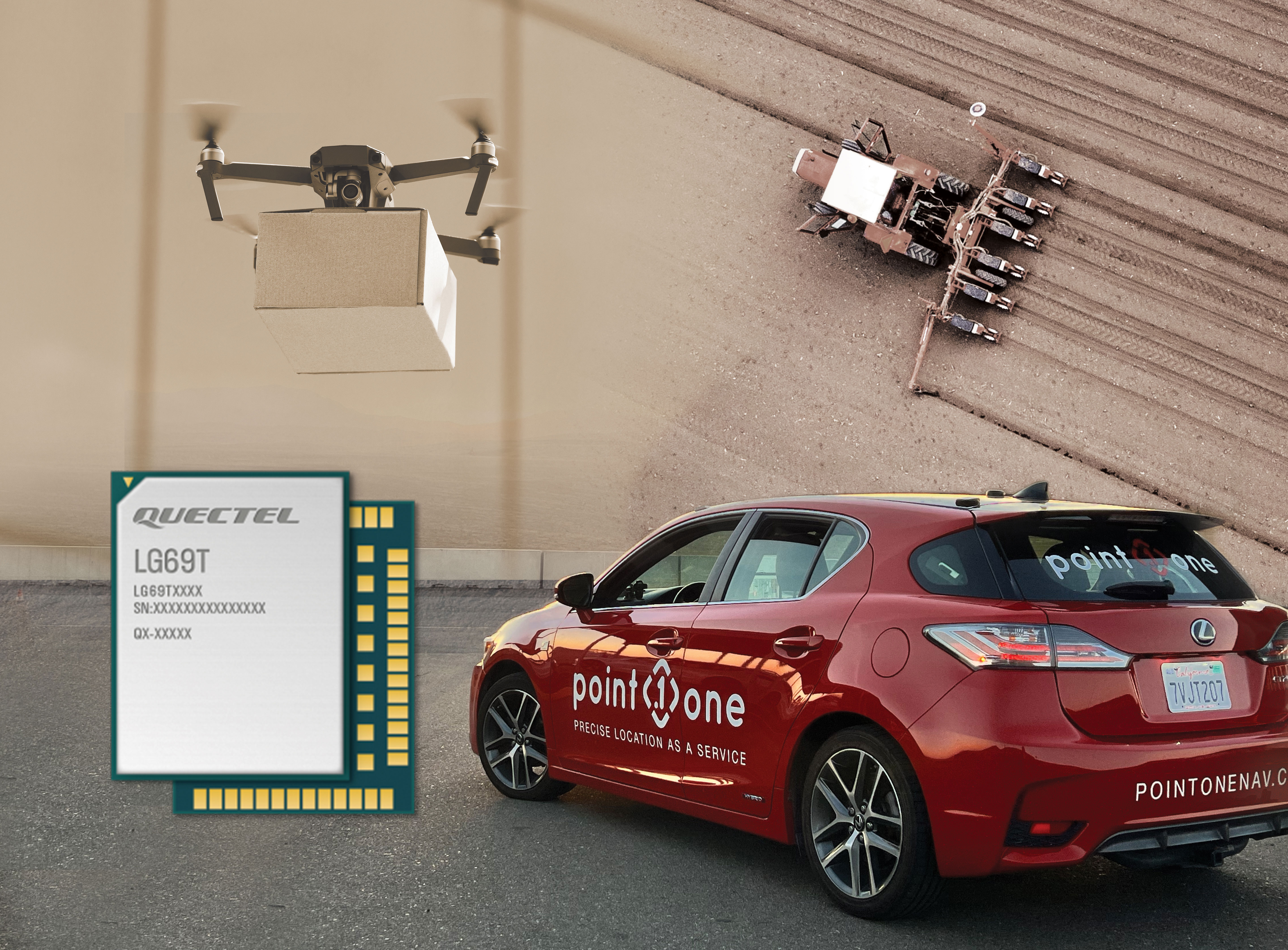
    Point One Navigation and Septentrio have partnered to expand upon the companies’ precision location solutions throughout Western Europe. The new developer compatibility is suitable for demanding applications, including industrial autonomy, precision agriculture, logistics and delivery, robots and autonomous vehicles.

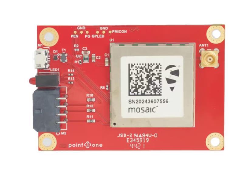
    Point One’s Polaris is a correction network that enables high-precision GPS and computer vision-based localization. Polaris has recently extended coverage to now include Western Europe, further expanding the reach of the network. This solution is powered by Septentrio’s GNSS receivers, including the mosaic compact multi-constellation GNSS receiver.

    The mosaic module — a multi-band, multi-constellation receiver in a low-power surface-mount module with a wide array of interfaces — is designed for mass market applications such as robotic and autonomous vehicle guidance systems. The module integrates GNSS and RF ASIC technology, as well as the robust positioning engine from Septentrio.

    Septentrio real-time kinematic (RTK) receivers can be used directly with Polaris to provide centimeter-level accuracy in seconds.

    This technology is complemented by Point One’s FusionEngine software, which further integrates cameras and additional sensors to achieve the desired level of precision — even in the complete absence of satellite signals.

    FusionEngine has the accuracy and the resilience to inclement weather required by Level 2 applications, such as highway lane keeping and V2X, while offering the robustness necessary for mission-critical Level 4 and Level 5 robotaxi and full autonomy applications.

  • Septentrio launches agnostic corrections program

    Septentrio launches agnostic corrections program


    Image: Septentrio
    Image: Septentrio

    Septentrio, a leader in high-precision GNSS positioning solutions, has launched the Agnostic Corrections Partner Program.

    The program facilitates the use of Septentrio receivers with high-accuracy services that provide varying levels of accuracy, coverage and delivery methods. This also allows users to select the service that suits specific applications and business models.

    The Agnostic Correction Partner Program, which includes Polaris from Point One, Skylark from Swift Navigation, and PointPerfect from u-blox, provides documentation for the use of Septentrio receivers with these high-accuracy services.

    Agnostic GNSS corrections refer to correction services that are not specific to a particular GNSS receiver or device. It provides correction data that can be used by any receiver that can process the correction signal. Agnostic corrections are useful in situations where multiple types of GNSS receivers are being used, such as in a large-scale surveying project or in a fleet of vehicles that use different types of navigation systems.

  • Quectel and Point One bring precise location to robotics and agriculture markets

    Quectel and Point One bring precise location to robotics and agriculture markets

    Photo: Quectel
    Photo: Quectel

    Quectel Wireless Solutions, a supplier of IoT modules and antennas, and Point One Navigation, a provider in precision location technology, have announced the LG69T-AM, the latest addition to the LG69T GNSS Module Series. Point One’s positioning engine powers the LG69T-AM and enables centimeter-level global accuracy by integrating augmented GNSS in a module with open-source API.

    The LG69T-AM GNSS module features STMicroelectronics’ Teseo V dual-band L1/L5 positioning receiver platform with 80 tracking and four fast acquisition channels compatible with GPS, GLONASS, Galileo, BeiDou, QZSS and NAVIC.

    The LG69T-AM leverages Point One’s RTK and SSR technology for centimeter-level accuracy and ultra-fast convergence time. It is designed for easy integration with minimal e-BOM modification and is well-suited for mass market adoption without the need for an expensive external co-processor. Due to its small package size, light weight, and excellent power consumption, it is ideal for applications such as robotics and precision agriculture.

    Embedded in the LG69T-AM is Point One’s FusionEngine and its Polaris correction service client. FusionEngine is compatible with standards-based corrections services including those based on RTCM.

    Polaris is Point One’s own GNSS correction service that unlocks better than 10cm absolute accuracy with a coast-to-coast footprint in the United States and coverage across Europe. It offers a variety of connectivity options including delivery over cellular and L-band. The network is purpose-built for precision agriculture customers and includes advanced anti-jam, interference mitigation, end to end security and automatic integrity monitoring unmatched by any other provider.


  • OpenARC provides positioning platform for autonomous vehicles

    OpenARC provides positioning platform for autonomous vehicles

    Aceinna and Point One Navigation launch hardware and software platform for precise positioning in agriculture, construction, mapping, surveying, robotics and trucking

    The OpenARC positioning service is now commercially available. OpenARC is a precise-positioning hardware and software platform for system integration of GNSS corrections with high-performance inertial navigation system (INS) and real-time kinematic (RTK) hardware.

    OpenARC is offered by Aceinna, a developer of inertial-based guidance and navigation systems, and powered by Point One Navigation.

    With an RTK positioning engine and GNSS corrections delivered from a ground-based network of secure base stations, OpenARC will reliably improve position accuracy for autonomous vehicles to centimeter-level accuracy. The platform combines Point One’s Polaris GNSS correction service with Aceinna’s OpenRTK330 hardware and software solution for developers of autonomous systems in trucking, precision agriculture, construction, mapping, surveying and robotics.

    OpenARC provides high-precision positioning and localization applications, enabling centimeter-level accuracy for challenging tasks such as lane keeping, precision agricultural guidance, and UAV landing maneuvers.

    OpenARC is integrated into the OpenRTK330LI navigation module to provide a secure, vertically integrated and easy-to-use positioning platform. OpenARC is very scalable, supporting single-unit installations and high-volume deployments.

    Point One’s proprietary Polaris GNSS cloud correction service delivers superior station density in areas where operators need it the most, including urban centers and suburban surrounding areas, enabling cold convergence times of under 10 seconds.

    Polaris provides continuous position monitoring and tracks all modern satellite constellations. Its base-station technology includes advanced anti-jam, interference mitigation, security and integrity monitoring. Its architecture allows for GNSS corrections in RTK or state space representation (SSR) configuration. Its open-source interfaces are compatible with multiple receivers and chipsets, and the service is compatible with any NTRIP/RTCM3 compliant receiver.

  • Aceinna, Point One Navigation partner for precise positioning

    Aceinna, Point One Navigation partner for precise positioning

    Photo: Aceinna
    The Aceinna OpenRTK330. (Photo: Aceinna)

    Aceinna, a developer of inertial-based guidance and navigation systems for autonomous vehicles and devices, has partnered with Point One Navigation, which delivers precise positioning for the next generation of transportation.

    According to the companies, the partnership enables a streamlined positioning platform that combines Point One’s Polaris GNSS cloud correction service with Aceinna’s OpenRTK330 hardware and software solution for developers in agriculture, construction, mapping, surveying, robotics and trucking.

    OpenRTK330, designed for use in Level 3 ADAS and other high-volume applications requiring precise position information, is a GNSS receiver with a built-in RTK engine and triple redundant inertial sensors. According to Aceinna, it includes a multi-band RTK/GNSS receiver coupled with redundant inertial sensor arrays to provide centimeter-level accuracy, enhanced reliability and superior performance during GNSS outages. OpenRTK300 is supported by Aceinna’s open-source tool chain.

    Through backend server synchronization between the companies, activation and authentication will be streamlined. In addition, true centimeter-level accuracy will be attainable and powered by the integration of Point One’s coast-to-coast Polaris network and Aceinna’s OpenRTK platform, the companies said.

    “This partnership between Aceinna and Point One harnesses and combines each of our distinct strengths, to offer a solution platform that makes high performance positioning accessible to a variety of industries and applications,” said Yang Zhao, chairman and CEO of Aceinna. “We are thrilled to work with Point One’s technical expertise and execution to advance this technology to the next level of precision.”

    The combined offering will be available for purchase beginning December 2020.

    Aceinna is headquartered in Andover, Massachusetts, and Point One Navigation is headquartered in San Francisco.

  • Polaris scanner uses GNSS to go indoors, outdoors

    Polaris scanner uses GNSS to go indoors, outdoors

    Teledyne-Optech-Polaris-TLS-W
    Photo: Polaris

    Teledyne Optech has released its Polaris terrestrial laser scanner, which automatically detects its location with a built-in GNSS receiver and selects the planned survey parameters for the site. Alternatively, operators can set up surveys in the field and resection/backsight the system using the menu-driven graphical user interface (GUI) on its touchscreen.

    The announcement was made at the SPAR 3D Conference and Expo, being held April 3-5, in Houston, Texas. Visitors to SPAR 3D will be able to see the Polaris’ streamlined user interface in action at booth #400 along with the Optech Maverick, Eclipse and award-winning Galaxy.

    Bridging the gap between indoor and outdoor scanners, the Polaris can survey targets up to 1600 meters away in long-range mode or collect up to 500,000 measurements per second in short-range mode. Its 360 × 120-degree field of view captures indoor panoramas from a single site, while its rugged design, light weight and swappable batteries let it travel deep into the field, the company said.

    Also on display at SPAR is the Galaxy airborne lidar, which was awarded the MAPPS Grand Award for Innovation, and Teledyne Optech staff will be on hand to explain the SwathTRAK technology that earned it the prize. By dynamically adjusting the Galaxy’s scanner field of view in response to changes in the ground’s elevation, SwathTRAK keeps the swath width and point density on the ground consistent, even in hilly terrain. This technology saves clients time and money by reducing the number of flightlines required and ensuring homogeneous point density.

    Finally, visitors to the Teledyne Optech booth can also get hands-on time with the Maverick, Teledyne Optech’s first backpack-mountable mobile mapping system, and see the autonomous Eclipse airborne data-collection system and learn how a pilot can operate it alone, saving the cost of a dedicated operator.