A roundup of recent products in the GNSS and inertial positioning industry from the May 2018 issue of GPS World magazine.
SURVEY & MAPPING
Rugged handhelds
Operate in harsh environments
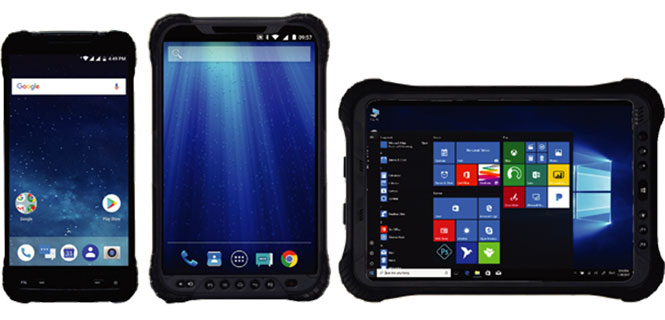 The UT series of GNSS-capable rugged handheld devices support industries such as construction, survey, GIS, mapping, asset/logistics management, public safety, utilities and military. The UT10 6-inch rugged phone and UT30 8-inch rugged tablet both feature Android 8.0 operating systems with Qualcomm octa-core 2.2 GHz processors, 4 GB of RAM and 32GB onboard storage.The UT50 10.1-inch full-rugged tablet features the Windows 10 operating system with an Intel Core Skylake i5 processor up to 2.8 GHz, 8 GB RAM and 128 GB of onboard storage. All three new UT models provide the latest high-resolution, capacitive touchscreen and direct sunlight-readable display technology for ease of visibility in all situations. The UT50 also has a 10-finger multi-touchscreen and supports wet hands and gloves operation. The devices have dual built-in cameras. They are designed to be drop-resistant from heights of 1.2 meters (1.5 meters for the UT10), are rated at IP67 (IP68 for UT50), and are certified to both MIL-STD-810G and MIL-STD-461F military standards to ensure durability in most outdoor or challenging environments.
Hemisphere GNSS, hemispheregnss.com
Controller and apps
For GNSS or total station operations
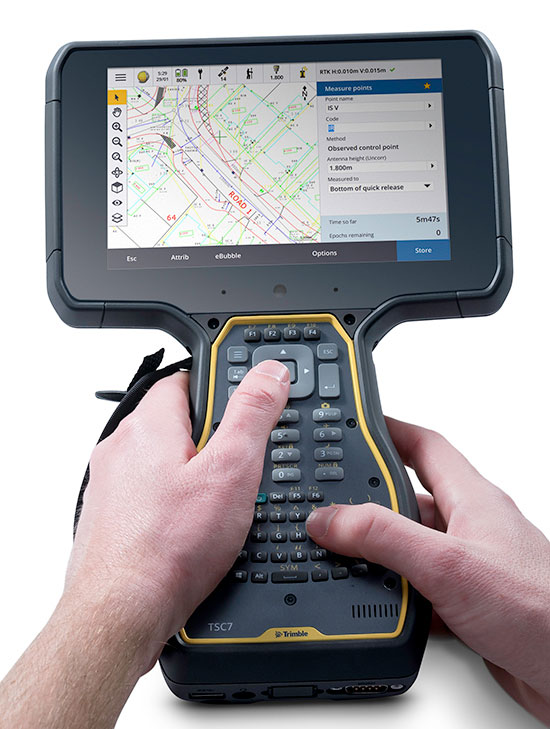
The Trimble TSC7 controller is a new field solution for land and civil construction surveyors. Equipped with GPS, it provides a tablet experience with a physical keyboard and a sunlight-readable 7-inch touchscreen that supports pinch, tap and slide gestures. Front- and rear-facing cameras allow users to video conference their office from the field for on-the-job support, and capture high-definition videos and images that provide valuable context to their data and clients. The TSC7 uses Windows 10 Professional with an Intel Pentium 64-bit quad-core processor. The processor and operating system make it easy to process data in spreadsheets and run office software programs. An ergonomic form factor, IP68-certified rugged design and optional, user-interchangeable modules make the TSC7 a flexible solution for all surveying applications.
Trimble, www.trimble.com
UAV
OEM GNSS/IMU Module
Enhances light UAVs
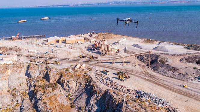
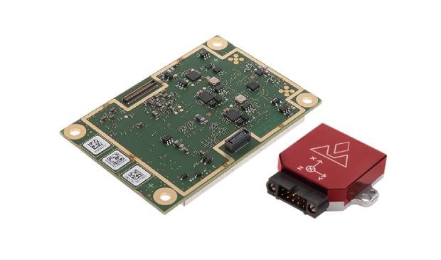 The AsteRx-i combines a multi-frequency multi-constellation GNSS engine with an external industrial-grade MEMS-based inertial measurement unit (IMU) to deliver positioning to the centimeter level as well as full 3D attitude at high update rates and low latency. The AsteRx-i is suitable for optical inspection and photogrammetry. Accompanied by a UAS-tailored carrier board, it integrates seamlessly into light UAVs. It also features Septentrio’s AIM+ interference monitoring and mitigation system.
Septentrio, septentrio.com
Aerial pollinator
Aids fruit tree growers
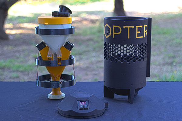
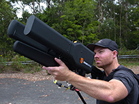
UAS startup DropCopter has initiated a drone pollination service that uses multi-rotor drones to dust almonds, pistachios and cherries, boosting crops by up to 15 percent. Dropcopter’s patent-pending Worker-Bee pollinator helps growers overcome environmental factors like bee shortages, as well as wind, cold, and night time that would prevent honeybee activity. The company is partnered with GENIUS NY and The NUAIR Alliance.
DropCopter, dropcopter.com
Drone Camera
Sensor Optimized for Drone Applications (S.O.D.A.)
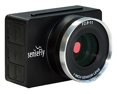
The senseFly S.O.D.A. camera is built for professional drone photogrammetry work. It captures sharp aerial images across a range of light conditions, allowing users to produce detailed, vivid orthomosaics and ultra-accurate 3D digital surface models. It has a 1-inch 20 megapixel RGB sensor that provides ground resolution of 2.9 centimeters per pixel flying at 400 feet (122 meters) above ground level. It has built-in dust and shock protection, enabling mapping across challenging terrain.
senseFly, www.sensefly.com