Tag: Public Regulated Service

  • ESA completes end-to-end test of enhanced, secure Galileo service

    ESA completes end-to-end test of enhanced, secure Galileo service

    Galileo Control Centre in Oberpfaffenhofen, Germany. (Photo: ESA)
    Galileo Control Centre in Oberpfaffenhofen, Germany. (Photo: ESA)

    News from the European Space Agency (ESA)

    Europe’s Galileo satellite navigation system continues to evolve. For the first time, end-to-end testing of the Galileo system demonstrated signal acquisition of an improved version of the Public Regulated Service (PRS), the most secure and robust class of Galileo services.

    The system test extended from the Galileo Security Monitoring Centre in Spain and the Galileo Control Centre in Germany to a Galileo satellite at ESA’s ESTEC technical heart in the Netherlands, which then broadcast in turn to a user receiver.

    Galileo’s PRS is an encrypted navigation and timing service for governmental authorized users and sensitive applications intended to remain available even in scenarios where other Galileo services might be degraded or jammed.

    An initial version of the PRS signal has been broadcast by the satellites up to now, but as of next year the signals will evolve into an enhanced version known as Full Operational Capability Public Regulated Service (FOC PRS), which has been defined in close collaboration with the European Commission, the European Union Agency for the Space Programme (EUSPA) and the EU Member States.

    The system’s FOC PRS capability is being enabled by an expansion of the Galileo ground mission segment — important upgrades of the Galileo Security Monitoring Centres (GSMCs) in St. Germain-en-Laye, France, and Madrid, Spain. These two sites oversee PRS provision and monitor its performance.

    This coming version of the security monitoring centers, set for the following year, is being developed by an industrial consortium led by Thales Alenia Space in France.

    Meanwhile the progressive deployment of remote system infrastructure is taking place over the course of this year, readying Galileo sensor stations to receive the upgraded PRS signals.

    Upgrade of Galileo Sensor Station on Norway's remote Jan Mayen Island in the Arctic Ocean. (Photo: ESA)
    Upgrade of Galileo Sensor Station on Norway’s remote Jan Mayen Island in the Arctic Ocean. (Photo: ESA)

    “To qualify, the FOC PRS Signal in Space required a major Galileo end-to-end test, demonstrating the compatibility of the space segment with the ground and user segments, called the System Compatibility Test Campaign (SCTC),” explained Federico Di Marco, ESA SCTC test director. “This test involved all Galileo key players spread across Europe, requiring close cooperation between the teams and months of preparation.”

    The SCTC was led by an ESA engineering team from the agency’s ESTEC technical center in Noordwijk, the Netherlands supported by the System Engineering Technical Assistance industrial team led by Thales Alenia Space in Italy and in close collaboration with the operations team supervised by EUSPA.

    “The testing involved three centers across Europe: the GSMC in Madrid, the Galileo Control Centre in Oberpfaffenhofen, and ESTEC hosting an actual Galileo satellite plus FOC PRS user receivers,” added Edward Breeuwer, who is in charge of Galileo system qualification at ESA.

    FOC PRS test receiver developed by Antwerp Space under ESA contract. (Photo: ESA)
    FOC PRS test receiver developed by Antwerp Space under ESA contract. (Photo: ESA)

    The FOC PRS signal was generated at the GSMC, sent to the German control center, then uplinked to the Galileo satellite at ESTEC, where the satellites are tested for space in advance of launch. The Galileo satellite then broadcast the FOC PRS signal in turn, to be picked up by a pair of receivers also on site: one developed by Antwerp Space under ESA contract and the other developed by Leonardo as part of a national development undertaken by Italy’s Competent PRS Authority, charged with overseeing the country’s PRS use.

    “This marks the first time we have integrated such a nationally developed receiver within a system test activity,” said Fabio Covello, who oversees system security for ESA. “Having achieved this for PRS makes us very proud. We are confident that this experience can pave the way for future fruitful collaborations between the Galileo Programme and EU Member States, in the frame of specific tests to guarantee compatibility between the ESA-developed system and nationally developed PRS receivers.”

    This successful outcome sets the scene for the PRS qualification at ground segment and system level, followed by operational validation planned in coming months, culminating in the first FOC PRS Signal In Space operational broadcast, in the course of next year.

    FOC PRS test receiver developed by Leonardo as part of a national development undertaken by Italy’s Competent PRS Authority, charged with overseeing the country’s PRS use. (Photo: ESA)
    FOC PRS test receiver developed by Leonardo as part of a national development undertaken by Italy’s Competent PRS Authority, charged with overseeing the country’s PRS use. (Photo: ESA)
  • GMV wins European NAVGUARD contract for Galileo PRS

    GMV wins European NAVGUARD contract for Galileo PRS

    Galileo Second Generation Batch#1B satellites. (Image: ESA).
    Galileo Second Generation Batch#1B satellites. (Image: ESA).

    Technology multinational GMV has been awarded the NAVGUARD project by the European Commission.

    NAVGUARD (Advanced Galileo PRS Resilience for EU Defence) will develop ground and space systems to detect illegal activities on GNSS frequencies and geolocate their sources. It also will build an information-management subsystem together with a user interface to provide a situational awareness picture.

    The Galileo Public Regulated Service (PRS) is an encrypted navigation service for governmental authorized users and sensitive applications that require high continuity.

    According to the EU Agency for the Space Programme (EUSPA), the PRS signal will ensure better continuity of service to authorized users when access to other navigation services may be degraded (resilience). In cases of malicious interference, PRS increases the likelihood of the continuous availability of the signal-in-space (robustness).

    NAVGUARD is among various European Defence Fund (EDF) projects designed to sharpen the competitiveness of the European Union defense industry and strengthen the EU’s strategic autonomy. Besides navigation, the projects contracted to GMV will focus on developing missile defense system capabilities, systems for dismounted soldiers, avionics, command and control and cyber defense.

  • GMV supplies a Galileo second-generation RF constellation simulator

    GMV supplies a Galileo second-generation RF constellation simulator

    Image: ESA
    Image: ESA

    The European Space Agency has selected GMV to supply the radio-frequency constellation simulator (RFCS) for the Galileo second generation (G2G) program.

    According to GMV, this is the multinational’s largest contract in Portugal.

    From Portugal, GMV will lead a consortium to supply an RFCS covering both the first and second Galileo generations. The Galileo first generation (G1G), running since December 2016, consists of space infrastructure (26 satellites to date) and ground infrastructure.

    Under the G2G RFCS contract, GMV teams in Portugal and Spain — partnering with Orolia and Tecobit — will develop an RFCS covering both Galileo generations as well as Galileo Open Service and Public Regulated Service (PRS). The RFCS will simulate the progressive deployment of the G2G with its new signals and will be key to supporting development of G2G infrastructure and testing of experimental user receivers.

    The G2G aims to phase in new services, improve existing services, and boost system robustness. It also will enhance security while cutting operating and maintenance costs.

    The RFCS will cover user characteristics such as dynamic behavior, signal impairments such as multipath and interference but also solution hybridization (for example, inertial sensors) and signal distortions. It will be designed to guarantee flexibility, configurability, modularity and scalability, as well as segregation of need-to-know information. For this purpose, the RFCS will be built with consumer-off-the-shelf products and follow a software-defined radio approach.

    The project is closely linked with other PRS activities within GMV, identified as strategic for the maintenance of GMV’s European leadership position in the Galileo program.

  • GEODE begins work on military user equipment for Galileo

    GEODE begins work on military user equipment for Galileo

    A crucial step toward the development of the Galileo Public Regulated Service (PRS) military user segment took place Monday, Feb. 8, with the kick-off meeting in Brussels of the GEODE (GalilEO for EU DEfence) project, according to a press release from FDC.

    GEODE is the biggest Galileo application development project ever launched.

    Sponsored by Belgium, Germany, Italy, France and Spain — contributions should exceed 82.7 million euros — GEODE is supported by the EU with a grant of about 44 million euros. The ambitious defence-cooperation project is under the umbrella of the European Defence Industrial Development Programme (EDIDP) of the European Commission.

    GEODE will establish the framework for developing the Galileo PRS user segment for defense applications. At kick-off, the project involved 30 companies and organizations from 14 EU Member States: Belgium, Czech Republic, Estonia, Finland, France, Germany, Greece, Italy, the Netherlands, Poland, Portugal, Spain, Sweden and Romania.

    The GEODE Roadmap

    National defense organizations — in close cooperation with industry — have defined a roadmap for the Galileo PRS military user segment development, beginning with a specification and standardization phase. GEODE will prototype, test and qualify

    • seven PRS security modules developed from various technologies
    • nine PRS receivers (including two server-based variants)
    • four GPS/Galileo PRS-compatible anti-jamming controlled radiation pattern antennas (CRPA).

    A common and standardized test environment will be developed as well as a PRS infrastructure to ensure the availability of the security assets for operational testing.

    Finally, military operational field testing will be organized on military platforms (naval, land and drones) and timing and synchronization systems in (at least) Belgium, Czech Republic, France, Germany, Greece and Romania.

    A PRS solution for spacecraft will also be designed and prototyped.

    Beyond paving the way for the equipment of EU Member States defense forces with Galileo PRS, the military user segment that is developed, tested and certified under GEODE is planned to be available for export to other countries that have the necessary PRS security agreements with the EU.

    The GEODE project will be completed in 2026.

    Plans are for GEODE to

    • boost EU competitiveness in the highly strategic domain of military positioning, timing and synchronization.
    • foster the equipment of EU Member States’ military forces with Galileo PRS capability, essential to reinforce their interoperability and autonomy.
    • facilitate access to complex security-certified technologies and make them affordable through means of standardization and by creating the necessary critical mass.

    In brief, the project will bolster EU Member States’ military capability, create business opportunities for the EU industry in the field of military application of satellite navigation, and maximize the benefits of the Galileo programme by energizing the adoption of its PRS service in all EU Member States and beyond.

    Background on GEODE

    This project has received funding from the European Defence Industrial Development Programme (EDIDP) under grant agreement No 039.

    The GEODE industrial consortium is led by FDC and comprises the major industry players of the field: Airbus Defence and Space, Antwerp Space, Cy4gate, Diehl Defence, Elettronica, Fraunhofer Institute for Integrated Circuits IIS, GMV Aerospace and Defense, Indra Sistemas, Safran Electronics and Defense, Leonardo, Siemens Aktiengesellshaft, Orolia, Tecnobit, Telespazio, Thales Alenia Space Italia, Thales AVS France, Thales SIX GTS France, accompanied with 12 other EU companies acting as subcontractors (c.f. picture hereafter).

    The GEODE project is developed in the context of the European Radio-navigation Solution (EURAS) project of the Permanent Structure Cooperation (PESCO). The EURAS project aims at promoting the development of EU military positioning, navigation and timing) capabilities and future cooperation taking advantage of Galileo and the PRS.


    Feature photo: U.S. Army

  • 2019 Munich Satellite Navigation Summit to cover Galileo PRS

    2019 Munich Satellite Navigation Summit to cover Galileo PRS

    The 2019 Munich Satellite Navigation Summit, which will take place March 25-27 in Munich, Germany, will offer a number of educational sessions to attendees.

    One of the sessions will key in on the future use of the Galileo public regulated service (PRS). According to show organizers, this session will discuss the deployment of the Galileo ground- and space-segment — including the PRS relevant components — which will reach full operational capability in the next years. The session will also cover PRS-receiver developments and PRS testing.

    Other sessions offered by the conference will include legal aspects on selected topics in the field of GNSS; augmented reality meets high-accuracy positioning; GNSS program updates; satellite and terrestrial navigation trends; and more.

    According to organizers, the Summit is part of the efforts of the Bavarian government and the cluster on aerospace and satellite navigation to stimulate applications and services in this high-tech field.


    Featured photo: European GNSS Agency

  • Galileo constellation grows by 4 satellites

    Galileo constellation grows by 4 satellites

    Galileo satellites GSAT0215, GSAT0216, GSAT0217 and GSAT0218, launched in December 2017, were commissioned for operational use as of Oct. 12, with all signals usable: Open Service, Public Regulated Service and Search and Rescue Service.

    This increases the number of Galileo satellites that are available for service provision to 18. Initial operational capability for the constellation was declared on December 15 2016.

    The additions to the GNSS almanac include the following:

    GSAT0215:  space vehicle E21 aka Nicole, occupying slot A03 if the constellation, with its payload running on a phased hydrogen maser (PHM) clock.

    GSAT0216: E25, Zofia, slot A07, PHM clock.

    GSAT02017: E27, Alexandre, slot A04, PHM clock.

    GSAT0218: E31, Irina, slot A01, PHM clock

    Each satellite weighs 715 kilo;  measures 2.7 x 1.2 x 1.1 meters with a deployed solar array span of 14.67 meters; has onboard power of 1,900 W; and broadcasts navigation signals in 3 bands: E5, E6 and E1. Design life of the new satellites is more than 12 years.

    Satellites GSAT-219 (Tara), GSAT-220 (Samuel), GSAT-221 (Anna) and GSAT-222 (Ellen) were launched on July 25 and are currently listed as under commissioning.

    Galileo status information

    Updated information on the status of the Galileo constellation can be found in the Constellation Status section of the European GNSS Service Centre’s (GSC’s) website.

    Delivery person uses Galileo on a mobile device to deliver a package. (Photo: GSA)
    Delivery person uses Galileo on a mobile device to deliver a package. (Photo: GSA)

    According the the European GNSS Agency (GSA), more than 100 million devices are using Galileo today.

    For more information on user technology, see GSA’s 2nd User Technology Report and a commentary, “Farewell to the Golden Age of GPS.”

    To keep track of Galileo-enabled devices serving a variety of needs as they become available, visit usegalileo.eu.

    The Galileo Initial Services allow the use of Galileo Open Service (OS), which enables a free of charge, global ranging, positioning and timing service for the OS users.

    Galileo is interoperable with the GNSS constellations (GPS, GLONASS, Beidou). By offering dual frequencies as standard, Galileo is set to deliver real-time positioning accuracy down to the meter range.

    For questions about Galileo, contact the GSC Helpdesk.

    Four Galileo satellites were added to constellation in October 2018. (Image: GSA)
    Four Galileo satellites were added to constellation in October 2018. (Image: GSA)
  • Spirent, Fraunhofer and LZE partner to ensure continuity of supply of Galileo PRS simulation tools

    Spirent Communications plc has partnered with Fraunhofer IIS and LZE GmbH to ensure continuity of supply of Spirent’s Galileo Public Regulated Service (PRS) Radio Frequency Constellation Simulator (RFCS) product extension after the United Kingdom leaves the European Union (EU).

    The new partnership will see sales and order processing hosted by LZE GmbH of Erlangen, Germany, with Munich-based Fraunhofer lIS taking on responsibility for the future development, fulfillment and support of Galileo PRS in the Spirent GSS9000 GNSS test solution.

    Fraunhofer will become the sole owner of the SimPRS software/firmware, which will no longer be accessible to Spirent after the U.K. leaves the EU.

    Spirent is exhibiting this week at ION GNSS+ 2018 in Miami.

    This partnership and strategy is technically made possible through Spirent’s RFCS system architecture providing a clearly defined interface, with strict need-to-know separation between the core RFCS and PRS hardware and software components. This well-defined delineation ensures that both the RFCS and PRS simulation tools can be developed independently, the companies said.

    “We are delighted with this new partnership with Fraunhofer and LZE,” said Martin Foulger, general manager of Spirent’s global positioning business. “We have been actively exploring contingency strategies to address the possibility that our UK-based Positioning Technology Division would be disallowed from engaging with Galileo PRS-related activities following Brexit. With this partnership in place, LZE, Fraunhofer IIS and Spirent are confident that this new approach will successfully deliver continuity of supply for Galileo PRS on the GSS9000 RFCS.”

    Spirent and Fraunhofer IIS, together with key Spirent Galileo RFCS customers, can confirm that authorization was given by the relevant authorities to proceed with the partnership and that a legal framework was agreed between the two organizations.

    That framework is allowing both parties to execute on a focussed technology transfer, training and quality assurance plan that will result in Fraunhofer IIS taking qualified technical ownership of the SimPRS product by the end of 2018.

    The technical challenge and programmatic risks associated with this migration exercise are significantly mitigated by Spirent’s similar experience in working with a third-party U.S. entity to add GPS Modernized Navstar Security Algorithm (MNSA) support to the GSS9000.

  • What the ‘Brexit’ vote means for EU space programmes, Galileo

    What the ‘Brexit’ vote means for EU space programmes, Galileo

    A Kingdom Divided: Whither EU Space Programmes?

    Brexit-WGood grief, it has been a wild week or two. I was hoping that I wouldn’t need to talk about the incredible, excruciating UK referendum on European Union membership, but as the result has gone to the “leave” campaign, I feel obliged to pick over the wreckage.

    What does a UK exit from the EU mean for EU space programmes and Galileo in particular?

    First: UK involvement in the European Space Agency (ESA) should be unaffected by the exit of the UK from the European Union as this is a separate institution. However, one could argue that non-membership of the EU might diminish its voice and could require a higher financial contribution.

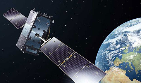
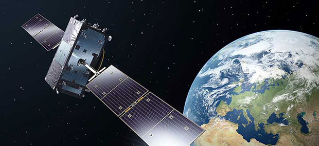
    Bids for the next Galileo satellite purchase contracts are due to be submitted in mid-July, and the European Commission has indicated that it will consider them purely on commercial terms. This is good news for the OHB System and Surrey Satellite Technology Limited (SSTL) consortium. And also for the Commission. If I were a betting man, I’d still wager the house on the incumbent consortium winning the contract to provide the remaining satellites required to provide a sustainable, 24/7 operational constellation for 1st generation Galileo. There would, in my opinion, be an unwarranted technical risk in doing anything else.

    However, for the next generation it is open season of course.

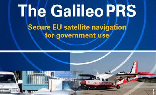
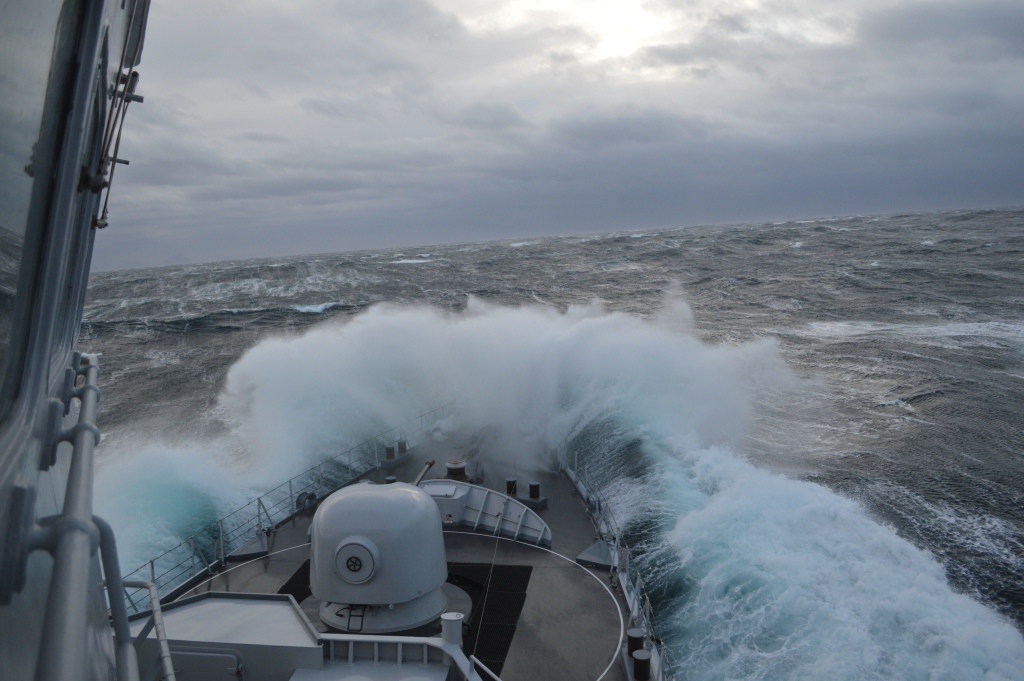
    Jewel in the Crown at Risk. But the real worry must be the Public Regulated Service (PRS). This is the unique feature of Galileo that is of great interest to civil and military authorities in Europe and beyond, due to its more robust encrypted signal and its potential anti-jamming and spoofing characteristics. Currently PRS will only available to EU Member States. In fact access to a PRS workshop at the European Space Solutions event (see below) was strictly “EU citizens only.” However, other countries, including the US and Norway, have indicated that they would love to be able to use it as well. No final decision on this has yet been made.

    The loss of the automatic right to access PRS would be damaging to the UK, and potentially to the full Galileo deployment timetable, as the country is currently host to the back-up Galileo Security Monitoring Centre (GSMC) — an essential part of PRS infrastructure — and I cannot see any part of the PRS infrastructure being left in a non EU Member State. PRS has been described as the “jewel in the Galileo crown,” but if the centre must be relocated then deployment of the full service could be delayed.

    In addition, the UK involvement in research and innovation activities around PRS may well be curtailed, even if other work on Galileo projects is not.

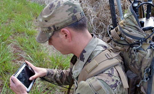
    The UK has been a leader in developing PRS applications. For example, Mark Dumville and colleagues at Nottingham Scientific Limited (NSL) have recently provided some very impressive demonstrations of cloud-based PRS applications including the first demonstration of the implementation of PRS authentication for an offender tag that was demonstrated using live Galileo (and GPS) signals. The demonstration provided real-time authentication flag generation, release and delivery to users. A second demonstration used cloud-based PRS in a proof-of-concept remote unattended, timing station where the primary user requirement was 100% confidence for the validity of signal. And a third demonstration illustrated the use of cloud-based PRS on a drone. “For users, demonstration of accreditation is key,” said Dumville when describing these results at the European Space Solutions event.

    Personally as a British citizen, and one who has spent the last 15 years in and out of the Brussels bubble, I see the EU referendum result as a national tragedy of epic proportions; and one that has been a long time in the making. Many global commentators are saying the UK has shot itself in the foot; sadly, in my opinion, it is much, much worse than that.

    United Europe

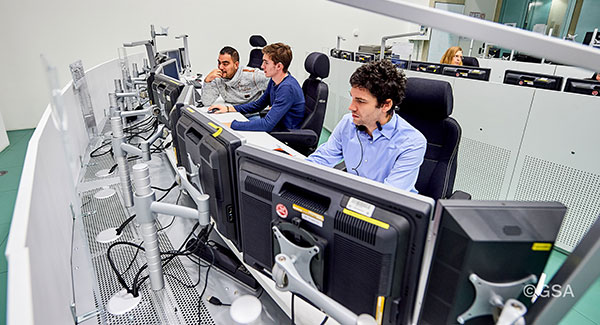
    The referendum news has certainly put a dampener on what I was hoping to be an optimistic, forward-looking article following the European Space Solution event in The Hague at the end of May. This was the fourth European Space Solutions conference and exhibition, attracting a large, global audience of policy-makers and industry players.

    At a press briefing just before the event kicked off on 30 May, and after an informal EU competitiveness ministerial council, Dutch minister for Economic Affairs Henk Kamp spoke about the ideas behind the forthcoming EU Space Policy. The policy, which should appear in the autumn/ fall, aims to elaborate a single and coherent European space strategy that will be the foundation of space programmes up to 2030.

    The policy will look to achieve three clear objectives:

    • to develop a strategy to ensure Europe maintains a strong and globally competitive space sector both upstream and in terms of use of data from space;
    • ensure independent access for Europe to space;
    • and maintain and upgrade the existing European space infrastructure — namely Galileo and Copernicus.

    Growth Vectors. Elżbieta Bieńkowska, the European Commissioner with responsibility for EU space programmes, indicated that the space policy would provide a “Coherent space vision for decades to come” and would be subject to public consultation. She was looking for “Maximum return on current programmes … and to respond to emerging needs in areas such as climate and security sectors.” The strategy will consider space-enabled solutions to societal challenges and as vectors for growth.

    She mentioned more than once that she is looking for long-term sustainability for the sector: a space sector that is able to adapt to disruptive technologies and maintain its competitive edge. My interpretation of this is that public money (from Europe) may not be as plentiful as previously, and the Commission will be looking for greater leverage of its tax Euros — that is, the private sector will need to invest more.

    Lowri Evans, Director-General for Internal Market, Industry, Entrepreneurship and SMEs, at the European Commission took up this theme. She saw huge opportunities as the cost of entry to the sector diminished, however private investment was still a problem. There was not enough in the EU and this must change. The Commission is aiming to create an environment for successful investment, she claimed.

    Jan Worner, the very positive Director-General of ESA said that “Space was indispensable” as an instrument for economic growth. It was also fascinating and inspiring. He felt it was also important that the different players in the EU space scene are working together for a “United Space in Europe.”

    The conference was also the venue for the official signing of the agreement for the future Galileo Reference Centre (GRC) that is to be established at Noordwijk in The Netherlands. The centre will play a crucial role in independently monitoring and reporting on Galileo’s performance and the quality of the system’s signal in space.

    Dual-Use Debate

    PRS was also a major talking point at the European Space Solution’s panel on ‘Space and Security.’ Despite the fact that Galileo is marketed as a civil controlled GNSS, “dual use” is becoming a potentially divisive area for debate. Marian-Jean Marinescu, MEP said there was a need for a common European defence and security strategy that includes securing all elements of the space value chain.

    Rini Goos from the European Defence Agency (EDA) said that the EU needed space systems to be able to “intervene successfully” and that space strategy needed to support Member State defence capabilities. This meant that the next generation of EU space systems must have dual-use capability. NATO is entrusted with external defence of the EU, but the Commission also needs to be able to provide defence, not just consume it, he concluded.

    Current Chairman of the Galileo Security Accreditation Board is a UK citizen – Jeremy Blyth. He said: “Space and Security, Security and Space. Whichever way we say it what is clear is that the two are inextricably linked together.” He believes that to ensure security it must be there “designed in from the beginning.” Security is an enabler, rather than a barrier, he claimed.

    He also believes that PRS gives the EU a real and competitive edge in secure positioning. However he indicated that there is a need to think deeply and have a rational debate about dual-use systems and in particular about the interface between civil and military use.

    Clearly there is a growing tension with regard to overtly military use of Galileo both now and in future generations of the system. Although a largely philosophical debate, given who in reality will be controlling and using PRS within many Member States, many European and national policy makers will want to retain the “purity” of Galileo as a global positioning system under fully civilian control.

    PRS Workshop

    Security was also a key feature of the PRS workshop organised by the Netherlands EU Presidency towards the end of European Space Solutions. Ger Nieuwpoort, Director of the Netherlands Space Office (NSO) reminded the audience that “For civil authorities, PRS provides the same level of security for Member States as the military in GPS.” While Christoph Kautz from the Commission said that the “Rationale for PRS was threats and user needs: better availability, high continuity, authentication, access control, exclusivity.”

    PRS offers defence in depth with a robust signal in space providing higher protection plus strong encryption on ranging codes, and the navigation and service messages. And the access to the technology is highly restricted.

    However some issues still need to be resolved. Bart Banning of the Netherlands Institute of Navigation asked ‘How will we use PRS?’ In terms of its use for protecting critical infrastructure, what if the owner of the infrastructure was a private company? Should it be granted access to PRS or have to make do with the Galileo Commercial Service aka PRS-lite?

    He also pointed out that PRS was no more protected against jamming than any other GNSS. And, currently, it was “not good for in-building, underground, or underwater.”

    He thought PRS could be a great time provider, but probably also need ground transmission, possibly via legacy radio towers. However, he saw the “killer app” for PRS being asset tracking of, for example, diamonds, VIPs or prisoners. He also agreed that for many EU countries the ministry of defence will be overseeing PRS services. “PRS is a good and unique addition to GNSS — but not the answer to all our needs.”

    Banning also highlighted the issue of commercial companies looking to buy LORAN / e-LORAN sites in Europe to provide a commercial service to back up GNSS. After the recent GPS timing glitch he said that the “timing community” had woken up to the vulnerability of their operations.

    Geospatial

    On a different tack, from 23–26 May the eighth edition of the Geospatial World Forum [www.geospatialworldforum.org] took place in Rotterdam, attracting professionals from the surveying and geoinformatic systems (GIS) sectors. I attended the event on 24 May and took part in a workshop that looked at the benefits of Galileo and EGNOS in geospatial applications in the context of the imminent launch of Galileo initial services.

    An industry survey undertaken by the GSA indicates that already more than 80% of GNSS receivers for surveying and mapping use are EGNOS-enabled, while 77% of geospatial reference network providers have enough information to upgrade Galileo and will be ready to provide a service by 2017. All good news. On the less positive side, more than 60% of professional surveyors did not know about EGNOS!

    The workshop also talked up the potential for synergies between Galileo GNSS and Copernicus Earth Observation (EO) systems — a topic of immense interest at the European Space Solutions as well. Hans Dufourmont from the European Environment Agency (EEA) highlighted the use of GNSS to track animal species and monitor migration paths when considering development opportunities. He saw a huge potential for synergies between geopositioning and surface imaging going forward.

    Maurice Barbieri, President of the Council of European Geodetic Surveyors (CLGE) also saw a “clear role for Galileo” in the surveying community with its potential ability to meet centimetre accuracy requirements much more than for EGNOS. He also speculated about the value of establishing a European Geoinformatic Agency that might coordinate the provision of European GNSS and EO data. He felt the private business community would appreciate such simplification.

    One presentation that caught my eye was from Laura van de Vyvere of M3 Systems in Belgium. She won the first-ever European Young Surveyor Prize with a paper taken from her Master’s thesis. The presentation addressed an innovative use of Galileo’s unique signal in space that is carried on four frequencies in the Open Service. Her work showed that the four frequencies enabled more precise phase measurements than with GPS so cycle slip is easier to detect and positioning data and reliability can be improved especially in harsh ionospheric conditions. The algorithm she developed could enable affordable multi-frequency receivers for mass-market applications, she claimed. An interesting idea.

    A bientôt, as they say in these parts.


  • Directions 2016: Galileo — strategic tool for European autonomy

    Directions 2016: Galileo — strategic tool for European autonomy

    Jeremie Godet, Galileo Implementation Head of Sector, European Commission (left); Fiammetta Diani, deputy head of Market Development, European GNSS Agency.
    Jeremie Godet, Galileo Implementation Head of Sector, European Commission (left); Fiammetta Diani, deputy head of Market Development, European GNSS Agency.

    By Jérémie Godet and Fiammetta Diani

    The Galileo programme is currently in its deployment phase, which is due for completion in 2020. Following declaration of initial services in 2016, an exploitation phase will start and aim at delivering a fully operational system by the end of 2020. The deployment and the exploitation are entirely financed through the budget of the European Union, while two non-EU members, Norway and Switzerland, contribute through international agreements.

    The aim of the Galileo programme is to establish and operate the first global satellite navigation system under the control of the European Union, thus contributing, amongst other things, to the strategic autonomy of the Union. This is the first time that the EU has developed, owned and been responsible for such a large-scale infrastructure.

    While independence is the main political objective, ensuring compatibility and interoperability with other existing and future systems is also critical. Indeed, frequency compatibility has been achieved with GPS, IRNSS, QZSS and COMPASS with a range of coordinations achieved in the last two years under the framework of the International Telecommunication Union (ITU). A wider international agreement was previously reached in 2004 between the U.S and the EU, achieving the compatibility and interoperability of their respective systems and resulting in a common modulation for both systems’ state-of-the-art open signals. A positive outcome of this for all GNSS users is that similar signals have been adopted by other global or regional systems, in particular the MBOC modulation jointly defined by the U.S. and the EU (Galileo, GPS, COMPASS, QZSS), the ALTBOC modulation adopted by COMPASS and a common signal in E6 adopted by QZSS.

    The Galileo programme will provide unique services, functionalities and performance levels that have never, or not yet, been provided by other satellites navigation providers.

    What Will Users Get, and When?

    These services, defined in consultation with user communities and EU Member States, will be offered by the system:

    • An Open Service (OS): With positioning accurate to around 1 meter using up to three different frequencies (E5a, E5b and L1), free of charge to the user and providing positioning and synchronization information intended mainly for high-volume satellite navigation applications;
    • A Public Regulated Service (PRS): Restricted to government-authorized users, for sensitive applications which require a high level of service continuity. It will use strong encrypted signals. This service is intended for security-related use for the EU Member States, the European Council, the European Commission, the European External Action Service and duly authorized Union agencies. It may be accessed by non-EU states and international organizations subject to bilateral agreements.
    • A contribution to the Search and Rescue Service (SAR) of the COSPAS-SARSAT system: Galileo’s worldwide search-and-rescue service will help to forward distress signals to a rescue coordination center by detecting emergency signals from beacons and relaying messages to them in near real time.
    • A contribution to integrity monitoring services by means of Galileo OS signals, in cooperation with other satellite navigation systems, aimed at users of safety-of-life applications in compliance with international standards;
    • A Commercial Service (CS): Encrypted for authentication purposes and offering very high accuracy to the sub-decimeter level, it will target applications for professional or commercial use owing to improved performance and data with greater added value than that obtained through the open service.

    As of 2016, Galileo will progressively offer initial services for the open service, search-and-rescue service and the public regulated service. Those initial services will be gradually improved, and the other two services will be gradually implemented, with the aim of reaching full operational capability by end 2020.

    The performance improvements of the services expected between 2016 and 2020 are linked to completion of the constellation deployment. In 2018, this will reach 24 satellites, the number required to achieve Galileo’s positioning performance targets, and the completed constellation with up to 30 satellites will be in place by the end of 2020 to provide the necessary spares to ensure performance commitments.

    On top of this, a number of additional capabilities are planned to be added to the core services, including:

    • An improvement of the OS nav message with full backward compatibility to enhance both the time-to-first-fix and the ability to perform signal acquisition and tracking for users in lower visibility conditions (INAV improvement);
    • An authentication of the OS navigation message allowing users to verify that a certain number of broadcast parameters are the actual Galileo data — aimed at applications requiring trusted position and timing information for commercial purposes;
    • An improvement of the PRS;
    • A new functionality within SAR that provides, via the navigation message, a Return Link Message to distress beacons acknowledging that a rescue center has received their distress signal.
    • Constellation Status

    The current Galileo constellation is composed of two different families of satellites: the In-Orbit-Validation (IOV) satellites procured before 2010 and the Full-Operational-Capability (FOC) satellites procured after 2010. Since the last Galileo launch on Sept. 10, there are four IOV satellites and six FOC satellites in orbit. The FOC satellites have improved capabilities regarding signal transmission compared to the IOV satellites, despite a similar mass and size. The FOC satellites carry a SAR payload; two IOV satellites have this capability. While this initial deployment faced a number of difficulties, these are now well behind us.
    Sixteen more FOC satellites are being built. The next launch of two FOC satellites is scheduled for Dec. 17, and four more launches (three Ariane 5 and one Soyuz) are foreseen from 2016 to mid-2018. This implies four to six satellites launched per year, and this is judged perfectly realistic as demonstrated already in 2015.

    An additional series of satellites will be procured in 2016 for deployment starting in late 2019/early 2020.

    Preparing to Use and Benefit

    The ultimate objective of the Galileo program is for its signals to be translated into valuable and reliable services for users across the globe. Europe aims to generate the return on investments in terms of public benefits for citizens and businesses, and for this reason the users are at center of the program.

    This is the focus of the European GNSS Agency (GSA), which is in constant dialog with user communities via a wide range of activities.

    For example, cooperation with chipset and receiver manufacturers aims to ensure that all products are Galileo-ready. This process involved a successful testing campaign done in cooperation with ESA and the EC’s Joint Research Centre (JRC). Equally important is to work closely with large user communities, such as road, maritime and rail, to support them in updating their systems so that they are ready to use Galileo. This is accomplished by dedicated market and technical support, via cost-benefit analyses, testing campaigns, initiation of standards and certification processes, user satisfaction surveys and more. These actions are part of tailored adoption roadmaps built with each user community. Periodic user fora are also organised to get feedback on current services and collect ideas for the evolution of the European GNSS systems.

    EU R&D programmes, such as Horizon 2020 for the development of Galileo applications as well as the recently launched Fundamental Elements program that focuses on funding European GNSS chipset and receiver technologies, are essential tools for preparing users and supporting EU competitiveness in the downstream sector.

    The GSA leverages these EU R&D programmes as a tool for adoption with large user communities and receiver manufacturers fully involved. The projects are managed by experienced staff specialised in different markets and application areas. In the case of PRS, the core user equipment technology is being designed and tested. This work is already paying off; today, a growing number of receivers available on the global market are Galileo-enabled, while almost 70 percent of the models have EGNOS.

    Among others, Europe’s ST Microelectronics in the automotive sector, and the U.S.’s Broadcom and the Taiwanese Mediatek in smartphones, have already announced their Galileo-ready chipsets. Many other chipset manufacturers are ready and tested for Galileo. It is expected that, with recent successful launches and the deployment schedule, most of them will bring their Galileo products to market in 2016.

    Galileo on the Horizon

    Despite its particularly challenging complexity, involving extensive technical and security requirements, Galileo deployment is now progressing well and services will be provided starting in 2016, to reach their full operational capability in 2020. One early benefit of interoperability with GPS is that even before the Galileo constellation is completed, the number of L5/E5a signals in space will allow meaningful use of that frequency for the first time. Galileo will deliver real advances in precision, availability, coverage and additional features unprecedented in any other satellite navigation systems to date: while GPS is today’s de facto standard, Galileo is aiming to be the world’s second GNSS reference system by 2020.


    Governance Set-up

    The European Commission (EC) has overall programme supervision and budget responsibilities. The EC delegates system design and infrastructure procurement to the European Space Agency (ESA) and service preparation, delivery and operations to the European GNSS Agency (GSA). ESA is one of founders of the Galileo system and has been responsible for the development phase, co-financed by the Member States of ESA and the EU. ESA is the procurement agent of core infrastructure and in charge of the overall system integration since 2007.

    The GSA’s role will grow considerably in the exploitation phase as it becomes the day-to-day interface with ESA in several areas, including infrastructure roll-out and maintenance. The GSA will procure main operations of the system from 2017 and will operate key services facilities such as the Galileo Security Monitoring Centre in France and the UK, the European GNSS Service Centre in Spain, and the Galileo Reference Centre in the Netherlands. The GSA also supports the enabling of receivers and chipsets for Galileo use and the development of applications in downstream segments, in close cooperation with the major user communities.


  • Galileo Maritime Tests Followed Route of Viking Ships

    Galileo Maritime Tests Followed Route of Viking Ships

    Belgian frigate Leopold I-F930 in rough water off Norway during Galileo maritime testing. In December 2013 the frigate participated in the first maritime trials outside mainland Europe of the Galileo satellite navigation system.
    Belgian frigate Leopold I-F930 in rough water off Norway during Galileo maritime testing. In December 2013 the frigate participated in the first maritime trials outside mainland Europe of the Galileo satellite navigation system.

    Results are being processed from the first Galileo maritime trials outside of mainland Europe. The long-range, high-latitude testing spanned the North Sea, following the same historical sailing route that Viking dragon-ships used 1200 years ago.

    Ancient manuscripts record Viking navigators relied on “sunstones” to find their way — archaeologists believe these may have been polarizing crystals to pinpoint the Sun even in overcast skies.

    By contrast, Belgian frigate Leopold I-F930, participating in the end-of-year trials, carried the most up-to-date equipment possible, with multiple Galileo receivers for both its public Open Service (OS) and secure Public Regulated Service (PRS).

    “Galileo is in a transition between its In-Orbit Validation (IOV) phase and follow-on Full Operational Capability phase,” said Miguel Manteiga Bautista, head of ESA’s GNSS Security Office. “This means we are engaging in all kinds of experimental demonstrations of all Galileo services, in particular PRS, which offers the most highly accurate positioning and timing performance, but with access strictly restricted to authorized users.”

    The recorded course of Belgian frigate Leopold I-F930  during the first high-latitude trials of Europe's Galileo satellite navigation system. The frigate sailed first from the Dutch marine base of Den Helder on 4 December 2013 to Stavanger in Norway. From there it progressed north in very rough seas with 10-m high waves, coming close to the Arctic circle on December 17 — a first for Galileo PRS observations — before heading homeward.
    The recorded course of Belgian frigate Leopold I-F930 during the first high-latitude trials of Europe’s Galileo satellite navigation system. The frigate sailed first from the Dutch marine base of Den Helder on 4 December 2013 to Stavanger in Norway. From there it progressed north in very rough seas with 10-m high waves, coming close to the Arctic circle on December 17 — a first for Galileo PRS observations — before heading homeward.

    The frigate sailed first from the Dutch marine base of Den Helder on December 4, 2013, to Stavanger in Norway. From there it progressed north in very rough seas with 10-meter-high waves, coming close to the Arctic circle on December 17 — a first for Galileo PRS observations — before heading home.

    The testing provided tangible in-situ evidence of Galileo signal stability across both its operating frequencies up at high latitudes, equaling low satellite elevations in the local sky.

    Following the completion of earlier road, then flight, testing last summer and autumn, the last challenge for Galileo’s IOV phase was to engage in a long-term maritime trial into high latitudes. The testing was performed as part of the PRS Participants to IOV project jointly managed by ESA and the European Commission, in collaboration with the European GNSS Office Agency and several Member States possessing PRS test receiver technology.

    The trials were performed by the Royal Military Academy of the Belgian Ministry of Defence, the UK Space Agency in collaboration with Nottingham Scientific Ltd. and ESA, to ensure PRS signals were available whenever the four Galileo satellites in orbit came into view.

    Two receivers, seen either side of the main antenna, were carried by Belgian frigate Leopold I-F930 during high-latitude testing of both Galileo's publicly-available Open Service and secure Public Regulated Service in December 2013.
    Two receivers, seen either side of the main antenna, were carried by Belgian frigate Leopold I-F930 during high-latitude testing of both Galileo’s publicly-available Open Service and secure Public Regulated Service in December 2013.

    A dual-test setup was fitted to the frigate at Den Helder. Belgium connected a PRS receiver and an OS receiver, both manufactured in Belgium by Septentrio NV, to a common antenna. The PRS receiver recorded raw PRS measurements on both frequencies while the OS receiver logged data from openly available Galileo, GPS and GLONASS signals at one-second intervals.

    Nottingham Scientific installed its Ultra system configured to record radio-frequency samples, allowing the detailed post-processing of Galileo OS and PRS signals.

    “As this was a first use of PRS equipment outside EU borders, the security issues were quite challenging,” said Bruno Vermeire, head of the Belgium Competent PRS Authority (Federal Public Service of Foreign Affairs). “Several partners from different countries and industries were involved. At all times the necessary security was assured, though this could not have been possible without the dedicated joint commitment of all partners.”

    David Parker, head of the UK Space Agency, commented, “This test is a significant milestone on the road to demonstrating early PRS capability across a range of platforms. It should serve as a model for wider international collaboration between national governments and industry to prove and demonstrate PRS in different applications.”

    Belgian frigate Leopold I-F930 at Den Helder dockyard in the Netherlands.
    Belgian frigate Leopold I-F930 at Den Helder dockyard in the Netherlands.

    Alain Muls, professor of the Royal Military Academy of Belgium, faced the challenge of coordinating the maritime trial without interfering with the normal operations of the frigate. “Thanks to the cooperation of with the Maritime Component of the Belgium Defence, in particular that of the frigate’s commander and crew, preliminary results look very promising. Reception of Galileo’s OS and PRS navigation services have been practically demonstrated under severe maritime conditions with waves of up to 10 meters in height.”

    “This activity is a truly collaborative effort at all levels. The trial involved UK and Belgian governments and industry partners with support from different European bodies as well as officials from the Netherlands and Norway,” said Mark Dumville, Nottingham Scientific general manager. “This team effort has enabled the concept of radio-frequency sampling processing of Galileo PRS signals to be tested in real-world operational environments. We have confirmed that the prototype receiver is now ready to support European governments and associated PRS applications.”

    The collaborative nature of this trial was formally recognized as the Leopold I-F930 reached Stavenger. Under the supervision of Belgium’s CPA, Jochen Devadder, the country’s Ambassador to Norway Michel Godfrind provided a Norwegian delegation with details of the testing.

    Results from the trial will guide future Galileo developments for years to come.