Tag: Ramsey Faragher

  • GPS World honors leaders in GNSS/PNT

    GPS World honors leaders in GNSS/PNT

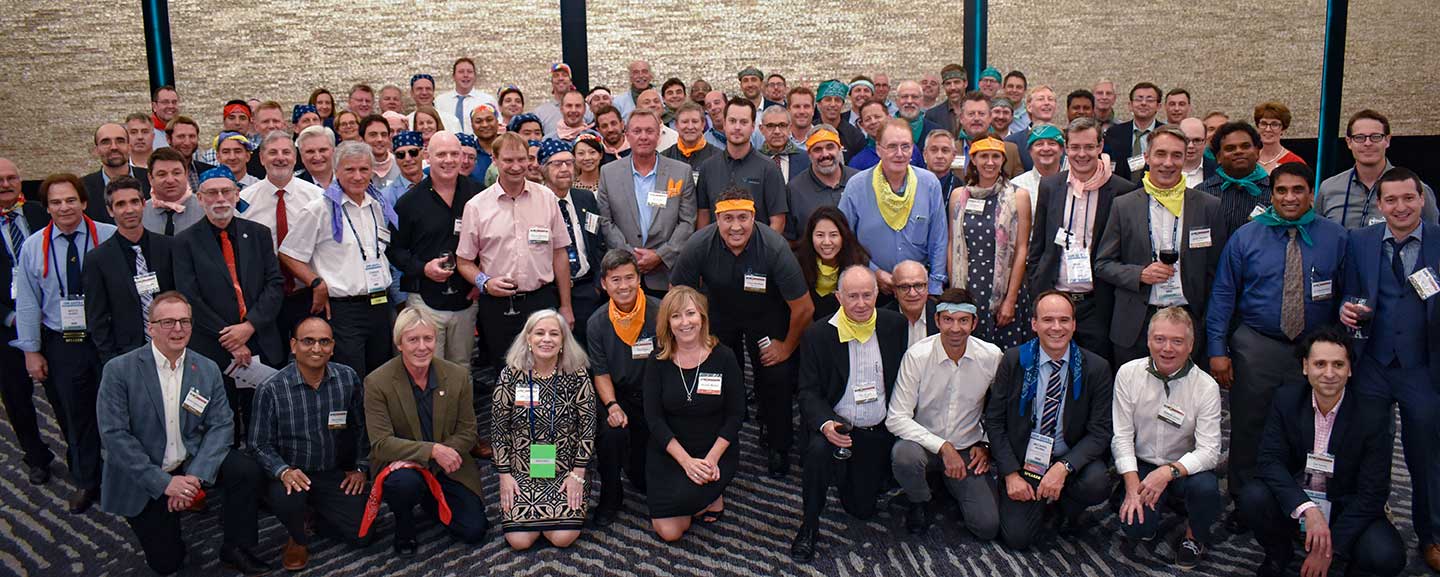
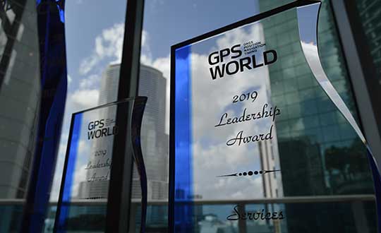
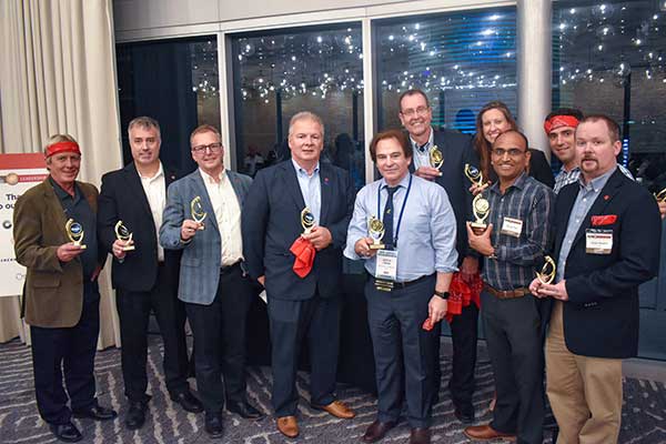
    On Sept. 19, in conjunction with the ION GNSS+ conference, GPS World hosted its annual Leadership Awards dinner. Five honorees — chosen by a panel of GNSS experts — were recognized for their outstanding recent contribution or achievement in four categories: Satellites, Signals, Services and Products.


    SATELLITES AWARD: Presented by Johnathan Caldwell (left) to Mark Crews, both of Lockheed Martin. Crews accepted on behalf of Tim Hartman. (Photo: GPS World)
    SATELLITES AWARD: Presented by Johnathan Caldwell (left) to Mark Crews, both of Lockheed Martin. Crews accepted on behalf of Tim Hartman. (Photo: GPS World)

    Satellites Award

    TIM HARTMAN: Satellites Award winner
    TIM HARTMAN: Satellites Award winner

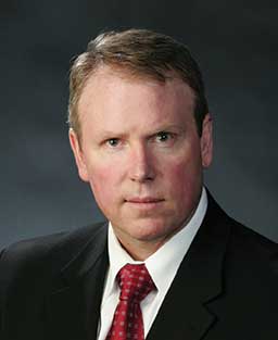
    Tim Hartman, Chief Engineer, Military Space Programs, Lockheed Martin

    Hartman was recognized for serving as the program manager for GPS IIRM and GPS III Space Segments. Tim’s leadership and program dedication helped support the U.S. Air Force’s decision to declare GPS III ready for launch on Oct. 17, 2017.

    Sponsor: Lockheed Martin

    On Aug. 22, Lockheed Martin Space celebrated the successful launch of the second of up to 32 next-generation GPS III/IIIF satellites that the U.S. Air Force contracted the company to design and build. Lockheed Martin’s commitment to positioning, navigation and timing can be found in the exemplary performance of the 18 Lockheed Martin-built GPS IIR and IIRM satellites that are a proud part of today’s 31-satellite GPS constellation. The company also is proud to support the Air Force with its continued sustainment of the current GPS Operational Control Segment.
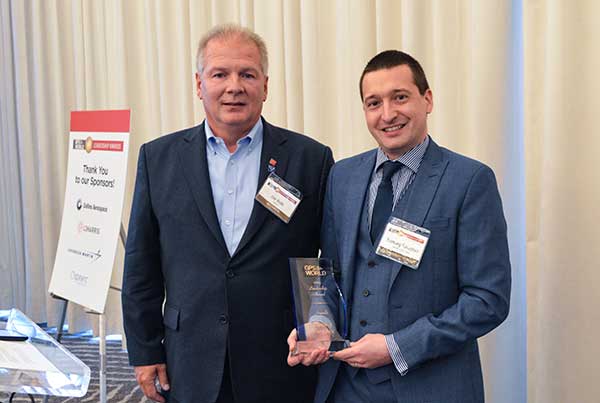

    SIGNALS AWARD: Presented by Joe Rolli of L3Harris (left) to Ramsey Faragher. (Photo: GPS World)
    SIGNALS AWARD: Presented by Joe Rolli of L3Harris (left) to Ramsey Faragher. (Photo: GPS World)

    Signals Award

    Ramsey Faragher, Founder and CEO, Focal Point Positioning

    Focal Point Positioning’s new supercorrelator approach to indoor and urban GNSS signal processing could revolutionize smartphone-based GNSS. New signal processing methods for the correlation stage of a GNSS receiver enable several seconds of coherent integration while the receiver is undergoing dynamic motions. This improves accuracy and integrity, and provides anti-spoofing and spoofer-localization capabilities — without hardware changes or requiring access to encrypted signals.

    Sponsor: L3Harris

    L3Harris Technologies is an agile global aerospace and defense technology innovator, delivering end-to-end solutions that meet customers’ mission-critical needs. The company provides advanced defense and commercial technologies across air, land, sea, space and cyber domains. L3Harris has approximately $17 billion in annual revenue and 50,000 employees, with customers in 130 countries.
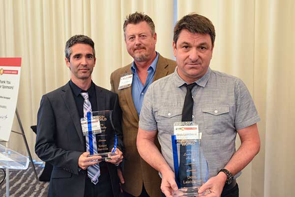

    SERVICES AWARD: Presented by Mike Shepherd of Collins Aerospace (back) to Simon Banville (front left) and Denis Laurichesse. (Photo: GPS World)
    SERVICES AWARD: Presented by Mike Shepherd of Collins Aerospace (back) to Simon Banville (front left) and Denis Laurichesse. (Photo: GPS World)

    Services Award

    Denis Laurichesse, Navigation Systems Department Expert, Centre National d’Études Spatiales (CNES)

    Simon Banville, Senior Geodetic Engineer, Natural Resources Canada (NRCan)

    Laurichesse and Banville demonstrated instantaneous, centimeter-level, multi-frequency precise point positioning (PPP). Their work shows PPP might become, within a few years, a practical alternative to real-time kinematic (RTK) for a wide range of applications.

    Sponsor: Collins Aerospace

    Collins Aerospace Systems, a unit of United Technologies Corp., is a leader in technologically advanced and intelligent solutions for the global aerospace and defense industry. Created in 2018 by bringing together UTC Aerospace Systems and Rockwell Collins, Collins Aerospace has the capabilities, comprehensive portfolio and expertise to solve customers’ toughest challenges and meet the demands of a rapidly evolving global market.
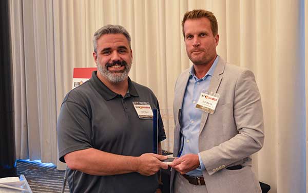

    PRODUCTS AWARD: Accepted by Paul Alves (left) from presenter Jeff Martin of NovAtel. (Photo: GPS World)
    PRODUCTS AWARD: Accepted by Paul Alves (left) from presenter Jeff Martin of Spirent Federal Systems. (Photo: GPS World)

    Products Award

    Paul Alves, P.Eng, Ph.D., Technology Manager — Correction Services, NovAtel, part of Hexagon

    Alves was recognized for his work on localization of interference sources for GNSS users leveraging the Interference Tool Kit. With the ITK, users can detect and mitigate adversarial jamming of GNSS signals, as well as unintentional interference from external sources.

    Sponsor: Spirent Federal

    Spirent has more than 30 years of experience delivering the world’s best test equipment. Spirent’s test solutions for GPS and GNSS, critical infrastructure SCADA vulnerabilities, Internet L3-L7 common vulnerabilities and exposures, and mobile vulnerabilities allow the world to communicate and collaborate faster. Spirent Federal Systems is a wholly owned subsidiary of Spirent Communications and was established to offer the world’s leading simulation equipment to U.S. government customers, armed services, education institutions, and prime contractors. Spirent Federal’s SimMNSA was the first to be granted Security Approval by the Global Positioning System Directorate.
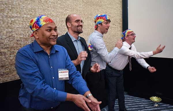
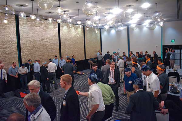

    PNT CHAMPS: The L3Harris team earned the most total points in all six games, and took home a trophy each. (Photo: GPS World)
    PNT CHAMPS: The L3Harris team earned the most total points in all six games, and took home a trophy each. (Photo: GPS World)

    PNT Games

    After dinner, guests broke into teams to test their personal positioning, navigation and timing skills, precisely determined by their ability to toss rings and throw horseshoes under time pressure. Each team rotated through yard games such as ladder toss, ring toss, corn hole and horseshoes to prove who was the most accurate and resilient. The L3Harris team took home the first-place prize.

    RAINBOW CONNECTION: Taking on giant pong are members of the rainbow bandana team, (from left) Sanjeev Gunawardena, Thomas Pany, Steffen Thoelert and André Hauschild. (Photo: GPS World)
    RAINBOW CONNECTION: Taking on giant pong are members of the rainbow bandana team, (from left) Sanjeev Gunawardena, Thomas Pany, Steffen Thoelert and André Hauschild. (Photo: GPS World)
    ORGANIZED CHAOS: Wearing different-colored bandanas, teams cheer on their team members and fight for every point. (Photo: GPS World)
    ORGANIZED CHAOS: Wearing different-colored bandanas, teams cheer on their team members and fight for every point. (Photo: GPS World)
    After all the awards were given, everyone got together for a memorable group photo. (Photo: GPS World)
    After all the awards were given, everyone got together for a memorable group photo. (Photo: GPS World)


  • Supercorrelation: Enhancing accuracy, sensitivity of commercial receivers

    Figure 1: Reflected signals in the local environment suffer different Doppler variations than the desired line­of­sight signal. This means that the supercorrelator that is created for a given satellite broadcast couples strongly to the desired line of sight version  of the signal, but attenuates any reflected  signals  arriving from different directions.  (Figure: Focal Point Positioning)
    Figure 1: Reflected signals in the local environment suffer different Doppler variations than the desired line­of­sight signal. This means that the supercorrelator that is created for a given satellite broadcast couples strongly to the desired line of sight version of the signal, but attenuates any reflected signals arriving from different directions. (Figure: Focal Point Positioning)

    The S­GPS/S­GNSS technology is a patent-protected suite of methods that provides software-based improvements to existing GNSS receivers. All methods within the software suite build upon a core technology called supercorrelation, which enables over a second of coherent integration while undergoing complex motions on low-cost platforms. The benefit is high sensitivity coupled with strong multipath mitigation capabilities, providing a high-accuracy and high-integrity positioning solution in traditionally difficult environments.

    Many GNSS receivers perform a small amount of coherent integration, typically less than 20 milliseconds, and then optionally incoherently integrate over many hundreds of milliseconds to boost sensitivity if needed. The major problem with this approach is the resulting susceptibility to multipath interference. Incoherent integration destroys the phase information stored within the captured data before combining it, resulting in line-of-sight and non-line-of-sight signals accumulating within the same correlation peak, producing a distortion of the desired line-of-sight information. This distortion leads to erroneous codephase estimates, which in turn leads to erroneous position estimates.

    Coherent integration can decorrelate signals arriving from different directions, but the degree of decorrelation depends on the user speed and the coherent integration time. Supercorrelator technology creates a clock-and-motion-compensated phasor correction sequence that provides over a second of coherent integration on low-cost consumer platforms. The outcome is signal tracking sensitivities down to nearly zero dBHz, combined with high multipath mitigation performance. Such long coherent integration times allow signals arriving from different directions to be separated out in the frequency domain, permitting new capabilities in anti-spoofing and 3D map-aiding methods by directly resolving GNSS angle-of-arrival using a single moving antenna.

    Figure 2: The result of supercorrelation on positioning performance in the urban canyons of central San Francisco. The red line is a standard state­-of-­the-­art vector tracking GPS solution, and the green line is the same positioning engine with supercorrelation processing enabled. (Image: Focal Point Positioning)
    Figure 2: The result of supercorrelation on positioning performance in the urban canyons of central San Francisco. The red line is a standard state­-of-­the-­art vector tracking GPS solution, and the green line is the same positioning engine with supercorrelation processing enabled. (Image: Focal Point Positioning)

    Traditionally, very long coherent integration times were not practical on consumer devices due to limitations of data modulation bits, crystal oscillator stability, and unknown (often complicated) receiver motion. Supercorrelation overcomes these limitations with signal processing and sensor fusion. Data modulation bits are not an issue for modern pilot signals, and for legacy signals they can be removed with a variety of methods, ranging from prediction or provision of the bits over a datalink, to stripping them directly with signal-squaring methods. Receiver motion can be inferred from inertial sensors mounted alongside the GNSS receiver, as is the case for smartphones and smartwatches, or can be modeled using multi-hypothesis methods. Low-cost crystal oscillators cause phase instabilities which traditionally reduce coherent integration time, but can also be accounted for by multi-hypothesis testing and by joint estimation processes across multiple channels.

    A decade ago, consumer GNSS receivers were typically an ASIC or similar hard-wired design. Modern designs incorporate a front-end correlator bank which may or may not be reprogrammable, feeding into a DSP stage which handles all tracking and navigation processing from the DLL, PLL, FLL stages onwards. The flexibility of reprogramming the code running on the DSP stage permits existing GNSS chipsets to be easily upgraded to support supercorrelation, without needing to design and fabricate a new receiver.

    Focal Point aims to have S-GNSS enabled chips by early 2020, with licensing opportunities available from summer 2019 onwards.