Tag: Red Sea

  • Maritime agency warns of AIS jamming in Red Sea region, ICAO condemns Russia and North Korea

    Maritime agency warns of AIS jamming in Red Sea region, ICAO condemns Russia and North Korea

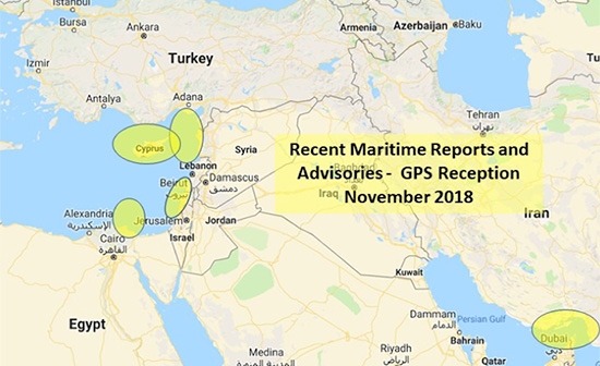
    The UK Maritime Trade Operations (UKMTO) has issued an advisory following a surge in reports of interference affecting GNSS and Automatic Identification System (AIS) displays. The disruptions, which began Oct. 3, are concentrated around Bandar-e-Pars (Iran), the Strait of Hormuz and Port Sudan.

    “UKMTO has received numerous reports of GNSS interference from vessels in the Red Sea and Persian Gulf, between October 3 and 7,” the operations centre said in the alert. “This is a significant increase of reports compared with the same period in the previous week.”

    UKMTO urged vessels to exercise heightened caution. Ships in the Gulf, Port Sudan, and Suez Canal areas are experiencing consistent AIS speed anomalies, further complicating navigation.

    Russia and North Korea named as culprits

    Also this week, the International Civil Aviation Organization (ICAO) Assembly issued two resolutions condeming Russia and North Korea for recurring incidents of GNSS interference, citing the intentional interference as infractions of the 1944 Convention on International Civil Aviation. The agency urgently called upon both countries to comply strictly with their obligations under the convention.

    The assembly also deplored the fact that incidents of GNSS interference originating from the two countries have continued despite concerns repeatedly expressed by the ICAO Council about the harmful impact of GNSS interference on the safety and security of international civil aviation. 

    Photo: ICAO
    Photo: ICAO

    The assembly reiterated the paramount importance of preserving the safety and security of international civil aviation through strict compliance with the principles enshrined in the Chicago Convention and its Annexes. It also recalled Assembly Resolution A41-8, which recognized that the spectrum used by GNSS should be free from harmful interference and urged countries to refrain from any form of jamming or spoofing affecting civil aviation.

    The resolutions were issued as the ICAO triennial assembly in Montreal concluded on Oct. 5.

  • GPS disrupted for maritime in Mediterranean, Red Sea

    GPS disrupted for maritime in Mediterranean, Red Sea

    The U.S. Maritime Administration issued an expanded advisory for GPS disruptions in the Middle East. The new advisory renews and repeats warnings for the eastern Mediterranean and adds the Port of Jeddah in Saudi Arabia.

    Reports have also been filed  with the U..S Coast Guard Navigation Center  about disruptions in Israel’s Port of Haifa and the Straits of Hormuz.

    Analysis by the Resilient Navigation and Timing Foundation and the non-profit firm C4ADS has also shown on-going disruptions in Russian waters of the Black Sea. Also, GPS jamming by Russia is suspected during a recent NATO exercise.

    The armed conflict in Syria has been blamed for much of the disruptions off of its shores.

    GPS jamming in support of illegal fishing is suspected by some as the cause of problems off of Port Said, and disputes over mineral rights has been suggested for the disruptions seen near Cyprus.

    Disruptions in the Black Sea are suspected to be security measures associated with the travel of Russian government officials.

    Map: U.S. Maritime Administration Advisory 2018-014-GPS
    Map: U.S. Maritime Administration Advisory 2018-014-GPS

    Text of Maritime Administration Advisory

    2018-014-GPS Interference-Eastern Mediterranean and Red Sea

    This revised advisory cancels U.S. Maritime Advisory 2018-007.

    Reference: U.S. Maritime Alerts 2018-004A, 2018-004B, 2018-008A.

    Issue: Multiple instances of significant GPS interference continue to be reported by vessels and aircraft operating in the Eastern Mediterranean Sea. These reports have been concentrated near Port Said, Egypt, the Suez Canal, and in the vicinity of the Republic of Cyprus. Additional instances of similar interference were reported in October 2018 near Jeddah Port, Saudi Arabia. This interference is resulting in lost or otherwise altered GPS signals affecting bridge navigation, GPS-based timing and communications equipment.

    Guidance: Exercise caution when transiting these areas. The U.S. Coast Guard Navigation Center (NAVCEN) and NATO Shipping Center websites contain information regarding effective navigation practices for vessels experiencing GPS interference. The information reaffirms safe navigation practices when experiencing possible GPS disruption, provides useful details on reporting possible GPS disruption, and is intended to generate further discussions within the maritime community about other disruption mitigation practices and procedures. This guidance also recommends taking note of critical information such as the location (latitude/longitude), date/time, and duration of the outage/disruption, and providing photographs or screen shots of equipment failures during a disruption to facilitate analysis. The NAVCEN information is available at https://go.usa.gov/xQBaU.

    Contact Information: GPS disruptions or anomalies should be immediately reported to the NAVCEN at https://go.usa.gov/xQBaw or via phone at 703-313-5900, 24 hours a day. The NATO Shipping Center has requested that instances of GPS interference also be reported to them using the format on their Cyber Interference link.

    Cancellation: This message will automatically expire on May 2, 2019.

    Link To MARAD Advisory


    Dana Goward is president of the nonprofit Resilient Navigation and Timing Foundation.