Tag: reference receiver

  • Jackson Labs’ PNT-6220 ready to protect critical infrastructure

    Jackson Labs’ PNT-6220 ready to protect critical infrastructure

    Photo: Jackson Labs
    Photo: Jackson Labs

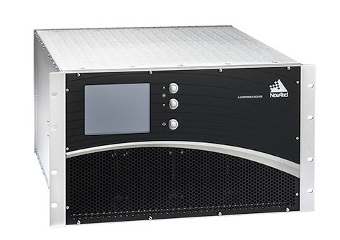
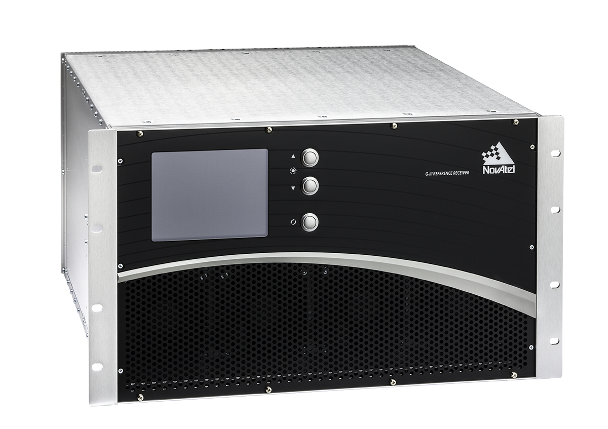
    Jackson Labs Technologies (JTL) has launched the PNT-6220 Assured Reference — a product combining low-Earth-orbit (LEO) signals, GNSS, terrestrial, wireline and atomic clock services in one small solution, specifically designed for critical infrastructure applications.

    The PNT-6220 reference seamlessly combines concurrent L1, L2, L3 and L5 GNSS reception with a custom JLT-designed LEO-based Satellite Time and Location (STL) timing receiver. It also includes terrestrial receivers and PTP/IEEE-1588 edge grandmaster (EGM) and PTP/IEEE-1588-slave capability.

    The PNT-6220 provides assured PNT for critical infrastructure applications such as those described in the directives of Presidential Executive Order 13905.

    It can serve as a timing reference for 5G equipment, an ePRTC-capable reference, or a high-performance disciplined reference that supports PTP/IEEE-1588, STL, RF distribution and multi-frequency GNSS capability.

    The PNT-6220 will be able to select the most optimal UTC reference input automatically and auto-switchover among its numerous reference inputs if one or more of them are jammed or spoofed, as well as average several references for additional stability and accuracy.

    If all external references are jammed, the unit can provide UTC timing from its internal holdover oscillator with options that have less than 100-ns drift over 24 hours. The unit is also capable of outputting a GPS RF distribution signal driven by the internal flywheel oscillator, which allows glue-less retrofitting of any GPS-based legacy user equipment to the state-of-the-art reference sources the PNT-6220 can receive by simply plugging into the legacy equipment GPS antenna input.

    Available Options

    Numerous options are available for the half-width 19-inch-wide rack-mount box.

    Input options (can run in parallel):

    • STL Iridium timing reference receiver
    • eLoran timing receiver option
    • GNSS (concurrent GPS, BeiDou, Galileo, GLONASS, QZSS, SBAS)
    • Secondary GPS as backup — for example, for diverse antenna locations
    • 1P PS from external source
    • 10 MHz from external source
    • PTP/1588 network slave capability, connects to an edge grandmaster as a PTP slave
    • Dual +12V redundant power supply option (use one or two as desired)

    Holdover clock options:

    • TCXO
    • SOCXO
    • DOCXO
    • Ultra Temp Range (-40C to +85C) low-g (vibration hardened) DOCXO
    • CSAC atomic oscillator (various to choose from)
    • Rubidium atomic Hodover oscillator (various to choose from, down to <100ns drift over 24 hours is available)
    • External 10MHz source input for ePRTC support

    Output signals:

    • Dual 10MHz Sine
    • Dual 1PPS CMOS
    • RS-232 1PPS and TOD (for NTP/SNTP/PTP servers) as well as console port
    • GPS RF output signal to upgrade existing GPS equipment with Assured Capability by simply replacing existing GPS antenna
    • PTP/1588 v2 Edge Grandmaster built-in
    • Ethernet Console port
    • USB Console port
  • NovAtel delivers signal generators to modernize FAA’s WAAS

    NovAtel delivers signal generators to modernize FAA’s WAAS

    Next-generation NovAtel ground uplink station signal generators delivered for SBAS modernization

    Photo: NovAtel
    Photo: NovAtel

    Hexagon/NovAtel announced that shipments of next-generation ground uplink station (GUS) signal generators have commenced in fulfillment of its contract with the United States Federal Aviation Administration (FAA) to support the FAA’s safety of life wide-area augmentation system (WAAS) navigation service.

    Developed by the FAA for civil aviation, WAAS is a safety-critical navigation aid that provides integrity monitoring and differential corrections for all phases of flight. The next-generation NovAtel GUS signal generator replaces the legacy product that has operated successfully for more than 15 years and ensures continued operation for years to come.

    Along with the GUS signal generator modernization, the contract includes ongoing engineering support services for the complete portfolio of NovAtel ground reference receiver products deployed by the FAA.

    “We have a long-standing relationship with the FAA and worked very closely with the WAAS program team to deliver this critical next-generation technology for SBAS modernization,” stated Jonathan Auld, NovAtel Vice President of Engineering and Safety Critical Systems. “We’re very pleased to continue our commitment to support the FAA and their safety of life WAAS service.”

  • NovAtel contracted to supply signal generators for FAA’s WAAS program

    NovAtel contracted to supply signal generators for FAA’s WAAS program

    NovAtel has been awarded a contract from the United States Federal Aviation Administration (FAA) to design, produce and deliver 40 next-generation Ground Uplink Station (GUS) Signal Generators to support the FAA’s safety-of-life WAAS navigation service. The service provides safety-critical infrastructure for the North American aviation navigation network.

    GUS signal generator. (Photo: NovAtel)
    GUS signal generator. (Photo: NovAtel)

    The contract also includes ongoing engineering support services for NovAtel’s complete portfolio of satellite-based augmentation system (SBAS) products deployed by the FAA, including the WAAS G-III reference receiver platform.

    The FAA has relied on NovAtel’s safety-critical SBAS technology for more than 20 years, starting with NovAtel’s first-generation WAAS reference receiver that was created in the 1990s.

    Developed by the FAA, the WAAS network is a safety-critical navigation aid that allows aircraft to use GPS for all phases of flight. Every time an aircraft takes off or lands within the WAAS coverage area, NovAtel technology is generating and processing data that allows aviators to make precision approaches to any airport.

    Since the program’s inception, NovAtel has provided the FAA with technology that delivers high-precision GPS receiver measurements and navigation information from WAAS Reference Stations and the GUS infrastructure.

    Under this new contract, NovAtel will help modernize the WAAS network by upgrading and extending support for the network’s GUS infrastructure. The next-generation of GUS signal generators, which are designed specifically for SBAS ground uplink systems, will include independent L1 and L5 signal paths to precisely control the frequency and phase of L1 and L5 code and carrier for dual-frequency SBAS.

    A GUS receiver system based on the WAAS G-III receiver platform will also be released along with the signal generator to complete the modernized GUS control loop.

    “We have a long history with the FAA and have worked very closely with the WAAS program team to develop multiple-generations of SBAS infrastructure,” said Jonathan Auld, vice president of engineering and safety critical systems at NovAtel. “NovAtel remains committed to supporting the FAA and their safety of life WAAS service and we are excited to deliver this critical next-generation technology for SBAS modernization.”

  • Tallysman launches VeraChoke high-performance GNSS antenna

    Tallysman launches VeraChoke high-performance GNSS antenna

    The VeraChoke GNSS antenna. (Photo: Tallysman)
    The VeraChoke GNSS antenna. (Photo: Tallysman)

    Tallysman, a manufacturer of high-performance GNSS antennas and related components, has introduced a high-accuracy choke ring antenna: the Tallysman VeraChoke.

    Adapting existing innovations on its patented VeraPhase antenna, Tallysman’s VeraChoke offers a choice in form factor for reference and monitoring applications.

    The VC6100, the first model variant of the VeraChoke antenna, shares a common high-efficiency element design with itsVeraPhase counterpart. With the choke-style form-factor, however, the rings have been optimized for all GNSS signals and are slightly pyramidal in shape to improve reception of low-elevation satellites.


    The VC6100 choke ring antenna offers a tight phase center variation of no more than ±1 mm for every frequency. It is capable of receiving all GNSS signals and achieves a very low axial ratio, the company said.

    According to Tallysman, the VC6100 is competitively priced to help increase antenna density for reference deployments, CORS networks and monitoring applications. The antenna also supports large and small SCIGN radomes.

    Tallysman’s GNSS antennas are on display at Booth Number 12.0D.059 at Intergeo, taking place Oct. 16-18 in Frankfurt, Germany.

  • Geneq introduces Net20 Pro GNSS CORS reference receiver

    Geneq introduces Net20 Pro GNSS CORS reference receiver

    Net20 Pro. (Photo: Geneq)
    Net20 Pro. (Photo: Geneq)

    Geneq Inc. has introduced the Net20 Pro, a robust system designed for Continuously Operating Reference Station networks.

    The Net20 Pro’s efficiency and flexibility will provide high-quality data for users interested in the proximity and reliability of a reference station while eliminating real-time kinematic (RTK) corrections service charges, the company said.

    The Net20 Pro uses multi-frequency, 555-channel technologies in a rugged casing to deliver accurate and effective positioning data even in a harsh environment.

    The receiver can be configured for correction data reception in client mode to calculate a fixed RTK position and to monitor the antenna position while continuing to work as a GNSS reference server.

    With its NTRIP Caster software, the Net20 Pro provides superior connectivity with an unlimited number of mount points, Geneq said. Users can have permanent transmission of RTK corrections with a simple local internet connection from a LAN working network.

    Equipped with an internal memory of 32 GB with an additional 32 GB external memory, the Net20 Pro provides enough storage space for permanent recording even for a 100-Hz high data sampling rate.

    The Net20 Pro comes with an ergonomic and easy-to-manage web user interface that features software upgrade, status and settings management, as well as data downloading via smartphone, tablet or other internet-enabled electronic devices.

  • Trimble introduces next-generation GNSS reference receiver

    Trimble has introduced its next-generation GNSS reference receiver for real-time network (RTN) applications: the Trimble Alloy GNSS reference receiver.

    With 672 channels, the continuously operating reference station (CORS) receiver provides users and operators with access to multiple constellations and signals, supplying robust and reliable reference data.

    With an IP68 rating for protection against dust and moisture, the Trimble Alloy performs even in the most rugged environments to meet the demands of professionals from the earth science, surveying, construction, mapping and agricultural industries.

    Delivering high-accuracy GNSS data to improve RTN performance and reliability, the Trimble Alloy GNSS receiver allows RTN owners and operators to:

    • Track and log all current and planned GNSS. Powered by the new Trimble Maxwell 7 GNSS dual chipsets, Trimble Alloy tracks and processes all of today’s current GNSS signals at data rates up to 100Hz, and is designed to be ready for planned signals and systems. The next generation receiver provides 672 channels for unrivaled GNSS constellation tracking including: GPS, GLONASS, BeiDou, Galileo, QZSS, IRNSS as well as the full range of SBAS.
    • Deliver absolute position monitoring. Leveraging Trimble RTX precise point positioning technology, the Trimble Alloy receiver is able to derive its position at centimeter-level accuracy in real-time. Combined with Trimble’s advanced Sentry monitoring technology, the receiver will automatically notify the operator of any status change including positional changes. The technology ensures users are receiving the most accurate correction data.
    • Realize new levels of user convenience. An all new intelligent receiver design brings an unprecedented level of usability to GNSS reference stations with the Trimble Alloy reference receiver. Featuring a tilted four-line OLED screen, Trimble Alloy displays key information without the need for scrolling through multiple menus. Dual hot swappable batteries, coupled with multiple power inputs, give users flexible installation options. Wi-Fi connectivity, multiple serial ports and remote access options allow users to configure the device easily, no matter how or where it’s installed.

    “Alloy provides a solution to address a variety of installation challenges faced by RTN owners and operators today,” said Mark Richter, marketing director of Trimble’s Advanced Positioning Division. “The receiver can track all satellite signals at the highest possible data rate while being easy to use, access and configure. All of these features make the receiver a compelling investment for owner/operators who are looking to modernize their networks or single station configurations. Trimble Alloy will carry them far into the future.”

    The Trimble Alloy GNSS reference station receiver is expected to be available in most of the world through Trimble’s Distribution Channel during the first quarter of 2018. For Asia and Latin America, the receiver is expected to be available in the second quarter of 2018.

  • Consortium records scintillation on Galileo signals in Antarctica

    At the end of 2016, the DemoGRAPE consortium observed, for the first time ever, ionospheric scintillations on Galileo signals in Antarctica, using Septentrio’s PolaRx5S GNSS reference receiver.

    DemoGRAPE investigates improvement of high-precision satellite positioning with a view to developing scientific and technological applications in Antarctica. At higher latitudes, GNSS signal degradation due to ionospheric activity is more pronounced.

    Septentrio’s PolaRx5S reference receiver.

    The more precise phase-based positioning modes are particularly vulnerable to ionosphere disturbance such as scintillations. Elevated ionospheric activity can cause a loss of precise-positioning mode or, in more extreme cases, a total loss of signal lock.

    Monitoring the movement and evolution of ice shelves and glaciers as well as geodetic prospecting require highly precise positioning. Besides this scientific interest, accurate positioning is important from a safety standpoint.

    When visibility is limited and travel is restricted, designated routes between remote locations have to be strictly followed to avoid dangers such as falling into a crevasse during a snowstorm.

    DEMOGrape is an international project lead by Istituto Nazionale di Geofisica e Vulcanologia (INGV), Rome, Italy in partnership with the Politecnico di Torino, the South African National Space Agency (SANSA) and the National Institute for Space Research, São Paulo, Brazil (INPE).

    Septentrio’s PolaRx5S is the benchmark for GNSS space weather applications. It provides data for scintillation analysis (I&Q correlations, phase, code and carrier-to-noise) at up to 100 Hz for all GNSS L-band frequencies. SBF, RINEX and BINEX data logging is possible on both a built-in 16 GB memory and on an externally connected device. Up to 24 independent data archives can be defined. Logged data can be accessed via the web UI server or automatically pushed to a FTP server.

    “We are really very happy of the fruitful collaboration with Septentrio colleagues that supported our measurements in the extreme environment of Antarctica,” the team said in an article published in Space Weather. “The first Galileo scintillations observed in the DemoGRAPE sites are attracting the attention of space weather communities, also beyond the European borders.” (Alfonsi, L., P. J. Cilliers, V. Romano, I. Hunstad, E. Correia, N. Linty, Fabio Dovis et al. “First Observations of GNSS Ionospheric Scintillations From DemoGRAPE Project.” Space Weather 14, no. 10 (2016): 704-709).

    “We are really proud to have enabled our colleagues and friends from INGV and the DEMOGrape consortium to make this first of a kind scintillation measurement on the Galileo signals,” said Bruno Bougard, director of R&D at Septentrio. “Galileo added value on high-precision application resides in its ability to increase the position availability and reliability compared to traditional GPS+GLONASS systems. Demonstrating its resilience to scintillation is key for operations at high latitudes.”

  • NovAtel to Develop WAAS G-III—Galileo Reference Receiver for FAA

    NovAtel to Develop WAAS G-III—Galileo Reference Receiver for FAA

    NovAtel's WAAS G-III—Galileo Reference Receiver.
    NovAtel’s WAAS G-III—Galileo Reference Receiver.

    The U.S. Federal Aviation Administration (FAA) and NovAtel have exercised a bilateral option to produce a Wide Area Augmentation System (WAAS) G-III—Galileo prototype receiver. Maintaining core NovAtel WAAS G-III functionality for GPS and SBAS signal processing, the new receiver will operate in the WAAS reference station test environment to facilitate research on multiple GNSS constellation utilization.

    The prototype receiver will also add functionality to support tracking and demodulating associated navigation data for Galileo satellites including:

    • Galileo E1 and E5a tracking
    • Ephemeris and almanac reporting/processing from E1 or E5a
    • Automatic channel assignments
    • Time solution computed from Galileo
    • Correlator information for signal deformation on Galileo signals

    The WAAS G-III—Galileo prototype receiver will be developed on NovAtel’s existing WAAS G-III receiver hardware and application software, and delivered as a field-loadable firmware package. The WAAS G-III—Galileo receiver will not be qualified to DO-178B Level D as part of this contract.

    NovAtel’s WAAS G-III reference receiver platform was designed with expandability and multi-GNSS SBAS evolution in mind, and can be customized to meet the needs of individual satellite networks. NovAtel has already delivered G-III based reference receivers to several programs worldwide, including the WAAS G-III receiver (US WAAS, FAA), IRIMS G-III receiver (India IRNSS, ISRO),  and QZSS G-III receiver (Japan QZSS, NEC) variants.

    The company’s reference receivers and uplink station equipment have been a central element of the U.S. WAAS since its inception. The WAAS third-generation reference receiver (G-III) uses fully updated hardware, and tracks all GPS signals including the legacy GPS L1 C/A, L2P(Y) (semi-codeless), and the modernized L2C, L5, L1C signals as well as the WAAS L1 C/A and L5 signals.

    The WAAS G-III reference receiver provides a rich set of range measurement data, signal integrity metrics, and logs for processing by the system’s data communication processor, NovAtel said. The WAAS G-III – Galileo prototype receiver is the first G-III platform evolution for the FAA, an important step towards possible GPS + Galileo dual-GNSS SBAS operations in the future.

  • NovAtel G-III Reference Receiver Technology Chosen for QZSS

    NovAtel G-III Reference Receiver Technology Chosen for QZSS

    The NovAtel G-III receiver.
    The NovAtel G-III receiver.

    NovAtel Inc. has entered an agreement with NEC Corporation to supply reference receiver products for use in the Quazi-Zenith Satellite System (QZSS). QZSS is Japan’s regional satellite-based augmentation system.

    The NovAtel receivers to be used by QZSS are based on the company’s third-generation (G-III) family of reference receivers. Designed for integrity monitoring and reference measurement applications, the receivers track signals independently to provide precise code- and carrier-phase reference measurements as well as signal quality measurements and other integrity monitoring metrics. Housed in a 19-inch rack-mount enclosure with AC power supply and integral cooling fans, the G-III reference receivers provide continuous, reliable operation in a reference station environment, NovAtel said.

    The G-III receiver platform has been customized to meet the needs of individual satellite networks. In addition to the QZSS G-III product, NovAtel supplies WAAS G-III reference receivers to the U.S. Federal Aviation Administration’s (FAA’s) modernized Wide Area Augmentation System (WAAS) network and IRNSS G-III reference receivers for the ground control segment of the Indian Regional Navigation Satellite System (IRNSS).

  • Leica’s GNSS Unlimited Allows Upgrades for Reference Receivers

    Leica Geosystems has extended its Spider product family with the new GNSS Unlimited for the Leica GR10 and GR25 GNSS receiver series, allowing receivers to be upgraded to the latest technology standards at any time. Both receivers are designed for Continuously Operating Reference Stations (CORS) infrastructure and monitoring applications, supporting GPS, GLONASS, Galileo, BeiDou and QZSS.

    Also, the classic Leica GRX1200+GNSS has been enhanced to support the Chinese BeiDou navigation system.

    The Leica GR10 and GR25 Unlimited are scalable reference receiver and server solutions designed for permanent and semi-permanent GNSS network installations and monitoring applications such as RTK and static networks, single base stations, field campaigns, structural monitoring, atmospheric and seismic studies and offshore positioning.

    One customer, the Michigan Department of Transportation (MDOT), took advantage of the future proof concept to provide cost-efficient and reliable data products for all its CORS users. MDOT has been working with Leica Geosystems since the beginning of 2000.

    “Leica Geosystems’ customer commitment and promise of future proof hardware guarantee has always ensured our investment remains current,” said Shawn Roy, statewide survey equipment development manager at MDOT. “Their promise has allowed MDOT to upgrade, modernize, and expand our network from the early GRX1200’s (GPS-only) in 2005 to the latest GRX1200+GNSS. The company’s continuous development for hardware and software on our GRX1200 family of devices has helped MDOT over the past 10 years to provide cost-efficient and reliable data products for all the users of the Michigan Spatial Reference Network and other affiliated partners, such as NGS and its data products.”

    GNSS Unlimited. High-precision GNSS users are faced with an ever-changing GNSS space segment, due to its modernization. According to Leica, the GR10 and GR25 receivers provide a safe and long-term investment for CORS operators and fully support the Chinese BeiDou and Japanese QZSS systems, as well as GPS, GLONASS, and Galileo. The GNSS Unlimited series includes an upgrade to more than 500 channels that will serve the users’ needs well beyond 2020.

    Both receivers allow an upgrade of all key hardware parts, such as tracking, memory, power and communications. This enables customers to always keep up with the latest technology advances at minimum cost and only when really needed. The GNSS reference receivers act just like a data center server that satisfies all needs for a reliable operation, such as backup power supplies, redundant data communications, secured access and an easy way to monitor all the servers’ activities.

    GRX1200+GNSS. First introduced a decade ago, the GRX1200 series is an example of Leica’s future-proof design with a newly released option to track the signals of the Chines BeiDou navigation system. Since 2004, customers have relied on the sensor’s innovation, allowing them to maintain and increase the value of their initial investment, Leica said.

  • Topcon NET-G5 Tracks New L3 GLONASS Signal

    Topcon's NET-G5 receiver and CR-G5-C antenna.
    Topcon’s NET-G5 receiver and CR-G5-C antenna.

    Topcon Positioning Group said that its latest GNSS reference receiver, the NET-G5, is capable of tracking a new signal from the GLONASS constellation.

    The GLONASS-M 55 satellite was launched in June 2014 and is equipped with the experimental payload capable of transmitting signals in the L3 frequency band. Engineers successfully tracked the signal with the NET-G5 receiver during a series of recent tests at the Topcon Technology Center in Moscow. The use of signals in L3 band alongside L1 and L2 bands is expected to further enhance the competitiveness of the GLONASS system.

    “Topcon is committed to continually investing in research and development to offer end-users and the industry the most up-to-date solutions,” said Ivan Di Federico, chief strategy officer for Topcon Positioning Systems.  “Our premier engineers, scientists and designers bring world’s first products and technologies to market, and the ability of the NET-G5 to track the latest signal — a first for the industry — is an excellent example of that dedication.”

    Using Vanguard and Universal Tracking technologies, the NET-G5 receiver incorporates 452-channels capable of tracking the full GNSS signal spectrum, including modernized GPS, GLONASS, Galileo, BeiDou, QZSS and SBAS signals.

  • Sokkia Announces Next-Generation Geodetic Reference Receiver

    Sokkia Announces Next-Generation Geodetic Reference Receiver

    The Sokkia GNR5 geodetic receiver. Photo: Sokkia
    The Sokkia GNR5 geodetic receiver. Photo: Sokkia

    Sokkia announces the latest addition to its line of geodetic GNSS reference receivers — the GNR5. Making use of 452 channels optimized to track the full GNSS spectrum, the GNR5 is designed to assign any visible signal to any available receiver channel.

    “The GNR5 is a comprehensive connectivity solution,” said Charles Rihner, vice president of the GeoPositioning Group. “Whether using the built-in Bluetooth and Wi-Fi wireless communication options, or standard Ethernet, serial and USB connections — the system provides a powerfully integrated reference station that is capable of tracking the GPS, GLONASS, Galileo, Beidou, QZSS and SBAS constellations.”

    Additional features include high-precision code and carrier phase measurements up to 100 Hz, Power over Ethernet (PoE), and advanced receiver management features.

    The new receiver is on display at InterGeo 2014, being held this week in Berlin.