Tag: request for information

  • DOT releases Complementary PNT Action Plan

    DOT releases Complementary PNT Action Plan

    Image: DOT
    Image: DOT

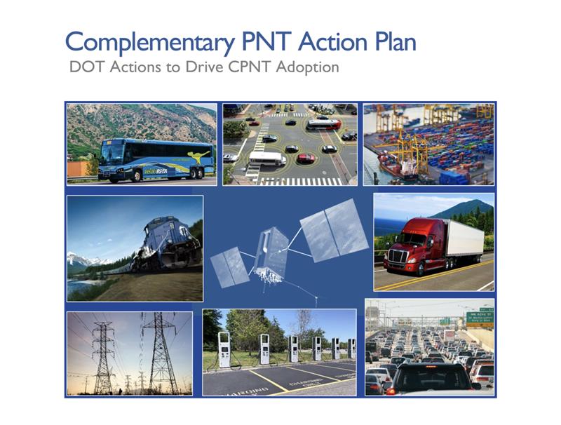
    The U.S. Department of Transportation (DOT) has unveiled its Complementary Positioning Navigation and Timing (CPNT) Action Plan, which contains steps the department is taking to drive CPNT adoption across the United States transportation system and within other critical infrastructure areas. This plan was mentioned by Robert Hampshire — Deputy Assistant Secretary for Research and Technology and Chief Science Officer, U.S. DOT — during his keynote address at the annual Civil GPS Service Interface Committee (CGSIC) meeting on September 12, at ION GNSS+, which GPS World’s Editor-in-Chief, Matteo Luccio, is attending.

    In 2020, the U.S. DOT Volpe National Transportation Systems Center conducted field demonstrations of various PNT technologies that could offer complementary service if GPS is disrupted. The department was able to gather information on PNT technologies at a high technology readiness level that can work in the absence of GPS.

    The U.S. DOT have selected 11 candidate technologies to demonstrate positioning or timing functions:

    • Two vendors demonstrated low-Earth orbit satellite PNT technologies — one L-band and one S-band; 
    • two vendors demonstrated fiber-optic timing systems, both based on the White Rabbit Precision Time Protocol; 
    • one vendor demonstrated localized database map matching database, inertial measurement unit, and ultra-wideband technologies; and, 
    • six vendors demonstrated terrestrial radio frequency PNT technologies across low frequency, medium frequency, ultra-high frequency, and Wi-Fi/802.11 spectrum bands.   

    Five of the selected technologies were demonstrated at Joint Base Cape Cod in Massachusetts, and six were demonstrated at NASA Langley Research Center in Virginia. The demonstrations were scenario-based implementations modeled on critical infrastructure use cases under different operating conditions.  

    Two central recommendations from the demonstration were made: the U.S. DOT should develop system requirements for PNT functions that support safety-critical services; and the U.S. DOT should develop standards, test procedures, and monitoring capabilities to ensure that PNT services, and the equipage that utilize them, meet the necessary levels of safety and resilience identified in recommendation one.   

    For the full U.S. CPNT Action Plan, click here

    Request for information

    The U.S. DOT has also released a request for information (RFI) as one of the steps in driving adoption of complementary PNT services to augment GPS. The department is planning a resiliency test, evaluation, and performance monitoring strategy for PNT-dependent transportation systems.  

    If any readers are interested in participating, click here for more information.  

  • SSC releases Epoch 2 RFI for industry inputs on MW/MT satellites

    SSC releases Epoch 2 RFI for industry inputs on MW/MT satellites

    Image: Lockheed Martin
    Image: Lockheed Martin

    The Resilient Missile Warning, Missile Tracking, and Missile Defense Acquisition Delta of the U.S. Space Force’s Space Systems Command (SSC) has released a request for information (RFI) seeking industry inputs for the next Epoch of medium-Earth-orbit missile warning and tracking (MW/MT) satellites. Responses from industry are requested by no later than May 16.

    A continuation of the Missile Track Custody (MTC) Program, Epoch 2 is the second increment of capability-based, phased deliveries that leverage a mature foundation of space system technology — which allows for the insertion of new technology. Resilient MW/MT Epoch 2 satellites and associated ground systems will provide next-generation overhead persistent infrared solutions to defeat advanced missile threats.

    The RFI solicits feedback from industry on the Epoch 2 acquisition strategy and technical approach for a multi-plane space segment, integrated ground segment and constellation-level systems operations.

    Epoch 2 will emphasize the maturation of MW/MT sensors, optical cross-links, data fusion, constellation mission management and robust ground communications.

    For more information on receiving the full Epoch 2 RFI can be found on the SAM.gov website linked here.

  • DARPA seeks tools to capture underground worlds in 3D

    DARPA seeks tools to capture underground worlds in 3D

    DARPA has issued a Request for Information (RFI) to augment its understanding of state-of-the-art technologies for 3D mapping and surveying. (Photo: DARPA)
    DARPA has issued a Request for Information (RFI) to augment its understanding of state-of-the-art technologies for 3D mapping and surveying. (Photo: DARPA)

    Request for Information pursues state-of-the-art technologies for collecting and characterizing 3D mapping and surveying data.

    DARPA is seeking information on state-of-the-art technologies and methodologies for advanced mapping and surveying in support of the agency’s Subterranean (SubT) Challenge.

    Georeferenced data — geographic coordinates tied to a map or image — could significantly improve the speed and accuracy of warfighters in time-sensitive active combat operations and disaster-related missions in the subterranean domain. Today, the majority of the underground environments are uncharted or inadequately mapped, including human-made tunnels, underground infrastructure, and natural cave networks.

    Through the Request for Information, DARPA is looking for innovative technologies to collect highly accurate and reproducible ground-truth data for subterranean environments, which would potentially disrupt and positively leverage the subterranean domain without prohibitive cost and with less risk to human lives. These innovative technologies will allow for exploring and exploiting these dark and dirty environments that are too dangerous to deploy humans.

    “What makes subterranean areas challenging for precision mapping and surveying — such as lack of GPS, constrained passages, dark or dust-filled air — is similar to what inhibits safe and speedy underground operations for our warfighters,” said Timothy Chung, program manager in DARPA’s Tactical Technology Office (TTO). “Building an accurate three-dimensional picture is a key enabler to rapidly and remotely exploring and searching subterranean spaces.”

    DARPA is looking for commercial products, software, and services available to enable high-fidelity, 3D mapping and surveying of underground environments. Of interest are available technologies that offer high accuracy and high resolution, with the ability to provide precise and reproducible survey points without reliance on substantial infrastructure (such as access to global fixes underground).

    Additionally, relevant software should also allow for generated data products to be easily manipulated, annotated, and rendered into 3D mesh objects for importing into simulation and game engine environments.

    DARPA may select proposers to demonstrate their technologies or methods to determine feasibility of capabilities for potential use in the SubT Challenge in generating and sharing 3D datasets of underground environments.

    Such accurately georeferenced data may aid in scoring the SubT competitors’ performance in identifying and reporting the location of artifacts placed within the course. In addition, renderings from these data may provide DARPA with additional visualization assets to showcase competition activities in real-time and post-production.

    Instructions for submissions, as well as full RFI details, are available on the Federal Business Opportunities website. Submissions are due at 1 p.m. EDT April 15. Email questions to [email protected].

  • GSA requests information for procurement of EGNOS payload services

    GSA requests information for procurement of EGNOS payload services

    SES-5 GEO satellite (artist’s depiction).

    The European GNSS Agency (GSA) has issued a request for information (RFI) in preparation for the procurement of EGNOS geostationary navigation payload services.

    The EGNOS space segment is provided by commercial satellite operators on the basis of service contracts. The GEO-1, GEO-2 and GEO-3 service contracts now cover the EGNOS space segment needs, and the GEO-1 and GEO-2 services will be the first of these to end, GSA reported. The GEO-1 and GEO-2 services will be replaced by new contracts, GEO-4 and GEO-5.

    GSA is planning how it will replace the services delivered by the GEO-1 and GEO-2 satellites, and it’s issuing the RFI to collect information about opportunities to embark navigation payloads on board GEO satellites launched in a suitable time frame.

    According to GSA, the results of the RFI will also be used to determine the best approach for the procurement of the payload services, which may be either procured at the same time or separately. It will help GSA define the tender specifications and decide on the most appropriate time to launch invitations to tender.

    In addition, GSA aims to obtain information from owners of geostationary satellites that will be available for operational service from 2021 to 2027 and able to embark a navigation payload. The agency is specifically seeking information on future satellite plans and the possibility to embark SBAS payloads in due time to ensure an operational start date from 2021 to 2027.

    The RFI will also request information service availability and long-term payload reliability; the process for EGNOS payload procurement, in-orbit testing and commissioning; information on the locations of the potential hosting sites for the EGNOS radio frequency uplink stations; and, finally, information on contractual arrangements, the payment scheme, and cost estimates, GSA added.

    Answers to the RFI should be sent electronically to [email protected] by Aug. 31.

  • DARPA Seeks Ideas for UAS Aircraft Carrier in the Sky

    The Defense Advanced Research Projects Agency (DARPA) is asking for input on how to launch and recover multiple small unmanned air systems (UAS) from existing large aircraft, such as the C-130. It has issued a Request for Information (RFI) seeking technical, security and business insights on “aircraft carriers in the sky.”

    In DARPA’s “blended approach,” a large aircraft would host a small UAS and facilitate its operations. The agency says it would be more cost-effective for intelligence, surveillance, reconnaissance (ISR) and other missions.

    Safety is another key aspect of the project. While small UAS can reduce putting an aircraft or pilot at risk, DARPA says it may lack the speed, range and endurance of larger aircraft.

    “We want to find ways to make smaller aircraft more effective, and one promising idea is enabling existing large aircraft, with minimal modification, to become ‘aircraft carriers in the sky,’” said Dan Patt, DARPA program manager. “We envision innovative launch and recovery concepts for new UAS designs that would couple with recent advances in small payload design and collaborative technologies.”

    The RFI is calling for short responses — no more than eight pages — that must address the following three areas:

    1. System-level technologies and concepts that would enable low-cost reusable small UAS platforms and airborne launch and recovery systems that would require minimal modification of existing large aircraft types. This area includes modeling and simulation as well as feasibility analysis, including substantiating preliminary data if available.
    2. Potentially high-payoff operational concepts and mission applications for distributed airborne capabilities and architectures, as well as relative capability and affordability compared to conventional approaches (e.g., monolithic aircraft and payloads or missile-based approaches). DARPA hopes to leverage significant investments in the area of precision relative navigation, which seeks to enable extremely coordinated flight activities among aircraft, as well as recent and ongoing development of small payloads (100 pounds or less).
    3. Proposed plans for achieving full-system flight demonstrations within four years, to assist in planning for a potential future DARPA program. DARPA is interested not only in what system functionality such plans could reasonably achieve within that timeframe, but also how to best demonstrate this functionality to potential users and transition partners. These notional plans should include rough order-of-magnitude (ROM) cost and schedule information, as well as interim risk reduction and demonstration events to evaluate program progress and validate system feasibility and interim capabilities.

    According to a news release by DARPA, technology development beyond the three areas will be considered if it supports the RFI’s goals.

    Proposals are due by 4 p.m. ET on Nov. 26, 2014, to [email protected].