Tag: ride sharing

  • Our insatiable appetite for GPS

    Our insatiable appetite for GPS

    1976: The first military GPS five-channel receiver built in one of several programs that studied the feasibility of GPS. The receiver weighed more than 270 pounds and had seats for two operators. (Photo: Rockwell Collins/Smithsonian)
    1976: The first military GPS five-channel receiver built in one of several programs that studied the feasibility of GPS. The receiver weighed more than 270 pounds and had seats for two operators. (Photo: Rockwell Collins/Smithsonian)

    Like the internet before it, GPS started as a niche technology and became a universally recognized one, though much misunderstood and often taken for granted. Both systems originated in the U.S. Department of Defense (DOD) to support military missions, and then exploded into mass-market civilian technologies. While the internet passed from military to civilian hands very early in its history, GPS is still operated by the U.S. Air Force, making it a unique experience for the DOD: a system for which it is responsible that has orders of magnitude more civilian applications and users than military ones.

    GPS has transformed entire professions — most notably, surveying; created new industries — such as ride sharing; boosted innumerable fields of scientific research — from archaeology to zoology; facilitated many aspects of everyday life — such as finding retail outlets and getting there; and given an advantage to U.S. military forces. One application discussed 30 years ago that has not yet lived up to its promised return on investment is precision agriculture.

    Challenges and debates that loomed large in the early days turned out to be growing pains —most notably, Selective Availability (SA). In 1990, Javad Ashjaee reflected the attitude of much of the GPS industry and user community when he said, “I can’t think of a word to say how bad it is.” Other debates have proven more persistent — such as the interference threat posed by LightSquared, reborn after bankruptcy as Ligado Networks.

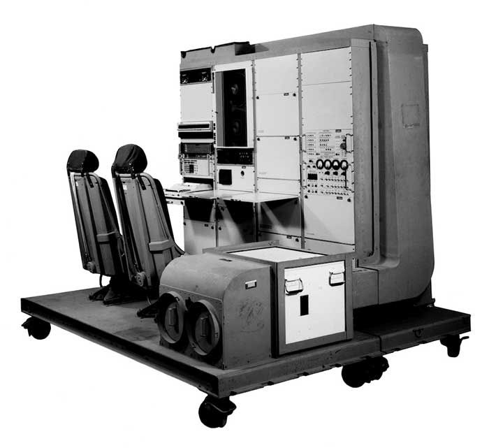
    GPS first drew considerable publicity in the wake of Desert Storm, when it became the subject of television features, newspaper reports, and special sections in the pages of recreational catalogs. “Ironically,” Brad Parkinson pointed out in September 1994 in GPS World, “civil companies [such as Garmin] developed most receivers used in Desert Storm, with no help from military sponsorship.” Later that decade, while most people were finally aware of GPS technology, it began disappearing deep into its applications and the systems that use it.

    In September 1991 — three and a half years before U.S. Air Force Space Command declared the system’s full operational capability (FOC) on April 27, 1995 — in a speech to the International Civil Aviation Organization in Montreal former FAA Administrator James B. Busey said: “I want to emphasize that we fully support the eventual replacement of [GPS] by other systems — and we are certain that will happen.” That may still happen, in the distant future. However, what Busey did not foresee is that GPS became but an element, though a key one, in a much larger positioning, navigation and timing (PNT) system. This worldwide system includes three other GNSS and two regional ones, several publicly and privately operated augmentation services, and a wide range of complementary and alternative technologies. These include inertial navigation (which has advanced much in the past three decades) and RF signals of opportunity. It may soon include navigation signals from non-GNSS satellites, eLoran, enhanced distance measuring equipment, and Earth-fixed navigation using very low frequency.

    I began my current career in geospatial technologies exactly 20 years ago, as this magazine’s managing editor, just a few months after the end of SA increased GPS’ accuracy by an order of magnitude, and equally expanded the number of its potential applications. Yet today, I still marvel at how pervasive this technology has become and how much further it will transform our lives.

    I will end with a quote from an early GPS World columnist, Hale Montgomery, who wrote in October 1991, “GPS users show an insatiable appetite for ever more precise data. Give them a mile and they want an inch.”


    Seeking back issues: I have the entire collection of GPS World’s print edition, except for the first issue, the 10 issues in the second year (1991), and the September through December 1993 issues. I would be thrilled to receive those missing issues, or facsimiles, from anybody who has them. Email [email protected].

  • Uber and Hyundai release full-scale air taxi model at CES

    Hyundai is the first Uber Elevate partner with manufacturing capabilities to mass produce Uber Air Taxis

    Uber and Hyundai Motor Company announced at CES 2020 a new partnership to develop Uber Air Taxis for a future aerial ride-share network and unveiled a full-scale aircraft concept. Hyundai is the first automotive company to join the Uber Elevate initiative, bringing automotive-scale manufacturing capability and a track record of mass-producing electric vehicles.

    CES 2020, the massive annual consumer electronics show, is taking place Jan. 7-10 in Las Vegas. Hyundai Motor’s innovative smart mobility solutions including UAM, PBV, Hub and more are showcased at Booth 5431 in the Las Vegas Convention Center North Hall.

    The taxi concept was created in part through Uber’s open design process, a NASA-inspired approach that jump starts innovation by publicly releasing vehicle design concepts so any company can use them to innovate their air taxi models and engineering technologies.

    In this partnership, Hyundai will produce and deploy the air vehicles, and Uber will provide airspace support services, connections to ground transportation, and customer interfaces through an aerial ride-share network. Both parties are collaborating on infrastructure concepts to support take-off and landing for this new class of vehicles.

    The SA-1 air taxi. (Photo: Uber/Hyundai)
    The SA-1 air taxi. (Photo: Uber/Hyundai)

    “Our vision of urban air mobility will transform the concept of urban transportation,” said Jaiwon Shin, Executive Vice President and Head of Hyundai’s Urban Air Mobility (UAM) Division. “We expect UAM to vitalize urban communities and provide more quality time to people. We are confident that Uber Elevate is the right partner to make this innovative product readily available to as many customers as possible.”

    “Hyundai is our first vehicle partner with experience of manufacturing passenger cars on a global scale. We believe Hyundai has the potential to build Uber Air vehicles at rates unseen in the current aerospace industry, producing high quality, reliable aircraft at high volumes to drive down passenger costs per trip. Combining Hyundai’s manufacturing muscle with Uber’s technology platform represents a giant leap forward for launching a vibrant air taxi network in the coming years,” said Eric Allison, head of Uber Elevate.

    In preparation for this announcement, Hyundai worked with Uber Elevate to develop a PAV (personal air vehicle) model, S-A1, that uses innovative design processes to optimize electric vertical take-off and landing (eVTOL) aircraft for aerial ridesharing purposes. S-A1 previous eVTOL designs Uber Elevate has released in the following ways:

    • It is designed for a cruising speed up to 180 miles/hr (290 km/hr), a cruising altitude of around 1,000-2,000 feet (300 – 600 mt) above ground, and to fly trips up to 60 mile (100 km).
    • The Hyundai vehicle will be 100% electric, utilizing distributed electric propulsion and during peak hours will require about five to seven minutes for recharging.
    • Hyundai’s electric aircraft utilizes distributed electric propulsion, powering multiple rotors and propellers around the airframe to increase safety by decreasing any single point of failure. Having several, smaller rotors also reduces noise relative to large rotor helicopters with combustion engines, which is very important to cities.
    • The model is designed to take off vertically, transition to wing-borne lift in cruise, and then transition back to vertical flight to land.
    • The Hyundai vehicle will be piloted initially, but over time they will become autonomous.
    • The cabin is designed with four passenger seats, allowing riders to board and disembark easily and avoid the middle seat with enough space for a personal bag or backpack.

    Ushering in the era of seamless mobility, Hyundai’s exploration of future urban transportation incorporates the electric PAV concept with a new ground transportation, the Purpose Built Vehicle (PBV) concept.

    Hyundai’s vision for creating communities from future transit systems comes into focus with yet another new infrastructure concept, called the Hub. When many PBVs and PAVs are docked and connected to a Hub, they make a new public space where diverse groups of people can come together.

  • The role of GNSS in driverless cars

    The role of GNSS in driverless cars

    Authenticated localization in driverless cars

    Growing awareness of the vulnerabilities of GNSS signals — weak, unencrypted and easily jammed or spoofed — have made GNSS less important to steering the driverless vehicle. What’s up with that?

    Extensive visual map databases are being created that, when coupled with cameras, radars and lidars on the vehicle and processed by artificial intelligence (AI) algorithms, enable the driverless car to be steered much the way humans drive. Pattern recognition processing in the vehicle allows it to “read” street signs and recognize landmarks, registering its position on the map.

    This is the way a person drives in his or her home town, where they always know their orientation and don’t need GNSS. The AI processing “brain,” with access to huge map databases, either through local storage or a network connection, will always be in its familiar home environment: continuously knowing its own position and properly oriented for navigation.

    So, will GNSS become unnecessary in the car of the future? Probably not.

    First, no one method of navigation is foolproof, and today, GNSS is our primary method of navigating our cars. It is a cost-effective, accurate way of determining position in real time, and with the integration of inertial navigation sensors to handle cases when GNSS is intermittently unavailable, it is improving.

    Second, it is not just the car itself that needs to know its location for navigation, but also others outside the car. Ride-sharing apps like Uber and Lyft, car-sharing, usage-based insurance apps, dynamic toll charging, and parking apps all depend on knowing where the car is at all times. GNSS offers sufficient accuracy for all these apps by providing location coordinates. Therefore, a GNSS receiver will most likely remain in the car.

    The case for jamming and spoofing

    Recall, however, that one of the weaknesses of GNSS is its open, unencrypted format. It is becoming increasingly easier to spoof these signals. Car-sharing, usage-based insurance and dynamic toll charging apps all create a monetary incentive for fraud that can be implemented with a spoofer. For example, a car in a car-sharing network can report a fake position indicating that it is safely parked in a secure area — while in reality, a thief is busy driving it away.

    (Image: Orolia)
    (Image: Orolia)

    Let’s assume that all wireless connections to and from the car are secure. This is a reasonable assumption, although recently there have been demonstrations of carjacking via unsecure remote links. Standard SSL encryption, similar to what is used to enter credit card information on the internet, works well here. We have both the awareness and the technology now to prevent such carjackings from ever reoccurring.

    However, even if communication links are secure, a GNSS spoofer in the car can fool the GNSS receiver into reporting a fake “safe” position right as it is being stolen. The same is true for insurance or toll apps. And the fraud does not have to be sophisticated. A simple, low-cost jammer can deny proper position just long enough to skirt payment. A secure location method is needed.

    Other signals for localization

    What would an ideal signal for localizing a driverless car look like?

    • It needs to be much stronger than GNSS so it is not easily jammed.
    • It needs to be encrypted so it cannot be spoofed.
    • It must be ubiquitous, available worldwide.
    • It must be reliable and robust — with 99.999% availability or better.
    • It must be practical and priced for the mass-market automotive application.

    Though accuracy is always important, the signal used for localization does not have to be as accurate as GNSS is today. Accuracy to 10s of meters is sufficient for all these applications needing fraud protection since it would not be used for steering the car, but rather, only localization. It can also be used in tandem with GNSS to authenticate a reported position when a GNSS signal is available.

    Such a signal is available today, worldwide: STL (Satellite Time and Location). Carried on the Iridium satellites, it is a special purpose signal that is more than 30 dB stronger than GNSS and encrypted for anti-spoof protection. Decoding of this signal is available via a subscription model to users.

    Here’s how it would work using a car-sharing example. A group of people subscribe to a car-sharing service that provides X number of cars to serve Y number of people, where X is less than Y. The service optimally schedules people when and where a car will be available. The service provider needs to know the whereabouts of the cars at all times to maximize utilization of the fleet, so every car has a GNSS receiver in it.

    But to ensure the authenticity of these reports, they also have a secure localization receiver. This receiver is assigned a unique ID that is authorized to decode the encrypted signal. (Eventually, we expect this receiver and GNSS to converge into one device much the way multi-GNSS receivers operate today).

    If a position report does not agree with the authentic localization report, the fleet manager can act to recover the car immediately. Insurance providers who cover secure localization-equipped cars would also give preferential rates as an anti-theft device.

    (Image: Pavel Vinnik/Shutterstock.com)
    (Image: Pavel Vinnik/Shutterstock.com)

    Could PRS do it?

    The new Public Regulated Service (PRS) from Galileo is encrypted and could provide a similar level of authentication protection, if made available. However, it is still a weak GNSS signal that can easily be jammed. Of course, any signal can be jammed, even one that is a thousand times stronger than GNSS.

    However, given the robust nature of a very strong signal, the managing system that is monitoring the cars — the insurance, toll or car-sharing system, for example — can alarm upon the loss of positioning information. Such alarms on a GNSS-only car would be frequent and often erroneous due to simple fades, yielding so many false alarms that it would render the monitoring system useless. But a loss of both the strong localization signal and GNSS would likely be considered suspicious and result in a valid alarm.

    GNSS navigation is truly one of the great advances of the modern era, giving us precise time and location for any place in the world. Its two major weaknesses — that it is easy to jam and spoof — can be overcome by augmenting it with other stronger encrypted signals, such as STL, providing robust jam-resistance and positive authentication.

  • Uber and Decarta: Automated Taxi Tomorrow?

    Uber and Decarta: Automated Taxi Tomorrow?

    Janice Partyka
    Janice Partyka

    The force of mapping was punctuated this month when Uber, the juggernaut taxi service, acquired long-time mapping and navigation company deCarta. Uber and its competitor, Lyft, redefined taxi service with a smartphone app that connects users and drivers. These services have exceled by offering reliable low-cost rides and quick pick-ups, functionality that is enabled by seamless mapping and navigation technologies. Acquisition of a mapping company serves Uber’s high ambitions.

    Following introduction in San Francisco and New York, Uber just rolled out its ride sharing service, UberPool, in my city, Los Angeles. The service allows multiple individual customers going in the same direction to share a ride and lower their fare by as much as half. The potential for reducing traffic in congested cities is large, but how likely is it that UberPool can find matches and people willing to ride with strangers?

    New-Logo-Vertical-Dark-TEffective vehicle routing, navigation and traffic prediction is critical to making UberPool work. First, Uber must find pairs of trips that are similar enough in their timing and pathways to make a pairing attractive to the riders. Then, Uber needs to execute quickly and on time, given the unpredictability of whether the other rider is ready when expected. Coping with these uncertainties will be a huge challenge for Uber. Just 10 percent of work trips in America are by carpool. Can Uber develop the algorithm to make ride sharing attractive? Let’s wait and see.

    It is no surprise that Uber has announced that it will be developing self-driving car technology with the goal of self-driving Uber taxis. This puts it in direct competition with Google, one of Uber’s largest investors. Uber has partnered with Carnegie Mellon University to create a research center for mapping, vehicle safety and autonomy technology. If Uber can someday build cars that drive themselves, they can eliminate the need for a driver. The question for 2015 may well be, who is not pursuing driverless cars? Maybe Macy’s and Martha Stewart will partner on a particularly tasteful automated vehicle? Do you think you’d still have to tip?

    In other news, two former leading location competitors, LocationSmart and Locaid, have merged. Together they have the largest location-as-a-service platform for enterprise location for mission-critical applications in a number of industries including service assistance, proximity marketing, workforce management, emergency alerting, mobile gaming and transaction verification. As far as I know, they are not developing a self-driving vehicle.