Tag: RTK GNSS

  • Topcon and Fixposition announce collaboration for integrated tech

    Topcon and Fixposition announce collaboration for integrated tech

    Topcon Positioning Systems and Fixposition have agreed to collaborate on integrated technology for future product offerings. The agreement was announced at Geo Week 2026 in Denver, Colorado.

    “Topcon provides high-precision GNSS positioning technologies for geomatics, construction and agriculture applications worldwide,” explained Ron Oberlander, head of the Topcon Geomatics Platform. “Working with companies such as Fixposition — specialists in visual RTK (real-time kinematic) and visual-aided positioning   helps create added value for our customers.

    According to Topcon, its customers are increasingly working in environments where satellite connection can be challenging, such as dense urban environments, and need consistent, reliable positioning to maintain productivity. Fixposition offers technology that augments satellite positioning, beneficial for users even while working inside structures and in indoor-outdoor transitions, without disrupting workflows by combining RTK GNSS with artificial intelligence to ensure position accuracy. “We see this AI-enabled technology as an innovative integration with our next-generation GNSS solutions,” Oberlander said.

    “We’re proud to supply Fixposition’s xFusion, vision and multi-modality fusion positioning technology to support Topcon’s next-generation GNSS solutions,” said Zhenzhong Su, CEO and co-founder of Fixposition. “We look forward to bringing this new solution to market — helping surveying professionals across geomatics, construction and agriculture deliver faster results and get more done without compromising quality, even in GNSS-challenging environments.”

    Fixposition has been integrating Topcon RTK corrections into its Vision-RTK sensors since 2023, when the companies announced an agreement providing Fixposition customers in North America and Europe with access to the Topnet Live RTK corrections service network.

  • Tersus introduces compact GNSS board with full constellation tracking

    Tersus introduces compact GNSS board with full constellation tracking

    Photo: Tersus GNSS
    Photo: Tersus GNSS

    Tersus GNSS Inc. has released the BX40C RTK board to support its series of GNSS boards and provide highly accurate and fast positioning services.

    Powered by the company’s new ExtremeRTK GNSS technology, the BX40C board can support multi-constellation and multi-frequency all-in-view satellite tracking.

    The Tersus BX40C is a compact GNSS real-time kinematic (RTK) board with full constellation tracking for providing centimeter-level accuracy positioning. It can be integrated with autopilots and inertial navigation units to meet various developing requirements. It is suitable for high-precision positioning, navigation and mapping.

    “Tersus has been proud of its BX-series RTK boards, and today we added a new member to the series by launching the new BX40C board,” said Xiaohua Wen, founder and CEO of Tersus GNSS. “The BX40C is with enhanced positioning accuracy and constellation tracking, even in harsh environments, the BX40C board can still control deviation within 3-centimeter in surveying and mapping applications. It supports 576 channels and can achieve centimeter-level position accuracy easily. We are excited to see how BX40C strengthens our product portfolio and technology competence to make a great effort in this industry.”

    The BX40C board supports multiple constellations and frequencies to improve the continuity and reliability of the RTK solution — even in harsh environments. In-built 4GB memory makes data collection easy, the company said. It is compatible with other GNSS boards in the market via flexible interfaces, smart hardware design and commonly used log/command formats.

  • Rugged tablet designed for accurate real-time measurements

    Rugged tablet designed for accurate real-time measurements

    RealSense 3D Camera is Fully Integrated to Capture Detailed Images

    DT301X-TR rugged tablet. (Photo: DT Research)
    DT301X-TR rugged tablet. (Photo: DT Research)

    DT Research is offering the new DT301X-TR rugged tablet, a lightweight military-grade tablet. The tablet is purpose-built to enhance the precision for bridge and construction inspections, 3D surveying and mapping of underground utilities.

    The DT301X-TR provides multi-frequency GNSS real-time kinematic (RTK) with carrier phase for mapping and positioning, and supports GPS, GLONASS, BeiDou, Galileo and QZSS.

    The optional foldable antenna supports high-accurate measuring field work, which can be measured with RTK GNSS positioning directly, or used to connect to an external antenna for higher precision.

    Its 10.1-inch high-brightness capacitive touch screen can be read in a wide range of lighting indoors and outdoors. The tablet comes with a choice of Intel 8th-generation Core i5 or i7 processors. Its MIL spec and IP ratings means it holds up to real-world hazards and performs in many industries and environments.

    Integrated 3D camera. The DT301X-TR integrates the optional Intel RealSense Depth camera which provides real-time 3D imaging to quickly and accurately create measurements for CAD, engineering, design, utility and project management, and crime/crash scene forensics. Scientific grade data, which is important for evidence as well as building plans, is now easier to access and use for specialists and non-credentialed workers alike.

    With this 3D camera technology, depth perception is integrated to add the most accurate image to make projects stay factual and consistent. The integration of the 3D camera with a rugged handheld tablet improves the mobility and reduces the bulk and limitations of a laser scanner for small, hard-to-reach spaces and brings the measurement, real- time scanning, and positioning together in one device which can also be used to process and transmit the data.

    Using rugged tablets with 3D technology allows the as-built status of a project to be tracked and documented in real time, reducing the project cycle time, and also allows data to be shared with the owner, general contractor and subs as it is captured. This boost to efficiency and accuracy validation shortens payment cycles as well as improving the overall BIM (building information modeling), getting infrastructure going quickly and getting payments to contractors faster.

    “The combination of the DT Research rugged tablet with the RealSense depth camera and DotProduct’s Dot3D Pro software enables projects to be quickly set up, tracked, and completed for all staff and tasks whether in the office or on the site. The ease of use these tools bring to 3D workflows can benefit a wide range of applications from construction verification to asset management to crime scene mapping.” says Tom Greaves, chief marketing officer at DotProduct.

    Data capture options besides the 3D camera are a 2D barcode scanner for equipment/location tags, long-range Bluetooth for 1,000-foot range suitable for connecting to robotic total stations and 4G LTE mobile broadband for the latest in high speed communications.

    The flexibility for set up and use is enhanced in the DT301X-TR rugged tablet with Microsoft Windows 10 IoT Enterprise operating systems for convenient integration with existing applications, bringing together the advanced workflow for data capture, accurate positioning and data transmitting.

    Another option is a bright LED light that can be attached to the DT301X-TR and stay consistently on for up to two hours, bringing light to underground infrastructure mapping and scanning.

    With high capacity 60 or 90 watt hot-swappable batteries, the rugged yet lightweight DT301X-TR keeps working continuously whether in the field, office, or vehicles, complemented with a variety of battery chargers so fully charged batteries are always available.

    This rugged tablet gives detailed accuracy combined with the latest 3D camera technology all in one tablet that is rugged and easy to use in the field. Whether at the construction site, mapping underground utilities, or at the freeway crash scene, the cost-effective DT301X-TR is ideal for accurate measurements to enable data-driven decisions, able to travel to wherever the work is.

    The DT301X-TR rugged tablet will be available in May 2019 from DT Research’s authorized resellers and partners. DT Research will be at booth 217 at AEC’s BuildTech show.

  • AMW offers new construction and ag products

    AMW offers new construction and ag products

    DIRT, the AMW Machine Blade Control Solution. (Photo: AMW)
    DIRT, the AMW Machine Blade Control Solution. (Photo: AMW)

    AMW Machine Control Solutions, a subsidiary of CHC Navigation, has introduced four new solutions for the survey, construction and agriculture markets, all of which run on Android and CHC Navigation GNSS tablet hardware.

    GRADE I and II Products. GRADE I runs on a CHC Navigation industrial tablet and utilizes an internal meter-accurate GNSS receiver for field workers and supervisors to view layered maps including design files, topo or Google Maps for locating elevations and topographical features.

    GRADE II adds centimeter elevation and positioning accuracy with an external CHC Navigation RTK-capable GNSS receiver that wirelessly communicates with the tablet.

    GRADE II collects topographic data on the jobsite by walking or driving the area, eliminating surveyor stakes and providing accurate data for earth-moving operations. The density of elevation points can be adjusted. The GRADE II “Smart Base” allows a user to establish RTK control points.

    DIRT I and II Products.

    DIRT combines GRADE II mapping functionality with automatic blade control for skid steer, scraper, grader or dozer applications for rough and fine land-shaping activities on large or compact equipment. DIRT is available as DIRT I or DIRT II versions depending on the type of blade control needed. Utilizing additional sensors, DIRT II adds the ability to manage cross slopes.

    DIRT includes an RTK GNSS, inclinometers, tablet computer, CANBUS controller and DIRT software running on a CHC Navigation tablet. The tablet wirelessly connects to the RTK receiver and other sensors, making the system easily portable so it can be reinstalled on other equipment.

    For agriculture applications, AMW Solutions’ proprietary algorithm within the DIRT solution results in accurately graded surfaces within the limits of the equipment.

  • Esri introduces high-precision GNSS mobile GIS software

    In its 47-year history, Esri has never before built a high-precision GNSS mobile GIS software . Sure, one could connect a high-precision GNSS receiver to ArcGIS Mobile or even ArcGIS desktop running on a tablet, but in those cases and all others, there’s no direct support for high-precision GNSS receivers.

    By support, I mean the software features that one needs to automatically collect reliable, verifiable and defensible high-precision GNSS coordinates and associated metadata, like real-time estimated accuracy, correction age and other metadata that can be referenced months or years later to understand the quality of the data collected.

    Until now…

    Collector for ArcGIS is a cross-platform mobile GIS app that’s available for iOS, Windows 10 and Android. Until now, Collector did not differentiate between low-precision GNSS data (for instance, a smartphone’s internal GNSS receiver) and RTK GNSS (centimeter-accuracy) receivers, so it was difficult to know what sort of accuracy one was achieving even when a centimeter-accurate receiver was connected to it.

    Esri is on its way to solving this problem.

    Earlier this month, Esri introduced a beta version of the new Collector for ArcGIS mobile GIS software that incorporates features for high-precision GNSS data collection. While Collector has been around for a few years, it has not allowed the user to differentiate between low-precision GNSS data (such as a smartphone internal GNSS receiver) and RTK GNSS (centimeter-accuracy) receivers. To circumvent that limitation, high-precision GNSS receiver vendors offered companion apps that run concurrently with Collector to display metadata. However, that’s not a fun solution because if the user wants to records GNSS metadata, he would have to tab between apps and hand-enter the GNSS metadata into attribute fields in Collector.

    Another nagging problem for high-precision GNSS users with Collector is the lack of an on-the-fly datum transformation feature. Sources of high-precision GNSS receiver corrections come in different datum flavors (ITRF08, NAD83/2011, NAD83/CSRS, etc.). Those datum flavors don’t necessarily match a user’s GIS database, sometimes introducing a meter or more of error.

    Historically, Collector didn’t give the user an opportunity to apply an on-the-fly datum transformation to reconcile datum differences between the high-precision GNSS receiver datum and the geodatabase datum. Yeah, you could fix it later by applying a datum shift after the fact, but it’s a tedious and laborious task to do so, and sort of defeats the purpose of having an efficient real-time GNSS data collection workflow.

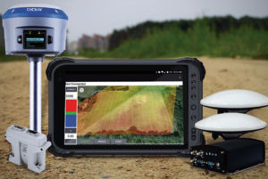
    I was using the beta version of iOS Collector for ArcGIS this week with a survey-grade  RTK GNSS receiver that, according to GPS World’s 2016 Receiver Survey, delivers 1-centimeter RTK accuracy. Setting up the GNSS correction profile is a bit tricky. There are three settings you need to select. Following is a screen capture of the profile settings I used for RTK in Collector when the RTK base was referenced to NAD83/2011:

    MOBILE-GIS-3

    When setting up a GNSS receiver profile to use WAAS/SBAS as a source of corrections in Collector, you’ll need to select GCS ITRF 2008 instead of GCS NAD 1983 2011.

    Once I got the proper datum transformations dialed in, RTK GNSS accuracy was where it should be when compared to a survey mark (3.7mm):

    MeasurementPostCollection-W

    Another tricky area with Collector is the GNSS metadata. It’s great that Collector supports automated GNSS metadata recording, but in order for Collector to record GNSS metadata, you’ll need to follow the Esri data model for GNSS metadata. Essentially, add fields to your database that will be populated. Here’s a link to the supported GNSS metadata fields.  http://arcg.is/22h41yR. Note that you’ll need to log in using your Esri account credentials to view the link.

    I didn’t add the GNSS metadata fields to the database to try it because this iOS beta version doesn’t support GNSS metadata (Esri says it will be supported on the next beta release), I did collect a bit of data. Here’s what the Collector screen looks like:

    MOBILE-GIS-1

    Some of the fields on the iPad Mini were cut off (I’ll report that to Esri), but you can see that it is entirely possible for Collector (iOS) to accept and record data from an iPad using an RTK GNSS receiver (note accuracy value at the bottom left corner of the screen.

    So, to Esri’s credit, they’ve appeared to address the GNSS metadata and datum transformation problems in the beta release of Collector, making it the first Esri mobile GIS that supports high-precision GNSS. The iOS and Windows 10 beta versions are available now to users who register for Esri’s Collector beta program. For support and answers to questions, you can visit Geonet.

    Before you get too excited, even with the new features Collector is still a light-weight mobile GIS and likely always will be, as long as it’s a free app (although not always free to use). But this is certainly a move in the right direction for high-precision GNSS receiver users who want to live in the Esri ArcGIS Online/Portal/Server ecosystem and rid themselves of shp files.

    Some of you may beg to differ that Collector is Esri’s first high-precision GNSS mobile GIS data collection software. I know ArcPad has been around for years and has supported high-precision GNSS receivers for many years. In fact, if you install the GeoBullsEye plug-in, ArcPad becomes the only 3D, high-precision GNSS data collection software that works real time in the Esri AGOL/Portal/Server ecosystem. But, it wasn’t built by Esri :-). An Australian company named Maptel built ArcPad, and then Esri acquired the company a few years ago.

    While the beta versions of Collector for Windows 10 and iOS are available now, Esri reports that the beta version of Collector for Android should be available next week.

    Thanks, and see you next month.
    Follow me on Twitter at GPSGIS_Eric

  • Which Industry Will Be the Largest Consumer of RTK Technology?

    Which Industry Will Be the Largest Consumer of RTK Technology?

    In September, I attended the Institute of Navigation (ION) GNSS+ conference in Tampa, Florida.

    Downtown Tampa, FL Location of the 2014 ION GNSS+ Photo: GPS World
    Downtown Tampa, location of the 2014 ION GNSS+. Photo: GPS World

    The ION GNSS+ conference is a gathering where many of the GNSS scientists from around the world come to share their successes, trials and tribulations. It gives one a view into the future of where GNSS positioning might go. Granted, most of the ideas and concepts presented won’t ever be introduced in a commercial product, but it’s great to see that engineers are pushing the technology envelope to see how much they can squeeze from receivers.

    As I was perusing the ION GNSS+ conference agenda, I was looking for presentations and other subject matter relevant to RTK GNSS technology. (Yes, I’ve been obsessed with low-cost RTK receivers this past year, if you haven’t been following).

    I’d like to tell you about two presentations I attended. The first was sort of unexpected, and the second was every bit of what I hoped it would be.

    The first was a presentation by SubCarrier Systems Corp (SCSC), a small consultancy focused on ITS (Intelligent Transportation Systems) technology. It just so happens, according to David Kelley of SCSC, that RTK receivers and RTK networks will play a critical role in the future of ITS and, as a result, help drive down the cost of RTK technology.

    How is RTK relevant to ITS?

    In ITS, I’ve been told there are three levels of accuracy that drive particular ITS applications. The accuracy terms are expressed in transportation terms:

    • Which Road?, Which Lane? and Where in the Lane?

    Translated into GPS accuracy terms:

    • Which Road? = Autonomous GPS — 5-meter accuracy
    • Which Lane? = WAAS (or SBAS)-corrected GPS — 1-meter accuracy
    • Where in the Lane? = RTK — 2-cm accuracy

    "Safety Applications are Enabled by increased accuracy in the rovers"

    Mr. Kelley further presented that transportation applications of RTK technology will drive mass-market adoption (commoditization) of RTK technology and into the millions of units sold.

    The Automotive Sector: Extending State Networks to Support Vehic

    Lastly, he discussed the strain that such massive deployment of RTK technology in transportation might place on existing RTK networks run by state agencies.

    The Automotive Sector: Extending State Networks to Support Vehic

    To view the entire presentation from Mr. Kelley, you can click here.


    The second RTK-centric presentation I attended at the conference was a moderated discussion panel entitled “High-Precision GNSS — What Will It Look Like in 2020?”

    If you’ve followed my articles over the past couple of years, you have to know I was looking forward to attending this discussion panel with great anticipation.

    Discussion Panel Members: High Precision GNSS - What will it Look Like in 2020?  Photo: GPS World
    Discussion Panel Members:
    High Precision GNSS – What will it Look Like in 2020? Photo: GPS World

    The discussion panel members were (from right to left):

    • Gian Gherardo Calini – European GNSS Agency
    • Ivan Di Federico, Chief Strategy Office and EVP, Topcon Positioning
    • Bernhard Richter, GNSS Business Director,  Leica Geosystems, Switzerland
    • Elmar H. Lenz, General Manager – Geospatial GNSS, Geospatial Division, Trimble Navigation Ltd.
    • Jan Van Hees, Director of Business Development, Altus Positioning Systems
    • Shaowei Han, Co-founder and CEO/President, Wuhan Navigation and LBS, Inc., China

    The discussion began with a short presentation by Gavin Schrock, who, among other things, administers the Washington State Reference Network, a state-wide RTK network, to frame the discussion.

    Next, each panel member commented on the presentation and provided some of their own thoughts. The thoughts by the mainstream manufacturers were largely what you’d expect, since they do not look forward to the day that RTK technology becomes a commodity.

    I’ll cut to the chase and just say that the gentleman from China, Dr. Han, stunned the audience with his claim that RTK GNSS chips will eventually be sold for $20 each. OK, to be fair, he also said RTK GNSS modules (an RTK GNSS chip on a circuit board with supporting components) will sell for $100. At first, these numbers seemed somewhat shocking to the audience, and one might dismiss it as being a speculative pipe-dream to disrupt the current RTK receiver competitive landscape. But then, when questioned, he dropped the reality bomb with a sort of puzzling look at the audience, being a little surprised why they didn’t understand. He said, and I’m paraphrasing, that $100 for an RTK module in 2020 doesn’t seem to be a stretch at all if you consider that RTK GNSS modules in China are selling for only $400 today. BOOM! He dropped the hammer. I admit, the $400 number even surprised me a bit. I thought it was more like $800.

    The reason for the low price is the number of RTK GNSS receivers sold in China is more than 100,000 per year now, and growing. That’s more than the rest of the world combined. What’s driving the demand for RTK GNSS receivers? You guessed it — transportation. While the mainstream RTK GNSS manufacturers are still talking about RTK GNSS technology for niche markets like surveying, engineering, GIS, construction, and agriculture, Dr. Han was talking about RTK GNSS technology being used by everyday consumers for everyday activities. He’s talking about the commoditization of RTK GNSS, and he’s right. The only question that remains is how soon it will arrive.

    Thanks, and see you next month.

    Following me on Twitter at https://twitter.com/GPSGIS_Eric


  • Hemisphere GPS Introduces miniEclipse Compact OEM Modules with GNSS Support

    Today, Hemisphere GPS announces the Eclipse P300 and Eclipse P301 OEM modules — its next-generation high‑performance compact modules for RTK GNSS applications. Based on new Hemisphere GPS multi-function application firmware and Eclipse GNSS multi‑constellation technology, P300 and P301 provide the ability for tracking commercially available GNSS signals for precise positioning.

    P300 is a drop-in board replacement for Hemisphere GPS’ successful Crescent L1 board as well as the first‑generation miniEclipse P200 GPS-only OEM board. P301 is the company’s 20‑pin OEM module configured as a drop-in replacement for a different industry standard interface. Eclipse P300 and P301 improve GNSS positioning performance, particularly with RTK applications, through Hemisphere GPS’ patent-pending SureTrack technology. Benefits include extended and more robust RTK solutions as the rover RTK receiver will process all available signals even if they are not common with the base receiver. RTK solutions are therefore better maintained in challenging environments, with baselines of up to 50 km, and reacquisition times are improved resulting in more robust overall performance, the company said.

    P300 and P301 are designed for OEM system integrators who demand the highest level of multi-frequency positioning, accuracy, fast initialization time, and GNSS RTK solutions. Hemisphere GPS’ miniEclipse series includes a single frequency L1 GPS + L1 GLONASS model named P202. Both series are designed for developing integrated high-precision and control applications for geomatics, survey, machine control, and unmanned vehicle solutions.

    “P300, P301, and P202 all improve upon our already successful miniEclipse OEM modules adding GNSS support to our most compact modules for excellent accuracy and affordability,” said Phil Gabriel, vice president and general manager, Precision Products, for Hemisphere GPS. “System integrators have a wider range of Hemisphere GPS solutions from which to choose to develop world‑class high‑precision products.”

    Measuring 71 mm long and 41 mm wide, miniEclipse allows for easy integration, especially for integrators who are accustomed to Hemisphere GPS’ Crescent and miniEclipse OEM module performance and footprint.

    All miniEclipse modules are available through the Hemisphere GPS Precision Products global dealer network.