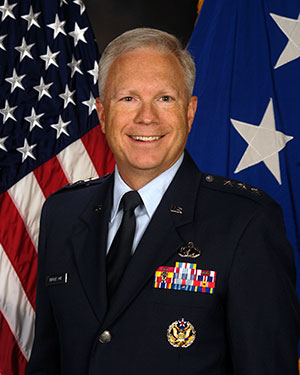
Lt. Gen. John F. Thompson, commander of the Space and Missile Systems Center (SMC), will retire Aug. 1. A ceremony celebrating his career and achievements took place July 27 at Los Angeles Air Force Base, California, where SMC is based.
Thompson, who is the longest serving three-star commander for SMC, retires after a 36-year career with the U.S. Air Force, having served in various roles leading defense acquisition programs, strategic systems and lifecycle management.
Brig. Gen. D. Jason Cothern, current vice commander of SMC, will serve as the SMC commander while the center awaits a confirmation of a three-star general officer.
SMC includes the positioning, navigation and timing (PNT) mission, in which professionals acquire, deliver and sustain reliable GPS capabilities to America’s warfighters, allies and civil users.
“Lt. Gen. Thompson’s exemplary career has made the nation safer, stronger and better secured against an increasingly contested space environment, and earned the well-deserved opportunity to enjoy this next chapter in his life,” stated a press release from SMC.
As the commander of SMC, he led more than 6,300 military, government service and contract employees nationwide, and oversaw an annual budget of $9 billion, which accounts for 85 percent of the nation’s space budget.
In the past 18 months, Lt. Gen. Thompson tirelessly led the groundwork for the stand-up of the U.S. Space Force’s newest Field Command, Space Systems Command, which will lead the Force in the development, delivery and acquisition of innovative space warfighting capabilities.
Having completed his four-year tour as the SMC commander, his retirement will not affect the timeline of the SSC stand-up — a complex process requiring activities and approvals at the highest levels before implementation.
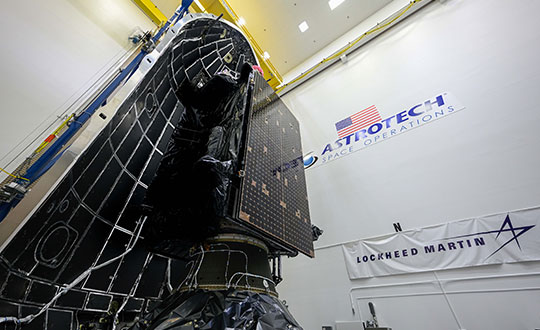
The fifth GPS III satellite was encapsulated within a SpaceX payload fairing on June 9 in preparation for its June 17 launch.
The U.S. Space Force’s Space and Missile Systems Center’s Lockheed Martin-built GPS III Space Vehicle 05 satellite was encapsulated within a SpaceX payload fairing at Astrotech Space Operations Florida facility on June 9 in preparation for launch, scheduled for June 17 from Cape Canaveral Space Force Station.
The 15-minute launch window opens 12:09 p.m. EDT. If SpaceX provides a live feed to view the launch, it will be available here.
Encapsulation of the satellite within the payload fairing protects the satellite from the impact of dynamic pressure and aerodynamic heating during its harrowing journey through the earth’s atmosphere, and supports the ability to communicate with the satellite until separation from the launch vehicle on orbit.
“The GPS III program continues to make strides in modernizing the GPS constellation for the United States Space Force, maintaining the ‘gold standard’ for position, navigation and timing,” said Col. Edward Byrne, Medium Earth Orbit Space Systems division chief, “SV05 is not only the first-ever USSF satellite launched on a previously flown booster, but also is the 24th military-code (M-xode) satellite introduced to our constellation, the last needed to bring M-code to full operational capability.”
GPS III SV05 will join the current 31-satellite operational constellation to continue to provide the gold standard in positioning, navigation and timing services for more than four billion users worldwide.
The Space and Missile Systems Center, located at Los Angeles Air Force Base in El Segundo, California, is the U.S. Space Force’s center of acquisition excellence for acquiring and developing military space systems. Its portfolio includes the development of advanced space and launch capability and systems, global navigation satellite systems, military satellite communications, defense meteorological satellites, space launch and range systems, satellite control networks, space-based infrared systems, and space situational awareness capabilities.
GPS III SV05 is encapsulated within a SpaceX payload fairing at Astrotech Space Operations Florida in preparation for its June 17 launch. (Photo: Lockheed Martin)
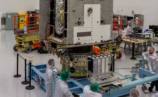
GPS III Space Vehicle (SV) 05 was transported from the Lockheed Martin facility in Waterton, Colorado, to the Space Coast Regional Airport in Titusville, Florida, by a C-17 Globemaster III crew from Joint Base Lewis-McChord, Washington. Lockheed Martin is the contractor for construction of the GPS III satellites.
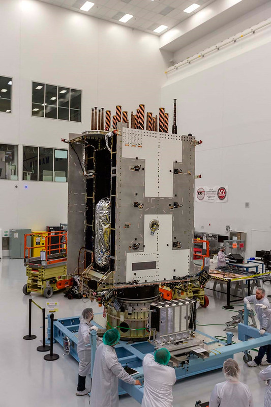
Now that the satellite has arrived at the Astrotech Space Operations facility, the latest addition to the GPS constellation modernization effort will begin final testing and checkout before the launch. While at Astrotech, it will undergo final post-ship functional testing, be fueled with onboard propellant, and then be encapsulated for launch.
Once these tasks are accomplished, SV05 will be horizontally integrated with the first-ever SpaceX Falcon 9 launch vehicle to be reflown for a National Security Space Launch (NSSL) mission.
“SV05 is the third GPS III satellite shipped to the Cape in the last 14 months and marks a key step to our larger goal of GPS constellation modernization,” said Col. Edward Byrne, SMC’s Space Production Corps Medium Earth Orbit Space Systems Division chief. “As the fourth GPS III launch campaign with SpaceX, this NSSL mission is historic both for the first reflight of a Falcon 9 rocket and for being the 24th military-code (M-code) satellite introduced to our constellation, the last needed to bring M-code to full operational capability.”
Slated to launch in June, GPS III SV05 will join the operational constellation of 31 GPS satellites, delivering enhanced performance and accuracy through a variety of improvements.
Improvements include increased signal protection, L1C signal interoperability, and the newest civilian signal, L5. As a crucial technological foundation for internet, financial, transportation and agricultural operations, GPS delivers the gold standard in positioning, navigation and timing services supporting U.S. and allied operations worldwide.
The U.S. Space Force’s Space and Missile Systems Center, located at the Los Angeles Air Force Base in El Segundo, California, is the center of excellence for acquiring and developing military space systems. SMC’s portfolio includes space launch, global positioning systems, military satellite communications, a meteorological satellite control network, range systems, space-based infrared systems, and space situational awareness capabilities.
The Space and Missile Systems Center’s Production Corps achieved a major GPS milestone on Nov. 18 with the approval for Operational Acceptance of GPS Military-Code (M-Code) Early Use (MCEU). MCEU serves as a gap filler for M-code operations before the entire GPS constellation’s operational transition to the Next Generation Operational Control System Block 1.
The encrypted M-code signal enhances anti-jamming and anti-spoofing capabilities for the warfighter. M-code signals are available on all 23 GPS Block IIR-M, IIF and III space vehicles currently on orbit. The successful testing events were completed at the Master Control Station at Schriever Air Force Base, Colorado and Alternate Master Control Stations at Vandenberg Air Force Base, California.
Operational Acceptance followed successful integrated developmental and operational testing of the GPS Operational Control Segment (OCS) upgrade. Operating in a trial period since June 2020, the MCEU upgrade allows the OCS Architecture Evolution Plan to task, upload and monitor M-code within the GPS constellation, as well as support testing and fielding of modernized user equipment. With M-code now declared operational, upcoming Military GPS User Equipment (MGUE) will be able to request early use of the M-code signal-in-space to provide more secure position, navigation and timing (PNT) to warfighters.
“MCEU ushers in a new era of GPS support that will provide operators across the warfighting domain with assured PNT access while further preventing unauthorized use by our adversaries. This is a critical step in remaining the gold standard of PNT systems and promoting a peaceful, secure, stable, and accessible space domain,” said Lt. Jordan Malara, 2nd Space Operations Squadron GPS Warfighter Collaboration Cell assistant flight commander.
M-code designed for security
Military code (M-Code) is a more-secure, harder-to-jam and spoof GPS signal specifically for military forces. Awarded in September 2017, M-Code Early Use (MCEU) is a software upgrade to the OCS AEP, which allows the current ground control system to task, upload and monitor M-Code within the GPS constellation. It will also help Accelerating M-Code’s deployment supports testing and fielding of modernized user equipment in support of the warfighter.
MCEU includes a new software-defined receiver installed globally at all six Space Force Monitoring Sites. The M-code Monitor Station Technology Improvement and Capability (M-MSTIC) uses commercial, off-the-shelf hardware to cost effectively receive and process M-code signals, enabling OCS operators to successfully monitor the M-code signals.
“M-code’s more-secure, harder-to-jam and spoof signals are critical to helping our warfighters complete their missions, especially in contested environments,” said Maria Demaree, vice president and general manager for Lockheed Martin’s Mission Solutions line of business. “This upgrade to the current GPS ground control system, and the launch of more modernized GPS III satellites, is making M-code’s full-fielding a reality.”
With the Dec. 1 Operational Acceptance of GPS III Space Vehicle 04 (GPS III SV04), 23 GPS IIR-M, GPS IIF and GPS III satellites broadcast M-code in the current GPS Constellation.
Ground Control Timeline — OCS AEP
Lockheed Martin has sustained the Space Force’s current GPS ground control system since 2013. The system is known as the GPS Operational Control Segment (OCS) Architecture Evolution Plan (AEP) or “OCS AEP.”
In February 2016, the Air Force contracted Lockheed Martin to develop the GPS III Contingency Operations (COps) software upgrade to the OCS AEP. COps was delivered in May 2019, successfully connected with on-orbit GPS III SV01 in October 2019, and was Operationally Accepted in February 2020. COps enabled the Air Force’s ground control system to command and control both the legacy satellites, as well the more powerful GPS III satellites beginning to launch.
In November 2018, the company completed the AEP 7.5 upgrade — the largest architectural change in the systems history — replacing significant code, hardware and software to improve the system’s cybersecurity capabilities and positioning the Air Force to better operate in contested, degraded and operationally limited environments.
In December 2018, the Air Force awarded Lockheed Martin the GPS Control Segment Sustainment II (GCS II) contract to continue to further modernize and sustain the OCS AEP through 2025.
In the fourth quarter of 2019, Lockheed Martin delivered the Red Dragon Cybersecurity Suite (RDCSS) Phase III upgrade to the OCS AEP, dramatically improving Defensive Cyber Operations (DCO) visibility into GPS network traffic. Other add-ons include user behavior analytics to analyze patterns of traffic and network taps to improve data collections.
Earlier this year — and key to enabling M-Code — Lockheed Martin installed new software-defined M-Code Monitor Station Technology Capability (M-MSTIC) receivers at six Space Force monitoring sites around the world. In Dec. 2019, SMC granted security approval for M-MSTIC.
From his side window, a crew chief relays vital position information back to the CH-47 Chinook pilot as paratroopers hook their pallet of equipment to the underside of the helicopter during sling load and air operations training. (Photo: U.S. Army/Maj. Robert Fellingham)
GPS World, in conjunction with Spirent Federal Systems, will be hosting a webinar on Oct. 8 that will cover GPS program updates, as well as the program’s role in the Space and Missile Systems Center’s (SMC) space enterprise architecture.
The event will also discuss the effects of COVID-19 and any future plans for the GPS program.
Event speakers will include Col. Ryan Colburn, director of SMC’s Spectrum Warfare Division; Shawn Ryan, BAE Systems Navigation & Sensor Systems director of business development for SMC; Mike Shepherd, associate director of business development at Collins Aerospace Mission Systems; and Christopher Hogstrom, engineer at Spirent Federal Systems.
Col. Ryan Colburn leads a team charged with designing and integrating the United States Space Force’s current and future integrated satellite communications and position navigation and timing enterprise architectures. He works with military, commercial, allied and government partners to ensure SMC is able to design, acquire, integrate and field the space systems needed to support today’s warfighters.
Shawn Ryan provides local leadership for all SMC and Los Angeles Industrial NSS efforts and engagement. NSS, headquartered in Cedar Rapids, Iowa, develops, designs and manufactures the most advanced GPS receivers and anti-jam GPS antenna electronics for military applications.
Mike Shepherd leads integrated business development for A-PNT, FVL, TITAN and JADC2. Previously, he was the senior manager of the ground U.S. military GPS receiver business and managed major accounts for all branches of the U.S. military users of GPS and A-PNT systems.
Christopher Hogstrom joined Spirent Federal in 2020. He currently supports various engineering efforts as well as customer trainings and product demos. He has worked extensively with adaptive beamforming and its applications in GPS anti-jam technologies. Hogstrom received his Bachelor and Master of Science in Electrical engineering from Brigham Young University.
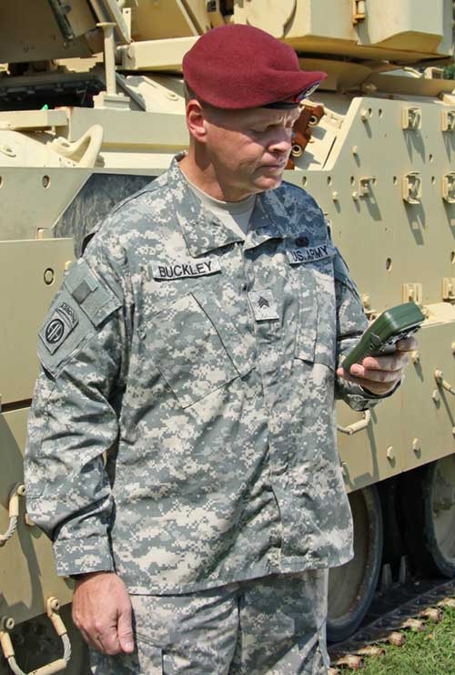
SMC awards multiple rapid prototyping agreements for joint modernized GPS handheld device; four demonstrations to be held
The Defense Advanced GPS Receiver (DAGR) in use in 2011. (Photo: U.S. Army)
On June 26, the United States Space Force’s Space and Missile Systems Center awarded three separate rapid prototyping agreements to Collins Aerospace, Raytheon Intelligence & Space and the Technology Advancement Group for a total of $41.1 million.
The firm-fixed price agreements are for the development of a basic working prototype of the joint modernized GPS handheld device. The contract provides the government with innovative solutions demonstrated via hardware and software prototype development.
The purpose of this rapid prototyping effort is to produce a joint modernized handheld smaller in size with low power consumption, increased military-code capability, and improved anti-jamming and anti-spoofing capabilities compared to the equipment now used by the military.
4 demonstrations coming
This is the second competitive objective under the current Phase I strategy and is the result of a down-select from five to three vendors. It builds off the first objective of Phase I, which focused on mock-ups and drawings.
These agreements provide for four demonstrations to be held with Army and Marine Corps representatives. The demonstrations give the end users an early opportunity to provide feedback and the ability to influence the final design — ultimately making for a more seamless transition to operations.
“This is the first major update to the military’s GPS handheld device in more than 15 years,” said Col. Clifford Sulham, User Products Division chief. “The advanced capabilities of this device will allow our airmen, soldiers, sailors and Marines to conduct operations in GPS-challenged environments.”
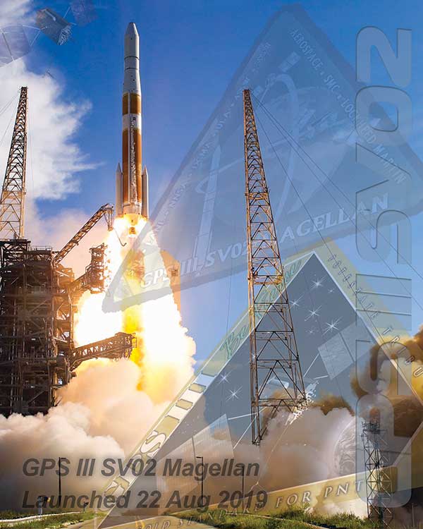
On March 23, the U.S. Space Force’s Space and Missile Systems Center successfully transferred the second GPS III space vehicle (GPS III SV02) to Space Operations Command.
GPS III SV02, dubbed “Magellan” in honor of Ferdinand Magellan, the Portuguese explorer who led the first expedition to circumnavigate the Earth, is now officially under the control of the Second Space Operations Squadron located at Schriever Air Force Base, Colorado.
GPS III SV02 was launched on August 22, 2019, aboard a United Launch Alliance Delta IV Medium+ launch vehicle from Cape Canaveral Air Force Station, Florida.
GPS III satellites deliver positioning, navigation and timing information with three times better accuracy, and up to eight times improved anti-jamming capability than its predecessor. This is crucial for the warfighter, who will benefit from the increased power, accuracy and protections provided by the newer GPS III systems.
“This marks our second transfer of Satellite Control Authority for the GPS III program as we continue to modernize the GPS constellation with more capable and resilient systems,” said Col. Edward Byrne, chief of Production Corps’ Medium Earth Orbit Space Systems Division. “It’s only through the hard work, professionalism, and dedication of our entire government and industry partner team that we can successfully transition GPS III SV02 to operations.”
The GPS III spacecraft has a 15-year design life, 25 percent longer than the last generation of GPS satellites currently on-orbit. Additionally, it delivers new capabilities, such as a fourth civilian signal (L1C), designed to enable interoperability between GPS and international satellite navigation systems, such as Galileo. GPS III satellites will also bring the full capability of the military code (M-code) signal, increasing anti-jam resiliency in support of the warfighter.
These continued improvements and advancements to the GPS system make it the premier space-based provider of positioning, navigation, and timing services for more than four billion users around the globe.
U.S. Space Force’s Space and Missile Systems Center, located at Los Angeles Air Force Base in El Segundo, California, is the U.S. Air Force’s Center of Excellence for acquiring and developing military space systems. Its portfolio includes the Global Positioning System, military satellite communications, defense meteorological satellites, space launch, range systems, satellite control networks, space-based infrared systems and space situational awareness capabilities.
Specifically, Booz Allen’s work will aid in the development and modernization of GPS systems through major programs such as Military GPS User Equipment (MGUE), GPS III and Next Generation Operational Control System (OCX).
The NIWC Pacific Positioning, Navigation, and Timing (PNT) Division is the Navy’s principal research and development center for navigation sensors and systems.
SMC is the center of technical excellence for developing, acquiring, fielding, and sustaining resilient and affordable military space systems.
With this contract, Booz Allen will continue to serve as a key mission partner for NIWC Pacific and SMC on the important endeavor of modernizing PNT systems for U.S. and Allied warfighters.
To execute this highly complex scope of work, Booz Allen will provide a range of essential services, including system definition, requirements synchronization, capability improvement, cybersecurity engineering, platform integration and testing, and acquisition program management.
“Booz Allen’s robust track record of work in both systems engineering and cybersecurity continues to inspire trust from our clients,” said Vice President Brian Zimmermann. “Our deep bench of leaders and technical experts reassures our clients that no project is too big or too complex. It’s our privilege to help the Navy and Air Force modernize GPS systems that are so vital to the security of our nation.”
Read more about Booz Allen’s work with PNT systems here.
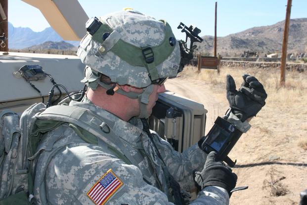
Staff Sgt. Reag Wood of 1st Combined Arms Battalion, 5th Brigade, 1st Armored Division, illustrates how he uses an iphone to obtain a visual image of a mock with insurgent activity during a field training exercise at White Sands Missile Range, N.M. (Photo: U.S. Army/Lt. Col. Deanna Bague)
By Colonel John Claxton Chief, PNT Mission Integration, Air Force Space and Missile Systems Center
Image: USAF
The Global Positioning System has provided the citizens of the United States and the world the gold standard for positioning, navigation and timing (PNT) for the past 40 years. These days, GPS is seamlessly integrated into our daily lives in ways that we hardly notice. In fact, most of us expect GPS to be available in much the same way that our lights come on when we flip a switch or water comes out when we use the kitchen faucet.
None of this is easy, however, and wouldn’t happen if it wasn’t for the incredible work and communication by the members of the GPS Program Office and our terrific enterprise partners. During the next 18–24 months, the GPS enterprise will deliver the new and more powerful modernized GPS III capabilities across all segments of the system, which have been in the works and promised for the past 8–10 years. As we transition to the Space and Missile Systems Center’s (SMC) 2.0, this is a very exciting time for the GPS program. Below are some updates on our major programs.
Program Updates
GPS III. The space segment of modernized GPS has reached our goals from 2018, and then some. SV01 “Vespucci” launched on Dec. 23, 2018, heralded by celebrations across the GPS community. The GPS III team was honored to share this event with so many giants of the GPS world. We completed space vehicle (SV) 01’s On-Orbit Checkout Test in July, meeting and exceeding all performance objectives, and plan to transfer SV01 Satellite Control Authority from SMC to the 14th Air Force by the end of the year. SV01 then begins operational testing and is expected to be certified for full operations in April 2020.
SV02 “Magellan” launched on Aug. 22 aboard a United Launch Alliance Delta IV Medium rocket — the last Delta of its class — to much fanfare and celebration as well. We completed SV02 orbit raising and initial checkout in early September, and Magellan is next in line to transition to operations in 2020.
We received delivery of SV03 and SV04 from Lockheed Martin Space Systems on May 16 and Sept. 10, respectively, with launches targeted for March and July 2020.
Challenges remain — this business is hard — but the GPS III team is focused on delivering capability: improving and streamlining the largest big-satellite production line in the Department of Defense and driving our launch campaign to bring modernized capabilities, higher power performance, and the shared international L1C signal to the GPS-using world.
Figure 1. Mature Glonass-M satellites show improved cesium frequency standards performance in terms of daily stability. (Image: Roscosmos)
GPS IIIF. The GPS III Follow-On program looks to continue the success of GPS III as it moves forward in production of the first two GPS IIIF satellites. The program is well into a year-long set of detailed design reviews projected to conclude in March 2020. With Lockheed Martin as the prime contractor for both GPS satellite programs, GPS IIIF can take advantage of production-line improvements learned from GPS III to significantly reduce assembly, integration and test timelines.
Additionally, the program is helping to shape SMC’s Enterprise Commonality Initiative: an effort focused on aligning common products and processes across multiple programs to improve quality, speed up delivery and lower costs. With plans to procure 22 satellites and a delivery timeline spanning 15 years, the program has implemented a technology-insertion strategy and partnered with the Air Force Research Laboratory to ensure a timely transition of new capabilities to meet future military requirements. It is great to see the progress GPS IIIF is making in delivering its new baseline capabilities along with the steps it’s taking toward future capability insertion. The first GPS IIIF satellite launch is forecast for 2026.
GPS Next Generation Operational Control System (OCX). This past year, we used OCX Block 0, also known as the GPS III Launch and Checkout System, to launch and initialize both GPS III SV01 and SV02 and have been flying them in caretaker status until they are ready to be incorporated into the operational constellation. On OCX Block 1, all coding is complete, and the program focus is transitioning from development to system integration, test, and then transitioning the system to operations. Program investments over the past couple of years to change the program culture and modernize the factory infrastructure (often referred to DevOps) is paying off and yielding real-time metrics used to make data-driven decisions and produce higher quality code at a significantly faster rate. As a result, OCX is no longer troubled, but is now a typical large-complex software-intensive program that will experience challenges and risks. Fortunately, the right tools are in place to deliver this critical capability.
GPS Legacy Ground Sustainment. We continue to sustain our existing GPS infrastructure associated with the current Operational Control System (OCS). These sustainment efforts ensure GPS will continue to deliver the gold standard in PNT while providing the crucial on-ramp to incorporate the next generation of modernized GPS capabilities. We operationally accepted the largest OCS upgrade in GPS history. This upgrade, known as Version 7.5, virtualized the network, implemented two-factor authentication, secured connections to worldwide ground antennas, and improved encryption for mission data.
Challenged with a need to rapidly mitigate mission risk and provide enhanced cyber protection, the Red Dragon Cybersecurity Suite (RDCSS) emerged as the GPS OCS monitoring platform, providing data aggregation, analytics and multi-level Indicators of Compromise (IOC). It has evolved into an efficient and effective means to detect, investigate, and report security events and incidents.
Additionally, in August 2019 we established an RDCSS connection into the Space Enterprise Defensive Cyber Operations (DCO) solution, known as the Cyber Defense Correlation Cell for Space. This created a layered defense and a tiered DCO environment for protecting and sustaining the GPS mission.
GPS User Equipment. Over the past year our soldiers, sailors, marines and airmen continued testing and integrating mature, next-generation GPS receiver cards that provide more accurate and reliable positioning, navigation and timing. The first
Military GPS User Equipment (MGUE) receiver card was qualified this year, and the core technologies are being leveraged to develop many other types of GPS receiver cards for a wide range of DoD weapon systems. This exciting work is the culmination of nearly two decades of modernization efforts throughout the GPS enterprise.
In the near term, we are utilizing M-code-capable lead platforms — the USAF B-2 Bomber, USMC Joint Light Tactical Vehicle, USN Arleigh-Burke Class Guided Missile Destroyer and Army Stryker combat vehicle — to prove those capabilities. The second increment of MGUE now underway will focus on requirements for precision-guided munitions, a joint common modular handheld unit, as well as circuit cards and components for low size, weight and power needs. With MGUE, the DoD and services are poised to have enduring PNT solutions the warfighter can leverage for years to come.
GPS Integration Roadmaps
Integration of modernized GPS III capabilities into our major programs is a key focus of the GPS Program Office as we deliver capabilities to our warfighter and civilians users. We have continued to refine our plans and further integrate our programs and teams to ensure a seamless transition and continued high level of service.
Enterprise Road to Launch (ERTL). The Road to Launch team achieved an historic victory of firsts in December 2018. We successfully launched GPS III SV01, the first of its class. SMC partnered with SpaceX to launch SV01 aboard a Falcon 9 rocket — their first National Security Space Launch. SV01 reached orbit under the command and control of our first GPS OCX delivery, the GPS III Launch and Checkout System.
This colossal accomplishment of firsts was only possible because of the exceptionally close integration, tenacity and highly collaborative effort among all players in the community — spacecraft, payloads, launch, control, signal monitoring, acquisition, operations, test and many others. For SV01, the ERTL has now passed the torch to the Enterprise Road to Mission team — but the Road to Launch team is as busy as ever.
The mission planners, launch and orbital operations crew ensured SV02 reached medium Earth orbit with needle-threading precision in August; the team is implementing improvements based on experience as we prepare for up to three more GPS III launches in 2020; and we are already ramping up efforts to design the launch campaign for GPS IIIF.
GPS Enterprise Road to Mission (ERM). With two GPS III satellites now on orbit, it is now time to execute the Enterprise “Integration Playbook” we have developed and coordinated over the past year. The Contingency Operations (COps) modification upgrade has now been integrated into OCS on the 2 SOPS operations floor and is undergoing Developmental Testing with the GPS III SV on orbit. The program anticipates operational testing in January 2020 and Operational Acceptance in April 2020. All of our community stakeholders are ready, and with the COps modification to OCS in place, it is time to get the GPS III satellites into mission and start providing its new capabilities to our users. Over the next few months, the GPS III capabilities are expected to be operationally certified and ready for use.
GPS Enterprise Road to M-Code Mission (ERM-M-Code). With COps now in place, the next major delivery will be M-Code Early Use modification to OCS, installation of new M-code signal monitoring equipment at sites around the globe, modification of mission planning software, MGUE Increment 1 development, service lead platform integration efforts, and operationalization of space receivers. It is our continued objective to improve the ability of the Combined Space Operations Center, to respond to urgent PNT needs of the combatant commanders as they engage more sophisticated adversaries. We remain closely aligned with our peers at USSTRATCOM, AFSPC and our worldwide users across the Joint Service and allied team.
Conclusion
It has never been a more exciting time to be part of the GPS program and enterprise. Our outstanding government and contractor teams have worked so incredibly hard on integrating and communicating our programs to ensure the successful and seamless delivery of GPS III capabilities to both our warfighter and civilian users. It is a great world we live in today, and GPS makes it even better.
The U.S. Air Force released two technical reports demonstrating that the Global Positioning System (GPS) continues to deliver exceptional performance to civilian users around the world, reported the Los Angeles Air Force Base.
Operated by the 50th Space Wing at Schriever Air Force Base, Colorado, the GPS constellation provides precise PNT services worldwide 24-hours a day, seven days a week.
The 2014 and 2015 performance reports confirm that the GPS Standard Positioning Service (SPS) satisfied nearly all measurable performance commitments documented in the GPS SPS Performance Standard, furthering the status of GPS as the “Gold Standard” for PNT.
The GPS Directorate at the U.S. Air Force’s Space and Missile Systems Center commissioned the GPS SPS performance reports to enhance public transparency of the real-world performance of civil GPS.
The GPS Directorate at the U.S. Air Force’s Space and Missile Systems Center commissioned the GPS SPS performance reports to enhance public transparency of the real-world performance of civil GPS. The reports confirm that GPS met all of the evaluated commitments for calendar years 2014 and 2015 with one exception.
This exception was that the reporting notification commitment for scheduled GPS satellite interruptions during calendar year 2014 was only met in 29 of 30 cases (96.7 percent). The vast majority of GPS users were not impacted by this single delayed notification. In this single case, the U.S. Air Force only provided 17 hours of advanced notice, as opposed to the SPS PS commitment of at least 48 hours advanced notice, before the scheduled satellite interruption.
The commitments evaluated in the reports include those of accuracy, integrity, continuity, and availability of the GPS signals-in-space. For example, the signal-in-space ranging accuracy of the GPS civil signals was significantly better than the published standard of “7.8 meters or better at the 95th percentile.” This metric represents a key component in the total “user range error” that GPS receivers experience.
Most impressively, the oldest GPS satellites still provided an average signal-in-space accuracy of 2.8 meters during their worst performing month of 2015 – surpassing the target accuracy metric by over 300 percent. On average, the signal-in-space accuracy of the GPS constellation in 2015 was 1.4 meters, which is a 0.4 meter improvement over the accuracy in 2013.
The GPS SPS performance reports are generated by Applied Research Laboratories, the University of Texas at Austin (ARL:UT), which is a Department of Defense University-Affiliated Research Center. Using data from 33 GPS monitoring and reference stations located around the globe, the ARL:UT team assesses GPS performance against the commitments defined in the 2008 GPS SPS Performance Standard. The ARL:UT reports focus on those commitments that can be verified by anyone with knowledge of standard GPS data analysis practices, familiarity with the relevant signal specifications, and access to a Global Navigation Satellite System data archive.
“The GPS Directorate remains committed to providing highly accurate and reliable PNT services to our users around the globe. The use of published standards to transparently guide data-driven decision making is how we have become the ‘Gold Standard’ in PNT,” said Col. Steven Whitney, director of the GPS Directorate. “The GPS Directorate is working every day on improved capabilities to ensure users receive the maximum benefit of the PNT services offered by GPS.”
ARL-UT expects to complete the 2016 SPS performance report later this year. The 2013, 2014 and 2015 reports are publicly available for free download. The National Coordination Office for Space-Based PNT maintains the GPS.gov website to provide official information about GPS to the public.
Air Force Space Command’s Space and Missile Systems Center, located at Los Angeles Air Force Base in El Segundo, California, is the U.S. Air Force’s center of excellence for acquiring and developing military space systems. Its portfolio includes GPS, military satellite communications, defense meteorological satellites, space launch and range systems, satellite control networks, space-based infrared systems and space situational awareness capabilities.
The first eight GPS III satellites are under contract and in production at Lockheed Martin’s GPS III Processing Facility outside of Denver.
The U.S. Air Force Space and Missile Systems Center awarded a contract option to Lockheed Martin Space Systems Company to procure two additional GPS III satellites, space vehicles nine and 10 of the next generation. The contract option procures long lead and production hardware.
“The GPS III SV 9 and 10 satellites are expected to be ready for launch in 2022, thus sustaining the GPS constellation and the global utility the world has come to expect,” said Lt. Gen. Samuel Greaves, the Space and Missile Systems Center’s commander and Air Force program executive officer for space.
The Lockheed Martin team is finishing up final testing and integration activities on the first GPS III satellite, GPS III SV01, and is preparing to deliver it to the Air Force later this year. The second satellite, GPS III SV02, is poised to have its major functional systems fully integrated into one space vehicle prior to starting its own environmental testing. GPS III SV03 also is beginning to take form in the company’s production clean room as its major subcomponents are being assembled. \All eight of the first set of GPS III satellites are in various stages of production at Lockheed Martin’s GPS III Processing Facility outside of Denver.
The government expects to compete future purchases of GPS III satellites, beginning with GPS III SV 11. This competition will maintain the current technical baseline of GPS III and will add additional hosted payloads to increase system accuracy, search and rescue capability, and universal S-band compatibility.
The GPS Directorate at the Space and Missile Systems Center (SMC) continues to look for someone to build 22 GPS III satellites in the near future.
SMC issued a request for proposals on Jan. 8, with rather complicated terms. The first eight GPS III satellites are already under contract, and two have been built, but delivery and launch schedules have dragged. The Air Force incorporated several other payload requirements for the satellites, beyond those of new GPS signals themselves.
This is the Air Force’s third effort to find a builder.
The RFP is for “11+ Phase 1 Production Readiness Feasibility Assessment. “ It covers GPS III space vehicles 11 and beyond. The process, if followed as the Air Force envisions, will award up to three relatively small fixed-price contracts.
According to an Air Force press release, “The scope of this effort includes the current GPS III SV01–08 technical baseline with the addition of redesigned Nuclear Detonation Detection System (NDS), Search and Rescue/GPS (SAR/GPS), and Laser Retroreflector Array (LRA) payloads, Unified S-Band (USB) compliance, Regional Military Protection capability No changes are allowed to the GPS Next Generation Operational Control System (OCX) or Military GPS User Equipment (MGUE) interfaces.”
The first Air Force effort to recompete the contract for future GPS III satellites came in 2014. A 2015 initiative lowered the bar as far as requirements, but also lowered the award very dramatically, from $200 million each for two companies to $6 million each for three companies.
The 2016 announcement appears to replicate the terms of the 2015 campaign. There has been no official explanation as to why the terms changed between 2014 and 2015, and why they did not between 2015 and 2016.
Rick Ambrose, executive vice president of Lockheed Martin Space Systems, tweeted on Jan. 13 that the satellite had successfully completed its thermal vacuum test (TVAC).
Lockheed Martin Space Systems is the prime contractor on the GPS III program to build a total of eight GPS IIIs. The contract includes options for up to four more satellites, and the Air Force has told Congress it expects to execute options for at least two of those satellites.
The first GPS III satellite is expected to launch in 2017.
Coast Guard Issues Jamming Alert
The U.S. Coast Guard issued a safety alert on Jan. 16, warning mariners of the potential detrimental impact to navigation caused by GPS interference or jamming. The warning emphasizes the importance of understanding how vessel equipment could be impacted by the loss of a GPS signal.
The Coast Guard states that this past summer, multiple outbound vessels from a non-U.S. port suddenly lost GPS signal reception. The net effect was various alarms and a loss of GPS input to the ship’s surface search radar, gyro units and ECDIS, resulting in no GPS data for position fixing, radar over ground speed inputs, gyro speed input and loss of collision avoidance capabilities on the radar display.
Fortunately, the vessels were able to safely continue theirvoyage using radar in heads up display, magnetic compass and terrestrial navigation. Approximately six nautical miles later, the vessels’ GPS units resumed operation. Although the vessels had back-up systems to allow a safe transit, the consequences could have been severe, warns the Coast Guard.
IRNSS Launches Fifth Satellite
The fifth satellite in India’s Regional Navigation Satellite System rode into orbit Jan. 20, joining a growing fleet of spacecraft to provide positioning services to users across South Asia.
“With this satellite in place, within our country we will be able to get, 24 x 7, a good positional accuracy,” said A.S. Kiran Kumar, chairman of the Indian Space Research Organisation (ISRO).”
IRNSS 1E will raise its orbit to an altitude of nearly 36,000 kilometers (22,300 miles) over the next few weeks, entering an orbit centered on 111.75 degrees east longitude and oscillating up to 28.1 degrees north and south of the Equator.
Two more IRNSS spacecraft are due for launch bythe end of March to complete the constellation.
The seven satellites — four in inclined geosynchronous orbits like the one intended for IRNSS 1E, and three in equatorial geostationary orbit — will give India an independent navigation system with coverage over Indian territory and regions extending up to 1,500 kilometers (932 miles) from its borders.
India started launching its navigation satellites in 2013. Each spacecraft is designed to operate for 12 years.