Tag: Street View

  • Taoglas launches street-view-ready GPS performance certification services

    Taoglas launches street-view-ready GPS performance certification services

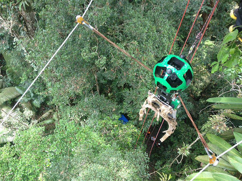
    Taoglas, a provider of Internet of Things (IoT) and GNSS antenna products, has released two new GPS certification testing services for Google and its device partners. The services are required for devices to meet Google’s new Street View auto-ready standard.

    Auto-ready certification distinguishes 360-degree cameras that deliver accurately positioned 360 video, even at high speeds. Taoglas worked with Google to develop the performance requirements, as well as the test methodology used to establish a basic minimum level of GPS receiver performance.

    The services are available at any of Taoglas’ design centers and labs in the United States, Ireland, Germany and Taiwan.

    Compact wireless devices such as digital cameras with built-in GPS receiver systems contain complex electronic systems that can emit unwanted RF signals that can impact radio receiver performance. The effect of this RF noise can be combated with critical design decisions like the antenna, low noise amplifier, filters, and transmission line choice and implementation.

    Taoglas’ new services will help device manufacturers objectively measure real-world performance to understand any GPS performance issues with their products. With this information, product manufacturers will know if their performance is optimized and will meet or exceed user expectation for the application at hand, as well as how it compares with their competitors.

    “Google Street View provides people with a 360-degree view of the world, and to enable these services, we require highly accurate location data,” said Charles Armstrong, product manager at Google. “By working with Taoglas to establish a standardized compliance process, we’re helping device manufacturers understand our requirements for GPS performance and quickly deliver products that match and exceed those high performance standards.”

    Taoglas is offering two levels of certification testing:

    Street View Auto-Ready Conformance Testing (GSA.31) provides a quick verification of minimum performance (in a pass/fail manner) required to achieve Street View certification. Taoglas uses its GPS constellation simulator and anechoic chamber to verify that radiated tracking and acquisition sensitivity meet a minimum performance standard at 15-degree intervals in one hemisphere.

    From these test results, manufacturers will be able to clearly see if the device’s GPS is performing adequately for basic location capabilities. The condensed period needed to run this test provides device manufacturers the best value to answer the question, “Is the GPS working optimally?”

    A street view image of Guatemala. (Credit: Google)

    Street View Auto-Ready Performance Testing (GSA.32) provides an absolute level of testing to assess the GPS receiver performance according to the optional Google Street View Assessment test procedures.

    Taoglas uses its GPS constellation simulator and anechoic chamber to measure radiated tracking and acquisition sensitivity at 15-degree intervals in one hemisphere. These optional tests provide more insight into how well a device performs, providing absolute receive sensitivity performance data.

    Testing results for both services include suggestions on next steps to resolve identified issues.

    “This partnership with Google to deliver GPS testing solutions for Google Street View compliance is an excellent example of how we’re working successfully with the world’s biggest companies to delivering high-quality, reliable antenna solutions,” said Dermot O’Shea, co-CEO of Taoglas. “By certifying their products through Taoglas, device manufacturers will also be able to take advantage of Taoglas’ deep RF expertise, achieving success quickly and reducing time to market.”

    “Street view” of the Ambrym Volcano, Vanuatu. (Credit: Google)
  • Google Maps Takes Street View Camera through Amazon

    The Street View Trekker on a zipline in the Amazon Rainforest.
    The Street View Trekker on a zipline in the Amazon Rainforest.

    New imagery of the highest canopy in the Amazon rainforest is now available on Google Maps. The Amazon rainforest is one of the most diverse ecosystems in the world, with many species high in the canopies of the forest still undiscovered.

    “Starting today, with the help of our partners at the Amazonas Sustainable Foundation (FAS), you can begin to unlock some of the wonders of the forest, by traveling from the upper canopy to the forest floor with Google Maps’ first zipline Street View collection,” wrote Karin Tuxen-Bettman, program manager, Google Earth Outreach on a March 1 blog.

    The project is part of Google’s partnership with FAS, who three years ago invited Google Maps to the Rio Negro Sustainable Development Reserve. “Their hope is that sharing the imagery of their local communities, rain forests and rivers with the world will raise awareness and support for their efforts to conserve these areas,” Tuxen-Bettman writes.

    The imagery was collected through Google Map’s Trekker Loan Program, which loans out the Street View camera and technology to tourism boards, non-profits, universities, and research organizations to help collect imagery of remote places.

    The Amazon map imagery was gathered through boat travels on 500 kilometers of rivers, hiking on 20 kilometers of forest trails and ziplining through forest canopies.

    “We hope it inspires you to embark on your own virtual expedition of the Amazon (you can leave the bug repellent at home!),” Tuxen-Bettman writes.

    The map on this page  shows where Google Maps has yet to collect Street View imagery.

    Google_trekker_river-W

  • Google Maps Takes Street View Camera through Amazon Canopy

    Google Maps Takes Street View Camera through Amazon Canopy

    The Street View Trekker on a zipline in the Amazon Rainforest.
    The Street View Trekker on a zipline in the Amazon Rainforest. (Photo credit: Google Maps)

    New imagery of the highest canopy in the Amazon rainforest is now available on Google Maps. The Amazon rainforest is one of the most diverse ecosystems in the world, with many species high in the canopies of the forest still undiscovered.

    “Starting today, with the help of our partners at the Amazonas Sustainable Foundation (FAS), you can begin to unlock some of the wonders of the forest, by traveling from the upper canopy to the forest floor with Google Maps’ first zipline Street View collection,” wrote Karin Tuxen-Bettman, program manager, Google Earth Outreach on a March 1 blog.

    The project is part of Google’s partnership with FAS, who three years ago invited Google Maps to the Rio Negro Sustainable Development Reserve. “Their hope is that sharing the imagery of their local communities, rain forests and rivers with the world will raise awareness and support for their efforts to conserve these areas,” Tuxen-Bettman writes.

    The imagery was collected through Google Map’s Trekker Loan Program, which loans out the Street View camera and technology to tourism boards, non-profits, universities, and research organizations to help collect imagery of remote places.

    The Amazon map imagery was gathered through boat travels on 500 kilometers of rivers, hiking on 20 kilometers of forest trails and ziplining through forest canopies.

    “We hope it inspires you to embark on your own virtual expedition of the Amazon (you can leave the bug repellent at home!),” Tuxen-Bettman writes.

    The map on this page  shows where Google Maps has yet to collect Street View imagery.

    Rio Mariepauá, Brazil. (Photo credit: Google Maps)
    Rio Mariepauá, Brazil. (Photo credit: Google Maps)