Tag: Terry Moore

  • Terry Moore wins international navigation award from IAIN

    Terry Moore wins international navigation award from IAIN

    Terry Moore is the first British academic to take home the John Harrison Award for outstanding contributions to navigation.

    Terry Moore
    Terry Moore

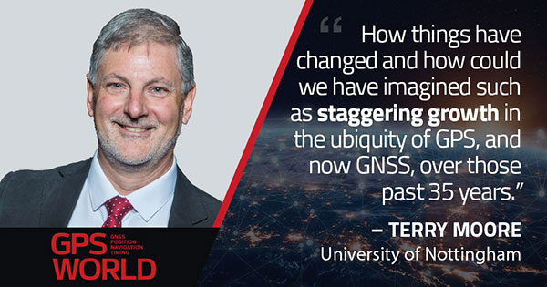
    Terry Moore, a positioning and navigation expert at the University of Nottingham and longtime GPS World Editorial Advisory Board member and author, has become the first British academic to win a prestigious international award in the field.

    Terry Moore is an Emeritus Professor and former director of the Nottingham Geospatial Institute at the University’s Faculty of Engineering.

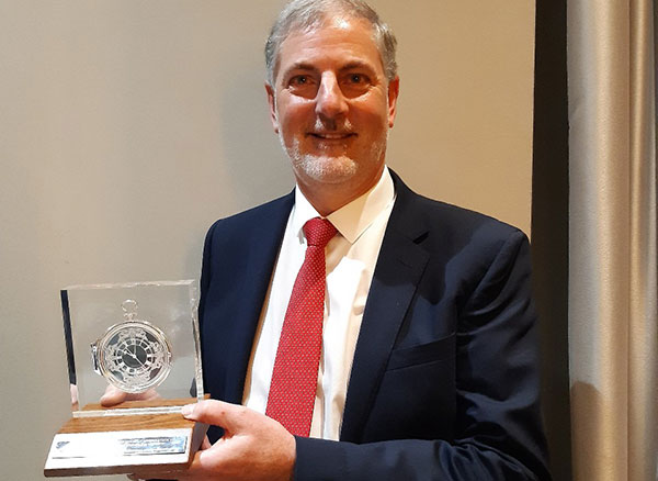
    The International Association of Institutes of Navigation (IAIN) awarded Moore with its John Harrison Award for outstanding contributions to navigation. The award ceremony took place during a special session of the Navigation 2021 Conference in Edinburgh, which took place Nov. 16-18.

    HRH The Princess Royal (Princess Anne) attended via Zoom to present the award, and had a one-to-one conversation with Professor Moore.

    The John Harrison award is a premier global award in the navigation field and Professor Moore is its first British winner.

    “It’s a great honor to be recognized by the global navigation community, and I feel quite humbled,” Moore said. “John Harrison was a simple country carpenter in the 18th century who solved the major problem of measuring longitude at sea, through his remarkable marine chronometers. Despite his genius, he struggled for acceptance by the scientific establishment, and it took many years until he received the recognition (and financial reward) he deserved. It is sad that over 200 years later we are still fighting for improved equality, diversity and inclusion throughout scientific disciplines. I am absolutely delighted to receive the award in his name.”

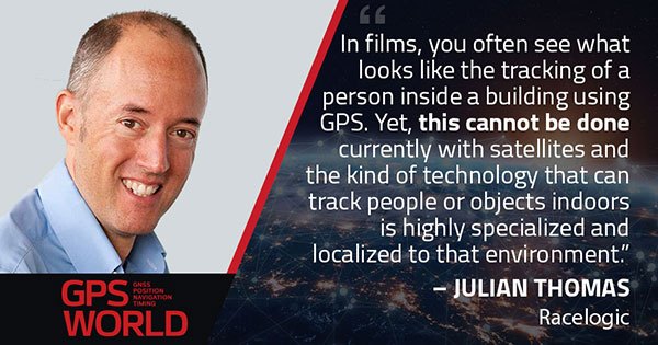
    A professor of satellite navigation for 20 years at the university, Moore’s association with Nottingham goes back to his undergraduate degree starting in 1979. During his distinguished career, all of it spent at Nottingham, he has taken a leading role in national and European initiatives aimed at integrating academic research and teaching activities in GNSS. He has also interacted closely with industry throughout that time.

    He was the founding director of GRACE — the GNSS Research and Applications Centre of Excellence — which was jointly funded by the University and the East Midlands Development Agency and has now been extended to cover all geospatial applications as the Geospatial Research and Applications Centre of Excellence.

    Moore has overseen numerous research projects funded by industry, research councils, the European Space Agency and the European Commission, and has supervised almost 40 successful PhD students.

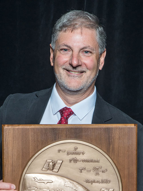
    He is a Chartered Engineer, a Fellow and the Immediate Past President of the Royal Institute of Navigation (RIN) and also a Fellow and a Member of Council of the Institute of Navigation (ION) in the United States. He was recently elected as the Chair of the European Group of Institutes of Navigation (EUGIN), and is an Honorary Member of IAIN. In 2013 he was awarded the RIN Harold Spencer-Jones Gold Medal. He received RIN’s J E D Williams Medal and the ION Johannes Kepler Award, both in 2017.

    Professor Moore is a member of the U.S. National Space-Based Positioning, Navigation and Timing (PNT) Advisory Board and is a Member of the European Space Agency (ESA) GNSS Science Advisory Committee. He was an expert contributing to the UK Government Blackett Review on GNSS Vulnerability and has worked extensively on the UK’s PNT Strategy.

    He is a Fellow of the Chartered Institution of Civil Engineering Surveyors, a Fellow of the Royal Astronomical Society, and an Associate Fellow of the Remote Sensing and Photogrammetry Society, and is a Member of the Editorial Advisory Council of The Journal of Navigation.

    “Many congratulations to Terry on this outstanding achievement,” said Stuart Marsh, director of the NGI. “It is fantastic to see our former director, who has spent so many years of his career in our faculty, serving in many different capacities, receive such a high honor.”

  • Editorial Advisory Board PNT Q&A: GPS in popular culture

    Editorial Advisory Board PNT Q&A: GPS in popular culture

    Photo: KenWiedemann/iStock/Getty Images Plus/Getty Images
    Photo: KenWiedemann/iStock/Getty Images Plus/Getty Images

    What is your pet peeve about how GPS/GNSS is portrayed or discussed in the media and popular culture?

    Headshot: Terry Moore
    Terry Moore, professor emeritus, University of Nottingham

    “What really annoys me is the misinformed assumption that SatNav and GNSS are one and the same. There is now a proliferation of ‘Do Not Follow SatNav’ signs [in the United Kingdom], and so many anecdotal stories about accidents caused by drivers blindly following SatNavs in their vehicles. These are almost always due to the deficiencies of the mapping and the route guidance components of the SatNav systems and not due to any problem with GNSS whatsoever. Nevertheless, it is GNSS that takes the blame.”

    Terry Moore
    University of Nottingham


    Headshot: Julian Thomas
    Julian Thomas
    Managing Director

    “In films, you often see what looks like the tracking of a person inside a building using GPS. Yet, this cannot be done currently with satellites and the kind of technology that can track people or objects indoors is highly specialized and localized to that environment.”

    Julian Thomas
    Racelogic Ltd.


    Headshot: Stuart Riley
    Stuart Riley, vice president of GNSS technology, Trimble

    “My pet peeve is the oversimplification of consumer navigation issues. I ran a few searches for ‘GPS fails’ and almost immediately saw images of cars in water and stuck in narrow streets. All too often, this is attributed to a GPS issue or failure. From a consumer perspective, the overall system from maps to satellites is considered GPS. The reality is that GPS (the satellites and control segment) is extremely reliable. Historically, satellite issues have been minimal. The most likely navigation errors are routing errors and old or erroneous maps, coupled with users blindly following the directions, and, to a lesser extent, receiver design issues (e.g., lack of ICD compliance) and harsh conditions (deep urban canyons).”

    Stuart Riley
    Trimble


    Mitch Narins
    Mitch Narins

    “For many, GPS/GNSS remains the miracle cure for all that ails you — for position/surveillance (e.g., ADS-B), for navigation (RNAV and RNP), and for the largest user base, time and frequency. Even while acknowledging the risks, many still treat GPS/GNSS interference as the 500-year flood that will ‘never’ happen in their lifetimes and, if it does, can be excused away as force majeure. It seems that in most of the articles I read it is always a sunny day and GPS/GNSS works perfectly. The need to incorporate resiliency is never emphasized. Nobody would buy a car without a spare tire. Isn’t it time for GPS/GNSS users to recognize the need and insist that an appropriate PNT ‘spare’ be included in the deal?”

    Mitch Narins
    Consultant


    Headshot: F. Michael Swiek
    Headshot: F. Michael Swiek

    “We can chuckle while watching spies, super sleuths, and adventurers receive GPS positions in incredibly challenged environments — even in caves. My main beef is that nowhere is any mention made of who operates GPS. Instead, GPS is treated as an assumed given, embedded in a smart device, constantly and reliably available on demand anywhere and under all conditions. It is about time recognition and credit is given to those who actually make the miracle of GPS happen.”

    Michael Swiek
    GPS Alliance

  • Transiting to GPS and beyond

    Transiting to GPS and beyond

    Headshot: Terry Moore
    Terry Moore, professor emeritus, University of Nottingham

    The end of July was quite a momentous occasion for me as I accepted the offer of voluntary redundancy from the University of Nottingham after almost 35 years of employment. If I then add the six years I spent at Nottingham as an undergraduate and then as a postgraduate student, that totals almost 41 years of my life spent at the university.

    I guess it is not surprising that recently I have spent some time reflecting on those years and the changes that have occurred in positioning and navigation throughout that long period. My first degree was in civil engineering, although I did specialize in land surveying in the final year.

    Professor Ashkenazi. My first contact with satellite navigation was early in 1981, when Professor Vidal Ashkenazi, later my mentor and good friend, brought a JMR-1 Transit Doppler NAVSAT receiver into our second-year surveying lectures. That gentle repetitive beep as the receiver tracked the Transit satellites had me hooked for life. I don’t think I realized then that navigation and positioning would be the focus of my working life, but I was fascinated by the technology and prospects, and it really was one of those life-changing moments.

    1984: Texas Instruments TI-4100. (Photo: NOAA National Geodetic Survey)
    1984: Texas Instruments TI-4100. (Photo: NOAA National Geodetic Survey)

    My Ph.D. continued in surveying and geodesy, and the focus was on the precise orbit determination of the LAGEOS geodetic satellite using Satellite Laser Ranging measurements. The goal was to investigate the determination of Earth Rotation Parameters (the Polar Motion and diurnal spin of the Earth) as part of an international collaboration known as Project MERIT.

    Using Transit. I remember taking a Magnavox MX 1502 Transit receiver down to a conference at Herstmonceux Castle, and over the weekend I set up the instrument in my parent’s back garden in Sheffield, much to their amazement.

    2020: Garmin Fenix6 smartwatch. (Photo: Garmin)
    2020: Garmin Fenix6 smartwatch. (Photo: Garmin)

    I did not start working on GPS until 1985, through my post-doc research position, sponsored by British Petroleum. This was investigating the first uses of GPS within the oil-and-gas sector for precise offshore positioning on platforms and survey vessels. The early GPS receivers we used were the Texas Instruments TI-4100 receivers, of which we borrowed five for the first long survey campaign to measure precise heights down the East Coast of England and Scotland. What a “pleasure” they were to use. I remember manually typing in the elements of the almanac for the receiver to acquire one satellite at a time.

    Soon after we bought our first two Wild-Magnavox WM-101 receivers, which looked to be masquerading as Samsonite luggage. And now here I sit typing this article with GNSS receivers in the Garmin watch on my wrist and the Samsung phone beside me on the desk.

    Last weekend, I was walking in the Lake District of England with my wife and daughter, and I did a quick count of our GNSS receivers. We had eight GNSS receivers (in watches, phones and handheld receivers) between the three of us, and of course there were others in our cars and the cycling GNSS receivers all nearby. How things have changed and how could we have imagined such as staggering growth in the ubiquity of GPS, and now GNSS, over those past 35 years.

  • Editorial Advisory Board PNT Q&A: Terrestrial PNT

    Which of several proposed terrestrial PNT technologies is best suited to complement and back up GPS?

    Jules McNeff
    Jules McNeff

    “Seeking PNT resiliency for critical functions, a layered, multi-source terrestrial RF backup strategy could include eLoran for continental coverage and Locata, or similar system(s), for high-precision, localized service where needed. However, don’t forget feature-aided navigation using optical, radar, lidar, etc., and positioning/timing from ‘validated’ signals of opportunity in data-rich environments.”
    Jules McNeff
    Overlook Systems Technologies


    Headshot Terry Moore
    Terry Moore

    “No single technology can provide a backup to GNSS to match the ubiquity of satellite-based PNT. However, placing inertial navigation systems at the core of our PNT solution, and focusing on bounding the growth of the positioning errors using whatever other space or terrestrial measurements are available, could provide an alternative paradigm to resilient positioning and navigation.”
    Terry Moore
    University of Nottingham


    Members of the EAB

    Tony Agresta
    Nearmap

    Miguel Amor
    Hexagon Positioning Intelligence

    Thibault Bonnevie
    SBG Systems

    Alison Brown
    NAVSYS Corporation

    Ismael Colomina
    GeoNumerics

    Clem Driscoll
    C.J. Driscoll & Associates

    John Fischer
    Orolia

    Ellen Hall
    Spirent Federal Systems

    Jules McNeff
    Overlook Systems Technologies, Inc.

    Terry Moore
    University of Nottingham

    Bradford W. Parkinson
    Stanford Center for Position, Navigation and Time

    Jean-Marie Sleewaegen
    Septentrio

    Michael Swiek
    GPS Alliance

    Julian Thomas
    Racelogic Ltd.

    Greg Turetzky
    Consultant

  • GPS World advisor honored with ION award

    Terry Moore

    Shortly after GPS World’s 2017 Leadership Awards ceremony during ION GNSS+ week, the Institute of Navigation rolled out its own distinguished panel of award recipients at a conference luncheon.

    ION’s Satellite Division presented Terry Moore with the Johannes Kepler Award, its highest honor. It is perhaps a bit of editorial license to call Terry Moore “one of our own,” but he has been an advisor to the magazine for lo, these 17 years or more. During that time his technical papers have formed the basis for several feature articles, and he has guided many of his students and colleagues to authorship in these pages.

    Director of the Nottingham Geospatial Institute (NGI) at the University of Nottingham, where he has long served as professor and dean, he is also a consultant and advisor to European and UK government organizations and industry. He did extensive work on the introduction and implementation of WGS 84 as the standard reference system for air and marine navigation, developed software tools for coordinate transformations and map projections, and pioneered the use of raw GPS code- and carrier-phase data from low-cost receivers.

    He is the founding director of the GNSS Research and Applications Centre of Excellence, which targets knowledge transfer between the NGI and business. He has a long career of volunteer service for both ION and the Royal Institute of Navigation. In this as in other things he exemplifies the best of the scientific community, or of any community for that matter.

    Among his articles for the magazine are “Not Just a Fairy Tale: A Hansel and Gretel Approach to Cooperative Vehicle Positioning,” 2014; “Network RTK for Intelligent Vehicles,” 2013; “Aiding Indoor Pedestrian Navigation with Building Heading,” 2011; “Integrating Computer Vision and Inertial Navigation for Pedestrian Navigation,” 2011; “Assessing Network RTK Wireless Delivery,” 2009; “Ubiquitous Positioning: Anyone, Anything: Anytime, Anywhere,” 2007; and “Simulation GPS in Urban Traffic Environments,” 2005.

    I was privileged to serve as in-house editor for many if not all of these articles. A learning experience that could have been more so had I applied myself harder. Story of my life.

    Nowhere to be found in the curriculum vitae of this Ph.D. in space geodesy are his performance as Commander Bond in “GNSS Murder, Mystery and Mayhem at the Mansion,” where he drank a mean martini, shaken not stirred, nor his regular appearances as vocalist at the NavtechGPS Open Mic Night, most recently dueting on “Paradise by the Dashboard Lights.”

    All of us at the magazine join in congratulating Terry on this well-deserved honor!

  • Terry Moore honored with Kepler Award

    Terry Moore honored with Kepler Award

    Terry Moore
    Terry Moore

    The Institute of Navigation’s (ION) Satellite Division presented Professor Terry Moore with its Johannes Kepler Award for his outstanding contributions to the development of satellite navigation through a sustained and distinguished professional career devoted to research and teaching.

    Moore received the award Sept. 29 at the ION GNSS+ Conference in Portland, Ore. Moore is a member of the GPS World Editorial Advisory Board.

    Terry Moore has more than 30 years of research experience in surveying, positioning and navigation technologies, and is a consultant and advisor to European and U.K. government organizations and industry.

    He has taken a leading role in national and European initiatives aimed at integrating academic research and teaching activities in GNSS and interacting closely with industry.

    Moore is credited with extensive work on the introduction and implementation of WGS 84 as the standard reference systems for air and marine navigation, as well as the development of standard software tools for coordinate transformations and map projections used extensively through the aviation industry.

    Additionally, he is known for the development of GRINGO software that pioneered the use of raw GPS code and carrier phase data from low cost Garmin receivers. His work has also includes the pioneering of novel methods and algorithms for GPS orbit relaxation; which led to reduced dynamic GPS-based orbit determination for LEO spacecraft, with a real-time implementation.

    Moore is the Director of the Nottingham Geospatial Institute (NGI) at the University of Nottingham where he has responsibility for all of NGI’s research and teaching. He is also the founding Director of GRACE, the GNSS Research and Applications Centre of Excellence, which was jointly funded by the University of Nottingham and East Midlands Development Agency, and targets knowledge transfer between the NGI and business. Additionally, he leads the university-wide Aerospace and Transport Technology Research Priority Area.

    Moore has supervised numerous research projects funded by industry, research councils, the European Space Agency and the European Commission, and has supervised more than 30 Ph.D. students.

    Moore is involved in the volunteer activities of numerous international professional and scientific bodies. He is currently a Royal Institute of Navigation (RIN) Vice-President (now also President Elect) and a member of their Technical Committee, while simultaneously serving on the ION Council as a Technical Representative and as a co-chair of the ION’s Satellite Division’s Technical Peer Review Committee.

    He has served on the ION’s Satellite Division Executive Committee on numerous occasions and is a past ION GNSS+ program and general chair.

    Moore is a Fellow of both the Institute of Navigation and the Royal Institute of Navigation (RIN). He is also a Fellow of the Chartered Institution of Civil Engineering Surveyors, a Fellow of the Royal Astronomical Society and an Associate Fellow of the Remote Sensing and Photogrammetry Society. In 1999 and 2008 he was awarded the RIN Richey Medal (best paper in the RIN Journal of Navigation), in 2013 was awarded the RIN Harold Spencer-Jones Gold Medal (outstanding contributions to navigation), and in 2016 the RIN J.E.D. Williams Medal (contributions to the RIN).

    He holds a BSc degree in Civil Engineering and Ph.D. degree in Space Geodesy, both from the University of Nottingham, where he was promoted to the U.K.’s first Chair of Satellite Navigation in 2001.

    The Johannes Kepler Award recognizes and honors an individual for sustained and significant contributions to the development of satellite navigation. It is the highest honor bestowed by the ION’s Satellite Division.

  • SatNav expert Terry Moore decorated by RIN

    SatNav expert Terry Moore decorated by RIN

    Terry Moore
    Terry Moore

    Terry Moore, satellite navigation professor at The University of Nottingham, has been honored with the J E D Williams Medal for his contributions to the Royal Institute of Navigation (RIN), in particular his leading role in staging its major conferences.

    Moore is a longtime member of GPS World’s Editorial Advisory Board.  

    His Royal Highness, The Prince Philip, Duke of Edinburgh, who is patron of the Royal Institute of Navigation, will present the award to Professor Moore at the RIN Annual General Meeting on July 19 at the Royal Geographical Society in London.

    “I am really surprised and delighted,” said Moore, director of the University’s Nottingham Geospatial Institute, on the news of his award. “I have been proud to serve the RIN for many years, and it is a great honor for my small contributions to be recognized in this way.”

    According to the university, Moore has now received more honors from RIN in its near 70-year history than anyone else.

    In 2013, Moore earned the Harold Spencer-Jones Gold Medal — the highest honor the RIN bestows — for outstanding contributions to navigation. He was also one of the youngest recipients of the esteemed award.

    Moore has also won the Richey Medal for best paper to be published each year in the Journal of Navigation in 1999 and again in 2008.

    RINlogoIn 2013, Moore was awarded Fellowship of the U.S. Institute of Navigation (ION) for his outstanding leadership of the navigation community, the establishment of GRACE (GNSS Research and Applications Centre of Excellence), the establishment of the Nottingham Geospatial Institute (NGI) and sustained contributions to the advancement of navigation and GNSS. He was the third Briton to receive ION Fellowship.

    With a long and distinguished career devoted to teaching and research, Moore started at The University of Nottingham with a B.Sc. in civil engineering followed by a Ph.D. in space geodesy. He is now a leading researcher on positioning and navigation technologies and their numerous and varied applications.

    He was promoted to the UK’s first chair of Satellite Navigation in 2001; he has completed numerous research projects funded by industry, research councils, the European Space Agency and the European Commission, and has supervised more than 25 Ph.D. students.

    He has authored, or been a leading contributor to, more than 200 technical research papers published in top journals. This is in addition to being a major supporter of national and international GNSS conferences and both national and international professional and scientific bodies.

    Moore is a Fellow of the Chartered Institution of Civil Engineering Surveyors, the Royal Astronomical Society and an Associate Fellow of the Remote Sensing and Photogrammetry Society.

    Moore is a longstanding Fellow of the RIN, and currently its vice president.

    The RIN is a learned society with charitable status formed in 1947. Its aims are to unite all those with an interest in any aspect of navigation in one unique body, to further the development of navigation in every sphere, and to increase public awareness of the art and science of navigation.

  • Terry Moore Considers Future of GNSS in RIN Lecture

    Terry Moore
    Terry Moore

    Professor Terry Moore explores “Where next for GNSS? ” in the Anderson Memorial Lecture at the Royal Institute of Navigation on March 2. Moore is the associate dean for infrastructure and director of the Nottingham Geospatial Institute, Faculty of Engineering, at the University of Nottingham.

    Moore will review the current status and proposed modernization of GPS with an emphasis on the benefits that the developments and new signals will bring to a variety of user domains. In a similar manner, the Russian GLONASS will also be described documenting the evolution to the system’s current status and the planned developments.

    The new European Galileo and Chinese BeiDou systems also will be described along with consideration of the international efforts directed towards interoperability of all the global systems. Other nascent and proposed systems will be introduced, such as IRNSS and QZSS.

    The lecture is presented by the Royal Institute of Navigation in conjunction with the RAF Cranwell Branch of the Royal Aeronautical Society. There is no charge for RIN or RAeS members, but RIN members who would like to attend should book through [email protected] to be informed of the security and entry arrangements. The lecture will be held at Whittle Hall, RAF Cranwell, Sleaford, Lincs, U.K.

    A member of the GPS World Editorial Advisory Board, Moore holds a B.Sc. degree in Civil Engineering and a Ph.D. degree in Space Geodesy from The University of Nottingham. He is a Fellow of the Royal Institute of Navigation, a former vice president and a member of its council. He is a member of the European Space Agency GNSS Scientific Advisory Committee and a member of the UK Space Agency Telecoms and Navigation Committee. He is also a member of The Institute of Navigation and a Fellow of the Royal Astronomical Society.