Trimble has released Trimble 4D Control (T4D) version 6.4 software and an add-on monitoring module for automated and semi-automated rail monitoring. The T4D Rail module enables simple data collection and reduces office work required to automate movement detection for rail monitoring projects.
The T4D software offers four main elements for automated monitoring: sensor management and data integration for GNSS, total station, geotechnical, vibration and environmental sensors; geodetic processing and adjustments for accurate results; analysis and visualization through several tools that provide real-time updates to support in-depth analysis and data presentation; and alarming and reporting.
The T4D Rail module enables integration of rail as-builts collected with the Trimble GEDO system or with a track measuring bar paired with the Trimble Access Gauge Survey app. It can also automate calculations for track geometry parameters, generate analysis charts, and trigger alarms.
The T4D software is offered in five editions to fit various project requirements. The editions include T4D Access, T4D Field, T4D Intermediate, T4D Geotechnical and T4D Advanced. T4D Access and T4D Advanced are the two editions that support the add-on Rail Module.
Geodesy without math equations: Is that possible? The answer is no, but basic geodetic concepts can be described without using complex math equations.
My previous column addressed the geodesy crisis in the United States. (See also this.) The newsletter was highlighted on LinkedIn (thanks, Jay); more than 235 individuals reacted to the post and there were 25 reposts.
I’m pleased so many people are interested in highlighting the discussion of the inverted pyramid. One reader of my column asked for material for non-geodesists to obtain a better understanding of geodetic concepts.
Geodesy does involve advanced mathematics that may not be familiar to some people. That said, there are various online lessons and tutorials that describe the basic concepts without using complex math equations.
As mentioned in my previous column, geodesy is involved with anything related to positioning. For example, have you ever wondered how your phone appears to know where you are on a digital map while you’re walking or driving down the street? Geodesy provides the foundation for all geospatial products and services.
Image: Dave Zilkoski
Location on a Map
A goal of mine has always been to get individuals (young and old) interested in obtaining a better understanding of geodesy. In my opinion, high schools and colleges should include courses that explain to students how their phones know where they are, why the Earth is not a sphere, how the movement of tectonic plates are measured and why, basic concepts of how satellites orbit the earth, and how geographic coordinates are important to making maps and their use in establishing an accurate geographic information system (GIS).
A good first step is to get high school teachers interested in the topic. When I was employed by the National Geodetic Survey (NGS), a group of us worked with local high school students to map their football field using GPS. They acquired observations in the field, and then downloaded the coordinates into their GIS. The teacher was instrumental in integrating the application into the students’ curriculum.
A reader of my last column suggested I provide concrete, meaningful things to lower the barrier of entry. I’m not exactly sure how to lower the barrier of entry — geodesy does require an individual to have a certain level of mathematical knowledge.
Since I retired from NGS, I have helped homeschool my eight grandkids. The one thing that I’ve found is that young students apparently either “like” math or they “hate” math. At least with my grandkids, there doesn’t seem to be an in between.
At this moment, I don’t believe any of my grandkids will become geodesists; well, actually, there’s still a possibility that one may have a “love for mathematics.” It appears that most students don’t really see a reason to learn math. They can use their phones or calculators to do what they need.
The reader suggested that the geodesy community could publish free, high-quality, web-based resources for the public. The reader made the following suggestions:
A set of 3D-printable designs for rudimentary survey tools; alternatively, how to acquire/build the tools in the most economical way possible. Even something that would be considered a “toy” that can be given to a child would be good.
A list of software tools (preferably open source) relevant to the subject and how to use them in this context.
Introductory material intended for young audiences.
This column will provide some free online lessons and tutorials that describe the concepts associated with geodesy and surveying. Some of the online videos are at a level for young audiences, and some are aimed at individuals with more advanced education. Let’s start with the young audience.
Lessons for Kids
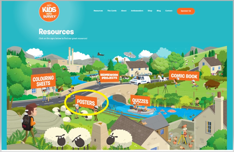
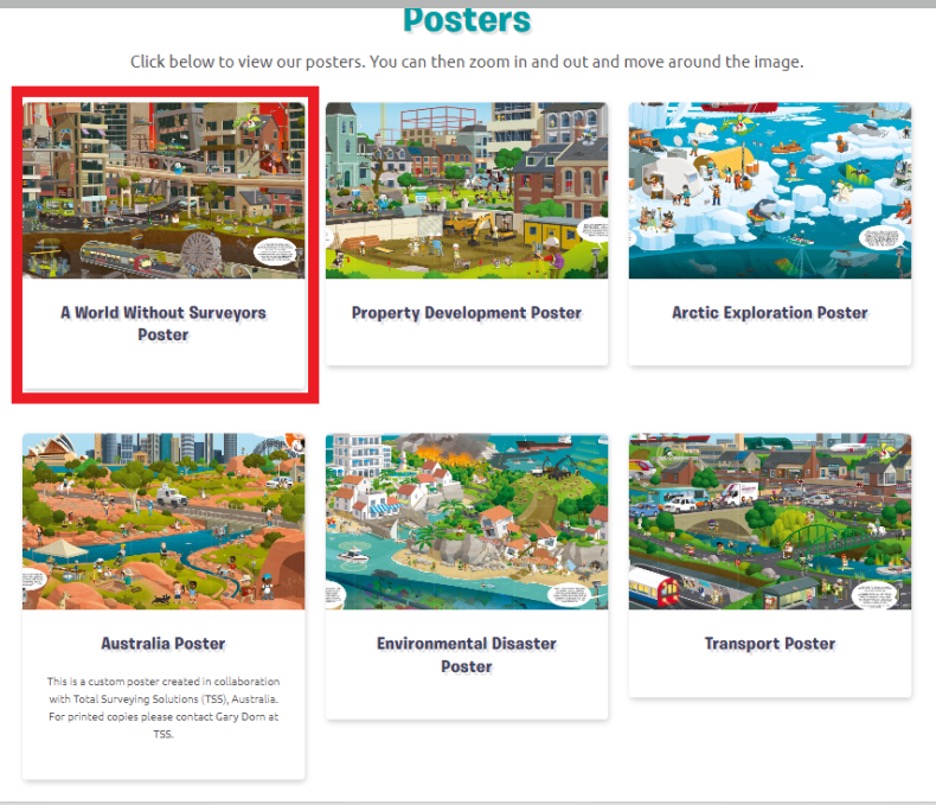
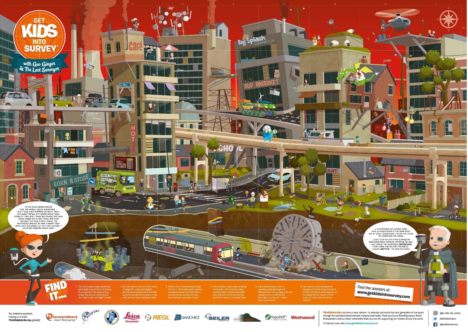
The website “Get Kids into Survey” provides materials focused on kids. The website states: “Bringing young people into the exciting world of survey through pioneering content and engaging experiences.” See the boxes titled “Get Kids into Survey Website,” “Get Kids into Survey Website – Poster Page,” and “Get Kids into Survey Website – World Without Surveyors Poster.”
Get Kids into Survey Website
Screenshot: Get Kids lnto Survey
Get Kids into Survey Website – Poster Page
Screenshot: Get Kids into Survey
Get Kids into Survey Website – World Without Surveyors Poster
Screenshot: Get Kids into Survey
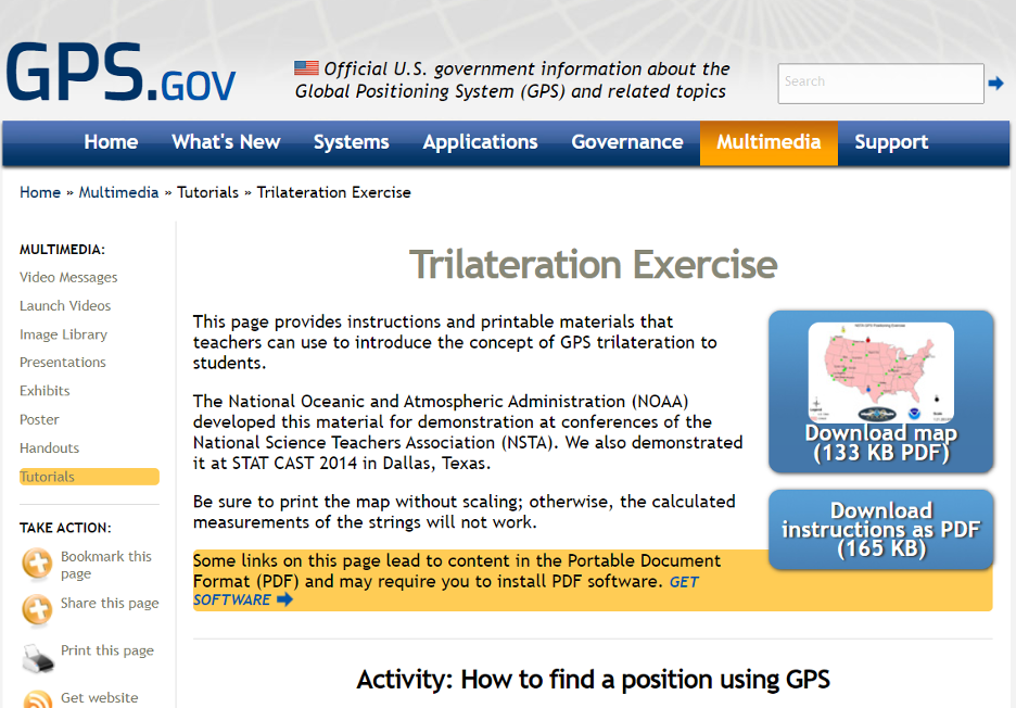
The GPS.gov website has lessons describing GPS that are designed for kids. One lesson introduces the concept of GPS trilateration. The lesson explains how GPS positioning works on two basic mathematical concepts:
trilateration, which literally means positioning from three distances, and
the relationship between distance traveled, rate (speed) of travel, and amount of time spent traveling.
This was developed by NGS for a National Science Teachers Association Conference. You can download both the instructions and map.’
GPS Trilateration Lesson
Screenshot: GPS.gov website
The following are several videos that describe the concept of trilateration.
This video explains trilateration and how the GPS ranges (distances from the satellite to the receiver) are computed.
This video uses distances on a map to describe trilateration.
Here is a detailed description of trilateration and why you need the fourth satellite.
Now, let’s look at some free online lessons and tutorials that describe the concepts associated with geodesy. As previously stated, some of the online videos are at a level for young audiences, and some are aimed at individuals with more advanced education. Most of them describe the concepts using diagrams with narratives, and without complex math equations. NGS provides a number of videos that can be downloaded here.
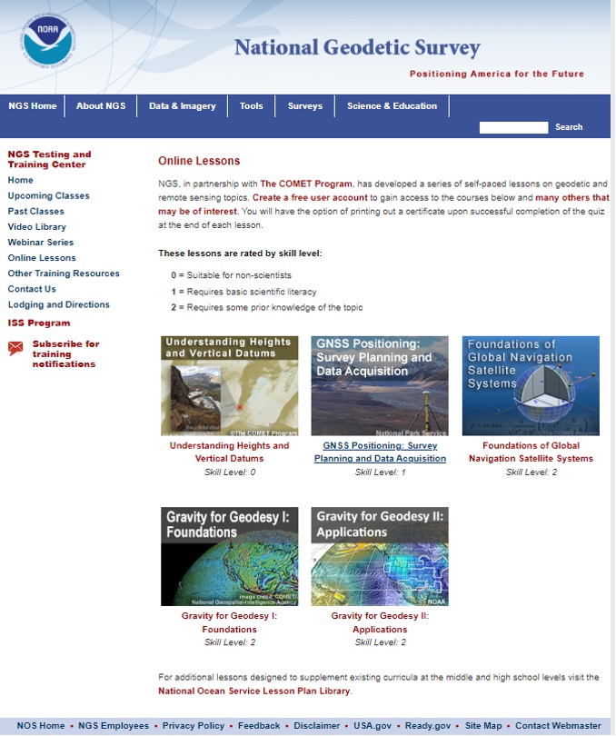
NGS, in partnership with the COMET program, has developed a series of self-paced lessons on geodetic and remote sensing topics. Users have to create a free user account to gain access to the courses. Users will have the option of printing out a certificate upon successful completion of a quiz at the end of each lesson.
The lessons are rated by skill level ranging from “Suitable for Non-Scientists” to “Requires some Prior Knowledge of the Topic.”
The COMET program provides teaching and training resources for the geoscience community. All of the content is completely free, but an account does need to be created. The COMET program is part of the University Corporation for Atmospheric Research (UCAR) Community Programs.
NGS Online Lessons
Screenshot: NGS Website
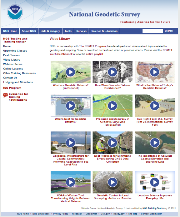
NGS and COMET Educational Videos
NGS also has a website that contains educational videos. Again, NGS, in partnership with the COMET Program, has developed short videos on topics related to geodesy and mapping.
NGS Educational Videos
Screenshot: NGS Website
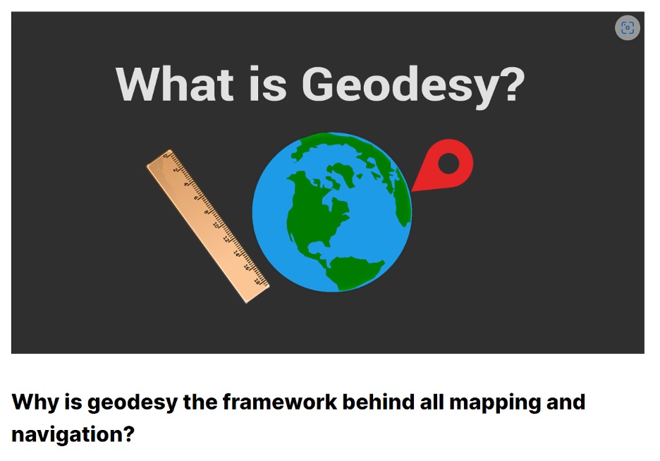
This link provides a tutorial on “Why is geodesy the framework behind all mapping and navigation?” The article states. “If you think about it, the whole field of geomatics lies on the shoulders of geodesists. Because it’s really geodesy that is the framework behind all surveying, mapping and navigation.”
What Is Geodesy?
Screenshot: Gisgeography Website
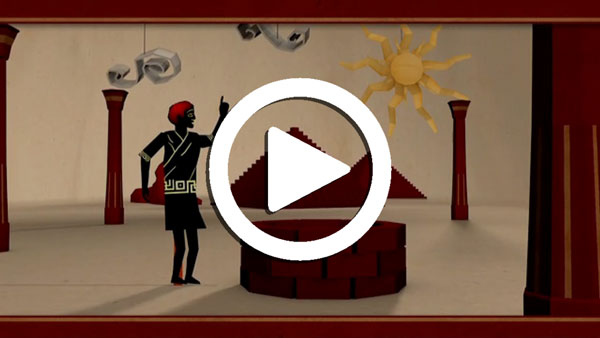
NASA’s Eratosthenes Estimating the Circumference of the Earth by Looking Down a Well
NASA offers a video titled “Looking Down a Well: A Brief History of Geodesy.” This video explains how it all started when Eratosthenes estimated the circumference of the Earth by looking down a well. It highlights how, over time, the field of geodesy has expanded and evolved dramatically, and how NASA uses technology such as radio telescopes, ground surveys, and satellites to contribute.
NASA’s Video on Looking Down a Well
UNAVCO Measures Plate Tectonics with Geodesy
UNAVCO, a non-profit university-governed consortium, facilitates geoscience research and education using geodesy. UNAVCO has a video that describes the tectonic plates and how geodesists measure their movements. Another UNAVCO video describes what geodesy actually is, as well as geodesy’s application in our everyday lives (UNAVCO’s 2017 USIP geoscience video production). Visit UNAVCO’s website to learn more about its mission.
Geodetic Software Tools
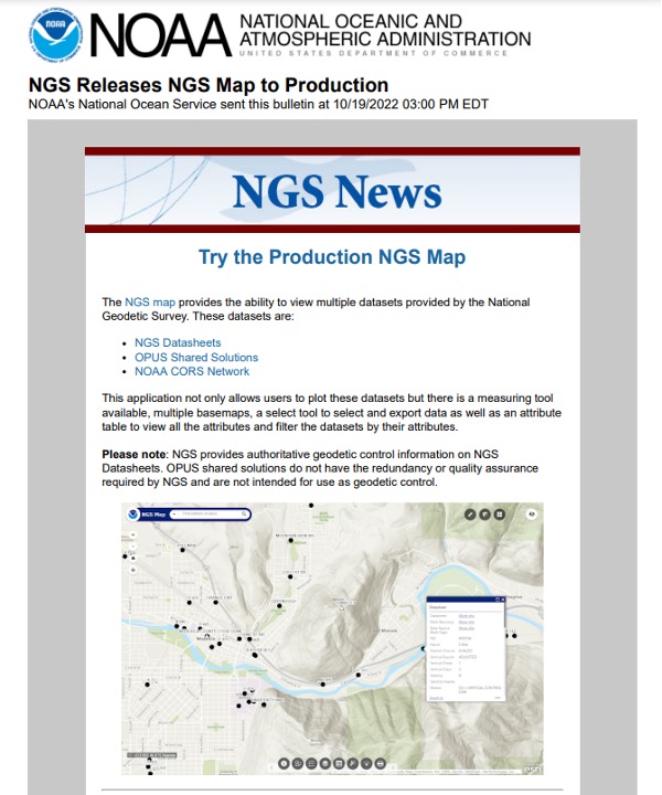
NGS provides tools that focused on meeting the needs of the surveying and mapping community. A few may be of interest to non-geodetic individuals. A map tool can be used to locate marks near someone’s location.
Production NGS Map
Screenshot: NGS Website
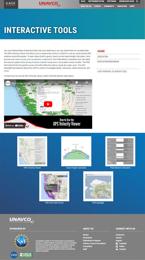
UNAVCO also has interactive tools that may be of interest to geospatial users. See the boxes below titled “UNAVCO Interactive Tools” and “UNAVCO Spotlight.”
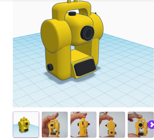
Now, let’s address the 3D printing of surveying equipment and tools. I’m not familiar with using a 3D printer, but I found several websites that provide information on surveying equipment. Some of the sites provide free information and others charge for their services. See the websites 3D Printer of Total Station and 3D Printer of GNSS Equipment.
3D Printer of Total Station
Screenshot: CULTS Website
3D Printer of GNSS Equipment
Screenshot: 3dmdb Website
I’m pleased a lot of people are interested in highlighting the discussion of the inverted pyramid. As commented by several individuals in the LinkedIn responses, the surveying and remote sensing (which includes photogrammetry) communities are experiencing the same crisis as geodesy. In my opinion, they are all related, because the surveying and mapping community provides tools other disciplines use.
As stated in my last column, the surveying and mapping community can do the following to help:
actively market geodesy in high schools as a rewarding career for the math stars before college entry
build back, support and sponsor geodesy programs at select universities; this support needs to be strategic with backing from the highest levels of the U.S. government
encourage U.S. government support in the form of grants, professional development of staff, and research collaborations/affiliations.
As previously mentioned, one of my goals has always been to get individuals (young and old) interested in obtaining a better understanding of geodesy. I hope this column helps to whet the appetite of some individuals to obtain a better knowledge of geodesy. Maybe even some high school and college teachers will introduce geodetic concepts in their lectures.
Writing about the geodesy crisis is a good first step, but we need to find champions that can influence high school and university teachers and administrators, federal and state government program managers, and congressional representatives.
Please feel free to email me at [email protected] if you have suggestions on how to lower the barrier of entry into the world of geodesy.
Earlier this year, we looked back at 2020 and reviewed how surveying has dealt with the worldwide pandemic while adapting to the new tools and technology being created. We discovered the need for surveyors did not diminish during this crisis, and in many places the demand has gone up significantly. Instruments, computers and measuring methods continue to increase in capability and complexity to help with the shortage of qualified field crews, yet we still need to expand our efforts to find the next generation of surveyors.
How do we find those future geospatial experts, data collectors and surveying professionals? The answer is right under our noses, and our current group of practitioners needs to get the word out.
What is the word, you ask?
Technology.
Younger generations understand technology better than most practicing surveyors. New devices, methods and operations are being invented at a fast pace, and our best and brightest should be considering using that technology in a rewarding career. Before we make the big pitch to them, however, we should refresh our understanding of recent surveying history to better understand why technology is a good thing.
How did we get here? A short historical look at measuring
The measurement methods, devices and instruments used by surveyors have radically changed in the past 50 years, and we have covered their evolution in past columns (Survey SceneMay 2016, May 2017 and Sept. 2019).
Instruments and devices used by surveyors vary in their function and output of information. Some are used to physically measure the distance from a stationary point to another, determine horizontal and vertical angles at a specific location, or determine grade differentials between various points. Other instruments are used to determine horizontal or vertical positions to establish locations and elevations. All these instruments are being used to gather positional data on any number of items, but the quality of the information may vary depending on the technology and method used. How?
Devices and methods for measuring distances
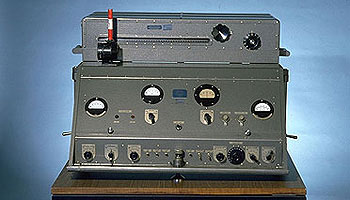
AGA Geodimeter NASM-2A. (Photo: NOAA)
Tools for measuring distances have been around for centuries. The Egyptians are famous for their “rope stretchers,” while early surveyors in Europe and the New Colonies were known to use the Gunter’s chain and a measuring wheel. In the early 1800s, steel tapes were invented to replace the chain. These measuring tapes continued to evolve well into the 20th century with varying metals, fiberglass and nylon-coated plastics.
In the mid-20th century, scientists and physicists began to experiment using light waves as a means of measuring terrestrial distances. These experiments led to the development of the first electronic distance meter (EDM), commercially produced by the Swedish company Svenska Aktiebolaget Gasaccumulator (AGA) in the early 1950s. Other methods of electronic measurement, including microwave and infrared wave technology, were also developed in the years following the introduction of the lightwave EDM.
For many years, the EDM was used independently from transits or theodolites to measure long distances. For those who needed to consistently measure long distances, the invention of the EDM was not just a time saver, but also provided much higher accuracy than manual measurements.
Other technologies were developed in the latter part of the 20th century, introducing the surveyor to laser scanning, but we can defer this topic until later in this column.
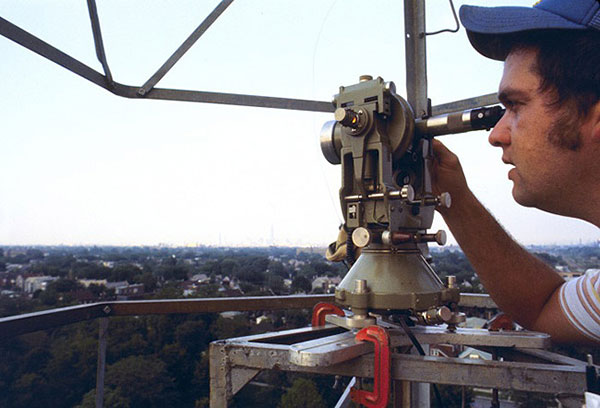
Devices for measuring angles
The T3 theodolite was introduced in 1925. With its 10.5-inch telescope, this theodolite had a range of up to 60 miles. It saw heavy use between 1952 and 1984. (Photo: NOAA)
The surveyor, like the astronomer, has consistently been at the forefront of developing optical instruments. The key has been combining high optical quality with a means of measuring horizontal and vertical angles within the instrument. The creation of the theodolite and the transit revolutionized the ability of the surveyor to accurately measure angles and apply trigonometric functions to determine mathematical computations. In addition, the surveyor’s compass was also developed to assist with angle measurement — with less accuracy but greater flexibility.
By the 1920s, optical theodolite technology was rapidly improving through the work of Switzerland’s Heinrich Wild. Beginning with the T2 and T3, these instruments provided accuracy and precision not previously available to the surveyor. Other manufacturers followed suit with similar instruments for the next several decades and were used in conjunction with the EDM for larger surveys. Anticipation grew with the competition to see which instrument company could marry the theodolite and the EDM into one easy-to-use, yet accurate, optical instrument.
Introducing the total station
By the late 1960s, technology had firmly entered the surveying world with a few electronic advancements. In 1968, Zeiss — a German company known for its lenses and optical systems — produced the first known tachymeter, combining a theodolite with an electronic distance meter. The tachymeter became better known as the total station, as it was capable of measuring angles and distances in one instrument. While somewhat crude and hard to use, the Elta 14 total station introduced the world to a future generation of surveying instruments that would revolutionize the field.
In the course of a few years, several manufacturers developed their own total stations. The biggest hurdle was combining the optics of the scope with the measuring axis of the EDM. By the end of the 1970s, most total stations were coaxial, therefore measuring angles and distances was done with one sighting.
Robotics were introduced in the early 1990s, with two servo motors to drive the horizontal and vertical movements of the total station. These movements were controlled remotely by the tracking system connected to the prism pole and data collector. Not requiring a human being to remain stationary and manually operate the total station provided cost savings and additional efficiency for the field crew.
Positions, everyone! Positions!
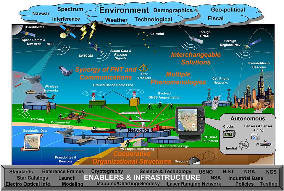
U.S. National PNT Architecture. (Graphic: U.S. Department of Transportation)
Positional measurement has revolutionized not just the surveying profession, but a large portion of everyday tasks as well. From monitoring travel times for your commute to providing your food-delivery driver with your location, position determination is the key element to these services. Satellite navigation is now the primary technology used for positioning, navigation and timing (PNT) and a big part of most aspects of surveying.
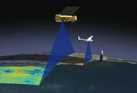
Remote sensing
Here is where we can discuss laser scanning and other remote sensing technologies. Remote sensing is the science and technology of gathering data from a distance. Traditionally this has been mostly done from aircraft, satellites and vessels. However, technology has expanded so that most practitioners now consider the use of laser scanning, lidar, photogrammetry, hyperspectral cameras, bathymetric sonar and simultaneous localization and mapping (SLAM) to be included in the category. Keep in mind that all these technologies are types of measurements; they are not the vehicle or instruments used for the measurement.
Image: NASA
These various sensor types can collect millions of data points in a short amount of time. While surveyors are adapting to working with point clouds and gigabytes/terabytes of data, it is a radical departure from our recent past using only total stations and GNSS receivers. Significant advancements in computer processing, data storage and programming have simplified the manipulation of point clouds, but they remain a challenging task for even newer surveyors to tackle.
Autonomous vehicles
Hobbyists have been building (and crashing) model airplanes and helicopters for many years. Most of the public does not realize that the big advancement in remote-control aircraft was the introduction of GNSS technology into the flight system. Sure, we all have GNSS receivers in our phones, but now to be included in our toys? This somewhat simple addition has turned unmanned aerial vehicles (UAV) into a revolutionary tool for several occupations, not just surveyors. More control and stability of the UAV means expanded uses for emergency personnel, utility providers, parcel delivery and much more. Being able to program a specific flight provides the UAV user with higher accuracy and precision, but it takes away the element of human control.
Image: Department of Transportation
Another vehicle gaining market share is the unmanned surface vessel (USV), used for performing hydrographic surveys. Like its UAV cousin, the USV is autonomous and is programmed to follow a specific route for greater accuracy and precision. Because of the shallow draft of a USV, it can be used in many areas deemed inaccessible by manned vessels.
An additional aspect of newer technology working with autonomous vehicles is collision avoidance systems. These systems have been implemented on newer UAVs and continue to improve, allowing their the use in tighter confines and spaces. By having a radar-based avoidance signal surrounding the entire UAV, collisions become less likely.
Geofencing is another advancement being implemented into more UAVs to help keep them from intruding into unauthorized spaces, by programming into their computer specific geographic areas that are off limits. UAVs are often also programmed to return to its takeoff location under certain circumstances.
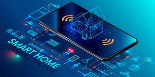
Other technological advances to consider
Image: State Department
How much technology do you have in your home and office? Probably more than you realize. While one may immediately think about a smart speaker or home automation system (Alexa, Echo, Nest, etc.), other components offer simple yet productive solutions.
Remote control systems enable you to check whether your doors are locked and your garage door is shut. If not, a touch of a button does the job. Motion sensors enable you to detect intruders around and inside the house, of course. Environmental sensors now monitor for water leaks, moisture and gas/carbon monoxide and provide alerts. How about home automation that utilizes robotic technology? The Roomba vacuum, automatic pool cleaners, and even window washing systems activated when dirt is recognized on your exterior windows are just some of the robotic devices in the modern home.
Precision agriculture utilizes autonomous vehicle control to increase the precision of planting, spraying and harvesting crops. This increase in efficiency has led to higher yields and lower operating costs for the equipment. Another market starting to see more interest is the robotic lawn mowers that functions like the Roomba vacuum. While significantly more expensive than manual mowers, they offer features that can be considered for trade-offs for your time. Depending on your location and needs, they can be set on timers to run day or night and return to base when their battery runs low.
Adapting today’s technology to tomorrow’s surveying tasks
Another relevant technology that does not fit into any of the topics above is the inertial measurement unit (IMU). These sensors are now routinely paired with GNSS receivers in UAVs to help them compensate for pitch and roll. Because of their small form factor, IMUs will increasingly be incorporated into other measurement devices.
It is also safe to say that more handheld devices and smartphones will include lidar scanning capability, as the iPhone 12 Pro and iPad Pro already do. Application and software developers are writing code to make use of data from these devices, so plan on other hardware makers following Apple’s lead.
Voice and motion control will continue to be integrated into data collectors and workstations. By minimizing physical entries into an input system, computers will begin to recognize patterns and automate procedures to increase efficiencies. Programmable voice commands during field data collection will activate various procedures (for instance, specific roadway cross sections or curb island locations) and walk the user through a predetermined set of steps. The possibilities are endless, but we should prepare to take advantage of the technology.
Enticing future generations into a geospatial career
Image: Digital.gov
A geospatial career is so much more than just being a surveyor. Our profession needs bright minds who see the world differently. What does that mean?
Most surveying and mapping tasks used to produce 2D deliverables on paper. Today’s geospatial technicians fly UAVs, use point clouds, draft existing conditions in 3D, and analyze data for future applications. By applying what they are learning with new devices, technologies and software platforms, our younger generations can help the surveying and geospatial profession evolve into a data-rich environment that helps facilitate change for our planet. These efforts can help with climate change, provide better data for our communities, and bring societies back together.
Our profession is much more than gathering data; it is helping to make our world a better place through better data analysis and knowledge. Who would not want that?
Sokkia has introduced a pair of software solutions for its total stations, robotics and GNSS rover systems — GeoPro Field and GeoPro Office.
Sokkia GeoPro Field software.
GeoPro Field provides a graphical user interface designed to collect field measurements for land surveying and construction activities.
“End-users needing a field tool to collect and import measurement data into design and drafting software will find GeoPro Field to be a fast and accurate method that will increase productivity with CAD functionality in the field,” said Ray Kerwin, director of global surveying products. “A key to GeoPro Field is its compatibility with various software workflows — point files are easily exported to third-party software.”
Sokkia GeoPro Office software.
Sokkia GeoPro Office is the office-processing complement to the field software — designed to clean, process, and analyze field data into its easiest-to-use form. “Users will immediately see the benefit in time saved, when compared to a variety of traditional manual methods,” Kerwin said.
The office software can also be expanded with an optional 3D and road design module, for further versatility to design roads with the processed field measurements.
“The Sokkia GeoPro Field and Office have user-friendly graphical interfaces, with simple in-field functions and office workflows. The user can get to work quickly due to the intuitive interface and simplicity of operation without the need for advanced training,” Kerwin said.