Tag: trackers

  • Antenova adds Agosti antenna for scaled-down GNSS designs

    Antenova adds Agosti antenna for scaled-down GNSS designs

    Photo: Antenova
    Photo: Antenova

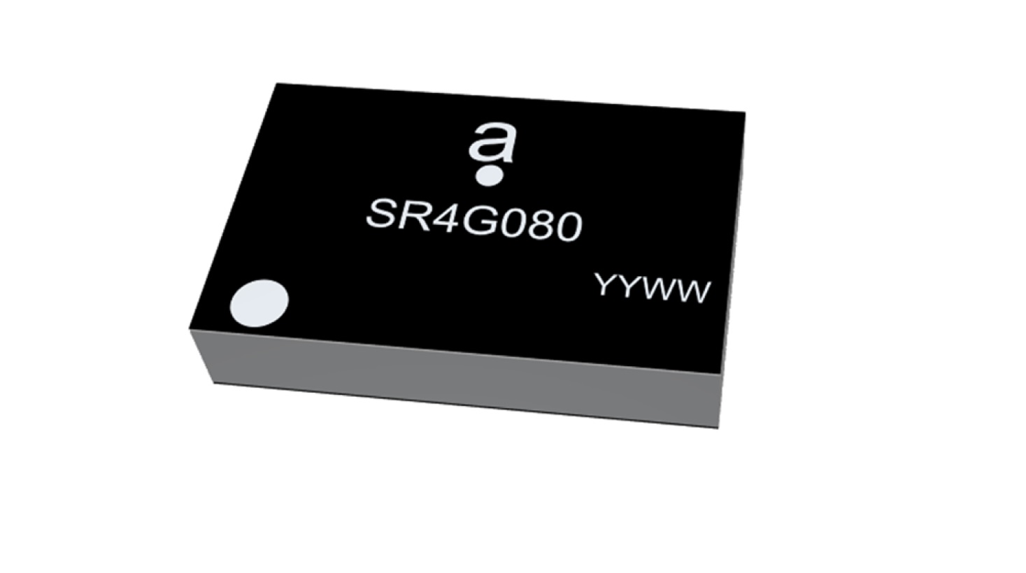
    Antenova Ltd. is adding a new offering to its range of miniature surface-mount-designed (SMD) antennas and modules for GNSS applications. The new antenna, Agosti (part number SR4G080), measures 9.0 x 5.8 x 1.7 mm and operates with exceptional efficiency in a reduced space on a corner of a printed circuit board (PCB).

    The key advantage of the Agosti antenna is its small ground-plane requirement. Most SMD antennas use the surface of the PCB around the antenna as a ground plane from which to radiate the signal — the ground-plane requirement, not the physical dimensions of the antenna, define the space it needs.

    Antenova’s radiated measurement results show Agosti operating well on small ground planes of 40 x 20 mm, 70 x 25 mm and 80 x 30 mm, making it a suitable choice for small form-factor designs, such as small wearable devices, trackers and on-board diagnostics (OBDs).

    Agosti is designed to integrate and co-exist with other antennas within the same device. OBDs and trackers often use 4G/LTE with A-GPS for fallback. The Agosti antenna has been tested with Antenova’s Pharoah antenna (part number SR4L073), which also has a very small ground-plane requirement. The two antennas have excellent isolation and can operate in close proximity to each other in a very small device without the 4G signal interfering with sensitive GNSS signals.

    “Small SMD antennas such as Agosti are an exciting alternative to the common delicate ceramic patch antennas used in GNSS designs,” said Michael Castle, product marketing manager, Antenova. “This is not just because the SMD antennas are significantly smaller. It is also because they provide omni-directional performance.

    “Patch antennas are typically 12 mm or 14 mm square, are heavier than SMD antennas, and need a much larger ground plane and keep-out area,” Castle said. “They also have to be placed in the center of a circuit board and only work well when they point at the sky. Antenova’s new generation of SMD antennas overcome all of these limitations and perform well regardless of position and orientation of the device.”

  • U-blox launches its smallest GPS module, the MIA-M10

    U-blox launches its smallest GPS module, the MIA-M10

    Photo: u-blox
    Photo: u-blox

    U-blox has announced its smallest GNSS module series to date, the u-blox MIA-M10.

    Built on the ultra-low-power u-blox M10 GNSS platform, MIA-M10 offers a power-efficient solution for size-constrained battery-powered asset tracking devices. The module targets an expanding market for people, pet and livestock trackers, as well as industrial sensors and consumer goods.

    The 4.5 x 4.5-mm form factor of the M1A-M10 allows developers to design more attractive and comfortable solutions, further driving the adoption of positioning technology in consumer and industrial solutions. The module offers ultra-low power consumption without compromising GNSS performance, the company said. Moreover, its power-save modes can double the battery life by optimally balancing position accuracy and power consumption.

    Like all u-blox M10 modules, the MIA-M10 concurrently receives four GNSS constellations (GPS, Galileo, BeiDou and GLONASS) for maximum satellite signal availability. Combined with its superior RF sensitivity, the module offers robust positioning performance for solutions with small antennas as well as for devices operating in weak signal environments such as deep urban canyons.

    Support for u-blox AssistNow assisted GNSS service, which delivers orbital data via the internet, cuts the time it takes the MIA-M10 to determine its initial position at startup, allowing it to immediately track satellites without having to wait for slow satellite data downloads to complete. And applications requiring extra-long power autonomy can use u-blox’s CloudLocate service, which extends the life of internet-of-things applications by offloading power-hungry position calculation to the cloud.

    The chip-sized, ready-to-use GNSS module requires no external components, reducing engineering and testing efforts, saving costs and resources, and speeding time to market.

    Two Variants

    MIA-M10 is available in two product variants.

    • The MIA-M10Q is for a growing market of highly size-constrained battery-powered tracking devices, wearable devices and highly dynamic applications such as small drones, cameras, bike computers and battery-powered sensors.
    • The MIA-M10C targets customers requiring more flexibility to combine the module with an active or custom antenna circuit.

    The MIA-M10 will be on display at the Sensors Converge and Embedded Technologies trade show in San Jose, California, at booth 1228. First samples will be available in July.

  • OneNav announces pureL5 GNSS digital IP core

    OneNav announces pureL5 GNSS digital IP core

    The PureL5 Customer Evaluation System is being tested by California and Chinese companies

    oneNav logoOneNav has announced the commercial availability of its pureL5 GNSS digital IP core.

    The pureL5 digital IP core’s architecture enables it to directly acquire and track L5 signals from GPS, Galileo, BeiDou, QZSS and GLONASS without any L1 aiding. This eliminates the entire L1 RF chain, saves space on the printed circuit board, and simplifies the RF front-end and antenna subsystem in smartphones, wearables and trackers.

    The pureL5 digital IP core’s massively parallel array processor searches the entire 1-millisecond L5 code space in parallel, delivering 1 second time to first fix (TTFF). The pureL5 digital IP core is 0.28mm2 in the 3-nm semiconductor process and consumes 4.7 mW of power in 1-Hz tracking mode.

    OneNav has delivered the pureL5 digital IP core register-transfer level (RTL) to its first system-on-chip (SOC) customer. IP core RTL verification and physical implementation are complete, and oneNav’s SOC licensee will tape out in the first quarter of this year. The pureL5 digital IP core RTL is available for customer licensing and shipment now.

    Customer Evaluation System. OneNav’s pureL5 Customer Evaluation System is being tested by companies in California and China. The system is available for smartphone and wearable OEMs and SOC providers who want to evaluate oneNav’s pureL5 in the field and the lab.

    PureL5 GNSS Features

    • Smaller footprint than L1+L5 hybrids, simplifying implementation in highly space-constrained devices such as 5G smartphones and wearables
    • Lowers bills of material (BOM) cost and simplifies the RF front-end and antenna subsystem by eliminating the entire L1 RF chain
    • No L1 aiding required: directly acquires L5/E5/B2 with 1-second TTFF
    • Less software complexity, simplifies RF coexistence engineering
    • Better interference resiliency
    • Scalable IP signal processing core is semiconductor process-node independent
    • Multi-constellation L5: Beidou, Galileo, GPS, QZSS, GLONASS.
  • Telit offers first L1+L5 module under collaboration with Sony

    Telit offers first L1+L5 module under collaboration with Sony

    Photo: Telit
    Photo: Telit

    Telit has launched the SE868SY-D multi-frequency, high-precision GNSS receiver module for applications that require high accuracy, fast updates, multi-constellation support and multipath resistance.

    At 11 x 11 mm, the SE868SY-D accommodates ultra-compact devices and IoT trackers.

    Available now, the high-precision SE868SY-D module is Telit’s first multi-frequency, multi-constellation GNSS receiver module, featuring an ultra-sensitive -167 dBm (tracking) RF front end. By using both the L1 and L5 bands, the SE868SY-D supplies a significantly higher location accuracy than single-frequency devices — even in high-multipath environments such as urban canyons, Telit said.

    This sub-1-meter precision is a major reason ABI Research expects more than 1 billion multi-frequency GNSS devices to ship annually by 2023.

    The SE868SY-D is the first product from a new strategic collaboration between Sony and Telit, and features Sony’s next-generation CXD5610 GNSS receiver large-scale integrated circuit (LSI).

    The Telit SE868SY-D is designed for battery-powered applications such as IoT trackers and wearables. With less than 45 mW in L1+L5 tracking mode, the module has low power consumption, despite using both L1 and L5 bands.

    For high-dynamic applications, the SE868SY-D a high update rate of up to 25 Hz. Its high-accuracy, one-pulse-per-second signal also makes the module suitable for timing applications.

    “With the new SE868SY-D, Telit is uniquely prepared to meet the burgeoning global demand for multi-frequency, multi-constellation GNSS receivers for IoT trackers, wearables and more,” said Eric Lagorce, Telit business development director. “The SE868SY-D also perfectly complements Telit’s two decades of GNSS expertise and its broad portfolio, and highlights the potential of our strategic collaboration with Sony.”

    The Telit SE868SY-D provides pin-to-pin compatibility for applications based on Telit’s legacy GPS module JF2 and GNSS module SE868V3.

  • YIC offers low-power GPS/GNSS module for internet of things

    YIC offers low-power GPS/GNSS module for internet of things

    YIC logoYuechung International Corp. (YIC) is offering a GPS/GNSS module for internet of things (IoT) applications.

    YIC is a manufacturing and design company for quartz crystals, crystal oscillators, GPS/GNSS modules, GPS/GNSS receivers and RF antennas. It provides low-power solutions to solve product problems that require frequent charging.

    YIC’s new product — the Ultra Low Power GPS/GNSS Module (Model YIC71009EBGG and YIC71513PGMGG) — is designed as an IoT product solution, targeted to improve the operating times of IoT applications such as trackers, wearables and portable devices.

    According to its press release, YIC “is dedicated to providing the best solution for GPS devices and sees a tremendous opportunity in the GNSS market to solve power consumption problems.” The recent industry trend of multi-frequency GPS, low-power consumption, and dead reckoning will be advantageous to YIC in terms of high-grade products entering the global market.

    Models YIC71009EBGG and YIC71513PGMGG provide:

    • Ultra-low power consumption – 6mA (Typical).
    • Multi-constellation – GPS/QZSS + GLONASS.
    • Small size

    About YIC

    Founded in 1994 and headquartered in New Taipei City, Taiwan, YIC is a professional partner in frequency control, GPS/GNSS modules, receivers and RF antennas, advanced low power GPS, and small size solutions.

  • Kolmostar releases low-power GNSS module JEDI-200

    Kolmostar releases low-power GNSS module JEDI-200

    JEDI-200 reduces the energy of getting one position fix by up to 150 times, according to the company.

    Photo: Kolmostar
    Photo: Kolmostar

    Kolmostar, a positioning technology company, has launched an ultra-low-power GNSS module at IoT World, which took place May 13-16 in Santa Clara, California.

    JEDI-200 reduces the energy for one position fix by up to 150x compared to traditional GNSS sensors, providing a positioning solution for location-based internet-of-things applications, the company said.

    JEDI-200 specification highlights include:

    • 10-mW ultra-low-power consumption (measured) @ 1 Hz navigation rate
    • 1-second ultra-fast time to first fix from cold start
    • 2-meter CEP high positioning accuracy
    • Supports GPS and Beidou constellations
    • 100-byte compressed ephemeris (EPH) to enable A-GPS with speedy download via LPWAN technologies such as LoRaWAN and NBIoT
    • High-performance cloud computing based on 50-byte raw position files for optimized radio transmission efficiency and minimum endpoint power consumption
    • Integrated SAW filter, stand-alone LNA and TCXO
    • 12 x 16 millimeter form factor for easy RF integration

    “JEDI-200 supports GPS as well as Beidou constellations,” said Tao Tong, co-founder and CEO of Kolmostar. “While achieving industry’s lowest power consumption, it helps our customers to achieve high accuracy even in dense urban canyon environment where existing GNSS modules on the market often drift due to multipath and other errors.”

    The JEDI-200 is designed specifically for IoT applications such as human and asset trackers (for bikes, scooters, vehicles, cargo, livestock, pets and more), smart wearables, smart farming and infrastructures,.

    Its reduced level of power consumption and its optimized efficiency with LPWAN technologies solve IoT endpoint deployment’s pain-point of needing frequent recharges or a large battery, enabling new possibilities in location-based IoT applications.

  • STATSports, Taoglas hit the field with GNSS trackers

    STATSports, Taoglas hit the field with GNSS trackers

    The Apex tracker has Taoglas inside. (Photo: STATSports)

    When the world’s best athletes take the field, many are equipped with a GPS-based performance monitor that tracks a wealth of data. By monitoring in real time the players’ actions, professional sports teams can collect and analyze data that gives them an edge over the competition.

    STATSports is a provider of GPS player tracking and analysis solutions for some of the biggest sports franchises in the world. Teams in the English Premier League, La Liga, National Football League, National Basketball Association and other leagues rely on STATSports to help them improve performance and strategy, and reduce injuries.

    Tracking Key Metrics. STATSports’ Apex System includes the Apex Pod and Apex Software. The Apex Pod is an ergonomically designed unit that curves to fit players’ backs. The pod is inserted into a specially designed vest or base layer.

    It tracks a variety of metrics, including a player’s total distance, speed, accelerations, decelerations, heart rate, fatigue level and other variables that teams can use in real time or alongside post-game reviews. The data is processed through Apex Software, which creates reports and visual tracking mechanisms to compare players, track players over time and provide metrics personalized for each team.

    A tablet app gives coaches portable functionality. (Photo: STATSports)

    Apex Live Streaming uses multiple channels and synchronized mesh networking to deliver data streams from players to Apex Software for analysis. Apex delivers GPS speed and positional data; heart-rate variability; and digital compass, gyroscopic and accelerometer data. It transmits half a million numbers every minute during training and games for a squad of more than 30 players.

    Accurate Antenna

    In devices so small and sensitive, antennas can be the most common point of failure in the communications chain, said Dermot O’Shea, co-CEO of Taoglas. STATSports evaluated several antenna options before selecting Taoglas.

    Taoglas’ 25×25-mm AGGBP.25B is a two-stage 28-dB active GPS patch antenna module that provides positional accuracy in a small form factor.

    With a few dozen players and coaches on the field in training and at games, highly accurate positioning is critical. Players move quickly and are often clustered around a ball, making it difficult to accurately track player movement. STATSports required location accuracy within 1 meter, precision that
    Taoglas delivered.

    The LA Galaxy team uses STATSports. (Photo: LA Galaxy)

    Because the STATSports technology captures data in real time, teams can make real-time tactical and strategic decisions and adjustments instead of waiting for post-game analysis.

    However, with that many antennas and transmissions in close proximity, interference can be an issue. Taoglas’ solution includes a front-end surface acoustic wave (SAW) filter in front of the two-stage low noise amplifier (LNA) to reduce out-of-band noise, such as signals from nearby cellular transceivers.

    The real-time nature of STATSports’ solution means the company also requires a condensed time to first fix — when the devices are turned on, STATSports needs them to register a signal quickly and begin to receive data. The Taoglas antenna is ready within 30 seconds of powering on.

    STATSports’ proximity to Taoglas’ Wexford, Ireland, headquarters and development labs means the teams can collaborate on new functionality as STATSports develops increasingly advanced performance-tracking solutions.

  • ESNC winner Sensolus keeps Antarctic scientists safe

    Scientists will now wear safety trackers from a Belgium start-up company while working in Antarctica.

    Antarctica is the coldest, windiest and harshest location on Earth. Temperatures can reach –90°C during winter and go down to –20ºC during summer. Winds can reach 250 km/h and visibility can sink to almost zero during whiteouts. With the potential for rapid changes in weather, all outdoor activities must always be done with the greatest care.

    Carrying a SticknTrack location tracker in the pocket from Sensolus, a start-up company from ESA’s Business Incubation Centre in Flanders, will help to keep the researchers safe. The same sensors will also be used to track skidoos, sledges and other equipment used.

    StickNTrack’s developers took third place in the 2014 European Satellite Navigation Competition (ESNC), after taking first in the Flanders regional competition. It also won the European Space Agency’s Innovation Award. The product debuted in August 2015.

    The Belgian Polar Secretariat, Sigfox and Sensolus announced an agreement in January to connect the 2016 Belgian Antarctic Research Expedition to the global Sigfox Internet of Things network.

    “This partnership will allow us to test technology that could be useful for the safety of our operations in Antarctica,” said Rachid Touzani, director of the Belgian Polar Secretariat.

    The expedition includes specialists in glaciology, climatology and geomorphology in charge of various Belgian and international scientific projects. They are hosted at Belgium’s Princess Elisabeth Research Station, 200 kilometers inland in the 2.7 million square kilometers region of Antarctica known as Queen Maud Land.

    The station — designed, built and operated by the International Polar Foundation — is the first polar base that combines eco-friendly construction materials, clean and efficient energy use, optimization of the station’s energy consumption and clever waste management. It can support up to 40 people during the brief Antarctic summer of November to February.

    The team members will work within 40 kilometers of the base and, for the first, 45 GPS-based Sensolus trackers connected to the Sigfox network will allow realtime tracking of their movements, in the often-extreme weather conditions.

    Sigfox ultra-narrow-band communications will secure the link to two antennas at the base station. The information will also be sent to Belgium.

    “Having our extremely battery-efficient StickNTrack GPS trackers at the Princess Elisabeth station is very exciting,” said Sensolus CEO Kristoff van Rattinghe. “We strongly believe that sustaining missions like this is the kind of real innovation we can achieve with the Internet of Things. And this is only possible through strong collaborations like the one set up for this mission.”

    The first results on the contribution of the Sensolus and Sigfox technology to the expedition will be released in March.