Tag: Trimble Connect

  • Trimble Connects 10 million with collaboration platform

    Trimble Connects 10 million with collaboration platform

    Driven by COVID-19, the uptick in adoption supports collaboration among remote workers as businesses adapt.

    The Trimble Connect cloud-based collaboration platform has surpassed 10 million users. In response to COVID-19, distributed working has intensified the need for teams to share information and collaborate remotely, leading 1.2 million users to join Trimble Connect in March and April alone.

    To date, Trimble Connect has hosted more than 80,000 design and construction projects, making it possible for people to collaborate and work together from anywhere in the world.

    Photo: Trimble
    Photo: Trimble

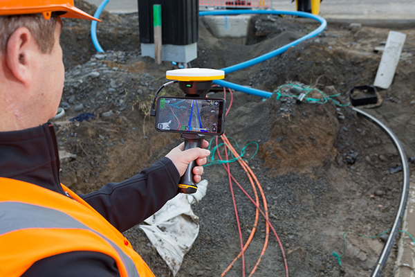
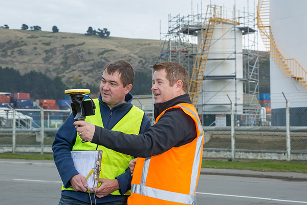
    Trimble Connect is an open collaboration platform for design and construction that connects project stakeholders with the data they need to inform decisions and improve team efficiency. Project stakeholders can share, review, coordinate and comment on data-rich constructible models, schedules and critical project information in real time — reducing costly miscommunication and improving coordination to keep projects on time and on budget.

    In addition to adding new users, the activity on Trimble Connect has shown a considerable increase in collaboration for businesses in the architecture, engineering and construction (AEC) industry.

    The number of invitations to collaborate on projects increased 58% in April over the previous month, indicating that users are adjusting to new remote and distributed working dynamics and enabling teams to stay resilient, despite interruptions to their traditional daily routines.

    “This is an exciting milestone for Trimble Connect,” said Ray Bagley, business area director for Trimble Connect. “Businesses in the AEC industry need an open, common data environment that allows project stakeholders to unlock the real value of building information modeling (BIM), civil construction and geospatial data. The increased adoption of Trimble Connect in recent months shows us that businesses need reliable, open collaboration more than ever before.”

    Trimble Connect’s open API enables data-flow to and from a variety of applications and allows users to customize workflows by integrating with existing enterprise solutions. Users can access project files stored on Trimble Connect directly through a wide range of solutions, including Tekla Structures software, Trimble Access field software, Trimble FieldLink layout software, SketchUP 3D modeling software and ProjectSight  construction management software as well as third-party applications.

  • Trimble handheld AR SiteVision takes data visualization outdoors

    Trimble handheld AR SiteVision takes data visualization outdoors

    Photo: Trimble
    Photo: Trimble

    Trimble has introduced its Trimble SiteVision system, an outdoor augmented reality (AR) solution that enables users to visualize 2D and 3D data on virtually any project site with cellular or internet connectivity for easier and more efficient planning, collaboration and reporting.

    Combining hardware and software in an integrated, lightweight handheld or pole-mounted solution, users can view 3D models and assets in a real-world environment at a 1:1 scale, from any angle or position.

    The system consists of:

    • Hardware: The Trimble SiteVision integrated positioning system integrates the Trimble Catalyst DA1 antenna, electronic distance measurement (EDM) rangefinder and power management into a lightweight, handheld device that connects to a user-supplied Android mobile phone.
    • Software Subscription: Available to single users on a monthly or yearly basis. The SiteVision software subscription combines Trimble’s high-accuracy positioning services and cloud-based processing technology to create a centimeter-accurate AR system. The system leverages Trimble cloud-based processing to manage and deliver data and design models.


    SiteVision enables users to visualize digital models from a wide range of data collection, design and constructible modeling tools in open industry-standard formats including IFC and LandXML.

    For civil projects, SiteVision accurately visualizes data from Trimble’s Quantm, Business Center and Novapoint; design data from Civil 3D and Bentley OpenRoads; and GIS data from Esri ArcGIS software.

    Photo: Trimble
    Photo: Trimble

    SiteVision powers building information modeling (BIM) projects with open data from Trimble’s Constructible BIM solutions including SketchUp and Tekla, and BIM data from Autodesk Revit and AutoCAD software. For utility companies, PLS-CADD power line design, Distribution Design Studio (DDS) and other industry-specific design data is also supported.

    Using Trimble Connect cloud-based hosting, SiteVision can access models from all stages of the lifecycle of infrastructure and buildings—from initial concepts of roads or buildings through the operations and maintenance phase of the assets—to increase collaboration, enhance work accuracy and ultimately improve operations and utilization.

    SiteVision simplifies complex concepts by allowing users to blend digital content with real-world environments. For example, city planners can visualize a new building design in the exact spot it is to be erected, a work crew could identify the exact position of underground cables or pipes before digging, an electric utility can confirm placement of poles and lines with customers and crews, or a construction supervisor could assess the progress of heavy equipment by visualizing actual work performed against the site plan.

    “It’s easier to understand complex ideas when we can see them in a real-world context,” said Mark Nichols, general manager at Trimble. “SiteVision improves our understanding of projects and worksites with a handheld device that is accessible to a wide range of users. Augmented reality is now ready for everyday use in a wide range of applications.”

    Trimble SiteVision is available to order now through Trimble’s authorized distribution channels for Civil Engineering and Construction, Geospatial and Buildings.

  • Trimble Enhances Cloud-based Software for Smart Water Infrastructure

    Trimble has introduced the latest version of its smart water infrastructure mapping and work management software — Trimble Connect version 1.8. The latest release of the cloud-based, geographic information system (GIS)-centric software includes a suite of applications that allow water, wastewater and stormwater utilities to visualize and efficiently manage their network maintenance and data collection activities.

    Trimble Connect software leverages Trimble’s GNSS rugged mobile devices and Esri’s GIS technologies to accurately map, locate and assess the condition of critical infrastructure assets, allowing utilities to keep their field infrastructure data up-to-date and accurate. Offered as a software-as-a-service (SaaS) subscription, the solution allows users to monitor asset operating conditions, manage leak repairs, reduce non-revenue water, deploy and inspect smart meters, lower potential threats to safety and health due to contamination and adhere to regulators’ reporting guidelines and requirements. Trimble Connect version 1.8 can be configured and deployed quickly on a variety of Trimble and non-Trimble mobile devices, laptops, tablets and smartphones, including Apple iPads, iPhones, Android, Windows and Windows Mobile devices to automate field workflows and eliminate paper-based maps.

    Trimble Connect utilizes the latest Esri ArcGIS 10.2.2 for Server, Mobile and ArcGIS Online basemap services. The software is designed to automate a variety of specific water and wastewater industry workflows through individual “apps” offered within the product and as part of a subscription. The new version provides standard core apps including Map Book, Manhole Inspector, Leak Repair, Hydrant Inspector, Valve Inspector, Meter Changeout, Incident Repair, Water Mapper, Wastewater Mapper and Stormwater Mapper. In addition, an optional partner app developed for American Flow Control (AFC) hydrant and valve data collection, “AFC Mapper,” can be purchased from AFC and their distributors for use with Trimble rugged handhelds.

    In addition to the standard core apps, Trimble Connect version 1.8 includes:

    • Full offline mobile support including GIS data for Android, iOS, Windows Mobile and Windows 7/8 platforms
    • Esri ArcGIS Online (AGOL) support to create and share Web Maps using data collected in Trimble Connect
    • Work management support for single and multi-asset work orders on all supported platforms
    • Enhanced workflows for asset inspection and condition assessment
    • Embedded business rules to define failed inspections or ones that need review
    • Enhanced workflows for asset mapping and data collection
    • Support for the Trimble Geo 7 series rugged mapping handheld and integrated Laser Rangefinder
    • Standard dashboards with each of the core apps