Tag: Tristan Allouis

  • Latest YellowScan lidar system designed for UAV surveys

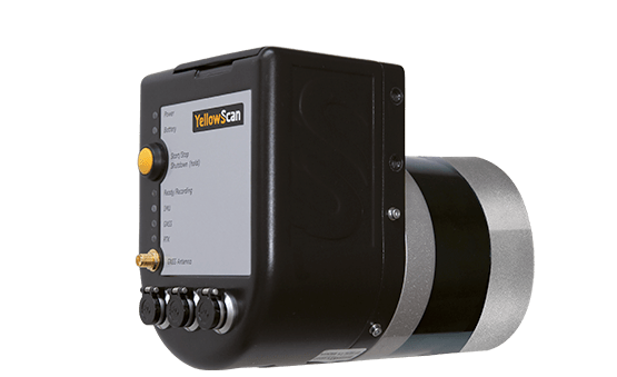
    YellowScan has launched a new lidar system, the Surveyor Ultra. It integrates the Velodyne VLP-32C scanner and the Applanix APX-15 GNSS/inertial measurement unit (IMU).

    With high density (600,000 shots per second), the system is suitable for high-speed UAVs and long-range needs (maximum range: 100 meters). Its light weight (1.7 kg) makes it easy to mount on any drone, including vertical takeoff and landing (VTOL) UAVs.

    As for all YellowScan lidar systems, the Surveyor Ultra is a turn-key system fitted for under vegetation 3D modeling and fast data processing, the company said.

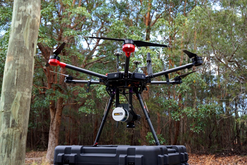
    Applications such as forestry, archeology and environmental research will benefit from Surveyor Ultra, as they require long-endurance flights high above trees or over rocky mountains and rugged terrain.

    “The Surveyor Ultra shows great potential to safely and efficiently operate lidar on lightweight fixed-wing UAVs,” said Tristan Allouis, YellowScan CTO. “The Surveyor Ultra completes our product line, including the successful Surveyor Lidar System (integration of the VLP-16 scanner from Velodyne).”

  • Velodyne partners with YellowScan for UAV lidar system

    Velodyne partners with YellowScan for UAV lidar system

    Velodyne Lidar Inc., maker of 3D vision systems for autonomous vehicles, is partnering with YellowScan to integrate its VLP-16 Puck and VLP-16 Puck LITE lidar sensors into YellowScan’s Surveyor.

    The result is a turn-key and reliable lidar system for demanding UAV applications, the companies said.

    Real-time lidar systems for UAVs are used around the world for industrial and scientific applications, including surveying, civil engineering, archeology and environmental science.

    By combining its LiveStation app with the real-time 3D data capture capabilities of Velodyne’s VLP-16 Puck and VLP-16 Puck LITE sensors — both of which feature a 360-degree horizontal field-of-view, 100-meter range, and weigh 830 grams and 590 grams, respectively — YellowScan delivers a turn-key surveyor system that can be mounted to any drone for short-time data processing needs.

    The result is a real-time in-flight lidar monitoring platform, with users able to see how the final map is being generated in real-time during the drone mission, and the basic map datasets available immediately after the mission.

    “YellowScan is known for its commitment to providing reliable and easy to use sensing solutions for the UAV industry, which make the VLP-16 Puck sensors an easy choice for the Surveyor system,” said Erich Smidt, executive director, Europe, Velodyne Lidar. “The VLP-16 Pucks are some of our newest offerings, with significant effort put into reducing weight while maintaining the resolution and reliability expected of Velodyne’s industry-leading lidar sensors.”

    “YellowScan Surveyor, the turn-key lidar solution integrating Velodyne’s advanced VLP-16 sensor, enables mapping professionals to do more in less time thanks to tremendously high density and accurate measurements acquired from UAVs,” said Tristan Allouis, CTO of YellowScan.