Tag: U-space

  • Unifly & Nexova complete NAVISP phase to advance cyber-resilient U-space operations

    Unifly & Nexova complete NAVISP phase to advance cyber-resilient U-space operations

    Unifly, in cooperation with Nexova, have successfully completed the SecureUTM 2 Phase I under the European Space Agency’s (ESA) NAVISP program, with emphasis on mitigating GNSS jamming and spoofing.

    The project establishes a certification-aligned, risk-driven cybersecurity foundation for secure, resilient and scalable unmanned traffic management (UTM) and U-space services across Europe. 

    As drone operations grow in complexity and cross-border interoperability, cybersecurity is becoming essential for operational continuity and public trust. SecureUTM 2 embeds cybersecurity engineering into the core architecture of UTM systems, aligning with European U-space regulations, Common Criteria methodology and ENISA risk frameworks. Security is treated as a foundational design principle rather than a late-stage compliance requirement. 

    Building on SecureUTM 1, SecureUTM 2 Phase I significantly expanded the cybersecurity baseline for UTM systems. Key outcomes include: 

    • Refinement of a harmonized Protection Profile (PP) for UTM 
    • Development of an updated Security Target (ST) for the Unifly platform 
    • Structured risk assessment and certification-aligned gap analysis 
    • Definition of a secure architectural baseline addressing real-world U-space complexity 
    • Setup of a PoC Testbed 

    Risk-based engineering roadmap

    A control-by-control gap assessment translated cybersecurity requirements into a prioritised implementation roadmap. Focus areas include: 

    • PNT source authentication and plausibility checks 
    • Enhanced session integrity and transport protection 
    • Denial-of-Service resilience 
    • Device-level authentication and auditing 
    • Secure storage and encryption 

    This structured approach supports operational deployment and future EU cybersecurity certification readiness. 

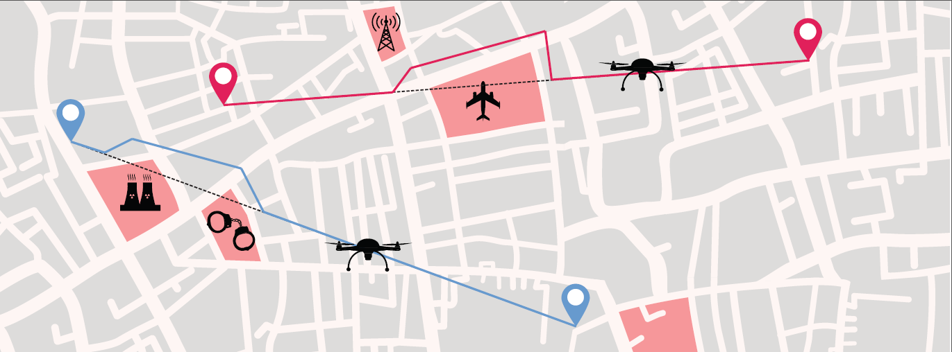
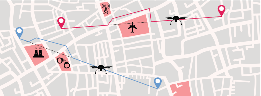
    Validated mitigations for GNSS and PNT threats

    SecureUTM 2 phase I placed strong emphasis on GNSS jamming and spoofing risks increasingly observed in drone operations. Practical, layered mitigations were validated through a dedicated U-space proof-of-concept testbed with Hardware-in-the-Loop UAV simulations. 

    Validated measures include: 

    • On-board GNSS jamming detection 
    • Fleet-level interference inference 
    • Trajectory plausibility and conformance monitoring 
    • OSNMA-based message verification 
    • Structured anomaly logging and alerting 

    The testbed enables repeatable attack simulation, KPI-based evaluation and regulator-ready evidence generation. 

    Foundation for Phase II and European deployment

    Phase I also delivered a structured U-space testbed blueprint, verification methodologies and digital twin foundations to support continued validation, operator training and continuous cybersecurity testing. 

    SecureUTM 2 directly supports Belgium’s U-space deployment strategy and strengthens its position in secure drone integration. 

    Phase II will focus on implementing prioritised controls, expanding validation capabilities and further aligning with EU certification frameworks. 

  • EHang to test Europe’s EGNOS for air-taxi VTOL flights

    EHang to test Europe’s EGNOS for air-taxi VTOL flights

    EHang deployed its EH216 eVTOL for flight trials in Europe including the recent Air Mobility Urban-Large Experimental Demonstration. (Photo: EHang)
    EHang deployed its EH216 eVTOL for flight trials in Europe including the recent Air Mobility Urban-Large Experimental Demonstration. (Photo: EHang)

    EHang will deploy its EH216 autonomous aerial vehicle in a European Union-funded project that is assessing how the European Geostationary Navigation Overlay Service (EGNOS) could be used for electric vertical-takeoff-and-landing (eVTOL) aircraft operations.

    The fully autonomous, all-electric vehicle will be used for flight trials at Lleida-Alguaire Airport in Spain as part of the Satellite Based Augmentation System Adoption in Multicopter VTOL Aircraft (SAMVA) program.

    As part of an initiative of the European Union Agency for the Space Programme (EUSPA), the SAMVA project is tasked with establishing how EGNOS could support planned air mobility services, including eVTOL air taxi flights. It is also intended to prepare for uncrewed vehicles to use the new U-Space concept for managing autonomous or remotely piloted aircraft.

    Aeroports de Catalunya will help China-based EHang to establish an operational center at its Lleida-Alguaire facility in the Catalonian region of northeast Spain. The EH216 will use the EGNOS technology to conduct unmanned traffic management (UTM) tasks and to demonstrate how eVTOL aircraft could operate in urban environments, including to and from airports.

    EHang is working to achieve Chinese certification for the two-seat EH216, which it intends to deploy with partners and customers for services such as air taxi and sightseeing flights. It also aims to get approval for its aircraft to operate in Europe and has been active in other air mobility partnerships in Europe, where it has provisional customers in places like Norway.

    In October, EHang completed its participation in the European Union’s Air Mobility Urban-Large Experimental Demonstration (AMU-LED) with a series of flight tests in Spain. The company — one of 16 consortium members in the AMU-LED program — demonstrated the EH216 at the Rozas Airborne Research Center, which is part of Spain’s National Institute of Aerospace Technology.

    “The SAMVA project will unleash EGNOS capabilities aboard EHang’s EH216 AAV to provide precise and integral navigation guidance and support U-Space airspace integration,” said Victoria Jing Xiang, the company’s chief operating officer for Europe and Latin America. “Our participation in this project reflects the meaningful progress we’ve made overseas with our strong technologies as our global footprint expands.”

  • M3 Systems, Pipistrel and Volocopter complete air traffic tests in France

    M3 Systems, Pipistrel and Volocopter complete air traffic tests in France

    The flight test is the third of several to simulate a variety of real-world scenarios that demonstrate how UTM and ATM intersect with multiple aircraft types.

    M3 Systems, Pipistrel and Volocopter have completed their first joint flight test campaign in France at Pontoise airfield.

    The week-long flight tests simulated three different avoidance maneuvers in real-world situations where unforeseen circumstances occur, such as a complete airport or vertiport closure, an unavailable final approach and takeoff area, and traffic deconfliction.

    M3 Systems was created from engineering activities in GNSS and consulting activities in air traffic management (ATM), including for uncrewed aircraft. M3 played a role in Galileo signal definition, among other projects for Europe’s various space agencies. Pipstrel is a light aircraft manufacturer specializing in electric propulsion, and Volocopter specializes in urban air mobility (UAM) systems.

    The joint campaign among the three companies — with French partners Groupe ADP and its subsidiary Hologarde — aimed to achieve smooth interaction within and between the new lower airspace’s unmanned traffic management (UTM) and standard civil aviation ATM systems.

    The Boreal system is a fixed-wing UAV with high-endurance and heavy payload capacity. (Photo: M3 Systems)
    The Boreal system is a fixed-wing UAV with high-endurance and heavy payload capacity. (Photo: M3 Systems)

    The aviation industry is experiencing an innovation upsurge driven by technology and societal pressure for new forms of aviation focused on sustainable, digital and autonomous air mobility. The resulting solutions will generate a significant increase in traffic density in the lower airspace.

    Because existing ATM systems are not designed to handle such volumes or digitalization, coordinating existing and new traffic management systems for brand-new aircraft integration will ensure efficient large-scale operations. This includes commercial, general and drone aircraft for cargo and passenger flights, both crewed and uncrewed.

    The CORUS-XUAM project, funded by the European Union’s initiative Single European Sky ATM Research (SESAR) Joint Undertaking, focuses on solving the challenge of conventional and new traffic management system integration and consists of 19 partners and 11 third parties. M3 Systems, Pipistrel and Volocopter all completed individual flight-test campaigns before this event to bring their aircraft in line with the U-space services.

    A week of flight tests ended with an Open Day air show and presentations. (Photo: M3 Mobility)
    A week of flight tests ended with an Open Day air show and presentations. (Photo: M3 Mobility)

    The CORUS-XUAM flight test conducted at Pontoise airfield near Paris is the third of several flight tests to simulate a variety of real-world scenarios that demonstrate how UTM and ATM intersect with multiple aircraft types.

    Moreover, the CORUS-XUAM project will continue to proactively test and create a safe and controlled lower airspace under the European Union’s ambitious Single European Sky (SES) initiative throughout 2022.

    The successful flight tests at Pontoise airfield were conducted with M3 System’s Boreal remotely piloted aircraft system, Pipistrel’s crewed Velis Electro, the only type-certified electric aircraft in commercial service in the world, and Volocopter’s fullscale, remotely piloted 2X prototype. Pipistrel uses the conventional ATM tower and system while Volocopter and M3 Systems use the UTM system. The following three flight scenarios were tested:

    • The unexpected occupancy of a final-approach-and-takeoff plan and aircraft diversion because of priority landing of another aircraft (Pipistrel and Volocopter aircraft).
    • The diversion of a flight path because of the closure of an airport or vertiport (M3 Systems).
    • The diversion of a flight path with two aircraft flying the same path (M3 Systems and Volocopter aircraft).

    “These successful tests confirm that our Boreal UAS will be an enabler for future XUAM operations in situations where aircraft need to safely divert paths to another vertiport due to an unforeseen closure or another aircraft in the air,” explained Marc Pollina, M3 Systems CEO. “By providing rerouting demonstrations and tactical communications with U-Space service providers, M3 Systems can support future coordination between AAM and airport operators.”

    Pipistrel is “As the manufacturer of the only type-certified electric aircraft in commercial service in the world, proud to take part in technical projects that shape the vision of air mobility and make progress in a meaningful way,” said Gabriel Massey, Pipistrel president. “The CORUS project and Paris demonstrations clearly show how UAM vehicles will be able to fly safely in regular airspace post-2030 and will help to unlock new lower-noise and lower-emission air passenger and air cargo services.”

    In 2019, Volocopter tested its 2X ATM integration at Helsinki airport and was actively involved in the development of the European U-Space Concept of Operations, according to Oliver Reinhardt, Volocopter’s chief risk and certification officer. “Building an efficient ecosystem around UAM is Volocopter’s mission, and connecting ATM/UTM integration with our digital platform, VoloIQ, is poised to be an integral part of bringing UAM to megacities worldwide,” Reinhardt said. “I am looking forward to the next CORUS-XUAM test flights later this year in Germany and what we can achieve there.”

    The project has received funding from the SESAR Joint Undertaking under the European Union’s Horizon 2020 research and innovation program under grant agreement No. 101017682.

  • Celestia Technologies Group joins European move for long-range drones

    Celestia Technologies Group joins European move for long-range drones

    The ADACORSA Project vision. (Credit: ADACORSA)
    The ADACORSA Project vision. (Credit: ADACORSA)

    Celestia Technologies Group (CTG) is taking part in the ADACORSA project, a European initiative designed to unlock the potential of long-range and beyond-visual-line-of-sight (BVLOS) drones and give Europe a world-class drone industry.

    ADACORSA — Airborne Data Collection on Resilient System Architecture — is a major collaborative project launched in May 2020 that aims to demonstrate the safety and efficiency of drones or unmanned aerial vehicles (UAVs) in extended out-of-line-of-sight operation ranges.

    Specifically, it draws on European expertise in developing sensor and communication technologies for UAVs to underpin their role and reliable capability in long-range applications, including observation, analysis and transport, taking them one step further toward being integrated into conventional airspace.

    ADASCORA also seeks to increase public and regulatory acceptance of modern UAV or drone technology. More than 49 specialist companies from 12 European countries are expected to contribute know-how and practical support. The project also aims to research and develop innovative components and systems for airborne observation and detection, telecommunication and data processing along the electronics value-chain.

    Task Forces Established

    To meet ADACORSA’s ambitious targets, task forces have been set up, one of which will be led by CTG. The company will lead the development of electronic components for reliable and fail-operational environment perception and run one project demonstrator designed to integrate unmanned aircraft systems safely into the common European airspace and ensure that they operate correctly in a multi-unmanned aircraft system environment.

    CTG is a Dutch supplier and part of a pan-European company group providing innovative technology products, systems and services to space, aerospace, defense, telecommunications and scientific markets.

    Galileo + EGNOS Transponder

    CTG will use its expertise in on-board UAV electronics to develop a lightweight, high-performance transponder capable of sending and receiving accurate identification and location data for unmanned aerial vehicles.

    Positioning will be based on Galileo, supplemented by its European Geostationary Navigation Overlay Service (EGNOS), allowing all airspace users to know the location of the vehicle and contribute to safety while supporting other on-board systems such as detect-and-avoid equipment.

    The transponder will be based on conventional aviation technologies such as Mode S Interrogator and Automatic Dependent Surveillance-Broadcast (ADS-B) and will integrate new concepts including network identification, meaning the vehicle can fly safely in various scenarios. These include in locations close to airports, in drone fleet operations and within the U-Space environment. U-space is a set of European services and procedures designed to support safe, efficient and secure access to airspace for drones.

    ADACORSA has received funding from the ECSEL Joint Undertaking (JU) under grant agreement No. 876019. The JU receives support from the European Union’s Horizon 2020 research and innovation program and Germany, Netherlands, Austria, Romania, France, Sweden, Cyprus, Greece, Lithuania, Portugal, Italy, Finland and Turkey.

  • TRACE drone carries EGNOS beacon for identification

    TRACE drone carries EGNOS beacon for identification

    Photo: lakshmiprasad S/iStock / Getty Images Plus/Getty Images
    Photo: lakshmiprasad S/iStock / Getty Images Plus/Getty Images

    The first drone of Europe’s U-space TRACE project took its maiden flight Sept. 23. It carried an EGNOS-enabled beacon that allows the identification of the aircraft while guaranteeing accurate, robust positioning.

    The drone lifted off at the ATLAS experimental flight center in Jaén, Spain, an aerodrome equipped for flight tests with unmanned aircraft systems.

    The Regional Minister for Economic Transformation, Industry, Knowledge and Universities, Rogelio Velasco said, “This event shows Andalusia’s commitment to hosting initiatives that promote innovation in the region.”

    TRACE project logoUsing enhanced EGNOS signals, the EU’s regional satellite-based augmentation system, TRACE supports the safe and effective integration of drones into U-space by providing essential services such as e-registration, e-identification and pre-tactical geofencing.

    The smart beacon allows for remote identification of drones flying at a very low altitude, enabling safer integration of drones into airspace through the use of U-Space. This makes it easier for traditional aviation pilots to know the position of drones. The smart beacon also enables better traffic separation when integrated with U-space services, thanks to EGNOS.

    “TRACE is a pioneering project in Europe that will allow us to demonstrate the advantages of EGNOS, particularly in terms of greater precision in locating drones,” said Luis Gómez, CEO of Alter Technology.

    The TRACE project is funded by a GSA EGNOS Adoption in Aviation grant. It designed and developed a smart beacon that leverages the robust signal corrections of EGNOS to improve positioning accuracy, and thus the safety of drone operations at very low altitudes.

    Carolina Jiménez, TRACE project manager at Alter Technology added, “TRACE will demonstrate compliance with the European Drone Regulation, an important aspect within the Alter business line, since one of the fundamental requirements in this new regulatory framework is that each system has the capacity for remote identification for future secure integration within the air space for these systems (U-Space).


    The TRACE project is led by Alter Technology, and is a result of collaboration among European companies such as Unifly (Belgium), Pildo Labs and FADA-CATEC (Spain).

    Vodafone, together with CATEC, presented the 5G Lab of ATLAS within the 5G initiative of RED.ES. A use case of 5G with drones for urgent defibrillator delivery was demonstrated with the participation of Fundación SSG, Vodafone and the technological support of CATEC.

    TRACE project partners include:

    • Alter Technology provides engineering and test services for electronic systems and E.E.E. components within the space and harsh environment markets.
    • FADA-CATEC, the Advanced Aerospace Technologies Center, promotes and develops creation of technological knowledge and its transfer to the productive aerospace industry.
    • Pildo Labs is an engineering company that specializes in aeronautics and aerospace technology and services.
    • Unifly is a software company with a platform for the safe integration of drones into the airspace.
    • The European GNSS Agency (GSA) manages operations, security and service provisions for Europe’s Galileo and EGNOS.

    The drone market is expected to outstrip any other user base in the aviation market. According to estimations, revenues from drone-based services are expected to exceed 150 million euros by 2023. GNSS is a key enabling technology for drones and it is expected that its role will continue to grow. Solutions like TRACE that use European GNSS (EGNOS and Galileo) are differentiators that can be leveraged to safely integrate drones into non-segregated airspace and into the U-Space.

    U-space

    The progressive deployment of U-space is linked to the increasing availability of services and enabling technologies. Over time, U-space services will evolve as the level of automation of the drone increases, and advanced forms of interaction with the environment are enabled (including manned and unmanned aircraft).

    These U-space services have been identified and gathered in four different phases, increasing the drone level of integration. Learn more in the U-space Blueprint.

    Image: GSA

  • SUGUS project launches survey for drone users, GNSS communities

    SUGUS project launches survey for drone users, GNSS communities

    Image: Tanaonte / iStock / Getty Images Plus / Getty Images
    Image: Tanaonte / iStock / Getty Images Plus / Getty Images

    SUGUS — a European Commission project to promote European GNSS services for the integration of drones into the airspace — is conducting an online survey of stakeholders.

    SUGUS, the European Commission’s project for the development of European GNSS (Galileo and EGNOS) services for U-space, is carrying out a survey to identify, gather and understand stakeholders’ needs, and to improve user experience of E-GNSS in complex operations and built-up areas.

    U-space is a set of new services and specific procedures designed to support safe, efficient and secure access to European airspace for large numbers of drones.

    SUGUS members invite all the stakeholders to take part in the survey, including suppliers of U-space services, manufacturers of unmanned aerial systems (UAS) platforms and GNSS receivers, UAS pilots and operators, public bodies, authorities and organizations, and centers for UAS testing and training.

    The survey will be available until May 15.

    The survey results will be used as a valuable input to tailor the E-GNSS Service Provision layer to specific drone missions’ needs, allowing a better mitigation of risks in complex operations like BVLOS (beyond visual line of sight) and UAM (urban air mobility), increasing safety and security.

    Also, the points of view collected will help to define the requirements and then the implementation of a new E-GNSS-based API which will deliver live and forecast information about performance, coverage, alerts to users and more.

    The API will be called upon by UTM service providers, UAS designers or UAS systems developers, and integrated in existing commercial solutions.

    “The survey organized by SUGUS is a key element for E-GNSS Programs to capture user requirements of the drone community,” explained Miguel Aguilera, European Commission advisor. “The results will be used to enhance EGNOS and Galileo Service Provision targeting drone operations, increasing safety and security, and facilitating a swift and efficient deployment of U-space.”

    SUGUS Project

    SUGUS (Solution for E-GNSS U-Space Service) is a European Commission’s project to promote European GNSS services (EGNOS and Galileo) for the drone market and for the effective and safe integration of these aerial platforms in the airspace.

    It is a European Union H2020 R&D project to be carried out by GMV (main contractor) with everis Aerospace, Defense and Security as co-leaders of a consortium also involving VVA Brussels, ESSP, FADA-CATEC and Unifly.

    SUGUS will help to develop services geared towards the effective integration of drones into the airspace. A series of trials will be held to show the benefits of E-GNSS for drone operators, as well as its approval by aviation authorities.

  • Drone projects summarized in Europe air traffic management report

    Drone projects summarized in Europe air traffic management report

    Cover: SESAR JC
    Cover: SESAR JC

    Drone technology takes center stage in a new European report on the continent’s air traffic management.

    U-Space: Supporting Safe and Secure Drone Operations in Europe, is a 42-page preliminary summary of SESAR U-space research and innovation results, following 19 demonstrations that took place from 2017 through 2019.

    The research and demonstration projects addressed topics such as drone operations; critical communications; surveillance and tracking; information management; aircraft systems; ground-based technologies; cyber-resilience; and geo-fencing.

    “Drones are disrupting business as usual in air traffic management,” said Florian Guillermet, executive director, SESAR Joint Undertaking. “A simple adaptation of our current air traffic management system is not enough; accommodating these air vehicles in the numbers forecast requires a new approach.”

    The projects map progress on development of the technological capabilities and all services
    required for making U-space a reality, starting with foundation services (U1) before progressing to initial services (U2), advanced services (U3) and finally full services (U4).

    Results of the projects summarized in the brochure will be fully detailed in a comprehensive report, expected to be published in the second half of 2020.

    Photo:
    Chart: SESAR JC

    SESAR 2020

    SESAR 2020 is a European Union innovative program for researching the future of air traffic management in Europe. It builds on its predecessor, SESAR 1, to deliver high-performing operational and technological solutions for uptake by the aviation industry.

    With a budget of 1.6 billion euros between now and 2024, SESAR 2020 will support projects to deliver solutions in these four key areas:

    • airport operations
    • network operations
    • air traffic services
    • technology enablers.

  • European drone-airspace integration project kicks off

    European drone-airspace integration project kicks off

    Photo by: aerogondo/iStock/Getty Images Plus/Getty Images
    Photo: aerogondo/iStock/Getty Images Plus/Getty Images

    GMV has been awarded the SUGUS project (Solution for E-GNSS U Space Service), which aims to speed the adoption of GNSS and Galileo in the unmanned aerial vehicle (UAV) segment and ensure safe airspace access by unmanned aircraft.

    SUGUS is an 18-month, 485,000-euro European Union research and development project. A series of trials will be held to show the benefits of E-GNSS for drone operators as well as its approval by aviation authorities.

    The project will be carried out by a GMV-led consortium including Everis Aerospace, Defense and Security; VVA Brussels; EGNOS service provider ESSP; FADA-CATEC and Unifly.

    The demand for UAV services is steadily increasing, with the potential to generate significant economic growth, as recognized in the 2015 European Union Aviation Strategy. More recently, the 2016 European Drones Outlook Study (by SESAR — Single European Sky ATM Research) estimated that the European drone market will clock up 10 billion euros a year by 2035 and more than 15 billion euros annually by 2050.

    U-Space services

    U-Space is a set of new airspace-management services and procedures designed to ensure airspace access too UAVs while looking out for operational security, the right to privacy and the safety of persons and infrastructure. These services rely on a high level of digitization and function automation, whether onboard the drone itself or part of the ground-based environment.

    Several initiatives are underway in Europe to develop U-Space and work toward the safe and efficient coexistence of manned and unmanned air traffic.

    At the same time, new European legislation on operating unmanned systems is providing a uniform, Europe-wide framework. The new regulation is broken down into three drone operation categories:

    • Open, calling for no AESA clearance or operator declaration
    • Specific, where both clearance and declaration will be necessary
    • Certified, reserved for riskier operations.

    To help integrate drones into the airspace, SUGUS will center on the Open and Specific flight categories.

    SUGUS tasks

    SUGUS will demonstrate the benefits for drone operations of the measures implemented at service-provision level and the new EGNSS API (European GNSS application programming interface) to be implemented in the project.

    These benefits included the mitigation of operating risks, improvement of preparation processes and clearance of the operator’s mission. Such measures as expected to ease future urban aerial mobility operations, such as aero taxis or parcel delivery.

    For the first step in this endeavor, SUGUS will carry out a review of the results of previous EGNSS projects while also pinpointing the needs of drone operators and unmanned traffic service providers in complex operations and built-up areas.

    This analysis will help to define and then implement the new EGNSS-based API.

    SUGUS will also be running several flight trials in complex environments to prove the benefits of the drone-operation measures. The overarching idea is to raise awareness and contribute towards drone standardization and regulation to maximize the chances of the proposed services being implemented as a U Space service.

  • Altitude Angel demonstrates UAV traffic management in Europe

    Safely integrating autonomous drones into global airspace is the goal of Altitude Angel.

    The company has completed its involvement in the Gulf of Finland (GOF) U-Space project, declaring the trials to have been a “huge success” and an “amazing showcase” of its unmanned traffic management (UTM) technologies.

    The GOF U-space demonstrations are funded by the SESAR Joint Undertaking for European sky air traffic management research.

    In July and August, advanced drone operational demonstrations took place across Estonia and Finland, showcasing use cases that involved both manned and unmanned aircraft in shared airspace. The demonstrations relied on systems such as Altitude Angel’s GuardianUTM O/S to remain safe.

    GuardianUTM, the company’s core system, is already helping drones operate in controlled airspace. It powers the UK’s national UTM system, operated by NATS, the UK’s main air navigation service provider.

    Altitude Angel was a key UTM partner for the trials, providing services that included integration to the FIMS (flight information management system) for the transport of flight plans, telemetry/position reports, AIM (geofencing/volume reservations), as well as alerts and registration data to-and-from the drone operators and manned aviation which were involved in the trials.

    Altitude Angel was able to demonstrate its UTM platform across a number of scenarios that varied in scope and range, and included:

    • urban drone fleet operations with police intervention,
    • long-distance multisensory inspection flights over forests,
    • urban drone operations in controlled airspace,
    • powerline inspection in rural areas, maritime search and rescue, and
    • international parcel delivery.

    The demonstration series concluded with an urban Volocopter air taxi flight around Vantaa International Airport, Helsinki.

    “We’ve been working with the SESAR team for over a year on this project. It’s been a great few months in Finland and Estonia supporting the live demonstrations which have been huge success and an amazing showcase of our world-leading UTM technologies,” said Simon Wynn-Mackenzie, Altitude Angel’s head of products.

    “Not only did the scenarios give us another opportunity to demonstrate our production UTM platform in another real-life environment, they went a long way to showing the public how drones can be used in a positive and socially beneficial way on a daily basis,” Wynn-Mackenzie said.

    “Our only disappointment was that we were not able to demonstrate our world-first Conflict Resolution Service which we unveiled in July, as the trial scenarios had already been agreed. However, we’ll be looking to showcase our constantly evolving platform and several new services very soon,” he said.

    Other UTM demonstrations. In November 2018, Altitude Angel led the team behind Operation Zenith, which gave a view of the future of air traffic management and drone integration into busy, complex airspace, demonstrating how by using the right technology, it’s possible to safely integrate unmanned traffic into controlled airspace and open the skies to commercial airspace worldwide.

    Altitude Angel’s developer platform is open and available to all.

    The U-space initiative. The GOF U-space project, with a broad consortium of 19 members, demonstrates Europe is on course with its implementation of U-space, an initiative that aims to ensure safe and secure drone traffic management, taking into account the rapid growth in the use of drones.

    The GOF concept enables shared situational awareness for all aviation stakeholders. The success of the project is based on deep air traffic management experience of all consortium members, including three world-leading UTM technology vendors and two air navigation services providers, developing interoperability and data-sharing solutions that are aligned with SESAR’s overall U-space architecture.

    The U-Space project has received funding from the SESAR Joint Undertaking under the European Union’s Connection Europe Facility (CEF) programme under grant agreement SJU/LC/343-CTR.

  • Thales to lead EU project on drone geofencing

    Thales to lead EU project on drone geofencing

    Principle of geofencing system. (Image: SESAR)
    Principle of geofencing system. (Image: SESAR)

    Thales is leading the SESAR Joint Undertaking to research and develop new services for safe, efficient and secure access to airspace for drones.

    The SESAR Joint Undertaking (SESAR JU) supports the European Commission’s U-space initiative by researching and developing new services for safe, efficient and secure access to airspace for an expected increase in drone use.

    Logo: GeoSafeThe Geosafe project is part of the founding services for the development of drones operation. Thales will manage the project, supported by Aeromapper, AirMap, Atechsys, Airmarine and SPH Engineering.

    The 280 flight tests with 16 different drones will be conducted in France, Germany and Latvia. These tests will explore all possible situations that an automated drone will face in urban and rural areas.

    By securing the flight pattern of drones to avoid determined zones, geofencing solutions are key safety enablers. Geofencing ensures that drones don’t fly in protected perimeters around critical infrastructures, such as power plants or airports.

    The objectives of Geosafe are to establish state-of-the-art geofencing solutions regarding U-space regulation and to propose improvements and recommendations for future geofencing system definition.

    Geosafe will be based on a one-year-long flight-test campaign, assessing a number of commercially available geofencing solutions so that it can propose an improved geofencing system and technological improvements for automated drones.

    Thales designs systems ensuring high security and safety levels for future air mobility. As the leader of the project, Thales will organize all tests and provide recommendations for the European geofencing system.

    “Thales is playing a leading role in shaping the autonomous world,” said Christian Bardot, Thales VP in charge of Helicopter and UAV Avionics Business. “Together with SESAR JU and the Geosafe partners, we will strengthen the foundations of drones’ safe and secure operations, unleashing the potential of this tremendous market.”