The Federal Aviation Administration (FAA) took a major step forward in expanding commercial UAS/UAV operations in the U.S. airspace. It’s chief said April 19 that the FAA is preparing to take another major step forward in further opening up commercial UAS/UAV operations by eliminating the need for a 333 Exemption for operating small UAS/UAV.
On March 29, the FAA announced it was doubling the altitude for blanket nationwide CoAs (Certificates of Waiver or Authorization) to 400 feet above ground level (AGL). The FAA has typically issued a blanket nationwide CoA with each 333 Exemption it has granted.
Before the announcement, the maximum altitude allowed for commercial operations under the blanket CoA was 200 feet AGL. Now, it is 400 feet AGL. At the stroke of a pen, the 3,000+ 333 Exemption holders with blanket CoAs are now authorized to fly to 400 feet. This is significant because UAS operators can now fly higher and cover more area more efficiently, and still meet the precision and accuracy requirements of most clients.
Another announcement, perhaps even more important, was made by FAA Administrator Michael Huerta, who spoke at the 2016 FAA UAS Symposium held April 19-20 in Daytona Beach, Florida. Huerta announced that the FAA is close to finalizing the FAA rules for small UAS.
“In late spring we plan to finalize our small UAS rule to eliminate the need for most 333 exemptions,” Huerta said. He was referring to the Small UAS Notice of Proposed Rulemaking (NPRM) that was announced Feb. 15, 2015, and opened for public comment through April 24, 2015. There were 4,650 public comments made. You can read the comments about the proposed rule here.
The proposed small UAS rule differs significantly from the current FAA requirements for operating UAS in the United States for commercial purposes. One of the major differences is that there will be a “UAS operator’s certificate” created so that commercial UAS pilots will no longer be required to have a FAA Pilot Certificate. Currently, the FAA requires commercial UAS pilots to have at least an FAA Sport Pilot certificate, which requires a substantial investment in money and time to achieve.
To summarize, the general proposed small UAS rules are:
UAS pilot
Must be at least 17 years old.
Must pass an aeronautical test at FAA-approved testing center, and renewed every 24 months.
Must be vetted by the Transportation Security Administration (TSA).
Must obtain an unmanned aircraft operator certificate with a small UAS rating
UAS operation
UASmust weigh less than 55 pounds.
Pilot in Command or Visual Observer must maintain visual line of sight (VLOS).
Can’t operate over people who are not part of the UAS operation.
Daylight operations only.
Yield to manned aircraft.
May use Visual Observer (VO), but not required.
First-person view camera cannot satisfy “see-and-avoid” requirement but can be used as long as requirement is satisfied in other ways.
Maximum airspeed of 100 mph.
Maximum altitude of 500 feet AGL (above ground level).
Minimum weather visibility of 3 miles from control station.
Can’t operate more than one UAS at a time.
No careless or reckless operations.
Operations in Class B, C, D and E airspace are allowed with the required ATC permission.
Operations in Class G airspace are allowed without ATC permission.
With these rules, neither a 333 Exemption nor a CoA is required, which would significantly ease the requirements for a surveying or geospatial company to begin offering UAS services.
The DJI Phantom 4 UAV.
In addition, the small UAS rule includes a framework to adapt future rules such as Micro UAS (0.55 pounds and under) rules that are being actively discussed within the FAA as well as a discussion about commercial operation of UAS over people.
In the meantime, consumer UAS are becoming more powerful with each new product introduction. DJI, the world’s largest UAS manufacturer (by far) introduced the Phantom 4. It’s a huge step forward due to one new feature: automatic collision avoidance. This feature will help operators avoid trees, buildings and potentially other UAS. I’m pretty sure this feature will eventually be included in all commercial UAS.
Intel CEO Brian Krzanich gives his keynote presentation at the 2016 Consumer Electronics Show Jan. 5, in Las Vegas, where he also announced the acquisition of Ascending Technologies for drone collision avoidance. (Photo: Intel)
Automatic collision avoidance is such a hot subject that in January, Intel acquired Ascending Technologies, a UAS manufacturer that has incorporated automatic sense and avoid technology in their UAS. According to the announcement, Intel sees “incredible opportunity for innovation across a multitude of industries. As a result, Intel is positioning itself at the forefront of this opportunity to increasingly integrate the computing, communications, sensor and cloud technology required to make drones smarter and more connected.”
Sentera LLC, a designer of sensors, software, and unmanned aerial vehicles (UAVs), has been granted a Section 333 exemption from the Federal Aviation Administration (FAA) to operate multiple types of commercially available UAVs. Applications for these systems include crop survey, infrastructure inspection, geospatial mapping and other aerial imaging missions.
“We are excited to receive the exemption,” said Sentera CEO, Eric Taipale. “While most exemption holders focus on providing revenue-generating flight services, Sentera flies primarily to demonstrate our products to customers and to gather and analyze aerial data which helps us enhance our OnTop Platform, a data management system designed specifically to support the thousands of images collected during a typical UAV flight.”
Sentera’s exemption for both fixed-wing and quadcopter UAVs ensures the company can capture a wide range of data types that are relevant to customer applications, including very high-resolution visual, multispectral, and thermal imagery, as well as specialized non-image information. Customers use Sentera input data to perform many tasks, such as developing planting and crop management advice for growers, building 3D models of buildings, structures, and terrain for asset owners, and monitoring environmental regulatory compliance for public agencies.
Comprehensive data management solutions are crucial to successful UAV inspections, asset audits, safety inspections, agriculture data collections, and point-cloud collection activities.
“Clients use a myriad of UAV-captured data types to increase safety, assess crop health, and boost ROI (return on investment),” explained Taipale. “Sentera already provides some of the most precise sensors and leading UAV solutions in the industry. Our Section 333 exemption allows us advance our OnTop Platform more rapidly, which ultimately helps our customers manage all of this data most efficiently.”
The FAA authorization allows Sentera to fly UAV platforms built by Lockheed Martin, DJI and Sentera.
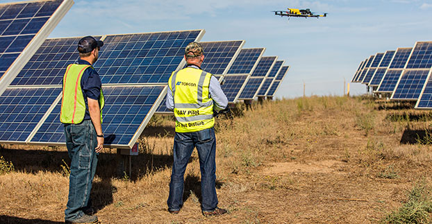
The Topcon Falcon 8 — powered by Ascending Technologies — is designed for inspection and monitoring, as well as survey and mapping applications.
“Along with our exemption for the Sirius fixed-wing system, the Falcon 8 exemption extends the Topcon UAS presence in the rotary-wing solutions market to be an even more powerful resource and provide demonstrations and training,” said Eduardo Falcon, executive vice president and general manager of the Topcon GeoPositioning Solutions Group. “Aerial data collection has a strong future in all the industries we serve, and the possibilities for survey, construction, agricultural, and emerging inspection applications are seemingly limitless.
“Building on the success the Falcon 8 has already seen in Europe, this exemption allows Topcon to expand on that momentum in the U.S. market,” said Falcon.
GPS World held a webinar on new unmanned aircraft initiatives on May 21 led by a panel of experts. On hand were Don Mark of the law firm Fafinski, Mark and Johnson; James Spicer and Adrien Perkins, both students in aeronautics and astronautics at Stanford University; and Peter Cosyn site manager and director of research and development at Gatewing, a Trimble company. I also participated.
Alan Cameron, editor-in-chief and publisher of GPS World, hosted the event and introduced the participants. Around 300 people signed up to listen to the webinar and ask questions.
Don Mark provided a legal overview of the FAA’s regulations for UAS, FAA and U.S. Senate initiatives, James Spicer and Adrien Perkins reviewed the Jäger UAV jammer detection project, and Peter Cosyn provided an overview of the Gatewing/Trimble UX5 UAS solution. I provided insight into recent UAS industry.
Finally, the panel discussed a few of several written questions submitted by the webinar attendees. We promised to publish both these questions and our attempt at providing answers. Please bear in mind that this is new area of technology, applications and regulations governing operations — so we welcome clarifications and inputs as we may miss the mark occasionally!
Q&A for GPS World Webinar:
“New Frontiers in Unmanned Flight: Hey You, UAV!”
Is the FAA going to keep requiring a pilot’s license to operate a UAV?
The draft sUAS rulemaking proposed by the FAA does not require a pilot’s license. Instead, there’s a requirement to pass an aeronautical knowledge test, obtain an FAA UAS operator certificate and to pass an FAA knowledge test every 24 months. However, the Section 333 exemptions granted by FAA so far have all required that the operator have a private pilot’s license.
What are the effects (operational, legal) of GNSS receiver failures in UAV missions and what are some technical measures to avoid them?
Most UAS used within a critical or commercial operation not only carry GNSS, but also have some form of navigation back-up system — MEMS inertial being the most common — so navigation is still possible, albeit for a short time with any degree of accuracy. And in the event of a communications link failure, the norm is to have the UAV follow a pre-programmed “return-to-base” route, so the vehicle returns safely to a known location.
What is the development of UAVs in the healthcare industry?
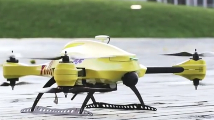
There are a number of ongoing and proposed applications of drones that are health related. A prototype system in Delft, Netherlands, carries a defibrillator to be used to revive heart-attack victims. The concept is that a network of geographically distributed drones would be called from a cellphone, and the closest UAV would be dispatched and would be able to arrive much quicker than a conventional ambulance.
This drone is part of a prototype healthcare delivery system in Delft, designed to carry a defibrillator to heart attack victims and caregivers.
Other healthcare applications could include the rapid delivery of vaccines, medications and supplies delivered right to the source of an outbreak. This could more rapidly reduce the incidence of life-threatening communicable diseases. Communication equipment, mobile technology and portable shelters could be delivered in a rapid fashion to areas where critical infrastructure damage would prevent ground or typical air transport. Drones have also been used extensively in disaster relief efforts.
Also, in July, unmanned aerial vehicles will deliver medical supplies to a free health clinic in Wise, Virginia. The most urgent prescriptions will be provided by pharmacies located out of town. To get the medicine to the community as soon as possible, the pharmacies will deliver them to their local airport, where they will be collected by NASA’s fixed-winged aircraft and be flown to Lonesome Pine Airport. When the prescriptions arrive there, they will be loaded onto Flirtey drones and delivered to the Wise County Fairground. Flirtey drones are expected to deliver around 24 packages of prescription medication.
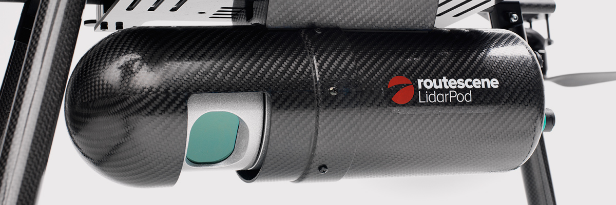
Please describe LiDAR systems available for UAVs.
There are many lightweight LIDAR systems on the market for UAV applications — some even come integrated within their own operational drone system. Coupling drone-mounted LiDAR systems with vision cameras, advanced computer processing and GPS, it has now become possible to create a remotely piloted flying LiDAR scanner.
Routescene’s LiDAR pod attached to the belly of a UAV.
Update us on legal matters within the European Union?
The EU has been very active in preparing for the commercial use of UAS, so drone use in the EU appears to be significantly higher than in North America because of the proactive effort of regulators to introduce drones into regular commercial applications. This Forbes article summarizes the approach being taken and the progress towards introducing regulations within the EU by the end of 2015.
You speak of “UAV navigation in environments where traditional GPS receivers may fail.” Are you considering indoors navigation or “just” urban environment?
It’s true that drones are being operated indoors — for instance, within restaurants. In these environments, all the typical indoor navigation techniques will be viable — RF/magnetic fingerprinting, Bluetooth beacons, Wi-Fi source databases, cellphone signals including small cells, and even optical sensors, all often combined with indoor maps.
Urban environments with a restricted view of the sky also continue to challenge GNSS only navigation, which has led to extensive use of integrated inertial/GNSS navigation sensors.
Modularity of UAVs? Different sensors for different types of applications using the same UAV?
A number of professional drone manufacturers offer UAS that could carry different payloads. However, most manufacturers seem to focus on particular applications (flying camera, LIDAR and/or video survey) and don’t carry an extensive range of optional third-party payload equipment.
What regulations are there for self-made UAS?
It’s hard to imagine that the regulations would be different for a commercially manufactured drone or a home-built UAS. Only time will tell as regulations are developed that include this category of UAS.
What background and abilities should a team possess if it wants to develop a UAV?
An engineering team that takes on developing a UAV needs to be aware of the basics of flight, navigation and control/communications — these are the principle elements of UAV operations.
Do you exploit software-defined radio techniques?
Software-defined radios may find their way into UAVs whenever weight/volume are an issue, but they potentially require higher computing capability, and maybe somewhat higher power to run co-processors. Weight and power consumption are at a premium on small UAVs, so any initiative that saves in these areas will no doubt be welcomed.
What are the emerging application areas for UAVs?
It would seem that the application areas for UAVs are virtually unlimited. High interest areas include agriculture, pipelines, buildings and transmission line inspection, aerial survey, filmmaking and newsgathering, wildlife and environmental monitoring, fishing and military reconnaissance/weapons delivery. But there are many, many applications, some of which might not fit into this summary of applications.
When will the UAV market move beyond focusing on the drone itself and get to the important topic of what sensor technology and back-office systems provide the best value to the user? The UAV is a commodity.
Good comment — the utility of the UAV comes from the payload it carries and the analysis of the data it collects and how it can be operated.
I’m curious if the UAV mission will be used in conjunction with autonomous agricultural tractors and construction machinery. I’m assuming an off-site tractor operator would benefit from the aerial data for their scope of work.
Absolutely — another possible UAV application.
Do you know when high-altitude long-endurance solar-powered UAVs will start being used?
The key application being pursued by Google using high-altitude, long-endurance, solar-powered drones is to provide Internet coverage in areas that currently have no ground infrastructure. A number of countries around the world would benefit from connection to the Internet using this approach. Unfortunately, the prototype aircraft built by Titan Aerospace recently crashed. But Google has vowed to continue with its efforts. Another development, called Project Loon, involves the use of high-altitude balloons and is already well underway.
I am currently enrolled in the UAV Pilots Certificate Training Program offered through the Unmanned Vehicle University. Is this certificate, which costs $3500, going to actually benefit me in my future commercial operations? Does the FAA recognize it as anything valid? So unless the certificate provides me some practical advantage, I’m not sure if it was legitimate or a scam. Any thoughts on this or experience with this “University”?
A recent Senate bill seeks to establish the six FAA test centers as the authorities for training UAS pilots. However, it would appear that currently no universal training course has yet been developed or approved for UAS pilot training — so it may be premature at this stage to engage with third parties for training until guidelines are published by the FAA.
What is the positional uncertainty associated with the locational measure of GPS systems on these UAVs? What will it be in five years?
Depending on the application, accuracies between 1 meter and a few centimeters are being achieved. For higher accuracy requirements such as precision surveying, post-processing of data collected during a survey can provide accuracies within a few millimeters.
In five years’ time there will be more satellites in more constellations, and it’s possible that accuracies could improve further. However, the most benefit will come from having more reliable signals, more often, thereby reducing re-test and operational costs.
What industry do you see being the fastest adopter of UAV technology in the USA?
The U.S. military is already leading in the number of applications, number of operational UAS and number of different types of vehicles. Commercial applications have increased substantially now that the FAA has authorized a large number of civilian operations in the last year or so. There are a number of film and TV applications for movie-making and newsgathering, and this appears to be a growing area for commercial UAS. Aerial survey is also growing in popularity, and there is a huge range of monitoring applications for building inspection, pipeline and transmission line inspection, and also for crop growth monitoring — which may turn out eventually to have the highest number of applications in the U.S.
How do you think the industry should protect UAVs from GPS spoofing and other forms of remote or internal component (example ICS or SCADA) attacks?
Solutions to mitigate GNSS spoofing and signal jamming are currently high on the list of most receiver manufacturers’ development agendas, with several options already having reached the market. Anti-jam antennas, improved signal rejection in RF front ends, and algorithms that claim to be able to deduce and overcome spoofing attacks — these are the leading solutions that have been fielded. But we have only just scraped the surface of deceptive techniques being used and the frequency with which they are being encountered, so we should continue to see the solutions evolving to counteract more sophisticated interference and spoofing capabilities over time.
Will the upcoming regulations only impact commercial users, or will they also directly affect non-commercial and/or recreational operators?
In the U.S., regulations governing the operation of recreational or hobby aircraft appear to be less stringent than, say, a drone operating commercially. As long as common sense rules are observed, hobby aircraft operators have been able to operate without the FAA looking over their shoulders — provided they stay below 400 feet in an open space away from sensitive areas such as schools or hospitals and don’t make an inordinate amount of noise, no one has yet proposed more restrictions for hobbyist model aircraft operators. The focus for the FAA is currently on bringing drones safely into the national airspace system for commercial operations, so regulations so far have been mostly formulated to enable this to happen.
Proposed legislation in the USA refers to one pilot per vehicle; no mention is made of swarming or control of multiple vehicles per pilot. Is it worth developing apps that use swarms of UAVs at the moment?
Certainly, it’s been difficult for the FAA to introduce regulations for UAS that are acceptable for most anticipated commercial operators, while still respecting and protecting current manned aircraft operations. So far, we’ve had case-by-case approval for specific operations, while regulations for small UAS (sUAS) have only just been circulated for comments — and a huge number of comments have been received. So regulations for “regular-sized” and operated drones and for larger vehicles have not yet seen the light of day. So, the more complex applications involving the operation of a swarm of UAS may not yet have been even considered by the FAA. It has taken years to get this far, and we still don’t have any published regulations for any class of UAS in commercial applications, so it’s doubtful that there is any work underway on regulations for swarming drones. So develop apps if you wish, but don’t expect much regulatory support for some time yet.
What assurance do we have that a UAV operator won’t deliver a weapon instead of an Amazon purchase?
The exemptions that have been published allow certain well-defined, specific commercial operations of UAS. The unmanned vehicle has to be registered to an individual and get a unique tail number. The operators have to be identified and must regularly demonstrate proficiency and adequate knowledge to become a recognized operator. So authorities get to inspect the UAV, know the owner and know the operator, and even get to review and approve the location of each UAS operation — not that that would prevent someone subsequently modifying the vehicle to carry ordinance, or knowingly attacking a target. It would, however, be pretty easy to track down the offender, but that doesn’t really prevent “weaponization” or delivery. But we are only at the small-vehicle-level currently, so its doubtful if major damage would be possible with small weapons, but an individual attack might still be lethal. Careful screening of individuals seems to be the route the regulators have taken to minimize this risk. This is still a difficult issue that is going to take some policing and close control.
Instead of an actual pilot’s license required for legal flight of a UAV, do you think an all-encompassing UAV pilot’s license will be required? I ask because I am a trained Trimble UX5 pilot, but I do not have my pilot’s license. I also build UAVs, and I am curious how I would get a UAV pilot’s license for a UAV I built? Unless they had an all-encompassing training course for pilot/flight safety.
The FAA proposed rulemaking for sUAS operations did not require operators to have a pilot’s license. Instead, UAS operators are required to undertake a specific recurrent training course for UAS operators, administered by FAA qualified trainers. Regulations relating to “home-built” UAS have yet to emerge, and may be some time away from publication.
It is said that mainland China has over 70% of the world UAV market? How did we fall so far behind?
Lack of regulations in the U.S. may have held back U.S. industry — see related comments by Amazon in testimony to the U.S. Congress.
But also the absence of restrictions in other countries may have helped overseas manufacturers get established and to gain initial market share. While the majority of done R&D was initially within the U.S., it’s clear that DJI and its Phantom line of drones have become very popular, very quickly. Strangely enough, the largest concentration of buyers and operators currently appears to be in the U.S.
Insurance against UAVs crashing and causing damage to humans: what progress has been made in this area?
Several insurance companies are now writing risk-coverage policies for UAS, including Global Aerospace, USAIG, Allianz and AIG.
We are operating a GNSS reference network in Greece, SmartNet-Greece (Leica Geosystems). Is there a tested NTRIP system on UAVs, to be connected and monitored to Ntrip caster? How could this augment real-time GNSS accuracy of UAVs?
Seems like you are trying to get RTCM corrections from a ground network to a flying UAV – correct? So do we need an Internet connection to get your ground network RTCM corrections onto the UAV? I’m not an expert on available mobile Internet hook-ups, but most smartphones have one, so it can’t be that hard to add this onto a UAV. Alternatively, wouldn’t it be easier to have the GNSS receiver on the UAV listen to a PPP broadcast from one of the several services providing these corrections? We could get down as far as 10 cm accuracy with one of these commercially available correction services.
Talk about the possibilities of precise positioning in UAVs, instead of mapping.
Precise real-time positioning on a UAV is a question of which GNSS receiver is onboard and which PPP or local RTK network transmissions are available in the area of UAV operations. Positioning accuracy is possible of a few centimeters down to a few millimeters post-processed.
Realistically, how close are we to being able to fly UAVs for commercial applications such as topographic surveys and earthworks applications such as mining sites?
As we heard during the webcast, obtaining an FAA section 333 exemption is quite possible for these applications, and some have already been granted. The FAA has been streamlining the process recently to reduce the time it takes to obtain these authorizations.
What is a practical ceiling for UAV flight?
The FAA has limited UAS operations to below 400 feet in the Section 333 exemptions that have been granted, while 500 feet is used as the maximum ceiling in the proposed draft sUAS regulations.
What is status of technology for “see and avoid” requirements for UAVs?
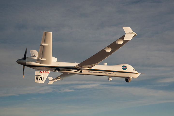
NASA, the Federal Aviation Administration (FAA), General Atomics Aeronautical Systems (GA-ASI) and Honeywell International Inc. have successfully demonstrated a UAS proof-of-concept sense-and-avoid (SAA) system. GA-ASI worked with NASA’s Armstrong Flight Research Center to integrate the new system aboard NASA’s Ikhana research aircraft, a civilian version of the company’s Predator B. The flight-test campaign in November and December 2014 evaluated the SAA system in a wide variety of collision-avoidance and self-separation encounters between two remotely piloted aircraft and various manned aircraft and included a sensor-fusion algorithm being developed by Honeywell.
NASA’s Ikhana Predator B drone.
An RTCA subcommittee is also working in parallel to develop the requirements for an SAA system, and these flight-test evaluations will contribute to those technical standards.
Other companies that are also thought to be active in SAA development include Rockwell/Collins, Sierra Nevada and Insitu/ Queensland University of Technology Australia.
So, a large number of questions on a pretty wide range of subjects — hopefully some of the answers we’ve provided will be of assistance — but please provide us with your comments if you have information to share.
Disclaimer: The statements, questions, views and opinions presented in this article are those of the author and webcast audience, and may not necessarily reflect the opinions of GPS World magazine, its owners or staff. Readers are also warned that the answers are provided on a best-effort basis and could be less than 100% correct.
The nation’s six unmanned aircraft system test sites now have blanket authorizations to fly drones and no longer have to seek authorizations for each type of aircraft flown, according to new Federal Aviation Administration regulations.
The new regulations streamline the approval process for UAS research by the test sites. They also allow those with only a recreational- or sport-pilot certificate to conduct test-site operations. Previously, the rules required operators to have a private pilot’s license. A third-class medical certificate also is no longer required. Now an operator only needs a valid driver’s license to satisfy the medical requirement.
The FAA expects this improved access for the test sites will provide more opportunities for research that may help the agency integrate UAS into the nation’s airspace more quickly and easily.
Under the new regulations, drones under 55 pounds operated by test sites may fly during the day up to 200 feet above ground level anywhere in the country, except in restricted airspace or near airports and heliports.
The new Certificates of Waiver or Authorization (COAs) also let the test sites fly various types of UAS under a single COA, making it easier for them to conduct research missions. Previously, the FAA required authorization for each type of UAS the operators wanted to fly.
Brian Wynne, president and CEO of the Association of Unmanned Vehicle Systems International (AUVSI), praised the FAA announcement. “This new policy will make it easier for the test sites to perform the research needed to safely integrate UAS into the national airspace system. It is an exciting time for the unmanned aircraft systems industry and policies like this help further advance UAS innovation.”
When Wynne testified at the House Committee on Science, Space and Technology earlier in the year, he specifically called for a comprehensive industry-government UAS research plan, more resources for the federal government to coordinate UAS research and intellectual property protections for the companies that participate in UAS R&D.
According to Wynne’s take on the new policy, things are heading in the right direction. “This new policy, the Center of Excellence designation and the Pathfinder Program announced earlier this month, along with ongoing industry and government research efforts, all point to a future where the possible will become reality,” he says.
“Today’s FAA announcement is great news for the future of Nevada’s UAS Test Site effort,” says Tom Wilczek, aerospace and defense industry specialist for the Nevada Governor’s Office of Economic Development. “Nevada has been working diligently to get companies up and flying UAVs on our test sites, and the ability for us to implement public aircraft operations that fly under 200 feet … will significantly speed up the ability to test on our Nevada sites and move this emerging industry into commercial flights.”
The expanded operational parameters for the test sites are similar to those the FAA implemented in March for civil UAS operations authorized under a Section 333 exemption.
The six UAS test sites are the first public operators to receive this type of “blanket” airspace access across the United States, including Alaska and Hawaii. The sites may still fly outside the “blanket” COA parameters if they receive or retain separate COAs specific to the airspace requested for those operations.
Great view of the Pentagon while departing from the U.S. Hydro conference held in Washington, D.C.
I’ve attended five conferences in the past couple of months; Esri Water Conference (first one!), Esri Partner Conference, US Hydro 2015, APSG (Association of Petroleum Surveying & Geomatics) and the Esri Petroleum User Group (PUG) conference. It may look Esri-heavy, but the fact is that Esri is doing a really good job of organizing vertical market GIS conferences, and people are showing up. Even with crude oil prices in the cellar (relatively speaking), 1,200 people still showed up at the PUG.
There were a lot of good presentations at these conferences, and I’ll post links to some of them below. Not surprisingly, drones are a major topic of discussion at most GIS conferences. There was even a drone demo (I missed) at the Esri Partner conference showing Esri’s workflow in working with drone-collected data.
If you don’t follow me on Twitter, you might consider it. Twitter is easy and free. When I’m at a conference, I send tweets (most with a photo) in near real-time when I see something of interest. For example, I tweeted when Jack Dangermond showed up at the Esri PUG (he usually doesn’t, but did this year because it was the 25th annual conference) and had something interesting to say (read below). You can sign up for Twitter here, and then choose to follow me at https://twitter.com/GPSGIS_Eric. I get that you may be hesitant to invest any time in this, but it looks like Twitter is becoming the standard for near real-time news (as opposed to other social media such as Facebook or LinkedIn.)
Of all the new technology I’ve heard about over the past few months at these conferences, two subjects continue to excite me.
Drone Mapping. Of course, one of them is drone technology for mapping. It seems like I’ve beat this horse to death over the past few months, but it continues to get juicier and juicier. Technology development in this industry is moving really fast. It seems like new drones are being announced as frequently as new smartphones, maybe more so.
Other ancillary technologies are being developed to support commercial drone operations. For example, in my hometown (Portland, Ore.), a company called Skyward just raised $4+ million in venture capital funding to provide “professional services for UAV operations.” Essentially, the company’s software helps drone operators stay within FAA regulatory compliance.
Last year, the Oregon Unmanned Systems Business Enterprise was formed “with a two-year $882,000 state grant from the Oregon Business Development Department and the Oregon Innovation Council and will be working to match the government money with private investment and other grants.” The organization will award grants up to $75,000. The point is, the money is flowing and it’s a wide-open market.
The drone market is so wide open, in fact, that most drone companies are just buying common airframes and associated parts, putting their brand name on them, and selling them. Perhaps oversimplified, but the point is there’s not much “special sauce” (technology) being added. The manufacturers that aren’t innovating and adding valuable “special sauce” will eventually disappear. Essentially, following are the parts needed for a fixed-wing drone for mapping:
Aircraft components:
Airframe (off the shelf)
Motor (off the shelf)
Servos (off the shelf)
Propeller (off the shelf)
Radio (off the shelf)
GPS (off the shelf)
Autopilot (off the shelf)
Batteries (off the shelf)
Camera trigger (off the shelf)
Camera (off the shelf)
Ground compoments:
900-MHz controller (off the shelf)
Battery chargers (off the shelf)
Mission planning software (off the shelf)
Propeller balancer (off the shelf)
As you can see, all of these components are available off the shelf. You can order each component (maybe all of them from Amazon!), have them shipped to you, and assemble your own UAS for mapping. That said, someone who has gone through the process of building, flying and producing a valuable deliverable that you can make decisions from can add value. But, as competition increases, there’s no doubt that the companies that don’t offer much added value will not be able to operate a sustainable business.
Finally, the U.S. Federal Aviation Administration (FAA) is being surprisingly nimble, approving “333 Exemption” requests at record pace and moving towards using a “summary grant” process to issue bulk approvals of 333 Exemption requests for commercial operations.
UAS presentation from Texas A&M University, one of six FAA-designated UAS test sites.
You may want to take a look at some of the other presentations at the APSG meeting. They were very good. Here’s a quick summary of each by Jon Stigant, long-time member of APSG:
This was a primer in LiDAR technology and methodology — while most of the paper is well understood in the survey community, it is and excellent overview. A reminder for some and a way to fill in the gaps for those not so close to this technology.
Integration of UAVs into O&G Operations — Stacey Lyle, BP (presentation forthcoming)
Stacey provided a valuable summary of the direction in which the FAA is going to regulate the emerging UAV technology. A “must read” for any company that intends to either provide or use this technology. As with most government regulation there is a lot of detail, the devil is in them. Stacey recommended that the APSG engage by developing some standards for the oil and gas industry.
Ron Hughes theme is massive data and managing it — also something of a common theme for all the talks. He focused on automating data processing and recommended a concept of doing this in an automated way with 80 percent of the data. This requires careful procedural development in collaboration with a given client’s business workflows. He gave an example of a large utility company, and how the development of an enterprise metadata server had functional impact for individual business units, but also had the knock on impact of improving inter-functional/inter-community collaboration within the enterprise.
Mike provided input on Geiger mode LiDAR, differentiating Harris’ approach from the more regular LiDAR methodology. The major difference is in data density, data frequency, volume and speed used from higher flying aircraft covering a larger area faster. Providing 10-cm accuracy and expecting 7-cm acuracy development using a/c at 25,000-ft height. Focus on fast processing of immense data volumes (pedabytes) – 24-hour delivery using Harris proprietary processing. Achieve higher density at lower cost.
Mark introduced developments in GIS associated with Common Operating Picture (COP), focusing on the combining of video and data in GIS system. DPFOS mnemonic: Data Management, Planning & Analysis, Field Mobility, Operational Awareness, Stakeholder Engagement. A new SIMOPS (SIMultaneous OperationS). The key is a single source of approved data. Examples of data required in COP from specific disciplines are provided — ROVs, shore clean-up, life of field data, asset and material tracking, live/recorded video, RT data and weather integration, “in the field’” vessel implementation.
GIS, Geospatial, Geomatics…Organizational Capability Evolution — Brian Boulmay, BP (presentation forthcoming)
Rethinking Geospatial Data Management at a major operator. One Map program — not physical, one-way provision. Focus on users vs. geospatial specialists. Users business driven, specialists IT and S driven. Geospatial data integrity and analytics – people, processes and technology. ID goals — massive deployment worldwide — has to be automated. Federated system — regions only have to deal with their own regional data, not be overwhelmed by whole enterprise on their doorstep. IT has the role of providing/maintaining a worldwide solution.
Update on Spring 2014 APSG meeting — All major networks launching satellites. Very soon will have 30 live in-view satellites (U.S., Russia, Europe and China). RTK coverage in China is the best due to BeiDou, supplemented by both Indian and Japanese systems SBAS. $100 RTK on cell phone giving centimeter accuracy eventually, and changing the commercial dynamic!
Set up for managing and analyzing LiDAR data in Global Mapper. Workflows: terrain modeling, visibility, biomass (change monitoring); asset: inspect and maintain pipelines, as-built modeling, simulation. High-accuracy at relatively low cost, outpacing regulatory management. Much public data available — earthexplorer.usgs.gov. xyz values — minimum height threshold, dense RGB point cloud (almost photographic).
Automated dashboard approach, reducing pilot distraction risk, speeding up RT transfer and operational activity reporting.
Esri Conferences
Here are a couple of neat things from the Esri conferences.
First, Jack Dangermond was his usual visionary self at the Esri PUG conference, making his appearance for the 25th annual PUG. He is a master at communicating his GIS vision.
The Evolution of GIS.
In speaking about the evolution of GIS, Mr. Dangermond spoke about the far-reaching impact of email and stated that eventually web-based GIS will be deployed organization-wide, just like email. I agree with this vision. I believe the only question is timing. Is it two years from now? Five years from now? 10 years?
Onto the less visionary and more tactical tidbits…
Of particular interest to me is high-precision GNSS in the Esri environment. A lot of people I talk to are screaming for this. What does high-precision GNSS in the Esri environment mean?
support for high-precision metadata in ArcGIS Collector (ArcPad already supports this).
support for high-precision horizontal (eventually vertical) datum transformations in ArcGIS Collector.
This is important because Esri is supporting ArcGIS Collector across all mobile platforms (Android, iOS and eventually Windows), and people want to use their smartphones and tablets. ArcPad will never run on iOS or Android, so Collector is the GIS collection tool of choice, at least for the Esri environment. It needs to support high-precision GNSS, and by the looks of the following slide, it will. It’s just a matter of timing…
ArcGIS Collector to support high-precision GNSS.
The other potentially neat product Esri announced was Navigator for ArcGIS. Imagine trying to guide a work crew to a buried valve across town (or in the next neighborhood). Displaying a system or region-wide map of valves would not be an efficient way of driving your way across town to find the valve. However, giving a crew turn-by-turn street directions to the street-level, then displaying the valves on that street section, might be a very efficient way of finding the valve.
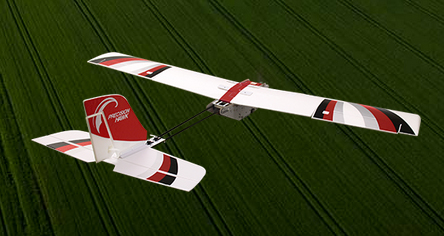
Topcon Positioning Systems has received a national exemption from the Federal Aviation Administration (FAA) that allows for operation of its unmanned aerial system (UAS) in the United States. The exemption covers the operation of the Sirius Basic and Sirius Pro for aerial data collection.
The Sirius Pro and Sirius Basic systems are designed to produce accurate solutions for the automated mapping of a wide range of sites — regardless of terrain — including construction sites, mines and quarries. The UAS are designed for land surveying, transmission line and pipeline inspection, and agricultural operations such as field mapping and livestock management. With the Sirius Pro model, Topcon eliminates the need for ground-control points by combining real-time kinematic (RTK) GNSS solutions with precision timing technology to provide accurate mapping results, Topcon said.
“This exemption is exciting news for the U.S. marketplace,” said Eduardo Falcon, executive vice president and general manager of the Topcon GeoPositioning Solutions Group. “It allows Topcon to be a resource for end-users and provide UAS demonstrations and training. Aerial data collection has a strong impending impact on all the industries we serve, and the possibilities for survey, construction, and agricultural applications are seemingly limitless.
“Building on the success the Sirius models have already seen in the European and Australian markets, this exemption allows Topcon to expand on that momentum in the U.S.,” Falcon said.
The “summary grant” process the Federal Aviation Administration (FAA) used last week to issue 30 Section 333 unmanned aircraft systems (UAS) exemptions is an example of how the agency is using a flexible regulatory approach to accommodate this rapidly evolving technology, according to a news statement from the FAA.
The new approach will speed up Section 333 exemption approvals for many commercial UAS operators, the FAA said. Section 333 is the part of the 2012 FAA reauthorization law that lets the Secretary of Transportation determine if certain low-risk UAS operations can be authorized before finalizing the small UAS proposed rule published in February.
Although the FAA still reviews each Section 333 petition individually, the agency can issue a summary grant when it finds it has already granted a previous exemption similar to the new request. Summary grants are far more efficient because the FAA doesn’t need to repeat the analysis performed for the original exemption on which they are based. Summary grants are a tool the FAA can use in all exemption areas, not just UAS.
The FAA’s experience in reviewing the Section 333 petitions shows they generally fall into two categories: film/television production and aerial data collection. Most exemptions in these categories will likely be handled through the summary grant process. For unique requests, the agency will still publish the petition in the Federal Register for public comment and will conduct a detailed analysis.
The FAA also made two other changes to the Section 333 exemption process last week:
The agency now allows operations under these exemptions by people who hold a recreational or sport pilot certificate. Previously, Section 333 operators were required to have at least a private pilot certificate. The newly added certificates are easier to obtain, and therefore less costly, than a private pilot certificate.
A third-class medical certificate is no longer required. Now, a Section 333 operator only needs a valid driver’s license to satisfy the medical requirement. This change is consistent with the agency’s approach for sport pilot certificate holders, who may fly light sport aircraft with a driver’s license and no FAA medical certificate.
Brian Wynne, president and CEO of the Association for Unmanned Vehicle Systems International (AUVSI), applauded the change. “For months, AUVSI has advocated for a more streamlined process for Section 333 exemptions that will help more industries realize the benefits of UAS technology,” Wynne said. ” The FAA’s new summary grant process is a step in the right direction that cuts through the red tape while making it easier for operators to fly UAS. We applaud the agency for lifting unnecessary restrictions and enabling more commercial uses of the technology in a safe and responsible manner.”
The Federal Aviation Administration has approved 30 more commercial unmanned aircraft systems exemptions, bringing the total number of approved operations to 99, reports AUVSI News. AUVSI is the Association for Unmanned Vehicle Systems International.
Among those receiving exemptions are the insurance companies USAA and AIG. USAA said in a press release that the exemption “could help speed review of insurance claims from its members following natural disasters.” USAA plans to fly the PrecisionHawk drone.
USAA also filed for an additional FAA exemption in November that will enhance USAA’s ability to use drones in catastrophes. That exemption petition is pending approval, and a decision is expected soon.
Other companies receiving exemptions include senseFly for precision agriculture, and AeroVironment for agriculture, aerial survey and patrol applications.
The Federal Aviation Administration has established an interim policy to speed up airspace authorizations for certain commercial unmanned aircraft operators who obtain Section 333 exemptions. The new policy helps bridge the gap between the past process, which evaluated every UAS operation individually, and future operations after the FAA publishes a final version of the proposed small UAS rule.
Under the new policy, the FAA will grant a Certificate of Waiver or Authorization (COA) for flights at or below 200 feet to any UAS operator with a Section 333 exemption for aircraft that weigh less than 55 pounds, operate during daytime Visual Flight Rules (VFR) conditions, operate within visual line of sight (VLOS) of the pilots, and stay certain distances away from airports or heliports:
5 nautical miles (NM) from an airport having an operational control tower; or
3 NM from an airport with a published instrument flight procedure, but not an operational tower; or
2 NM from an airport without a published instrument flight procedure or an operational tower; or
2 NM from a heliport with a published instrument flight procedure
The blanket 200-foot COA allows flights anywhere in the country except restricted airspace and other areas, such as major cities, where the FAA prohibits UAS operations. Previously, an operator had to apply for and receive a COA for a particular block of airspace, a process that can take 60 days. The agency expects the new policy will allow companies and individuals who want to use UAS within these limitations to start flying much more quickly than before.
Section 333 exemption holders will automatically receive a blanket 200-foot COA. For new exemption holders, the FAA will issue a COA at the time the exemption is approved. Anyone who wants to fly outside the blanket parameters must obtain a separate COA specific to the airspace required for that operation.
More information on the UAS exemption process is available on the FAA’s UAS page.