Guest column by Brian Wynne AUVSI President and CEO
Brian Wynne, AUVSI president and CEO
A recent analysis found that just 10 percent of the unmanned aircraft systems (UAS) included in the Unmanned Systems and Robotics Database maintained by the Association for Unmanned Vehicle Systems International (AUVSI) can operate beyond the visual line of sight (BVLOS) of its operator.
While the technology for BVLOS operations has existed for years, under current federal regulations, only the military is permitted to use it. The absence of federal regulation allowing BVLOS operations hinders the full value and benefits that the UAS industry has to offer.
Regulations that provide guidance and rules for operating unmanned systems are necessary for the industry’s advancement. Earlier this year, the Federal Aviation Administration (FAA) issued a proposed rule for UAS operations over people, and the UAS community is eagerly anticipating the agency will offer an additional rule requiring UAS to be equipped with remote identification.
“Remote ID is a crucial next step to gain the confidence of federal defense and security agencies, manned aviation users and the public.”
However, the rulemaking process for remote ID has been delayed by the FAA twice this year and is now slated to be released in December. The need for remote ID cannot be overstated, as the advancement of the UAS industry depends on identifying and tracking UAS flying in the airspace.
Furthermore, remote ID is a crucial next step to gain the confidence of federal defense and security agencies, manned aviation users and the public. With this confidence, UAS can further integrate into the national airspace to perform important BVLOS operations such as inspection of utility rights of way, widespread search-and-rescue missions, and package delivery.
A clear, national regulatory framework and the support of the federal government is needed to drive the adoption of unmanned systems technology and its applications. Currently, the UAS industry is working with our government partners on remote ID and tracking standards, but we recognize that more needs to be done and at a faster pace than the regulatory process allows. That is why the UAS industry is stepping up to explore near-term solutions before remote ID regulations are finalized and published.
In May, AUVSI and the Airports Council International-North America commissioned a Blue Ribbon Task Force on UAS Mitigation at Airports. The task force is working to refine procedural practices and provide a policy framework to address the timely and critical issue of incursions by unauthorized UAS at airports and how best to mitigate this threat, including industry and government recommendations for remote ID. The task force will release a report this year.
Applications of unmanned systems aren’t limited by technology or imagination; they’re only limited by regulations. We need a streamlined regulatory environment that allows for the safe deployment of unmanned systems into our nation’s transportation infrastructure so we can begin to reap the full benefits of this technology.
Harris Corporation has introduced a comprehensive solution to increase the safety of drones and other commercial unmanned aircraft systems (UAS) flying at low altitudes in the U.S. The announcement was made during Xponential 2016 being held May 2-5 at the Ernest N. Morial Convention Center in New Orleans.
Harris’ ADS-B Xtend service provides critical surveillance information to help UAS operators and airspace managers to increase safety of their operations by providing them with a real-time view of other aircraft flying at low altitudes under 500 feet.
The ADS-B tower with the Xtend antenna. (Photo: Harris Corp.)
The system supplements the FAA’s existing ADS-B network, which provides precise and reliable satellite-based surveillance for the nation’s air traffic control system. The solution features a networked, dual-band receiver and relay system that can be attached to existing structures or to mobile vehicles for roaming coverage.
ADS-B Xtend expands the benefits of the company’s existing UAS situational awareness tool, Symphony RangeVue, which provides data for higher altitude flight traffic. Symphony RangeVue puts real-time FAA aircraft tracking data, flexible background maps and weather information in the hands of UAS operators through a web-hosted platform so they can make better informed decisions.
Data from networks of ADS-B Xtend relays is fused with all FAA system derived real-time aircraft surveillance data from more than 650 ADS-B ground stations with more than 425 FAA radar systems. This unique combination of local infrastructure and NAS surveillance data makes ADS-B Xtend a comprehensive situational awareness solution for the UAS market.
“Strategically deploying ADS-B Xtend receivers will close gaps in ADS-B coverage, significantly increasing the quality and quantity of data available UAS operators,” said Ed Sayadian, president, Harris Mission Networks. “This will increase surveillance data available to UAS operators and enhance safety and efficiency. ADS-B Xtend is yet another step in our commitment to develop the most comprehensive surveillance airspace data set available.”
Interview with Graham Purves, Executive Vice President, NovAtel
Graham Purves, NovAtel
GPS World (GPSW): In the regulatory picture for unmanned autonomous vehicles (UAVs), what are the concerns for the GNSS research, design, and manufacturing community regarding air-space regulation?
Graham Purves (GP): The main concern is the scope and impact of certification requirements for UAV navigation systems in the National Air Space. Certification places constraints on software complexity, so it is difficult to define solutions if the certification framework is unclear.
In the context of current avionics for civil aviation, design standards and certification requirements are well defined. In the case of pilot-less aircraft, the navigation systems may make use of additional features and technologies that are not part of the current certification paradigm. Examples are tightly coupled inertial navigation systems (INS) for flight control and redundancy, and real-time kinematic (RTK) and differential GPS for landing and capture. Certification requirements and design assurance levels for these features will have a major impact on the definition and design process, and may even prevent some effective technical solutions from being used, due to the software complexity. Of course, communications and communication standards will also present a significant hurdle.
GPSW: What are the concerns for the GNSS research, design, and manufacturing community regarding vehicle/road regulation for UGVs?
GP: Similar answer. The software used in positioning and navigation systems is significantly more complex than the safety-critical software in current automotive systems. Regulation for UGVs may result in restrictive certification requirements that affect or prohibit the use of more complex software. Until we have a clear understanding of the certification framework, it is difficult to define technical solutions.
GPSW: In looking forward to the Federal Aviation Administration tests at six sites for integrating unmanned aerial vehicles into the commercial airspace safely, what are some of the technical challenges that you (and presumably NovAtel’s partners) are facing?
GP: We have proven some excellent technical solutions in the non-civil applications and believe the main barrier is not a technical but a regulatory challenge.
GPSW: What other pieces/technologies do you have to pull into the UAV/UGV integration to make it work? Inertial, certainly. What else?
GP: The UAV/UGV application is a very interesting arena for other positioning technologies that either augment or complement GNSS. Apart from navigation and auto-pilot functions, we believe the sense-and-avoid functions will require other sensing technologies, like scanning lasers. When you include the mission-related functions that require precise steering, pointing and measuring systems, the UAV/UGV is a very exciting category for companies like NovAtel.
GPSW: Is UAV/UGV a game-changer for the GNSS industry? Similar to the cellphone/smartphone implementation of GNSS chips, which created a whole new sector?
GP: It does have two elements that might be considered game-changers:
The movement of GNSS and other positioning technologies into a safety-critical role. It seems inevitable that someday we will live in a world where autonomous vehicles are the norm, and the idea of having a human behind the wheel is both complex and unsafe.
The UAV/UGV is an enabling technology and a platform for innovation. Similar to the wireless revolution, the killer applications may well be things we haven’t yet conceived of.
Graham Purves has been active in the GNSS industry since 1990, starting in ASIC development and continuing with various technical and business positions within NovAtel over the last 26 years.
On November 7, the FAA released a new roadmap for the “Integration of Civil Unmanned Aircraft Systems (UAS) in the National Airspace System (NAS)” — which it is hoped will provide improved guidance for those extremely interested operators, manufacturers, systems suppliers and those with pending civilian applications of unmanned aircraft.
The forward to the Roadmap by FAA Administrator Michael Huerta says,
‘This roadmap outlines the actions and considerations needed to enable UAS integration into the NAS. The roadmap also aligns proposed FAA actions with Congressional mandates from the FAA Modernization and Reform Act of 2012. This plan also provides goals, metrics, and target dates for the FAA and its government and industry partners to use in planning key activities for UAS integration.”
The FAA, acting through the Unmanned Aircraft Systems Integration Office, aims to enable the integration of UAS safely and efficiently into the NAS. To do so, the FAA is working with stakeholders — manufacturers, vendors, industry trade associations, technical standards organizations, academic institutions, research and development centers, governmental agencies, and other regulators.
The premise is that UAS will be allowed to operate in the NAS, but in so doing cannot reduce existing capacity or decrease safety, cannot negatively impact current operators/operations, and cannot increase the risk to airspace users or people or property on the ground — any more than the integration of other new or novel technology. While progress has so far been significant, many challenges and opportunities apparently lie ahead.
Up to the recent Restricted Type Certification of a couple of unmanned aircraft systems by FAA — namely the Boeing/Insitu Scan Eagle and the AeroVironment’s Puma AE — operators have been and still are required to apply to the FAA for individual Certificates of Authorization (CoA) for each and every U.S. application of UAS. The FAA Roadmap is intended to provide an initial estimate of timing and to list tasks and considerations that will ultimately enable UAS integration into the NAS for the planning purposes of the UAS community.
Boeing/Insitu Scan Eagle loaded for launch.
Commercial operations that the FAA envisages include:
security awareness;
disaster response, including search and support to rescuers;
communications and broadcast, including news/sporting event coverage;
cargo transport;
spectral and thermal analysis;
critical infrastructure monitoring, including power facilities, ports, and pipelines;
commercial photography, aerial mapping and charting, and advertising.
Other commercial and public applications that the FAA might also want to add to the increasing demand for airspace access include:
crop monitoring;
precision surveying and GIS;
wildlife monitoring;
(ground) traffic monitoring and control;
firefighting support;
police services;
many, many more applications which will emerge rapidly once regulations permit ready access to airspace.
Of course, the FAA controls an ever increasingly complex airspace to which certified manned aircraft already have regulated access – it’s only fitting that existing safety and commercial use be primarily maintained and in no way compromised. Successful demonstration of UAS to achieve demanding communications, navigation, and surveillance performance will be essential.
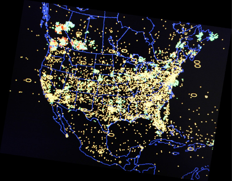
U.S. National Airspace System.
The Roadmap quotes the International Civil Aviation Organization (ICAO) Circular 328, “Unmanned Aircraft Systems (UAS) Circular”:
“A number of Civil Aviation Authorities (CAA) have adopted the policy that UAS must meet the equivalent levels of safety as manned aircraft… In general, UAS should be operated in accordance with the rule governing the flight of manned aircraft and meet equipment requirements applicable to the class of airspace within which they intend to operate…To safely integrate UAS in non-segregated airspace, the UAS must act and respond as manned aircraft do. Air Traffic, Airspace and Airport standards should not be significantly changed. The UAS must be able to comply with existing provisions to the greatest extent possible.”
Another significant FAA statement:
“Except for some special cases, such as small UAS (sUAS) with very limited operational range, all UAS will require design and airworthiness certification to fly civil operations in the NAS.”
So, having set the tone that UAS will have to grow up in a major way to become equivalent to existing manned aircraft and to comply with virtually the same rules, the Roadmap goes on to provide much more detail of what will be required.
The FAA is working on UAS regulations — this is not really a big surprise. It would seem that there is significant effort underway to get rules in place, detailed rules which not everyone in the UAS industry will welcome. One scenario is that the huge range of UAS suppliers that we see regularly at the AUVSI annual convention/exhibit could be slimmed down if the market indeed transitions to commercial operations from the current level of military applications, and only the big companies who can afford to comply will remain. Reduced competition usually means increased costs for users, so this may not sit well with the market.
Then there are more difficulties in adapting existing airborne regulations for commercial aircraft to UAS and UAS applications. An example is given of regulations for commercial transport cockpit doors — what’s a “cockpit” when you think of UAS, and where’s the “door” for a ground-based control system in a mobile trailer, or a handheld iPad flying a small quad-rotor air vehicle? (Maybe a different thought process is required here.)
Then the air-traffic control system has to absorb flight of unmanned aircraft in an already overcrowded route network system. Of course, only some UAS operations will be intertwined with regular commercial transport air traffic, but there are huge numbers of “less-disciplined” General Aviation fixed-wing and rotor aircraft with which UAS are bound to interact. So ATC has to understand, control and regulate that interaction. Surely these are common-sense statements which most people would support?
Major technology challenges are anticipated due to the absence of an on-board pilot.
“Removing the pilot from the aircraft creates a series of performance considerations between manned and unmanned aircraft that need to be fully researched and understood to determine acceptability and potential impact on safe operations in the NAS.”
There’s that dreaded word — “researched.” For anyone in the business of selling UAS or UAS systems, including GNSS-based guidance systems, the need for potentially prolonged research may spell death for a nascent business, currently bursting with potential!
Development of Sense and Avoid and Control and Communications (C2) systems with adequate performance are seen as the principle challenges, so a phased introduction of UAS is anticipated while these core systems are fielded and matured over a lengthy period. The current CoA approach is termed “accommodation,” while evolution is expected towards more compliant vehicles and systems during the integration phase — ultimately, with fewer and fewer CoAs. Although the Roadmap talked about “broad timelines,” this key section doesn’t try to predict how long this all might take.
The FAA summarizes the accommodation phase as:
Accommodation of UAS in the NAS through evaluation and improvement of safety mitigations.
Work with industry and the Aviation Rulemaking Committee (ARC) to review the operational, pilot, and airworthiness regulations.
Development of required standards to support technological solutions to identified operational gaps (Minimum Operational Performance Standards [MOPS]).
Safety case validation for UAS operations in NAS — collect/analyze operational and safety data.
Robust research, modeling, and simulation for UAS Sense and Avoid, C2, and human factors.
The Integration phase is characterized by adoption of FAA regulations through certification of compliant UAS and UAS systems — the balance between CoA operations and regular operations in the NAS shifts toward more compliant, and presumably more unrestricted, access within FAA regulations. With UAS and UAS systems achieving airworthiness certificates, and trained and certificated UAS pilots filing regular flight plans for UAS operations, integration moves towards adoption. “All UAS must file and fly an IFR flight plan.” Lessons learned in earlier phases are moved into updated regulations and incorporated into equipment capabilities, and certificated UAS get increasingly better access to the airspace they require.
FAA also makes mention that in the integration phase, the six proposed UAS FAA test ranges will be selected. This has been in the works for considerable time. The assessment of proposals and award of contracts had initially been delayed on the basis of privacy questions, but these now appear to have been adequately addressed to allow these key parts of the UAS integration program to move ahead. A principle objective of the test ranges is to help provide a verification mechanism for safe operations before unmanned aircraft are integrated into the NAS. Tasks envisaged include development and proving of:
manned-unmanned operations,
certification standards and air traffic requirements,
coordination and leveraging of National Aeronautics and Space Administration (NASA) and DoD resources,
civil and public unmanned aircraft systems,
coordination with NextGen (a major NAS update program currently being undertaken by FAA).
Integration will have been successfully established when new operational rules and associated standards, policies, and procedures have been established for small UAS and other UAS, and C2 link standards have been defined for integrity, latency, and continuity. FAA will also need to have accepted Minimum Aircraft System Performance Specifications (MASPS) to enable development of detailed MOPS and the FAA should have published policy and operational guidance to define acceptable methods to comply with operational rules in accordance with an acceptable UAS certification basis for each applicant, along with flight-crew training and certification standards.
For the final “Evolutionary” phase of adoption of UAS, it’s expected that there will be seamless operations of certified UAS and crew members in the evolving NAS; FAA will have published Type Standard Orders (TSOs) based on system level MOPS; and certified Sense and Avoid algorithms will be available for collision avoidance and self-separation that are interoperable with evolving NextGen ATC systems and manned collision avoidance systems.
Quite a long list of extensive requirements to meet for a new industry that, so far, has been largely unregulated and has, so far, been used to providing rapid military/governmental solutions that prove themselves operationally over time. More empirical development to satisfy specific operational needs than compliance to published regulations. This isn’t exactly a sea-state change for the industry as it sits today, but perhaps rather a shift into another dimension.
To even get itself onto this road, let alone follow this extensive 74-page roadmap, the UAS industry may have to completely re-invent itself. But with military sales declining, the funding to take on even the simplest of these requirements may be drying up. The tendency for operators may be to try to cling to the CoA system indefinitely and just live with the hassle of applying for FAA authorization each time. FAA’s seeding of commercial applications using Restricted Type Certification of existing platforms that use existing uncertified systems and payloads may also be a way out for some time. If the Scan Eagle can gain limited access to take on commercial, paying applications because it has +800,000 proven military flight hours, eventually other UAS may also creep into some sort of equivalent eligibility. And if we manage to operate safely without major headlines, the FAA may relent in some of its extensive requirements.
Then again, the FAA just published a rather extensive roadmap, with separate backup, which says it has other ideas in mind….
I asked a couple of industry experts what they thought of the Roadmap. One comment was, “To me the real challenge is flexibility in the plan such that it will be a reasonable process to adapt to changes based on findings, experiences as this goes forward.” I agree, and believe that the FAA has gone to some length to make it clear that this is the first issue of the Roadmap, that there will be updates as more is learned. The whole process is one of learning from what has gone before in earlier stages.
Please join us Thursday, November 21, for a GPS World webcast on Unmanned Aircraft Navigation. We’ll have a number of industry leaders who will present their companies’ experience and capabilities in navigation for UAS, along with how they see this exciting market segment progressing, and how the FAA’s plans could impact their vision of the future for UAS navigation systems suppliers. Register today for free.