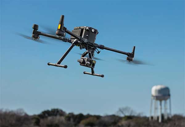
Auterion, an open-source drone software platform provider, has partnered with C2 Group — a program, project and construction management firm — to power the use of drones for inspection, mapping and disaster response across the utilities and critical infrastructure industries.
The collaboration has been formed after C2 Group conducted extensive testing of the Vantage Robotics Vesper drone powered by Auterion to inspect power lines at its UAS testing ground and assess viability within the utilities space.
Auterion and C2 Group have seen a shift in the utility industry to move away from drones manufactured overseas to focus on the adoption of U.S.-made products such as the Vesper, a Blue sUAS-certified product used by the U.S. military.
Features on the Vesper that the utilities industry can use include high-quality sensors and thermal capabilities, while its stability and lightweight design make it rapidly deployable.
Utilizing the data security, quality and flexibility enabled by Auterion across multiple UAS manufacturers means C2 Group pilots can be trained on one flight platform but fly any drone associated with it; reducing the training time and increasing overall productivity. Further productivity measures are achieved with Auterion’s Suite used to identify pilot efficiencies and its Simulator to augment pilot training. At the same time C2, with its industry knowledge having worked with multiple major utilities in the US, is providing insight that is helping to shape Auterion’s roadmap for new sensors and airframes into the future.
Brandon Del Priore, CTO at C2 Group, said: “We are proud to partner with Auterion to bring some of the best technology developed in the US to our clients in the utilities and critical infrastructure industries. When safety, data security, and data quality matter most, C2 Group will be there to offer customers the same US-made hardware and software used by the DoD’s Defense Innovation Unit and the US military. The open source ecosystem is helping to drive a better footprint within the marketplace and a better level of compatibility for US made products.”
Cynthia Huang, VP Enterprise Business Development at Auterion, said: “With DJI added to the entity list, we’re seeing enterprise drone operators accelerate their search for alternatives. Auterion’s open source software ecosystem provides more options, more solutions, and faster development timelines to the needs being identified today and companies are embracing the power of our approach. We are excited to partner with C2 Group to bring US made solutions and the advantages of open source to their customers.”
For more information, visit www.auterion.com/enterprise
New Matrice 300 RTK and Zenmuse H20 series cameras ready for new generation of work, including digitalization and artificial intelligence (AI)
DJI has unveiled its most advanced commercial drone platform, the Matrice 300 RTK (M300 RTK), along with the Zenmuse H20 Series, a hybrid, multi-sensor camera.
The Matrice 300 RTK UAV from DJI is designed for the next level in data collection and site inspection. (Photo: DJI)
DJI engineered the all-in-one, high-tech solution for areas of work never explored before in precise aerial inspections and data-collection missions.
“With the M300 RTK flying platform and the Zenmuse H20 camera series, we are providing a safer and smarter solution to our enterprise customers” said Christina Zhang, senior director, Corporate Strategy at DJI. “This solution sets an entirely new standard for industrial UAV solutions, significantly enhancing operations across public safety, law enforcement, energy, surveying and mapping as well as critical infrastructure inspections.”
The M300 RTK is the first DJI product that integrates modern aviation features, advanced AI capabilities, six directional sensing and positioning system, a UAV health management system, and 55 minutes’ flight time.
The drone platform has AES-256 encryption and an IP45 weather-resistant enclosure. It has a built-in all-new OcuSync Enterprise transmission system that provides a triple-channel 1080p video transmission signal reaching up to 15 km away.
The M300 RTK can support up to 3 payloads simultaneously and has a maximum payload capability of up to 2.7 kg.
“For our teams working in the oil & gas industry, performance and safety are not optional,” said customer Adam Serblowski, Robotics Theme Lead at Shell. “We cannot compromise on our pursuit of utilizing the best and most efficient tools available. The DJI Matrice 300 RTK proves to be an ideal upgrade over the existing DJI product line, and it helps us to further enhance the benefits of our drone programs. Our productive partnership with DJI will continue to help elevate safety in the world’s largest industry.”
With the Zenmuse H20 Series Camera
Combined, the M300 RTK and Zenmuse H20 Series solution offers users two intelligent ways to collect data:
Smart Pin & Track. Intelligent functions that enhance synchronization of aerial intelligence in coordinated missions. It includes PinPoint, a function that allows users to mark the subject of interest and instantly share the precise location data to a second operator or if necessary to ground teams via DJI FlightHub; and Smart Track, which allows users to automatically detect and track a moving object, even at extreme distances, while synchronising the subject’s dynamic location in real time.
Smart Inspection. A new set of features developed to optimize routine data collection missions such as power lines, railway and oil and gas inspections. It consists of Live Mission Recording for recording sample automated missions in real time; AI-Spot Check, which enables data collection from exactly the same location every time, greatly improving the accuracy of automated missions. After photos from a sample waypoint inspection mission have been recorded, operators are able to mark the subject of interest. During subsequent automated flight missions, AI algorithms perform a comparison between the marked subject and current live view, thus correcting the camera orientation accordingly to deliver accurate and consistent results; and Waypoints 2.0 — an improved mission planning system offering up to 65,535 waypoints, while supporting an array of consecutive actions, 3rd party payloads, and more.
Aviation-Grade Situational Awareness. Inspired by today’s modern aircraft, the M300 RTK features a Primary Flight Display (PFD) that merges real-time flight and navigation data into one integrated display. Besides standard telemetry data like altitude and speed, the M300 RTK PFD provides obstacle data for visualising nearby obstacles during flight, enabling pilots to adjust flight trajectory if needed. These enhancements allow users to keep track of the aircraft while further enhancing the pilot’s situational awareness.
Dual-operator mode. New to DJI’s commercial drone platforms and exclusive to the M300 RTK, is Advanced Dual Operator Mode – multi-pilot control protocols that enable the execution of missions with enhanced safety, reliability and flexibility.
The M300 RTK, when controlled by two pilots, gives each pilot equal access to gain flight-control priority, the transfer of which is displayed by a series of icons on the DJI Smart Controller Enterprise. If one pilot becomes compromised or their controller loses battery or connection, the other pilot gains full control over the M300 RTK and its payloads.
When training new pilots, the teacher/main pilot can safely take over flight control if necessary.
Improved safety and reliability
The M300 RTK comes with new and improved safety and reliability enhancements, including:
AES-256 Encryption: for secure data transmission of the command & control uplink and video transmission downlink.
AirSense (ADS-B technology): for enhanced airspace safety.
Anti-Collision Beacon: for increased aircraft visibility, especially in low-light conditions.
IP45 Protection Rating & Self-Heating Battery: for adverse weather conditions (-20 to 50° C).
6 Directional Sensing and Positioning System: offers a maximum detection range of up to 40 m horizontally, with options to customize the aircraft sensing behavior via DJI Pilot.
As with modern-day jetliners, the M300 RTK offers an integrated UAV Health Management System (UHMS) to optimize fleet maintenance. It records the aircraft’s flight data throughout its entire lifecycle, and utilizes the drone’s hardware and software systems to understand current aircraft performance and determine when it should be serviced. Taking advantage of this new system, users can get a quick overview of all critical aircraft systems, manage firmware updates across an entire fleet, track pilot hours and review flight missions.
DJI Zenmuse H20 Series
The new camera payloads are designed to improve mission efficiency. The Zenmuse H20 series offers DJI’s first Hybrid multi-sensor solution, allowing capture of any kind of images for industrial applications and public-safety missions where efficient time management and immediate access to multiple layers of visions are paramount.
The H20 Series is IP44 rated, which protects enclosures from splashes of water from any direction.
The H20 series comes in two versions:
The H20, a triple sensor with a 20-MP, 23x hybrid optical zoom camera, a 12-MP wide camera, and a laser range finder covering distances from 3 to 1200 meters
The H20T, a quad sensor that adds a 640 x 512 radiometric thermal camera, allowing operators to see what is invisible to the human eye using high thermal sensitivity at 30 frames per second video definition.
Integrated user interface
To enable pilots to operate so many sensors at once, the accompanying DJI Pilot app interface was redesigned. The new user interface lets pilots quickly switch between cameras and simplifies the process of zooming in and out by letting pilots preview the zoom field of view on top of the wide angle or thermal camera footage.
With a multi-sensor integrated user interface, the Zenmuse H20 series allows users to smoothly switch between wide, zoom or thermal cameras. It also includes features for maximum flexibility when used on time-sensitive missions.
High-Res Grid Photo: Captures in one snap detailed imagery of defined subjects with the help of a custom grid. The images can be stored for later detailed inspection.
One-Click Capture: Captures videos or photos of up to three cameras simultaneously without having to manually switch between camera views or repeat a mission.
Night Scene: Gains clearer visibility when lighting conditions are not optimal.
The M300 RTK and Zenmuse H20 series are available for pre-order from official DJI Enterprise dealers and will start shipping in Q2 2020.
Terra Drone Corporation has launched a new UAV and artificial-intelligence (AI)-based solution designed for maintenance of power transmission and distribution equipment.
The solution was developed based on market gaps identified after inspecting more than 90,000 kilometers of power lines beyond visual line of site (BVLOS) throughout the world.
Acquired data is automatically processed and analyzed by artificial intelligence algorithms trained to detect crossovers at the bottom of transmission lines, buildings and construction machinery.
The system identifies rust on bolts, loosening and missing tower parts, bird’s nests and more. It then generates a smart report highlighting areas that require action. The error (identified anomaly) detection system is accurate up to 92.5%.
The algorithm for an area is developed through a process identifying anomalies in a training data set of 1,500 images. This allows for a custom solution to be created for the end client where all pertinent anomalies are identified and reported.
The development and training of the algorithm only need to be completed once for a particular type of asset and can be implemented easily at different locations on similar assets.
With such a high-precision algorithm, the productivity of AI processing allows for fast actionable results to be provided to clientele. Clients also have the ability to identify the appropriate security protocols for data storage in either a cloud-based or on-premises storage environment. These protocols can then be implemented in a custom client-specific solution.
Loosening and missing tower parts identified by high-accuracy detection system (Photo: Terra Drone)
Power transmission and distribution companies must conduct periodic inspections of power line infrastructure to ensure reliable electric power distribution, although the conventional methods of deploying ground staff or low-flying helicopters to complete the inspections, they are typically cost-prohibitive. Conventional helicopter and boots-on-the-ground service also pose HSE concerns with low flying helicopters and people working in the field. UAV service and AI inspection can aid in minimizing HSE concerns by reducing the number of workers in the field and eliminate low level manned helicopter missions.
This solution has been built from ground up with the aim to simplify and streamline the maintenance work for transmission and distribution facilities.
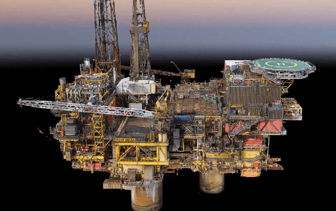
As part of a framework agreement with Dubai Petroleum, Cyberhawk was appointed to inspect more than 350 risers on 63 offshore platforms. The inspection took one month to complete, followed by the production of more than 90 detailed engineering inspection reports.
Photo: Cyberhawk
The rationale behind Dubai Petroleum’s use of UAVs was to quickly complete detailed inspections of all their risers. Risers are traditionally a difficult area of an offshore platform to inspect; in the under deck and the splash zone, options for access, such as abseiling or scaffolding, are limited, extremely time consuming and very expensive.
Using UAVs as a scanning tool, the high-quality reports produced by the Cyberhawk team allowed the client to plan contact-based inspections or repairs. With a full inspection completed on all risers, defects can be tracked over time to understand their long-term degradation.
Daily reports were produced to notify Dubai Petroleum of potentially serious defects, with detailed inspection reports then produced by Cyberhawk’s experienced oil and gas inspection team.
On the same project, an additional three elevated flare stacks and 24 bridges were inspected, maximizing the value of the mobilization.
Image: Cyberhawk
“Having worked with Cyberhawk in the past, we understand and appreciate the potential on offer from UAV inspections,” said Dubai Petroleum’s asset integrity manager. “This confidence led us to use UAVs in a new area within our business; this risers survey project. The campaign was a great success and we are pleased with the outcome. The speed and efficiency with which this project was completed has proven that the scope and application of UAV inspection can be expanded for our requirements, and we look forward to continuing our relationship with Cyberhawk in the future.”
U.S. Secretary of Transportation Elaine Chao provided further details of the department’s new Drone Integration Pilot Program at a public event held Nov. 2 at the U.S. Department of Transportation (DOT) headquarters in Washington, D.C.
Chao was joined by hundreds of drone operators, industry leaders, members of the public, law enforcement and first responders, and local, state, tribal and federal officials.
The pilot program is designed to safely test and validate advanced operations through various partnerships across the country with oversight by the Federal Aviation Administration (FAA).
A Federal Register notice lays out the timeframe, requirements, and goals of the new program, which will pair local, state, and tribal entities with private sector players in the drone industry to develop and deploy new operational concepts that are not currently in widespread use.
The first step is for government officials to complete a Notice of Intent, signifying their intention to complete a full program application. Applicants will have 20 days to complete a Notice of Intent, followed by the requirement that they complete an application through the FAA/UAS Portal within 57 days. Within 180 days, initial program applicants who receive approval could begin deploying drones under the limitations coordinated and agreed to with the FAA. The program will last for three years.
After evaluating all the applications, DOT will select a minimum of five partnerships. Full details of the Federal Register Notice and Application process can be found here.
Webinars Scheduled. The FAA is hosting three webinars providing an overview of the program, application process and specific criteria and deadlines that must be met. The webinars will be held on the following times.
The pilot program will evaluate a variety of operational concepts, including night operations, flights over people, flights beyond the pilot’s line of sight, package delivery, detect-and-avoid technologies, counter-UAS security operations, reliability and security of data links between pilot and aircraft, as well as local management of UAS operations subject to FAA oversight.
Industries that could see immediate opportunities from the program include commerce, photography, emergency management, precision agriculture, and infrastructure inspections and monitoring.
The program will help tackle the most significant challenges in integrating drones into the national airspace while reducing risks to public safety and security. The program is designed to provide greater regulatory certainty and stability to local governments and communities, UAS owners and operators who are accepted into the program.
In less than a decade, the potential economic benefit of integrated unmanned aerial systems into the nation’s airspace is estimated to equal up to $82 billion and create up to 100,000 jobs,, according to AUVSI’s The Economic Impact of Unmanned Aircraft Systems.
Chao told attendees the program application and deployment process will move quickly because a priority for DOT is encouraging innovation in the drone industry while maintaining safety for communities involved.
“The drone pilot program will accelerate the safe integration of drones into our airspace by creating new partnerships between local governments, the FAA, and private drone operators,” Chao said. “These partnerships will allow local communities to experiment with new technologies like package delivery, emergency drone inspections, and more, on terms that work for them and in ways that support a unified and safe airspace.”
“This program will put community and industry partnerships at the leading edge of aviation technology,” said FAA Administrator Michael P. Huerta. “What we learn through testing operational concepts in these communities will be invaluable and give us clarity on rules that ensure safety and continued innovation.”
“More and more businesses and public safety providers are embracing UAS to expand and enhance their service offerings,” said Brian Wynne, president and CEO, Association for Unmanned Vehicle Systems International. “This growing demand illustrates a new renaissance in aviation and technology, which requires sustained collaboration and support by government at all levels.”
Drones are quickly becoming a staple of the maritime industry. In January, the European Maritime Safety Agency (EMSA) issued the largest ever civilian maritime drone contact, valued at €67 million.
Under the contract, drones will be used to assist with border control, search-and-rescue operations and monitoring of pollution, as well as the detection of illegal fishing and drug and people trafficking.
External Vessel Inspections. Big names in the maritime industry such as DNV-GL, Lloyds Register and Maersk have all shown strategic intent to revolutionize their operations by embracing drone technology, and many maritime operators are now following suit.
All ship owners know that traditional methods of external vessel inspection can be a costly affair. Now that high-definition, camera-equipped drones are widely available and affordable, it is becoming more common to use them for external vessel inspections to assess structural conditions. Identifying substantial corrosion, significant deformation, fractures, damage or other structural deterioration can be done quickly, easily and cost-effectively using drones.
Tank Inspections. The visual inspection of cargo tanks was traditionally performed by workers suspended on ropes to inspect the tank structure. The sheer size of modern-day vessels means that access methods including staging, rafting and climbing are often used by surveyors to access tanks.
In contrast, drone surveys require no human access to the tank and, since no access equipment is required, there are no setup costs, and inspections can be completed within a quicker timeframe.
Martek Marine’s V-200 UAS. (Photo: Martek Marine)
Bathymetric Surveys. Accurate and reliable information on the features of water bodies and their shorelines is vital to navigational safety. Bathymetric surveys gather the information, which is then published for use on nautical charts. Rather than using a fixed-wing airplane or helicopter, bathymetric sensors developed for drones allow this type of survey to be carried out flexibly and at a fraction of the cost.
To operate effectively in the harsh maritime environment, the technology has been developed to withstand storm force wind and heavy rain, snow and salt spray.
As technology advances, so does the flight time available on drones, meaning more area can be covered in a quicker timeframe.
Floating Flare-Tip Inspections. Drone surveys typically exist to provide close visual and thermal inspections of high, live or difficult to access structures offshore, and there’s nothing more challenging to access than a flare tip, 70 meters above water, on a floating production facility.
Drone survey inspections for flare tips remove the need for a shutdown to inspect the flare and offer reduced costs compared to aerial surveys carried out by helicopter or plane.
Offshore Wind Energy. The wind energy sector is growing fast. Storm force winds, erosion, lightning strikes and even build-up of insects can have an impact on turbines, and blades need to be inspected for deterioration. Inspectors have traditionally had to scale the turbines with the help of ropes and cables.
The maritime surveying company Martek Marine uses a drone fleet designed for turbine-blade inspections onshore or offshore. Qualified and trained pilots quickly and accurately identify and assess faults.
Traditional surveying requires turbines to be offline for two hours up to a day, but Martek’s inspection process reduces this time to 45 minutes.
Following the inspection, the client can access the data through Martek’s secure, cloud-based asset management portal where they can download a detailed PDF report and access raw survey data.
Fully Autonomous Drones? Fully autonomous drones could be the next big thing for maritime surveying. The drones can be pre-loaded with a 3D model of the ship. This allows the drone to autonomously work its way around the vessel, stopping at points of interest to obtain detailed video or image data.
Advancing this further, a drone could be designed to create its own 3D map of the vessel before carrying out the survey independently.
This article is excerpted from a blog by Martek Marine, a UK-based maritime surveying company. Read the full blog, with more details and examples.
A pair of companies is using unmanned aircraft systems (UAS) for powerline construction.
Sharper Shape, a drone-based automated inspection provider, and SkySkopes, a professional UAS flight operator, took on a project in cooperation with an investor-owned utility.
Photo: Sharper Shape
The mission used the Sharper A6 UAS to string sock lines for a 675-kilovolt line construction project.
Sock pulling, the act of flying a strong and lightweight rope and attaching it to the towers, is typically performed via helicopters or by workers climbing the towers.
Both these methods involve risk to both helicopter pilots and ground crews. The use of UAS is eliminating the previously complex process — consisting of several steps of reattaching the rope — and decreasing the risk of injury for people involved.
The mission highlighted how UAS are a safe and effective option for many applications in the utility industry beyond basic inspections, according to Matt Dunlevy, CEO and president of SkySkopes.
“This is a great proof of concept for unmanned aircraft because we proved that they can string both the outboard lines and the center line through the middle of the center phase of a tower,” Dunlevy said. “There are risks associated with both helicopter and tower climbing methods. Now there is another option as proven by Sharper Shape and SkySkopes.”
Photo: SkySkopes
“When the utility first reached out there were lots of unknowns,” said Paul Frey, director, electric utilities for Sharper Shape. “Working as a team, we pulled together, developing a test plan and executing the flights.”
The team modified a heavy-lift small UAS to carry line, and then ran five test flights to test objectives related to pulling the line through each of the tower phases and setting the line on the center pulley.
SkySkopes’ pilots are trained for difficult missions, often flying advanced heavy-lift multi-rotor aircraft with precision where autonomy is impractical.
EagleView Technologies is actively flying to acquire post-storm imagery in Florida following Hurricane Irma. With more than 20 planes staged or in the air, EagleView is continuously capturing high-resolution aerial imagery to enable rapid assessment and response to Hurricane Irma relief efforts.
EagleView is a provider of aerial imagery and property analytics for the government, insurance and commercial sectors.
Using both fixed-wing aircraft and drones, EagleView imagery supports post-hurricane insurance claims adjusting, property assessment, public safety and land surveying professionals.
“With these hurricanes affecting so many Americans, we’re putting our planes in the air as soon as possible to begin the image capture process,” said EagleView President Rishi Daga. “From our unique high-resolution post-event imagery to our industry-leading machine learning capabilities, EagleView’s technology can massively accelerate recovery efforts and because of this, we find it crucial to take flight immediately once permitted into the airspace.”
EagleView’s historical image library, dating back to 2002 in Florida, offers insurance carriers, first responders, non-profit organizations and local government agencies the ability to analyze the impact of the storm on homes, commercial buildings and infrastructure by comparing previously captured imagery with the latest post-event images.
Image capture and processing post-Hurricane Irma will take place continuously over several weeks, with EagleView making constant updates to its nearly four-petabyte imagery and data library.
“We have access to an impressive amount of resources in Florida and the surrounding areas, allowing us to provide the largest post-storm image capture capabilities to our clients,” said Jay Martin, senior vice president of operations for EagleView. “Our team is working around the clock to deliver imagery to those who need it most following these devastating weather events.”
EagleView is capturing varying types of aerial imagery throughout Florida. This includes its ultra-high-resolution (UHR) imagery, also known as Reveal imagery, which is the highest resolution aerial imagery available on the market today.
Using UAVs, TUV India, under TÜV Nord Group, is conducting an assessment of a 25-MW solar photovoltaic (PV) power project 160 kilometers from Bengaluru spread across 90 acres. TÜV Nord Group is a technical service provider working in 70 countries.
For the Indian solar project, the first phase involved a site assessment, flight planning, undertaking drone flights, uploading data from the drone to advanced software, data processing, analysis, documentation, interpretation and delivering the final report. The second phase will take place after installation of solar modules and operation of PV power projects for at least six months.
Having executing this solar PV power project successfully with the drone, TUV India is confident it can use UAV technology for assessment, surveillance and inspection of infrastructure projects such as rail, roads, seaporta, airports and utilities.
Daniel Sällstedt (left), CEO of Sky Eye Innovations, and Erik Eklund, business development manager of Spacemetric, discuss their new partnership to develop inspection drones. (Photo: Patrik Hellström, Sky Eye Innovations)
To meet the growing demand for advanced industrial airborne inspection tools, Sky Eye Innovations and Spacemetric have entered a strategic partnership to provide turnkey solutions for collection, storage and management of data from airborne sensors.
Sky Eye Innovations produces a UAV solution with capabilities to control advanced sensing technologies, and Spacemetric is a provider of image data management software solutions.
More and more organizations see the enormous potential for increased efficiency in inspection, monitoring, asset assessment and preventative maintenance through use of drones (UAVs) equipped with various sensor technologies. The huge growth in drone use has been helped by software tools that support data collection and data processing, many of them provided through the cloud.
The new partnership connects a leading image management tool with a very high-performance UAV solution built for daily use in the most demanding conditions. The result is an integrated and highly effective inspection tool for preventative maintenance and decision making that uniquely combines imagery from UAVs, satellites and handheld sensor units.
“At Spacemetric we’ve actively developed our software to handle the growing volumes of data coming from UAVs. We’ve actively been looking for a UAV partner and are very impressed by Sky Eye Innovations and their unique offering, which is much in demand,” said Erik Eklund, who is responsible for Spacemetric’s new Airborne business area.
The partnership creates a unique set of expertise. Spacemetric specializes in solutions to manage large volumes of imagery and streamline the process of efficient capture and storage to accelerated sharing and delivery of geospatial imagery for users like the Swedish Air Force.
Sky Eye Innovations contributes with development and manufacturing of extremely performant UAV platform solutions that alone in the world are able to lift and control FLIR System’s most advanced cameras used for industrial inspection and monitoring tasks.
“Sky Eye Innovations are constantly working on improvements and looking at new ways to address the challenges the industry is experiencing. Our ultimate goal is to offer cost-effective solutions that drive productivity and improve working conditions. To achieve this we need our UAV platform to excel and collaboration with world-leading expertise is critical to providing high quality customized solutions that are in demand. Therefore we are proud to announce our partnership with Spacemetric, and the next generation of industrial inspection tools this will lead to,” said Daniel Sällstedt, founder and CEO of N.M.M Innovation Sweden AB (also known as Sky Eye Innovations).
A methane leak at a Southern California Gas (SoCalGas) storage facility has shone a spotlight on how unmanned aerial vehicles can be used to inspect utilities. The massive three-month leak — temporarily plugged on Feb. 12 — chased thousands of Los Angeles residents from their homes.
At least 2 percent of natural gas is wasted through methane leaks at production sites, according to the U.S. Department of Energy (DOE).
UAVs are already being used for some electrical grid and pipeline inspections, mostly in pilot programs, but their potential for hands-off long-distance monitoring is just starting to be realized.
Along with criminal charges, SoCalGas is facing regulatory mandates to improve air-quality monitoring at its facilities. Nationally, the DOE’s Advanced Research Project Agency-Energy is funding a program to accurately locate and measure methane emissions associated with natural gas production.
Bridger’s proposed leak detector uses lidar in combination with range and gas absorption measurements. (Illustration: Bridger Photonics)
The program has given one company, Bridger Photonics, a $2 million grant to develop a leak detector. Bridger plans to build a mobile methane sensing system capable of surveying a 10 x 10 meter well platform in just over five minutes with precision that exceeds existing technologies used for large-scale monitoring.
Bridger’s detector useslaser beams to generate 3D images that show the distance and concentration of a gas leak, even showing the types and concentration of the hydrocarbons.
Mounted on a UAV, the sensor would give inspectors access to complicated or obscured infrastructures at processing plants, drilling rigs and pipelines. The sensor could also be mounted on a vehicle.
Bridger’s goal is for its devices to be able to service up to 85 sites, and cost $1,400 to $2,220 a year to operate per wellsite. Bridger plans to field test its technology this year and make it available commercially in 2017.
Bridger’s imager
Bridger’s gas imager is a point-scanning lidar sensor that performs simultaneous range and gas absorption measurements, according to Mike Thorpe, chief technology officer of Bridger Photonics. The measurements are combined to derive high-accuracy estimates of the gas concentration.
The measurement beam is scanned around the scene to create 3D topographic images of hard targets overlaid with 2D maps of the gas concentration.
The datasets will be geo-registered using GPS and inertial measurements.
The prototype sensor will have the following performance specs:
1 kpps measurement rate
3-100 m range
1 cm down-range resolution
2 cm cross-range resolution
<3 ppm-m methane detection sensitivity for distances < 30 m
<15 ppm-m methane detection sensitivity for distances < 100 m
Bridger also is developing measurement approaches and algorithms to enable automatic leak detection and leak rate estimation.