Tag: UAV payload

  • UAVOS introduces stratospheric Earth observation payload after successful flight tests

    UAVOS introduces stratospheric Earth observation payload after successful flight tests

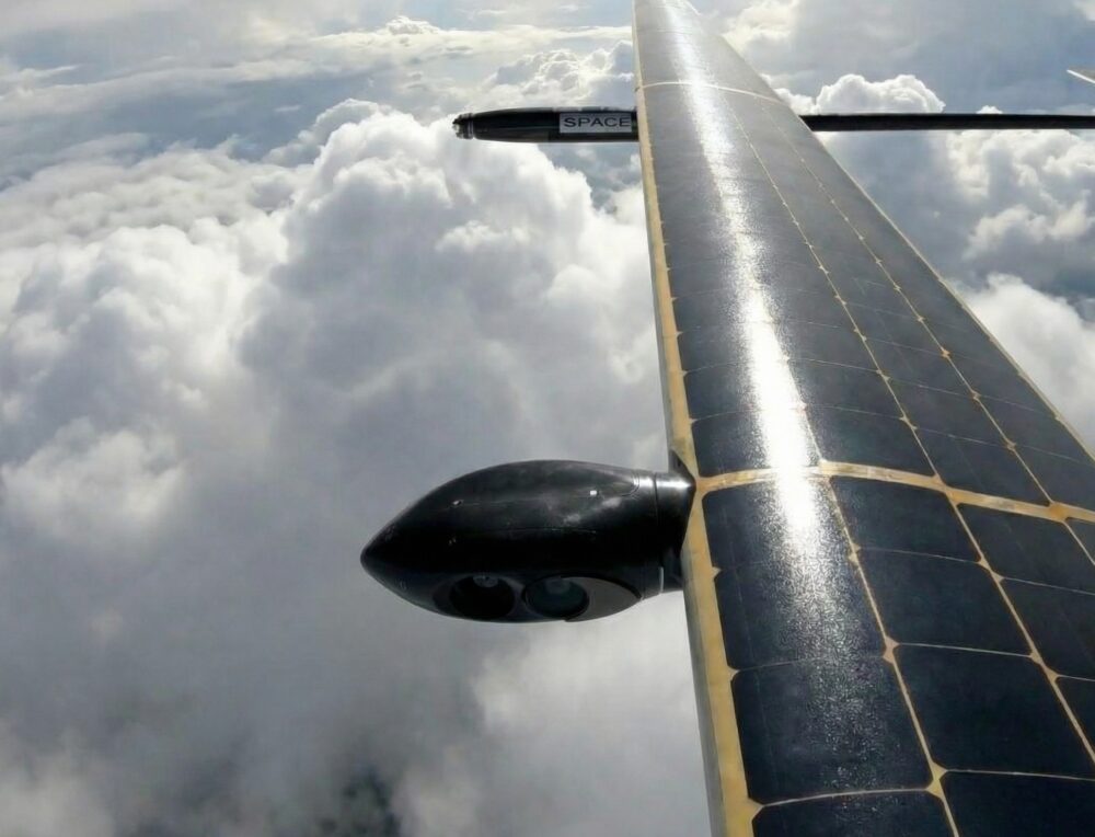
    UAVOS has completed successful flight testing of its optoelectronic, gyro‑stabilized payload onboard device (POD), integrated into the HAPS ApusNeo 18. The ApusNeo 18 is a solar‑powered high‑altitude pseudo‑satellite developed as part of a joint project with Mira Aerospace.

    Using steerable high-resolution cameras, the system demonstrated coverage of 472 km of electro‑optical imagery with a ground sampling distance of 69 cm per pixel, as well as infrared imagery at 480 cm per pixel, from an altitude of 15,000 m. The camera’s footprint covered 53.9 km², while its steerability allowed access to any point within a 54.5 x 12.3 km area at any time.

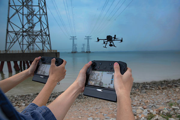
    Designed specifically for stratospheric operations, the POD significantly enhances the intelligence, surveillance and reconnaissance capabilities of HAPS platforms. 

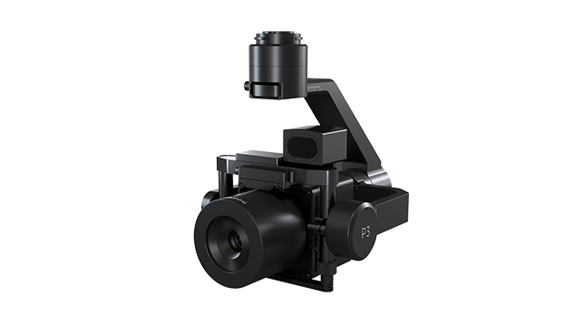
    The POD weighs 3.6 kg and features a compact form factor measuring 845 mm (length) × 128 mm (width) × 142 mm (height). It is equipped with an onboard computer for data processing and a UAVOS radio modem with a 10 W amplifier, enabling high‑throughput data transmission to the ground control station.

    To ensure reliable high-altitude performance, the POD incorporates an integrated heating and cooling system that maintains optimal operating conditions for onboard sensors. It also includes a foldable, servo‑driven antenna that can be stowed  in a safe position when required.

    Additionally, the mechanical design enables video and photo acquisition with roll stabilization of up to ±50 degrees, expanding operational flexibility and imaging performance.

    The Payload Onboard Device (POD) has already been successfully tested for wildfire monitoring in Spain. When integrated with the HAPS ApusNeo 18, which is capable of surveying hundreds of kilometres in a single flight, the system delivers a comprehensive situational picture, improving operational efficiency, reducing costs, and increasing overall mission effectiveness,” said Aliaksei Stratsilatau, founder and CEO of UAVOS.

  • DJI provides dual controllers for two UAV operators

    DJI provides dual controllers for two UAV operators

    Photo: DJI
    Photo: DJI

    DJI now offers dual UAV controllers. Dual operator mode allows a pilot to focus solely on safe operation of the drone, while another operator can focus on payload operations — creating a 3D scan of a location, hoisting or releasing items, or operating a lidar scanner or air-quality sampler.

    The DJI Inspire 2 and M600 have dedicated forward-facing video feeds so pilots can see where they are flying, regardless of what the payload camera or other sensors are doing.

    Dual controls can ensure safe operation remains the top priority of even a complex and challenging drone flight. 

  • Phase One announces P3 drone payload for asset inspection

    Phase One announces P3 drone payload for asset inspection

    Photo: Phase One
    Photo: Phase One

    Phase One, a developer of digital imaging technologies, has announced the P3 Payload, a versatile solution designed for fast, efficient and safe inspection of critical infrastructure with an unmanned aerial vehicle (UAV).

    The P3 Payload includes a Phase One iXM 100MP or 50MP camera, one of the RSM lens options, and a new gimbal with integrated rangefinder.

    Available in the second quarter of 2021, the P3 Payload is offered in two configurations to meet a wide range of user requirements.

    • The P3 for the DJI M300 is plug-and-play, developed mainly for operators and service providers that already own, or are considering purchasing, a DJI M300.
    • The P3 MAVLink is ready for integration with drones based on the open-source MAVLink protocol, and suitable for bundling by OEMs and solution integrators.

    “The P3 addresses the unmet need for a high-quality, integrated imaging solution for inspection of critical assets where capturing the details is of paramount importance,” said Michael Messerschmidt, portfolio director for drones and inspection. “The P3 Payload is designed specifically for aerial drone inspection of diverse infrastructure where every flight — and every shot — must count.”

    The centerpiece of the payload is the customer’s choice of Phase One iXM 100MP or 50MP camera. Robust and waterproof, these sensors feature a dynamic range that guarantees sharp image collection in high-contrast or low-light environments. The variety of lens options ensures large surface areas can be captured with millimeter-level detail, even at safe distances from the asset. The new gimbal with the integrated laser rangefinder ensures precise and fast focusing on every shot, eliminating blurry and out-of-focus images.

    The P3 Payload is suitable for these inspection applications:

    • High-value assets. Bridges, dams and energy facilities where the value of the structure itself is high and the demand for frequent, accurate and detailed data is critical.
    • High-risk assessment. Electric transmission lines, oil refineries and other complex sites where inherent danger requires high-resolution inspection from a distance that is safe for the structure, the drone and personnel.
    • Time-critical assets. Wind turbines, offshore oil rigs, and other facilities where inspection windows are limited, and every UAV flight must successfully capture the required information.

    “We developed the P3 Payload for cost-effective, productive operation so that large surface areas can be covered in fewer images, significantly shortening the mission time,” Messerschmidt said. “More importantly, the P3 can be operated with minimal risk to the asset and ground crew.”