Tag: UAV software

  • GE Aviation and Auterion team on commercial drone platform

    GE Aviation and Auterion team on commercial drone platform

    Photo: iStock.com/valio 84sl, via FAA
    Photo: iStock.com/valio 84sl, via FAA

    Team to provide all-in-one hardware and software platform for commercial drones.

    GE Aviation and Auterion are integrating the Auterion Enterprise PX4 operating system on GE Aviation’s Unmanned Aircraft System avionics platform.

    The companies signed a teaming agreement to provide a comprehensive hardware and software solution for drone manufacturers and operators seeking to enable commercial drone operations at scale.

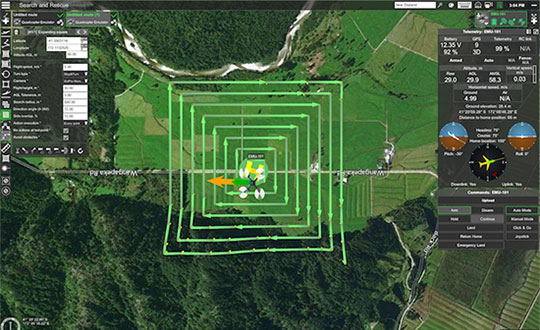
    The hardware and software platform is designed with commercial vehicle original equipment manufacturers (OEMs) and service providers in mind. It is being displayed at Auterion’s booth (#2009) at AUVSI Xponential, taking place this week in Chicago.

    The teaming enables a full-stack solution with airborne autopilot and application computing hardware, flight management, safety management and integration. GE Aviation is providing the avionics hardware, application computing, flight management and integration into airframes. Auterion is providing Enterprise PX4, the operating system that runs on the vehicle, in the cloud and the ground station.

    The core architecture of the hardware and software platform has been implemented with the objective of supporting developers through global open software standards while maintaining an independent and authoritative safety controller.

    The combination of the two supports long-term flexibility and a high level of design assurance to enable commercial drone operations beyond visual line of sight (BVLOS) and within complex airspace and obstacle environments.

    Flight testing of the hardware and software platform took place over the last three weeks at Reno-Stead airport in Reno, Nevada.

    “In demonstrating a seamless integration of ground, cloud and airborne components, we’ve reached another milestone in helping to unlock the value in autonomous and UAS advanced operations,” said Alan Caslavka, president of Avionics Systems for GE Aviation. “Auterion’s open standards leadership and cooperative legacy with the developer community is the foundation to scale a sustainable solution critical for commercial drones.”

    “We are excited about the collaboration with GE Aviation that allows us to offer our operating system on high reliability hardware to meet future regulations,” said Kevin Sartori, Co-Founder of Auterion. “With this collaboration, the combined solution will significantly reduce barriers commercial cargo drones face flying in manned airspace or inspection drones to flying in urban areas.”

  • Search pattern planning for UAVs helps rescue response

    Search pattern planning for UAVs helps rescue response

    UgCS, a provider of mission planning software for unmanned aircraft systems (UAS), and public safety and disaster response UAS expert Airborne Response have developed a comprehensive search capability for drones that will allow remote pilots to more effectively conduct search-and-rescue operations using the UgCS platform.

    The software enhancements will provide users with customizable search patterns such as the “expanding square” and “creeping line” that can be easily deployed in emergency and non-emergency situations.

    Based on the flight altitude input by the operator, the UgCS software will automatically calculate key variables such as the course heading and track spacing necessary to provide the prescribed coverage area for a search target.

    Tom “Oaty” Oatmeyer is an air rescue expert with 28 years of experience piloting helicopters for both the U.S. Air Force and the Miami-Dade Fire Rescue department. As an aircraft commander, Oatmeyer is credited with saving more than 150 lives during emergency and disaster response operations.

    Oatmeyer worked directly with the UgCS development team to bring the new features to fruition.

    “As first responders, we are trained to develop an emergency search plan using time-tested and proven tactics,” said Oatmeyer, chief pilot, Airborne Response. “The new enhancements to the UgCS mission planning software will allow remote pilots at every skill level to quickly plan and implement a professional search mission with a UAS.”

    Airborne Response and UgCS will be hosting a joint web conference on Thursday, Aug. 16, at 2 p.m. ET to officially unveil the new search features of the UgCS mission planning software. Register here.

    Also, Airborne Response and UgCS have reached an agreement for Airborne Response to offer the UgCS mission planning software and associated training to public safety and emergency response professionals throughout the U.S.

    “When lives are on the line, every second counts,” Oatmeyer said. “UgCS now represents another valuable link in the UAS technology chain to enhance the public safety mission.”

    “The new UgCS search feature is designed to make searching for a target with a drone as simple and reliable as possible,” said Janis Kuze, sales director at SPH Engineering. “We look forward to continue working with the Airborne Response team to further enhance the software capabilities and implement additional search pattern features.”


  • Remote Geosystems UAV software free for hurricane work

    To assist with Hurricane Harvey and Irma emergency response and damage assessments efforts, Remote GeoSystems is donating LineVision software licenses to official agency, volunteer and non-profit drone operators.

    In addition to supporting a Texas A&M team responding to Harvey, LineVision is being pre-deployed to volunteers organized by Florida State University’s Emergency Management and Homeland Security Program to help with the Hurricane Irma search and rescue and damage assessment.

    Any other volunteer teams, first responders and non-profit organizations providing essential response and recovery services are encouraged to complete the contact form to request free copies of LineVision software for disaster relief efforts.

    LineVision lets emergency response teams easily map drone video of Hurricane Harvey damage assessments. (Image: Remote Geosystems)
    LineVision lets emergency response teams easily map drone video of Hurricane Harvey damage assessments. (Image: Remote Geosystems)

    The LineVision solution is a commercial software suite for UAV, airborne and terrestrial mobile inspection and survey projects requiring geo-referenced video playback, analysis, collaboration and reporting using standard Esri maps and data, Esri ArcMap and Google Earth GIS applications.

    Using the software, anyone with a GPS-enabled video camera, drone or geospatial DVR that can geotag video in the proper format can immediately load their videos and photos to Esri ArcGIS and Google Earth along with compatible geospatial data.

    As the video plays, a position marker moves along an aerial or terrestrial GPS track positioned on a map, continuously indicating where the current frames were recorded. Users may also geospatially “navigate” a video recording by simply clicking a single point along an aerial or terrestrial GPS track.

    The video then automatically advances to that point in the recording so that users can visually interpret what was recorded at that specific place and time. If something of interest is detected in the video, users may also “snap” an image from the video, which is geotagged and saved for future analysis.

    In addition to video, users can import photos and documents from disaster survey and assessment projects. All these imported data types can be saved in a Remote GeoSystems “geoProject” file for data portability, reporting and future analysis in other versions of LineVision desktop, cloud and server applications.

    Help with Harvey

    Remote GeoSystems was contacted by the Texas A&M Engineering Experiment Station Center for Robot-Assisted Search and Rescue (CRASAR), who was deployed with the Fort Bend County Office of Emergency Management.

    All parties involved moved quickly, and within a few hours after being contacted, drone video data collection teams were using various versions of the company’s donated LineVision video and photo mapping software to map and view interactive UAV flight tracks with corresponding videos in Esri ArcGIS and Google Earth GIS software.

    The software is being used to help visualize, distribute and share the data available from a record 119 UAS flights that CRASAR conducted over 11 days, including 61 flights on a single day.

    “We first learned about Remote GeoSystems’ LineVision software for mapping geotagged video from drones about a year ago, and at that time even did a proof of concept demo for the USCG and first responders,” said Justin Adams, Air Operations Branch Director for Fort Bend County Manned/Unmanned Ops and CRASAR director of operations for Harvey.  “Now with the Texas Gulf Coast facing a long and difficult assessment and recovery process and Hurricane Irma bearing down on Florida, it became clear now was the time to deploy this valuable UAV solution to operators and volunteers working the affected areas.

    “I have been involved in manned and unmanned aviation for the better part of two decades and Remote Geo offers not only the simplest, but most complete solution for rapid geospatial aerial and ground-based disaster assessment and reporting in the industry.”

    Key Features of LineVision

    • Play videos from single and multi-camera data collection platforms
    • “Click-on-Map” video navigation
    • Set a custom geo-fence around the moving position marker
    • Load Esri ArcGIS or Google Earth-compatible geospatial data files
    • Save video and photo work as geoProjects for simple project reporting, archive and search