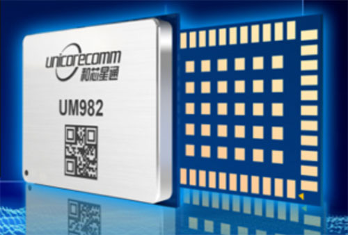
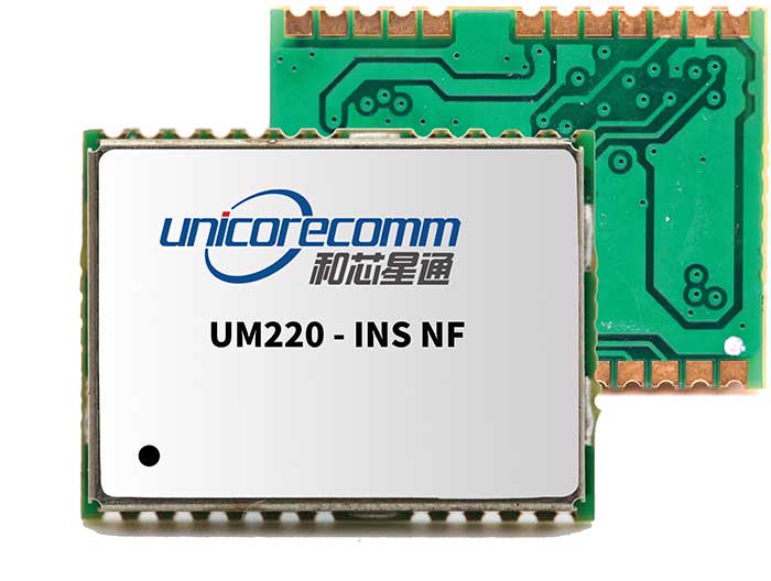
Rx Networks is offering for both the North and South American markets the next-generation high-precision GNSS modules from Unicore Communications, based in China.
Based on the new NebulasIV systems-on-chip (SOC), the UM960, UM980 and UM982 modules offer all-constellation, multi-frequency, high-precision real-time kinematic (RTK) positioning and heading capabilities.
Rx Networks is exhibiting at ION-GNSS+ taking place this week in Denver, at Booth 108, and will exhibit at Intergeo in Essen, Germany, Oct. 18-20, at Booth F2.033.
Available in a small footprint with low-power consumption, the Unicore modules are suited for use in reference stations, surveying and mapping, precision agriculture, heading applications, machine control, drones and robotics, vehicle navigation, precision timing, and more.
Photo: Unicore
Rx Networks is a key supplier of high-accuracy services and assistance data to a growing list of GNSS hardware manufacturers. As high-precision GNSS becomes ubiquitous, those seeking precise positioning solutions can now have Unicore GNSS hardware enlightened with Rx Networks data services.
“We are pleased to be bringing this new leading GNSS Technology into the Americas,” said Cameron Baird, head of Business Development, GNSS Hardware. “With further product miniaturization coupled with added performance, features and functionality, Unicore GNSS technology is well suited for all precision GNSS applications.”
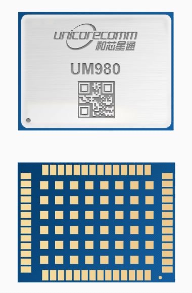
Unicore Communications has released its new generation of high-precision GNSS module. The UM980 uses real-time kinematic (RTK) technology to achieve centimeter-level positioning accuracy.
The UM980 is based on the small high-performance system-on-chip NebulasIV, which integrates radio frequency, baseband and high-precision algorithms on a single chip. It has 1,408 channels to concurrently receive satellite signals from multiple constellations and multiple frequencies.
The UM980 module can track BDS B1I/B2I/B3I/B1C/B2a/B2b, GPS L1/L2/L5, GLONASS L1/L2, Galileo E1/E5a/E5b/E6 and QZSS L1/L2/L5, as well as supporting SBAS.
Its advanced multi-mode multi-frequency computing engine provides powerful signal processing ability, characterized by fast initialization time, accurate positioning results, and a high data-update rate of up to 20 Hz.
The UM980 features low power consumption, typically 480 mW. The module is a surface mount device (SMD) measuring 17 x 22 x 2.6 millimeters. Compared to Unicore’s previous generation of high-precision GNSS modules, the UM980 is nearly half the size while the performance remains excellent.
The UM980’s compact form occupies less printed-circuit-board area and makes the product more portable. The UM980 is also equipped with an advanced anti-jamming unit, which ensures high reliability even in complex electromagnetic environments.
Thanks to its high precision, high performance and high reliability, UM980 is suitable for applications in surveying, mapping and precision agriculture. The UM980 is qualified according to the international quality standards (RoHS, REACH, CE, FCC, and IC) and is in mass production.
Unicore is a manufacturer of GNSS hardware and a sister-company to Rx Networks within the BDStar group of companies, which is headquartered in Beijing, China.
Unicore GNSS receivers have been deployed in a wide variety of applications, including reference stations, surveying, mapping, precision agriculture, machine control, drones and robotics, vehicle navigation, timing, internet of things (IoT) and more.
Rx Networks is a supplier of high-accuracy services and assistance data to a growing list of GNSS hardware manufacturers. As high-precision GNSS becomes ubiquitous, those seeking precise positioning solutions can now make use of Unicore GNSS hardware made even more accurate with Rx Networks data services.
“Unicore GNSS hardware has shown to have outstanding positioning performance,” said Cameron Baird, head of Business Development, Hardware Sales. “I am excited to see the democratization of inexpensive high-precision GNSS hardware with Rx Networks’ TruePoint.io PPP-RTK correction services.”
integration with inertial measurement units (IMUs) and other sensors
positioning using cell phones and other consumer devices
any other areas or challenges they find particularly significant.
All four respondents in this issue, like to those in the January issue, report that they are making full use of the new GNSS signals available, taking hardware and software measures to counter jamming and spoofing, and integrating IMUs and other sensors with their GNSS receivers to help achieve continuous navigation and positioning in obstructed environments. In addition, they are continuing to develop mass-market applications, because high-precision positioning is becoming increasingly important for cellphones and wearable devices. For a fuller review of these trends, see my introduction to the first installment.
Notably, two of the companies featured in this issue, ComNav Technology and Unicore, are Chinese.
With Chad Pillsbury, Senior Director, Raytheon Intelligence & Space’s Resilient Navigation and Reconnaissance Solutions
Utilizing Galileo and BeiDou
Integration and fusion of multiple space position services is a key element in achieving assured positioning, navigation and timing (PNT). A combination of commercial and military-code navigation signals, when coupled with evolving sensors, provide more resilient methods of navigation and enable new concepts of operations related to PNT. Over the next two years, RI&S will customize these concepts of operation (CONOPS) for our United States and international allies to harness the power of fusion in resilience.
Dealing with jamming and spoofing
As threats to GPS continue to evolve and mature, RI&S continues to develop alternative navigation solutions, as well as GPS-capable receivers and antennas, aimed at defending against a variety of spoofing and jamming technologies. Our latest anti-jam, anti-spoof and high-precision solutions leverage a recent technology breakthrough that lowers size, weight, power and cost while boosting performance in the new M-code and alternative navigation applications.
Integration with IMUs and other sensors
IMUs are the cornerstone of high-performance navigation systems and will continue to be in the future. Recent innovations allow some systems to become more IMU agnostic, or even to consider microelectromechanical systems (MEMS) IMUs depending on performance, which can allow the customer greater flexibility and a more open architecture.
Positioning with consumer devices
RI&S sees 5G as a game-changing technology, with a lot of possibilities in the assured navigation market. We also look to cellphones as a great area of interest — especially for exploring unforeseen signals, considering human international models, and learning how the next generation of GPS users expect to see PNT information displayed.
Other significant challenges and opportunities
The future of GPS lies in a system-of-systems approach. Using time as a backbone, navigation systems can securely share time, data, position and intent across the network. Broadly, this approach can be used in civil, commercial and military environments. RI&S is fully focused on developing capabilities to achieve this ideal state.
Unicore Communications
With Gao Jingbo, Marketing Director
Utilizing Galileo and BeiDou
Most of Unicore’s high-precision products support all constellations and multiple frequencies. The new BeiDou 3 provides precise point positioning (PPP) service from three geostationary satellites via the B2b frequency, while Galileo offers up to five frequencies — E1, E5a, E5b, E5 AltBOC and E6. End users will benefit from improved PNT availability, reliability and continuity as access to those signals greatly reduces multipath effects and allows faster PPP convergence times.
Dealing with jamming and spoofing
To effectively deal with signal jamming and spoofing, it is important to know their sources. GNSS receivers also are susceptible to electronic interference and vulnerable to complex electromagnetic environments. Unicore integrates GNSS RF, baseband and algorithms into a single GNSS system-on-chip (SoC) that mitigates external interference. Joint time-frequency domain interference mitigation technology also is adopted in chip design.
Photo: Unicore Communications
Integration with IMUs and other sensors
Demand for seamless, accurate indoor-outdoor location is increasing. The integration of GNSS with IMUs, lidar, cameras and other sensors helps achieve continuous navigation and positioning in obstructed environments such as urban canyons and tunnels. Unicore offers receivers integrated with both high-end IMUs and affordable MEMS-based devices. Dual-frequency GNSS plus MEMS provides an ideal positioning solution for automotive applications.
Positioning with consumer devices
High-precision positioning is becoming increasingly important for cellphones and wearable devices, and multi-scenario adaptation is necessary. Instead of integrating standalone GNSS chips with smartphone processors, cellphone manufacturers prefer to cooperate with GNSS manufacturers through GNSS intellectual property (IP) licensing. To ensure high-precision service, better cellphone antennas are also important.
Other significant challenges and opportunities
We strive to deliver reliable, timely and smart positioning for anything, anywhere, anytime. Next-generation GNSS location products and services should be more end-user-friendly. The hardware interface will be more universal, flexible, configurable and adaptable with different algorithms for a diverse range of applications.
Teleorbit
With Daniel Seybold, CEO
Utilizing Galileo and BeiDou
Our GOOSE receiver has been able to use Galileo since its beginning and BeiDou since the forth quarter of 2020. Signals from both can be used individually or with other signals (GPS, Galileo, GLONASS and BeiDou, plus SBAS).
Dealing with jamming and spoofing
Open Service Navigation Message Authentication (OSNMA) is now implemented on the GOOSE, which helps mitigate spoofing attacks. GOOSE’s recording function enables users to record simulated jamming/spoofing attacks, and then analyze the behavior of the GOOSE and the received signals. We are developing various GNSS antenna arrays for nulling and beamforming, as well as a left- and right-hand circular polarized (LHCP/RHCP) antenna with GOOSE adaption for signal processing.
Signal conditioning on the GOOSE platform is based on a high-rate discrete Fourier transform (DFT)-based data manipulator algorithm, known as an HDDM algorithm, that fulfills multiple roles. The HDDM algorithm removes a wide range of interference signals, equalizes the spectrum, or restructures the spectrum.
Image: Teleorbit
Integration with IMUs and other sensors
We offer a GNSS antenna with an integrated IMU. Thanks to its open software interface, fusing IMU or other sensor data with GNSS data is easily done with GOOSE. Vector tracking, deep coupling and other sensor fusions (for example, 5G) are on the GOOSE roadmap.
Positioning with consumer devices
Our ongoing AMELIE project will study advanced techniques for the miniaturization and radiation enhancement of GNSS mass-market antennas to be applied in the design, manufacturing and testing of a multi-frequency, low-cost, high-gain dual circularly polarized antenna for the next generation of consumer devices. In 2021, we will build the following antenna demonstrators: single-frequency (L1/E1), dual-frequency (L1/G1/E1, L5/E5a/E5b) and multi-frequency (L1/G1/E1, L5/E5a/E5b, L2, E6).
Other significant challenges and opportunities
GOOSE can track the Galileo E5AltBOC (wideband) signal, which provides code-range variances below a few decimeters. This offers a significant increase in the accuracy of code measurements in terms of reduced noise and mitigation of multipath effects, compared to conventional signals. GOOSE will provide two different approaches for robust tracking: vector tracking for dealing with challenging environments where multipath occurs or buildings block signals, and adaptive tracking to allow the receiver to acclimate to its surroundings by adapting the bandwidth in the loop depending on movement, such as high dynamics.
ComNav Technology
With Min Xu, Director of GNSS Technology R&D Department
Utilizing Galileo and BeiDou
We keep up with the development of GNSS. Our new K8 series of high-precision GNSS modules support the recently completed BDS-3 and Galileo constellations concurrently, significantly improving positioning accuracy especially when signals are partially obstructed. Despite their complex design, the size of K8 modules decreased by almost 36% from their precursors and power consumption dropped to 1.0W, making them easier to integrate.
Dealing with jamming and spoofing
We have developed algorithms to eliminate specific forms of jamming and spoofing, with a focus on narrowband interference. The newly released Quantum III SoC chip — integrated with wideband signal-receiving technology, wideband and narrowband anti-interference technology, and anti-continuous wave interference technology — can provide high-quality observation information in a complex electromagnetic environment.
Photo: ComNav Technology
Integration with IMUs and other sensors
There is an increasing need to add IMUs to supplement obstructed GNSS signals. Empowered by a high-precision IMU, our N5 receiver supports tilt survey with accuracy of less than 2.5 cm. Users can survey without a centering bubble as its calibration-free tilt compensation protects it from magnetic disturbances. We are also focusing on image sensors, such as cameras and radars, to make data collection more flexible and reliable.
Positioning with consumer devices
Our high-precision products are mainly used in professional fields such as land surveying, deformation monitoring, and UAVs. We are continuing to explore GNSS products for consumer markets, which are sensitive to power consumption and cost. The upcoming M10 GNSS is a compact and portable receiver for mass-market applications, such as person or vehicle tracking and fleet management.
Other significant challenges and opportunities
GNSS technology can be widely applied in agriculture, transportation and infrastructure construction. We developed the AG360/AG360 Pro Agricultural Automatic Driving system, which drives autonomously without damaging crops. We collaborated with China Mobile to build more than 2,000 CORS stations to provide high-precision positioning services in support of smart-city construction, IoT and location-based services.
Social distancing and stay-at-home orders are affecting every sector of our economy. How are companies in our industry rising to this enormous challenge? What are they doing to keep their staffs, customers, and communities safe and to help slow down the spread of the pandemic? What are they learning in the process?
We asked our marketing partners, Editorial Advisory Board members and “Innovation” Editor Richard Langley the questions below so that we could share their collective wisdom with you, our readers. The advertisers’ responses appear in alphabetical order by company, followed by the responses by EAB members.
We will continue to publish these responses here as we receive them; we will also publish a selection of them in the May print issue of GPS World.
Professor, Department of Geodesy and Geomatics Engineering,
University of New Brunswick, Fredericton, Canada
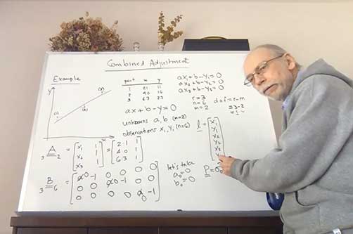
“Innovation” Editor and UNB Professor Richard Langley lectures to his students online. (Screenshot: Richard Langley/UNB)
On March 13, the president of the University of New Brunswick announced that as of the following day due to the Coronavirus-19 outbreak in the province of New Brunswick, all in-person classes would be suspended for the remained of the school term, and that starting March 23, classes would resume using alternative methods to support delivery outside the classroom. Faculty members like me had a week to find other ways to deliver our courses to the students. Some of us turned to pre-recorded video presentations and some, like me, to live class sessions using online video conferencing tools like Zoom and Microsoft Teams. I tried both but ended up using Teams on the advice of the university administration.
This term I was teaching GGE 3111: Introduction to Adjustment Calculus. Basically, it’s an introductory course on the mathematical technique of least-squares analysis. Least squares, where one seeks to find the minimum of the sum of the squares of the estimated errors in measurements, is a fundamental technique for analyzing data in many application areas in the sciences and engineering disciplines, including the processing of GNSS data. It was pioneered back in the early 1800s by Gauss, the great German mathematician and father of modern geodesy.
Incidentally, Kalman filtering also widely used for processing GNSS data, is essentially a recursive approach to the least-squares problem. The example I am doing on the board (see screenshot) is how to fit a straight line to data pairs x and y where both the x and y values contain random measurement errors. I have always taught GGE 3111 using the blackboard or, since lecturing from the dining room of my house by video link, a whiteboard.
I recorded my home-delivered lectures and provided these to the students through the Desire to Learn platform that UNB uses for teaching. Not all of the students could attend the live lectures as some had returned home to provinces with several hour time differences from New Brunswick making it inconvenient to attend a morning lecture. Others no longer had a good Internet connection to view real-time video.
The recordings also provided a useful resource to the students for reviewing the course material. When we eventually return to normality, I might continue to record my lectures. They could even form the basis of an online version of my course available to UNB students and non-students alike.
CAST Navigation has overcome many obstacles and challenges to be able to provide our customers with the products and services that are valuable to them during this difficult period. The company has instituted a set of strict policies and procedures that allow us to manage our facility hours and employee “distancing” practices.
We have also enabled employees to work remotely if necessary and we continue to work very closely with our vendor supply chain to minimize delays and impacts to our schedule. These policies and procedures, along with a very focused and devoted staff, have allowed us to continue to provide the superior quality products and services on which our customers rely.
Eos Positioning Systems’ employees are able to work remotely in most cases. In fact, prior to the pandemic, a number of full-time employees worked remotely across Canada, the United States, and the Asia/Pacific region. Now, we’ve transitioned all employees to remote working and transitioned the tasks of individuals whose routine work was directly affected by the virus. We’ve also added a weekly all-staff video Zoom meeting to address everything from company questions to individual wellbeing.
We were already grateful for our ecosystem of staff, partners, and customers, but everyone has shown their positive colors even more in response to this pandemic. Everyone remains responsive across platforms and time zones. The uptick in social media engagements of our customers and partners has been particularly great to see.
In addition, we’ve heard from some customers that they are using our GNSS receivers more during this time. Because our receivers are easy to use for the novice, office workers who would typically not do fieldwork are being trained on field work, which can be a naturally socially distanced, one-person job.
As expected, many of the events we enjoy sponsoring have been postponed or canceled. We’re working with event coordinators and our own team to ensure that when events start up again, we are prepared to go back to business as usual. We are really, truly looking forward to seeing our customers, partners, and colleagues in person again!
At GeoNumerics, we are all OK, including our families. As we are an R&D-intensive company focused on algorithms, software, and consultancy, we are lucky these days. Furthermore, some of our employees —women with young children — were already teleworking most of the time. Therefore, it was easy to extend this to the rest of the company.
Since mid-March, everyone is at his/her place teleworking. This enables us to:
keep the company running
keep our employees busy like in “normal” days
protect our customers by meeting deadlines
protect the economy by not stopping the business
on a case-by-case basis, help our providers/partners who had to stop their business.
Internally, we share a “good morning” short communication via WhatsApp and a daily 20 minute “virtual coffee break” after lunch via Skype.
Miguel Amor, Chief Marketing Officer, Autonomy & Positioning Division
Editorial Advisory Board Member
Miguel Armor
COVID-19 is affecting everyone on a global scale, which means that we all must work together to limit the spread of the virus and protect the people at risk. At Hexagon, our priority is keeping our employees and customers safe, and we are following all guidelines and recommendations set up at national, regional and local levels to do so.
Through all of this, we recognize that our employees and our customers are relying on Hexagon more than ever. Rest assured that we are taking all necessary steps to protect our employees and to minimize risk to the supply of our products and our services to our customers.
At Hexagon | NovAtel, we believe our size, reach, and position not only provide great opportunities but also carry great responsibilities. We understand that the GNSS community in general is relying on NovAtel more than ever and we are taking all the necessary steps to support the community and our customers.
Just like many of you, we at JAVAD GNSS are quickly and actively adapting to the changing times caused by the global COVID-19 pandemic. We recognize that JAVAD plays an important role in many of your operations and in supporting the critical missions of our customers. To that end, we are following best practices to curtail the spread of this virus and protect the well-being of our employees and partners, while ensuring we meet the commitments to you that you have come to expect.
Our primary message today is JAVAD GNSS is Open for Business! Our support team is here and ready to assist you as it always has. Please do not hesitate to contact us.
While there was a short pause in March when news broke in the U.S. about COVID, much of this now seems to be subsiding. At the same time, the value for instantly accessible aerial maps is more obvious than it ever was. As teams work from home and push to keep projects on track, the need for remote access to aerial photography remains strong at a time when travel and remote site inspection is lower than it ordinarily would be. Judging from very recent activity (all April 2020), there’s high interest from city government, engineering, construction, solar/energy and land development.
For Orolia, this crisis has highlighted the importance of the word “resilient.” As a leader in resilient positioning, navigation and timing (PNT) and as an essential business, we need a resilient organization that can keep delivering the critical solutions that our customers need. We can’t let our customers down because they support defense and critical infrastructure programs worldwide. Now more than ever, we recognize the essential nature of what we provide, and we must keep supporting our customers, even in times like this.
Orolia plays an essential role in the Defense Industrial Base (DIB) in the Critical Infrastructure Sector, as defined in the Department of Homeland Security (DHS) Memorandum on Identification of Essential Critical Infrastructure Workers During COVID-19 Response and the DHS Guidance on the Essential Critical Infrastructure Workforce: Ensuring Community and National Resilience in COVID-19 Response.
Many global companies need to continue operating as normally as possible to provide much needed capabilities in order to help governments, members of the armed forces and critical infrastructure to stay operational.
Our Supply Chain/Sourcing team conducts regular risk assessments to ensure that Orolia partners can continue to provide uninterrupted service by securing materials and products. Our service, support, business development. and engineering teams also remain ready to respond to requests.
We use Skype extensively, to keep in touch with our customers and partners but also for internal conference calls and meetings. There isn’t really a substitute for face-to-face meetings, but Skype is as close as you can get. In terms of communicating with our partners we have very much moved into the digital space. We have instead held webinars using WebEx which have been very well received. We have more planned so watch this space!
We have learned that we can work very well under pressure! With COVID-19 postponing some of our favorite shows we didn’t want to sit back and do nothing. We had to act very quickly and look at other ways of communicating our message. Not only have we as a business been agile enough to do this, despite working remotely, our channel partners have really taken on board what we’ve been trying to achieve and helped us exceed our goals.
Don’t use COVID-19 as an excuse to rest on your laurels. Take it as an opportunity to do some of the things that you otherwise wouldn’t have done.
To collaborate remotely, a safe distance from each other, we use video messaging (MS Teams) with team(s) daily, as well as Confluence (engineering documentation) and Jira (task management) for remote collaboration.
Much of our team is able to continue efficient operations while working remotely. Collaborating with our customers has always been a service we offer – which, we believe, leads to better product performance and reliability. This pandemic has pushed the majority of the country/world into remote working. While we aren’t able to be in person with customers, accessible remote tools and collaboration help us continue to provide hands-on customer service, without actually using our hands.
Parker LORD designs and produces MicroStrain inertial sensors that are used in robots that aid in delivery, mapping, and surveillance activities. Our inertial measurement units (IMU) and inertial navigation systems (INS) are designed to allow quick time-to-market development. We offer IMU/INS integration with our recently updated Robot Operating System (ROS) drivers for ease of use. By using our sensors, we have reduced development time while also offering top performance and competitive pricing. There are different levels of inertial sensors based on the performances available depending on the application being used.
As the need for measurement and navigation solutions increase with the demand for delivery, safety and automated robotic monitoring, our new 3DMGQ7-GNSS/INS dual antenna RTK-enabled INS provides next level performance with integrated custom IMU, dual integrated RTK-capable multi-constellation GNSS receivers, integrated barometric pressure sensor, and magnetometer. Beyond the integrated sensors the GQ7 offers hardware support for wheel odometry and API support for external velocity sensor measurements. This sensor has been designed for use in markets such as beyond visual line of sight (BVLOS) unmanned aerial vehicles (UAV), unmanned vehicle navigation, legged robots, and autonomous vehicles. It’s an all-in-one system solution (GNSS-INS + RTK + SensorCloud RTK).
Get ready for the robot revolution. There was momentum in that direction before, in areas such as delivery, recon and mapping. Acceptance of these technologies will only increase now and in the future.
Racelogic, the company behind LabSat GNSS simulators, is based in Buckingham, UK. Like many companies, we are adjusting to new ways of working and remote collaboration. With the majority of our 100 staff now working from home, I have few concerns about their ability to adapt and am confident that the outcome will be one of success. However, I am also aware that the paths taken over the coming weeks or months are unlikely to be without a few bumps in the road.
I am hearing reports from all corners of Racelogic about how staff are dealing with these unprecedented circumstances. For example, Katie Harland, our LabSat Support and Applications Technician, is continuing to support our customers from home. However, without a rooftop antenna on her building she has had to be a little inventive about how she gains a live satellite feed to record test scenarios. Her solution was to mount an antenna on a ground plate devised from the lid of a biscuit tin and set it on her garden wall. An effective solution, but one that is not straight forward when you are 5’2” and the garden wall is 7’ tall.
I am also noticing changes to what a “normal” day at work now looks like. With so many staff working remotely I find myself walking through the office and instead of checking on project progress I am rebooting computers, connecting equipment, accessing server files, and generally servicing those who are working remotely. I think it is easy to fall into the trap of obsessing about perfecting remote working. I don’t think you can go too far wrong if you focus on the things you can do, even if you need a ladder to get there.
During these challenging times, Septentrio continues to be operational and to serve its customers. We have taken measures to ensure health and safety within the company. Most of my colleagues and I are working from home, while manufacturing has been divided into two shifts to guarantee continuity and provide the safest possible working conditions. Although international travel is suspended for the moment, we continue to have regular meetings via phone or web with our partners, customers and prospective clients.
This virus is forcing us to rethink the way we work and interact. As we adjust to the new situation, we are finding ways to continue working with as little disruption as possible, leveraging the efficient communication networks and remote-control solutions available to us today. Along the way we might even discover new more efficient and environmentally friendly ways of working.
In addition to ensuring employee safety, Septentrio is also dedicated to help fight the virus by providing reliable high-accuracy positioning solutions to technologies that are making a difference. For example, aerial drones have been used by police in Europe to announce new government regulations in public places and to scope out large areas for public gatherings. To ensure public safety it is vital that the sensors aboard these aerial drones, such as their positioning receivers, are robust and reliable even in challenging conditions.
Other delivery drones such as Zipline and Wing are expected to ramp up speed with the increase of automation required to fight the coronavirus. In the European Union and the United States regulations around drone use are stricter than in China and thus the full potential of drones is not yet realized to its maximum.
Since our inception, a few of our employees have worked from home due to traffic issues, work/home responsibilities, or simply geographical location issues. Over the years, we decided as a company not only that this was working very well, but that everyone who could work from home should be allowed to have the same privileges. In the past two years, we have allowed everyone to work from home, only requiring to come into the company offices those who must be in a lab or for security reasons. Everyone has a laptop computer and remote access to files. We use Zoom, email, and cell phones to communicate with each other and our customers.
When the recommendations from the CDC and the President of the United States were issued to work from home, we were already doing this, so there were no adjustments needed. Those that must work in the lab are practicing social distancing and working on alternate days in some cases.
When we first contacted our customers to attempt visits, we were told that they were not receiving visitors and that it was going to take a few days or weeks to get everyone outfitted with laptops and other technology to continue working from home. We were a bit surprised to learn that others were going through this as we were not having any of these issues.
This crisis has taught us that being prepared and trusting our team to work independently pays off when we really need it. Everyone is being a little extra patient, kind, and understanding. We are seeing this general compassion outside of the office as well and we hope that this has a lasting effect on the world.
Jackie Ferreira, Director of Corporate Communications
Jackie Ferreira, Topcon
We are fortunate in that our team is well-versed in online collaboration software, including teleconferencing and online digital asset management systems. We are leveraging tools such as those to keep productive in this crisis.
We are working very well together via safe distancing practices. Our employees around the world are staying active with ongoing conference calls across multiple time zones. Our primary concern is the health and safety of everyone we interact with and we continue to be impressed with how all involved have responded.
Topcon operates with a primary goal of the health and safety of its employees, customers, and suppliers and in accordance with applicable state and local orders, including social distancing requirements. To this end, we provide on-going guidance from the World Health Organization (WHO) and Center for Disease Control (CDC) to our employees to support their health in these critical times.
We encourage compliance with applicable governmental orders concerning their ability to continue to operate, with the understanding of roles within the critical infrastructure supply chain.
We are dedicated to supporting our customers at this critical time and have specific teams working to meet demands to the best of our ability.
Our relationships with our customers and partners are important to us. Topcon strives to work closely together with our partners to protect the industries we serve and accelerate the economic recovery needed in light of the current world crisis. Together we can serve as a beacon of cooperation and commitment to successfully weather these unusual times.
The outbreak of COVID-19 started around the Spring Festival, and strict control measures to stop the spread of the virus were taken even before the holiday ended. Unicore postponed the return-to-job date by one week and encouraged working from home, except for the key R&D and ST engineers, who cannot perform verification, testing, or debugging outside the labs. However, even then strict social distancing measures were guaranteed. As of February 10, Unicore’s return-to-work rate was more than 80%, with nearly 40% of the employees doing it from the office, while now nearly 90% of Unicore’s labor force is back to normal working mode. Thanks to the 4G networks, fast mobile and Web communications, as well as cloud computing technologies, we were able to easily organize video conferencing, online meetings and group messaging.
Our R&D and product delivery were slightly affected by the COVID-19 due to the delays at some supply plants. However, Unicore has a well-run and organized inventory management system, so most of the orders can be fulfilled on time.
Some of Unicore’s clients use drones to perform disinfectant spraying and logistics transportation, which help to ensure an uninterrupted supply of food and goods. Other clients make intelligent and autonomous sweepers that reduce the need for manual labor and keep the workers safely at home. In order to avoid personal injury, infection and transmission in epidemic areas, drones and/or unmanned vehicles with GNSS high-precision positioning technology have been used for cleaning and disinfection, supplies delivery, and aerial photography in engineering construction.
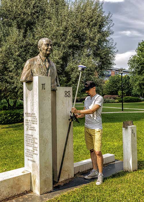
Top receiver manufacturers discuss what’s on the horizon for GNSS receivers. The companies reveal recent and upcoming innovations, how to combat spoofing and jamming, fusing GNSS with other sensors, and the impact of increasing accuracy both for professional surveyors and consumers.
With regard to jamming and spoofing, the preferred approach is a combination of monitoring, detection and filtering. However, shielding, the use of IMUs and other third-party sensors, and advances in processing algorithms also help mitigate interference. In a few years, hopefully, encrypted or “watermarked” signals will substantially reduce this problem.
IMUs and other sensors are now routinely integrated with GNSS receivers, with their outputs fused. This trend is largely propelled on the demand side by the needs of the emerging market for autonomous vehicles and on the supply side by smaller, cheaper and more accurate IMUs and lidar scanners. Meanwhile, developments in algorithms have improved the modeling of errors to correct for the inherent tendency of IMUs to drift. Additionally, digital cameras, lidar and other industry-specific sensors are increasingly common, especially for collision avoidance in human-machine interactions.
In surveying, the use of all constellations and frequencies, as they become available, is an industry trend. Costs will continue to drop as the growth in the adoption of GNSS solutions enables manufacturers to take greater advantage of economies of scale. Precise point positioning (PPP), which benefits greatly from the growth in GNSS constellations, is now giving real-time kinematic (RTK) positioning a run for its money. Available applications enable Android mobile devices to achieve centimeter accuracy, while innovations continue in core positioning algorithms.
In the world of mobile consumer devices, dual-frequency, multi-constellation GNSS chipsets are increasingly prevalent. As increased accuracy fuels expectations for even higher accuracy, precision positioning may become the norm in the consumer space, and new applications for these devices may emerge. Already, crowdsourcing the monitoring of both GNSS signals and interference helps improve accuracy for everyone, in a positive feedback loop.
Other notable trends include the introduction and expansion of 5G data networks, the increased use of satellite-based correction services, and continued efforts to develop precise positioning for indoor areas. (See part 2 of this feature here.)
Topcon
Jamming and Spoofing. “We continue to develop and deploy patented technology to detect spoofing,” said Alok Srivastava, director, product management. “We already have cutting edge GNSS antenna technology to provide stellar support for interference rejection and filtering.” All Topcon end products have this advanced antenna and filtering technology.
Sensor Fusion. “Topcon has been using inertial systems for decades for a variety of positioning applications — such as machine control, mobile mapping, and agriculture,” said Srivastava. “In recent years, advancements in IMU technology have progressed to where the size and cost of these sensors are at levels to be utilized at a larger scale. For example, the recently released Topcon HiPer VR takes advantage of inertial technology to improve productivity in real time with our Topcon Integrated Leveling Technology (TILT), which compensates for mis-leveled field measurements out of plumb by as much as 15 degrees.”
Surveying. Topcon continues to invest in its core positioning algorithms to innovate such features as quartz lock loop, advanced multi-engine platform, and VHD heading technology into its positioning engines, Srivastava said. “We also produce solutions such as our Millimeter GPS and Hybrid Positioning innovations, which are designed around improving accuracy, higher reliability, and greater flexibility by converging positioning technologies.”
Consumer Devices. “GNSS in consumer devices and other commercial systems is used to aid other positioning sensors,” Srivastava said. “So, it may not be in the best of interest to offer that level of accuracy from GNSS alone.”
Other Challenges. Precise indoor positioning is a requirement of the vertical construction industry. “Topcon’s combined optical instrument takes a unique approach to solve that problem by integrating a compact laser scanner with a fully featured robotic total station,” Srivastava said.
Photo: CHC Navigation
CHC Navigation
Jamming and Spoofing.CHCNav is currently taking a twofold approach to GNSS interference, said François Martin, vice general manager, International Division. “As a GNSS system integrator, we focus our design around strong electromagnetic shielding and sealed isolation chambers.” Additionally, he pointed out, the advanced filtering of GNSS signals and an antenna patch produce optimal interference mitigation.
Sensor Fusion. Integrating interference-free, high-dynamic IMUs instead of MEMS has brought the full benefits of tilt compensation to users, Martin said. The latest development in algorithms dramatically obviated the need for the annoying process of initializing GNSS IMU receivers and boosted the availability of GNSS RTK in demanding environments.
Surveying. The fast adoption of GNSS solutions by large user segments has reduced costs by enabling a sizable manufacturing economy of scale, Martin pointed out. “Tighter combination of embedded technologies such as GNSS and connectivity modules are sustaining that cost reduction process.”
Consumer Devices. “The emergence of dual frequency multi-constellation GNSS chipsets supports the development of untapped user segments, but the position accuracy repeatability remains an issue,” Martin said. “The integration of GNSS chipset and high-performance helical antennas, as precision add-on modules, onto rugged Android cell phone and tablets is creating a prosumer-grade centimeter to decimeter accuracy answering to a wide range of mobile workforce applications.”
Other Challenges. A growing number of positioning and navigation applications require the fusion of technologies to increase productivity, Martin said. “The integration of advanced tightly integrated positioning algorithms, scanners, IMUs, HDR cameras, IoT and cloud-based connected solutions are a clear trend.” However, their adoption by a large user base remains limited by their current price point.
Photo: Septentrio
Septentrio
Jamming and Spoofing. “Recent developments in receiver-antenna combinations maximize the benefits of anti-jamming techniques,” said Gustavo Lopez, market access manager. Third party sensors, such as IMUs, also help mitigate interference, he pointed out. “Septentrio’s advanced receiver technology such as AIM+, a standard feature on all the company’s products, bring not only real time monitoring but also jamming/spoofing mitigation. Galileo and GPS have clear roadmaps bringing signal authentication in order to avoid spoofing.”
Sensor Fusion. Smaller IMUs with higher grade performance now on the market are enabling new use cases in autonomous applications, said Lopez. Other important elements are a new generation of compact high-performance sensors and the growing importance of multi-sensor technology “to provide even higher levels of positioning integrity.” He cited Septentrio’s AsteRx-i family of products as an example of GNSS/INS integrated solutions.
Surveying. As an example of Septentrio’s survey-specific products, which “continuously benefit from advanced developments being rolled out in our platform,” Lopez cited the Altus NR3.
Consumer Devices. The increasing positioning accuracy of cell phones, Lopez pointed out, “has spurred innovations such as PPP and the use of mobile phone measurements,” as well as “other purposes, such as interference detection and crowdsourcing.”
Other Challenges. “Sensor fusion is a key element in positioning and orientation,” Lopez said. “Easy integration is a key element in this trend. Also, integrity in error reporting and positioning will be required as well as reliable raw measurements which can be integrated with other sensors. This drives the requirement for receivers capable of running customer proprietary software. Another important element will also be the possibility of running positioning algorithms on a third-party processor.”
Photo: Hemisphere GNSS
Hemisphere GNSS
Jamming and Spoofing. “Hemisphere’s new Lyra II ASIC platform used in our Phantom and Vega series positioning and heading boards,” said Miles Ware, director of marketing, “introduces new technology and filtering methods to identify and mitigate known and unknown interference sources that typically have an adverse effect on GNSS performance.”
Sensor Fusion. “Advancements in IMU integration and sensor fusion,” Ware said, “will continue to be a key focus for Hemisphere to support the growth and adoption of the expanding autonomous vehicle and application marketplace. The positioning and heading technology offered in our Vega 28 will be a core component for autonomous marine, machine control, and agriculture solutions for new and emerging markets.”
Surveying. “Access to modern and future signals like BeiDou Phase III, ALTBOC and BS-ACEBOC significantly enhance GNSS accuracy, especially in challenging environments where satellite visibility is compromised by the topography and or the structures present,” Ware pointed out. “Survey solutions that can not only track but also use all the available GNSS measurements in their RTK solution will have a substantial advantage in the market.”
Consumer Devices. “As mobile phones and consumer devices continue to adopt hardware designs that can access the latest GNSS signals,” Ware said, “the opportunities for solutions where high precision measurement engines can be hosted within mobile devices opens up a new realm of solutions that can leverage the high accuracy positioning performance found in Hemisphere technology and products. We see this as a very exciting and emerging area.”
Other Challenges. Ware pointed to “leveraging GNSS technology to further support environmentally friendly transportation solutions and sustainable agriculture,” for which GNSS continues to be an integral component.
Photo: Unicore
Unicore Communications
Sensor Fusion. “We are implementing GNSS with different level IMUs, including low-cost and high-end, targeting automotive, intelligent driving, and robot application scenarios,” said Gao Jingbo, marketing director. “The algorithm can also integrate with the already-existing sensors on the platform, such as IMUs, cameras and odometers. The solution can be done on the GNSS side, with high information synchronization accuracy, or processed on the platform.”
Surveying. Products with Unicore boards inside can provide centimeter- to millimeter-level positioning accuracy, said Jingbo. “Unicore’s high-precision boards and modules can track all frequencies of all satellite systems. The UGypsophila RTK technology can make the most of the observation data of all frequencies in all systems even without the observations of the base station in the RTK solution, thus greatly improving the usability, reliability and accuracy of RTK.” The company is now also working to reduce the dimensions and cost of its products, Jingbo pointed out. “With Unicore’s single GNSS SoC on board, the UB4B0M and UM4B0 modules are making affordable high-end high precision surveying possible.”
Consumer Devices. Algorithms and hardware are ready now to implement PPP+RTK in cell phones, Jingbo said, and this increase in positioning accuracy will enable many more applications. “We have rich experience in high precision GNSS, but the antenna might be a challenge. Our new generation 22 nm GNSS SoC features low power consumption and support of sensor fusion. Additionally, true point technology by Rx-Networks (also a BDStar company) can provide sub-meter data service, which also enables users to access centimeter-level accuracy location data through their mobile phones and wearable technologies, without increasing the demand for processing power.”
Photo: Trimble
Trimble
Jamming and Spoofing. “Trimble’s latest GNSS receivers leverage our seventh-generation Maxwell technology, which implements hardware- and software-based techniques to detect and mitigate spoofing,” said Stuart Riley, vice president, GNSS Technology. “In addition, Trimble continues to improve the robustness of our GNSS receivers with advances in processing algorithms and hardware enhancements such as the integration of inertial technology.”
Sensor Fusion. “For many years, IMUs have been widely used in Trimble agriculture and Applanix products,” Riley said. “Over the past few years, we’ve created a new line of lower-cost inertially integrated board-level GNSS receivers. We have also integrated inertial components into survey and construction products, including tilt compensation in the Trimble R10, R12 and SPS986 receivers. Trimble also combines its GNSS solutions with optical, laser, lidar and other sensors.”
Surveying. Trimble’s GNSS products, Riley pointed out, range from GIS handhelds to high-performance mobile mapping systems.
Consumer Devices. “The Trimble Catalyst system uses Android-based smartphones or tablets to run an application that includes a software-defined GNSS receiver,” Riley said. “The recently introduced SiteVision system builds on this ecosystem and integrates Google’s ARCore platform with precision GNSS to provide an augmented reality solution for a variety of professional applications.”
Other Challenges. To address signal masking and multipath, Trimble has “continued to improve performance in difficult environments with products such as the Trimble R12 receiver, which provides sophisticated multipath mitigation and an advanced precision processing engine.” Riley said, “Trimble’s RTX Correction Services, delivered via satellite, enable users to achieve RTK speed and accuracy nearly anywhere on the planet without the need for local reference stations.”
Photo: NovAtel
NovAtel
Jamming and Spoofing. “The RF environment is at best crowded and at worst hostile,” said Sandy Kennedy, vice president of innovation, Hexagon’s Positioning Intelligence division. “The NovAtel OEM7 generation of receivers was launched in 2016, with interference detection and mitigation as key features on every variant. Protecting authenticity, availability, and precision for multifrequency measurements is the challenge going forward — in all segments of the system: constellation management and SIS, antenna, receiver design and processing in FW/SW.”
Sensor Fusion. In the last three years, Kennedy pointed out, IMU manufacturers have made significant improvements in the performance offered in smaller, cheaper IMUs. “At the same time, new methods to improve error modelling (to control positioning errors) have been added to the NovAtel SPAN product line, especially in SPAN Land profile. Extended GNSS outages are easily handled now.”
Surveying. “PPP has become a strong competitor to RTK, as convergence times have decreased, and this will continue in service offerings like Terrastar-X from NovAtel,” Kennedy said.
Consumer Devices. The devices, Kennedy said, offer “the tantalizing promise of quality measurements from a common utility device with huge computing horsepower and data connectivity built in! It’s fun to watch, and we shall see if accuracy is truly addictive enough to fuel development for general use of precision positioning.”
Other Challenges. “In the past 20 years, users have moved from awe and wonder that centimeter-level positioning is possible — to utter contempt when it is not,” Kennedy said. “This will continue, with an added requirement of integrity and functional safety. Continuously available positioning within a usable protection level is a requirement for autonomous vehicles.”
Unicore Communications’ Gao Jingbo discusses the company’s product line — including the CLAP-B, UB4B0, UM4B0 and more — at Intergeo 2019, which took place Sept. 17-19 in Stuttgart, Germany.
Unicore Communications’ Liyang Dao offers GPS World an overview of the company’s UB4B0M BDS/GPS/GLONASS/Galileo multi-system multi-frequency compact high precision board at Intergeo 2018 in Frankfurt, Germany. According to the company, the board features low-power consumption design and offers millimeter-level carrier phase observation value, as well as centimeter-level RTK positioning, supporting chip-level multi-path mitigation.
Unicore Communications has launched CLAP-B, a multi-GNSS/MEMS integrated inertial navigation board, which integrates a miniaturized high-performance inertial measurement unit (IMU) on a compact high performance GNSS board.
The high-accuracy GNSS positioning coupled with a high-precision gyro and accelerometer provides stable, continuous three-dimensional position, velocity and attitude, as well as original acceleration and angular velocity measurements, even in GNSS-denied environments, the company said.
CLAP (Concurrent Localization & Attitude Pilot) technology is a high-precision multi-sensor fusion positioning and orientation technology developed by Unicore.
The CLAP- B, along with all the UM and UB family of receivers, are on display at BDStar booth C12.0C.022 for the duration of Intergeo 2018 starting Oct. 16 in Frankfurt, Germany.
Key features of the CLAP-B include:
Compact size: 46 × 71 × 17.1 mm
5-ns RMS PPS output
0.1 degree (1σ) pitch and roll
WINS optimized technology (wheel INS) for vehicles, wheeled robotics
With the features of compact size, light weight, low power consumption, and easy for integration and mass production, CLAP-B is suitable for applications such as autonomous driving, smart surveying, unmanned aerial vehicles and various attitude stabilization platforms. Customer samples will be available by the first quarter of 2019.
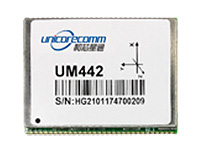
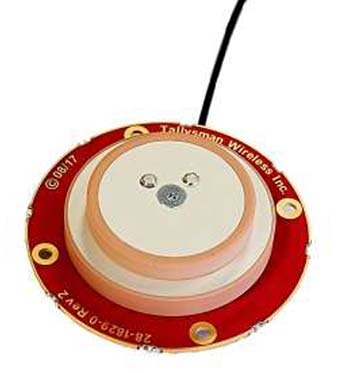
The UM442 can simultaneously track GPS, BDS, GLONASS and Galileo. It also supports SBAS and QZSS. It uses Uncore’s new-generation Nebulas II chip and UGypsophila real-time kinematic (RTK) algorithm. Based on high-performance data-sharing technology and the simplified operation system of the Nebulas II chip, the UGypsophila RTK algorithm dramatically optimizes matrix processing, enabling the UM442 to track more satellites and shorten the initialization time to 5 seconds.
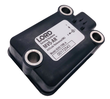
The MV5-AR inertial sensors are designed for off-highway and military vehicles, marine and mobile robot applications, and the autonomous vehicle market. The rugged, compact sensors use LORD’s fifth-generation high-performance industrial-grade solid-state six-degrees-of-freedom (6-DOF) micro-electromechanical accelerometer and gyro inertial sensor technology. Successfully deployed on ground robots and heavy machinery, applications also include autosteer and terrain compensation; dynamic incline detection (roll, pitch, rotation); vehicle stability and leveling; platform control, alignment and stabilization; operator feedback; and precision navigation. The compact and rugged reinforced housing is fully sealed for immersion and pressure wash. Each sensor is calibrated and temperature compensated.
BeiDou Phase 3 signals are now available on Spirent GNSS RF constellation simulators GSS7000 and GSS9000 — existing users can obtain the software upgrade by contacting Spirent. Phase 3 of the Chinese BeiDou system will extend its coverage from Asia to the entire world, providing receiver developers and integrators with additional GNSS signals to make positioning, navigation and timing systems more accurate, and help to support new applications, such as autonomous vehicles. Customers can test their designs before the system is fully operational in 2020.
The ZED-F9P multi-band GNSS module has integrated multi-band real-time kinematic (RTK) technology for machine control, ground robotic vehicles and high-precision unmanned aerial vehicles applications. It measures 22 x 17 x 2.4 millimeters and uses technology from the u‑blox F9 platform to deliver robust high-precision positioning performance in seconds. The ZED-F9P is a mass-market multi-band receiver that concurrently uses GNSS signals from all four GNSS constellations (GPS, GLONASS, Galileo and BeiDou). Combining GNSS signals from multiple frequency bands (L1/L2/L5) and RTK technology lets the ZED‑F9P achieve centimeter-level accuracy in seconds.
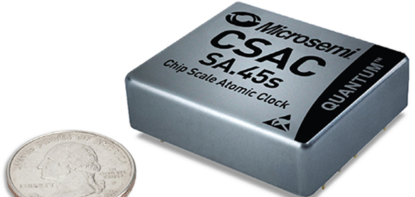
The SA.45s Commercial Space Chip-Scale Atomic Clock (CSAC) is a commercially available radiation-tolerant CSAC suitable for low Earth orbit (LEO) applications. The device provides the accuracy and stability of atomic clock technology while achieving significant breakthroughs in reduced size, weight and power consumption. It provides excellent drift performance and built-in 1 pulse per second (PPS) input for GPS disciplining, making the device well-suited for holdover applications. Commercial and research space applications include satellite timing and frequency control; satellite cross linking; assured position, navigation and timing; and Earth observation.
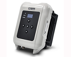
The long-range, power-efficient eRadio is designed to support high-precision GNSS real-time kinematic (RTK) applications in surveying and precision agriculture. It is enabled with intelligent serial baud rate identification for different RTK devices. It can automatically identify RTK serial baud rate with a radio data cable and provide a plug-and-play form for easy connection between the eRadio and RTK. With its high transmitting power (5-35 Watts), transmission data can be up to 19200 bps/s over a connection distance of 50–80 kilometers. It can work as either a base or repeater with other Harxon radio modems in challenging environments.
Wireless communication with any Android or Windows terminal
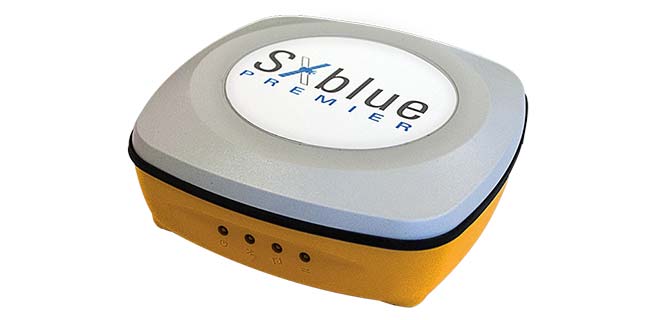
Image: SXblue/Geneq
The SXblue Premier GNSS receiver is available in a submetric version (GNSS) or centimetric version (RTK). It is equipped with Pacific Crest Maxwell 6 Trimble technology with BD910 (GNSS version) and BD930 (RTK version) OEM boards, delivering 220 channels to acquire and track GNSS signals from all constellations in view. It makes effective use of GPS, GLONASS, Galileo, BeiDou, QZSS and SBAS signals for precise positioning.
The single-frequency, multi-GNSS Vector V123 and V133 all-in-one smart antennas are multi-GNSS compass systems using GPS, GLONASS, BeiDou, Galileo and QZSS for simultaneous tracking for heading, position, heave, pitch and roll. Both support NMEA 0183 and NMEA 2000. The V123 and V133 thrive in radar/ARPA, AIS, ECDIS, side-scan survey, multi- and single-beam surveys, dredging and general navigation applications.
The Trak4 provides GPS tracking with cell-trilateration fallback. Ping rates can be selected from every two minutes to once a day, with email and text alerts provided for geozone entry and exit or if the high-capacity rechargable battery is low (the battery runs up to 12 months on a single charge.) The Trak4 is designed for tracking vehicles, assets and inventory; it can also be used to track people such as the elderly. Indoor/outdoor weatherproofing allows “anywhere” mounting.
PCTEL’s multi-GNSS L1/L2/L5 antennas combine aerospace-level precision with global satellite compatibility in a highly durable package. They enable critical applications including vehicular automation, 5G network timing synchronization and Positive Train Control (PTC) systems. The antennas increase the accuracy of timing and location information by providing simultaneous access to multiple GNSS signals across multiple frequency bands. The antennas support all relevant GPS, GLONASS, BeiDou and Galileo frequencies with excellent multipath mitigation and high out-of-band rejection for greater signal clarity. Their robust AAR and IP67-compliant design makes them suitable for years of use on railways and in other harsh real-world environments.
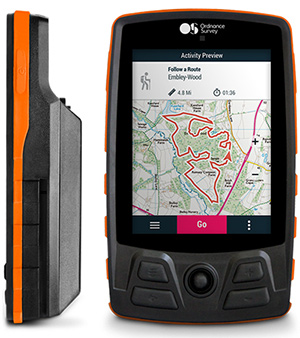
Four new GPS handhelds are designed for off-road use, with safety in mind. All four of the OS GPS models have a built-in SIM card with access to the SeeMe subscription-based service and its safety features. With I.C.E (In Case of Emergency), users can send emergency alerts with exact coordinates to family and friends directly from the OS GPS. Live Tracking enables the user to be locatable at all times, sharing location and performance data with up to 20 friends in real time. Aventura, the most advanced navigation device, can be used in all weather conditions.
Zubie Fleet Connect provides real-time GPS fleet tracking, driver check-in and performance reports, and vehicle health alerts. The monitoring and reporting service lets managers of fleets from 2 to 5,000 vehicles optimize business on the road. Wi-Fi connection to the cloud delivers important information about the health and performance of the vehicle, enhancing driver safety. Zubie also works with large enterprises to develop custom data flows and access driving data that can be used to analyze driving patterns, spot geographical trends in activity, or improve fleet asset management based on vehicle wear and tear.
The Heliscope 2.0 provides onboard data collection with speed, efficiency and productivity improvements for the utility inspection industry. It provides a solution for operations over greater distances or in harsher environments than drones can accommodate The system integrates multiple sensor systems into a single, lightweight helicopter payload, capable of simultaneously collecting a range of data types required for utility maintenance and vegetation management inspections. Deployment enables optimized inspection and maintenance schedules, offering potential cost savings in those operational activities by as much as 50 percent. The Heliscope 2.0 has flexible mounting configurations and the ability to adapt for mounting on many different helicopter types.
Based on DJI’s M600 Pro platform, the Leica Aibot system is designed to rapidly and autonomously enable digitizing of critical infrastructure. It enables users to get a complete data set quickly with a user-friendly interface. Using Leica Infinity for point-cloud, digital surface model and orthophoto generation enables surveyors to process and visualize aerial data. For construction projects, Aibot provides access to critical information to perform volume calculations and monitor site progress. Users can see high-definition imagery and 3D mapping of the site and document progress. The UAV data can be combined with other survey technologies such as GPS for a more complete set of information.
Two lightweight, compact antennas are designed for UAVs with a low aerodynamic profile. Antenna model TW1829 is for original equipment manufacturers (OEMs), and model TW8829 is a housed version. Accutenna technology provides high-level rejection of multipath signals, a phase linear response and tight phase-center variations. Pre-filters prevent saturation of the front-end low noise amplifier by strong near frequency and harmonic signals.
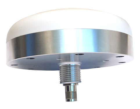
The HA32 high-performance antenna supports GPS, GLONASS, Galileo, BeiDou and Hemisphere’s Atlas L-band correction service. It is designed for UAVs, geographic information systems (GIS), surveying, real-time kinematic (RTK) and other applications requiring high-precision positioning and navigation. The HA32 is built on a proprietary four-helix antenna technology that provides superior filtering and anti-jamming performance with features such as a low noise figure of 2.0 dB (typical) and up to 30-dB gain (typical). Suitable for most outdoor and harsh operating environments, the HA32 antenna is sealed in a durable and ruggedized IP67-rated. The lightweight (40 g, typical), compact form factor (40 x 75 mm) makes it resistant to wind when on UAVs.
With the successful launch of newest BeiDou-3 navigation satellites, Beidou’s pace of globalization is quickening. As a provider of China’s domestic GNSS core products, Unicore Communications brought its full range of products to the Consumer Electronics Show (CES), which took place Jan. 9-12 in Las Vegas.
Unicore’s exhibits are targeting intelligent drive and the internet of things (IoT).
For intelligent drive, Unicore is showcasing its UM482 high-precision GNSS module, which is designed for high-end L3 self-driving and robots.
Unicore also is introducing a cost-effective low-power GNSS module — UM442 — which is suitable for L2 ADAS applications and community-based GNSS navigation and maps.
UM442 is a cost-efficient high-precision real-time kinematic (RTK) and heading module that can simultaneously track GPS, BDS, GLONASS and Galileo. It also supports SBAS and QZSS.
Based on high-performance data-sharing technology and the simplified operation system of the Nebulas II chip, the UGypsophila RTK algorithm dramatically optimizes matrix processing. Therefore, the UM442 can track many more satellites and shorten the initialization time to 5 seconds.
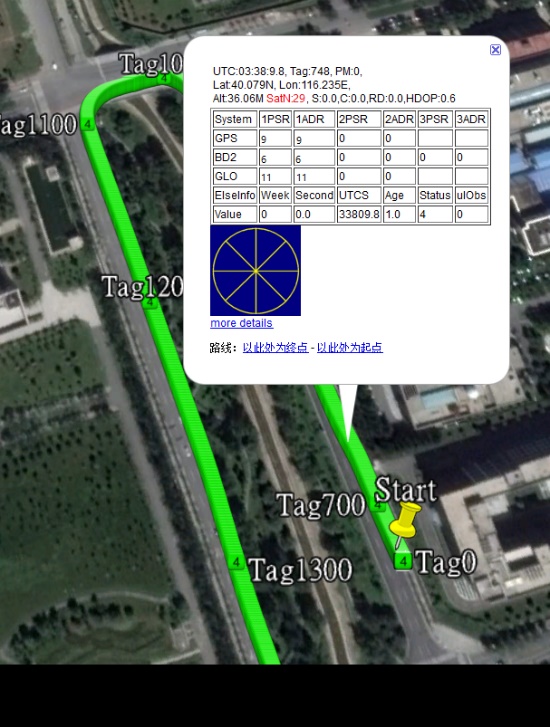
Satellite view during a UM442 road test using the UGypsophila RTK algorithm. UM442 achieves centimeter-level RTK positioning using a low-cost ceramic antenna.
With on-board MEMS and the U-Fusion integrated navigation algorithm, UM442 can achieve accurate and reliable positioning even in the most challenging environments such as urban canyons and tunnels.
UM442 also provides attitude information such as rolling angle and pitching angle, which is suitable for many new applications such as community-based navigation maps and ADAS. Even with a low-cost ceramic antenna, the UM442 can achieve centimeter-level RTK positioning, as well as a 0.2-degree/1-meter baseline heading accuracy.
At CES, Unicore plans to introduce BeiDou products into the large volume market of consumer electronics. Ufirebird is an ultra-small, ultra-low-power multi-GNSS positioning system-on-chip (SoC), using 28-nm technology. The chip supports BDS, GPS, GLONASS and Galileo signals, and the software can be extended to support WAAS/QZSS/EGNOS/MSAS/GANGAN enhanced signals.
Unicore’s UFirebird-UC6226 low-power GNSS SoC is designed for mobile devices.
Two packaging methods are available: WLCSP and QFN40. For WLCSP packaging, the chip size is only 1.73 x 2.87 mm, and for QFN40 packaging, the chip is AEC-Q100 compliant, aimed for highly reliable automotive-grade applications.
UC6226 is equipped with a built-in sensor hub capable of providing access for multiple sensors for fusion positioning. It supports Wi-Fi, Bluetooth, GNSS hybrid positioning, and better than 1-m differential positioning accuracy.
Compared with Unicore’s previous generation GNSS SoC, UC6226 has reduced power consumption by 60%. The minimum tracking power consumption is lowered to 18 mW, significantly improving battery endurance.
With a built-in anti-jamming module, LNA and -162dB sensitivity, UC6226 can maintain accurate and precise positioning under complex environments.
UC6226 has been successfully applied by China’s bicycle sharing companies. In addition, the chip will be used in intelligent watches, smartphones, smart cameras and many other IoT devices requiring smaller size, lower power consumption.
Unicore Communications’ Kongzhe Chen discusses the company’s UM482 all-system multi-frequency high-precision heading module and UFirebird UC6226 GNSS SoC at Intergeo 2017, which took place Sept. 26-28 in Berlin, Germany.