Tag: unmanned aircraft system

  • Companies join on shore-to-ship delivery with heavy-lift UAVs

    Companies join on shore-to-ship delivery with heavy-lift UAVs

    Photo: Skyports
    Photo: Skyports

    ST Engineering, Sumitomo Corp. and Skyports have formed a consortium to provide unmanned aircraft system (UAS) services for heavy-lift shore-to-ship parcel delivery in Singapore, home to one of the biggest ports in the world

    Each consortium member will use its respective operational and technological capabilities to expand the use of UAS for deliveries of maritime essentials to anchored vessels. During a nine-month pilot program, the consortium will engage key customers for maritime UAS deliveries, with the goal of establishing a delivery network capable of carrying parcel payloads of 10 kg.

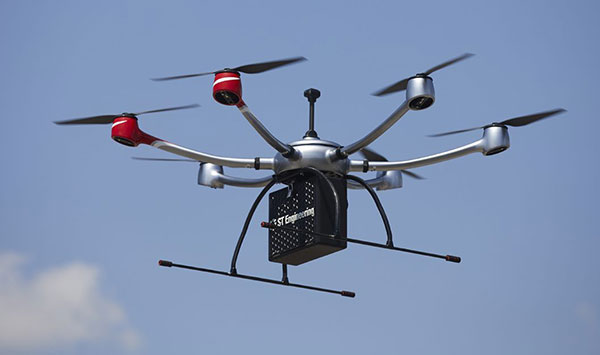
    ST Engineering will provide the UAS technology using its end-to-end solution DroNet. Skyports will jointly conduct the beyond-visual-line-of-sight (BVLOS) flight operations with ST Engineering. Sumitomo Corporation will provide go-to-market support, including its own fleet of vessels.

    As an unmanned systems participant in Singapore, ST Engineering has been testing and developing autonomous solutions to enable BVLOS UAS operations for shore-to-ship delivery in close collaboration with regulators and industry partners.

    Through funding support from the Civil Aviation Authority of Singapore (CAAS), the group completed the initial development of a UAS for shore-to-ship parcel delivery based on the DroNet solution.

    Compared to the traditional form of delivery by boats, UAS operations can significantly slash response time and speed up turnaround for shore-to-ship delivery, in addition to reducing logistics costs. Replacing launch-boat delivery with a UAS service also helps reduce carbon emissions and contribute to the maritime industry’s overall efforts to operate sustainably.

  • Canadian UAV companies offer joint training for pilots, agencies

    Canadian UAV companies offer joint training for pilots, agencies

    A Canadian drone pilot flies a UAV over a field. (Photo: Onfokus/iStock/Getty Images Plus/Getty Images)
    A Canadian drone pilot flies a UAV over a field. (Photo: Onfokus/iStock/Getty Images Plus/Getty Images)

    360iSR and Canadian UAVs have agreed to jointly offer comprehensive unmanned aircraft system (UAS) operations training on the market globally.

    The joint training offering leverages the partnership’s detect-and-avoid technology, which is available for multiple platforms and approved by Transport Canada, a branch of the Canadian government. The center will provide end-to-end UAS training solutions in alignment with NATO Standard ATP-3.3.8.1 requirements.

    The initiative will provide access to comprehensive UAS operations training in these areas:

    • operational airworthiness
    • airmanship
    • general UAS information
    • detect-and-avoid systems and procedures
    • the integration of UAS in non-segregated airspace
    • intelligence, surveillance and reconnaissance (ISR) procedures.

    Canadian UAVs is a Transport Canada registered training company with a proven track record providing UAV training to the Department of National Defense. The company has highly qualified UAS personnel who hold Transport Canada Advanced small RPAS Pilot Certificates (including those with Flight Reviewer ratings) and is authorized to provide beyond-visual-line-of-sight (BVLOS) UAS Operations Training at Foremost UAS Test Range in Foremost, Alberta, Canada.

    360iSR offers end-to-end ISR support with an experienced team to deliver all aspects of ISR. 360iSR has worked on projects ranging from counter-poaching in Southern Africa to large-scale security events such as the London Olympic Games.

  • FAA to test unmanned aircraft detection, mitigation equipment at airports

    FAA to test unmanned aircraft detection, mitigation equipment at airports

    Image: olaser/iStock / Getty Images Plus/Getty Images
    Image: olaser/iStock / Getty Images Plus/Getty Images

    The Federal Aviation Administration (FAA) plans to evaluate technologies and systems that could detect and mitigate potential safety risks posed by unmanned aircraft. The effort will be a part of the agency’s Airport Unmanned Aircraft Systems Detection and Mitigation Research Program.

    The FAA Reauthorization Act of 2018 requires the agency to ensure that technologies used to detect or mitigate potential risks posed by unmanned aircraft do not interfere with safe airport operations.

    The FAA plans to test and evaluate at least 10 technologies or systems. The evaluations are expected to begin later this year and will initially occur at the FAA’s William J. Hughes Technical Center, located next to the Atlantic City International Airport in New Jersey.

    After the initial testing and evaluation in New Jersey, the agency expects to expand the effort to four additional U.S. airports. Those selections will be made at a later date.

    According to the FAA, interested manufacturers, vendors and integrators of drone detection and/or mitigation technologies/systems will have 45 days to respond to its announcement.

    In addition, the FAA expects to issue another solicitation in the coming weeks for airport operators interested in hosting the additional research and testing.

  • FAA issues proposed rule on remote identification for drones

    FAA issues proposed rule on remote identification for drones

    Photo by: aerogondo/iStock/Getty Images Plus/Getty Images
    Photo by: aerogondo/iStock/Getty Images Plus/Getty Images

    The U.S. Department of Transportation’s Federal Aviation Administration issued a proposed rule that would require unmanned aircraft systems (UAS) to be identifiable remotely.

    The rule, deemed the “Notice of Proposed Rulemaking for Remote Identification,” would apply to all drones that are required to register with the FAA (recreational drones weighing under 0.55 pounds are not required to register), as well as to persons operating foreign civil UAS in the U.S.

    “Remote ID technologies will enhance safety and security by allowing the FAA, law enforcement and federal security agencies to identify drones flying in their jurisdiction,” said U.S. Transportation Secretary Elaine Chao.

    According to the FAA, nearly 1.5 million drones and 160,000 remote pilots are registered with the administration. Equipping drones with remote identification technologies would build on previous steps taken by the FAA and the UAS industry to safely integrate operations, including the small UAS rule, which covers drones weighing less than 55 pounds, and the Low Altitude Authorization and Notification Capability, which automates the application and approval process for most UAS operators to obtain airspace authorizations, the FAA added.

    “As a pilot, my eye is always on safety first,” said FAA Administrator Steve Dickson. “Safety is a joint responsibility between government, pilots, the drone community, the general public and many others who make our nation so creative and innovative.”

    The proposed rule will be accompanied by a 60-day comment period to receive public feedback and help the FAA develop a final rule to enhance safety in the skies over the U.S.

  • UAvionix offers testing of CNPC command link radios for UAS

    UAvionix offers testing of CNPC command link radios for UAS

    uAvionix, designer and manufacturer of communications, navigation, and surveillance (CNS) equipment for unmanned and manned aircraft, is testing its prototype of a command and non-payload control (CNPC) radio for unmanned aircraft systems (UAS) and urban air mobility vehicles.

    Photo: Allison Barwacz
    Photo: Allison Barwacz

    SkyLink is an L-band frequency-modulated CNPC radio ultimately intended for point-to-point or networked Beyond Visual Line of Sight (BVLOS) UAS operations. uAvionix has focused on minimizing size, weight, and power consumption (SWaP) while maximizing range and spectrum efficiency.

    The current 50-gram 10-Watt prototype is testing successfully at ranges exceeding 40 miles at low altitude. uAvionix is testing under an experimental transmit license and approval from the Federal Communications Commission and Federal Aviation Administration, respectively.

    Prior to founding uAvionix, CEO Paul Beard invented and brought to market the Spektrum digital spread spectrum radio control (RC) technology which moved the control link from 27 and 72 MHz bands to a high-bandwidth 2.4-GHz ISM band.

    “Building high performance datalinks for airborne applications is insanely challenging,” said Beard. “Combining our ability to produce TSO certified equipment with the experience of developing and deploying millions of commercial products globally with Spektrum, we expect to bring affordable, scalable, and safe solutions to enable the UAS and UAM markets.”

    Visit uAvionix at AUVSI Xponential 2019 at booth 4421.

  • Long-flight Orion UAS contracted by U.S. Air Force

    Aurora’s Orion ultra-long-endurance UAS.

    The U.S. Air Force has awarded a $48 million contract to Aurora Flight Sciences for the continued development of the Orion unmanned aircraft system (UAS). Aurora Flight is a Boeing company.

    Orion is a twin-engine high-performance UAS that can stay aloft over 100 hours at a time with payloads in excess of 1,000 pounds.

    Development of the Orion started in 2006 and its first flight was in August 2013. In December 2014, the Orion established the UAS world endurance record with an 80-hour, 2-minute and 52-second flight.

    The new contract funds the development of a certified version of Orion that will be suitable for deployment anywhere in the world. The work will be performed in Columbus, Mississippi, and Manassas, Virginia.

    Boeing completed the acquisition of Aurora Flight Sciences in November 2017.

  • USDOT launches Drone Integration Pilot Program

    U.S. Secretary of Transportation Elaine Chao has launched an initiative to safely test and validate advanced drone operations in partnership with state and local governments in select jurisdictions.

    The Unmanned Aircraft Systems (UAS) Integration Pilot Program implements a directive signed by President Trump, and the results will be used to accelerate the safe integration of UAS into the national airspace and to realize the benefits of unmanned technology in our economy, according to a U.S. Department of Transportation (USDOT) press release.

    Prospective local government participants are asked to partner with the private sector to develop pilot proposals. After evaluating all of the applications,  USDOT will invite a minimum of five partnerships.

    The department also will publish a Federal Register Notice with more details about how applications will be evaluated and how the program will work.

    More about the program is available on the DOT website.

    The program will help tackle the most significant challenges in integrating drones into the national airspace while reducing risks to public safety and security,  USDOT said. The program is designed to provide regulatory certainty and stability to local governments and communities, UAS owners and operators who are accepted into the program.

    In less than a decade, the potential economic benefit of integrated unmanned aerial systems into the nation’s airspace is estimated to equal up to $82 billion and create up to 100,000 jobs, according to an economic report by the Association for Unmanned Vehicle Systems International (AUVSI).

    The program will help the USDOT and Federal Aviation Administration (FAA) develop a regulatory framework to:

    • allow more complex low-altitude operations;
    • identify ways to balance local and national interests;
    • improve communications with local, state and tribal jurisdictions;
    • address security and privacy risks; and
    • accelerate the approval of operations that currently require special authorizations.

    “This program supports the president’s commitment to foster technological innovation that will be a catalyst for ideas that have the potential to change our day-to-day lives,” Chao said. “Drones are proving to be especially valuable in emergency situations, including assessing damage from natural disasters such as the recent hurricanes and the wildfires in California.”

    The pilot program will evaluate a variety of operational concepts, including night operations, flights over people, flights beyond the pilot’s line of sight, package delivery, detect-and-avoid technologies, counter-UAS security operations, and the reliability and security of data links between pilot and aircraft.

    Industries that could see immediate opportunities from the program include commerce, photography, emergency management, precision agriculture and infrastructure inspections and monitoring.

    “Stakeholders will have the opportunity through this program to demonstrate how their innovative technological and operational solutions can address complex unmanned aircraft integration challenges,” said FAA Administrator Michael Huerta. “At the same time, the program recognizes the importance of community participation in meaningful discussions about balancing local and national interests related to integrating unmanned aircraft.”

  • Sanborn gathers drone imagery of Denver golf courses

    The City of Denver has contracted with the Sanborn Map Company Inc. to collect high-resolution, full-motion video imagery of the city’s seven public golf courses and its Aqua Golf facility.

    Sanborn employs a commercial-grade unmanned aircraft system (UAS) from Denver-based Leptron Unmanned Aircraft Systems. The UAS is capable of producing unprecedented accuracy and resolution, including high-quality, engineering-grade digital terrain models exceeding 2-inch accuracy; multispectral frame imagery at sub-centimeter resolution; and crisp, vibration-free video. Earlier this year, the Federal Aviation Administration granted Sanborn a Section 333 Exemption, which permits the firm to offer commercial UAS services nationwide.

    “We launched our new golf website earlier this year and now we look forward to adding the Sanborn imagery,” said Leslie Wright, Denver Golf director of marketing. “Our course locations range from densely populated urban areas to mountainous terrain with elevations above 7,000 feet. We also had a very tight window in which to perform the work. Considering these diverse challenges, Sanborn has approached the project with a high degree of professionalism and has been great to work with.”

    The city will use the images for marketing, as well as to give golfers a bird’s-eye view of every hole with realistic fly-overs down each fairway from the tee box to the green. The city’s Overland Park Golf Course is the oldest operating course west of the Mississippi River, according to a news release from Sanborn.

    “Sanborn’s UAS technology is a great fit for a host of customers,” said Sanchit Agarwal, director of mapping operations. “Among them are police and fire departments, agricultural operations, utilities, oil and gas concerns, emergency response managers, local government, mine operators and the media.”

    Sanborn acquired this bird’s-eye view video of the 17th hole at Denver’s Evergreen Golf Course with its commercial-grade UAV.

  • Spirent Federal Systems GSS9000 GPS/GNSS Constellation Simulator

    Jeff Martin of Spirent Federal Systems talks about how its GSS9000 simulator can help with unmanned aircraft system (UAS) development while at Unmanned Systems 2015, held May 4-7 in Atlanta. The GSS9000 simulator supports multi-system, multi-constellation GNSS testing for UAS.

  • Lockheed Martin Displays K-MAX Cargo UAS Helicopter at AUVSI Show

    Lockheed Martin Corporation and Kaman Aerospace Corporation transformed Kaman’s K-MAX power lift helicopter into an unmanned aircraft system (UAS) capable of autonomous or remote controlled cargo delivery. Jon McMillen explains at Unmanned Systems 2015, held May 4-7 in Atlanta, that its mission for the last three years has been to resupply battlefield cargo for the U.S. military in Afghanistan. McMillen says another possible application for K-MAX is firefighting.